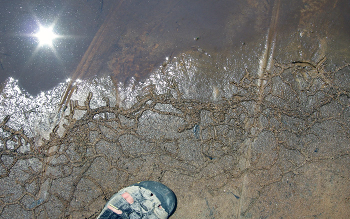
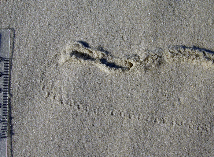
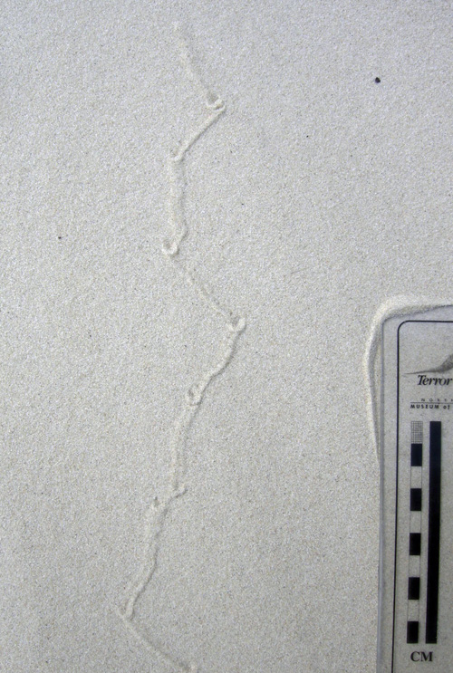
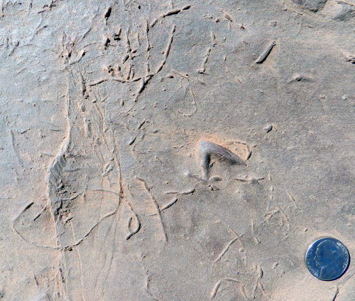
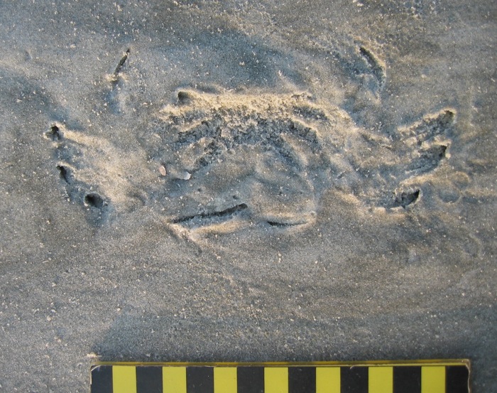
Tracking the Wild Horses of Cumberland Island

(The following post is one of a series about traces of important invasive species of mammals on the Georgia barrier islands and the ecological effects of these traces. An introduction to this topic from last week is here.)

Perhaps the most charismatic yet problematic of non-native animals on any of the Georgia barrier islands are the wild horses (Equus caballus) of Cumberland Island. These horses are the source of much controversy, which becomes even more apparent whenever anyone tries to apply some actual science to them. So I will talk about them here from my perspective as a paleontologist and geologist in the hope that this will add another dimension to what is often presented as a two-sided and emotional argument.
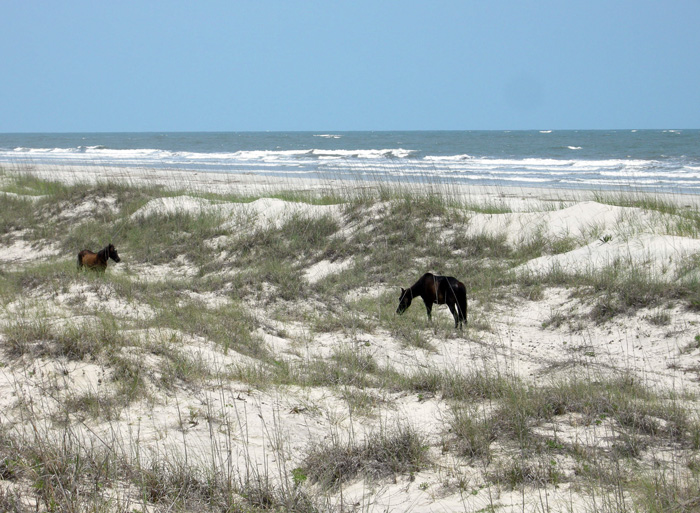
Ah, the wild horses of Cumberland Island, Georgia, roaming free since the time of the Spanish in a pristine, unspoiled landscape, grazing contently on the sea oats and strolling through the coastal dunes, in perfect harmony with nature. How much of the preceding sentence is wrong? Almost all of it. If you want to find out why, please read on. But if your mind is already made up about the feral horses of Cumberland and you don’t want to hear anything bad said about them, then you might like this site. (Photograph by Anthony Martin.)

Cumberland Island, much of which is part of the U.S. National Park system as a National Seashore, is the only Georgia barrier island with a population of feral horses. Nevertheless, despite their uniqueness and fame – the latter figuring as key attractions in advertisements about Cumberland and inspiring dreamy book titles – their origins remain murky. One of the recurring romanticized claims is that these horses descended from livestock brought there by Spanish expeditions in the 16th century. This idea is reassuring to the people who repeat it for two reasons:

(1) It establishes horses as living in the landscape for a long time (especially by American standards), meaning that their presence there now is considered “natural.”

(2) It lends itself to the comforting thought that the horses connect to a European cultural heritage, putting an Old World imprint on a New World place.

However, once said enough times, such just-so stories become faith-based and any evidence contradicting them is not tolerated. Thus even when genetic studies of the Cumberland horses show they are not appreciably different from populations of horses on other islands of the eastern U.S. (arguing against a purely Spanish origin), any questioning of the stated premise – in my experience – provokes angry responses from its defenders.

I suspect this virulent reaction is a direct result of challenging both the “naturalness” and “cultural heritage” of the horses on Cumberland. In reality, though, these are opposing values. After all, an admission that these feral horses came from European stock at any point during the past 500 years supports how they clearly do not belong on Cumberland Island, or anywhere else in the Western Hemisphere if we’re talking about the last 10,000 years or so. In other words, the point is moot whether the current horse population originated in the 16th, 17th, 18th, 19th, or 20th century, or is a mixture of older and newer stock. If only horses could talk, then we would know for sure. (A detailed history of the horses on Cumberland Island is provided here for anyone interested in learning more about this.)

Arguments of heritage aside, these horses are newcomers in a geological and ecological sense. The fossil record of the modern Georgia barrier islands backs this up, as some of the islands (including Cumberland) have sediments more than 40,000 years old, but none have body or trace fossils of horses, or anything like a horse. Although three species of horses were living on the mainland part of North America during the Pleistocene Epoch until their respective extinctions more than 10,000 years ago, none were known to have inhabited any of the barrier islands, Pleistocene or recent. The closest ancient analogue to horses on any of the Georgia barrier islands would have been bison (Bison bison), but their bones are rare. This scarcity leads paleontologists to wonder whether the islands ever had self-sustaining populations of large herbivores.

So with all of that human history and pre-history in mind, the traces made by the feral horses of Cumberland and their ecological effects are exceptional to it and every other Georgia barrier island, and hence worth our attention. Just to keep this simple, I will cover three primary types of traces made by these horses. What these traces all have in common (other than being made by a horse, of course) is the decidedly negative impacts these have on the native plants and animals of Cumberland, including keystone species in the oft-labeled “pristine” ecosystems of the island.

Tracks and trails – These traces are the abundant and easily spotted on Cumberland, even to someone with little or no training in ichnology. Horses are unguligrade, which means they are walking on their toenails (unguals), and the ungual (more popularly called a hoof) is on a single digit. Hooves make circular to slightly oval compression shapes, but if preserved in the right substrate – like a firm mud or fine sand – they will show a “Pac-Man”-like form. Front-foot (manus) tracks are slightly larger than rear-foot (pes) tracks; manus impressions are 11-14 cm (4.3-5.5 in) long and 10-13 cm (4-5.1 in) wide, whereas pes impressions are 11-13 cm (4.3-5.1 in) long and 9-12 cm (3.5-4.7 in) wide, with variations in size depending on ages of the horses making the tracks.
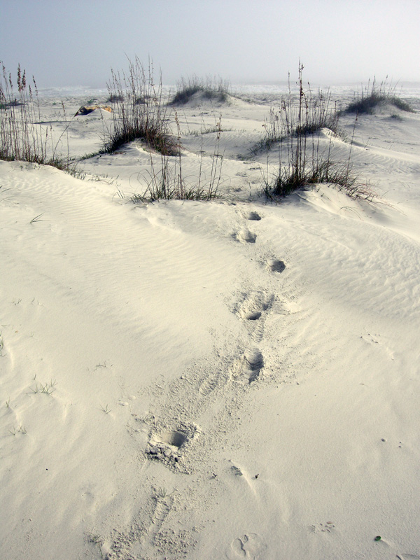
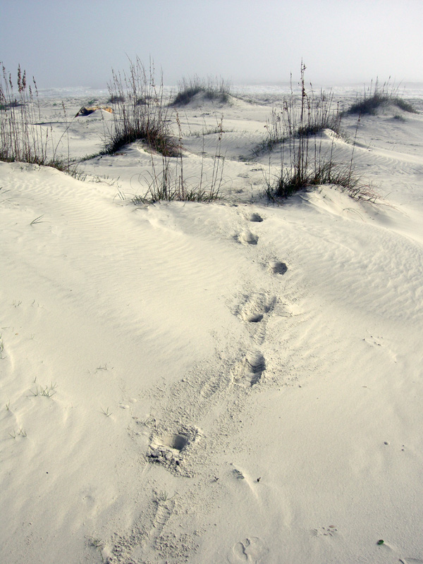
Trackway of feral horse moving through the coastal dunes of Cumberland Island. Note the diagonal walking pattern and how front- and rear-foot impressions merge to make oblong compound traces.

An important point to keep in mind when tracking horses or any other hoofed animals is that their feet readily cut through sediments and vegetation, leaving much more sharply defined and deeper impressions than padded feet of an equivalent-sized animal. Because Georgia-coast sands contain whitish quartz and darker heavy minerals, these contrasting sand colors help to outline horse tracks on surfaces and in cross-section as deep and sharply defined structures that cut across the bedding.

When asked to think about horses in motion, it might be tempting to imagine them galloping, especially along a beach at sunset. Nonetheless, a horse would tire quickly if it galloped all day, especially for no valid reason. Instead, its normal gait is a slow walk, which causes the rear foot to register partially on top of the front-foot impression, but slightly behind; with a slightly faster walk, the rear foot will exceed the front-foot impression. The overall trackway pattern then is what many trackers call “diagonal-walking,” as the right-left-right alternation of steps can be linked with imaginary diagonal lines. Trackway width, also known as straddle, is about 20-40 cm (8-16 in) if a horse was just walking normally, but narrows noticeably once it starts picking up speed.
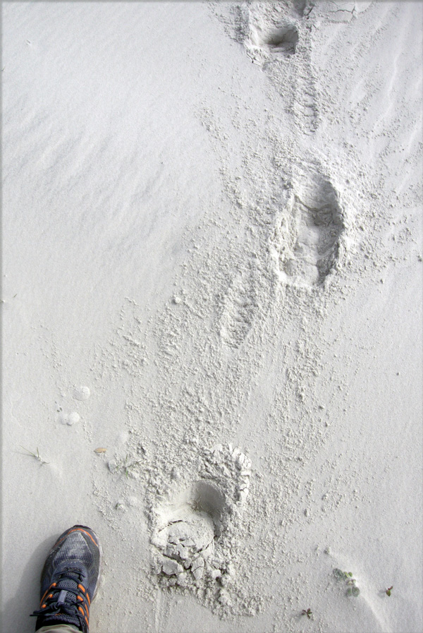
Feral-horse tracks on Cumberland Island, a close-up of the same trackway shown in the previous photo. This one was likely doing a slow walk, with indirect register of the rear foot just behind and onto the front-foot impression. The scale (my shoe) is a size 8½ mens. (Photograph by Anthony Martin.)

Given enough back-and-forth movement along preferred paths, repeating and overlapping trackways result in trails, which can be picked out as linear bare patches of exposed sand or mud cutting through vegetation. Because horses are much larger than the native white-tailed deer (Odocoileus virginianus) on Cumberland, their trails are considerably wider.
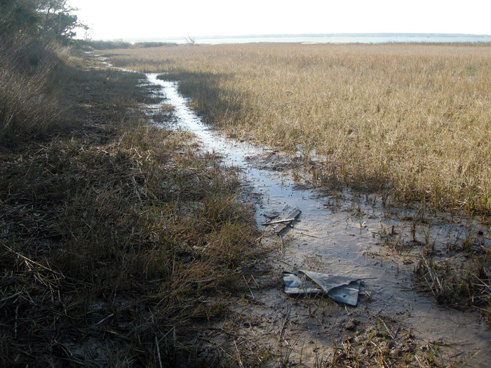
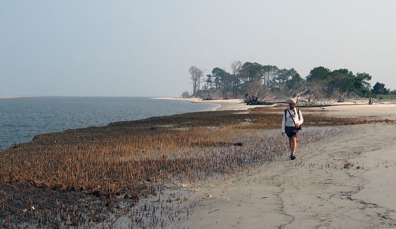
Feral-horse trail along the edge of a low salt marsh where they have trampled and overgrazed the smooth cordgrass in that marsh (Spartina alterniflora). (Photograph by Anthony Martin, taken on Cumberland Island.)

Chew marks – Horses are grazers and low-level browsers, and they eat a wide variety of vegetation on Cumberland. The most important plant species they eat through grazing are smooth cordgrass (Spartina alterniflora), sea oats (Uniola paniculata), and live oak (Quercus virginiana).  All three of these plants are keystone species in their respective ecosystems: smooth cordgrass predominates in the low salt marshes, sea oats are the mainstay plants of coastal dunes, and live oaks are the largest and most long-lived trees in the maritime forests. Their effects of horses consuming  smooth cordgrass and sea oats is straightforward, as these plants hold in sediments in place keep them from eroding, but how do horses affect live oaks? They eat the seedlings, which means that older oaks are being replaced by younger ones at a slower rate.

Grazing traces consist of clean cuts of vegetation within a vertical swath and over a broad area. Horses, unlike white-tailed deer, have teeth on both their upper and lower jaws, thus they shear plants on the branches, stems, or leaves. In contrast, deer leave more ragged marks, as they only have teeth on their lower jaws and hence have to pull on vegetation to break it off. Horses also can make a browse line, which is an abrupt horizontal line of decreased vegetation at a certain consistent height that more-or-less correlates with the average head height of the horses.

Dung – During any given stroll on Cumberland, you cannot avoid seeing, smelling, and stepping in horse feces. This abundance of fecal material means that the feces are not being recycled quickly enough into the ecosystems, which implies that native populations of dung beetles are overwhelmed by such abundance. I have seen a few traces of dung beetles in fresh piles of feces, but no matter how hard I have looked, I have yet to witness great thundering herds of beetles rolling balls of dung across the Cumberland Island landscape.

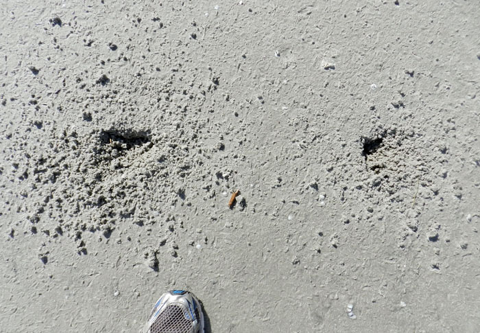
An impressive collection of horse dung, which was probably dropped by a single horse. Note the small holes in the middle, which were likely made by dung beetles that tunneled into this rich supply of food for their offspring.
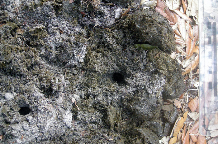
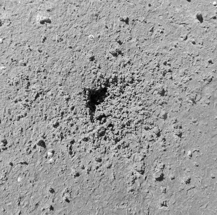
Close-up of those probable dung-beetle burrows, some with short trails attached. The white quartz sand sprinkled on top shows how it was pulled up by beetles from underneath the dung pile and onto the top surface, thus giving a minimum depth of the burrows. (Both photographs by Anthony Martin, taken on Cumberland Island.)

One of the more interesting ecological consequences of horse dung I have seen on Cumberland is how it influences the behavior of smaller animals as pellets or piles form a microtopography. For example, on some of the dunes near Lake Whitney on Cumberland – the largest body of fresh water on any of the Georgia barrier islands – I was surprised to see that small lizards – probably skinks – were moving around the dung piles or burrowing under them.
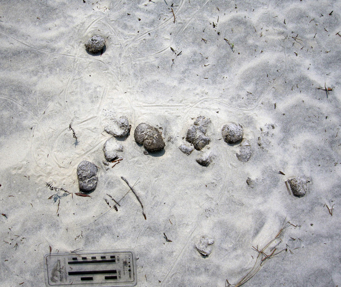
Horse droppings as a part of the landscape for small lizards. Here their tracks, accompanied by tail dragmarks, wind around partially buried feces in a sand dune. (Photograph by Anthony Martin, taken on Cumberland Island.)
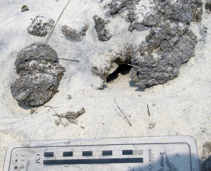
Small lizard burrow entrance immediately below a horse pellet, showing its use as a sort of roof. This could probably inspire some clever statement on shingles and, well, you know, but I’ll refrain for now. (Photograph by Anthony Martin, taken on Cumberland Island.)

All three categories of traces – tracks, chew marks, and dung – can be found together in ecosystems wherever horses are trampling, grazing, and defecating, respectively.

So now let’s put on our paleontologist or geologist hats (not to be confused with archaeologist hats) and ask ourselves about the likelihood of such traces making it into the fossil record, and how we would recognize them if they did. Their likelihood of preservation, in order, would be tracks, feces, and chew marks. Tracks would be evident as large compression shapes in horizontal bedding planes or deep disruptions of bedding planes in vertical section. Feces, or their fossil versions called coprolites, might get preserved, although herbivore feces, filled with vegetative material, is less likely to make it into the fossil record compared to carnivore feces, which may have lots of bone material in it. The last of these – chew marks – would be nearly impossible to tell from normal tearing and other degradation of plant material before it became fossilized. Good luck on that.

But could the ecological damage caused by an invasive species, in which the introduction of a species serve as a sort of trace fossil in itself? In the case of horses or ecologically similar animals, subtle changes to the landscape over time might take place. This experiment actually has been done on Assateauge Island (North Carolina), which also has a feral horse population. In areas where horses were excluded by fences, the dunes were on average 0.6 meters (2 ft) feet higher than those of overgrazed and trampled dunes. Geologists conducted another study done on Shackleford Banks (North Carolina) in which they examined areas where fences had separated non-horse from horse-occupied parts of the island. These geologists similarly found that horses caused dunes to be less than 1.5 m (5 ft) high, whereas dunes without horses were as much as 3.5 m (11.5 ft) high. This meant that storms more easily penetrated the barriers provided by coastal dunes, more commonly resulting in storm-washover fans.

This change in the coastal geology of back-dune areas also means that ground-nesting shorebirds will become less common, as their nests and nestlings will be drowned or buried more frequently. Horses also are known to step on shorebird eggs and nests, or can scare away parents from nests, which increases the likelihood of egg or nest predators taking out the next generation of shorebirds.

If any horses made it to the Georgia barrier islands during the Pleistocene and established breeding populations, a geologic sequence following their arrival would look like this, from bottom to top: high dunes suffused with root traces (before horses); lower dunes corresponding with fewer root traces and deep disruptions of bedding (horse tracks); increased numbers of storm-washover fans; and a high salt-marsh. In short, a geologist would see an overall progression from a dune-dominated shoreline to a high salt marsh. Similarly, a paleontologist might see a decrease in root trace fossils and shorebird nests, eggshells, and tracks, possibly culminating in local extinctions of each.

This is your Georgia coast.

This is your Georgia coast with horses. Any questions?

Top panorama is of high-amplitude coastal dunes and well-vegetated back-dune meadows on Sapelo Island, whereas the bottom panorama is of low-amplitude dunes with no appreciable back-dune meadows on Cumberland Island. (Both panoramas based on photos taken by Anthony Martin.)

Based on what we know then, should the feral horses of Cumberland Island be removed? Yes. Will they be removed? Probably not. However, regardless of happens, I will keep teaching about the horses of Cumberland Island and their traces, both as an educator and a concerned citizen. Perhaps with enough awareness, circumstances will change for the better so that Cumberland Island can not only remain a beautiful place, but also will become more like what it was before the arrival of horses there.

(Next week in this series about invasive mammal species of the Georgia barrier islands and their traces, I’ll cover a less inflammatory but still intriguing topic: the feral cattle of Sapleo Island.)

Further Reading

Buynevich, I.V., Darrow, J.S., Grimes, T.A.Z., Seminack, C.T., and Griffis, N. 2011. Ungulate tracks in coastal sands: recognition and sedimentological significance. Journal of Coastal Research, Special Issue 64: 334-338.

De Stoppalaire, G.H., Gillespie, T.W., Brock, J.C., and Tobin, G.A. 2004. Use of remote sensing techniques to determine the effects of grazing on vegetation cover and dune elevation at Assateague Island National Seashore: impact of horses. Environmental Management, 34: 642-649.

Dilsaver, L.M. 2004. Cumberland Island National Seashore: A History of Conservation Conflict. University of Virginia Press, Charlottesville, Virginia: 304 p.

Elbroch, M. 2003. Mammal Tracks and Sign: A Guide to North American Species. Stackpole Books, Mechanicsburg, Pennsylvania: 779 p.

Goodloe, R.B., Warren, R.J., Osborn, D.A., and Hall, C. 2000. Population characteristics of feral horses on Cumberland Island and their management implications. The Journal of Wildlife Management, 64: 114-121.

Sabine, J.B., Schweitzer, S.H., and Meyers, J.M. 2006. Nest Fate and Productivity of American Oystercatchers, Cumberland Island National Seashore, Georgia. Waterbirds, 29: 308-314.

Turner, M.G. 1987. Effects of grazing by feral horses, clipping, trampling, and burning on a Georgia salt marsh. Estuaries and Coasts, 10: 54-60.

Turner, M.G. 1988. Simulation and management implications of feral horse grazing on Cumberland Island, Georgia. Journal of Range Management, 41: 441-447.


Alien Invaders of the Georgia Coast

(This is the first in a series of posts about invasive species on the Georgia barrier islands, their traces, the ecological impacts of these traces, and why people should be aware of both their traces and impacts.)

Paleontologists like me face a challenge whenever we study modern environments while trying to learn how parts of these environments might translate into the geologic record. Sure, we always have to take into account taphonomy (fossil preservation), through which we acknowledge that nearly none of the living and dead bodies we see in a given environment will become fossilized; relatively few of their tracks, trails, burrows, or other traces are likely to become trace fossils, either.

Because of this pessimistic (but realistic) outlook, paleontologists often rub a big eraser onto whatever we draw from a modern ecosystem, telling ourselves what will not be there millions of years from now. We then retroactively apply this concept – a part of actualism or, more polysyllabically, uniformitarianism – to what happened thousands or millions of years ago. When paleontologists do this, they assume that today’s processes are a small window through which we can peer, giving insights into processes of the pre-human past.

Feral horse (Equus caballus) tracks crossing coastal dunes on Cumberland Island, Georgia. During their evolutionary history, horses originated in North America and populations migrated to Asia, but populations in North America went extinct during the Pleistocene Epoch about 10,000 years ago. Using the perspective of geologic time, then, could someone argue that horses are actually “native,” and these feral populations are restoring a key part of a pre-human Pleistocene landscape? (Photograph by Anthony Martin.)

However, a huge complication in our quest for actualism is this reality: nearly every ecosystem we can visit on this planet is a hybrid of native and alien species, the latter introduced – intentionally or not – by us. Thus when we watch modern species behaving in the context of their environments, we always need to always ask ourselves how non-native species have cracked the window through which we squint, through the past darkly.

This theme is considered in Charles C. Mann’s most recent book, 1493: Uncovering the New World Columbus Created, in which he argues how nearly all terrestrial ecosystems occupied by people were permanently altered by the rapid introduction of exotic species worldwide following Columbus’s landfall in the Western Hemisphere. Going even further back, though, the introduction of wild dogs (dingoes) into mainland Australia by humans about 5,000 years ago irrevocably changed the environments of an entire continent. Examples like these show that European colonization and its aftermath in human history during the last 500 years was not the sole factor in the spread of non-native species, and hints at how species invasions have been an integral part of humanity and its movement throughout the world.

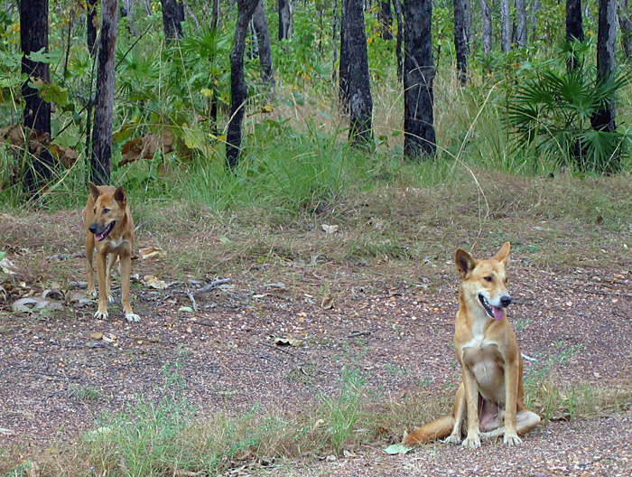
Something tells me we’re not in Georgia any more. A male-female pair of dingoes (Canis lupus dingo) pose for a picture in Kakadu National Park, Northern Territory, Australia. Although now considered “native,” dingoes are an example of an invasive species that had a huge impact once brought over by people from southeast Asia about 5,000 years ago. For one, its arrival is linked to the extinction of native carnivorous mammals in the mainland Australia, such as thylacines (Thylacinus cynocephalus) and Tasmanian devils (Sarcophilus harrisii). (Photograph by Anthony Martin.)

Well-meaning (but deluded) designations of “pristine,” “untouched,”and “unspoilt” aside, the Georgia barrier islands are no exception to alien invaders. Moreover, like many barrier-islands systems worldwide, they differ greatly from island to island in: which species of invaders are there; numbers of individuals of each species; and the degree of how these organisms impact island ecosystems and even their geological processes.

Feral cat tracks in back-dune meadows of Jekyll Island, Georgia. Jekyll is one of the few Georgia barrier islands with a significant human presence year-round, hence these cats are descended from domestic cats that were either purposefully or accidentally let loose by residents. What impact do these cats have on native species of animals and ecosystems, and are these effects comparable to those of other invasive species on other islands? Scale = 15 cm (6 in). (Photograph by Anthony Martin.)

This is one of the reasons why I devoted several pages of my upcoming book, Life Traces of the Georgia Coast, to the traces of invasive species – tracks, trails, burrows, and so on – despite their failing an “ecological purity test” for anyone who might prefer to focus on native species and their traces. With regard to invasive species, the genie is out of the bottle, so we might as well study what is there, rather than apply yet another metaphorical eraser to species that are drastically shaping modern ecosystems and affecting the behavior of native species, thus likewise altering their traces.

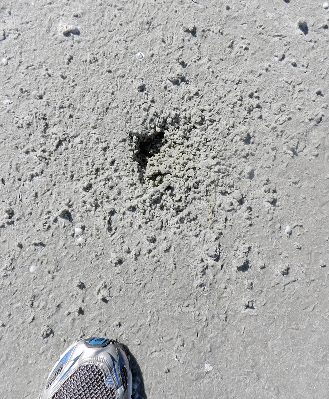
A large pit of disturbed sand in a back-dune meadow caused by feral hogs (Sus crofa) on St. Catherines Island, Georgia. Because feral hogs are wide-ranging omnivores with voracious appetites, they cause considerable alterations to island habitats, from maritime forests to intertidal beaches. How do these traces affect the behavior and ecology of other species, especially native ones, in such a broad range of environments on the Georgia barrier islands? Can their traces actually alter the geological character of the islands? (Photograph by Anthony Martin.)

What are some of these invasive species? What makes for an “invasive species” versus a mere “exotic species”? How do the traces of invasive species affect native species on the Georgia barrier islands, and the ecology and geology of the islands themselves? And how do paleontologists and geologists figure into the study of invasive species?

These are all questions that I hope to explore in upcoming weeks here, and for the sake of simplicity, I will showcase an invasive species of mammal and its traces each week. Some of the photos shown here serve as a visual teaser of the invasive species and their traces that will be covered: feral horses (Equus caballus), cattle (Bos taurus), hogs (Sus crofa), and cats (Felis domestica). Yes, I know, there are many others, but these four are among the most ecologically significant species, they consist of animals that nearly everyone knows, and – best of all – they make easily identifiable traces. So these fours species will provide a starting point in our learning how the Georgia barrier islands can be used as case studies in the traces and ecological effects of traces made by invasive species.

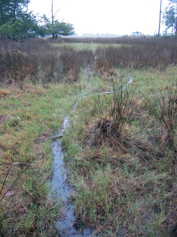
Trail made by feral cattle (Bos taurus) cutting through a salt marsh and extending to the horizon, providing a clue of how this forest-dwelling animal can travel deeply into and affect marginal-marine environments. How might such traces show up in the geologic record, and was there a species that might have made similar traces on the islands in the recent past? (Photograph by Anthony Martin.)

Shorebirds Helping Shorebirds, One Whelk at a Time

How might the traces of animal behavior influence and lead to changes in the behavior of other animals, or even help other animals? The sands and the muds of the Georgia barrier islands answer this, offering lessons in how seemingly inert tracks, trails, burrows, and other traces can sway decisions, impinging on individual lives and entire ecosystems, and encourage seemingly unlikely partnerships in those ecosystems. Along those lines, we will learn about how the traces made by laughing gulls (Larus altricilla) and knobbed whelks (Busycon carica) aided sanderlings (Calidris alba) in their search for food in the sandy beaches of Jekyll Island.

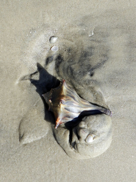
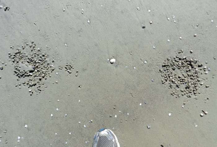
A roughly triangular depression in a beach sand on Jekyll Island, Georgia, blurred by hundreds of tracks and beak-probe marks of many small shorebirds, all of which were sanderlings (Calidris alba). What is the depression, how was it made, and how did it attract the attention of the sanderlings? Scale = size 8 ½ (men’s), which is about 15 cm (6 in) wide. (Photograph by Anthony Martin.)

Last week, we learned how knobbed whelks (Busycon carica), merely through their making trails and burrows in the sandy beaches of Jekyll Island, unwittingly led to the deaths of dwarf surf clams (Mulinia lateralis), the latter eaten by voracious sanderlings. Just to summarize, the dwarf surf clams preferentially burrowed around areas where whelks had disturbed the beach sand because the burrowing was easier. Yet instead of avoiding sanderling predation, the clustering of these clams around the whelks made it easier for these shorebirds to eat more of them in one sitting. Even better, this scenario, which was pieced together through tracks, burrows, and trails, was later verified by: catching whelks in the act of burying themselves; seeing clams burrow into the wakes of whelk trails; and watching sanderlings stop to mine these whelk-created motherlodes of molluscan goodness.

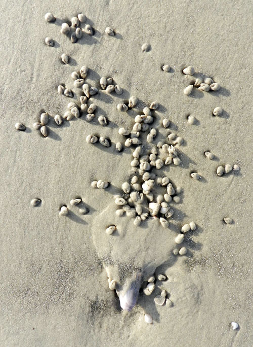
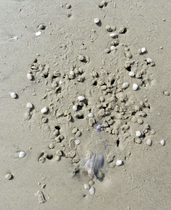
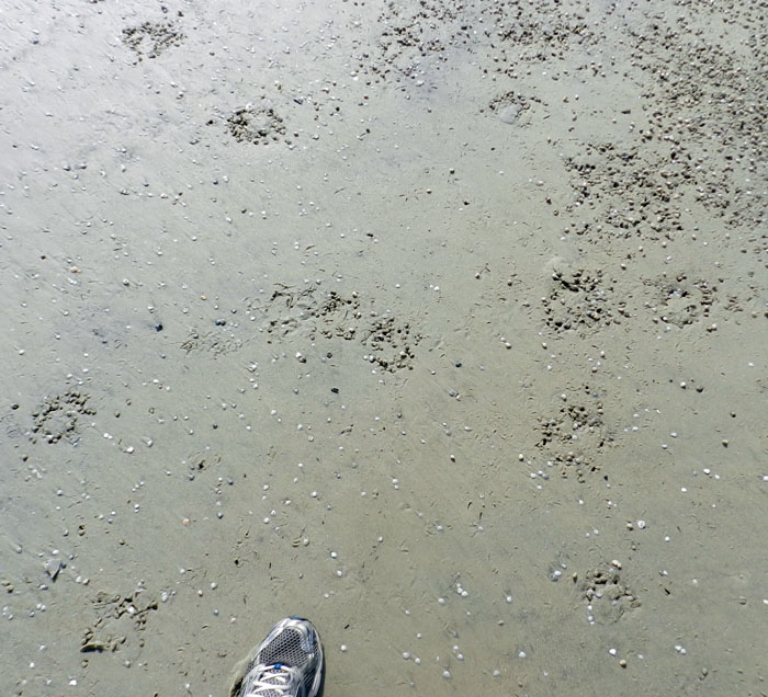
Before and after photos, showing how the burrowing of a knobbed whelk caused dwarf surf clams to burrow in the same small area (top), which in turn provided a feast for sanderlings (bottom); the latter is evident from the numerous tracks, peak-probe marks, and clam-shaped holes marking where these hapless bivalves formerly resided. (Both photographs by Anthony Martin, taken on Jekyll Island, Georgia.)

Was this the only trace-enhanced form of predation taking place on that beach? By no means, and it wasn’t even the only one involving whelks and their traces, as well as sanderlings getting a good meal from someone else’s traces. This is where a new character – the laughing gull (Larus altricilla) – and a cast of thousands represented by the small crustaceans – mostly amphipods – enter the picture. How these all come together through the life habits and traces these animals leave behind is yet another example of how the Georgia coast offers lessons in how the products of behavior are just as important as the behavior itself.

Considering that knobbed whelks are among the largest marine gastropods in the eastern U.S., it only makes sense that some larger animal would want to eat one whenever it washes up onto a beach. For example, seagulls, which don’t need much encouragement to eat anything, have knobbed whelks on their lengthy menus.

So when a gull flying over a beach sees a whelk doing a poor job of playing “hide-and-seek” during low tide, it will land, walk up to the whelk, and pull it out of its resting spot. From there, the gull will either consume the whelk on the spot, fly away with it to eat elsewhere (“take-out”), or reject it, leaving it high and dry next to its resting trace. An additional trace caused by gull predation might be formed when gulls carry the whelk through the air, drop them onto hard surfaces – such as a firmly packed beach sand – which effectively cracks open their shells and reveals their yummy interiors.

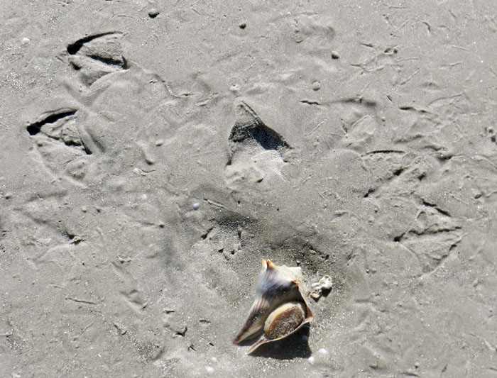
Paired gull tracks in front of a knobbed whelk resting trace, with the whelk tracemaker at the bottom of the photo. Based on size and form, these tracks were made by laughing gulls (Larus altricilla). The one on the left is likely the one that plucked the whelk from its resting trace, as its feet were perfectly positioned to pick up the narrow end of the whelk with its beak. The second gull might have seen what the first was doing and arrived on the scene soon afterwards, hoping to steal this potential meal for itself. For some reason, though, neither one ate it; instead, they discarded their object of desire there on the sandflat. For those of you who wondered if I then just walked away after taking the photo, I assure you that I threw the whelk back into water. At the same time, though, I acknowledged that the same sort of predation and rejection might happen again to that whelk with the next tidal cycle. Other shorebird tracks in the photo are from willets and sanderlings. (Photograph by Anthony Martin, taken on Jekyll Island.)

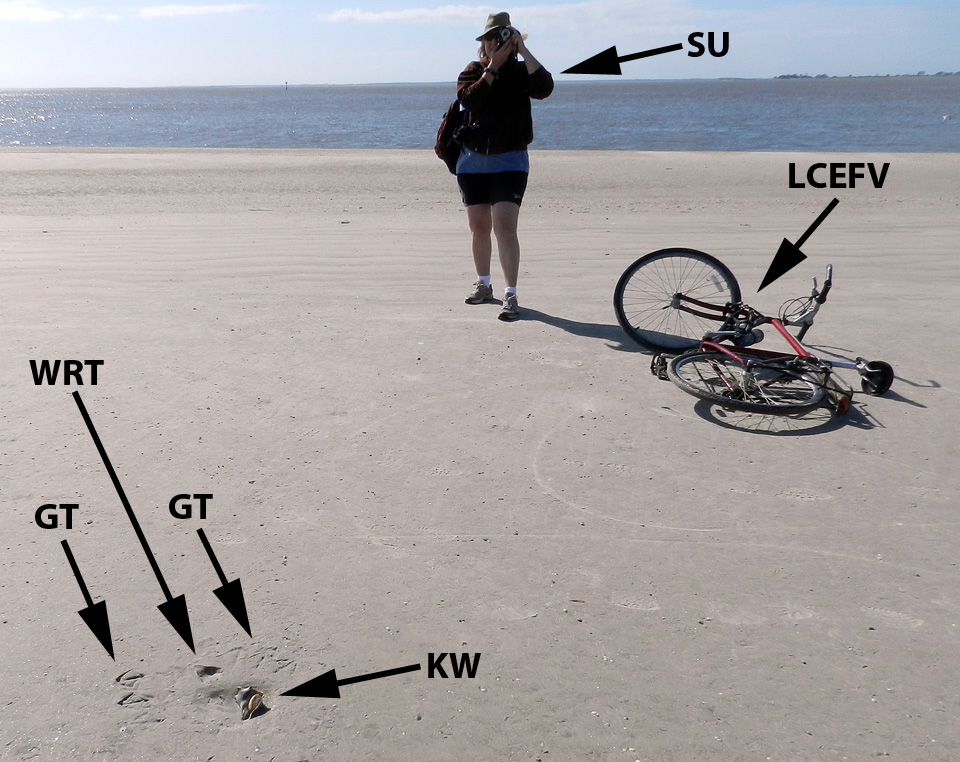
Sure enough, on the same Jekyll Island beach where we saw the whelk-surf clam-sanderling interactions mentioned last week, and on the same day, my wife Ruth Schowalter and I noticed impressions where whelks had incompletely buried themselves at low tide, only to be pried out by laughing gulls. Although we did not actually witness gulls doing performing, we knew it had happened because their paired tracks were in front of triangular depressions, followed by more tracks with an occasional discarded (but still live) whelk bearing the same dimensions as the impression.

My wife Ruth aptly demonstrates how to document seagull and whelk traces (foreground) while on bicycle, no easy feat for anyone, but a cinch for her.  Labels are: GT = gull tracks; WRT = whelk resting trace; KW = knobbed whelk; SU = spousal unit; and LCEFV = low-carbon-emission field vehicle. (Photograph by Anthony Martin, taken on Jekyll Island, Georgia.)

With this search image of a whelk resting trace in mind, we then figured out what had happened in a few places when we saw much more vaguely defined triangular impressions. These were also whelk resting traces, but they were nearly obliterated by sanderling tracks and beak marks; there was no sign of gulls having been there, nor any whelk bodies. Hence these must have been instances of where the gulls flew away with their successfully acquired whelks to drop them and eat them somewhere else. But why did the sanderlings follow the gulls with the shorebird equivalent of having a big party in a small place?

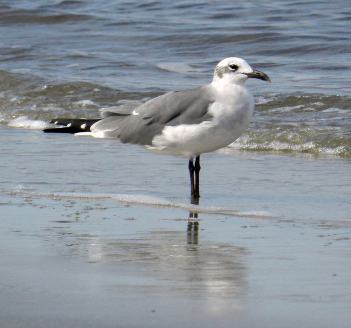
Yeah, I did it: so what? A laughing gull, looking utterly guiltless, stands casually on a Jekyll Island beach, unaware of how its going after knobbed whelks also might be helping its little sanderling cousins find amphipods. (Photograph by Anthony Martin.)

Although many people may not know this, when they walk hand-in-hand along a sandy Georgia beach, a shorebird smorgasbord lies under their feet in the form of small bivalves and crustaceans. The latter are mostly amphipods (“sand fleas”), which through sheer number of individuals can compose nearly 95% of the animals living in Georgia beach sands. Amphipods normally spend their time burrowing through beach sands and eating algae between sand grains or on their surfaces.

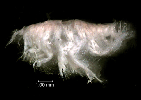
Close-up view of the amphipod Acanthohaustorius millsi, one of about six species of amphipods and billions of individuals living in the beach sands of the Georgia barrier islands, all of which are practically begging small shorebirds to eat them. Photo from here, borrowed from NOAA (National Oceanic and Atmospheric Administration – a very good use of U.S. taxpayer money, thank you very much) and linked to a site about Gray’s Reef National Marine Sanctuary, which is about 30 km (18 mi) east of Sapelo Island, Georgia.

Because amphipods are exceedingly abundant and just below the beach surface, they represent a rich source of protein for small shorebirds. But if you really want to make it easier for these shorebirds to get at this food, just kick your feet as you walk down the beach. This will expose these crustaceans to see the light of day, and the shorebirds will snap them up as these little arthropods desperately try to burrow back into the sand. This, I think, is also what happened with the gulls pulling whelks off the beach surface. Through the seemingly simple, one-on-one predator-prey act of a gull picking up a whelk, it exposed enough amphipods to attract sanderlings, which then set off a predator-prey interaction between the sanderlings and amphipods, all centered on the resting trace of the whelk.

Two whelks near one another resulted in two resting traces, and now both are missing, which likely means they were taken by laughing gulls. Notice how all of the sanderling trampling and beak marks have erased any evidence of the gulls having been there. (Photograph by Anthony Martin, taken on Jekyll Island.)

So as a paleontologist, I always ask myself, how would this look if I found something similar in the fossil record, and how would I interpret it? What I might see would be a dense accumulation of small, overlapping three-toed tracks – with only a few clearly defined – and an otherwise irregular surface riddled by shallow holes. The triangular depression marking the former position by a large snail, obscured by hundreds of tracks and beak marks, might stay unnoticed, or if seen, could be disregarded as an errant scour mark. The large gull tracks would be gone, overprinted by the many tracks and beak marks of the smaller birds.

Take a look again at the scene shown in the first photograph, and imagine it fossilized. Could you piece together the entire story of what happened, even with what you now know from the modern examples? I’m sure that I couldn’t. Scale bar = 15 cm (6 in). (Photograph by Anthony Martin.)

Hence the role of the instigator for this chain of events, the gull or its paleontological doppelganger, as well as its large prey item, would remain both unknown and unknowable. It’s a humbling thought, and exemplary of how geologist or paleontologist should stop to wonder how much they are missing when they recreate ancient worlds from what evidence is there.

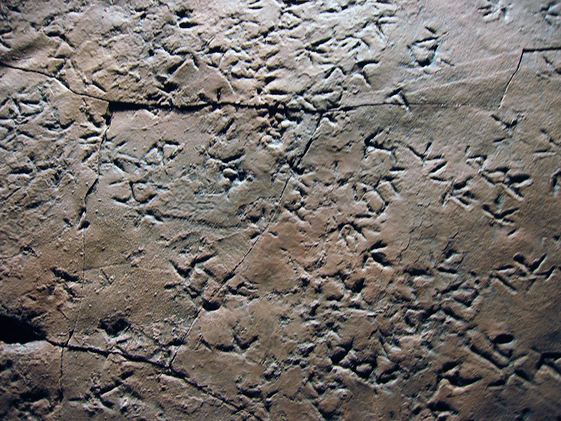
Cast (reproduction) of a dense accumulation of small shorebird-like tracks from Late Triassic-Early Jurassic rocks (about 210 million years old) of Patagonia, Argentina. These tracks are probably not from birds, but from small bird-like dinosaurs, and they were formed along a lake shoreline, rather than a seashore. Nonetheless, the tracemaker behaviors may have been similar to those of modern shorebirds. Why were these animals there, and what were they eating? Can we ever know for sure about what other animals preceded them on this small patch of land, what these predecessors eating, and how their traces might have influenced the behavior of the trackmakers? (Photograph by Anthony Martin; cast on display at Museo de Paleontológica, Trelew, Argentina.)

Another parting lesson that came out of these bits of ichnological musings is that all of the observations and ideas in this week’s and last week’s posts blossomed from one morning’s bicycle ride on a Georgia-coast beach. Even more noteworthy, these interpretations of natural history were made on an island that some scientists might write off as “too developed” to study, its biota and their ecological relationships somehow sullied or tainted by a constantly abundant and nearby human presence. So whenever you are on a Georgia barrier island, just take a look at the life traces around you, whether you are the only person on that island or one of thousands, and prepare to be awed.

Further Reading

Croker, R.A. 1968. Distribution and abundance of some intertidal sand beach amphipods accompanying the passage of two hurricanes. Chesapeake Science, 9: 157-162.

Elbroch, M., and Marks, E. 2001. Bird Tracks and Sign of North America. Stackpole Books. Mechanicsburg, Pennsylvania: 456 p.

Grant, J. 1981. A bioenergetic model of shorebird predation on infaunal amphipods. Oikos, 37: 53-62.

Melchor, R. N., S. de Valais, and J. F. Genise. 2002. The oldest bird-like fossil footprints. Nature, 417:936938.

Wilson, J. 2011. Common Birds of Coastal Georgia. University of Georgia Press, Athens, Georgia: 219 p.

Knobbed Whelks, Dwarf Clams, and Shorebirds: A Love Story, Told Through Traces

For the last three Thanksgivings, my wife Ruth and I have fled the metropolitan Atlanta area and sought “nature therapy” through the environments of Jekyll Island on the Georgia coast. For this all-too-short vacation, we take our bicycles with us, stay in a hotel near the beach, and ride for hours on Jekyll’s plentiful bike paths or long beaches, taking in the fresh sea air and stopping to look at and document any animal traces that catch our interest. It is ichnology with a low carbon footprint, natural history that’s also eco-chic. Best of all, though, we have been to Jekyll enough times to know where the best traces are likely to be found. Because of this inside knowledge and enthusiasm for all things ichnological, we sometimes discover phenomena, that, as far as we know, were previously unnoticed on any of the undeveloped Georgia barrier islands.

This Thanksgiving break was one of those times. The cast of characters in our latest novel find includes: two molluscans, knobbed whelks (Busycon carica) and dwarf surf clams (Mulinia lateralis); and two species of shorebirds, sanderlings (Calidris alba) and laughing gulls (Larus altricilla). How these four animals and their traces related to one another made for a fascinating story, nearly all of it discerned through their traces left on that Jekyll Island beach.

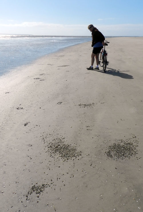
A view of a sandy beach on Jekyll Island at low tide with clusters of shallowly buried dwarf surf clams (Mulinia lateralis). These bivalves and their burrows, combined with beak marks and tracks of one of their predators, sanderlings (Calidris alba), make for the dark patches on the sand. But do you also see the abundant knobbed whelks (Busycon carica) and their traces in this photo? If not, please read on. (Ruth Schowalter for scale, happily standing by her bicycle, and photograph by Anthony Martin.)

Jekyll is a developed island on the Georgia coast, its southern end about 30 kilometers (18 miles) north of the Georgia-Florida border, with sandy beaches, dunes, salt marshes, and maritime forests, all interrupted by residences, roads, golf courses, boutique shops, and other human-centered amenities. On the southeastern end of Jekyll, however, the beachside condominiums and hotels become fewer and the sandy natural areas correspondingly expand, holding bountiful traces of the local wildlife. With this geography in mind, we headed south on our bikes along the beach our first full day there. During this exhilarating outing, Ruth and I paused occasionally to figure out what animal activities might have taken place in the minutes or hours before our arrival, just after the high tide had turned and exposed broader areas of sandy beach.

We were not disappointed, as some traces immediately caught our attention. Low in the intertidal zone, we noticed upraised flaps of sand that marked the subsurface positions of variably sized knobbed whelks, which are among the largest marine snails in the eastern U.S. These whelks, brought in by the high tide and strong waves, had burrowed down into the sand as soon as the tide subsided. This behavioral mode has been positively reinforced by millions of years by natural selection, a tactic by the whelk that avoids both desiccation and predation.

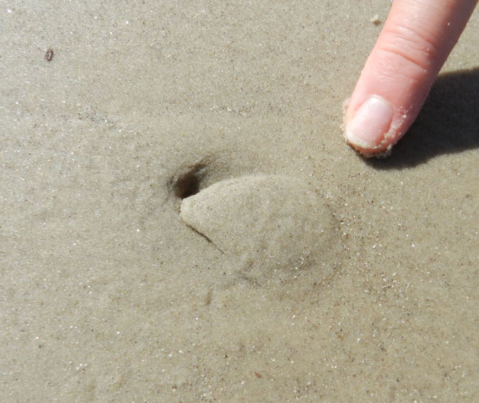
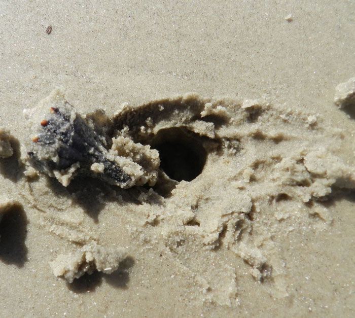
Here’s how to spot a buried whelk. Look for a triangular interruption in an otherwise smooth surface, where a flap of sand is slightly raised. Sometimes this trace also has a small hole at one end of the triangle. Test your hypothesis by digging in gently with your fingers. If you’re wrong, then revise your search image for their traces until you get it right. The knobbed whelk pictured here is a small one, but check out the size of the one in the next picture. (Both photographs by Anthony Martin, taken on Jekyll Island.)

A whelk uses its muscular foot to bury itself, expanding and contracting it so that the foot probes into the still-saturated sand left by the high tide; once the foot anchors in the sand, it pulls the rest of the whelk sideways and down. This really isn’t so much “burrowing” as an intrusion, where the animal insinuates itself into the sand. Contrast this method with the active digging we normally associate with burrows made by most terrestrial animals with legs.

A robust specimen of a knobbed whelk (held by Ruth), showing off its well-developed foot, which it uses to bury itself. (Photograph by Anthony Martin, taken on Jekyll Island.)

A knobbed whelk caught in the act of burying itself, leaving a short trail behind and a mound of sand in front as it starts to get underneath the beach surface. (Photograph by Anthony Martin, taken on Jekyll Island.)

Once a whelk is buried, waves may wash over its trail, erasing all evidence of its preceding actions. Nonetheless, once emergent, seawater drains downward through the sand and tightens these grains around the whelk, denoting it as a triangular “trap door” that occasionally has a small hole at one end. This hole marks where the whelk expelled water through the bottom end of its shell.

Near these clear examples of whelk traces on this beach were clusters of dwarf surf clams. Similar to whelks, these clams were washed up by the hide tide and waves, and they instinctually burrowed once exposed on the surface. Although much smaller and more streamlined than knobbed whelks, they likewise use a muscular foot to intrude the sand, anchor, and pull in their shelled bodies. Under the right conditions, these clams will also leave a trail behind them before descending under the sand, although such traces are easily wiped clean by a single wave.

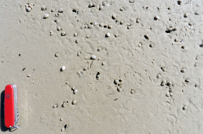
Cluster of dwarf surf clams that burrowed into the sand at low tide, some noticeable through little “sand caps” on top of them. Say, I wonder why there’s a triangular-shaped bare spot of sand toward one end of that cluster? (Swiss Army knife = 6 cm (2.4 in) long; photograph by Anthony Martin, taken on Jekyll Island.)

Although dwarf surf clams ideally orient themselves vertically and push two siphons through the sand – making a Y-shaped burrow – they sometimes only have enough strength to bury themselves on their sides, hidden by a mere cap of sand. This bivalve equivalent of hiding under a blanket makes them much more vulnerable to predation, especially from shorebirds that find these clams and make quick snacks of them, such as sanderlings.

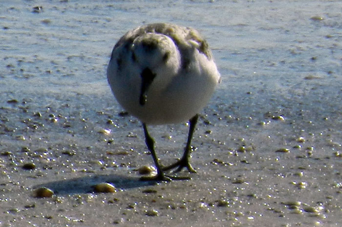
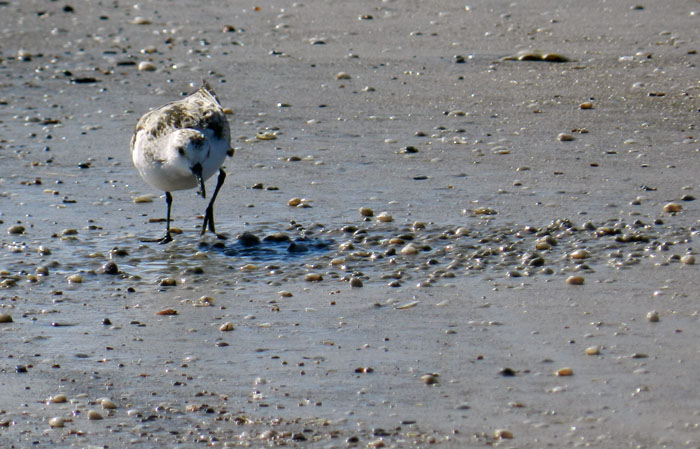
Sanderling (Calidris alba), 50-100 g of pure avian fury, prowling the sandy tidal flat of Jekyll Island in search of prey. Moon snails, given their fierce predation on other molluscans, may be the “lions of the tidal flat,”  but as far as small crustaceans and clams are concerned, sanderlings are the “tyrannosaurs.” (Photograph by Anthony Martin, taken on Jekyll Island.)

Sanderlings eat many small crustaceans that live in the sand, but they are also fond of small bivalves, such as dwarf surf clams. Sure enough, wherever you find a cluster of these clams, you will also find abundant tracks and beak probe marks made by these birds. Both their tracks and the probe patterns made by their beaks are diagnostic of this species: when I see these traces on any Georgia beach, I don’t have to look at a bird-identification guide to know whether sanderlings, dunlins, plovers, or sandpipers were there. Their food choices are clarified even more when you see their tracks and beak-probe marks directly associated with almond-shaped holes, where they neatly extracted the clams from their burrows.
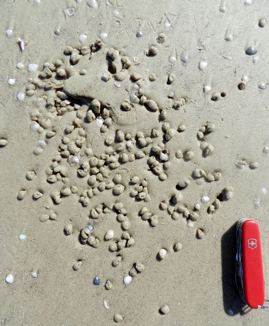
Sanderling tracks and beak-probe marks, with holes where clams were located by the sanderlings and  plucked out of their shallow burrows. (Swiss Army knife = 6 cm (2.4 in) long; photograph by Anthony Martin, taken on Jekyll Island.)

So how do these three species and their traces all relate to one another? (And what about the laughing gull?) Well, this is where it got even more interesting. Ruth and I soon started spotting triangular outlines within the clam clusters, bare spots on the sand devoid of both clams and beak marks. Underneath these were whelks. As we stood back and looked down the beach, we then saw how these clumps of clams were throughout the intertidal zone, and each was surrounding a whelk. Somehow the whelks had served as nucleation sites for clams, which had chosen to burrow in the sand around the whelks, instead of being randomly dispersed throughout the beach.

Remember this previous photo? There’s a whelk buried underneath that bare triangular patch.

Didn’t believe me? Well, there it is. It’s almost as if ichnology is a science, in which hypotheses, once confirmed by evidence-based reasoning, have predictive power.

Here are two more clusters of dwarf surf clams around buried whelks, hidden but still identifiable.

Quiz time: how many whelks are here? Thanks to ichnology, you don’t actually have to see them to dig them out for a census. (All four photographs by Anthony Martin and taken on Jekyll Island.)

Why were the clams burrowing around the whelks? Was this some sort of commensalism, in which the clams found more food around the whelks? No, because these clams are filter feeders, taking in water with suspended organic material for their sustenance, instead of ingesting the sand around them. How about protection? That didn’t seem likely either, because the whelk had no interest in defending the clams, and its body wasn’t even serving as a shield against shorebirds.

So I thought about how these clams burrow, and then it all made sense. Because dwarf surf clams are so small, sand grains are more like cobbles would be to you and me. Moving through these sediments thus takes considerable effort, especially as water drains from the sand and surface tension holds together the grains more tightly. This means the clams have to take advantage of sand that acts more like quicksand and less like concrete, and burrow when the sand has lots of water between the grains.

This is where the whelk became both the unwitting friend and enemy of the dwarf surf clams. As it burrowed, it fluidized the sand around it, shaking up the grains so that more space opened between them, which allowed in more water. This zone of disturbance and liquified sand was eagerly exploited by nearby clams, which easily burrowed into both the whelks’ trails and the immediate areas around their bodies.

Alas, this opportunity for safety provided by the whelk ultimately led to the sanderlings chowing down on the clams. What might have been a meticulous search for small clams sprinkled hither and tither throughout the broad Jekyll beach had now became a lot easier, thanks to both the whelks and the clams. All a sanderling had to do was find each motherlode of clams conveniently grouped around a buried whelk and start probing. It was an all-you-can-eat clam feast, and the traces clearly showed where some of these birds stopped and took their time gorging on the clams. Their tracks also showed where one stopped sanderling attracted the attention of others, which then rushed to the scene and joined in the buffet.

Wait, what have we here? A sanderling alters its course to investigate an obvious dense accumulation of dwarf surf clams. How did this population get so dense? Blame the knobbed whelk, which was just minding its own business by burrowing.

The carnage of sanderling plundering, in which about a third of buried dwarf surf clams were pulled from their burrows and the sand was trampled by thundering avian feet. This gruesome scene can all be laid at the feet, er, foot of the the whelk pictured here, which through its burrowing made it easier for the clams to burrow around it. (Both photographs by Anthony Martin and taken on Jekyll Island.)

But what about the laughing gull and its role in this story? Sorry, that will have to wait until next week’s post. In the meantime, in these days immediately following the Thanksgiving holiday in the U.S., let us all be thankful for the natural areas still preserved on Jekyll Island that allow for such wanderings of our bodies and minds, as well as the little personal discoveries of its life traces, infused with wonder, that can be shared with others.

Further Reading

Elbroch, M., and Marks, E. 2001. Bird Tracks and Sign of North America. Stackpole Books. Mechanicsburg, Pennsylvania: 456 p.

Howard, J.D., and Dörjes, J., 1972. Animal-sediment relationships in two beach-related tidal flats: Sapelo Island, Georgia. Journal of Sedimentary Research, 42: 608-623.

MacLachlan, A., and Brown, A.C. 2006. The Ecology of Sandy Shorelines. Academic Press, New York: 373 p.

Powers, S.G., and Kittinger, J.N. 2002. Hydrodynamic mediation of predator–prey interactions: differential patterns of prey susceptibility and predator success explained by variation in water flow. Journal of Experimental Marine Biology and Ecology, 273: 171-187.

Wilson, J. 2011. Common Birds of Coastal Georgia. University of Georgia Press, Athens, Georgia: 219 p.

Fossils in Progress

Despite whatever lamentations are made about the “incompleteness” of the fossil record, fossils are actually quite common. This truism is brought home even more so whenever trace fossils – tracks, burrows, and other evidence of organismal behavior – are included in a fossil checklist (as well they should be) when examining any given outcrop of sedimentary rocks formed in the past 550 million years or so.

For example, many a time I have visited an outcrop described previously as “lacking fossils,” and instead found it filled with trace fossils; hence what people meant was “lacking fossils” equals “no body fossils.” Normally these trace fossils are invertebrate burrows, which might be glibly identified as “worm burrows,” but tracks or other trace fossils may also reveal themselves to those who are looking for them. Indeed, this expectation of finding fossils is such that on occasions when geologists find a sedimentary rock layer devoid of either body or trace fossils, this is odd enough to cause geologists to scratch their heads and ask why.

But how do the former bodily remains of plants or animals, or traces of their behaviors, become preserved as fossils in the first place? This question other related ones are answered by the science of taphonomy. Coined by Russian paleontologist Ivan Yefremov, the etymology of this term stems from Greek, in which taphos ( = burial) and nomos (= law). In such a term, he was thus alluding to an expectation that natural processes that result in fossils becoming preserved are orderly and predictable.

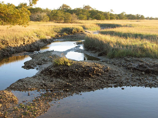
An overview of taphonomy as a field of study would be far too lengthy to explore here, so instead I will use one example from the Georgia coast to show how it is supposed to work. This superb case in point is a relict marsh. It is what’s left of a salt marsh from about 500 years ago, and it has been revealing its nature to paleontologists, geologists, and students for the past few decades.

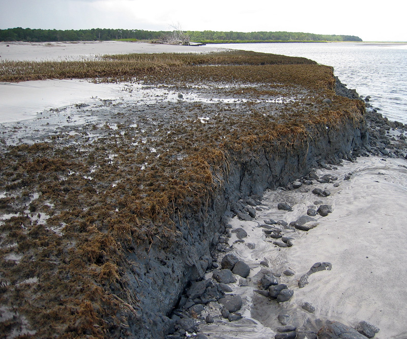
Overall view of relict marsh exposed on Cabretta Beach, Sapelo Island, Georgia. Me for scale, but photo taken 7 years ago, so the scale might now be slightly wider now. (Photograph taken by Ruth Schowalter.)

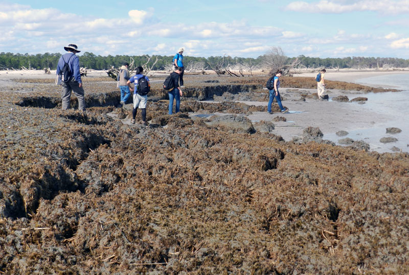
Just a little more than a week ago, my colleague Steve Henderson and I took a group of students from Emory University to Sapelo Island for a weekend field trip (detailed last week). One of our goals on this trip was to take them to a relict marsh on Cabretta Beach so that they could better appreciate how a sedimentary deposit makes a transition from living ecosystem to inert rock, yet filled with evidence of its formerly teeming life. Similar relict marshes are on St. Catherines Island and other Georgia-coast islands, but when it comes to teaching about taphonomy in the field, I prefer using the one on Sapelo.

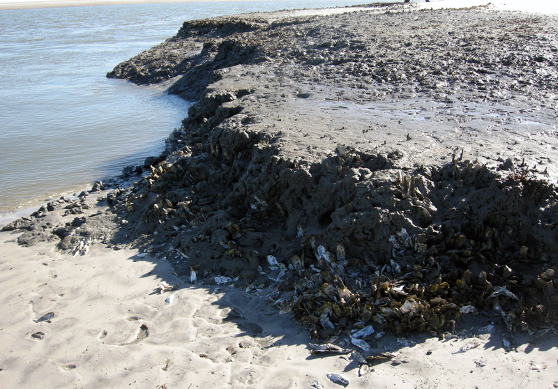
Closer view of relict marsh on Sapelo Island, showing 500-year-old remains of smooth cordgrass (Spartina alterniflora), cross section of its muddy sediments, and quartz sand deposited on top by tides, waves, and wind. (Photograph by Anthony Martin.)

As mentioned in a previous entry, modern salt marsh on the Georgia coast have a few key components that make them among the most productive of all ecosystems: smooth cordgrass (Spartina alterniflora), marsh periwinkles (Littoraria irrorata), mud fiddler crabs (Uca pugnax), and ribbed mussels (Geukensia demissa). So if a Georgia salt marsh were to be buried quickly – say, by a storm that dumps a thick layer of sand on it – what would be preserved? The Cabretta relict marsh partially answers that question, showing us incipient trace and body fossils of these biota. They are not quite fossils, but on their way there, giving us a glimpse of the fossilization process well before it is completed.

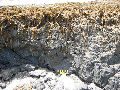
For example, the tall, green or golden stalks of smooth cordgrass that we see today, adorned my millions of marsh periwinkles (Littoraria irrorata), are absent from the relict marsh. Only the lowermost ochre-colored stubs and extensive root systems remain, and traces made by the roots below what was the marsh surface.

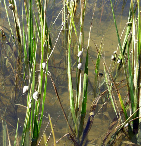
Modern smooth cordgrass (Spartina alterniflora) and its constant companions, marsh periwinkles (Littoraria irrorata) on Sapelo Island, Georgia.

Cross-sectional view of relict marsh, what is left from a formerly magnificent marsh: stubs, roots, root traces, and not many periwinkles. (Both photographs by Anthony Martin.)

Once in a while, I also find old marsh periwinkle shells scattered on the surface of the relict marsh. These are made of calcium carbonate and will dissolve in slightly acidic waters, so these might not last for long once exposed. The real reason for why these tend to disappear quickly, though, is modern hermit crabs. Hermit crabs encounter these periwinkle shells on the relict marsh surface, say “Hey, free shells!”, then happily trot away with these, not caring that their “new” homes are actually 500 years old.

No mud-fiddler crab remains were apparent on the surface, nor have I seen them in 20-30 visits to this relict marsh. This is not surprising, as their exoskeletons are made of chitin and dissolve more quickly than molluscan shells. Nonetheless, their burrows are always abundantly evident on the surface as perfectly round holes, which are sometimes accompanied by new burrows made by modern fiddler crabs, as well as bivalves that will bore into this firmground.

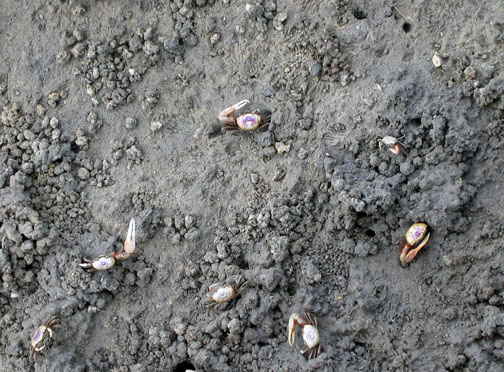
Modern salt marsh surface on Sapelo Island with mud fiddler crabs (Uca pugnax) showing off a few of the behavioral traits they do best: eating, fighting, mating, and burrowing. Note that burrows, surface scrapings, and pellets are a few of the traces they make. Which of these traces get preserved?

Close-up of eroded relict marsh surface, showing cross-sections of old fiddler-crab burrows now being filled with modern beach sand. Think of how this will look in the fossil record. (Scale in centimeters).

Longitudinal view of former fiddler-crab burrows associated with smooth-cordgrass root traces. Fill the deeper parts of these burrows with sand, and they’re more likely to get preserved as trace fossils. Scale to right is 15 cm (6 in) long. (All photographs by Anthony Martin.)

Modern ribbed mussels are harder for us to see in the field because we would have to wade into soft, deep, sulfurous mud to get close to them, and however amusing that might be, we don’t have time to do our laundry before getting back into our rental vans for the ride home. So the students take our word for it that those mussels are indeed in the marsh, then we point to the old ones clumped on the relict-marsh surface that are still in life position.

Cluster of ribbed mussels (Guekensia demissa) directly associated with stubs of smooth cordgrass on relict marsh surface. Now that they’re exposed, how long will these shells last on the surface? (Photograph by Anthony Martin.)

Oysters (Crassostrea virginica) are less common in the relict marsh, but given the right exposure, these can be observed on some visits too. These clumps of oyster shells mark the edges of tidal creeks that wound through the marsh.

(Top) Modern salt marsh with tidal creek cutting through it and oyster bank exposed at low tide, Sapelo Island.

Former oyster bank peeking out of relict marsh, formerly buried for about 500 years, now revealed by erosion of the modern shoreline. (Both photographs by Anthony Martin.)

Because it was all too easy to spot the similarities between this relict marsh and a modern one less than 100 meters (330 feet) from where we stood, I then asked about other differences. For instance, take the fact that we were standing on the relict marsh while discussing its traits: could we do the same in the modern marsh nearby? No, was the universal answer, and I affirmed that they would likely be up to their waists in ribbed-mussel-produced mud. (I asked for volunteers to test this hypothesis, and they very smartly declined.)

This led to a discussion of why the relict marsh could be so firm, which introduced them to the concept of diagenesis: how a sedimentary deposit can change over time, an important consideration in taphonomy. Such alterations are especially apparent in muds, which lose considerable volume as these lose their water content, causing a “softground” to become a “firmground,” then eventually a “hardground.” The students were surprised when I told them that the relict marsh acting as the floor of our “classroom” was likely 2-3 times as thick as what was there now.

Would these students so blithely walk around on a modern salt marsh? I don’t think so, and please don’t experiment with this yourself. Nevertheless, a relict marsh, thanks to dehydration of its muds and compaction, is just fine for exploring on foot. (Photograph by Anthony Martin.)

We spent only about an hour at the relict marsh before regretfully walking back to our field vehicle, followed by a ferry ride to the mainland part of Georgia and a long drive home to Atlanta. Yet I felt assured that the lessons about taphonomy, ancient environments, ichnology, and diagenesis imparted by this relict marsh encompassed enough material to fill 4-5 class sessions in an indoor classroom. Moreover, if we had been all enclosed by four walls and a ceiling, and without a former marsh underfoot, there was no guarantee that these concepts would be understood or retained.

This is why we geoscientist-educators take our students outside, enriching our collective awareness of how environments change through time and how we piece together the clues left behind from ancient environments. It’s memorable, it’s fun, and it works. But don’t take my word for it. Whether you’re an educator or student, try it yourself sometime, whether on the Georgia coast or elsewhere, and see what happens.

Further Reading

Basan, P.B., and Frey, R.W. 1977. Actual-palaeontology and neoichnology of salt marshes near Sapelo Island, Georgia. In Crimes, T.P., and Harper, J.C. (editors), Trace Fossils 2. Liverpool, Seel House Press: 41-70.

Edwards, J.M. and Frey, R.W. 1977. Substrate characteristics within a Holocene salt marsh, Sapelo Island, Georgia. Senckenbergiana Maritima, 9: 215-259.

Frey, R.W. and P.B. Basan. 1981. Taphonomy of relict Holocene salt marsh deposits, Cabretta Island, Georgia. Senckenbergiana Maritima, 13: 111-155.

Frey, R.W., Basan, P.B. and Scott, R.M. 1973. Techniques for sampling salt marsh benthos and burrows. American Midland Naturalist, 89: 228-234.

Letzsch, W.S. and Frey, R.W. 1980. Deposition and erosion in a Holocene salt marsh, Sapelo Island, Georgia. Journal of Sedimentary Research, 50: 529-542.

Morris, R. W. and H. B. Rollins. 1977. Observations on intertidal organism associations on St. Catherines Island, Georgia. I. General description and paleoecological implications. Bulletin of the American Museum of Natural History, 159: 87-128.

Smith, J.M., and Frey, R.W. 1985. Biodeposition by the ribbed mussel Geukensia demissa in a salt marsh, Sapelo Island, Georgia. Journal of Sedimentary Research, 55: 817-825.

Using Traces to Teach about Traces

This past weekend, my colleague Steve Henderson and I co-led a field trip to Sapelo Island, Georgia with 13 Emory University undergraduate students and our spouses. This trip is done biannually as a firm requirement for students taking a class of mine at Emory called Modern and Ancient Tropical Environments. This course, in turn, is a prerequisite for a 10-day field course we’ll do in December-January, ENVS 242, which appropriately has the same name as ENVS 241 except for the addition of “Field Course” at the end. That course, though, will take place on another island, albeit a very different one, San Salvador, one of the “Out Islands” of the Bahamas.

Why were we on Sapelo Island to prepare for a field course in the Bahamas? It was to fulfill several learning goals that will sound familiar to all science educators who take their students outside of a classroom for their learning. In no particular order, these are:

  • Get students to observe natural phenomena while in the field;
  • Ask good questions about what they’ve observed;
  • Learn how to properly record their observations;
  • Come up with explanations (hypotheses) for whatever questions were provoked by their field experiences; and
  • Staying safe while doing all of this, which included adjusting to whatever conditions we might encounter in the field.

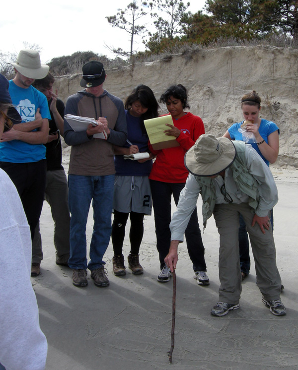
Our spouses, Ruth Schowalter and Kitty Henderson, are also educators; Ruth teaches English as a Second Language (ESL) at Georgia Tech, and Kitty is a middle-school earth-science teacher in Covington, Georgia. Moreover, both have been to Sapelo Island many times, having gained a wealth of field-gained knowledge about its natural history. Hence our students were lucky to have all four of us there to introduce them to the island, and we likewise felt very fortunate to be there with such an eager group on a gorgeous fall weekend.

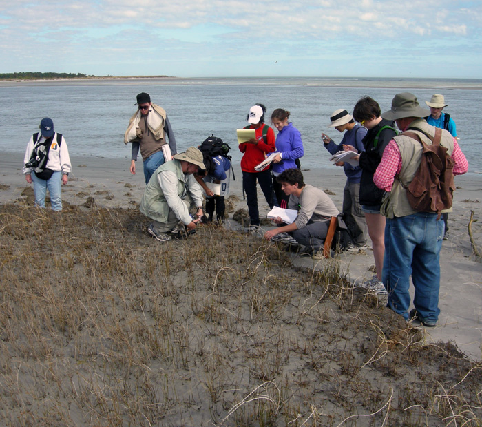
Environmental Studies students from Emory Univeristy with me (foreground) and Steve Henderson (right), looking at a 500-year-old relict salt marsh, exposed by erosion along Cabretta Beach on Sapelo Island, Georgia. Sure beats staying in a classroom to learn about modern and ancient environments. (Photograph by Ruth Schowalter.)

Of course, once on Sapelo or any other barrier island of the Georgia coast, I cannot help but use ichnology – the study of traces – as a uniting theme for my teaching. Steve, who did his Ph.D. research on Sapelo in the late 1970s, is more of a taphonomist, which is someone who studies how fossils are made, from death to burial to preservation. Nonetheless, ichnology and taphonomy overlap considerably, hence our respective approaches complement one another very well, a synergism aided by our having had the same Ph.D. advisor – Robert (Bob) Frey – at the University of Georgia. Once in the field, every track, burrow, feces, and body part of a dead animal we found – and the occasionally sighted live animal – became a dynamic learning opportunity for us, in which we could apply basic scientific methods that were all accented by a sense of wonder.

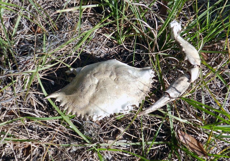
A dead blue crab (Callinectes sapidus) found in the middle of Sapelo Island, at least 2 kilometers (1.2 miles) from the ocean. How did it get there, and what happened to it? Our students went through the possibilities based on the evidence – main body nearly entire, no toothmarks on it, but bleached white and missing most legs. We finally concluded that it had been dropped by a large predatory bird, such as a great blue heron (Ardea herodias) or great egret (Ardea alba), which probably had shaken off most of the crab’s legs before attempting to eat it. A nice little lesson in taphonomy, for sure. (Photograph by Anthony Martin.)

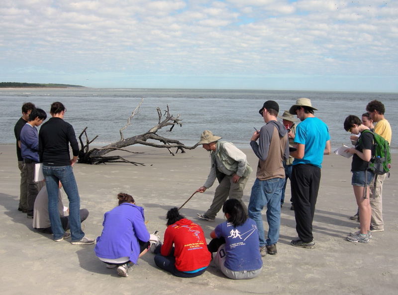
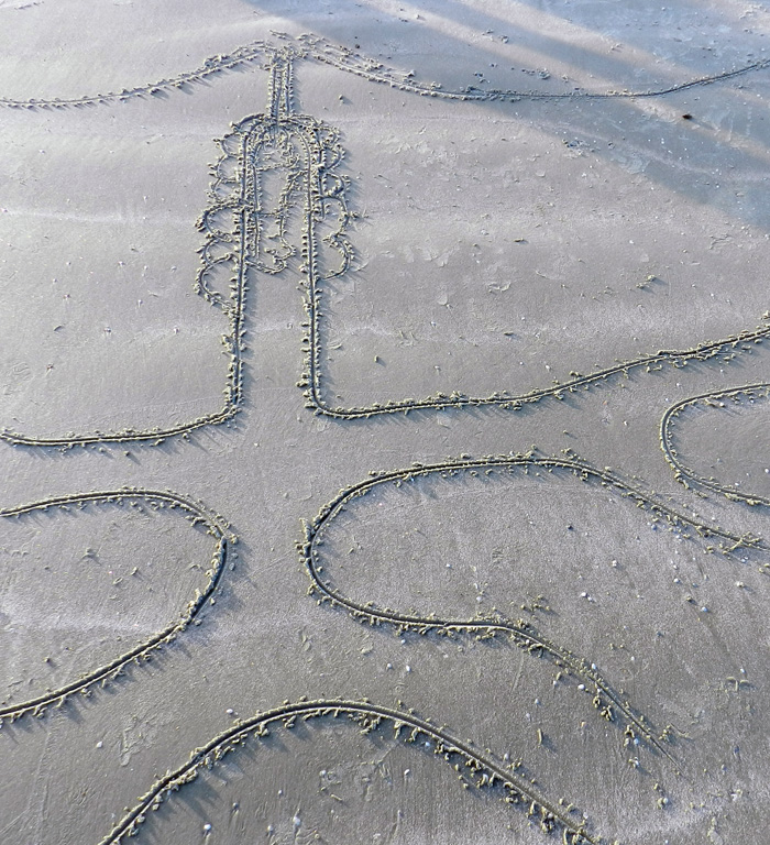
But perhaps my favorite teaching techniques to use while on Sapelo or any other Georgia barrier island is to use the completely low-tech and ancient method of drawing in the sand. Through my own traces, then, I can teach my students about ichnology and its applications to understanding geologic processes. For example, one of the beaches on Sapelo – Cabretta Beach – is undergoing rapid erosion from a combination of longshore drift and sea-level rise. At this place, downed pines and oaks laid prone in the surf, a former forest now a beach. This was the perfect place to introduce the students to Walther’s Law, which states that laterally adjacent environments will succeed one another vertically in the geologic record. This principle then can be applied to figuring out how a given sequence of strata might reflect a rising or lowering of sea level in the past.

No PowerPoint? No projector? No computer? No problem. Teaching in the field is easy when you have such a nice canvas to work with. (Photograph by Ruth Schowalter.)

So with the sea behind me, a sandy beach wiped clean by the receding tide, and a handy stick, I scratched out a typical sequence of sedimentary strata and their diagnostic traces that would result from sea level going up (a transgression) on the Georgia coast. (Ruth and I were also inspired to create artwork on this theme, discussed in a previous entry.) Terrestrial environments with tree-root and insect traces were at the base of the sequence, succeeded vertically by sandy dune deposits with ghost-crab and insect burrows, then sandy beach deposits with ghost-shrimp burrows, topped off by offshore sandy muds and sands burrowed by fully marine echinoderms, such as heart urchins, sea stars, and brittle stars. I then asked the students to look around them and point to each of the laterally adjacent environments represented in my sand drawing, which they dutifully did. Finally, just to make sure our students got it, we inquired about what sequence should result if sea level dropped, and they correctly surmised that the place would revert back to terrestrial conditions, with the marine sediments buried below.

My applying the final touches on a sand-sketch masterpiece of a transgressive-regressive sequence of strata and its traces, as my students watch. Would you like to see it? Sorry, the tide came in just a few hours after I drew it, and we didn’t get a photo of it. So you’ll just have to draw your own, and preferably on a beautiful beach. (Photograph by Ruth Schowalter.)

As we all stood back to look at the transgressive-regressive sequence of strata, the formerly abstract concept of Walther’s Law became far more real for our students. The dead trees on either side of our group, an eroded dune and maritime forest behind us, and the sea in front of us, all reinforced this lesson, bolstered by our presence in a place with those environments being actively affected by geological and biological processes.

Another instance of using traces in the sand to teach about traces was with ghost-shrimp burrows. At low tide on the previous day of the field trip, the students found many small, volcano-like mounds on the intertidal beach surface some with neat piles of tiny mud-filled cylinders that looked like “chocolate sprinkles” sometimes seen on cupcakes. What were these?

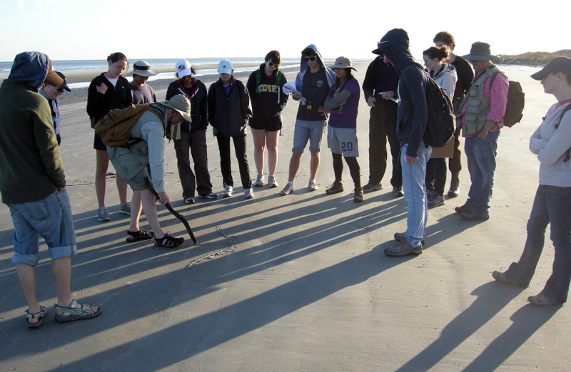
I informed them that we were looking at the tops of ghost-shrimp burrows and their fecal pellets; earlier, we had seen the knobby, pelleted walls of these same ghost-shrimp burrows, which were the deeper parts. What does an entire ghost-shrimp burrow system look like in cross-section? Time for another sand drawing. This one introduced the students to what had been only disembodied words memorized for an exam – ghost shrimp, pellets, walls, vertical shafts, branching – that now could be supplemented by actual traces next to the drawing. You can’t beat these sorts of visual aids, a huge bonus from our being in the right places to see them.

Using a “clean slate” of a beach wiped smooth by the tide for sketching a cross-section of a typical ghost-shrimp burrow, many of which also happened to be underneath our feet. (Photograph by Ruth Schowalter.)

The final sketch of a ghost-shrimp burrow, showing its volcano-like top, narrow “chimney” leading down to the main shaft of the shrimp’s living chamber, some of the pellets lining its burrow walls, and the geometry of the burrow network below. (Photograph by Anthony Martin.)

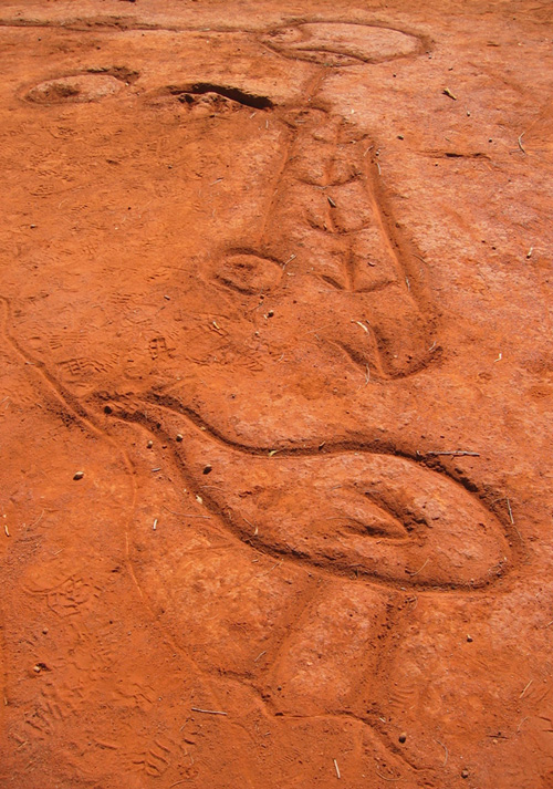
Was my teaching technique new and innovative, worth presenting at an educational conference as an assessment-friendly pedagogy that would maximize outcome-based education? In short, no. Sand drawing as a tool for education has a very long tradition in indigenous cultures, especially those that have their own forms of ichnology (such as tracking) at their cores. For example, in central Australia, Ruth and I had seen a creation story etched in the ground that had been done some by the Arrente people who live near Uluru. This story likewise used animal traces (emu tracks) as a key feature, a sort of iterative use of traces for inspiration and teaching.

Creation story of the Arrente people drawn in the soil near Uluru in Northern Territory, Australia. The figure at the bottom is an emu, and its tracks are shown leading away from it. (Photograph by Anthony Martin.)

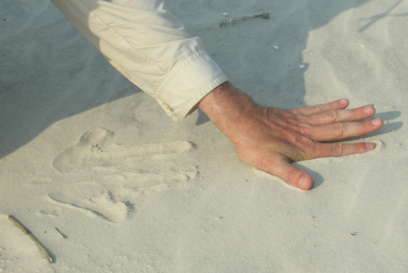
At the same place, we also watched an Arrente elder demonstrate how to make animal tracks using only his fingers and palms, which was also described in books we had read about

Did you know you can use your hands to make animal tracks? In this photo, I use the fine-grained dune sands of Sapelo Island to create a reasonable depiction of kangaroo tracks. Yes, I know, kangaroo tracks on the Georgia barrier islands are not very likely, but you get the idea. Next time I’ll do raccoon tracks instead.

Some of us educators are old enough to remember using a technological succession of blackboards and chalk, overhead projectors with pens, whiteboards with dry-erase pens, and now presentation software (Keynote, PowerPoint, and so on) for imparting lessons. So it gives me great comfort to know that, with a generation of students who have never known a world without computers with a concomitantly reduced connection to the outdoors, we can still switch back to using the ground beneath our feet, our eyes, hands, and imaginations to teach and learn about the life traces around us.

Further Reading

Bingham, J. 2005. Aboriginal Art and Culture. Raintree, Chicago, Illinois: 57 p.

Hoyt, J.H., and Hails, J.R. 1967. Pleistocene shoreline sediments in coastal Georgia: deposition and modification. Science, 155: 1541-1543.

Hoyt, J.H., Weimer, R.J., and Henry, V.J., Jr. 1964. Late Pleistocene and recent sedimentation on the central Georgia coast, U.S.A. In van Straaten, L.M.J.U. (editor), Deltaic and Shallow Marine Deposits, Developments in Sedimentology I. Elsevier, Amsterdam: 170-176.

Louv, R. 2005. Last Child in the Woods: Saving Our Children from Nature-Deficit Disorder. Algonquin Books, Chapel Hill, North Carolina: 390 p.

Middleton, G.V. 1973. Johannes Walther’s Law of the Correlation of Facies. GSA Bulletin, 84: 979-988.

Weimer, R.J., and Hoyt, J.H. 1964. Burrows of Callianassa major Say, geologic indicators of littoral and shallow neritic environments. Journal of Paleontology, 38: 761-767.

“Worm Burrows” as a Geological Cliché

This past week, I was privileged to have participated in a marvelous three-day field trip to the Triassic and Jurassic sedimentary rocks in and around St. George, Utah. The field trip, organized by paleontologist Andrew Milner and many others in association with the Society of Vertebrate Paleontology meeting in Las Vegas, Nevada, provided our enthusiastic group of nearly forty professional and amateur paleontologists with a grand geological tour of southern Utah and northern Arizona, along with the fantastic dinosaur tracksites in that area.

Foremost among these places where dinosaurs left their marks was one of the most incredible tracksites have seen anywhere, which, like Lark Quarry in Queensland, Australia, is enclosed within a building to protect it. This place, called the St. George Dinosaur Discovery Site at Johnson Farm, has one of the few sitting-dinosaur trace fossils known from the fossil record, along with the world’s best collection of dinosaur swimming tracks, rare examples of dinosaur tail-drag marks, hundreds of other dinosaur tracks, and thousands of invertebrate trace fossils. All were enthralling as detailed records of daily life in the Early Jurassic Period, from about 195 million years ago.

You would think on a field trip like this that Georgia – countering Ray Charles’ memorialized sentiment – would not be on my mind. Yet the modern traces made by living animals of the Georgia barrier islands habitually creep into my thoughts whenever I travel into the geological past. In this instance, the trigger for my thoughts of Georgia traces was through hearing other field-trip participants utter the most recurring of geological clichés connected to invertebrate trace fossils: “worm burrows.”

Invertebrate trace fossils (left) directly associated with theropod dinosaur footprints (right) from the Moenave Formation (Lower Jurassic), southern Utah. These trace fossils are probably the burrows of larval insects made in moist muddy sand, rather than burrows made by earthworms in soils. So don’t be calling them “worm burrows,” or else a baby kitten will get mildly scolded. (Photograph by Anthony Martin.)

Several people spontaneously spoke this ichnological banality as soon as they saw small burrows preserved in the rock, many of which were directly associated with the exquisitely preserved dinosaur tracks. This happened often enough (which is to say, twice) that I just had to call attention to this geological faux pas. “Stop saying ‘worm burrows’!” I said with mock outrage. I quickly followed my joking admonishment with a brief explanation of how most of the burrows were much more likely to be from insects, rather than worms. Traits of the burrows – such as scratchmarks and short, branching, angled tunnels – implied insect tracemakers, such as the larvae of beetles or flies.

Insect traces associated with dinosaur tracks should not be all that surprising to anyone. After all, insects originated in terrestrial environments about 400 million years ago, meaning they were more than halfway through their evolutionary history by the time these Jurassic trace fossils were made. I had seen many similar burrows made by insects on the Georgia barrier islands and elsewhere in Georgia, which gave me enough confidence to propose their more probable identity.

Insect burrows – probably made by “mud-loving” beetles – along the shore of a freshwater pond on Sapelo Island, Georgia. Notice the burrows are relatively younger than (cross-cut) two tail dragmarks made by resident alligators (Alligator mississippiensis). Sandal as scale, which is size 8 1/2 (men’s). (Photograph by Anthony Martin.)

Of course, once you draw attention to a word or phrase among friends that is guaranteed to provoke annoyance, you should expect them to bring it up more frequently later as fodder for their amusement. Indeed, this happened for the remainder of the field trip, and I did not disappoint my audience as I responded with histrionic cringing, flinching, and groaning each time we encountered more of these “worm burrows” in Triassic or Jurassic rocks and they were identified as such.

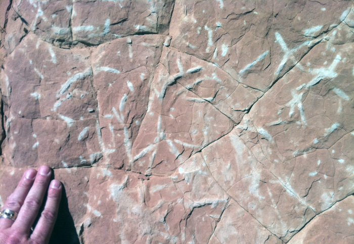
Look, worm burrows! Ha-ha! The beautiful invertebrate trace fossils, former burrows filled with white sand that contrasts from the surrounding hematite-stained sand, are also in the Moenave Formation (Lower Jurassic) of southern Utah. (Photograph by Anthony Martin.)

All frivolity aside, the point I was trying to make to my field-trip tormenters was this: whenever we look at sedimentary rocks formed in continental environments, and we happen to notice invertebrate trace fossils in those same rocks, we should think before speaking. In other words, we do better as paleontologists, geologists, or naturalists in general when we reexamine our neat, preconceived labels before applying them loudly and confidently to observed phenomena, and particularly with invertebrate trace fossils.

For example, even the word “burrow” can be too glib for interpreting certain invertebrate trace fossils. Many invertebrates do not move underneath a sedimentary surface but along it; traces of such movements are either trackways, which are made with legs and leave impressions of these, or trails, which are made by whole-body movement without legs, such as those formed by worms or snails.

In my experience, trackways and trails are often lumped in with burrows, despite possessing impressions made by legs, furrows, and levees. For example, some of the trace fossils we saw on the field trip were certainly trails, yet I heard these called “burrows” by a few people. Granted, this sort of confusion is actually more understandable than the “worm-burrow” mistake, because trails can segue into shallow horizontal burrows and vice-versa, or some “trails” actually can have tiny leg impressions, meaning they actually are trackways. Thus the distinction between these end members can become blurred quite easily if you don’t pay attention to the details of a given invertebrate trace.

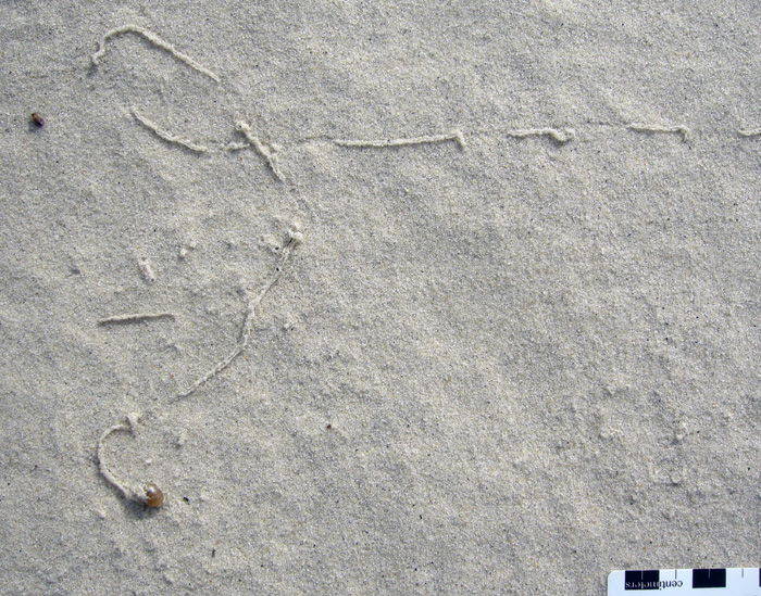
Modern land snail (pulmonate gastropod) making a trail on surface of a coastal dune, Cumberland Island, Georgia; scale in centimeters. (Photo by Anthony Martin.)

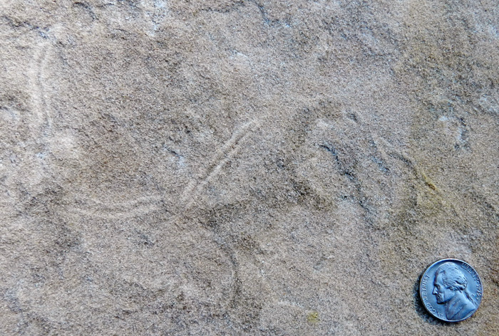
Fossil trail, possibly made by a snail, on a former sand dune in the Navajo Formation (Lower Jurassic) of southern Utah. Research funding for scale. (Photograph by Anthony Martin.)

Insect burrow, probably made by a beetle larva, in which it changes from a shallow burrow to a trackway on the surface of a coastal dune, Little St. Simons Island, Georgia. Scale in millimeters. (Photograph by Anthony Martin.)

In the sands and muds of the Georgia barrier islands, insect burrows in particular have often caused me to keep quiet about what I think made them, versus what really made them. Many times I have seen a little lump at the end of a horizontal burrow, scooped up the tracemaker hiding underneath, and been surprised by what was there. Most of these tracemakers have turned out to be small adult beetles or beetle larvae of various species, but I can’t ever predict which life stage or species will be there based just on their traces. (At least, not yet.)

Shallow burrow with short branches in a coastal dune, Cumberland Island, Georgia. Gee, I wonder what worm made it?

Surprise! It was a tiny adult beetle, found at the end of the burrow. Didn’t see that coming, did you? Well, maybe you did after all of the pedantic foreshadowing. (Both photographs by Anthony Martin.)

As a result of these insect-inspired search images, embedded in my consciousness from years of looking at Georgia-coast insect traces, I cannot ever again look at trace fossils made in formerly terrestrial environments and simply say, “worm burrows,” at least with a clear scientific conscience or a straight face. Hence whenever I see similar burrows in sedimentary rocks that were formed in lakes, streams, or soils from the Devonian Period to the recent, my default hypothesis is “insect burrows,” rather than “worm burrows.” Is this always right? No, as some terrestrial trace fossils, such as Edaphichnium and Castrichnus, were almost certainly made by earthworms, and nematode worms may have formed others, like Cochlichnus. (Although Cochlichnus has also been linked with insect tracemakers – but that’s a another story for another day.) Nonetheless, saying “insect burrows” is more likely to be correct than the alternatives, and in science, it’s good practice to learn from your mistakes.

So geologists and paleontologists everywhere, I beseech you not to limit yourselves descriptively when you encounter the millions of lovely and varied invertebrate trace fossils in sedimentary rocks formed in terrestrial environments. The truth will set you free (or at least put you on parole), and these seemingly simple trace fossils will become more intriguing as you realize their full complexity and potential mystery. Call them something other than “worm burrows,” then see what happens.

Invertebrate trace fossils (burrows) in sandstone from the Moeanave Formation (Lower Jurassic) in St. George, Utah. Do they look a little different to you now that you’re ready to give them a different name than mere “worm burrows”? (Photograph by Anthony Martin.)

(Acknowledgements: Many thanks to Andrew Milner, Jim Kirkland, Tyler Birthisel, Martin Lockley, Brent Breithaupt, Neffra Matthews, and many others for their organizing a most excellent three-day field trip to the Triassic-Jurassic rocks of southern Utah and northern Arizona. We all learned heaps from this direct experience, and greatly appreciate the huge amount of time and effort put into preparing for the field trip.)

Further Reading

Milner, A.R.C., Harris, J.D., Lockley, M.G., Kirkland, J.I., and Matthews, N.A. 2009. Bird-like anatomy, posture, and behavior revealed by an Early Jurassic theropod dinosaur resting trace. PLoS One, 4(3): doi:10.1371/journal.pone.0004591.

Rindsberg, A.K., and Kopaska-Merkel, D. 2005. Treptichnus and Arenicolites from the Steven C. Minkin Paleozoic footprint site (Langsettian, Alabama, USA). In Buta, R. J., Rindsberg, A. K., and Kopaska-Merkel, D. C., eds., = Pennsylvanian Footprints in the Black Warrior Basin of Alabama, Alabama Paleontological Society Monograph No. 1: 121-141.

Smith, J.J., Hasiotis, S.T., Kraus, M.J., and Woody, D.T. 2008. Relationship of floodplain ichnocoenoses to paleopedology, paleohydrology, and paleoclimate in the Willwood Formation, Wyoming, during the Paleocene–Eocene thermal maximum. Palaios, 23: 683-699.

Verde, M., Ubilla, M., Jiménez, J.J., and Genise, J.F. 2006. A new earthworm trace fossil from paleosols: aestivation chambers from the Late Pleistocene Sopas Formation of Uruguay. Palaeogeography, Palaeoclimatology, Palaeoecology, 243: 339-347.
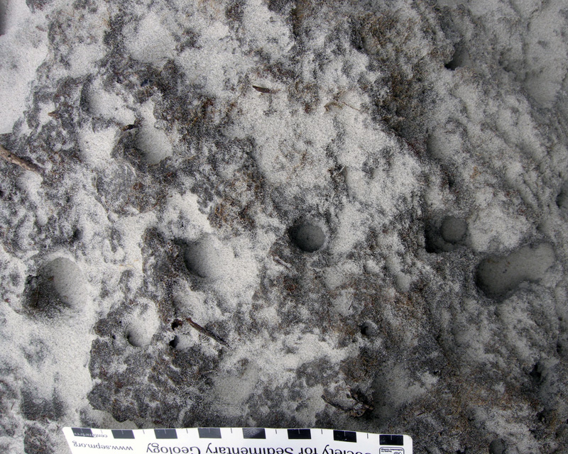
Ghost Crabs and Their Ghostly Traces

The ghost crabs of the Georgia barrier islands – all belonging to the species Ocypode quadrata – are among my favorite tracemakers anywhere, any time. My ichnological admiration for them stems from the great variety of behaviors they record in the beach and dune sands of the islands, telling many fascinating tales of what they were doing while no one was watching. Thus I thought it only appropriate that a blog entry posted close to Halloween deserved a story about an animal that not only has the word “ghost” in its common name, but one that also leaves mystifying marks of its unseen behavior.

On the dawn of June 22, 2004 on Sapelo Island (Georgia), my wife Ruth and I were presented with one of the most intriguing of ghost-crab mysteries related to their vestiges. We were scanning the freshly scoured surfaces of Nannygoat Beach on the south end of the island; high tide only a few hours before had cleansed the beach of the previous day’s traces. The low-angle rays of early-morning sunlight were optimal for contrasting any newly made animal signs on the beach, which is why we were there then. We went to the beach with our minds open to anything novel; indeed, my experience with the Georgia barrier islands is that no matter how many times you visit them, they always hold previously unsolved puzzles.

Sure enough, within about 15 minutes of stepping foot on the beach, Ruth paused and asked one of the most simple – yet important – of scientific questions: “What is this?” She pointed to a depression on the sandy surface, and what I saw was astonishing. It was a trace perfectly outlining the lower (ventral) half of a ghost crab, preserving in detail: impressions of all eight walking legs (pereiopods), including their pointed ends (dactyli); its smaller claw (inferior cheliped) and larger claw (superior cheliped); and its main, rectangular body.

A perfect outline of the bottom side of a ghost crab (Ocypode quadrata), found just after dawn and high tide on Nannygoat Beach, Sapelo Island, Georgia. Why would a ghost crab make such a trace? (Scale in centimeters, and photograph taken by Anthony Martin.)

Even more strangely, only one set of tracks connected with this body imprint, leading away from it, and none moved toward it. This was not an impression made by the dead body of a crab. Instead, the tracks showed that the crab was very much alive when it made its resting trace and immediately afterwards. But what happened just before then? It looked as if the crab floated through the air, dropped vertically, made a perfect 10-point landing, sat there for a while, and walked away.

Another exquisitely defined ghost-crab body impression, and with tracks leading away from it, showing this is not a crab “death mask,” but one made by a live crab. (Scale in centimeters, and photograph taken by Anthony Martin.)

The same ghost-crab impression as above, but this time with the crab anatomy labeled and direction of movement after it stopped and sat down on the sand. What happened to the tracks that must have led to its resting spot? And what’s with that word “hydration”? Let’s just say this is what you call “foreshadowing” in the story. (Scale in centimeters, and photograph taken by Anthony Martin.)

Knowing that ghost crabs can do a lot of things, but not aerial acrobatics, we wondered how this could have happened. Well, single observations can be the start of good science, but for this inquiry to progress any further, we had to see if this seemingly unusual observation could be repeated. So we walked further south along the beach to test whether this was an isolated incident, or if we could find any other ghost-crab outlines with single trackways attached. With such a search image in mind, we quickly found about a dozen more such marks made by crabs of various sizes, but showing an identical behavior. Even better, all were located just below the high-tide mark of the previous night.

Yet another beautiful ghost-crab resting trace, surrounded by a scoured beach surface. Lot of these traces and all just below the high-tide mark meant something was happening that could be answered by the awesome power of science. (Scale in centimeters, and photograph taken by Anthony Martin.)

Time to think. These crabs must have walked to their resting places, but why didn’t they leave any tracks? We soon realized that the tracks were certainly made, but not preserved. So like all other surface traces on the beach, they must have been made erased during high tide. Yes, that was it! The crabs walked to the surf zone just after the high tide, sat down, waited long enough for the tide to drop a little bit, and walked away.

Mystery solved? Well, not quite. This was an incomplete explanation, one with a big, unanswered question. Why did the ghost crab walk to – and sit down in – the surf? (With a prompt like that, feel free to create your own intertidal-crab equivalent of “chicken-crossing-road” punch lines.) Ghost crabs normally spend much of their time in deep, J- or Y-shaped burrows close to or in the dunes, and above the high-tide mark. They are most active at night, when they come out of their burrows to scavenge delectable dead things dumped on the beach by waves and tides, or to prey on smaller invertebrates, like dwarf surf clams (Mulinia lateralis). They also leave their burrows to seek mates, which might involve one crab enticing another to check out its burrow.

A seemingly indignant and defiant ghost crab outside of its burrow during the day, either looking for new territory, food, mates, or all three. They’re greedy that way. In this instance, though, it was mostly running away from me and my camera. (Photograph taken by Anthony Martin.)

None of the crabs that made these traces were scavenging, preying, or mating, yet something in the surf was life-sustaining enough for them to risk becoming meals for early-morning predatory shorebirds. I searched my memory for what I had read previously about ghost crabs and their biological needs, and finally realized what could have driven them to the surf in the middle of the night: they were thirsty.

You see, ghost crabs are living examples of so-called transitional animalsthat evolution-deniers insist do not exist, having an interesting mixture of adaptations to different environments. These crabs are descended from fully marine crabs, so they still have gills that allow them to filter oxygen from marine water. Yet they also have little lungs and can breathe air, enabling them to stay out of the water for hours. Having both gills and lungs makes them semi-terrestrial, living in a world between the land and ocean, and dependent on both realms. They live close to the sea for their food, reproduction (females lay their fertilized eggs in sea water), and water, but their main livelihood is gained from the beach and dunes.

In this respect, ghost-crab burrows in the upper parts of beaches and lower parts of dunes provide protection against predators, but also keep the crabs hydrated. One of the functions of a ghost-crab burrow – which can be more than one meter (3.3 feet) deep, is to intersect the water table below. That way, when a crab needs water for proper respiration, it crawls down the burrow to that saturated area and replenishes it bodily fluids. But they can’t stay down there as the tide rises, so they move higher up the burrow to where there’s some air. Unlike blue crabs (Callinectes sapidus), which have completely developed gills and hence fully marine, if you keep a ghost crab in sea water too long, it drowns.

The previous night was a higher tide than normal, which probably flooded many of the ghost-crab burrows and causing these crabs to abandon their homes. This meant the crabs spent most of the night outside of their burrows, resulting in dehydration, but having to wait out the high tide. As soon as the tide turned and began to drop, the crabs ran to the surf zone, settled down into the wet sand, and soaked up water through small openings where the legs connect to the main body. Spiky “hairs” (setae) on their legs help with this water up-take, drawing up moisture from the sand through capillary action.

My legs? Sorry, I meant to shave. Guess you’ll have to deal with it. Hey, wait a minute: does that pose look like it could make anything you’ve already seen, like, oh, I don’t know, a resting trace? Keep reading. (Photograph by Anthony Martin.)

Ghost crabs are amazingly efficient at pulling water out of sand. So their hunkering down onto a saturated sandy surface with waves breaking on top of them must have been like the ghost-crab equivalent of drinking from a funnel, quenching their thirst in a most satisfying way. Meanwhile, waves washed away their tracks leading to these resting spots. They stayed a while, long enough for the tide to drop and expose the sandy beach surface. Only then did they get up and walk away, fully rehydrated, refreshed, and ready to go back to their burrows or dig new ones.

This was a detailed explanation, but one based entirely on traces and what little I knew about ghost crabs from the scientific literature. How else to test it and see whether it was right or not?

If you just said, “By directly observing this interpreted behavior in a ghost crab,” you would be right. A little more than a month later, on July 30, 2004, I actually got to witness this behavior, and on Nannygoat Beach. Back without Ruth this time, and by myself, I was looking for more traces following a high tide, when I saw a small, wraith-like movement out of the corner of my eye. It was a beautiful adult ghost crab, flat-out running in full daylight and heading straight from the dunes to the surf zone. I stood back and watched it reach the surf, where it promptly sat down and became still.

Here’s a ghost crab that doesn’t mind getting a soggy bottom. This one sprinted from the dunes to the surf, stopped abruptly, and sat a spell. (Photograph by Anthony Martin.)

I took photos while walking toward this crab, expecting it to bolt at any moment. Instead, I was instead surprised to see it remain where it sat, even as its eye stalks rotated to look warily at me. Amazed, I grasped that this one must have been thirsty enough to risk being eaten or stomped. The photo you see shows just how close I got to it, and I was thrilled to see it in exactly the same position depicted by the traces Ruth and I had seen the month before.

Although scientists aren’t always right, if you practice good science, you sometimes hit the nail on the head. Or the crab on the sand. Or, well, never mind. Anyway, this ghost crab is making a trace just like the ones documented the month before and in the same place, and it is a direct result of the same behavior interpreted from just the traces and some knowledge of their physiology. It’s almost as if science has predictive power. Who’d have thought? (Photograph by Anthony Martin.)

With the “resting trace = rehydration” hypothesis now supported by both traces and direct observation, I wrote the results into a formal, peer-reviewed paper. Unexpectedly, such traces had never been documented for ghost crabs, and especially from the perspective of a paleontologist. In the paper, published in 2006, I pointed out that this behavior would explain similar-looking trace fossils in the geologic record, or the preservation of crab bodies frozen in the same position by death, perhaps reaching the surf too late and being buried by wave-borne sands. The geological significance of such trace fossils would be their value in pointing exactly to where the surf may have washed across an ancient shore, millions of years ago. Geologists really like this kind of precision, and become grateful to ichnologists who give them such tools they can easily use in the field.

A fossil crab from the Miocene Epoch (about 15 million years old), preserved in a sandstone bed cropping out on a beach near Comodora Rivadavia, Argentina. This crab and others like it in the sandstone were all preserved the same way: nearly entire, implying they were buried quickly, and parallel to the original sandy surface on which they settled. Could these have died after dehydration near the surf, and then been buried? How long ago did some crabs evolve to become semi-terrestrial? I don’t know, but now we have a hypothesis that can be applied to fossils like these and tested. (Coin is about 2.5 cm (1 in) wide; Photograph by Anthony Martin.)

Since then, I have seen these resting traces on the beaches of every Georgia barrier island, in the Bahamas, and other places where ghost crabs dwell. Although trace fossils echoing this behavior in ghost crabs or their ancestors have not yet been found, I predict that with the right images now in mind, geologists and paleontologists will recognize them some day.

So with this ichnological lesson from ghost-crab traces, I hope they have become just a bit less “ghostly” and much more alive in your imaginations.

Further Reading

Duncan, G.A. 1986. Burrows of Ocypode quadrata (Fabricus) as related to slopes of substrate surfaces. Journal of Paleontology, 60: 384-389.

Martin, A.J. 2006. Resting traces of Ocypode quadrata associated with hydration and respiration: Sapelo Island, Georgia, USA. Ichnos, 13: 57-67.
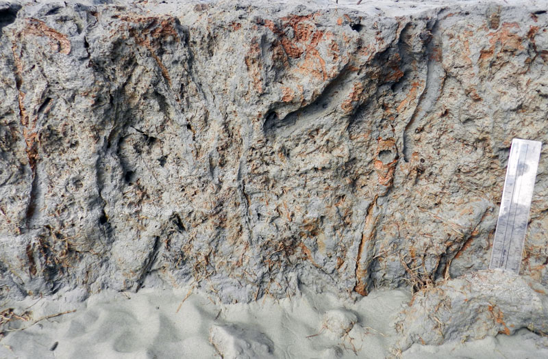
Wolcott, T. G. 1978. Ecological role of ghost crabs, Ocypode quadrata (Fabricius) on an ocean beach: Scavengers or predators? Journal of Experimental Marine Biology and Ecology, 31: 67-82.
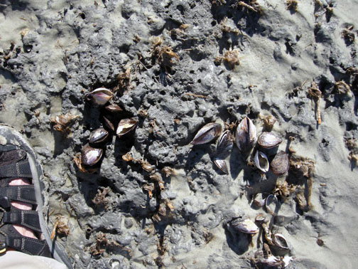
Wolcott, T. G. 1984. Uptake of interstitial water from soil: mechanisms and ecological significance in the ghost crab Ocypode quadrata and two gecarcinid land crabs. Physiological Zoology, 57: 161-184.

Of Sandhill-Crane Footprints and Dinosaurs Down Under

Last week, while in Athens, Georgia, I found myself musing about footprints from the barrier islands of Georgia and the Cretaceous rocks of Australia, despite their separation by half a world and more than 100 million years. These seemingly random thoughts came to me during a visit to the Department of Geology at the University of Georgia to give a lecture in their departmental seminar series.

It was a pleasure speaking at the geology department for many reasons, but perhaps the most gratifying was how it was also a homecoming. I had worked on my Ph.D. there in the late 1980’s, and in 1988-1989 had taught introductory-geology classes in the very same lecture hall where I gave my presentation. Several of my former professors, who were junior faculty then, are still there and now comprise a distinguished senior faculty. So seeing them there now, their smiling faces in the audience along with the latest generation of undergraduate and graduate students, generated all sorts of warm-and-fuzzy feelings.

But enough about the present: let’s go back about 100 million years to the Cretaceous Period, which was the subject of my talk. I had actually asked to speak about the modern Georgia barrier islands and their traces: you know, the main theme of this blog and my upcoming book of the same title (Life Traces of the Georgia Coast, just in case you need reminding). Nonetheless, my host and valued friend, paleontologist Dr. Sally Walker, figured that a summary of my latest research on the Cretaceous trace fossils of Victoria, Australia would bring in a wider audience, especially if I used the magical word “dinosaur” in the title (which I did).

For my talk at the UGA Department of Geology, I could have talked about this place – St. Catherines Island, Georgia – and it’s modern traces. After all, it’s only about a four-hour drive and short boat ride from Athens, Georgia.

But instead I talked about this place – coastal Victoria, Australia – and its trace fossils from more than 100 million years ago. Which wasn’t such a bad thing.

In retrospect, she was right, and I thoroughly enjoyed putting together an informative and (I thought) entertaining presentation that shared highlights of fossil discoveries from that part of Australia during the past five years. For the benefit of the students in the audience, basic geology was woven throughout the talk, as I included facets of sedimentology, stratigraphy, geochemistry, paleobotany, paleoclimatology, plate tectonics, evolution, history of science, field methods, and oh yes, dinosaurs. (If you are interested in hearing more about the science and personal experiences behind these recent findings in Australia, these are related in another blog of mine written previous to this one, The Great Cretaceous Walk.)

So how do the barrier islands of the Georgia coast and their animal traces relate to the Cretaceous of Australia? I mentioned the main reason briefly in my talk, but will elaborate more here: I likely owed one of my most important fossil discoveries in Australia to track-imprinted memories gained from field work on the Georgia coast. The fossil find, which happened in June 2010, was of about two dozen thin-toed theropod dinosaur tracks in Cretaceous rocks along the Victoria coast. These tracks represent the best assemblage of dinosaur tracks found thus far in southern Australia, and the largest collection of polar-dinosaur tracks in the Southern Hemisphere. Moreover, some of these tracks just happened to be about the same size and forms of footprints made by sandhill cranes (Grus canadensis).

Comparison between the footprint of a sandhill crane (Grus canadensis), made in moist sand next to a freshwater pond, St. Catherines Island, Georgia (top), and a footprint made by a theropod dinosaur about 105 million years ago on a river floodplain, Victoria, Australia (bottom). Notice the resemblance?

Sandhill cranes do not normally live on the Georgia barrier islands, and nearly all of them simply fly over or stop briefly during their annual migrations from south of Georgia to the Great Plains, or vice versa. However, at least a few have settled on St. Catherines Island, the same place on the Georgia coast where I recently studied gopher tortoise burrows. According to Jen Hilburn, the island ornithologist, some of these cranes found life so comfortable on the island that they stayed. This turned out to be fortunate for me, as I became familiar with their tracks after repeated visits to St. Catherines. Even though these tall, beautiful, and majestic birds restrict themselves to just one island year-round, St. Catherines is big enough to hold a wide variety of habitats and substrates, so I have seen their tracks in salt marshes, next to fresh-water ponds, and along dusty roads throughout the entire length of the island.

Who are you calling a “dinosaur”? A sandhill crane on St. Catherines Island graciously poses for its portrait, helping this ichnologist get a better idea of what an anatomically similar tracemaker might have looked like more than 100 million years ago.

Sandhill-crane trackway on the sandy substrate of a high salt marsh, St. Catherines Island, Georgia. In this environment, its tracks are accompanied by fiddler-crab burrows and feeding pellets, as well as the tracks and dig marks of raccoons hunting the fiddler crabs. Scale (toward the top of the photo) in centimeters.

So to make a long story short, while walking along the Victoria coast last year, I also carried with me mental picture of these tracks in Georgia. These images, I am sure, contributed to my stopping to look at a rock surface that held faint but nearly identical impressions made by dinosaurian feet on the once-soft sediments of a river floodplain. This is how ichnology is supposed to work, and it did.

A comparison between sandhill-crane tracks on the Georgia barrier islands and those of Cretaceous dinosaurs in Australia is actually not as far-fetched as one might think at first. For one, we now know that birds are dinosaurs, evolutionarily speaking. This formerly vague hypothesis is now a certainty, and is based on an ever-improving fossil record of feathered theropod dinosaurs, as well as studies from modern biology that show genetic and developmental affinities between modern birds and theropods. Even so, this idea is not new, either. For example, evolutionary biologist Thomas Huxley (1825-1895), friend and noted proponent of Charles Darwin, readily connected Archaeopteryx, the Late Jurassic bird (or dinosaur, depending on evolutionary perspective) with theropod dinosaurs.

Preceding Huxley, though, was one of the first scientists to formally apply ichnology to fossilized dinosaur tracks, Edward Hitchcock (1793-1864). Hitchcock interpreted the abundant dinosaur tracks of the Connecticut River Valley – many made by theropods – as those of large, flightless birds that lived before humans. Although he never made the evolutionary connection between dinosaurs and birds, his hypothesis reflected anatomical similarities between their feet.

A close-up look at sandhill crane feet while it takes a step. Notice the left foot has a little toe facing backwards, but off the ground. This is the equivalent of our “big toe,” also known as digit I, and it rarely registers in their tracks unless a crane walks in soft mud or sand. Instead, you will see impressions of the other three toes with clawmarks, and the middle toe normally makes the deepest mark.

Theropod dinosaurs, like many modern birds, mostly made three-toed tracks, a condition also called tridactyl. Although theropod tracks are occasionally confused with similar tracks made by ornithopod dinosaurs, they have the following traits: (1) three prominent, forward-facing digit impressions; (2) a footprint that is longer than wide; (3) angles of less than 90° between the outermost digits; and (4) well-defined clawmarks. One of the many changes that happened to bird feet as they evolved from non-avian theropods was the dropping of and rearward projection of their first digit (equivalent to our big toe). This condition was a great adaptation for grasping branches in trees and otherwise getting around off the ground. Bird tracks from the Cretaceous Period also tend to be wider than long, a function of the angles between the outermost toes becoming greater than 90°, and most of these also show the impression of a backward-pointing toe. Sandhill-crane footprint made in firm sand of a high salt marsh, St. Catherines Island, Georgia. Like many bird tracks, this one is wider than it is long, which is unlike most theropod dinosaur tracks. Still, these are very similar to tracks made by certain types of thin-toed theropod dinosaurs during the Cretaceous Period. Scale in centimeters.

Much later in their evolutionary history, though, some lineages of birds became either flightless or otherwise spent more time on the ground than in the trees, such as wading birds and shorebirds. These circumstances resulted in their first digit becoming reduced or absent, or vestigial. Violá, the tridactyl theropod-dinosaur footprint came back in style, so to speak, and now dinosaur ichnologists regularly study the tracks and behaviors of birds with such feet to better understand how their theropod relatives may have moved during the Mesozoic Era.

Comparison of a track made by a greater rhea (Rhea americana, right), which is a large flightless bird native to Argentina, to that of an equivalent-sized theropod dinosaur track (right). Both tracks have three forward-facing digits ending with sharp clawmarks and are longer than wide. Scale = 15 cm (6 in). The dinosaur track is a replica of an Early Jurassic theropod (from about 200 million years ago) from the western U.S. Photograph of the rhea track is by Anthony Martin, and of the dinosaur-track replica is by Ty Butler of Tylight™. Scale in the photo to the left = 15 cm (6 in).

Thus while writing the research paper on the dinosaur tracks, I kept in mind the comparison between sandhill-crane footprints in Georgia and the Australian dinosaur tracks. I also recalled how paleontologists had previously measured theropod skeletons – feet and rear limbs, specifically – and proposed a relationship between foot length and probable hip height.

Based on these studies, you can take a theropod track, multiply it by 4.0, and you get the approximate hip height of its trackmaker. When I applied this calculation to the Australian tracks, their hip heights ranged from about 25 to 60 centimeters (10-23 inches). The smallest of these dinosaurs I imagined as chicken-sized; perhaps these were juveniles of the larger ones. But what might be living today that would compare to the largest of the trackmakers? Immediately I thought of herons, but then it struck me that sandhill cranes provided a more apt analogy.

So I think you know where this is going. Adult sandhill-crane tracks are about 12 centimeters (4.7 inches) long, so if you apply the same formula for theropod-dinosaur tracks to them, their hip heights should be 48 centimeters (19 inches). Would this relationship also hold up on a modern dinosaur, such as a sandhill crane?

Just to satisfy my curiosity, I wrote to Jen Hilburn (St. Catherines Island) and asked her to do me a little favor: could she measure the hip height of a living, adult sandhill crane for me? Fortunately, Jen carried out my unusual request (she said it was not easy, so I definitely owe her), and she wrote back with an answer: 58 centimeters (22 inches). This wasn’t a perfect fit with regard to the footprint formula, but it certainly worked for the size of the Australian dinosaurs I had in mind as trackmakers. Based on my study of the Australian tracks, they were made by small ornithomimids, which likewise made thin-toed tridactyl tracks.

After thanking Jen, I delighted in explaining how her measurement of a Georgia-island-dwelling sandhill crane related to a dinosaur-track discovery on the other side of the world. Furthermore, in the Emory University press release that accompanied the publication of the dinosaur-track discovery in August 2011, the reporter (Carol Clark) used my analogy of the trackmakers as “…theropods ranging in size from a chicken to a large crane.”

Sandhill crane walking down a sand pile next to a fresh-water pond and maritime forest on St. Catherines Island, Georgia, and leaving lovely tracks for an ichnologist to study and keep in mind while tracking non-avian theropod dinosaurs.

Artist conception of Struthiomimus, a Late Cretaceous non-avian theropod dinosaur from western North America. Although not a perfect fit, the tracks of cranes and other similarly sized birds can be compared to those of ornithomimid dinosaurs to better discern the presence and behaviors of these dinosaurs. Artwork by Nobu Tamura and from Wikipedia Commons.

What other modern traces from the Georgia coast will contribute to our better understanding the fossil record? Time will tell, and I hope some day to again share those thoughts at my former home – the Department of Geology at the University of Georgia – with friends, students, and colleagues, new and old.

Further Reading

Elbroch, M., and Marks, E. 2001. Bird Tracks and Sign: A Guide to North American Species. Stackpole Books, Mechanicsburg, PA: 456 p.

Forsberg, M. 2005. On Ancient Wings: The Sandhill Cranes of North America. Michael Foreberg Photography: 168 p.

Henderson, D.M. 2003. Footprints, trackways, and hip heights of bipedal dinosaurs: testing hip height predictions with computer models. Ichnos, 10: 99–114.

Johnsgard, P.A. 2011. Sandhill and Whooping Cranes: Ancient Voices over America’s Wetlands. University of Nebraska Press, Lincoln, NB: 184 p.

Lockley, M.G. 1991. Tracking Dinosaurs: A New Look at an Ancient World. Cambridge University Press, Cambridge, UK: 264 p.

Martin, A.J., Anthony J., Rich, T.H., Hall, M., Vickers-Rich, P., and Gonzalo Vazquez-Prokopec. 2011. A polar dinosaur-track assemblage from the Eumeralla Formation (Albian), Victoria, Australia. Alcheringa: An Australiasian Journal of Palaeontology, article online August 9, 2011. DOI: 10.1080/03115518.2011.597564

Georgia Life Traces as Art and Science

This past Friday evening (October 14), Fernbank Museum of Natural History in Atlanta, Georgia hosted the official opening of Selections, a visual-art show themed on evolution, especially as it relates to Charles Darwin. Many other art shows or other creative ventures have revolved around evolutionary themes, especially in 2009, which marked the 150th anniversary of On the Origin of Species and the 200th of Darwin’s birth. But two aspects of this display make it distinctive: (1) it was planned more than two years in advance to accompany the traveling exhibit Darwin, on loan at Fernbank from the American Museum of Natural History; and (2) five of the eight participating artists, all local to the Atlanta area, are also scientists.

Other than once again disproving the notion that artists and scientists live in divergent intellectual realms, once lamented by C.P. Snow in 1969 (for a few other examples of how this false dichotomy is becoming less and less defensible, look here, here, here, here, and here), I am pleased to share that my wife Ruth Schowalter and I are two of the artists in this show. Seven drawings and paintings of ours are on display, with three of those collaborative works, in which we freely mixed scientific concepts with our respective artistic expressions.

Here I will focus on just one of those works, a collaborative piece titled Abstractions of a Rising Sea (2011). My reason for taking a closer look at this one exclusively is because of its having been visually inspired by plant and animal traces of the Georgia barrier islands. Also, in keeping with a Darwinian theme, it depicts how changing environments – in this case, rising sea level – can likewise impact the survival of species, thus affecting the types of traces that are formed and preserved in a given place.

Abstractions of a Rising Sea (2011), by Ruth Schowalter and Anthony Martin: watercolor on paper, 66 X 101 cm (26” X 40”), on display at Fernbank Museum of Natural History until January 1, 2012. But this isn’t just abstract art: it’s also a scientific hypothesis. How so? Please read on. (Photograph taken by Anthony Martin.)

Although this painting may look abstract to most viewers, given its strange, funky shapes and patterns expressed with a colorful palette, its basic elements actually embody an evidence-based prediction. The artwork design, shown below, originated as a conceptual drawing I made for my upcoming book, Life Traces of the Georgia Coast; in fact, it will be the last illustration in the book. The drawing, which I later scanned and modified slightly with Adobe Photoshop™, portrays a vertical sequence of traces made by plants and animals on a typical Georgia shoreline, but considerably altered as sea level went up along that shoreline. In short, it reflects my prognosis of how a coastal dune will become inundated by the sea over the next few decades, with traces of marine animals succeeding those of terrestrial plants and animals.

The original illustration that inspired the artwork, which I drew to portray the sequence of traces that would be made in a given place on the Georgia coast as sea level goes up in the next few hundred years. (Illustration by Anthony Martin.)

So if you’ll bear with me for a few minutes, here’s a more detailed explanation. The traces at the bottom of the illustration represent those of a coastal dune, with plant-root traces, insect burrows, and sea-turtle nests. Just above, those traces are replaced by the burrows of ghost crabs, which are semi-terrestrial animals, but dependent on the sea. A typical Y-shaped burrow of a ghost crab (Ocypode quadrata), viewed in longitudinal section in the eroded face of a coastal dune on Sapelo Island, Georgia. This formerly open burrow was filled from above by sand of a slightly different composition, making it easier to spot. But also note that it cuts across the layering (bedding) of the dune, showing that the crab burrow is relatively younger than the dune deposit. (Photograph by Anthony Martin.)

Next are burrows made by marine invertebrates that live in the intertidal and shallow subtidal areas of a beach, such as polychaete worms, sea cucumbers, and acorn worms.

A variety of abandoned polychaete worm burrows, all washed out of their original places by a vigorous waves and tides and found along a beach on Sapelo Island, Georgia. Although each burrow is distinctive, what they share are behavioral adaptations to living in sandy environments dominated by the surf, shown by their reinforced walls. All four species of worms also orient their burrows vertically, which helps prevent too-frequent exhumation. (Photograph by Anthony Martin.)

Accompanying these is a snail shell (lower third, center) with a drillhole, a cannibalism trace made when a moon snail preyed on its own kind.

Drillhole in the shell of a common moon snail (Neverita duplicata) caused by another moon snail, a trace of both predation and cannibalism: Sapelo Island, Georgia (Photograph by Anthony Martin.)

A broken clam shell to the right of the snail is a likewise a predation trace, but attributable to a seagull. (The bird flew up with the clam in its beak, dropped it onto a hard-packed beach sand at low tide, and dined on its freshly killed contents.)

Broken shell of the giant Atlantic cockle (Dinocardium robustum), caused by a sea gull that picked it up, flew with it, and dropped it onto a sandflat at low tide on Sapelo Island, Georgia. Scale in centimeters. (Photograph by Anthony Martin.)

The upper half of the figure is then dominated by traces of marine invertebrates that live fully submerged offshore, such as ghost shrimp and other crustaceans, other polychaete worms, sea urchins, and brittle stars.

Labeled version of the illustration, depicting an overall progression from onshore traces (bottom) to offshore traces (above). If this sequence of sand and mud were to fossilize, this is how paleontologists and geologists would interpret it. (Illustration by Anthony Martin.)

The preceding artistic-scientific deconstruction should also help a viewer to better understand how geologists think when they look at a vertical sequence of sedimentary rock. For example, geologists follow several basic principles when trying to figure out the relative timing of different events in the geologic past.

One of these is called superposition, in which the effects of the oldest (first occurring) event in a given sequence of sedimentary rock are at the bottom, and the effects of subsequent events are recorded in progressively younger rocks toward the top.

The second principle is cross-cutting relationships, in that whatever is cutting across a previously existing structure must be younger than it. Think about how an animal burrow may cut across burrows made by previous generations of animals, and how you could unravel the sequence of “burrowing events” by simply observing which intersects which burrow.

A third principle is Walther’s Law, named after German geologist Johannes Walther (1960-1937) which states (more-or-less) that laterally adjacent environments succeed one another vertically. In other words, where a maritime forest and coastal dune are next to one another today on the Georgia coast, a drop in sea level means that coastal dunes might by succeeded vertically by the forest. Conversely, sea level going up implies that sediments of offshore environments, which are currently next to the beach and dunes, will some day overlie those of the dune.

Hence the illustration shows all three principles at play with a rising sea. For example, ghost-crab burrows cut across a sea-turtle nest from above, vertical burrows of a polychaete worm in turn dissect ghost-crab burrows below them, and a ghost-shrimp burrow from above interrupts one limb of a U-shaped acorn-worm burrow. Even better, a trained ichnologist can look at this sequence of traces and discern the environmental change that happened over the time represented by the sediments.

You can test this supposition by showing the illustration to other ichnologists, and I predict they will say, “Looks like sea level went up.” As a result, seemingly abstract patterns can become meaningful as we apply these images within the context of time passing, a concept we think Darwin – as a geologist and biologist – would have appreciated.

When I first showed this illustration to Ruth, she was quite taken by its forms and compositions, and she imagined what it would look like made much larger and in color. So we got to work on it, purposefully choosing a large piece of watercolor paper, onto which I drew the ichnological design. She then composed the color scheme, using a combination of water-color pencils and brushes, and I painted in a few details here and there, but most of the hard work was hers.

Ruth and my artistic styles are quite different – she’s a visionary artist, whereas I’m a more of a surrealist – but we both agree that meaningful art should provoke thought. So we very much like how this artwork also addresses and combines two contentious issues in American society: evolutionary theory and global-climate change. In Georgia, as in many other places in the U.S., scientists and science-educators still encounter resistance to the teaching of evolution, despite its extensive testing during the past 150 years and its consequent acceptance by virtually all scientists worldwide. Likewise, in recent years, so-called “global-warming deniers” have put much effort into rebuffing, ignoring, or otherwise downplaying the effects of human-caused climate change – despite near-universal scientific consensus – resulting in the twisting of scientists’ words or outright censorship.

For the plants, animals, and people who live on the Georgia coast, politically charged arguments become pointless as the shoreline moves up and over the land. As global climate continues to change and sea level goes up along the Georgia coast, how will life respond to these changes, especially if the sea rises faster than most organisms can adapt? This is a question we could have put to Charles Darwin, and one we attempt to pose through this synthesis of art and science.

(Acknowledgements to my wife and art-science collaborator, Ruth Schowalter, for her invaluable input on this post: thank you! Selections, featuring the artwork discussed here as well as others by us and six other artists, will be showing at Fernbank Museum of Natural History in Atlanta, Georgia until January 1, 2012. Admission to the museum includes viewing of the artwork, permanent exhibits, and the Darwin exhibit.)

Further Reading

Pilkey, O.H., and Fraser, M.E., 2005. A Celebration of the World’s Barrier Islands. Columbia University Press, New York: 400 p.

Purcell, W.S., and Gould, S.J., 2000. Crossing Over: Where Art and Science Meet. Three Rivers Press, New York: 159 p.

Trusler, P., Vickers-Rich, P., and Rich, T.H., 2010. The Artist and the Scientists: Bringing Prehistory to Life. Cambridge University Press, Cambridge, U.K.: 320 p.