Walking with the Alligators

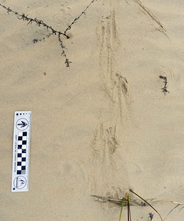
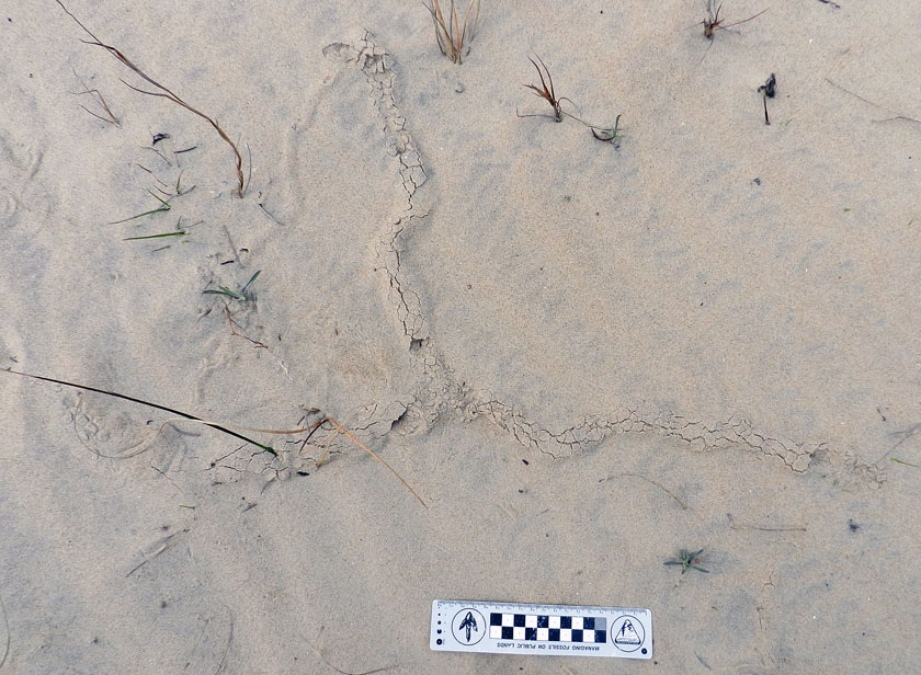
Alligators swim, and they walk. However, most people who live in coastal areas with American alligators (Alligator mississippiensis) – such as the Georgia barrier islands – also know that alligators can (and do) swim in the open ocean, and that they can (and do) walk long distances overland on beaches and dunes. Still, despite many visits to Georgia coast barrier islands hosting healthy populations of alligators, I have not yet witnessed either behavior. Fortunately, I’m an ichnologist, so I don’t have to just take the word of local residents or actually see these ‘gator behaviors to know they happen. Tracks and other traces are there to inform, letting me know where these alligators go, what they are doing, and when they are doing whatever alligators do when human eyes are not watching.

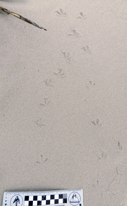
Fresh tracks and tail-drag traces of a large adult alligator (Alligator mississippiensis) going for a stroll on a beach after an open-ocean swim. Where did it go after crossing the beach? Find out for yourself in the following video. (Yours Trult for scale; photo taken by Ruth Schowalter on Sapelo Island, Georgia.)

Since the end of my academic year in May, I have spent much of the summer at home in Decatur, Georgia writing my next book. I’m pleased to report that I made good progress on that writing, but I really needed a break from it, and one that took me away from home to some other place for a mental shift. That “other place” was Sapelo Island on the Georgia coast, where my wife Ruth and I got in three days of glorious field work. And among the many ichnological and other nature-related wonders we encountered were these alligator tracks.

I’ll let the following video do the talking for me, and I mean that literally, as it is me talking in the video. Because I used my digital camera as the video-recorder, the sound quality isn’t perfect (wind intrudes), but should be 95% understandable. Also, the camera lens had a smudge that I didn’t notice until later, which makes the image a little blurry in spots. So if you can filter out both of these audio and video flaws, you just might enjoy walking with those Sapelo Island alligators, tracking them from the ocean to, well, you’ll have to watch and see.

Teaching on an Old Friend, Sapelo Island

(This post is the fourth in a series about a spring-break field trip taken last week with my Barrier Islands class, which I teach in the Department of Environmental Studies at Emory University. The first three posts, in chronological order, tell about our visits to Cumberland Island, Jekyll Island, and Little St. Simons and St. Simons Islands. For the sake of conveying a sense of being in the field with the students, these posts mostly follow the format of a little bit of prose – mostly captions – and a lot of photos.)

When planning a week-long trip to the Georgia barrier islands with my students, I knew that one island – Sapelo – had to be included in our itinerary. Part of my determination for us to visit it was emotionally motivated, as Sapelo was my first barrier island, and you always remember your first. But Sapelo has much else to offer, and because of these many opportunities, it is my favorite as an destination for teaching students about the Georgia coast and its place in the history of science.

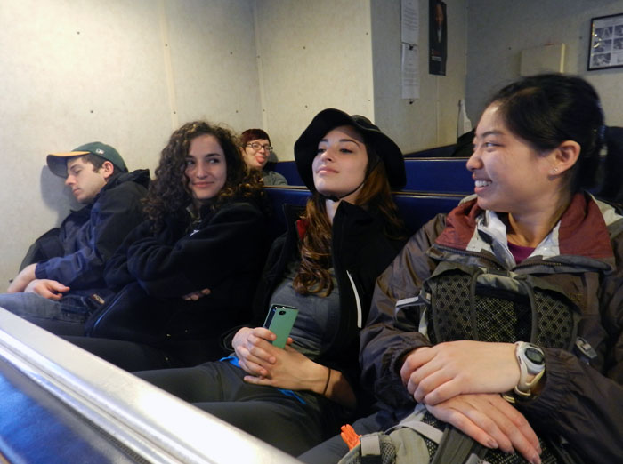
Getting to Sapelo Island requires a 15-minute ferry ride, all for the low-low price of $2.50. (It used to cost $1.00 and took 30 minutes. My, how times have changed.) For my students, their enthusiasm about visiting their fourth Georgia barrier island was clearly evident (with perhaps a few visible exceptions), although photobombing may count as a form of enthusiasm, too.

I first left my own traces on Sapelo in 1988 on a class field trip, when I was a graduate student in geology at the University of Georgia. My strongest memory from that trip was witnessing alligator predation of a cocker spaniel in one of the freshwater ponds there. (I suppose that’s another story for another day.) Yet I also recall Sapelo as a fine place to see geology and ecology intertwining, blending, and otherwise becoming indistinguishable from one another. This impression will likely last for the rest of my life, reinforced by subsequent visits to the island. This learning has always been enhanced whenever I’ve brought my own students there, which I have done nearly every year since 1997.

As a result of both teaching and research forays, I’ve spent more time on Sapelo than all of the other Georgia barrier islands combined. Moreover, it is not just my personal history that is pertinent, but also how Sapelo is the unofficial “birthplace” of modern ecology and neoichnology in North America. Lastly, Sapelo inspired most of the field stories I tell at the start of each chapter in my book, Life Traces of the Georgia Coast. In short, Sapelo Island has been very, very good to me, and continues to give back something new every time I return to it.

So with all of that said, here’s to another learning experience on Sapelo with a new batch of students, even though it was only for a day, before moving on to the next island, St. Catherines.

(All photographs by Anthony Martin and taken on Sapelo Island.)

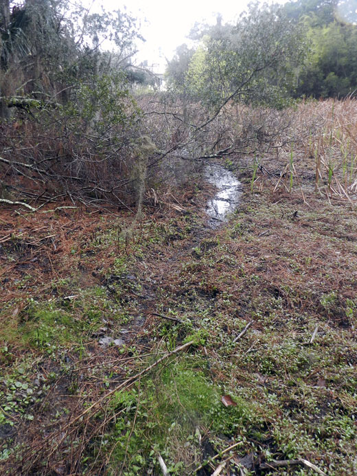
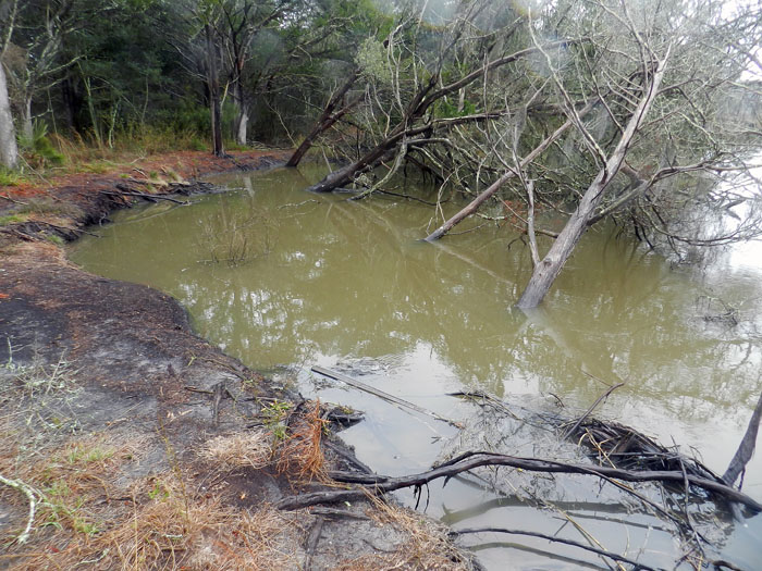
Next to the University of Georgia Marine Institute is a freshwater wetland, a remnant of an artificial pond created by original landowner R.J. Reynolds, Jr. More importantly, this habitat has been used and modified by alligators for at least as long as the pond has been around. For example, this trail winding through the wetland is almost assuredly made through habitual use by alligators, and not mammals like raccoons and deer, because, you know, alligators.

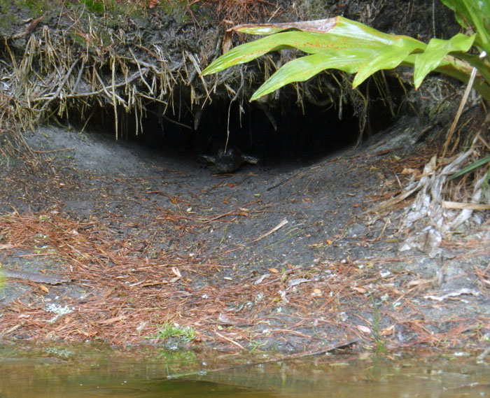
Photographic evidence that alligators, much like humans prone to wearing clown shoes, will use dens that are far too big for them. This den was along the edge of the ponded area of the wetland, and has been used by generations of alligators, which I have been seeing use it on-and-off since 1988.

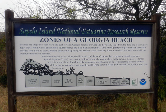
An idealized diagram of ecological zones on Sapelo Island, from maritime forest to the subtidal. This sign provided a good field test for my students, as they had already (supposedly) learned about these zones in class, but now could experience the real things for themselves. And yes, this will be on the exam.

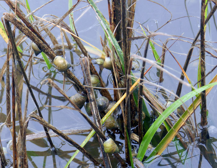
When it’s high tide in the salt marsh, marsh periwinkles (Littoraria irrorata) seek higher ground, er, leaves, to avoid predation by crabs, fish, and diamondback terrapins lurking in the water. Here they are on smooth cordgrass (Spartina alterniflora), and while there are getting in a meal by grazing on algae on the leaves.

Erosion of a tidal creek bank caused salt cedars (which are actually junipers, Juniperus virginiana) to go for their first and last swim. I have watched this tidal creek migrate through the years, another reminder that even the interiors of barrier islands are always undergoing dynamic change.

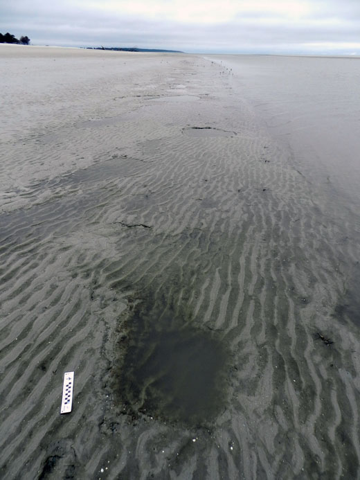
OK, I know what you’re thinking: where’s the ichnology? OK, how about these wide, shallow holes exposed in the sandflat at low tide? However tempted you might be to say “sauropod tracks,” these are more likely fish feeding traces, specifically of southern stingrays. Stingrays make these holes by shooting jets of water into the sand, which loosens it and reveals all of the yummy invertebrates that were hiding there, followed by the stingray chowing down. Notice that some wave ripples formed in the bottom of this structure, showing how this stingray fed here at high tide, before waves started affecting the bottom in a significant way.

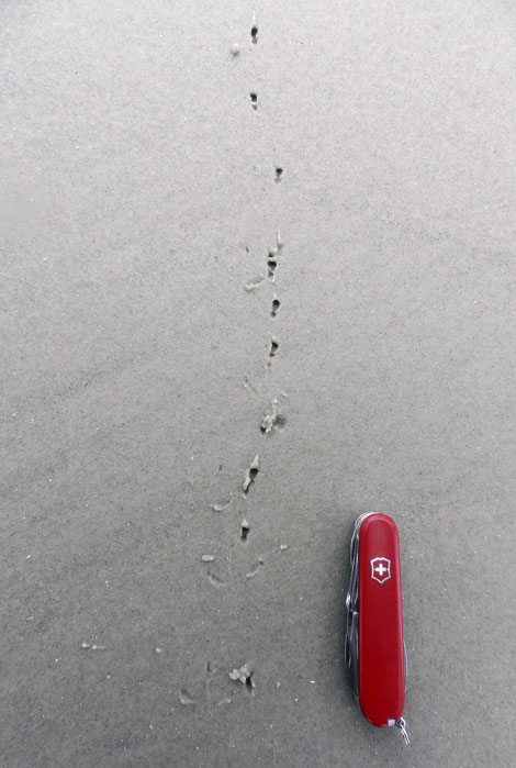
Here’s more ichnology for you, and even better, traces of shorebirds! I am fairly sure these are the double-probe beak marks of a least sandpiper, which may be backed up by the tracks associated with these (traveling from bottom to top of the photo). But I could be wrong, which has happened once or twice before. If so, an alternative tracemaker would be a sanderling, which also makes tracks similar in size and shape to a sandpiper, although they tend to probe a lot more in one place.

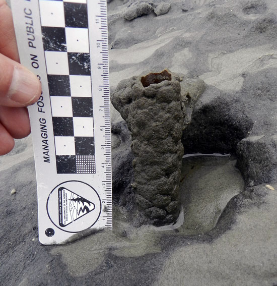
Just in case you can’t get enough ichnology, here’s the lower, eroded shaft of a ghost-shrimp burrow. Check out that burrow wall, reinforced by pellets. Nice fossilization potential, eh? This was a great example to show my students how trace fossils of these can be used as tools for showing where a shoreline was located in the geologic past. And sure enough, these trace fossils were used to identify ancient barrier islands on the Georgia coastal plain.

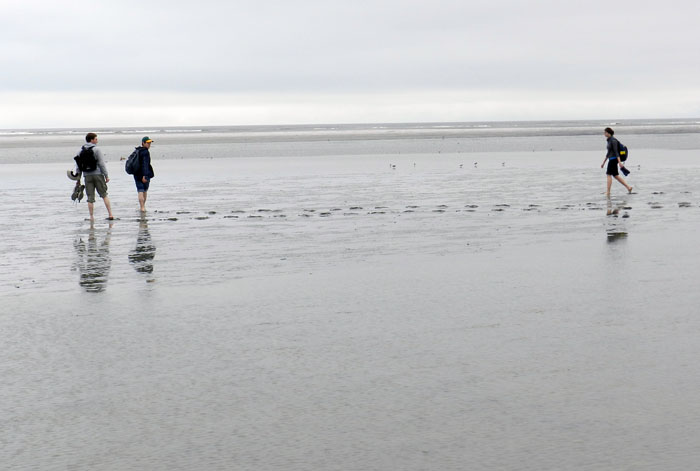
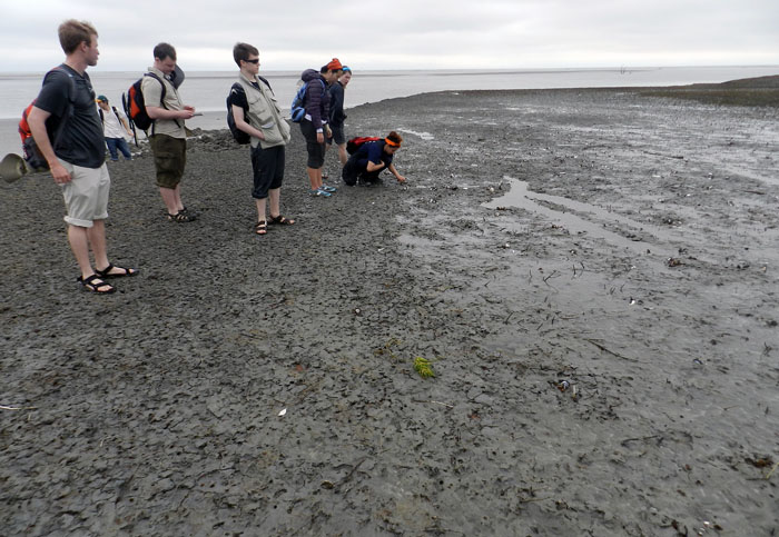
Understandably, my students got tired of living vicariously through various invertebrate and vertebrate tracemakers of Sapelo, and instead became their own tracemakers. Here they decided to more directly experience the intertidal sands and muds of Cabretta Beach at low tide by ambulating through them. Will their tracks make it into the fossil record? Hard to say, but I’ll bet the memories of their making them will last longer than any given class we’ve had indoors and on the Emory campus. (No offense to those other classes, but I mean, you’re competing with a beach.)

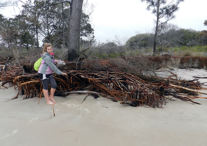
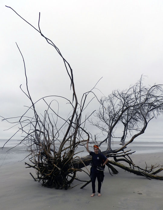
The north end of Cabretta Beach on Sapelo is eroding while other parts of the shoreline are building, and nothing screams “erosion!” as loudly as dead trees from a former maritime forest with their roots exposed on a beach. Also, from an ichnological perspective, the complex horizontal and vertical components of the roots on this dead pine tree could be compared to trace fossils from 40,000 year-old (Pleistocene) deposits on the island. Also note that at this point in the trip, my students had not yet tired of being “scale” in my photographs, which was a good thing for all.

Another student eager about being scale in this view of a live-oak tree root system. See how this tree is dominated by horizontal roots? Now think about how trace fossils made by its roots will differ from those of a pine tree. But don’t think about it too long, because there are a few more photos for you to check out.

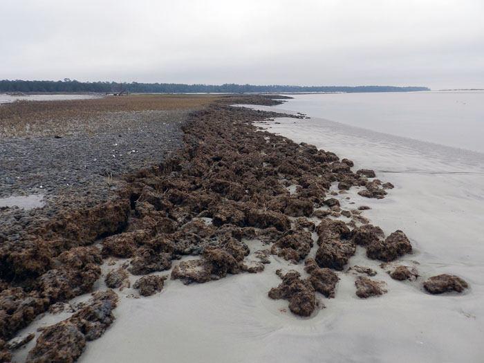
Told you so! Here’s a beautifully exposed, 500-year-old relict marsh, formerly buried but now eroding out of the beach. I’ve written about this marsh deposit and its educational value before, so will refrain from covering that ground again. Just go to this link to learn about that.

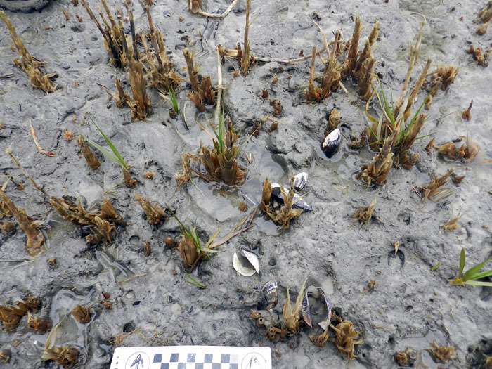
OK geologists, here’s a puzzler for you. The surface of this 500-year-old relict marsh, with its stubs of long-dead smooth cordgrass and in-place ribbed mussels (Guekensia demissa), also has very-much-live smooth cordgrass living in it and sending its roots down into that old mud. So if you found a mudstone with mussel shells and root traces in it, would you be able to tell the plants were from two generations and separated by 500 years? Yes, I know, arriving at an answer may require more beer.

Although a little tough to see in this photo, my students and I, for the first time since I have gone to this relict marsh, were able to discern the division between the low marsh (right) and high marsh (left). Look for the white dots, which are old ribbed mussels, which live mostly in the high marsh, and not in the low marsh. Grain sizes and burrows were different on each part, too: the high marsh was sandier and had what looked like sand-fiddler crab burrows, whereas the low marsh was muddier and had mud-fiddler burrows. SCIENCE!

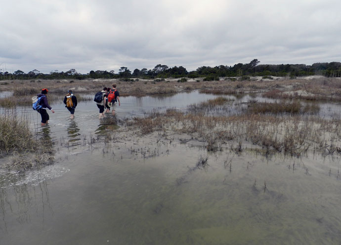
At the end of a great day in the field on Sapelo, it was time to do whatever was necessary to get back to our field vehicle, including (gasp!) getting wet. The back-dune meadows, which had been inundated by unusually high tides, presented a high risk that we might experience a temporary non-dry state for our phalanges, tarsals, and metatarsals. Fortunately, my students bravely waded through the water anyway, and sure enough, their feet eventually dried. I was so proud.

So what was our next-to-last stop on this grand ichnologically tainted tour of the Georgia barrier islands? St. Catherines Island, which is just to the north of Sapelo. Would it reveal some secrets to students and educators alike? Would it have some previously unknown traces, awaiting our discovery and description? Would any of our time there also involve close encounters with large reptilian tracemakers? Signs point to yes. Thanks for reading, and look for that next post soon.


A Tale (and Tails) of Two Islands

After visiting Cumberland Island and Jekyll Island, our Barrier Islands class had entered its third day (Monday, March 11), and was now about to embark onto our third and fourth barrier islands of the Georgia coast. These islands were a Pleistocene-Holocene pair – St. Simons and Little St. Simons, respectively – and the latter was our primary goal. After all, Little St. Simons is a privately owned and undeveloped island, one of the few that has not been logged or otherwise majorly altered by those ever-nefarious and industrious post-Enlightenment humans. St Simons, though, had its own lessons to teach us, including a realization I had that ichnological factors (bivalve feces, specifically) had played a role in deciding the fate of European power struggles on the Georgia coast during the 18th century.

Just like the previous two posts, this one will be told through photos and captions, which I hope captures much of what my students and I learned during our times on these two islands. Just watch out for those tails.

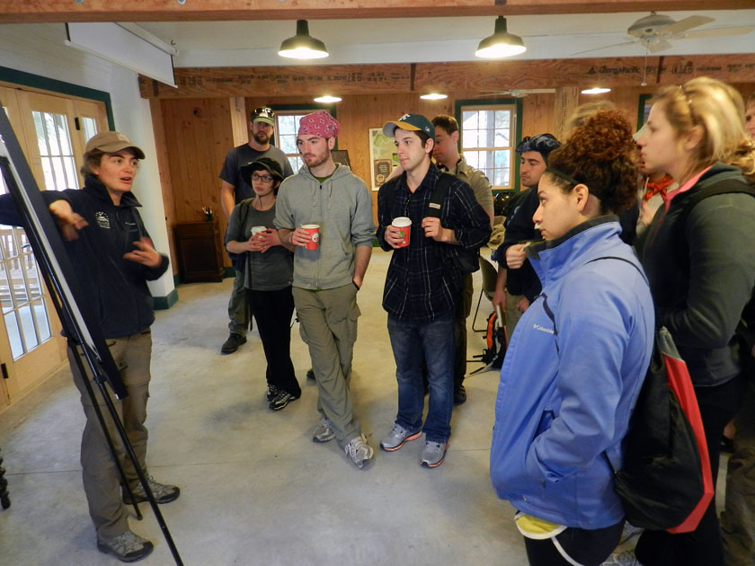
Little St. Simons is a privately owned island, but is available for day tours of groups like ours that are led by their knowledgeable and friendly naturalists. Soon after arriving by small boats on the island and being greeted by the naturalists assigned to us, Laura (pictured) and Ben (you’ll see him soon enough). While there, Laura provided a brief introduction to the geological history of Little St. Simons: Holocene (probably only a few thousands years old), and rapidly gaining weight (sediment, that is) each year, supplied by the nearby Altamaha River.

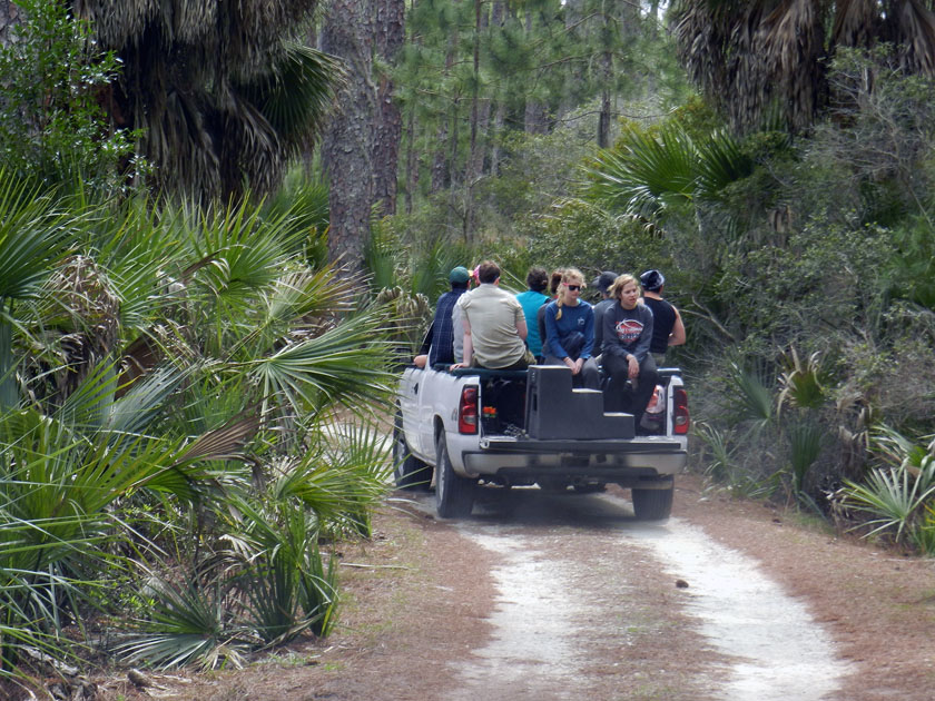
Check out our air-conditioned field vehicles! Seeing that this is a field course, traveling this way was ideal for experiencing the island a bit more directly, yet without descending in a Heart-of-Darkeness or Lord-of-the-Flies sort of mode. Because that would be bad.

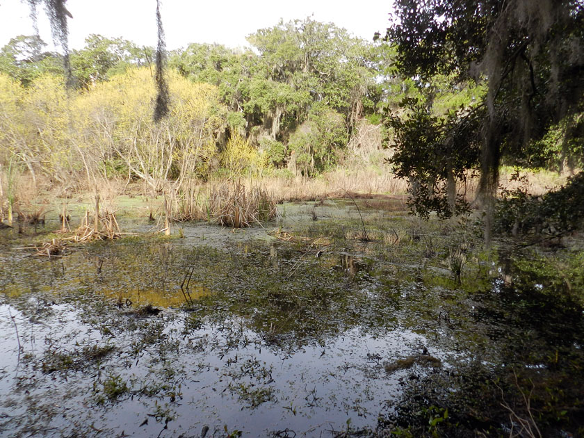
Little St. Simons has a healthy number of freshwater wetlands for such a small island (like this one), more closely resembling what used to be on the Georgia barrier islands before a few people decided that plantations and paper mills were great ideas.

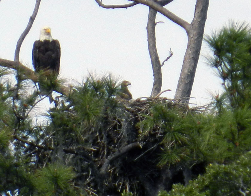
Say, isn’t that an all-American bird? Yes, it is, but more importantly, it has a rather prominent trace next to it – a bald eagle nest – that is also occupied by a couple of young eagles. (Here, one is sticking its head out of the nest while being overseen by a protective parent.) Bald eagle nests are among the largest tree nests made by any modern bird, leading me to wonder what tree-dwelling dinosaur nests from the Cretaceous Period must have looked like.

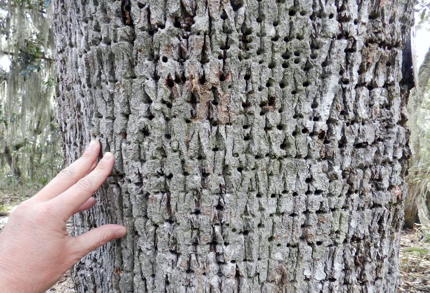
Sorry folks, can’t get enough of bird traces on this island. Many of the tree trunks on Little St. Simons bear the horizontally aligned holes of yellow-bellied sapsuckers. These woodpeckers pierce tree trunks to cause the tree to bleed sap, which attracts insects, which get stuck, which get eaten by the sapsuckers. Sap + insects = tasty treat!

Armadillo tracks on a coastal dune at the north end of the island show just how far-ranging these mammals can get. Having only recently arrived to the Georgia coast since the 1970s, these prolific tracemakers are now on every island.

Near the armadillo tracks, also in the coastal dunes, were these mystery burrows. I had no idea what made these, as they were too small to be mole burrows, too big to be insect burrows, and too horizontal to be mouse burrows. Just a reminder that even the author of a 700-page book about Georgia-coast traces still has a lot more to learn.

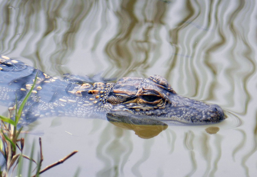
Aw, look at this cute little baby alligator, which was near its momma in one of the freshwater ponds on Little St. Simons. I wonder where it came from originally?

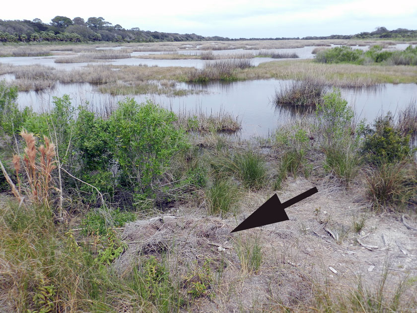
Why, there’s where it came from: it’s momma’s nest! The arrow is pointing toward a now mostly collapsed alligator nest, which hatched the little tykes that are now in the nearby wetland. Alligator nests are composed mostly of loose vegetation that the mother collects and piles, enough that it will give off heat to incubate her eggs. Such nests have very poor preservation potential in the fossil record, but it is still very interesting to study how they disintegrate so rapidly.

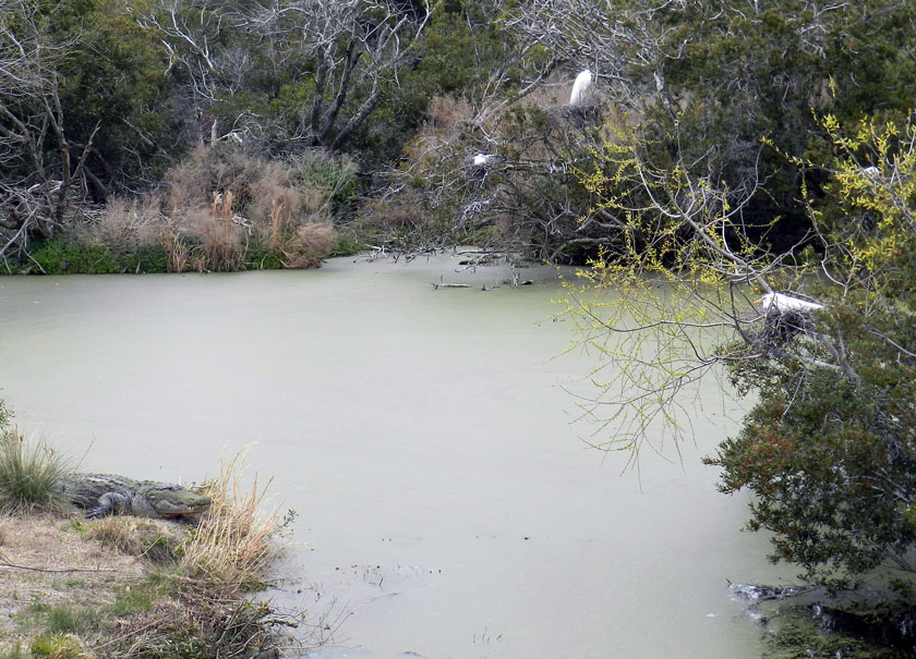
Alligators (left) and birds (right, with one on her nest) last shared a common ancestor early in the Mesozoic Era, but here they are, working together to their mutual benefit. Great egrets and woodstorks nest on islands, which are guarded by large alligators, who are good deterrents to egg predators. (In a grudge match between an alligator and raccoon, who do you think would win?) As payment for this protection, alligators get an occasional chick falling out of the nest, a small evolutionary price for the birds to pay when compared to an entire clutch of eggs getting munched.

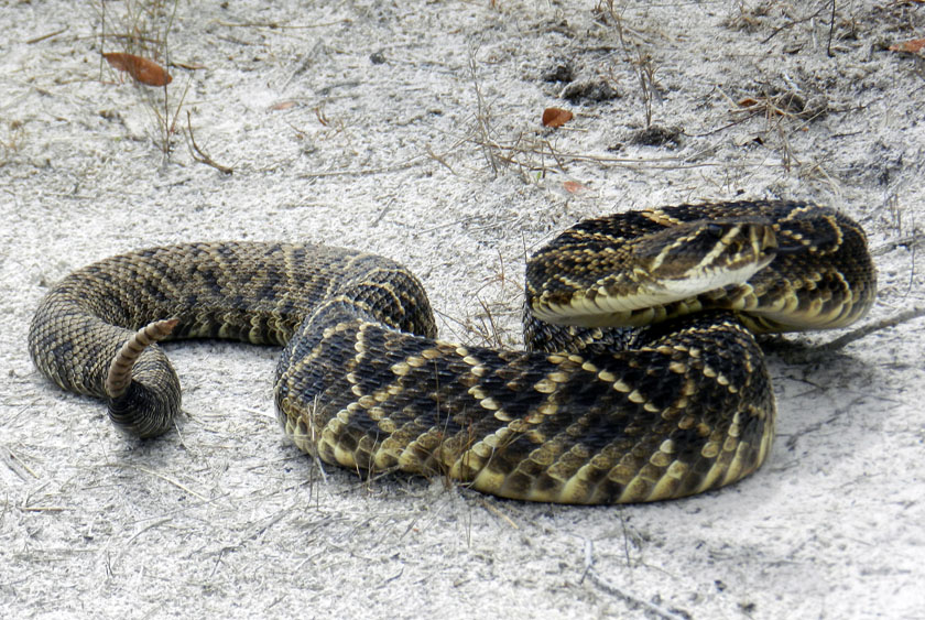
My, what a noisy tail you have! We were delighted to encounter this diamondback rattlesnake on one of the sandy roads of Little St. Simons, which urged us to approach it carefully, using a clearly audible warning and threat postures. (P.S. It worked.)

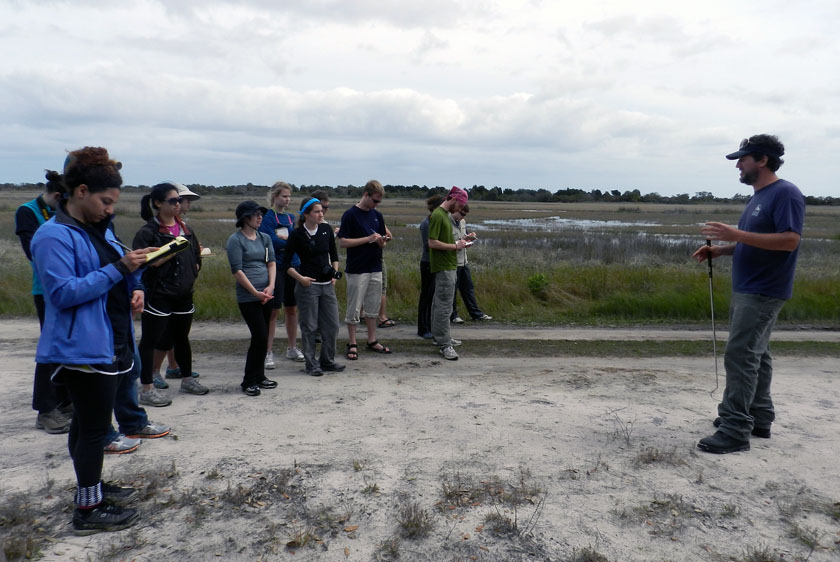
Our other guide, Ben, had an obviously deep affection for venomous reptiles, expressed first through some impromptu snake-handling. (No, he did not use his hands, nor did he speak in tongues. See that snake-handling device in his right hand?) Following our not-too-close encounter, he expounded on the ecological importance of rattlesnakes to the island, and related some interesting facts about rattlesnake behavior. Gee, you think the students might remember some of this lesson? (Personal note: Bring rattlesnakes into the classroom more often.)

At the south end of Little St. Simons is a very nice beach, and on that beach were – you guessed it – shorebird tracks. Here are some plover tracks, which could be from Wilson’s plovers, semi-palmated plovers, or some other species.

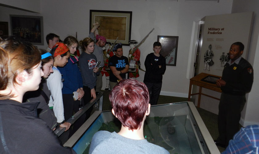
Sadly enough, our tour of Little St. Simons lasted only until 3:00 p.m., so we had some time on St. Simons to do a bit more learning. So I decided we would stop at Fort Frederica National Monument, on the north end of St. Simons Island. It turned out this was a educationally sound decision, especially when one of the rangers on duty – Mr. Ted Johnson (right) – volunteered to give our group a spirited and informative lecture about the former military importance of Fort Frederica. However, judging from the downcast looks on several of the students, I imagine they were already missing alligators, snakes, and shorebirds of Little St. Simons Island, and (of course) their traces.

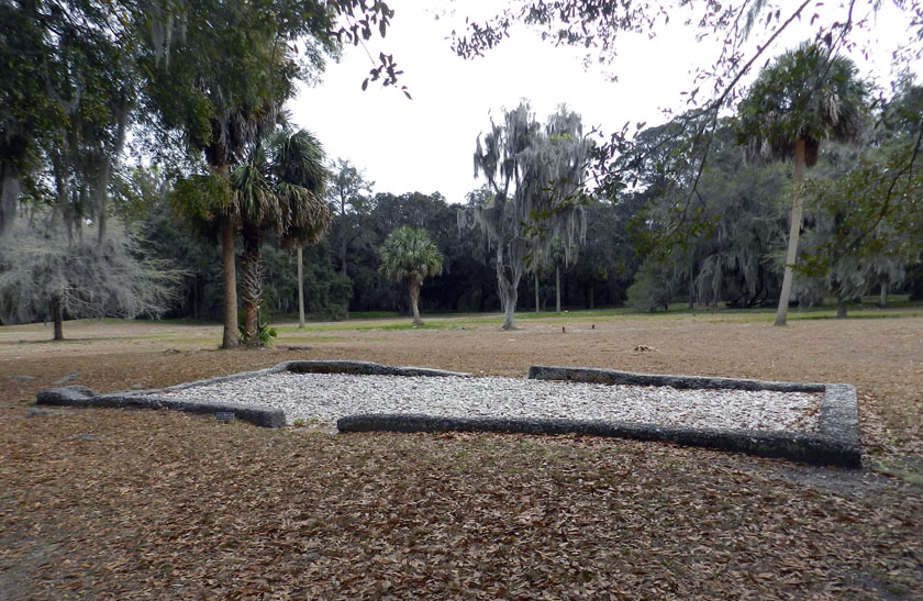
The most obvious human traces at Fort Frederica are these “footprints” (foundations) of some of the buildings there in the 18th century. Established as a British outpost in Georgia to compete with the Spanish presence to the south, Fort Frederica was a thriving town as long as the military was there.

OK, you’ve no doubt read this far to find out how bivalve feces helped the English to defeat the Spanish in the mid-18th century and consequently gain a permanent foothold in Georgia (until those pesky colonials defeated them later that century, that is). See where the fort is located? Right on a point, facing a tidal channel, and with salt marsh on either side of it. Because the salt marshes are largely composed of feces and similar muddy ejecta of ribbed mussels and other invertebrates, these make for wonderfully gooey substrates. Such substrates tend to discourage rapid movement of ordinance-laden ground troops, which forced the Spanish to try other means for attacking the fort, which failed. Bivalve feces for the win! Traces rule! ¡En la cara, los conquistadores!

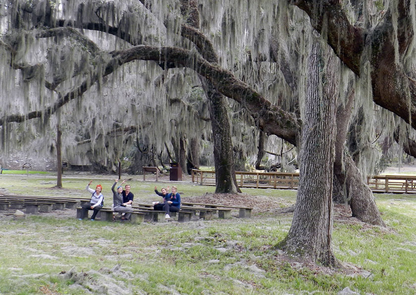
As our day neared an end, my students decided that an appropriate way to signal their pleasure with all they had learned was for them to give me the now-official fiddler crab salute, waving their mock claws in unison. We all plan to still use this when greeting on the Emory campus, which should thoroughly mystify other students, faculty, and especially administrators, the latter of whom will wonder if it is some sort of secret-society sign. (Which, in a sense, it will be. Be afraid. Be very afraid)

What island was next on our journey? My old favorite, Sapelo Island, just to the north of Little St. Simons and St. Simons, and as different from these as the preceding islands were from one another. Stay tuned for those photos and comments in just a few days, and get ready to learn.

Deconstructing an Ichnology Abstract, with Alligators

Many people from outside of the realm of academia (or is it a fiefdom?) prefer to get the latest scoops on new paleontological or geological research directly from the source, rather than just reading a press release or news article about it. As someone looking from the inside out, I’m pleased to see so many non-scientists try to probe one layer deeper with their understanding of a beloved scientific topic that interests them, and I try to encourage it through my own blogging, speaking, teaching, and other forms of outreach.
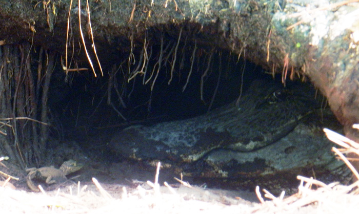
An alligator den on St. Catherines Island, (Georgia), with baby alligator and “big momma” alligator for scale. This week, I presented a poster with about these big burrows and their makers  at the Society of Vertebrate Paleontology meeting in Raleigh, North Carolina. The original field work we did for this research was reported back in March here, and now we’re ready to share more of what we found out. (Photograph by Anthony Martin.)

Unfortunately, many of the original research articles that become subjects of media attention are behind paywalls, requiring a reader to pay for access to read those articles, even if the research was publicly funded. This practice is especially common if the research is published in one of those glamorous journals that seemingly make or break academic careers in science, regardless of the lasting quality of the research. (I won’t name them directly, but let’s just say that’s the nature of science nowadays.)

So one option for these curious folks is to read abstracts from proceedings volumes of professional meetings. Abstracts, which ideally are succinct summaries highlighting the most significant findings of a given study, can thus serve as a way for the public to at least get a few insights on the latest scientific research happening in their favorite disciplines.
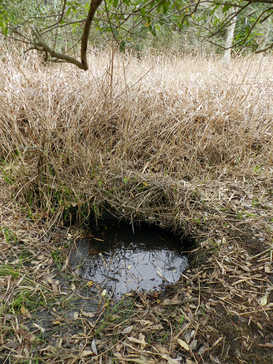
Want to get below the surface with this research? Oh, sorry, I was just being metaphorical. You really don’t want to go below the surface of an alligator den, which is why we mostly studied abandoned ones, mapped them, and otherwise tried to use methods that didn’t bother the alligators or otherwise have uncomfortable encounters with them.

Along those lines, the annual meeting of the Society of Vertebrate Paleontology (SVP) has been taking place this week in Raleigh, North Carolina, and it has an abstract volume associated with the meeting. Regrettably, though, the general public does not have access to these abstracts, only SVP members and people who have registered for the meeting. The Society of Vertebrate Paleontology also has a policy regarding researchers who publicly share their research results based on these abstracts, muddied by the word “embargo.” In short, this policy holds that people working for the media, which include reporters and bloggers (the latter of whom are also sometimes reporters), cannot write about and otherwise publicize research results presented at the meeting. That is, unless the researchers have given their permission to do so, or the results have been freely distributed by the researchers through a press release, blog, or other forms of outreach.

So in the spirit of the public having easier access to this primary scientific information, the following is our SVP abstract, which I presented as a poster at the meeting yesterday. The abstract is co-authored with Michael Page (Emory University), Sheldon Skaggs (Georgia Southern University), and R. Kelly Vance (also Georgia Southern University), and we worked together on the research, writing, and editing of the abstract. Because this abstract also includes a lot of scientific shorthand (charitably referred to as “jargon”), I also included a sentence-by-sentence explanation of it, in which the abstract text is in italics and my explanation is in formal typeface. So I hope you, the gentle reader, get something from this exercise in explanation, and we look forward to sharing more of this research with you as it continues to evolve and we publish it sometime next year as a peer-reviewed paper.

DENS OF THE AMERICAN ALLIGATOR (ALLIGATOR MISSISSIPPIENSIS) AS TRACES AND THEIR PREDICTIVE VALUE FOR FINDING LARGE ARCHOSAUR BURROWS IN THE GEOLOGIC RECORD

MARTIN, Anthony J., Emory University, Atlanta, GA, United States; PAGE, Michael, Emory University, Atlanta, GA, United States; SKAGGS, Sheldon, Georgia Southern University, Statesboro, GA, United States; VANCE, Robert K., Georgia Southern University, Statesboro, GA, United States

Large archosaur burrows are rarely interpreted from the geologic record, a circumstance that may be attributable to a lack of search images based on modern examples, rather than actual rarity.

Archosaurs make up an evolutionarily related group of vertebrates that include crocodilians (alligators and crocodiles), dinosaurs (the non-bird ones, that is), birds, and their extinct relatives. A few of the larger extinct archosaurs may have dug burrows, but paleontologists have reported very few of these, with one exception being the small Cretaceous ornithopod dinosaur Oryctodromeus cubicularis, found in its burrow with two juveniles of the same species. The authors are proposing here that this “rarity” of archosaur burrows in the fossil record might be more attributable to paleontologists not knowing what modern archosaur burrows look like. So they don’t recognize the fossil ones, leading to a perceived rarity rather than an actual one.

To test this idea, we measured, imaged, and mapped den structures of the American alligator (Alligator mississippiensis) on St. Catherines Island (Georgia, USA).

By “measured,” I mean that my colleagues and I used a low-tech instrument known as a “tape measure” to assess the width and height of an alligator den entrance. By “imaged,” we used a much more technologically complex instruments and method, called ground-penetrating radar (GPR) in combination with computers to figure out what these dens looked like below the surface. By “mapped,” I mean that we looked for alligator dens on St. Catherines Island (Georgia) and recorded their locations using a handheld GPS (global positioning system) unit, then plotted the distribution of these points to see if any patterns emerged.

St. Catherines is an undeveloped barrier island on the Georgia coast, consisting of Pleistocene and Holocene sediments.

St. Catherines Island is undeveloped in the sense that very few buildings or people live on the island year-round. It is privately owned and reserved for researchers’ uses under the direction of the St. Catherines Island Foundation. Like most of the Georgia barrier islands on the southern part of its coast, St. Catherines also has a geologically complex history. Its northwestern end is made of sediments deposited about 40,000 years ago – during the Pleistocene Epoch – whereas its southeastern end is made of much more recent sediments from the Holocene Epoch.

Alligators dug most dens along the edges of freshwater ponds in loosely consolidated Holocene or Pleistocene sand.

This sentence doesn’t need much more explanation other than to reemphasize that alligators gravitate to freshwater ecosystems to dig their dens (pictured below), not saltwater ecosystems, like salt marshes or coastal dunes.

Adult female alligators use dens to protect offspring, but burrows also aid in thermoregulation or serve as refugia for alligators during droughts and fires.

This is probably the neatest insight we gained from doing the research, is that the dens aren’t just used by big momma ‘gators for raising baby ‘gators, but also to make sure alligators of all ages are cozy during winters, stay wet during droughts, and are safe from fires. For instance, because southern Georgia has been going through a drought the past few years, some of the occupied dens we saw were in places that were high-and-dry, but the dens themselves intersected the local water table (seen in one photo above).

Some dens are evidently reused and modified by different alligators after initial construction.

This is an important point for paleontologists to know, and probably shouldn’t have been buried so far into the abstract, but we couldn’t very well put it at the beginning, either. Dens, like other homes, get used again, and probably by generations of alligators. This means that once a den is dug, stays open, and has a wetland nearby, alligators may just move into an abandoned den and modify it if needed, an alligator form of “home improvement.”

Drought conditions along the Georgia coast have exposed many abandoned dens, thus better allowing for their study while increasing researcher safety.

The drought is bad for alligators but was good for us when we did our field work, because so many dens were abandoned and exposed on dry land. This also eased any concerns we had about bothering the alligators, but especially alleviated worries we might have had about close encounters with protective parents near occupied dens. To be sure, we ran into a few of those, but not as many as we would have if conditions had been wetter.
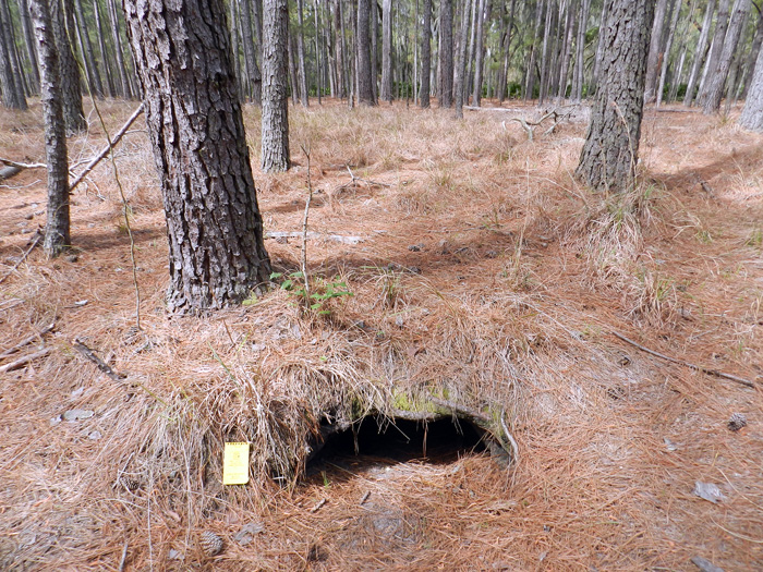
Den entrances have half-moon cross-sections, and based on one sample (n = 20), these range from 22-115 cm wide (mean = 63 + 23 cm) and 14-55 cm high (23 + 9 cm).

I like throwing numbers into ichnology, just to remind people that this is a part of it as a science. Although our sample size is small compared to other studies of traces and trace fossils, it gives people an idea of the range of sizes of these dens, or at least their entrances. As an exercise in the imagination, think about whether you could squeeze into one of these. You know, if you were crazy enough to do such a thing.

In addition to field descriptions, we applied geographic information systems (GIS) and ground-penetrating radar (GPR) to help define the ecological context and subsurface geometry of these structures, respectively.

Computer-aided mapping methods like GIS helped us to test how alligators decided to make dens as a function of the landscape. For instance, we found most of their dens were in lower-elevation areas, which made sense when you think about water accumulating in those places. And the GPR served the dual purpose of not bothering the alligators if they were in their dens, while also keeping us away from their, um, denizens. (Sorry.)

GIS gave spatial data relatable to alligator territoriality, substrate conditions, and proximity to potential nest sites. GPR produced subsurface images of active dens, which were compared to abandoned dens for a sense of taphonomic history.

Big alligators tend to stay away from other big alligators. They also tend to burrow in sediments that don’t take too much effort for them. Female alligators also make their nests close to water bodies and dens, so their little tykes don’t have to travel so far to the water. Newer, active dens were also compared to those no longer being used to see what happens to them over time with neglect, kind of like how an old, abandoned house tends to fall apart and collapse on itself over time.

Most den entrances are southerly facing, with tunnels dipping to the northwest or northeast.

This is pretty self-explanatory, but I’ll just ask readers to think about why these dens are oriented like this.

From entrances, tunnels slope at about 10-15°, turn right or left within a meter, and lead to enlarged turn-around chambers.

Pure description here too, but by “turn-around chamber,” that means the den has enough room inside the den for a big adult alligator to go in head-first and turn around so that it’s head is right at the entrance. (See the photo of “big momma” at the top for an example of that.)

Collapsed dens in formerly ponded areas (secondary-succession maritime forests) provided further insights into subsurface forms of these structures.

Dens left high-and-dry from years ago and taken over by forests collapsed in a way that we could see the full outline of the den and measure these.

These features are: 3.1-4.6 m long; 30-40 cm deep, relatively narrow at either end (35-60 cm), and 1.2-1.6 m wide in their middles.

Dude. Those are big burrows. Dude.

Expansive areas were probable turn-around chambers, and total volumes of collapsed dens accordingly reflect maximum body sizes of their former occupants.

The bigger the den, the easier it was for a large occupant to turn around in it. And although smaller, younger alligators could have lived in these dens, some of the dens were too small to allow the really big alligators from moving into them.

One sampled area (8,100 m2), an almost dry former pond, had 30 abandoned dens, showing how multiple generations of alligators and fluctuating water levels can result in dense concentrations of alligator burrows over time.

Think of an area about the size of an American football field, and put 30 alligator dens in that area. (Now that would make for an interesting game, wouldn’t it?) These dens weren’t all made at the same time, though, and were constructed or abandoned as the pond filled or dried out, respectively.

In summary, the sheer abundance, distinctive traits, and sizes of these structures on St. Catherines and elsewhere in the Georgia barrier islands give paleontologists excellent search images for seeking similar trace fossils made by large semi-aquatic archosaurs.

That’s the big take-home message here for vertebrate paleontologists. All of the information we gathered about these alligator dens from the Georgia barrier islands, especially what they look like, can be applied to test the fossil record of archosaurs. In other words, did archosaurs actually leave lots of dens for us to find, but we just didn’t know what to look for? Hopefully we’ll find out because of this research.
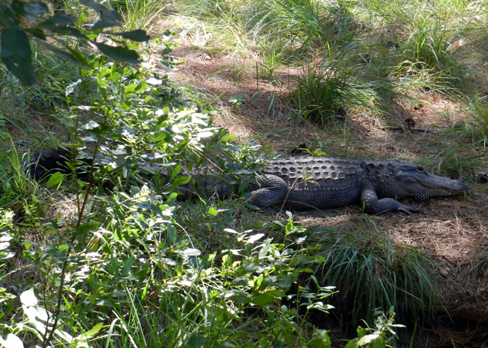
Later, denning ‘gator. (Photograph by Anthony Martin, taken on St. Catherines Island, Georgia.)

(Special thanks to Ruth Schowalter for assisting with the field work, and to the St. Catherines Island Foundation for funding some of the research.)

Source of Abstract (Reference):

Martin, A.J., Page, M., Vance, R.K., and Skaggs, S. 2012. Dens of the American alligator (Alligator mississippiensis) as traces and their predictive value for finding large archosaur burrows in the geologic record. Journal of Vertebrate Paleontology, 32 [Suppl. to No. 3]: 136.