Tracking Tybee Island

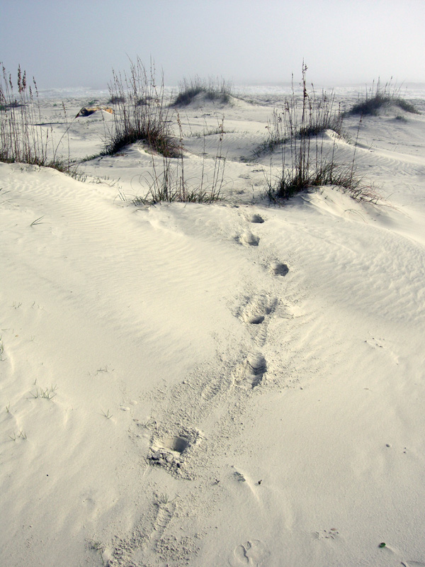
Plan to be surprised. That’s my adopted attitude whenever I’m on a developed barrier island of the southeastern U.S. coast and looking for animal traces. When primed by such open-mindedness, I’ve found that looking beyond the expected – or listening for the whispers below the shouts – can sometimes yield traces of the unexpected.

South-Tybee-Dunes-2A beach-to-dune-to-fencing-to-vacation-home transect on the south end of Tybee Island, Georgia. Not much for an ichnologist or any other naturalists to learn here, right? Try, try again. (Photograph by Anthony Martin.)

Last month, just a couple of days after a successful book-related event in Savannah, Georgia (described here), my proximity to the Georgia coast meant I had to get to the nearest barrier island, which was Tybee Island. However, a challenge presented by Tybee – and the one that causes most coastal naturalists to run away from it screaming – is its degree of development.

Actual footage of a cephalopod ichnologist reacting to the news that a field trip would go to a developed barrier island. P.S. Octopus tentacle prints would make for the coolest trace fossils ever. (Source here.)

Accordingly, Tybee Island also has large numbers of people, especially on a pretty weekend during the summer. Granted, the development is not so awful that Tybee no longer has beaches and marshes. But it does have enough paved streets, houses, vacation rentals, hotels, restaurants, shops, and other urban amenities that you can easily forget you’re on a barrier island.
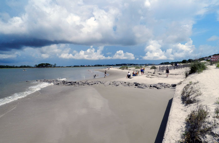
Rip-Rap-Seawall-South-TybeeAn oddly shaped beach on the south end of Tybee Island, molded by a combination of a seawall, big blocks of igneous rock, fences, boat wakes, and oh yeah, waves, tides, and sand. Better than a shopping mall, for sure, but it takes some getting used to for naturalists who do their field work in less peopled places. (Photograph by Anthony Martin.)

Tybee’s beaches are also “armored” with rip-rap and seawalls, which were placed there in a vain attempt to keep sand from moving. (On a barrier island, this is like telling blood it can only circulate to one part of a body.) Moreover, its modest coastal dunes rely on fencing as a half-buttocked substitute for healthy, well-rooted vegetation holding the sand in place. The sand in those dunes also looks displaced to anyone acquainted with Georgia-coast dunes on undeveloped islands. This is because that sand really is from somewhere else, having been trucked in from somewhere else and dumped there for beach “renourishment.” There’s also not much of a maritime forest there, or freshwater ponds. So yeah, I guess those cranky naturalists have a point.
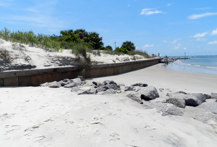
Tybee-Seawall-Rip-Rap-South-EndAnother view of the south end, showing the sharp vertical drop between the beach and dunes because of the seawall between them. The rocks (foreground) probably didn’t help much, either. (Photograph by Anthony Martin.)

Ergo, a pessimistic expectation I had before arriving on Tybee is that it would have a barrage of human and dog tracks, a tedium only punctuated by human-generated trash, all of which would assault and otherwise insult my ichnological senses. Fair or not, this prejudice kept me away from Tybee when I was doing field research for Life Traces of the Georgia Coast, and I stayed off St. Simons Island for a while, too, before succumbing in 2009. (I’m glad my wife Ruth convinced me to visit St. Simons – and I’ve been back several times since – but the interesting ichnology of St. Simons is the topic of another post.)

But then again, there was the matter of honoring the all-American right to convenience. Tybee Island is only about a 20-minute drive from Savannah, and you could drive there thanks to a causeway that connects the island to the mainland. Plus I had been to Tybee several times with students on field trips, and knew that lots could be learned there if I put a gag on my cynicism. I even had a research question, wondering how many ghost crab burrows would be in the dunes there compared to other Georgia barrier islands.

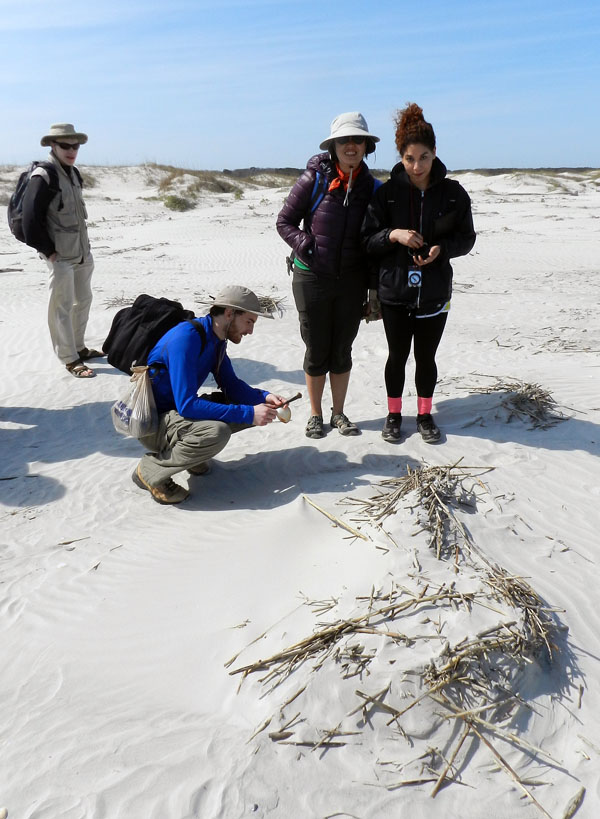
So thanks to the Hartzell Power Couple™, who were hosting Ruth and me in Savannah for the aforementioned book event, we were in their car on a Saturday morning and soon found ourselves walking on the south end of the Tybee, checking out its dunes and beaches, and (of course) their traces.

Fortunately, my question about the ghost crab burrows was answered within a few minutes of arriving at the south-end beach. Sure enough, we spotted a few of these distinctive holes, sand piles outside of the holes, and ghost-crab tracks scribbled on the dunes. Their traces weren’t nearly as common as on other undeveloped islands, but still, there they were.
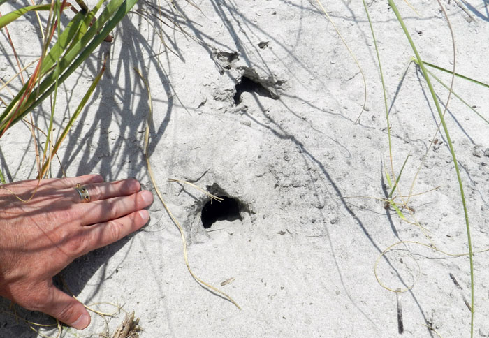
Ghost-Crab-Burrows-TybeeGhost crab burrows really do exist on developed barrier islands: whoa! Although it’s still a good question about their relative abundance on a developed Georgia barrier island versus one that’s barely altered, like nearby Wassaw Island. Sounds like some science needs to be done on that. (Photograph by Anthony Martin.)

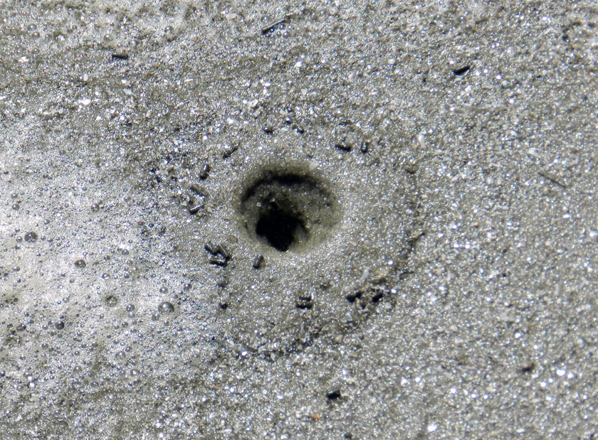
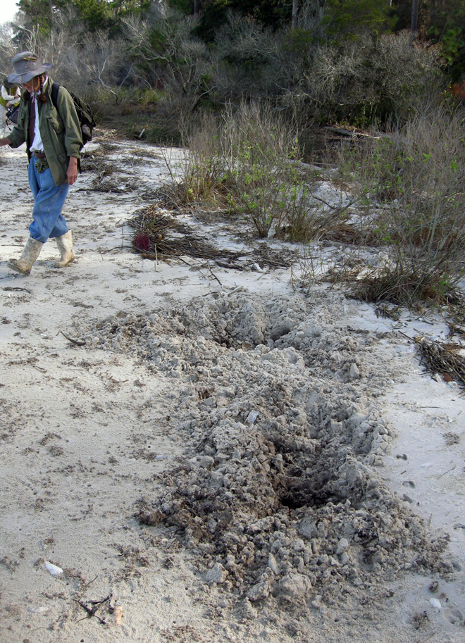
But here’s the coolest thing we saw, ichnologically speaking. The dunes also had little holes that were about the width of a pencil, with crescent-shaped openings and fresh sand aprons just outside these holes.
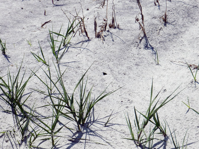
Wasp-Burrow-Dunes-Tybee-1What have we here? A little hole in the dunes with some freshly dumped sand outside of it. The game’s afoot! (Photograph by Anthony Martin.)
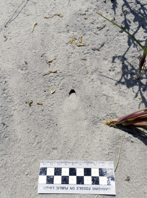
Wasp-Burrow-TybeeA close-up look of another hole very similar to the previous one. I wonder what could have made this? Oh well, I guess we’ll never know. Unless you read more, that is. (Photograph by Anthony Martin.)

I was pretty sure what made these, but as a scientist, I needed more evidence. So after pointing out the holes to my companions (Ruth and the Hartzell Power Couple™), we stood in one place and waited a few minutes. That’s when one of the tracemakers arrived.
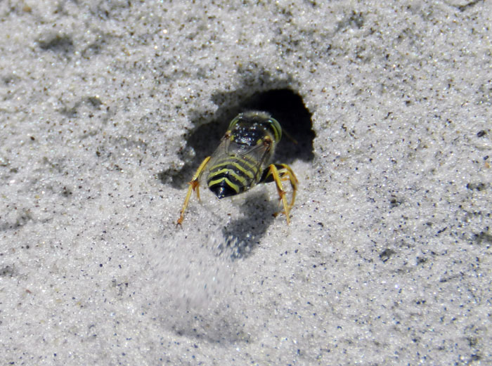
Wasp-Digging-Burrow-TybeeBehold, the mystery tracemaker revealed! Check out that incredible digging! She’s got legs, and knows how to use them! (Photograph by Anthony Martin.)

Hypothesis confirmed! I predicted these were wasp burrows, and after watching several flying around the dunes, landing, walking up to and entering the holes, digging energetically, and emerging (repeat cycle), this was all of the evidence I needed. The wasps were some species of Stictia (sometimes nicknamed “horse-guard wasps” because they prey on horse flies). Moreover, these were female wasps making brooding chambers, little nurseries where they were going to lovingly lay eggs on paralyzed prey as a form of parasitoid behavior. (P.S. I absolutely adore parasitoid wasps, and you should, too.)
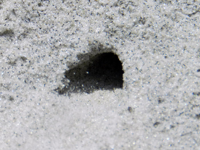
Wasp-Burrow-Sand-Kicked-TybeeUp-close view of the same wasp burrow shown above. Oh, she’s in there, all right. See those sand grains getting kicked out of the burrow? (Photograph by Anthony Martin, taken on Tybee Island.)

In our too-brief time there on Tybee, we also saw feral cat tracks in the dunes. This is a common trace on developed islands, especially where people live year-round. Sometimes these are from pets that residents let roam free, but more likely these are made by the descendants of escaped cats that then breed in the wild.
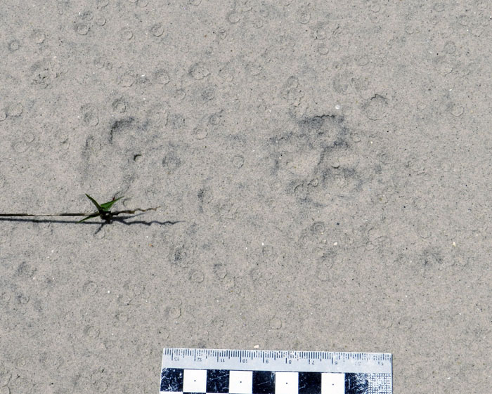
Feral-Cat-Tracks-TybeeFeral cat cats on dune sands, probably a day old at the time the photo was taken, eroded by wind and rain (see the raindrop impressions?). How to tell cat tracks from little foo-foo dog tracks? Cats make round compression shapes, a three-lobed heel pad, and rarely show claws. (Photograph by Anthony Martin, taken on Tybee Island.)

Another possible trace from a feral cat was an opened bird egg we found on the dunes. Admittedly, I’m quite the ichnological novice when it comes to egg traces, and can’t tell for sure whether this one was from predation (by a cat or other egg predator) or from hatching. But some clues are there, such as nearly half of the eggshell fragments adhering to the inside of the shell, instead of being absent.
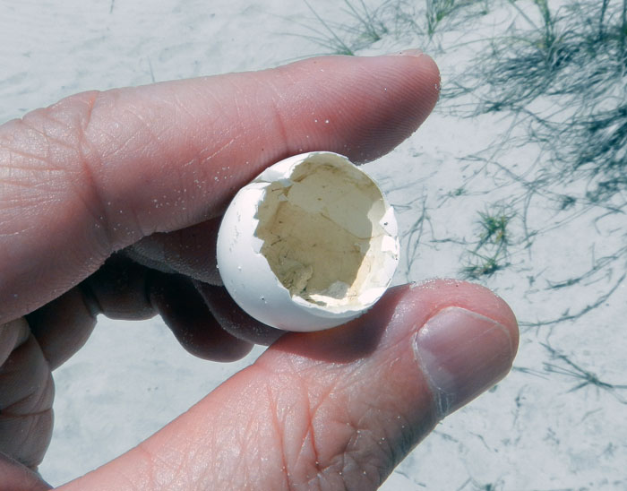
Opened-Egg-Trace-TybeeIs it a birth trace or a death trace? Empty bird eggshells always present such questions. (Photograph by Anthony Martin, taken on Tybee Island.)

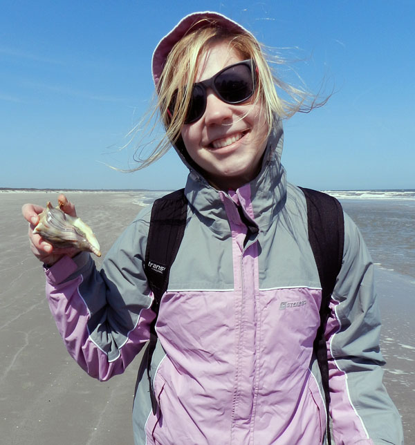
Down on the beach, one of the most common (and hence easiest) traces to find on Tybee or any other developed island with clam or snail shells washing up on their shores are predatory drillholes made by moon snails, the lions of the tidal flat. Sometimes these shells also have smaller holes, which are made by clionid sponges. Shells can thus bear the histories of life-and-death and life-after-death.
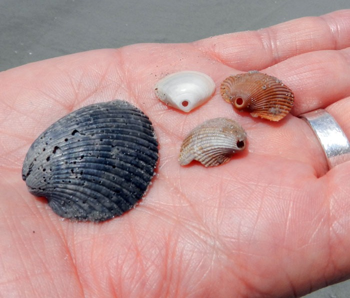
Drillholes-Bioerosion-Shells-TybeeThese shells are looking a little bored. (Yes, that’s a pun, albeit not a very good one.) The clam shell on the left was bored by a clionid sponge, and the three shells on the right were made by moon snails, probably Neverita duplicata. (Photograph by Anthony Martin, taken on Tybee Island.)

Once we were off the beach and walking on a paved road to where the car was parked, the ichnology didn’t stop then, either. In front of the car was a tree with some beautifully expressed rows of yellow-bellied sapsucker drillholes in its trunk.
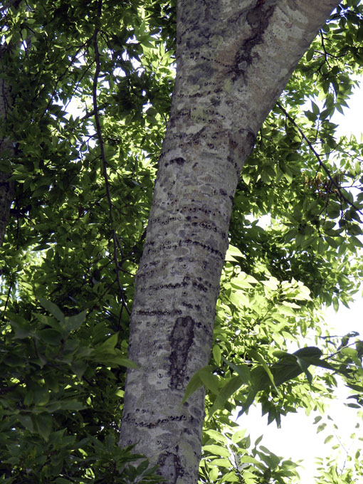
Sapsucker-Holes-Tree-TybeeWhat can I say, I’m a sucker for sapsucker holes. (Photograph by Anthony Martin, taken on Tybee Island.)

So can you still do ichnology on Tybee Island, or other developed barrier islands, for that matter? Looks like…

So next time you go on that beach vacation to Tybee, Jekyll, St. Simons, or other developed barrier islands, may you likewise be pleasantly surprised on your ichnological endeavors. Good luck!

Teaching on an Old Friend, Sapelo Island

(This post is the fourth in a series about a spring-break field trip taken last week with my Barrier Islands class, which I teach in the Department of Environmental Studies at Emory University. The first three posts, in chronological order, tell about our visits to Cumberland Island, Jekyll Island, and Little St. Simons and St. Simons Islands. For the sake of conveying a sense of being in the field with the students, these posts mostly follow the format of a little bit of prose – mostly captions – and a lot of photos.)

When planning a week-long trip to the Georgia barrier islands with my students, I knew that one island – Sapelo – had to be included in our itinerary. Part of my determination for us to visit it was emotionally motivated, as Sapelo was my first barrier island, and you always remember your first. But Sapelo has much else to offer, and because of these many opportunities, it is my favorite as an destination for teaching students about the Georgia coast and its place in the history of science.

Getting to Sapelo Island requires a 15-minute ferry ride, all for the low-low price of $2.50. (It used to cost $1.00 and took 30 minutes. My, how times have changed.) For my students, their enthusiasm about visiting their fourth Georgia barrier island was clearly evident (with perhaps a few visible exceptions), although photobombing may count as a form of enthusiasm, too.

I first left my own traces on Sapelo in 1988 on a class field trip, when I was a graduate student in geology at the University of Georgia. My strongest memory from that trip was witnessing alligator predation of a cocker spaniel in one of the freshwater ponds there. (I suppose that’s another story for another day.) Yet I also recall Sapelo as a fine place to see geology and ecology intertwining, blending, and otherwise becoming indistinguishable from one another. This impression will likely last for the rest of my life, reinforced by subsequent visits to the island. This learning has always been enhanced whenever I’ve brought my own students there, which I have done nearly every year since 1997.

As a result of both teaching and research forays, I’ve spent more time on Sapelo than all of the other Georgia barrier islands combined. Moreover, it is not just my personal history that is pertinent, but also how Sapelo is the unofficial “birthplace” of modern ecology and neoichnology in North America. Lastly, Sapelo inspired most of the field stories I tell at the start of each chapter in my book, Life Traces of the Georgia Coast. In short, Sapelo Island has been very, very good to me, and continues to give back something new every time I return to it.

So with all of that said, here’s to another learning experience on Sapelo with a new batch of students, even though it was only for a day, before moving on to the next island, St. Catherines.

(All photographs by Anthony Martin and taken on Sapelo Island.)

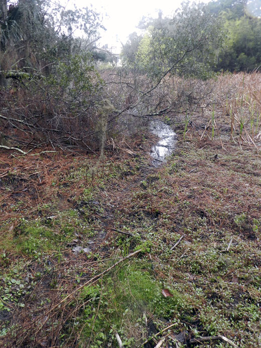
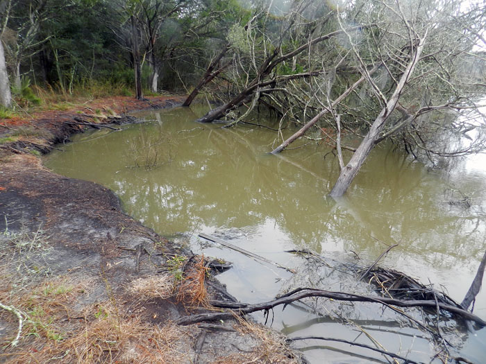
Next to the University of Georgia Marine Institute is a freshwater wetland, a remnant of an artificial pond created by original landowner R.J. Reynolds, Jr. More importantly, this habitat has been used and modified by alligators for at least as long as the pond has been around. For example, this trail winding through the wetland is almost assuredly made through habitual use by alligators, and not mammals like raccoons and deer, because, you know, alligators.

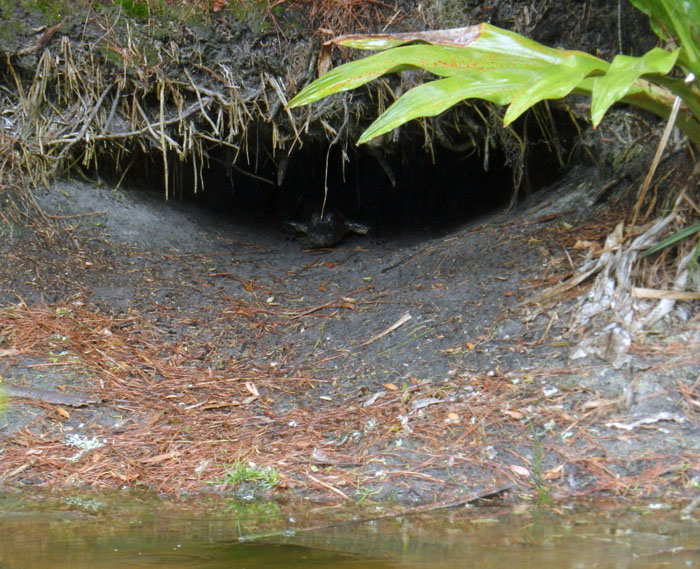
Photographic evidence that alligators, much like humans prone to wearing clown shoes, will use dens that are far too big for them. This den was along the edge of the ponded area of the wetland, and has been used by generations of alligators, which I have been seeing use it on-and-off since 1988.

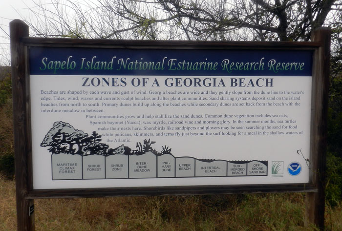
An idealized diagram of ecological zones on Sapelo Island, from maritime forest to the subtidal. This sign provided a good field test for my students, as they had already (supposedly) learned about these zones in class, but now could experience the real things for themselves. And yes, this will be on the exam.

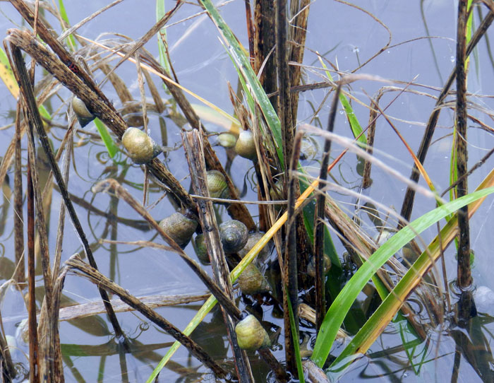
When it’s high tide in the salt marsh, marsh periwinkles (Littoraria irrorata) seek higher ground, er, leaves, to avoid predation by crabs, fish, and diamondback terrapins lurking in the water. Here they are on smooth cordgrass (Spartina alterniflora), and while there are getting in a meal by grazing on algae on the leaves.

Erosion of a tidal creek bank caused salt cedars (which are actually junipers, Juniperus virginiana) to go for their first and last swim. I have watched this tidal creek migrate through the years, another reminder that even the interiors of barrier islands are always undergoing dynamic change.

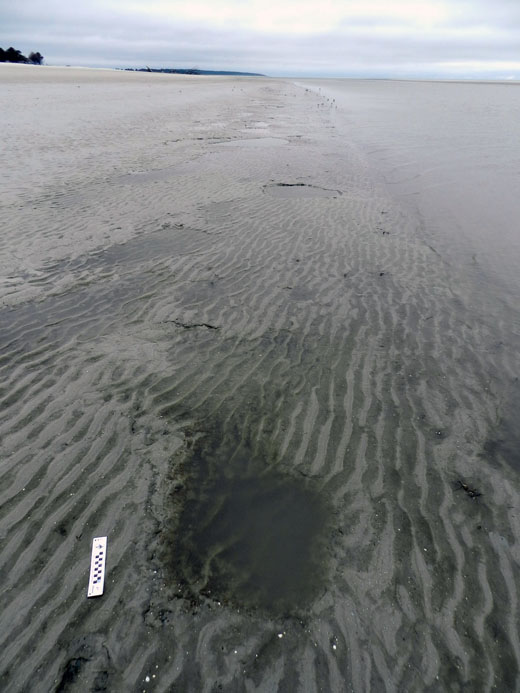
OK, I know what you’re thinking: where’s the ichnology? OK, how about these wide, shallow holes exposed in the sandflat at low tide? However tempted you might be to say “sauropod tracks,” these are more likely fish feeding traces, specifically of southern stingrays. Stingrays make these holes by shooting jets of water into the sand, which loosens it and reveals all of the yummy invertebrates that were hiding there, followed by the stingray chowing down. Notice that some wave ripples formed in the bottom of this structure, showing how this stingray fed here at high tide, before waves started affecting the bottom in a significant way.

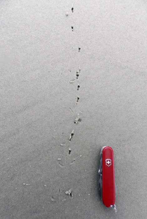
Here’s more ichnology for you, and even better, traces of shorebirds! I am fairly sure these are the double-probe beak marks of a least sandpiper, which may be backed up by the tracks associated with these (traveling from bottom to top of the photo). But I could be wrong, which has happened once or twice before. If so, an alternative tracemaker would be a sanderling, which also makes tracks similar in size and shape to a sandpiper, although they tend to probe a lot more in one place.
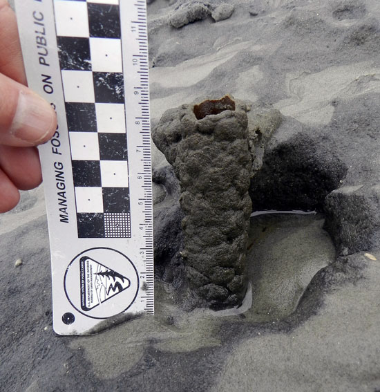
Just in case you can’t get enough ichnology, here’s the lower, eroded shaft of a ghost-shrimp burrow. Check out that burrow wall, reinforced by pellets. Nice fossilization potential, eh? This was a great example to show my students how trace fossils of these can be used as tools for showing where a shoreline was located in the geologic past. And sure enough, these trace fossils were used to identify ancient barrier islands on the Georgia coastal plain.

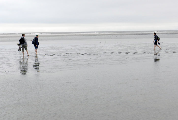
Understandably, my students got tired of living vicariously through various invertebrate and vertebrate tracemakers of Sapelo, and instead became their own tracemakers. Here they decided to more directly experience the intertidal sands and muds of Cabretta Beach at low tide by ambulating through them. Will their tracks make it into the fossil record? Hard to say, but I’ll bet the memories of their making them will last longer than any given class we’ve had indoors and on the Emory campus. (No offense to those other classes, but I mean, you’re competing with a beach.)

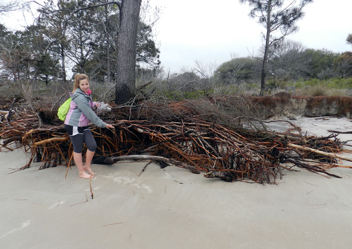
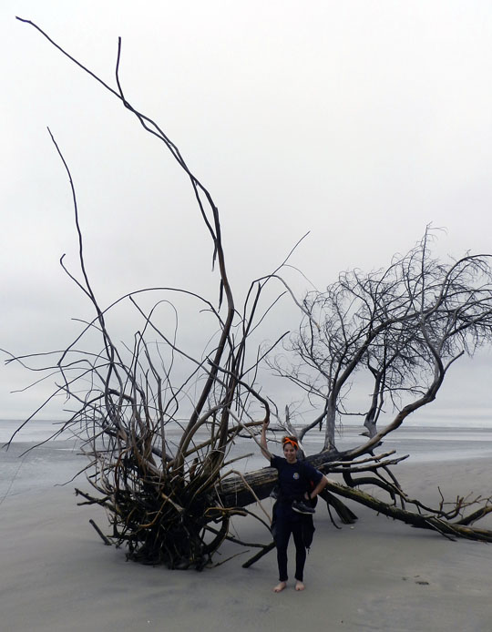
The north end of Cabretta Beach on Sapelo is eroding while other parts of the shoreline are building, and nothing screams “erosion!” as loudly as dead trees from a former maritime forest with their roots exposed on a beach. Also, from an ichnological perspective, the complex horizontal and vertical components of the roots on this dead pine tree could be compared to trace fossils from 40,000 year-old (Pleistocene) deposits on the island. Also note that at this point in the trip, my students had not yet tired of being “scale” in my photographs, which was a good thing for all.

Another student eager about being scale in this view of a live-oak tree root system. See how this tree is dominated by horizontal roots? Now think about how trace fossils made by its roots will differ from those of a pine tree. But don’t think about it too long, because there are a few more photos for you to check out.

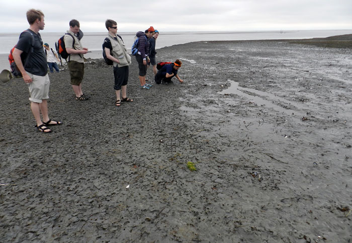
Told you so! Here’s a beautifully exposed, 500-year-old relict marsh, formerly buried but now eroding out of the beach. I’ve written about this marsh deposit and its educational value before, so will refrain from covering that ground again. Just go to this link to learn about that.
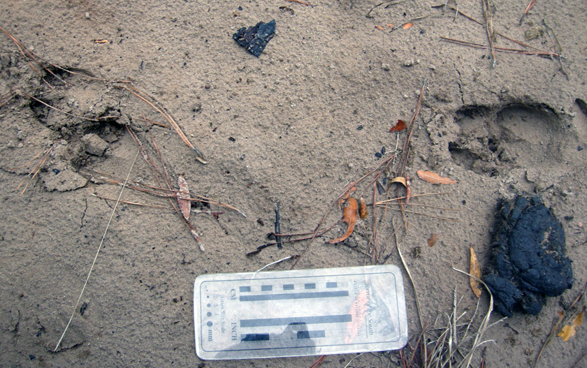
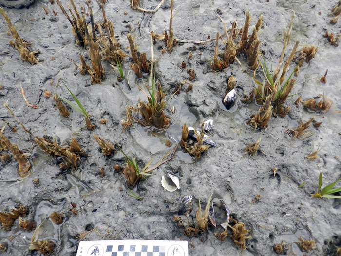
OK geologists, here’s a puzzler for you. The surface of this 500-year-old relict marsh, with its stubs of long-dead smooth cordgrass and in-place ribbed mussels (Guekensia demissa), also has very-much-live smooth cordgrass living in it and sending its roots down into that old mud. So if you found a mudstone with mussel shells and root traces in it, would you be able to tell the plants were from two generations and separated by 500 years? Yes, I know, arriving at an answer may require more beer.

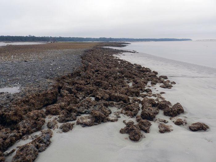
Although a little tough to see in this photo, my students and I, for the first time since I have gone to this relict marsh, were able to discern the division between the low marsh (right) and high marsh (left). Look for the white dots, which are old ribbed mussels, which live mostly in the high marsh, and not in the low marsh. Grain sizes and burrows were different on each part, too: the high marsh was sandier and had what looked like sand-fiddler crab burrows, whereas the low marsh was muddier and had mud-fiddler burrows. SCIENCE!

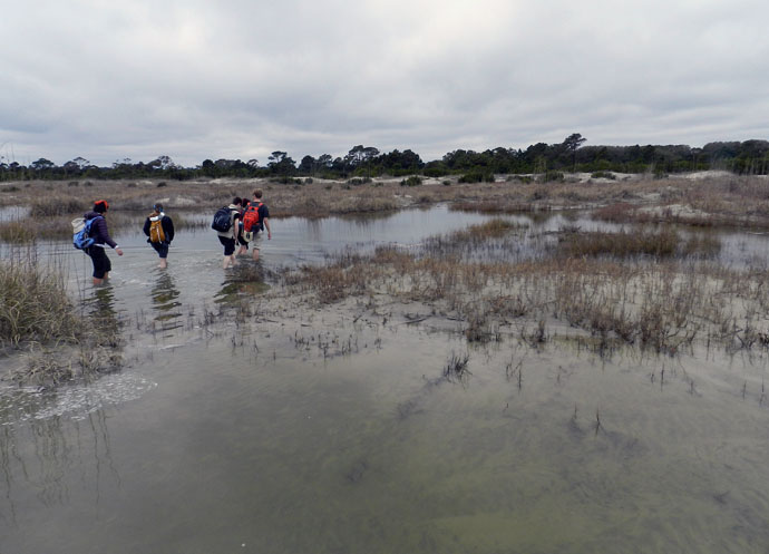
At the end of a great day in the field on Sapelo, it was time to do whatever was necessary to get back to our field vehicle, including (gasp!) getting wet. The back-dune meadows, which had been inundated by unusually high tides, presented a high risk that we might experience a temporary non-dry state for our phalanges, tarsals, and metatarsals. Fortunately, my students bravely waded through the water anyway, and sure enough, their feet eventually dried. I was so proud.

So what was our next-to-last stop on this grand ichnologically tainted tour of the Georgia barrier islands? St. Catherines Island, which is just to the north of Sapelo. Would it reveal some secrets to students and educators alike? Would it have some previously unknown traces, awaiting our discovery and description? Would any of our time there also involve close encounters with large reptilian tracemakers? Signs point to yes. Thanks for reading, and look for that next post soon.


Doing Field Work on a Developed Barrier Island

The second day of our Barrier Islands class field trip (Sunday, March 10), which is taking place along the Georgia coast all through this week, involved moving one island north of Cumberland (mentioned in this previous post), to Jekyll Island. I’ve been to Jekyll many times, but none of my students had, so they didn’t quite know what to expect other than what I had told them.

For one, I warned the students that Jekyll was not at all like Cumberland, which is under the authority of the U.S. National Park Service as a National Seashore. Consequently, it has a few residents, but is limited to less than 300 visitors a day. In contrast, many more people visit or live on Jekyll, and people have modified it considerably more. For example, Jekyll has a new convention center, regularly sized and miniature golf courses, a water park, restaurants, bars, and other such items absent during most of its Pleistocene-Holocene history. Another difference is that a ferry was need to get onto Cumberland, whereas we could drive onto Jekyll and stay overnight there in a hotel.

So why go there at all with a class that is supposed to emphasize the geology, ecology, and natural history of the Georgia barrier islands? The main reason for why I chose Jekyll as a destination for these students was so they could see for themselves the balance (or imbalance) between preserving natural areas and human development of barrier islands. Jekyll is one of those islands that is “in between,” where much of its land and coastal areas have been modified by people, but patches of it retain potentially valuable natural-history lessons for my students.

So what you’ll see in the following photos will focus on those more natural parts of Jekyll island, with some of the wonders they hold. However, this series of photos will end with one that will shock and horrify all. Actually, you’ll probably just shake your head and sigh with rueful resignation at the occasional folly of mankind, especially when it comes to managing developed barrier islands.

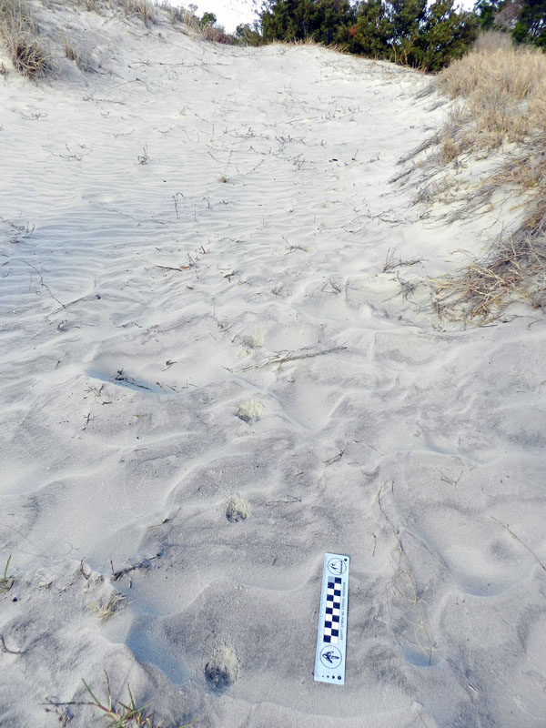
We started our morning like every day should start, with ichnology. Here, tracks of a gray fox, showing direct register (rear foot stepping almost exactly into the front-foot impression) cut between coastal dunes on the south end of Jekyll Island. The presence of gray foxes on Jekyll has caused some curiosity and concern among residents, with the latter emotion evoked because these canids are potential predators of ground-nesting birds, like the Wilson’s plover. Also, people have no idea how many foxes are on the island. If only we had some cost-effective method for detecting their presence, estimating their numbers, and interpreting their behavior. You know, like tracking.

My students show keen interest in the gray fox tracks, especially after I tell them to show keen interest as I take a photo of them. Funny how that works sometimes.

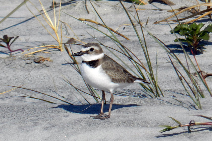
A Wilson’s plover! At least, I think it is.( Birders of the world, please correct me if this is wrong. And I know you will.) We spotted a pair of these birds traveling together on the south end of the island, causing much excitement among the photographers in our group blessed with adequate zoom capabilities on their cameras. Wilson’s plovers are ground-nesting birds, and with both gray foxes and feral cats on the island, their chicks are at risk from these predators. Again, if only we had some cost-effective method for discerning plover-cat-fox interactions. Tracking, maybe?

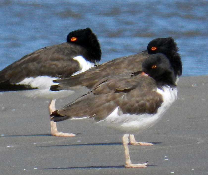
Here’s a little secret for shorebird lovers visiting Jekyll Island. Walk around the southwest corner of the island, and you are almost assured of seeing some cool-looking shorebirds along the, well, shore, such as these American oystercatchers, looking coy while synchronizing their head turns. These three were part of a flock of about twenty oystercatchers all traveling together, which I had never seen before on any of the islands. If you go walking on Jekyll, and know where to walk, you’ll see some amazing sights like this.

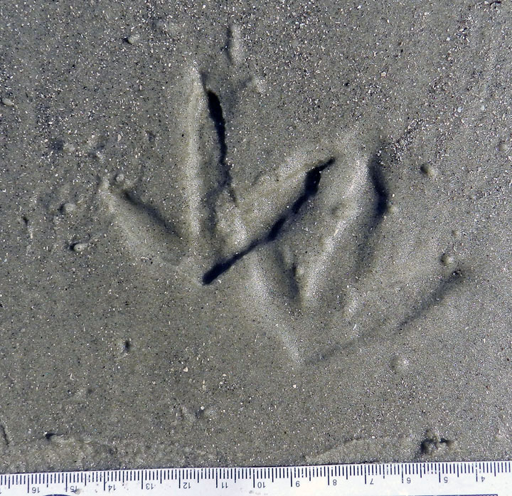
You were probably all wondering what American oystercatcher tracks look like, especially those made by ones that are just standing still. Guess this is your lucky day. Also notice the right foot was draped over the left one, causing an incomplete toe impression on the right-foot one. Wouldn’t it be nice to find a trace fossil just like this?

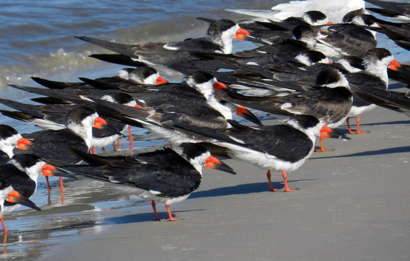
Black skimmers! We didn’t get to see them skim, but we still marveled at this flock of gorgeous shorebirds. These were in front of the oystercatchers, with an occasional royal tern slipping into the party, uninvited but seemingly tolerated.

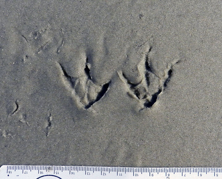
Yeah, I know, you also wanted to know what black skimmer tracks look like. So here they are. Now you don’t need to use a bird book to identify this species: just look at their tracks instead!

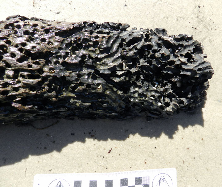
You think you’re bored? Try being driftwood, with marine clams out there adapted for drilling into your dead, woody tissue. This beach example prompted a nice little lesson in how this ecological niche for clams has been around since at least the Jurassic Period, which we know thanks to ichnology. You’re welcome (again).

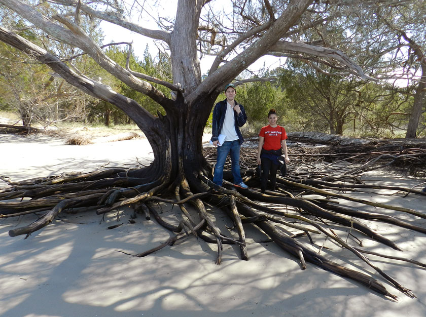
Beach erosion at the southernmost end of Jekyll gave us an opportunity to see the root systems of the main tree species there, such as this salt cedar (actually, it’s a juniper, not a cedar, but that’s why scientists use those fancy Latinized names, such as Juniperus virginiana). My students are also happily learning to become the scale in my photos, although I suspect they will soon tire of this.

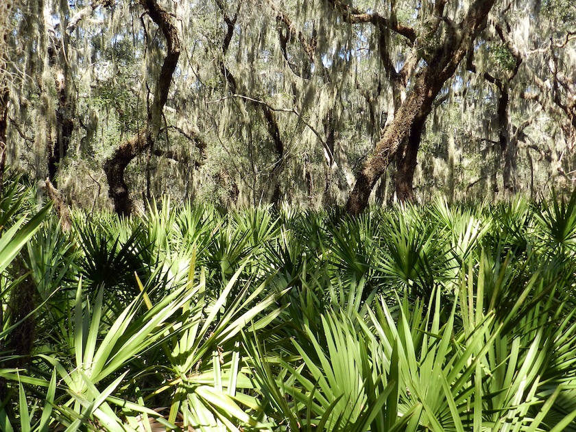
Look at this beautiful maritime forest! This is what I’m talking about when I say “…patches of it [Jekyll Island] retain potentially valuable lessons in natural history.” This is on the south end of the island, and this view is made possible by walking just a few minutes on a trail into the interior.

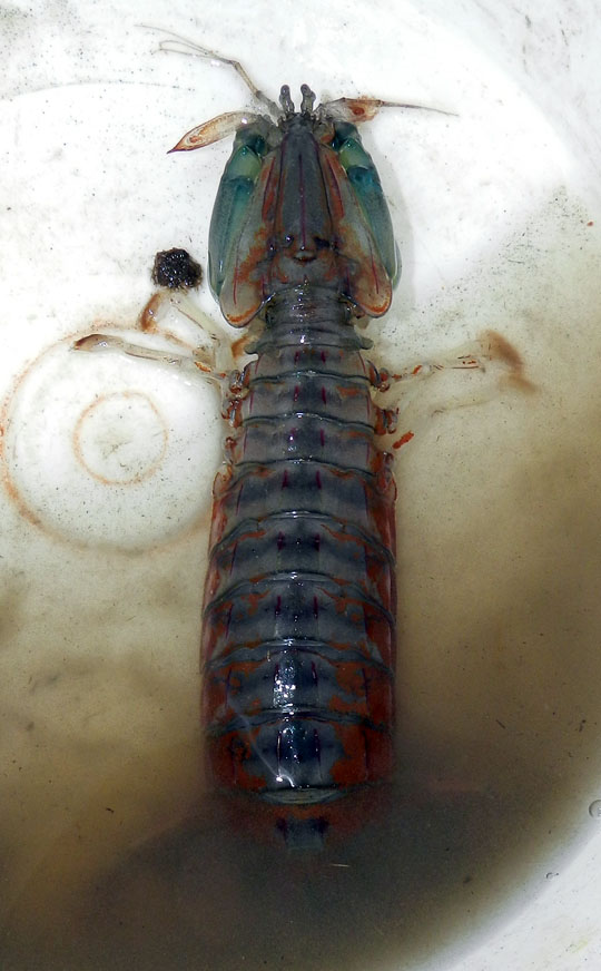
Few modern predators, invertebrate or vertebrate, provoke as much pure unadulterated giddiness in me as mantis shrimp. So imagine how I felt when, through sheer coincidence, a couple walked into the 4-H Tidelands Nature Center on Jekyll, while I was there with my class, and asked if I identify this animal they found on a local beach. The following are direct quotations from me: “Wow – that’s a mantis shrimp!! Squilla empusa!! It’s incredible!!” I had never seen a live one on the Georgia coast, and it was a pleasure to share my enthusiasm for this badass little critter with my students (P.S. It makes great burrows, too.)

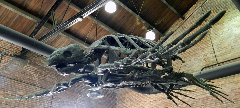
A stop at the Georgia Sea Turtle Center on Jekyll was important for my students to learn about the role of the Georgia barrier islands as places for sea turtles to nest. But I had been there enough times that I had to find a way to get excited about being there yet again. Which is why I took a photo of their cast of the Late Cretaceous Archelon, the largest known sea turtle. I never get tired thinking about the size of the nests and crawlways this turtle must have made during the Cretaceous Period, perhaps while watched by nareby dinosaurs.

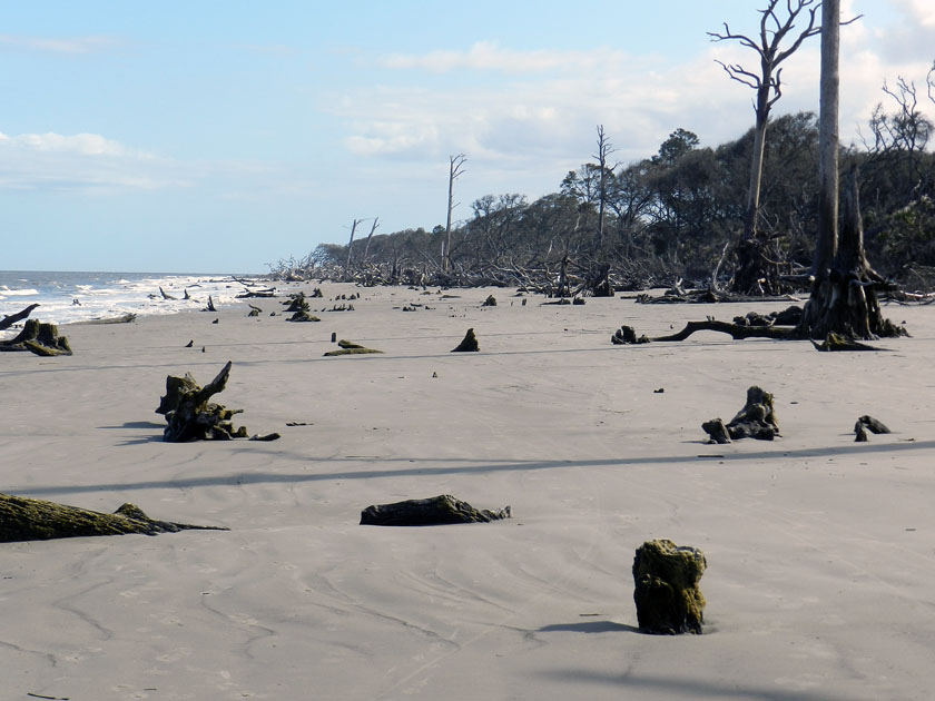
At the north end of Jekyll, shoreline erosion has caused the beach and maritime forest to meet, and the forest is losing to the beach. This has caused the forest to become what is often nicknamed a “tree boneyard,” in which trees die and either stay upright or fall in the same spot where they once practiced their photosynthetic ways.

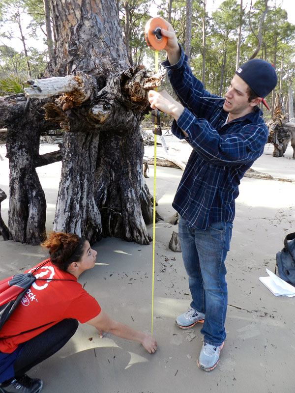
Quantify it! Whenever we encountered dead trees with root systems exposed, I asked the students to measure the vertical distance from beach surface to the topmost horizontal roots. This gave an estimate of the minimum amount of erosion that took place along the beach.

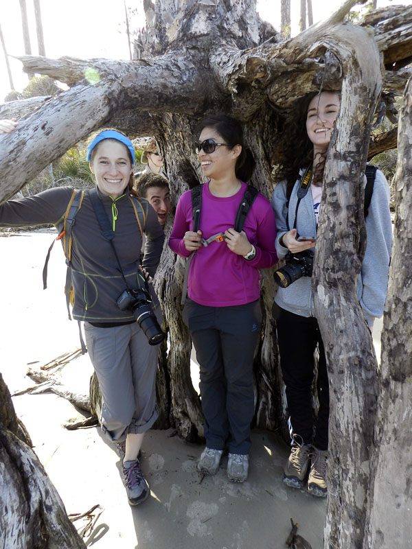
Perhaps a more personal way to convey the amount of beach erosion that happened here was to see how it related to the students’ heights. It was a great teaching method, well worth the risk of being photobombed.

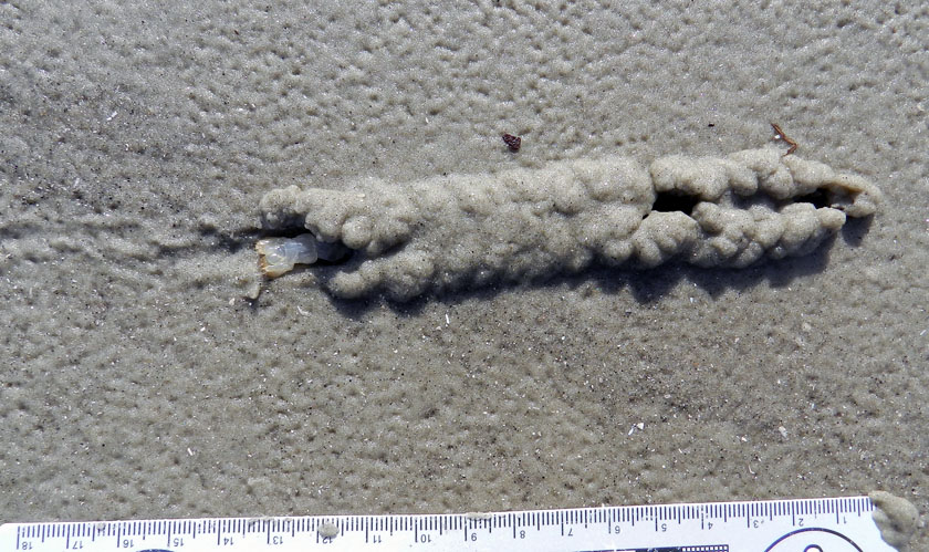
Are you ready? Here it is, in three parts, what was without a doubt the traces of the day. Start from the lower left with that collapsed burrow, follow the tracks from left to right, and look at that raised area on the right.

A close-up of the raised area shows a chevron-like pattern, implying that this was an animal that had legs, and knew how to use them. Wait, is that a small part of its tail sticking out of the left side?

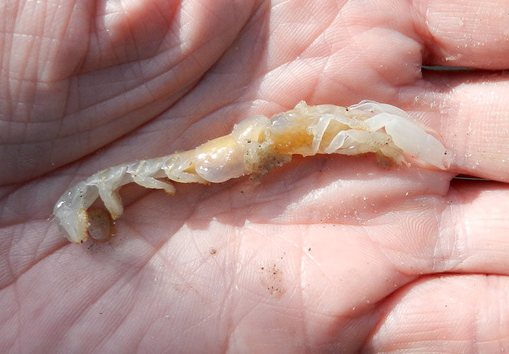
Violá! It was a ghost shrimp! I almost never see these magnificent burrowers alive and outside of their burrows, and just the day before on Cumberland Island, the students had just learned about their prodigious burrowing abilities (the ghost shrimp, that is, not the students). I had also never before seen a ghost shrimp trackway, let alone one connected to a shallow tunnel on a beach. An epic win for ichnology!

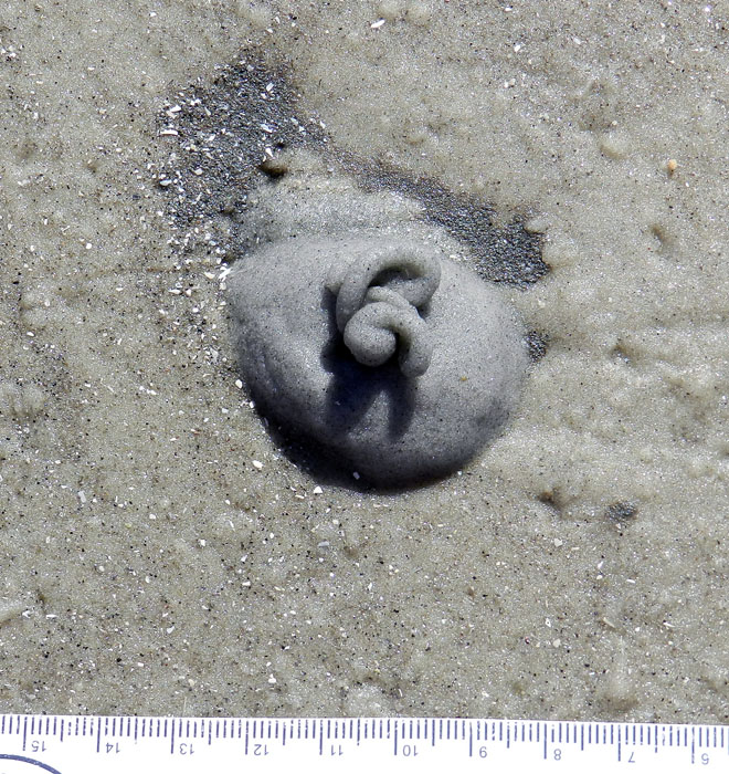
This may look like soft-serve ice cream, but I suspect that it’s not nearly as tasty. It’s the fecal casting of an acorn worm (Balanoglossus sp.), and is composed mostly of quartz sand, but still. These piles were common on the same beach at the north end of Jekyll, but apparently absent from the south-end beach. Why? I’m guessing there was more food (organics) provided by a nearby tidal creek at the north end. But I’d appreciate all of those experts on acorn worms out there to augment or modify that hypothesis.

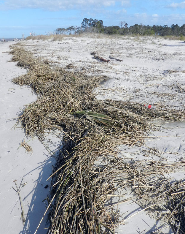
This is how dunes normally form on Georgia barrier-island beaches: start with a rackline of dead smooth cordgrass (Spartina alterniflora), then windblown sand begins to accumulate in, on, and around these. Throw in a few windblown seeds of sea oats and a few other dune-loving species of plants, and next thing you know, you got dunes. Dude.

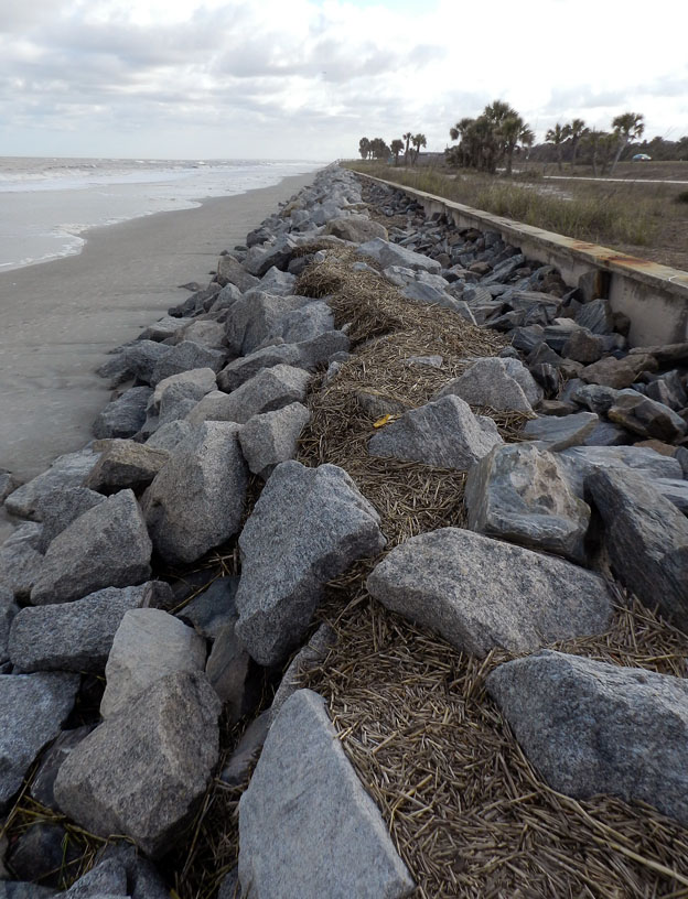
In contrast, here is how not to form dunes on Georgia barrier-islands beaches. Build a concrete seawall on the middle part of the island, truck in thousands of tons of metamorphic rock from the Piedmont province of Georgia, place the rocks in front of the seawall, and watch the beach shrink. So sad to see all of that dune-building smooth cordgrass going to waste. Anyway, the contrast and comparison you just saw is also what my students experienced by standing in both places the same day.

Jekyll Island gave us many lessons, but we only had a day there. Which islands were next? St. Simons and Little St. Simons, with emphasis on the latter. So look for those photos in a couple of days, in between new exploits and learning opportunities.


Cumberland Island, Georgia: Not a Barrier to Education

When learning about the natural sciences, there comes a time when just reading and talking about your topics in the confines of a classroom just doesn’t cut it. This semester, we had reached that point in a class I’m teaching at Emory University (Barrier Islands), in which we all needed a serious reality check to boost our learning. So how about a week-long field trip, and to some of the most scientifically famous of all barrier islands, which are on the coast of Georgia?

Last Friday, March 8, our excursion officially began with a long drive from the Emory campus in Atlanta, Georgia to St. Marys, Georgia. Fortunately, Saturday morning was much easier, only requiring that we walk across the street, step onto a ferry, and ride for 45 minutes to Cumberland Island. Cumberland was our first island of the trip, and the southernmost of the Georgia barrier islands. I have written about other topics there, including the feral horses that leave their mark on island ecosystems, the tracks of wild turkeys, and those marvelous little bivalves, coquina clams.

So rather than my usual loquacious ramblings, punctuated by whimsical asides, this blog post and others later this week will be more photo-centered and accompanied by mercifully brief captions. This approach is not only a practical necessity for proper time management while teaching full-time through the week, but also is meant to give a sense of the daily discoveries that can happen through place-based learning on the Georgia coast. I hope you learn with us, however vicariously.

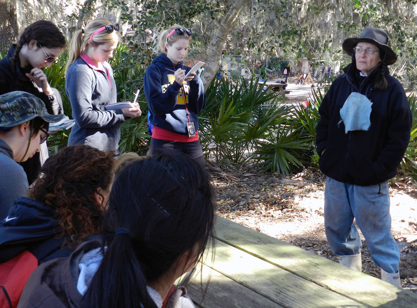
After a 45-minute ferry ride to Cumberland Island, the students received a different sort of lecture when naturalist extraordinaire Carol Ruckdeschel – who is writing a book about the natural history of Cumberland Island – met with them and gave them a brilliant overview of the island ecology. She mostly talked with the students about the effects of feral animals on the island, then spent another hour with us in the maritime forest and through the back-dune meadows. It was a real treat for the students and me, and a great way to start the field trip.

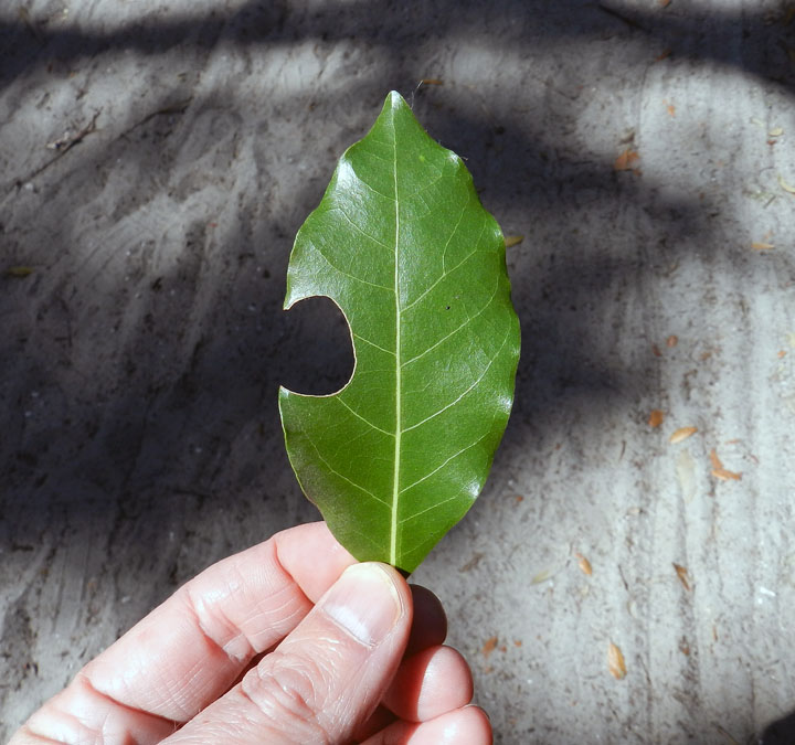
A leaf-cutter bee trace! Despite my writing about these and illustrating them in my book, these distinctive incisions were the first I can recall seeing on the Georgia barrier islands. These traces were abundantly represented in the leaves of a red bay tree we spotted along a trail through the maritime forest, making for a great impromptu natural history lesson for the students.

A freshly erupted ghost shrimp burrow on the beach at Cumberland, in which the students were lucky enough to witness the forceful ejection of muddy fecal pellets by the shrimp from the top of its burrow. I mean, really: explain to me how the life of an ichnologist-educator can get any better than that?

The fine tradition a field lunch, made even more fine by the addition of fine quart sand to our meals, freely delivered by a brisk sea breeze. Did the sand leave any microwear marks on our teeth? I certainly hope so.

A student is delighted to test my ichnologically based method for finding buried whelks underneath beach sands, and find out that it is indeed correct. (Was there any doubt?) Here she is proudly holding a live knobbed whelk, which I can assure you she promptly placed back into the water once its photo shoot was finished for the day.

Just to join in the fun, other students decided my “buried whelk prospecting” method required further testing. Let’s just say this student did not disprove the hypothesis, but rather seemed to confirm it, and doubly so. It’s almost as if ichnology is a real science! (Yes, these whelks went back into the water, too.)

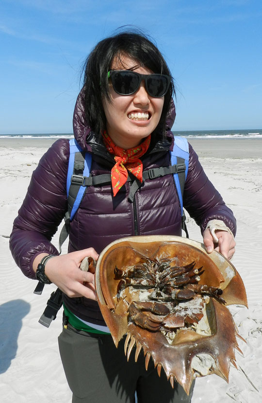
OK, enough about marine predatory gastropods (for now). How about some of the largest horseshoe crabs (limulids) in the world? We found a large deposit of their carapaces above the high-tide mark, some of which were probably molts, but others recently dead. Sadly, though, we did not see any of their traces. Bodies only do so much for me.

Where do dunes come from? Well, a mother and father dune love each other very much… No wait, wrong story. What happens is that dead cordgrass from the salt marshes washes up onto the beach, where it starts slowing down wind-blown sand enough that it accumulates. Now it just needs some wind-blown seeds of sea oats and other plants to start colonizing it, and next thing you know, dune. Dude.

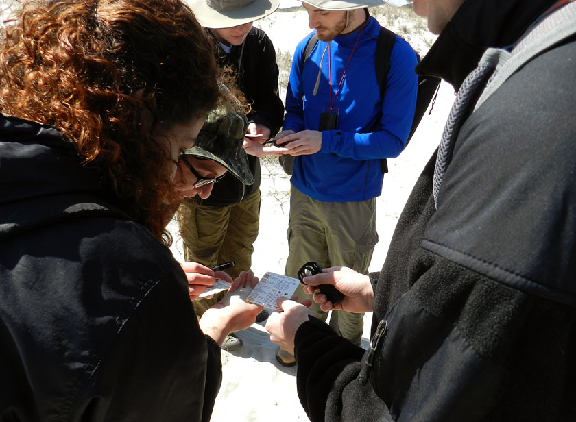
Ah, a geological tradition in action: comparing actual sand from a real outdoor environment to the sand categories on a handy grain-size chart, and using a hand lens. It’s enough to bring a tear to the eyes of this geo-educator. Or maybe that was just the wind-blown sand.

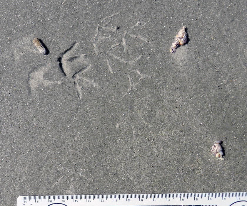
Finally, something that really matters, like ichnology! This is a three-for-one special, too: sanderling feces (left), tracks, and regurgitants (right), the last of these also known as cough pellets. Looks like it had coquina and dwarf surf clams for breakfast.

Wow, more shorebird traces! The tracks are from a loafing royal tern, and it clearly needed to get a load off its mind before moving on with the rest of its day.

Tired of shorebird traces? How about a modern terrestrial theropod? Wild turkey tracks in the back-dune meadows of Cumberland were a happy find, leading to my grilling the students with the seemingly simple question, “What bird made this?” They did not do well on this, but hey, it was the first day, and at least no one said “robin” or “ostrich.”

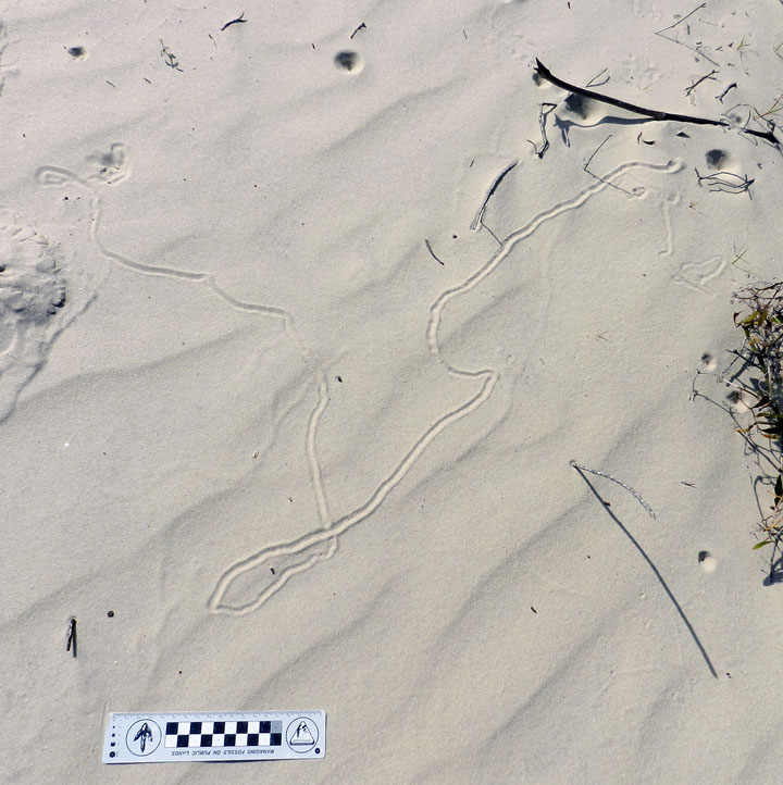
Did somebody say “doodlebug?” This long, meandering, and collapsed tunnel of an ant lion (a larval neuropteran, or lacwing) tells us that this insect was looking for prey in all the wrong places.

Behold, tracks that bespeak of great, thundering herds of sand-fiddler crabs that used to roam the sand flats above the salt marsh. Where have they gone, and will they ever come back? Who knows where the males might be waving their mighty claws? Do the female fiddler crabs suffer from big-claw envy, or are they enlightened enough to reject cheliped-based hierarchies imposed upon them by fiddler-crab society? All good questions, deserving answers, none of which make any sense.

Yes, that’s right, feral horses are really bad for salt marshes. Between overgrazing and trampling, they aren’t exactly what anyone could call “eco-friendly.” My students had heard me say this repeatedly throughout the semester, and Carol Ruckdeschel said the same thing earlier in the day. But then there’s seeing it for themselves, another type of learning altogether.

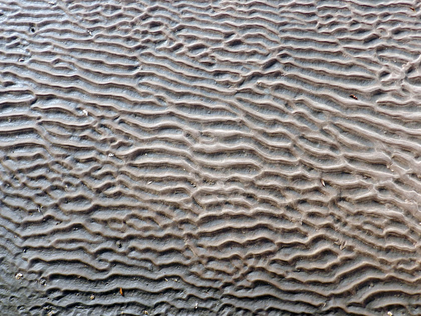
And the day ended with beautiful ripple marks, beckoning from the sandflat below the boardwalk on our trip back onto the ferry. Even this ichnologist can appreciate the aesthetic appeal of gorgeous physical sedimentary structures.

What’s the next island? Jekyll, which is just north of Cumberland along the Georgia coast, visited yesterday. Stay tuned, and look for those photos soon.

Traces of Toad Toiletry and Naming Trace Fossils

Sometimes I envy those people on the Georgia barrier islands who, through sheer number of hours in the field, come upon animal traces that I’ve never seen there. But this was one of those instances where the find was so extraordinary that I will suppress my jealous urges, celebrate the person who found it, marvel at it, and share its specialness with others.

Gale Bishop, a fellow ichnologist who is currently on St. Catherines Island, found an intriguing sequence of traces during a morning foray on its dunes and beaches there last week. In his second life – his first was as a geology professor at Georgia Southern University – he has transformed into an indefatigable sea-turtle-nesting monitor on St. Catherines and coordinator of a teacher-training program. Part of his daily routine there, among many other duties, includes looking for mother-turtle traces – trackways and nests – during the nesting season, which in Georgia is from May through September.

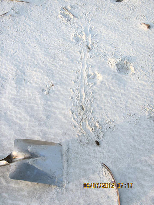
Along the way, with his eyes well trained for spotting jots and tittles in the sand, Gale often notices oddities that likely would be missed by most people, including me. The following photograph, which he shared on the St. Catherines Island Sea Turtle Program page on Facebook, is from a find he made about 7:15 a.m. on Saturday, July 7. Take a look, and please, if you haven’t already, forget the title of this post as you ponder its clues.

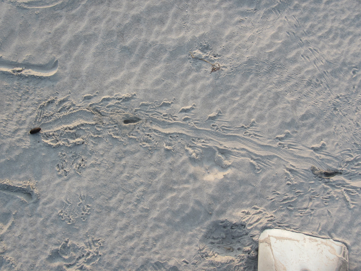
A mystery in the dune sands of St. Catherines Island on the Georgia coast, begging to be interpreted. No, not the shovel: those are never mysterious. Look at the traces to the left and above the shovel. What made these, what was it doing, and who else was in the neighborhood afterwards? Oh, and again, stop staring at the shovel. (Photograph by Gale Bishop.)

Gale called me out specifically when he posted this and several other related photos on Facebook, and asked me to tell a story about it. I gave him my abbreviated take in the comments, kind of like an abstract for the research article:

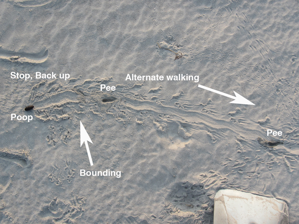
Looks like southern toad (Bufo terrestris) to me. What’s cool is the changes of behavior: hopping, stopping, pooping, and alternate walking (which people don’t expect toads to do – but they do).

That was my knee-jerk analysis, which took a grand total of about a minute to discern and respond. (After all, this was Facebook, a forum in which prolonged and deep thinking is strongly discouraged.) But I also kept in mind that quick, intuitive interpretations later need introspection and self-skepticism, especially when I’m making them. (See my previous post for an example of how wrong I could be about some Georgia-coast traces.) So rather than fulfill some Malcolm Gladwell-inspired cliché through my intuition, I sat down to study the photo with this series of questions in mind:

  • Why did I say “Southern toad” as the tracemaker for the sequence of traces that start from the lower left and extend across the photo?
  • What indicates the behaviors listed and in that order: hopping, stopping, pooping, and alternate walking?
  • What signified the changes in behavior, and where did these decisions happen?
  • Why did I assume that most people don’t expect toads to walk (implying that they think they just hop)?

The first leap in logic – how did I know a Southern toad (Bufo (Anaxyrus) terrestris) was the tracemaker – was the easiest to make, as I’ve often seen their tracks in sandy patches of maritime forests and coastal dunes. These hardy amphibians leave a distinctive bounding pattern, with the front-foot impressions together and just preceding the rear-foot ones; the toes of their front feet also point inward. In the best-expressed tracks, you will see four toes on the front feet and five toes on the rear.

Close-up of bounding pattern (from lower left of previous photo), showing front-foot impressions just in front of and more central than the rear feet impressions. Direction of movement is from bottom to top of photo. (Photograph enhanced to bring out details, but originally taken by Gale Bishop.)

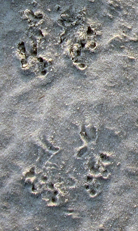
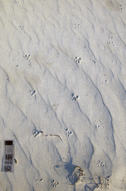
The only other possible animal that could make a trackway pattern confusable with a toad in this environment is a southeastern beach mouse (Peromyscus polionotus). Still, mice mostly gallop, in which their rear feet exceed their front feet as they move. Mouse feet are also very different from those of a toad, with toes on both feet all pointing forward (remember, toad toes point inward). So although dune mice live in the same environment as these tracks, these weren’t mouse tracks. The only alternative tracemakers would be spadefoot toads (Scaphiopus holbrookii) or a same-sized species of frog, such as the Southern leopard frog (Rana sphenocephala). But neither of these species is as common in coastal dunes as the Southern toad, so I’ll stick with my identification for now.

Mouse tracks – probably made by the Southeastern beach mouse (Peromyscus polionotus) – on costal dunes of Little St. Simons Island, Georgia. The two trackways on the left are moving away from you, whereas the one on the trackway on the right is heading toward you. All three show a gallop pattern, in which the larger rear feet exceeded the front feet. Scale = 10 cm (4 in). (Photograph by Anthony Martin)

The second conclusion – the types of behaviors and their order – came from first figuring out the direction of travel by the tracemaker, which from the lower left of the photo toward its middle. This shows straight-forward hopping up to the point where it stops.

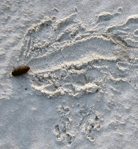
From there, it gets really interesting. The wide groove extends to the left past the line of travel and had to be made by the posterior-ventral part of the toad’s body (colloquially speaking, its butt). This, along with the disturbed sand on either side of the groove, shows that the toad turned to its right (clockwise) and backed up with shuffling movement. That’s when it deposited its scat, which I’ve also seen in connection with toad tracks (and on St. Catherines, no less). This really helped me to nail down the identity of the tracemaker, almost being able to declare, “Hey, I know that turd!”

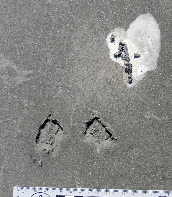
Southern toad bounding pattern that abruptly stops, followed by clockwise turning, backing up, and, well, making a deposit. (Photograph by Gale Bishop, taken on St. Catherines Island.)

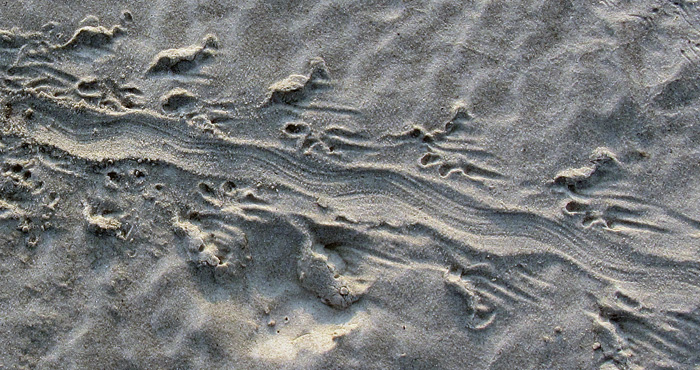
How about the alternate walking? Turns out that toads don’t just hop, but also walk: right side, left side, right side, and so on. This pattern – also called diagonal walking by trackers – is in the remainder of the photo (with the direction of movement left to right). When toads do this, the details of their front and rear feet are better defined, and you can more clearly see the front foot registers in front of the rear and more toward the center line of the body.

This side-by-side movement is also what imparted a slight sinuosity to the central body dragmark, which was from the lower (ventral) part of its body, or what some people would call “belly.” In my experience, most people are very surprised to find out that toads can walk like this, which I can only attribute to sample bias. In other words, they’ve only seen frogs and toads hop away from them when startled by the approach of large, upright bipeds.

Close-up of alternate walking pattern and body dragmark made by Southern toad. Direction of movement is from upper left to lower right. (Photograph enhanced to bring out its details, but original taken by Gale Bishop on St. Catherines Island.)

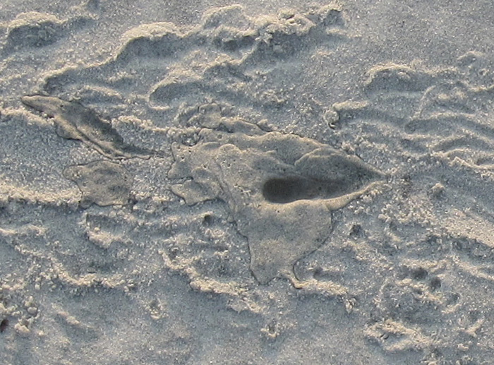
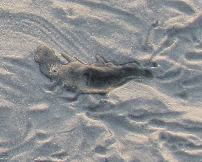
But wait, what are those two dark-colored depressions in the center of the alternate-walking trackway? Well, it doesn’t take much imagination to figure those out, especially if you’ve already had a couple of cups of coffee. Yes, these are urination marks, and even more remarkable, there are two of them in the same trackway. So not only did this toad do #2, but also #1 twice.

Southern toad urination mark #1, not too long after doing #2. (Photograph by Gale Bishop.)

Urination mark #2 , which you might say was #2 of #1, but with both #1’s after #2, or, oh, never mind.

Notice that the second mark seems to have had less of a stream to it, which makes sense in a way that I hope doesn’t require any more explanation or demonstration.

So to answer to one of the questions above – what signified the changes in behavior – you have to look for the interruptions in the patterns, much like punctuation marks in a sentence. The commas, semi-colons, colons, dashes are all part of a story too, not just the words.

The summary interpretation of what happened. Let’s just say that this frog (or toad, whatever) didn’t come a courtin’.

Through the series of photos Gale shared in an album on Facebook, he also showed that he was following a protocol all good trackers do: he changed his perspective while observing the traces. Likewise, I teach my students to use this same technique when presented with tracks and other traces, that it’s a good idea to walk around them. While doing this, they see changes in contrast and realize how the direction and angle of light on the traces alters their perceptions of it. At some points, a track or other trace may even “disappear,” then “reappear” with maximum clarity with just a few more steps.

A different perspective of the same traces, viewed from another angle. Do you notice something new you didn’t see in the previous photo and its close-ups? (Photograph by Gale Bishop, taken on St. Catherines Island.)

Now, because I’m also a paleontologist, this interesting series of traces also prompts me to ask: what if you found this sequence of traces in the fossil record? Well, it’d be a fantastic find, worthy of a cover story in Nature. (That is, if the tracks somehow went across the body of a feathered dinosaur.) Right now, I can’t think of any trace fossils like this coming from vertebrates – let alone toads or frogs – so let’s go to invertebrate trace fossils for a few examples of similarly interconnected behaviors preserved in stone.

In 2001, a sequence of trace fossils was reported from Pennsylvanian Period rocks (>300 million years old), in which a clam stopped, fed, and burrowed along a definite path, with all of its behaviors clearly represented and connected. The ichnologists who studied this series of trace fossils – Tony Ekdale and Richard Bromley – reckoned these behaviors all happened in less than 24 hours; hence the title of their paper reflected this conclusion.

Ichnologists have a sometimes-annoying and always-confusing practice of naming distinctive trace fossils, giving them ichnogenus and ichnospecies names. (For a detailed discussion of this naming method, I talked about it in another blog from the dim, dark, distant past of 2011 here.) For instance, Ekdale and Bromley stated in their study that three names could be applied to the distinctive trace fossils made by a single clam, with each a different form made by a different behavior: Protovirgularia (burrowing), Lockeia (stopping), and Lophoctenium (feeding).

Along those lines, another ichnologist (Andy Rindsberg) and I also suggested that an assemblage of trace fossils in Early Silurian rocks (>400 million years old) of Alabama, with many different ichnogenera, were all made by the same species of trilobite. The take-home message of that study, as well as Ekdale and Bromley’s, is that a single species or individual animal can make a large number of traces. This also means that ichnodiversity (variety of traces) almost never equals biodiversity (variety of tracemakers).

So let’s go back to the toad traces, put on our paleontologist hats, and think about a “what if.” What if you found this series of traces disconnected from one another: the hopping trackway pattern, the diagonal walking pattern, the urination marks, the groove, and the turd, all found in disparate pieces of rock? Taken separately, such trace fossils likely would be assigned different names, such as “Bufoichnus parallelis,” “B. alternata,” “Groovyichnus,” “Tinklichnus,” and “Poopichnus.” (Please do not use these names beyond an informal, jovial, and understandably alcohol-fueled setting.)

Color, present-day version of the variety of traces made by a Southern toad (above), and a grayscale imagining of it fossilizing perfectly (below). Key for whimsically named ichnogenera in fossilized version: Bp = “Bufoichnus parallelis,” Ba = “Buofichnus alternata,” G = “Groovyichnus,” P = “Poopichnus,” and T = “Tinklichnus.” Please don’t cite this.

Granted, the environment in which Gale noted these traces – coastal dune sands – are not all that good for preserving what is pictured here, but other environments might be conducive to fossilization. To quote comedian Judy Tenuta, “It could happen!”

So if someone does find a fossil analogue to Gale’s evocative find on St. Catherines Island, I will understand their giving a name to each separate part, even if I won’t like it. The most important matter, though, is not what you call it, but what it is. And in this case, the intriguing story of toiletry habits left in the sand one July morning by a Southern toad is worth much more than any number of names.

Further Reading

Ekdale, A.A., and Bromley, R.G. 2001. A day and a night in the life of a cleft-foot clam: Protovirgularia-Lockeia-Lophoctenium. Lethaia, 34: 119–124.

Halfpenny, J.C., and Bruchac, J. 2002. Scats and Tracks of the Southeast. Globe Pequot Press, Guilford, Connecticut: 149 p.

Jensen, J.B. 2008. Southern toad. In Jensen, J.B., Camp, C.D., Gibbons, W., and Elliott, M.J. (editors), Amphibians and Reptiles of Georgia. University of Georgia Press, Athens, Georgia: 44-46.

Rindsberg, A.K., and Martin, A.J. 2003. Arthrophycus and the problem of compound trace fossils. Palaeogeography, Palaeoclimatology, Palaeoecology, 192: 187-219.

Marine Moles and Mistakes in Science

A first day of field work in the natural sciences can be expected to hold surprises, no matter what type of science is being attempted. Sometimes these are unpleasant ones, such as finding out the fuel gauge in your field vehicle – which you are driving for the first time, and in a remote place – doesn’t work. Other times, you make a fantastic discovery, like a new species of spider, a previously undocumented invasive plant, or a fossil footprint. But sometimes you see something that just makes you scratch your head and say, “What the heck is that?”, or more profane variations on that sentiment.

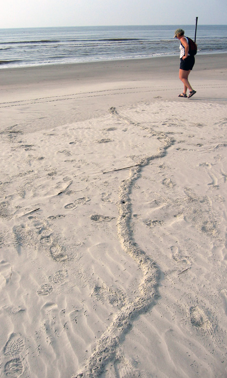
What is this long, meandering ridge making its way through a beach to the high tide mark on Sapelo Island, Georgia, and what made it? If you’re curious, please read on. But if you already know what it is, then you know a lot more than I did the first time I saw something like this. (Photograph by Anthony Martin.)

The last of those three scenarios happened to me on Sapelo Island, Georgia, in June 2004. My wife Ruth was with me, and we had just arrived on the island the previous afternoon, having stayed overnight at the University of Georgia (Athens) Marine Institute, or UGAMI. We decided that our first full morning in the field would be at Nannygoat Beach on the south end of Sapelo, which is a 5-minute drive or a 20-minute walk from the UGAMI.

We drove a field vehicle there (the gas gauge and everything else worked), parked, and took the boardwalk over the coastal dunes. Our elevated view from the boardwalk afforded a good look at many insect, ghost crab, bird, and mammal tracks made in the early morning. Circular holes punctured the dunes, made by ghost crabs (Ocypode quadrata). Sand aprons composed of still-moist sand were next to these burrow entrances, bearing crisply defined ghost-crab tracks, although early-morning sea breezes had already started to blur these.

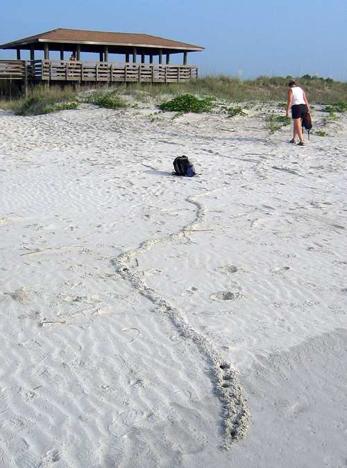
At some point after walking onto the beach, though, we saw traces that we had not noticed in previous visits to Sapelo, and ones I have rarely seen there or on other Georgia barrier islands since. These oddities were meters-long, slightly sinuous to meandering ridges, about 15-20 cm (6-8 in) wide, extending in the sandy areas from the dunes through the berm and down to the high-tide mark, where they ended abruptly.

Same meandering ridge shown in the first photo, but viewed from the high-tide mark, showing how it connects with the primary dunes. Note how a few holes are punched in the part near me: more about those soon. (Photograph by Anthony Martin, taken on Sapelo Island, Georgia. P.S.: My wife Ruth is the scale in both photos, fulfilling one of the top 10 signs that I might be a geologist.)

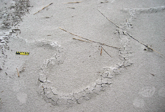
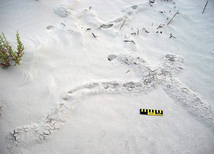
Although a few ridges crossed one another, they rarely branched, and if they did, the branches were quite short, only about 10-15 cm (4-6 in). When we followed them to the dunes, they seemed to originate from some unseen place below the sandy surfaces. We investigated further by cutting through some of the ridges to see what they looked like inside. They turned out to be mostly open tunnels with circular cross sections about 5 cm (2 in) wide, slightly wider than a U.S. dollar coin. They were mostly hollow, and only occasionally did we encounter a plug of sand interrupting tunnel interiors. This supposition was backed up by ridges that had collapsed into underlying voids. A few of the ridges stopped with a rounded end the same diameter as the ridge, or as a larger, raised, elliptically shaped “hill.”

Ridge with quite a bit of meander in it. Check out the short branch toward the top right, where the tracemaker must have changed its mind and backed up, then continued digging toward the viewer. Scale = 15 cm (6 in). (Photograph by Anthony Martin, taken on Sapelo Island, Georgia.)

Two separate ridges intersecting, caused by one crossing the other, resulting in “false branching.” Also notice the partial collapse of sand into underlying hollow tunnels and how one of the ridges ends in a rounded mound. Scale = 15 cm (6 in). (Photograph by Anthony Martin, taken on Sapelo Island, Georgia.)

A short ridge ending in a raised, elliptical “hill,” connected to a partially collapsed tunnel that is not otherwise evident as an elevated surface. Same scale as before. (Photograph by Anthony Martin, taken on Sapelo Island, Georgia.)

Ruth and I agreed that these tunnels were burrows, instead of some random features made by the winds, tides, or waves. But by what? Clearly their makers were impressive burrowers, capable of digging through meters of sand. Their bodies also were probably just a little narrower than the burrow interiors, which helped us to think about body sizes. Then we considered where we were – dunes and beach – and what animals were the most likely ones to burrow in these environments.

A process of elimination – determining what they were not – was a good way to start figuring out their potential makers. For example, no way these burrows were from insects, such as beetle larvae, ant lion larvae, or mole crickets, because they were just too big. Insects also have a tough time handling salinity, so once they got to the surf zone with its saturated, saline sand, they would have had problems, or (more likely) an aversive reaction and turned around immediately instead of plowing ahead.

Insect burrow in coastal dune sand, made by a small beetle. Look at both the form and scale, and you’ll see this is not a match for what we were seeing. Scale in centimeters. (Photograph by Anthony Martin, taken on Cumberland Island, Georgia.)

Small mammals, like beach mice (Peromyscus polionotus), didn’t seem like good candidates either. Beach-mouse burrows are totally different from what we were seeing, and their burrows do not run all of the way down to the intertidal zone. Mice, like insects, also don’t like marine-flavored water; even if they might be able to temporarily tolerate it, they wouldn’t continue to burrow through moist, salty sand.

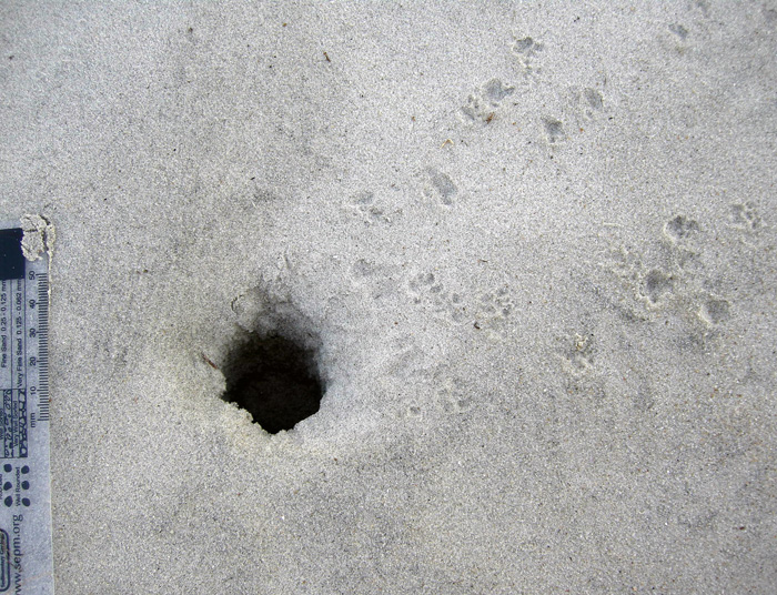
A beach-mouse burrow, with their tracks coming and going. Either the mice dug this burrow, or they occupied an abandoned ghost-crab burrow. Regardless, this also doesn’t match our mystery traces. Scale in millimeters. (Photograph by Anthony Martin, taken on Little St. Simons Island, Georgia.)

This led to an initial hypothesis that these burrows were from one of the most common larger burrowing animals in the area, and one comfortable in dune, berm, and beach environments with saturated, salty sand. These could only be from ghost crabs, I thought, an explanation supported by undoubted ghost crab burrows that perfectly intersected these tunnels, accompanied by undoubted ghost-crab tracks.

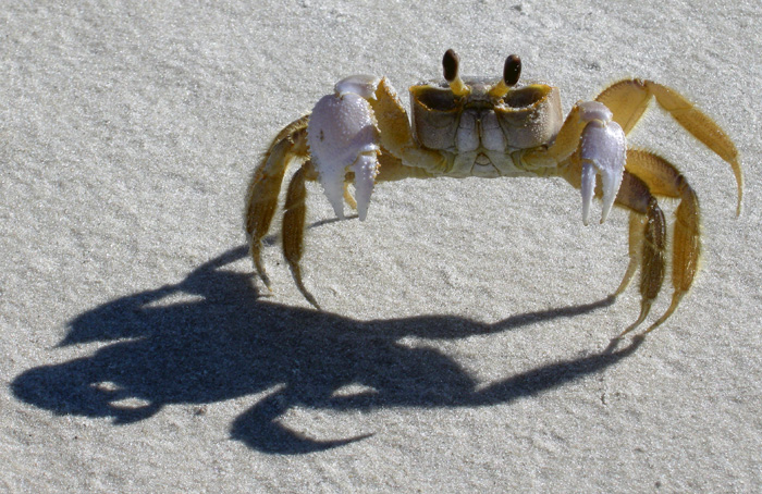
Ghost-crab burrows intersecting tunnels, accompanied by lots of ghost-crab tracks. Wow, that’s really convincing circumstantial evidence, wouldn’t you say? (Photograph by Anthony Martin, taken on Sapelo Island, Georgia.)

End of story, right? Well, no. I and a lot of other scientists have said this before, but it bears repeating: part of how science works is that in its practice we do not prove, we disprove. I somehow knew the “ghost crab burrowing horizontally through meters of sand from the dunes to the beach” hypothesis was a shaky one, and it bothered me that it just didn’t seem right. So I started reading as much as possible about ghost-crab burrowing behaviors. I thought I already knew a lot about this subject, but nonetheless was willing to acknowledge that there might be some holes in my learning (get it – holes?) that needed filling (get it – filling? Oh, never mind).

The gentle reader probably surmised what happened next. That’s right: not a single peer-reviewed reference mentioned ghost crabs digging meters-long shallow tunnels from the dunes to the beach. So either I was wrong, or I had documented a previously unknown and spectacular tracemaking behavior in this very well-studied species. A single cut by Occam’s Razor simply said, “You’re wrong.”

You thought I made long horizontal burrows that go all of the way from the dunes to the surf zone? Wow, you primates are dumber than I thought. (Photograph by Anthony Martin, taken on Sapelo Island, Georgia.)

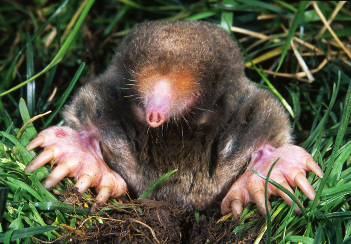
If not a ghost crab then, what else could make meters-long horizontal burrows of the diameter we had seen? This is when I began to reconsider my original rejection of moles as possible tracemakers.

So what am I: chopped liver? (Photograph from Kenneth Catania, Vanderbilt University, and taken from Wikipedia.org here.)

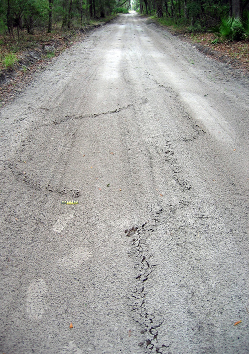
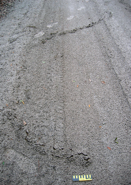
Here’s what was the most interesting about this mistaken interpretation: it was made because of where we were. In other words, our initial mystification about these traces stemmed from their environmental context. Had we seen these burrows winding down a sandy road in the middle of a maritime forest on Sapelo Island, we would not have hesitated to say the word “mole.” Yet because we saw exactly the same types of burrows in coastal dunes and beaches, we said, “something else.”

A long, meandering mole burrow in the sandy road going through a maritime forest on the north end of Sapelo Island. So if you see a burrow like this in the forest, you instantly say “mole.” But if you see it on the beach, you say, “Um, uh, duh…must be something else!” My tracks (size 8 1/2, mens) and 15 cm (6 in) photo scale for, well, scale. (Photograph by Anthony Martin.)

Another long, meandering ridge ended in a rounded “hill,” a trace that no one would hesitate to call a mole burrow, especially because it’s in the middle of a maritime forest. (Photo by Anthony Martin, taken on Sapelo Island, Georgia.)

A trip back to the literature further confirmed the mole hypothesis while also serving up a big slice of humble pie. I was embarrassed to find that these same burrows were described and interpreted as mole burrows in an article published in 1986. Even more mortifying: my dissertation advisor (Robert “Bob” Frey) was the first author on the article; it had been published while I was doing my dissertation work with him; and I had read the article years ago, but didn’t remember the part about mole traces. It was like these burrows were saying to me, “Go back to school, young man.”

OK, so these are mole burrows. Case closed. Now that we’ve identified them, we can stop thinking about them, and go on to name something else. But that ain’t science either, is it? This one answer – mole burrows – actually inspires a lot of other questions about them, which could lead to heaps more science:

Which moles made these burrows? The Georgia barrier islands have two documented species of moles, the eastern mole (Scalopus aquaticus) and star-nosed mole (Condylura cristata). Of these two, eastern moles are relatively common on island interiors, whereas star-nosed moles are either rare or locally extinct from some of the islands. But star-nosed moles are also more comfortable next to water bodies and seek underwater prey. So could these traces actually signal the presence of star-nosed moles in dune and beach environments? Frey and his co-author, George Pemberton, originally interpreted these as eastern mole burrows, but they also didn’t eliminate the possibility of star-nosed moles as the tracemakers, either.

What is the evolutionary history of moles on the Georgia barrier islands? Are these moles descended from populations isolated from mainland ones 10,000 years ago by the post-Pleistocene sea-level rise, or do they represent more modern stock that somehow made its way to the islands? A genetic study would probably resolve this issue, but who the heck is going to compare the genetic relatedness of moles from the Georgia barrier islands to those on the mainland?

What were they eating? Moles don’t just burrow for the exercise, but for the food. While burrowing, they are also voraciously chowing down on any invertebrate they encounter in the subsurface. But what would they eat in beach sands? As many shorebirds know, Georgia beaches are full of yummy amphipods, which would likely more than substitute for a mole’s typical earthworm and insect-filled diet in terrestrial environments. Yet as far as I can find in the scientific literature, no one has documented mole stomach contents or scat from coastal environments to test whether these small crustaceans are their main prey or not.

What happened to these moles once their burrows got to the surf zone? Did they turn around and burrow back, or did they go for a swim in the open ocean? The latter is actually not so far fetched, as moles are excellent swimmers, especially star-nosed moles. But how often would they do this?

Just how common (or rare) are these burrows in beaches? Just because I just perceive these burrows as rare could be an example of sample bias. Yes, I wrote an entire book about Georgia-coast traces and tracemakers and have done field work on the islands since 1998. But I don’t live on the Georgia barrier islands, nor have I spent more than a week continuously on any of them. Keenly observant naturalists who live on the islands or otherwise spend much time there could better answer this question than me. I suspect they’re actually much more common than I originally supposed, and now look for them to photograph or otherwise document whenever I go back to any of the islands.

Would such burrows preserve in the geologic record? Probably so, especially if they were made in dunes and filled with a differently colored or textured sand. But I’ll bet that nearly every paleontologist or geologist would make the same mistake I did, and reach for a burrowing marginal-marine crab or some other invertebrate as the tracemaker.

Geologists would be further fooled if fossil mole tunnels were intersected by genuine ghost-crab burrows, which would constitute a great example of a composite trace made by more than one species of animal. But why did the crabs burrow into the mole tunnels? Because it was easier. After all, the moles left hollow spaces and loosened sand over wide areas, practically begging ghost crabs to exploit these disturbed areas.

Anyway, I doubt many geologists would think of a small terrestrial mammal as a tracemaker for such burrows in sedimentary rocks formed in marginal-marine environments, although I’d love to be proved wrong on this. I’m hoping my writing about it here will help to prevent such confusion, and that whoever benefits from it will buy me an adult beverage as thanks.

In summary, this example of making a crab burrow out of a mole tunnel thus serves as a cautionary tale of how where we are when making observations in the field can influence our perceptions. But it also goes to show us how our wonderment with what we observe in natural environments can be renewed and encouraged by daring to be wrong once in a while, and learning from those mistakes.

Further Reading

Frey, R.W., and Pemberton, S.G. 1986. Vertebrate lebensspuren in intertidal and supratidal environments, Holocene barrier island, Georgia. Senckenbergiana Maritima, 18: 97-121.

Gorman, M.L., and Stone, R.D. 1990. The Natural History of Moles. University of Chicago Press, Chicago, Illinois: 138 p.

Harvey, M.J. 1976. Home range, movement, and diel activity of the eastern mole, Scalopus aquaticus. American Midland Naturalist, 95: 436-445.

Henderson, R.F. 1994. Moles. Prevention and Control of Wildlife Damage, Paper 49, University of Nebraska, Lincoln: D51-58. (Entire text here.)

Hickman, G.C. 1983. Influence of the semiaquatic habit in determining burrow structure of the star-nosed mole (Condylura cristata). Canadian Journal of Zoology, 61: 1688-1692.

Life Traces as Cover Art

I’ve been a long-time admirer of the artistic appeal of tracks, trails, burrows, nests, and other traces of animal behavior. My fondness for the beauty of traces also no doubt contributes to my science: after all, the longer I look at a trace, the more I learn about it. This sentiment accords with a long-time principle of paleontology, botany, and other facets of natural history, which is, “If you draw it, you know it,” with the added benefit of expressing your appreciation of natural objects to others through visual depictions.

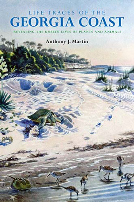
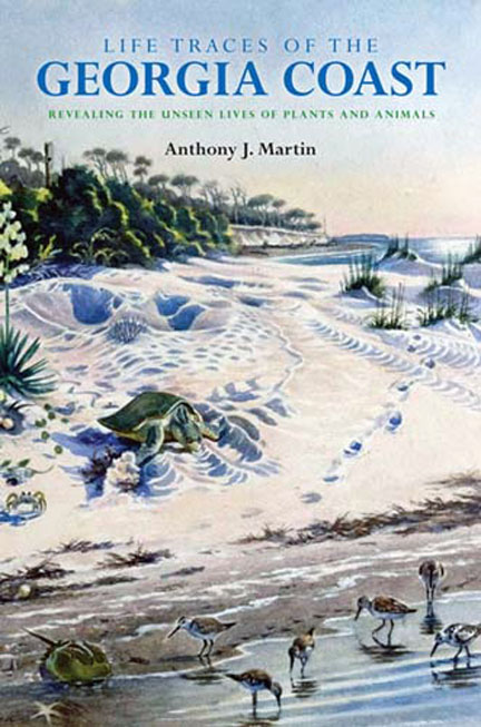
Here it is: the cover for my upcoming book, Life Traces of the Georgia Coast: Revealing the Unseen Lives of Plants and Animals! The book is scheduled to be published by Indiana University Press in the fall of 2012, so be watching out for it then. But in the meantime, look at the beautiful cover art. Who created it, what inspired it, and what science lies behind its aesthetically pleasing composition? Please read on to find out.

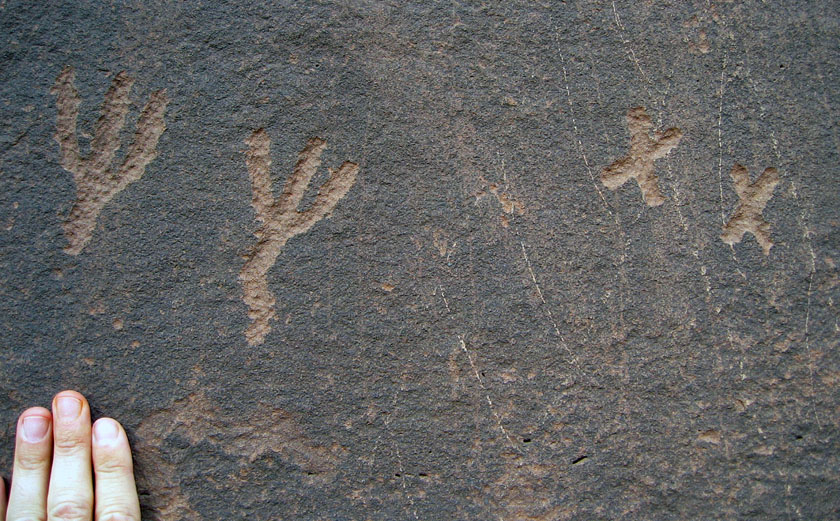
My thinking about traces as objects of art is not very original, though, and in fact has been preceded by most of humanity. For example, animal tracks and other traces were common subjects of rock art extending back to the Pleistocene Epoch. Whether made as pictographs or petroglyphs, these traces of traces are in Australia, southern Africa, Australia, and Europe, with some tens of thousands of years old. Based on this tantalizing evidence, one could reasonably propose that the representation of animal traces through art composes an intrinsic part of our heritage as a species. Yes, I know, that’s a tough hypothesis to pursue any further. So I’ll leave it to my paleoanthropologist colleagues to work out (or not).

Petroglyphs that likely represent bird tracks, etched in Triassic sandstone by Native Americans hundreds of years ago (sorry, I’m a paleontologist, not an archaeologist). The pair of marks on the right is similar to the tracks made by a perching bird with three forward pointing toes and one rearward-pointing toe – such as an eagle – whereas those to the right may be like those of a roadrunner, which has an X-shaped foot. Petroglyphs are in northeastern Arizona, near Petrified Forest National Park.

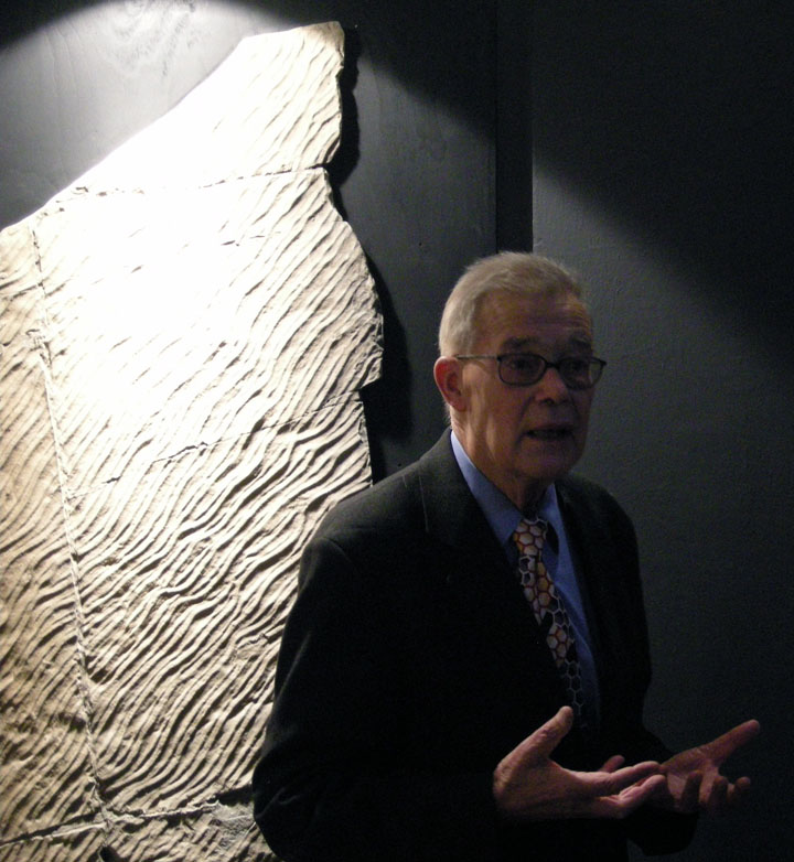
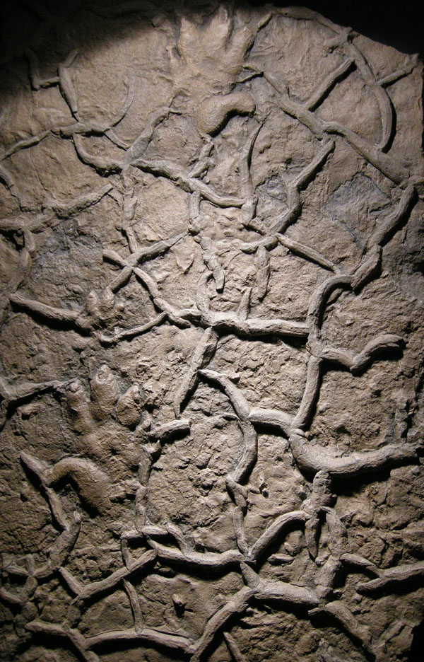
Much more recently, trace fossils similarly inspired renowned ichnologist Dolf Seilacher, who also saw these vestiges of past behavior as lovely objects that fill us with wonder. As a result, in the mid-1990s, he conceived of a traveling exhibit and book showcasing tableaus of trace fossils and other sedimentary structures, titled Fossil Art. For this show – embraced by natural-history venues but mostly rejected by art museums – Seilacher prepared it by: (1) making latex molds of sedimentary rock surfaces; (2) pouring epoxy resin into the molds to make casts mimicking the original bedding planes; and (3) using indirect lighting to enhance details; and (4) assigning creative titles to each piece as if they were works of art.

So these artificial slabs are not human-made art in the traditional sense, but nonetheless invoke marvel, project splendor, and otherwise make us think, engaging the same senses and thought processes that accompany an appreciation of art. Moreover, the slim book Seilacher authored for the exhibit contains explanatory text about each of the objects, illuminated further by his marvelous illustrations and visual interpretations. I remember first seeing a version of this exhibit in Holzmaden, Germany in 1995, near Seilacher’s home in Tubingen, and most lately enjoyed strolling through it with other many ichnologists – and Seilacher himself – in Krakow, Poland in 2008.

World-renowned ichnologist and (oh yeah) Crafoord Prize winner, Dolf Seilacher, lecturing about the planning and execution of Fossil Art as an exhibit while it was showing at the Geological Museum of Jagiellonian University in Krakow, Poland in September 2008. Photograph by Anthony Martin.

A close-up of Wrong Sided Hands, one of the pieces displayed in Fossil Art, cast from a latex mold of a sample from Lower Triassic Buntsandstein of Germany. The piece is so-called because the false appearance of a “thumb” on the outside of the tracks originally led to the mistaken idea that the animal awkwardly crossed its own path with each step. This turned out to be wrong. Also, check out the mudcracks! Photograph by Anthony Martin.

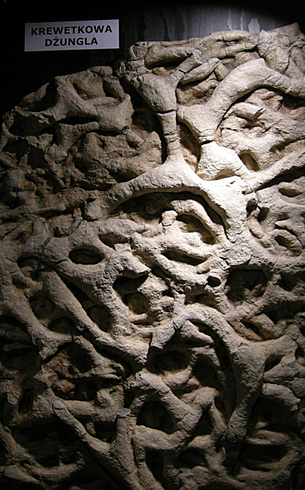
Another close-up of a piece from Fossil Art, titled Shrimp Burrow Jungle (helpfully translated into Polish here). This one is based on burrow systems made by crustaceans during the Late Triassic in Italy, which became densely populated over time and hence contributed to overlapping systems. Photograph by Anthony Martin.

Hence during my writing of a book about the modern traces of the Georgia barrier islands, I was well aware of how some of these traces could likewise lend to artistic expression. Some of this mindfulness was applied to a collaborative artwork done with my wife, Ruth Schowalter, in which we took an illustration of mine from the book and used it as the inspiration for a large watercolor painting depicting traces that would form with rising sea level along the Georgia coast (discussed in detail here).

Nonetheless, it was especially important to think about traces as art when considering a potential cover for the book. Book authors know all too well that a well-designed, attractive cover is essential for grabbing the attention of a potential reader, so I had that practical consideration in mind. But I also wanted a cover that pleased me personally, sharing my love of beautiful traces with others, especially those varied and wondrous tracks, burrows, and trails I had seen and studied on the Georgia barrier islands during the past 15 years.

In such an endeavor, I also faced the added pressure of precedence set by my publisher, Indiana University Press. My book is part of a series by IU Press, called Life of the Past, which is widely admired not only for its comprehensive coverage of paleontological topics, but also for its fine cover art, showcasing works done by a veritable “who’s who” of “paleoartists,” So I knew the cover art for my book needed to both conform to this legacy of artistic excellence, but also stand out from other books in the series because of its unique themes. After all, this would be first book in Life of the Past focusing specifically on ichnology. Moreover, the book is more concerned on modern tracemakers and their environments, rather than plants and animals of pre-human worlds. This was done with the intention of demonstrating how our knowledge of modern traces helps us to better understand life from the geologic past, an intrinsic principle of geology called uniformitarianism.

Ideally, as an ichnological purist, I would have had a cover devoid of any animals, and just shown environments of the Georgia of the Georgia coast with their traces. Indeed, I did just that in some of my illustrations in the book, in which I purposefully omitted animals and left only their traces. This “ichno-centric” mindset actually serves a pedagogical purpose, in that it would echo the truism that many sedimentary rocks are devoid of body fossils, yet are teeming with trace fossils.

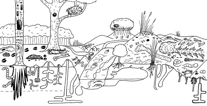
Figure 1.3 from Life Traces of the Georgia Coast, conveying a sense of the variety and abundance of traces on a typical Georgia barrier island, from maritime forest (left) to shallow intertidal (right). I purposefully drew this illustration using a more cartoonish technique to introduce broad search images of traces for people who may not ordinarily think about these. But also notice what’s missing from the figure: the animal tracemakers. Instead, only immobile plants are depicted. Would this make for good cover art? No and no, especially if you’ve seen the typical covers done for Indiana University Press books. Illustration by Anthony Martin.

Realistically, though, I also knew that modern traces, particularly those made in places as easy to visit as parts of the Georgia coast, would be more eye-catching if accompanied by some of their charismatic tracemakers in a beautiful, natural setting. After all, the Georgia coast has lengthy sandy beaches, dunes, maritime forests, and salt marshes, inhabited by a wide variety of animals, such as sea turtles, shorebirds, alligators, horseshoe crabs, ghost crabs, and many others.

I also knew that a paleoartist would not be as well suited to the task of creating a cover as someone who works more with modern environments. A better pick would be someone who was familiar with the landscapes, plants, and animals of the Georgia barrier islands, but also a fine artist. I briefly toyed with the idea of doing it myself, but already felt like far too much of the book had been “DIY,” and was not confident enough in my skills to put together a compelling cover in enough time before the book came together. An artfully done photograph was another possibility, so I sent several prospective examples to the editors for their appraisal, but these were all shot down for not having enough aesthetic elements for an attention-getting cover (i.e., traces + landscapes + sky + water = very difficult to get into a single photo).

Fortunately, through social connections that still happen despite the Internet and its incentives for becoming increasingly introverted, I met Alan Campbell through mutual friends in December 2008 at a dinner party on the Georgia coast. Fortuitously enough, our meeting was also just before Ruth and I did three weeks of field work on the barrier islands for the book. It was only fitting, then, that our first meeting was spent dining with both of us facing a Georgia salt marsh, filled with fiddler crab burrows and other such traces. Alan is a Georgia artist with much life experience along its coast, he has often portrayed its environments through gorgeous watercolors, and he has worked with scientists in the field.

Consequently, I kept Alan in mind as a potential cover artist for the next few years, and after I had finished the text and all figures for the book, I contacted him last year about my idea, while simultaneously suggesting him to the editors at IU Press. After much back-and-forth negotiations, with me in the middle, both parties finally came to an agreement, and Alan had a contract to do the artwork for the cover by December 2011.

To help Alan in researching his task, I sent him all of my illustrations and photos used in the book so that he would have an extensive library of trace images on hand for reference. He also had this blog as a source, in which I regularly write about Georgia-coast traces, explanations that are always accompanied by photographs and an occasional illustration. We also exchanged many e-mails and talked on the phone whenever needed. I told Alan my preferred cover would feature a coastal scene, but one filled with traces. He voiced a concern that the painting might become too “busy,” and the details might be lost in reduction of the image to the size

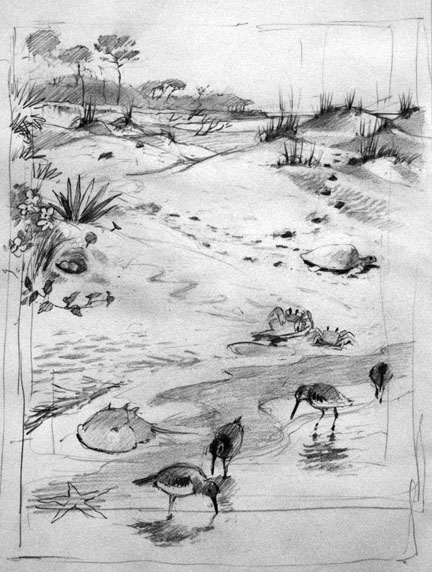
Alan’s contract specified that he would have preliminary study sketches would be done by February 1, and the final cover art was to be finished by March 30. He was only a little late with the study sketches (delayed by a minor operation), and I was delighted to see the following sketch in mid-February.

Study sketch by Alan Campbell for the cover of Life Traces of the Georgia Coast. Reprinted with his permission, and anyone else who want to use it, you have to ask him, too. By the way, every time you use original artwork without permission, a little kitten dies.

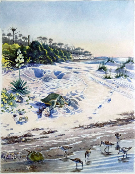
After a little bit of feedback from both me and graphic designers at IU Press, Alan went back to the drawing board (so to speak), and came up with the following watercolor painting.

Life Traces of the Georgia Coast, 2012, watercolor on paper, 14” X 18” by Alan Campbell. Again, if you want to use it, you have to ask him first and get permission. Remember those kittens? They’re alive now, but there’s no guarantee they’re going to stay that way.

I gave this artwork a big thumbs up, as did the people at IU Press. So once approved and the scan was sent to IU Press, it was up to the graphic designers there to pick out the typeface, color of the type for the main title, subtitle, author name, and placement of type without covering up the main composition of the painting. I had no say in this, and that’s a good thing, because they really knew what they were doing. It is a very nicely designed cover, and the only thing that would please me more is if they had produced a holographic image of it. (Maybe next year.)

The final cover art for Life Traces of the Georgia Coast revisited. Does it look a little different, now that you know more about how it came about?

I won’t spoil the fun for potential readers, scientists, and art appreciators by explaining in detail all of the ichnological, ecological, and geological elements incorporated into the cover. After all, I’d like to sell a few copies of the book, while also letting readers make their own personal discoveries. But hopefully all of you now have a better appreciation for how traces made by animals, our recognition and admiration for these, and artistic expression of them can all combine to contribute to a book that can be accurately judged by its cover.

Further Reading

Leigh, J., Kilgo, J., and Campbell, A. 2004. Ossabaw: Evocations of an Island. University of Georgia Press, Athens, Georgia.

Martin, A.J., in press. Life Traces of the Georgia Coast: Revealing the Unseen Lives of Plants and Animals. Indiana University Press, Bloomington, Indiana.

Morwood, M.J. 2002. Visions from the Past: The Archaeology of Australian Aboriginal Art. Allen & Unwin, Sydney, Australia.

Seilacher, A. 2008. Fossil Art: An Exhibition of the Geologisches Institut. Tubingen University, Tubingen, Germany.

Tomaselli, K.G. 2001. Rock art, the art of tracking, and cybertracking: Demystifying the “Bushmen” in the information age. Visual Anthropology, 14: 77-82.


Going Hog Wild on the Georgia Barrier Islands

(The following is the third part of a series about traces of invasive species of mammals on the Georgia barrier islands and the ecological effects of these traces. Here is an introduction to the topic, the first entry about the feral horses of Cumberland Island, and the second entry about the feral cattle of Sapleo Island.)

Anytime I hear someone refer to a Georgia barrier island as “pristine,” I wince a little bit, smile, and say, “Well, bless your heart.” The truth is, nearly every island on the Georgia coast, no matter how beautiful, is not in a pristine state, having been considerably altered by humans over the past 4,500 years, whether these were Native Americans, Europeans, or Americans. These varying degrees of change are sometimes subtle but nonetheless there, denoted by the loss of original habitats and native species or the addition of non-native species.

Still, one Georgia barrier island comes close to fulfilling this idealistic label: Wassaw Island, which during its 1,000-year geologic history somehow escaped commercial logging, agriculture, animal husbandry, and year-round settlements. Partially because of this legacy, Wassaw is designated as a National Wildlife Refuge, and is reserved especially for ground-nesting birds. One of the ways this island works well as a refuge for these birds is – as of this writing – its “hog free” status, a condition that can be tested with each visit by looking for the obvious traces of this invasive species.

The interior of Wassaw Island, with maritime forest surrounding a freshwater wetland created by alligators, the rightful owners of the island. On Wassaw, there are no tracks or signs of feral hogs, qualifying it as a “pristine” island. (Photograph by Anthony Martin.]

Contrast this with Cumberland Island National Seashore, where hogs run wild and freely. The huge pits here are in an intertidal zone of a beach on the northwest corner of the island. Naturalist Carol Ruckdeschel (background) for scale. (Photograph by Anthony Martin.)

Feral hogs (Sus scrofa) have a special place in the rogue’s gallery of invasive mammals on the Georgia barrier islands, and most people agree they are the worst of the lot. Hogs are on every large undeveloped island – Cumberland, Sapelo, St. Catherines, and Ossabaw – and they wreak ecological havoc wherever they roam. The widespread damage they cause is largely related to their voracious and omnivorous diet, in which they seek out and eat nearly any foodstuff, whether fungal, plant, or animal, live or dead. Their fine sense of smell is their greatest asset in this respect: every time I have tracked feral hogs, their tracks show head-down-nose-to-the-ground movement as the norm, punctuated by digging that uses a combination of their snouts and front hooves to tear up the ground in their quest for food. In other words, they generally act like, well, you know what.

Most importantly from the standpoint of native animals that try to live more than one generation beyond a single hog meal, feral hogs eat eggs. Hence ground-nesting birds and turtles are among their victims, and hogs are quite keen on eating sea turtle eggs. Mothers of all three species of sea turtles that nest on the Georgia coast – loggerhead (Caretta caretta), green (Chelonia mydas), and leatherback (Dermochelys coriacea) – dig subsurface nests filled with 100-150 eggs full of protein and other nutrients, making tempting targets for any free-ranging feral hogs. Similarly, hogs also threaten another salt-water turtle, the diamondback terrapin (Malaclemys terrapin); this turtle lays its eggs in shallow nests near the edges of salt marshes, which hogs manage to find. Conservation efforts to save diamondback terrapins from human predation have mostly succeeded (it used to be a tasty ingredient in soups), but hogs can’t read and don’t discriminate when it comes to eating eggs. Here is where feral hogs are particularly dangerous as an invasive species: unlike feral horses or cattle, which “merely” degrade parts of their ecosystems: feral hogs can contribute directly to the extinction of native species. As I often tell my students, if you want to cause a species to go extinct, stop it from reproducing.

Sea-turtle nest on Sapelo Island, marked by a stake and protected by plastic fencing to prevent feral hog and raccoon depredation of its eggs. An individual raccoon would only eat about 1/3 of the eggs in a sea-turtle nest, whereas pigs would just keep on eating. (Photograph by Anthony Martin.)

As an ichnologist, though, what astounds me the most about these hogs is the extremely wide ecological range of their traces. I have seen their tracks – often made by groups traveling together – in the deepest interiors of maritime forests, in freshwater wetlands, and crossing back-dune meadows, high salt marshes, coastal dunes, and beaches. If their traces became trace fossils, paleontologists would refer to them as a facies-crossing species, in which facies (think “face”) are the identifiable traits of a sedimentary environment preserved in the geologic record. Based on their tracks and sign, they are ubiquitous in terrestrial and marginal-marine environments. Oh, and did I mention they are also good swimmers? Swimming across a tidal channel at low tide is an easy feat for them, enabling hogs to spread from island to island, without the assistance of humans.

Run away, run away! Feral hogs in a St. Catherines Island salt marsh, consisting of two juveniles and an adult, do not stick around to see whether humans are going to shoot them; they just assume so. This sighting, along with their widespread tracks and other traces, show how feral hogs can occupy and affect nearly every environment on a Georgia barrier island. (Photograph by Anthony Martin.)

So to better understand why feral hogs are such successful invaders of the Georgia islands, it’s helpful to think about their evolutionary history. As expected, this history is complicated, just like that of any domesticated species in which selective breeding narrowed the genetic diversity we see today. About 15 subspecies of Sus scrofa have been identified, making its recent family tree look rather bushy. Based on genetic studies, divergence between wild species of Sus scrofa (so-called “wild boars”) and various subspecies may have happened as long ago as 500,000 years ago in Eurasia, although humans did not capture and start breeding them until about 9,000 years ago.

Depiction of a European wild boar from 1658, in The History of Four-Footed Beasts and Serpents by Edward Topsell. Original image from a woodcut, digital image in Wikipedia Commons here.

The closest extant relatives to these hogs native to North America are peccaries, which live in the southwestern U.S., Central America, and South America. However, peccaries are recent migrants to North America, and only one Pleistocene species (Mylohyus nasutus) is known from the fossil record of the eastern U.S. This means that the post-Pleistocene ecosystems of the eastern U.S., and especially those of the Georgia barrier islands, have never encountered anything like these animals. Also, unlike the feral horses of Cumberland Island and the feral cattle of Sapelo Island, the feral hogs of the Georgia barrier islands were likely introduced early in European colonization of the coast, and may have started with the Spanish in the 16th century.

Unfortunately, part of the selective breeding of Eurasian hogs was for early sexual maturity and large litter sizes. Female feral hogs can reach breeding age at 5 months, and litters typically have 4-8 piglets, but can be greater than 12; females also can produce three litters in just more than a year. Do the math, and that adds up to a lot of pigs in a short amount of time. Furthermore, on Georgia barrier islands with few year-round human residents, the only predation pressures young piglets face daily include raptors (no, not that kind of raptor) or alligators. This means young hogs reach sexual maturity soon enough to rapidly overrun a barrier island.

Feral hog trackway in a sandy intertidal zone of Cumberland Island, showing a typical gallop pattern (four tracks together –> space –> four tracks together), symbolizing how they are running roughshod over this and other islands. (Photograph by Anthony Martin.)

Yet as we have learned in North America, and particularly on the Georgia barrier islands, feral hogs rapidly revert to their Pleistocene roots. Similar to the feral cattle of Sapelo Island, these hogs are rarely seen by people, especially on islands where humans regularly hunt them. Every time I have spotted them on Cumberland, Sapelo, St. Catherines, or Ossabaw, they instantly turn around, briefly flash their potential pork loins and ham hocks, and flee. As anyone who has raised hogs can tell you, pigs are smart and learn quickly. Hence I imagine that after only one or two shootings of their siblings or parents, they readily associate upright bipeds with imminent death, especially if these bipeds are carrying boomsticks.” (Speaking of which, I know of at least one sea turtle researcher who does his part to decrease feral hog populations – while also feeding the local vultures – through his able use of such a baby-sea-turtle-protection device.)

Hence much of what we learn about these free-ranging pigs and their behaviors in the context of the Georgia barrier islands is from their traces. Among the most commonly encountered feral hog traces are:

• Tracks

• Rooting pits

• Wallows

• Feces

Feral hog tracks are potentially confused with deer tracks, as they both consist of paired hoofprints and overlap in their size ranges, which are about 2.5-6 cm (1-2.5 in) long. Nonetheless, feral hog tracks are less “pointed,” have nearly equal widths and lengths, rounded ends, and the two hoofs often splay. Two dew claws – vestigial toes – frequently register behind the hoofs, especially when hogs step into soft sand or mud or are running. Trackways normally show indirect register of the rear foot onto the front footprint in a diagonal walking pattern, but can also display a whole range from slow walk to full gallop patterns. With repeated use of pathways, trackways become trails, although I’m not sure if hogs are merely using and expanding previously existing whitetail deer trails, if they are blazing their own, or a combination of the two. (I suspect the last of these is the most likely.)

Feral hog tracks, showing nearly equal lengths and widths, rounded ends, and splaying of hooves, all three of which help to distinguish these from whitetail deer tracks. Scale in centimeters. (Photo by Anthony Martin, taken on Sapelo Island.)

Feral hog trackway on upper part of a sandy beach (moving parallel to shore), showing slow diagonal walking pattern, verified by hoof dragmarks between sets of tracks. Scale = 10 cm (4 in). (Photo by Anthony Martin, taken on St. Catherines Island.)

Rooting pits are broad but shallow depressions – as much as 5 m (16 ft) wide and 30 cm (1 ft) deep – that are the direct result of feral hogs digging for food. In most instances, I suspect they are going for fungi and plant roots, but they probably also eat insect larvae, lizards, small mammals, and any other animals that live in burrows. These pits are typically in maritime forests and back-dune meadows, but I have seen them in salt marshes and dunes, and, most surprisingly, in the intertidal areas of beaches. What are they seeking and eating in beach sands? I think anything dead and buried that might be giving off an odor. I have even seen their tracks associated with broken carapaces of horseshoe crabs (Limulus polyphemus), a menu item that never would have occurred to me if I had not seen these traces.

Rooting pit in back-dune meadow on St. Catherines Island. Former student, who answers to the parent-given appellation of “Andrew,” for scale. (Photograph by Anthony Martin.)

Evidence of feral hog feeding on a horseshoe crab (Limulus polyphemus). All I can say is, it must have been really hungry. (Photo by Anthony Martin, taken on St. Catherines Island.)

Wallows are similar in size and appearance to rooting pits, but have a different purpose, which is to provide hogs with relief from both the Georgia summer heat and biting insects that invariably go with this heat. These structures are often near freshwater wetlands in island interiors, but I’ve seen them next to salt marshes, too. If these wallows intersect the local water table, they also make for attractive little ponds for mosquitoes to breed, meaning these hog traces indirectly contribute to the potential spread of mosquito-borne diseases.

Wallow in maritime forest, Sapelo Island, with a standing pool of water indicating the local water table at the time. (Photo by Anthony Martin.)

Hog feces may look initially like deer pellets, but tend to aggregate in clusters. Most of the ones I have seen are filled with vegetation, but the extremely varied diets of feral hogs means you should expect nearly anything to show up in their scat.

Feral hog feces on Sapelo Island, which is more clumped than that of whitetail deer. Scale in centimeters. (Photo by Anthony Martin, taken on Sapelo Island.)

Which of these traces would make it into the fossil record? I would certainly bet on at least some of their tracks getting preserved, based on the sheer ubiquity of these traces in nearly every sedimentary environment of a Georgia barrier island. Other likely traces would be their pits and wallows, although their broad size and shallow depths would make them difficult to recognize unless directly associated with tracks. Feces would be the least likely to make it into the fossil record as coprolites, unless these contained a fair amount of bone or other mineralized stuff, which could happen with hogs.

What to do about these hogs, and how to decrease the impacts of their traces? Well, as most people know, pigs are wonderful, magical animals that were domesticated specifically for their versatile animal protein. So one solution is more active and year-round hunting of hogs, and using them to supplement breakfasts, lunches, and dinners of local residents on the Georgia coast, a neat blend of reducing a harmful feral species while encouraging a chic “locavore” label on such food.

However, the sheer numbers of hogs on some of the islands would likely require a more systematic slaughter to make a dent in their numbers, an approach that would probably deter any ecotourism unrelated to hog hunting. (Let’s just say that firearms and bird watching are an uneasy mix.) The introduction of native predators is another possible solution. For example, Cumberland Island has a population of bobcats (Lynx rufus) that was introduced primarily to control the whitetail deer population, but these cats probably also take a toll on the feral hogs (although how much is unknown). I have even heard suggestions of reintroducing red wolves (Canis rufus) to a few of the islands. These pack-hunting predators were native to the southeastern U.S. before their extirpation by fearful European settlers, and probably would reduce feral hog populations, but just how much of an impact they would have is hard to predict.

In summary, the feral horses, cattle, and hogs of the Georgia barrier islands have significant effects on the ecology and geology of the Georgia barrier islands, and will continue to do so until creative solutions are proposed and implemented to reduce and otherwise manage their numbers. In the meantime, though, these invasive species present opportunities for us to study their traces, learn more about their unseen behaviors, and compare these behaviors with their evolutionary histories. More science is always good, and in this respect, the Georgia barrier islands are the gifts that keep on giving.

Traces of feral mammals on Sapleo Island: feral hog tracks strolling past a piece of feral cattle scat in a sandy road next to a maritime forest. What is the fate of these invasive species on the Georgia barrier islands, and how will these environments continue to change because of their presence? (Photo by Anthony Martin, taken on Sapelo Island.)

Further Reading

Ditchkoff, S.S., and West, B.C. 2007. Ecology and management of feral hogs. Human-Wildlife Conflicts, 1: 149-151.

Giuffra, E., Kijas, J.M.H., Amarger, V., Carlborg, Ö., Jeon, J.-T., and Andersson, L. 2000. The origin of the domestic pig: independent domestication and subsequent introgression. Genetics, 154: 1785-1791.

Mayor, J.J., Jr., and Brisbin, I.L. 2008. Wild Pigs in the United States: Their History, Comparative Morphology, and Current Status. University of Georgia Press, Athens, Georgia: 336 p.

Taylor, R.B., Hellgren, E.C., Gabor, T.M., and Ilse, L.M. 1998. Reproduction of feral pigs in southern Texas. Journal of Mammalogy, 79: 1325-1331.

Wood, G.W., and Roark, D.N. 1980. Food habits of feral hogs in coastal South Carolina. The Journal of Wildlife Management, 44: 506-511.

Tracking the Wild Cattle of Sapelo Island

(The following is part of a series about traces of key invasive species of mammals on the Georgia barrier islands and the ecological effects of these traces. Here is an introduction to the topic from last month, and the first entry was about the feral horses of Cumberland Island.)

If I were pressed to name my favorite Georgia barrier island, it would be a tough choice, but it would be Sapelo. Many reasons support this preference, both practical and emotional, which I will relate before getting to the topic featured in the title.

Trails made by feral cattle traveling far into a salt marsh on Sapelo Island, Georgia. But I thought cows only stayed in grassy fields and chewed their cuds? Please read on. (Photograph by Anthony Martin.)

As I mentioned in a previous entry, Sapelo is an excellent place to take university students for teaching basic coastal ecology, geology, ichnology, and taphonomy. Many ecologists consider it as the birthplace of modern ecology, which happened in the 1950s and ‘60s, and it hosted studies that established many basic principles of neoichnology (the study of modern traces) in the 1970s and ‘80s. For the latter, one of the key figures was Robert (Bob) Frey, who was my Ph.D. advisor when I attended the University of Georgia. Sapelo’s human history is also fascinating, dating back to more than 4,000 years ago – evidenced by a prominent Native-American shell ring – and continues through today with Hog Hammock, the only Gullah (“saltwater Geechee”) community left on the Georgia coast.

I have been to Sapelo dozens of times, with or without students, and each time there, I continue to be surprised and delighted by some new observation that reveals itself to those with open eyes and minds. Thus it has everything a field-oriented scientist could want, especially one who likes to learn something different with each visit.

All of these facts and feelings, though, may also lend to an impression that Sapelo is an idyllic and ecologically “pure” place, a true slice of what a Georgia barrier island should aspire to be. Alas, it is not, and like other Georgia barrier islands, Sapelo has been ecologically altered because of exotic plants and animals introduced there during colonial and post-colonial times. Among these species, the most noteworthy on Sapelo is Bos taurus, the only population of wild cattle on any Georgia barrier island and one of the few in the continental U.S.

Unlike the feral horses on Cumberland Island, nearly everyone agrees on the origin of the wild cattle on Sapelo: they are most likely descended from domestic cattle released on the island by millionaire R.J. Reynolds, Jr. (of carcinogenic fame). Although the details are sketchy as to exactly when and why he did this, Reynolds, who owned most of Sapelo from 1933 until his death in 1964, let loose his dairy cows and bulls in the first half of the 20th century. Many generations of these cattle have bred in the wild since, and still roam the island in sufficient numbers to warrant some attention from wildlife biologists, ecologists, and others interested in learning about their behavior and impacts on the local ecosystems.

In my experience, though, the words “wild” and “cattle” are rarely used in everyday conversations about these animals that, through our domestication of them, provide us with milk, cheese, and meat. Ask someone to describe a cow, for instance, and most people will be unflattering: “slow,” “docile,” and “stupid” are among the most common adjectives applied, which is sometimes followed by a giggling reference to the Midwestern U.S. tradition of cow-tipping.

Thinking of tipping this cow? Be my guest, and be sure to forward the resulting video to Animal Planet for others’ lurid entertainment. The “cow” is actually a feral bull, and it was standing its ground at the edge of a field on Sapelo Island, fully aware that we spindly little bipeds were staring at it, and seemingly daring us to get closer. The poor quality of this photo is because I had my camera on maximum digital zoom: my momma didn’t raise no dumb kid. (Photograph by Anthony Martin.)

Yet these cattle are descended from wild species, aurochs (Bos primigenius) that survived the end-Pleistocene mass extinctions. You know, the same extinctions event that wiped out mammoths, mastodons, giant ground sloths, wooly rhinoceroses, saber-toothed cats, dire wolves, and other formidable megafauna of the Pleistocene. Hence aurochs must have had adaptive advantages over their Pleistocene cohorts. This was perhaps was related to their preferred ecosystems of wetland forests and swamps: remember that point with reference to Sapelo. Following the mass extinction, though, people in Eurasia, Africa, and India domesticated aurochs about 8,000 years ago. Through selective breeding, people came up with the present-day varieties we see of Bos taurus, which is considered a subspecies of B. primigenius.

Painting titled The Aurochs, by Heinrich Harder (1858-1935), probably made in 1920. Image is in the public domain and I found it on this Web site, authored by Peter Maas. Contrast how the artist depicted an auroch fighting off a pack of wolves with current expectations of how domestic cattle should behave in the face of pack-hunting predators, and you’ll get a better sense of the actual behaviors shown by wild cattle on Sapelo Island.

I am reminded of this evolutionary heritage whenever I go to Sapelo, because the cattle there are cryptic creatures of the maritime forest. Yes, that’s right: cryptic and living in the forest. A casual day-trip visitor to Sapelo will almost never see one, let alone any of several small herds that roam the island. Whenever an individual bull or herd is encountered in more open, grassy areas, they seemingly revert to Pleistocene behavior and slip into the woods, quickly concealing themselves from the prying eyes of humans. In short, they are not slow, docile, or stupid, and would never allow a person to get close enough to make an short-lived and ill-fated attempt to tip any of them.

This is about all you’ll see of a recent presence of the feral cattle on Sapelo Island: tracks, and if you are lucky enough to sight one, it will leave a lot more tracks and sign for you to study than that all-too-brief glimpse. Scale is in centimeters, and look closely where the slightly smaller the rear-foot track (manus) registered directly on top of the fron-tfoot (pes) track. (Photograph by Anthony Martin.)

Hence any meaningful study of these cattle and their ecological effects on Sapelo requires the use of – you guessed it – ichnology. Consequently, I have tracked these cattle, sometimes with my students and sometimes by myself, during many visits there. Although these tracking forays have generated many anecdotal yarns of yore about these “wild cows of mystery” worth retelling, I will reluctantly restrict myself here to summarizing their traces and the effects of these traces on the landscapes of Sapelo.

Traces of feral cattle on Sapelo consist largely of their tracks, trails or otherwise trampled areas, feces, and chew marks. In my experience, the vast majority of their traces are on the northern half of the island, although herds or individual bulls will occasionally leave their marks in the southern half when they graze on grassy areas there.

Tracks made by these feral cattle are unmistakable when compared to those of any other hoofed animal on Sapelo – such as white-tailed deer or feral hogs – which is a function of their greater size. Tracks are shaped like robust, upside-down Valentine’s hearts, with two bilaterally symmetrical hoof impressions rounded in the front and back. Tracks are normally about 9-14 cm (3.5-5.5 in) long, although I have seen newborn calf tracks as small as 5-6 cm (2-2.3 in) long; track widths are slightly less (by about 20%) than lengths. These cattle, like deer, spend much of their time walking slowly, so their rear-foot (pes) impressions often overlap behind their front-foot (manus) impressions, but can also overprint in direct register. Trackways typically show a diagonal-walking pattern, although these can be punctuated by frequent “T-stops,” in which tracks form a “T” pattern, with the top of the “T” made by the front feet whenever a trackmaker stopped.

Near-perfect direct register of smaller rear foot into front-foot tracks made by adult feral cow, recorded in exquisite detail in fine-grained sand. Scale in centimeters. (Photograph by Anthony Martin, taken on Sapelo Island.)

Because these cattle, for the most part, obey herding instincts, they habitually follow one another along the same narrow pathways through maritime forests and salt marshes, resulting in well-worn trails that wind between live oaks in forest interiors or cut straight across marshes. Nonetheless, the cattle also like to use the open freeways provided by the sandy roads that criss-cross much of the northern part of the island, which makes tracking them much easier, especially after a hard rain has “cleaned the slate.” When using a road, the cattle break single file and walk parallel or just behind one another, indicated by their overlapping and side-by-side trackways. On forest trails, they often drag their hooves across the tops of logs downed along trails, chipping and otherwise breaking down the wood.

Feral cattle tracks showing different sizes – and hence age structures – of the cattle, with some trackways overlapping (following one another) and some parallel, taking up the entire width of a sandy road on the north end of Sapelo Island. (Photographs by Anthony Martin, composite of three stitched together in Photoshop™.)

Log on feral-cattle trail, showing chipped wood on surface where hooves dragged across the top, possibly over generations of trail use. White-tailed deer do a similar behavior on their trails, but do not cause such obvious traces. (Photograph by Anthony Martin, taken on Sapelo Island.)

OK, here’s a reminder of something I just said and showed in a photo earlier: these cattle also form trails that wind deeply into the salt marshes. Why? Turns out that instead of restricting themselves to a terrestrial-only diet, they are eating smooth cordgrass (Spartina alterniflora), which grows abundantly in the marshes. This feeding results in their leaving many other traces, such as near-ground-level cropping of Spartina with clean tears, accompanied by considerable trampling of grazed areas. Although I was surprised to discover this for myself several years ago, people who raised cattle on the island in the 19th and early 20th centuries, perhaps through necessity, knew about this alternative foodstuff and fed it to cattle as a substitute for hay. Sure enough, historical references verify the use of smooth cordgrass as part of their diet (of the cattle, not the people, that is).

Evidence that feral cattle of Sapelo walk into salt marshes as a herd and eat the smooth cordgrass (Spartina alterniflora) there, based on trampling and overgrazing. Michael Bauman, who was an Emory undergraduate student at the time, for scale. (Photographs by Anthony Martin.)

Close-up of traces left on smooth cordgrass from feral cattle grazing, which are at various heights according to the level of their grazing activity. (Photograph by Anthony Martin, taken on Sapelo Island.)

Of course, among the most obvious traces these cattle leave in their wake are the end products of digestion (pun intended), feces. These “cow patties” vary in size depending on both the size of the tracemaker and liquid content of the scat. The bigger the tracemaker and the greater the water content to the plants, the wider the patties, which can exceed dinner-plate size. Similar to the situation on Cumberland Island with its feral horses and their feces, the native dung beetles must not be able to keep up with such a bounty, as I see many unrecycled, dried patties throughout the island, and have nearly stepped on freshly dropped pies that showed no signs of having been discovered by caring dung-beetle mothers.

Looks like cow scat. Smells like cow scat. Feels like cow scat. Tastes like cow scat. Good thing we didn’t step in it! But notice that the tracemaker did, leaving a bonus trace (track) on top of its impressive pile. (Photograph taken by Anthony Martin, taken on Sapelo Island.)

Given that the northern part of the island has extensive salt marshes flanking the maritime forest, and places with fresh-water sloughs containing more wetland plants, it makes sense that the cattle would stay mostly in that half of the island. The absence of humans on the north end of the island – other than occasional deer hunters, Department of Natural Resources personnel, or crazy ichnologists – is also a plus, as these cattle avoid people whenever possible.

But how does any of this relate to geology and paleontology? Well, because these feral cattle interact so much with Sapelo salt marshes, I actually included these animals as marginal-marine tracemakers in my upcoming book (Life Traces of the Georgia Coast, just in case you needed reminding). This places these bovines in the same category as feral horses – which negatively affect coastal dunes and salt marshes – and feral hogs, which even go into the intertidal zones of beaches for their foraging.

The biggest difference between the cattle and these other two hoofed species, though, is their impact on the marshes. In all of my years of noting cattle tracks and other sign on Sapelo, I have never seen evidence of their going to the beach, or even to the coastal dunes. Instead, they stay in the forests and wetlands, whether the latter are fresh-water or salt-water ones. This possibly reflects how the cattle, within just a few generations, switched back to auroch behaviors of the Pleistocene, preferring to live in wooded wetlands instead of in the terrestrial grasslands we modern humans keep forcing them to graze.

Thus any paleontologists looking into the fossil record of aurochs or their ancestral species – whether of body fossils or trace fossils – might use these present-day clues when prospecting for fossils. This serves as a great example of why I urge paleontologists to pay attention to invasion ecology and conservation biology, in which “ecologically impure” invasive species give us valuable insights on their evolutionary histories.

What else can we learn about these feral cattle and their ecological and geological impacts on Sapelo, especially through studies of their traces? For one, knowing the actual number of cattle on the island would be useful, as their quantity surely relates to how well the island ecosystems can handle present and future populations. But probably more important than this would be better defining their behaviors in the context of these non-native ecosystems. How to do this with a species that stays hidden so well, one that has apparently reverted to a Pleistocene way of life? Fortunately, behaviors can be defined through the ichnological methods I have outlined here. These methods can then easily augment others normally used by conservation biologists, such as trail cameras and direct observation.

Once this is done, we will know much more about these wild cattle than before, and will no longer have to rely on whispered legends of the mysterious bovines of Sapelo Island. Regardless, there is certainly still room for such stories, perhaps even artwork, operas, plays, movies, and music. Cattle have played such an integral role in the development of humanity, there is every reason to suppose that, as long as they continue to live on Sapelo, they and their traces will continue to intrigue us.

Further Reading

Ajmone-Marsan, P., Fernando Garcia, J., and Lenstra, J.A. 2010. On the origin of cattle: how aurochs became cattle and colonized the world. Evolutionary Anthropology, 19: 148-157.

Bailey, C., and Bledsoe, C. 2000. God, Dr. Buzzard, and the Bolito Man: A Saltwater Geechee Talks about Life. Doubleday, New York: 334 p.

McFeeley, W.S. 1995. Sapelo’s People: A Long Walk into Freedom. W.W. Norton, New York: 200 p.

Sullivan, B. 2000. Sapelo Island (GA): Images of America. Arcadia Publishing,  Mt. Pleasant, South Carolina: 128 p.

Teal, M., and Teal, J.M. 1964. Portrait of an Island. Atheneum, New York: 167 p. [reprinted by University of Georgia Press, Athens, in 1997: 184 p.]

Alien Invaders of the Georgia Coast

(This is the first in a series of posts about invasive species on the Georgia barrier islands, their traces, the ecological impacts of these traces, and why people should be aware of both their traces and impacts.)

Paleontologists like me face a challenge whenever we study modern environments while trying to learn how parts of these environments might translate into the geologic record. Sure, we always have to take into account taphonomy (fossil preservation), through which we acknowledge that nearly none of the living and dead bodies we see in a given environment will become fossilized; relatively few of their tracks, trails, burrows, or other traces are likely to become trace fossils, either.

Because of this pessimistic (but realistic) outlook, paleontologists often rub a big eraser onto whatever we draw from a modern ecosystem, telling ourselves what will not be there millions of years from now. We then retroactively apply this concept – a part of actualism or, more polysyllabically, uniformitarianism – to what happened thousands or millions of years ago. When paleontologists do this, they assume that today’s processes are a small window through which we can peer, giving insights into processes of the pre-human past.

Feral horse (Equus caballus) tracks crossing coastal dunes on Cumberland Island, Georgia. During their evolutionary history, horses originated in North America and populations migrated to Asia, but populations in North America went extinct during the Pleistocene Epoch about 10,000 years ago. Using the perspective of geologic time, then, could someone argue that horses are actually “native,” and these feral populations are restoring a key part of a pre-human Pleistocene landscape? (Photograph by Anthony Martin.)

However, a huge complication in our quest for actualism is this reality: nearly every ecosystem we can visit on this planet is a hybrid of native and alien species, the latter introduced – intentionally or not – by us. Thus when we watch modern species behaving in the context of their environments, we always need to always ask ourselves how non-native species have cracked the window through which we squint, through the past darkly.

This theme is considered in Charles C. Mann’s most recent book, 1493: Uncovering the New World Columbus Created, in which he argues how nearly all terrestrial ecosystems occupied by people were permanently altered by the rapid introduction of exotic species worldwide following Columbus’s landfall in the Western Hemisphere. Going even further back, though, the introduction of wild dogs (dingoes) into mainland Australia by humans about 5,000 years ago irrevocably changed the environments of an entire continent. Examples like these show that European colonization and its aftermath in human history during the last 500 years was not the sole factor in the spread of non-native species, and hints at how species invasions have been an integral part of humanity and its movement throughout the world.

Something tells me we’re not in Georgia any more. A male-female pair of dingoes (Canis lupus dingo) pose for a picture in Kakadu National Park, Northern Territory, Australia. Although now considered “native,” dingoes are an example of an invasive species that had a huge impact once brought over by people from southeast Asia about 5,000 years ago. For one, its arrival is linked to the extinction of native carnivorous mammals in the mainland Australia, such as thylacines (Thylacinus cynocephalus) and Tasmanian devils (Sarcophilus harrisii). (Photograph by Anthony Martin.)

Well-meaning (but deluded) designations of “pristine,” “untouched,”and “unspoilt” aside, the Georgia barrier islands are no exception to alien invaders. Moreover, like many barrier-islands systems worldwide, they differ greatly from island to island in: which species of invaders are there; numbers of individuals of each species; and the degree of how these organisms impact island ecosystems and even their geological processes.

Feral cat tracks in back-dune meadows of Jekyll Island, Georgia. Jekyll is one of the few Georgia barrier islands with a significant human presence year-round, hence these cats are descended from domestic cats that were either purposefully or accidentally let loose by residents. What impact do these cats have on native species of animals and ecosystems, and are these effects comparable to those of other invasive species on other islands? Scale = 15 cm (6 in). (Photograph by Anthony Martin.)

This is one of the reasons why I devoted several pages of my upcoming book, Life Traces of the Georgia Coast, to the traces of invasive species – tracks, trails, burrows, and so on – despite their failing an “ecological purity test” for anyone who might prefer to focus on native species and their traces. With regard to invasive species, the genie is out of the bottle, so we might as well study what is there, rather than apply yet another metaphorical eraser to species that are drastically shaping modern ecosystems and affecting the behavior of native species, thus likewise altering their traces.

A large pit of disturbed sand in a back-dune meadow caused by feral hogs (Sus crofa) on St. Catherines Island, Georgia. Because feral hogs are wide-ranging omnivores with voracious appetites, they cause considerable alterations to island habitats, from maritime forests to intertidal beaches. How do these traces affect the behavior and ecology of other species, especially native ones, in such a broad range of environments on the Georgia barrier islands? Can their traces actually alter the geological character of the islands? (Photograph by Anthony Martin.)

What are some of these invasive species? What makes for an “invasive species” versus a mere “exotic species”? How do the traces of invasive species affect native species on the Georgia barrier islands, and the ecology and geology of the islands themselves? And how do paleontologists and geologists figure into the study of invasive species?

These are all questions that I hope to explore in upcoming weeks here, and for the sake of simplicity, I will showcase an invasive species of mammal and its traces each week. Some of the photos shown here serve as a visual teaser of the invasive species and their traces that will be covered: feral horses (Equus caballus), cattle (Bos taurus), hogs (Sus crofa), and cats (Felis domestica). Yes, I know, there are many others, but these four are among the most ecologically significant species, they consist of animals that nearly everyone knows, and – best of all – they make easily identifiable traces. So these fours species will provide a starting point in our learning how the Georgia barrier islands can be used as case studies in the traces and ecological effects of traces made by invasive species.

Trail made by feral cattle (Bos taurus) cutting through a salt marsh and extending to the horizon, providing a clue of how this forest-dwelling animal can travel deeply into and affect marginal-marine environments. How might such traces show up in the geologic record, and was there a species that might have made similar traces on the islands in the recent past? (Photograph by Anthony Martin.)