In the southeastern U.S., the most common large herbivorous mammal native to this region is the white-tailed deer (Odocoileus virginianus). Accordingly, deer traces, such as their tracks, trails, scat, and chew sign are abundant, easy to identify, and interpret. Some of these traces I discuss in my upcoming book, which has, like, you know, the same title as this blog. (Oh, all right, here’s the link.) But since writing the book, I’ve encountered many more examples of deer traces that surprise me, with implications for better understanding the behavioral flexibility of these mammals.
 Yours Truly taking a break from biking to look at some deer tracks on a beach. Yes, that’s right: deer on a beach. Which I’ll take any day over, say, snakes on a plane. (Photograph by Ruth Schowalter, taken on Jekyll Island, Georgia.)
The ecology and ichnology of deer is a big subject, and I began writing a much longer post addressing just that, explored in exquisite detail, with stunningly brilliant insights and witty bon mots sprinkled throughout. Fortunately for all of us, I realized I was being a typical perfectionist (and pedantic) academic, instead of just getting to the point of this post. Thus the gentle reader will be spared such a tome for now, and instead I’ll talk about the cool deer traces my wife Ruth and I encountered while on Jekyll Island (Georgia) last week.
For the past four years, Ruth and I have traveled to Jekyll during our Thanksgiving break for a much–needed escape from teaching, grading, and urban environments of Atlanta, trading these in for wide beaches, beautiful salt marshes, fresh air, and exercise. Like previous years, we took our bicycles with us and spent several days there riding on its plentiful bike trails, or on the beaches at low tide.
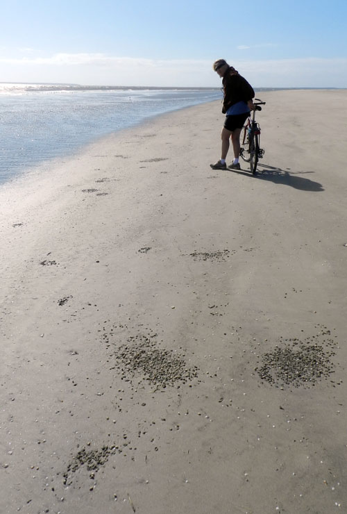
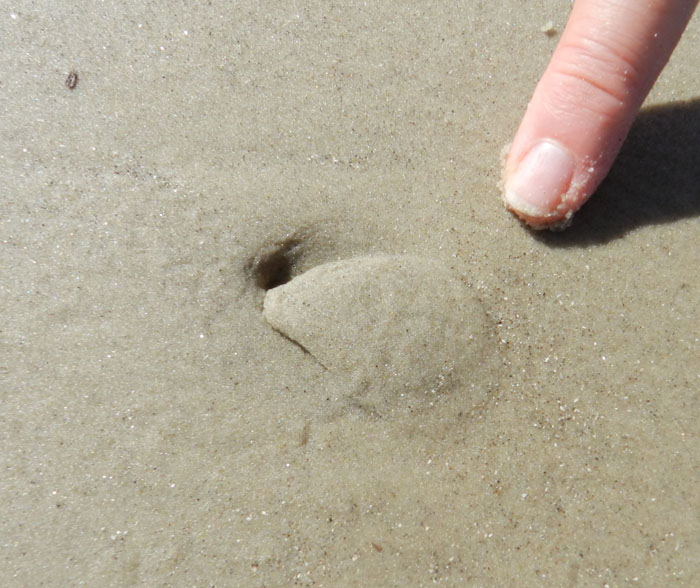
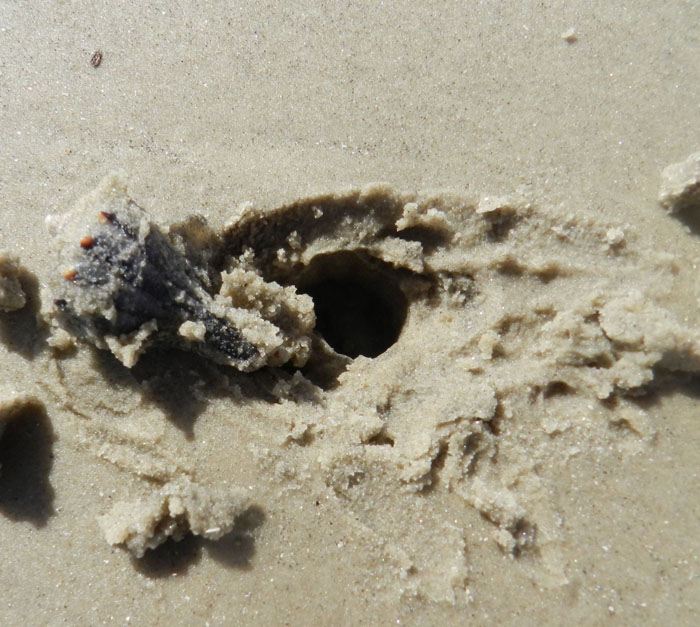
Jekyll, unlike most other Georgia barrier islands, is partially developed, with about a thousand residents, and is amenable to tourists staying on the island. This made it convenient for us to pull up on Thursday, check into a hotel, saddle up, and start riding. Of course, we don’t just ride our bikes, but we also look for traces and other interesting tidbits of natural history while speeding along Jekyll’s beaches. For example, last year while riding there, we discovered interesting interactions happening between small burrowing clams, whelks, and shorebirds (links to those here and here), a phenomenon we had never noticed before on other Georgia barrier islands.
This year, on a gorgeous Friday morning on the south beach of Jekyll, we breezed past thousands of human and dog tracks, but grew bored with the ichnological homogeneity wrought by these two tracemakers. But then, something different popped out in the midst of these ordinary, domestically produced ones, prompting us to stop and look more closely. These were deer tracks, and from two deer walking together in the intertidal zone of the beach, where a dropping tide had cleaned the beach surface.
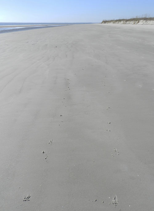 A broad expanse of sandy beach on the south end of Jekyll Island, exposed at low tide, and with two sets of deer tracks pointing downslope and then parallel to the shoreline. Note how these trackways are more-or-less equally spaced from one another, implying that the deer were next to one another and maintained their respective “personal spaces” at this point. (Photograph by Anthony Martin.)
We had seen deer tracks on Georgia barrier-island beaches before, but these are typically in the upper parts of Georgia beaches, closer to the dunes and above the high tide mark. Hence these trackways were unusual for us, showing an unexpected foray into a habitat that was not life-sustaining at all for these deer: no food, no cover, no bedding material, or other creature comforts provided by the forests and back-dune meadows. Just open beach.
Still, there they were, so we enjoyed this opportunity to figure out what they were doing while there. For one, we wondered exactly when they were on the beach. Fortunately, this was relatively easy to answer, as one of the nicer aspects of tracking animals in intertidal zones of beaches (other than being on a beach, of course) is that their tracks can be aged accurately in accordance with the tides. In this instance, high tide was in the early morning, at 3:43 a.m., and the low tide was at 10:18 a.m. We spotted the tracks at about 11:30 a.m., so it was still low tide then, but rising. The furthest down-beach extent of the deer tracks was in the middle of the intertidal zone. This implied that about three hours had elapsed after the high tide receded sufficiently to allow the deer to travel this far down the beach slope: so at 6:45-7:00 a.m. Dawn that morning was at 7:00 a.m., so their presence in this area just before dawn also synched well with the well-known crepuscular movements of deer.
Two sets of deer tracks, showing them moving downslope from above the high-tide mark (look at the rackline in the bottom third of the photo), and heading toward a runnel before turning to the left and paralleling the surf zone. You may have also noticed where their trackways cross over further down the beach. Say, looks like there’s some differences in their trackway patterns. I wonder why? (Photograph by Anthony Martin, taken on Jekyll Island.)
Further evidence of the freshness of these tracks was the moistness of the fine-grained sand, still holding their shape. The morning sunlight had dried them slightly along the edges, and especially the plates or ridges (pressure-release structures) outside of the tracks. The ocean breeze coming out of the east, though, was too gentle to have eroded the tracks, so they looked as if they had been made only a few hours before. Which they had.
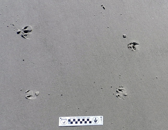 Tracking deer doesn’t get much easier than this, folks. Fine-grained and well-packed sand, still moist enough to hold the shape of the tracks and pressure-release structures, gentle wind, and fresh tracks, only about four hours old. (Photograph by Anthony Martin, taken on Jekyll Island.)
We backtracked the deer to their entry point on the beach, which was from the eroded scarp of the primary dunes. One deer must have been following the other, as their tracks came together at this point. The lead deer made the decision to step down onto the beach, a drop of a little more than a meter (3.3 ft), and then the second one followed it down.
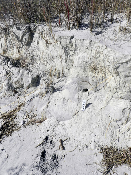 The decision point, where one of two deer took the lead and stepped down from the primary dunes to the beach (indicated by tracks at top and bottom of the photo). Note the ghost-crab burrow in the middle-right part of the photo, just above the photo scale. (Photograph by Anthony Martin, taken on Jekyll Island.)
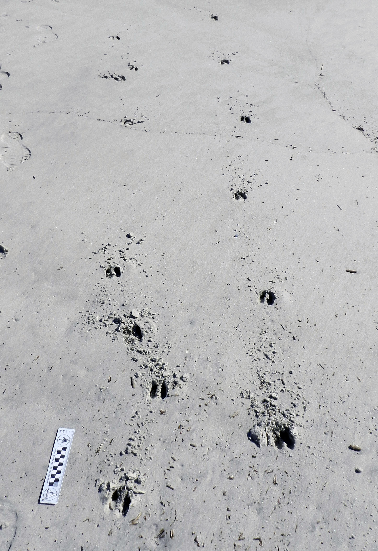
What was really interesting for me, as an ichnologist and just a plain ol’ tracker, was to see the differences in how they stepped down and moved once both deer were on the beach. Based on the trackway patterns, the lead deer simply took a big step down, landed with little drama, and began moving in a normal (baseline) gait for a deer, which is a diagonal pattern with indirect and direct register (rear-foot track on top of front-foot track on the same side). In contrast, the second deer leaped nearly two meters from the dune scarp to the beach, landed heavily, and broke into a gallop, denoted by a set of four tracks – both rear footprints ahead of both front footprints – followed by a space, then another set of four tracks.
![]() Me taking a closer look at the tracks of the “jumper,” whose first tracks show up just behind me, whereas the other deer preceding it simply took a big step down. (Photograph by Ruth Schowalter, taken on Jekyll Island.)
Me taking a closer look at the tracks of the “jumper,” whose first tracks show up just behind me, whereas the other deer preceding it simply took a big step down. (Photograph by Ruth Schowalter, taken on Jekyll Island.)
A contrast in trackway patterns by deer on a beach: one that made a normal, diagonal-walking pattern with direct or indirect register (rear foot registering totally or partially on the front-foot impression), and the other galloping, in which front feet landed, then were exceeded by both rear feet, followed by a suspension phase. (Photograph by Anthony Martin, taken on Jekyll Island.)
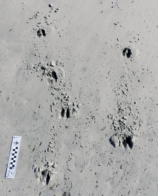 A close-up of those tracks, in which Deer #1 (right) was strolling relaxedly, not kicking up so much sand, whereas Deer #2 (left) was taking sand with it as it forcefully punched through and extracted its feet from the sand while galloping. (Photograph by Anthony Martin, taken on Jekyll Island.)
This stark difference in their gait patterns led me to ask a simple question: why? This is where a bit of intuition came into play, in which I imagined the following scenario:
- The first deer arrived at the dune scarp first, surveyed the scene, saw no threats in the immediate area, stepped down onto the beach, and walked normally.
- The second deer, following behind the first, must have temporarily lost sight of the first deer once it stepped off the dune scarp. Not wanting to be left behind, it quickened its pace up to the scarp edge, spied its companion walking nonchalantly down the beach, and jumped.
- The best way to catch up with its companion from there was to gallop, which it did.
With this hypothesis in mind – that maybe one deer was trying to catch up with the first one to join it – I had to be a good scientist and test it further. Looking down the beach, we saw how the tracks of the walking and the galloping deer eventually crossed one another, with the walking one crossing left, and the galloping one crossing right. Aha! I could use the old tried-and-true method used by generations of geologists, cross-cutting relations! This principle states that whatever cross-cuts another medium (say, a fault cross-cutting bedrock) is the younger of the two events. In this instance, I tracked the galloping deer to where it crossed and stepped on the tracks of the walking deer. Hence it came afterwards, but perhaps only a few minutes later, as the preservational quality of its tracks were identical to the first deer’s tracks. So it was very likely following and trying to catch up with its companion.
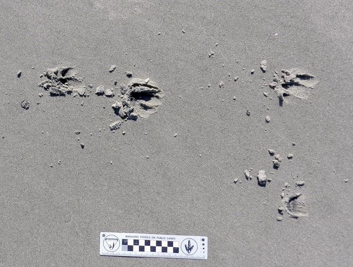 Close-up of the where Deer #2 stepped on the tracks of Deer #1 as it tried to catch up. This cross-over point is also where Deer #2 started going to the right of Deer #1, and was on the ocean side of it once they started traveling together, side-by-side. (Photograph by Anthony Martin, taken on Jekyll Island.)
 Close-up of where Deer #2 stepped on the tracks of Deer #1 as it crossed its trackway, eventually traveling to the right of Deer #1. Scale in centimeters. (Photograph by Anthony Martin, taken on Jekyll Island.)
The tracks went down-slope for a distance further, and at some point turned to the left (north), showing where they walked next to one another, about 1.5 m (5 ft) apart and paralleling the surf zone. Where did they go from there? We don’t know, but I suspect they soon went back up into the dunes and back-dune meadows, just in time to avoid all of the humans and dogs who would be on the beach in the next few hours following sunrise. Still, the tracks conjured a beautiful image, of two white-tailed deer walking down the beach together, side-by-side, as the sun came up over the ocean to their right.
Not wanting to spend our entire morning tracking these two deer, we said, “OK, that was neat,” and got back on our bikes for more riding. Later, though, while reflecting on this lesson imparted by the deer tracks in a paleontological sense, I extended their range back into prehistory. How might such tracks from terrestrial mammals have been preserved in ancient beach sediments? If they did get preserved, how would we would recognize them for what they were, or would we just assume they must be traces from some marine-dwelling animal (probably an invertebrate)? And even if we did realize these traces came from big terrestrial mammals, would we have the skills to interpret how two or more animals were affecting each others’ behaviors, which we did so easily with modern, fresh tracks directly in front of us, and knowledge of the daily tides and sunrise? This is the power of ichnology, in which these life traces motivate us to move mentally from the present, to the past, and back again.
As it was, we ended up not seeing a deer during the four days we spent on Jekyll. Nevertheless, we came away with a good story of at least two deer, knowing about their almost-secret trip to the beach, just a few hours before our own.
Further Reading
Elbroch, M. 2003. Mammal Tracks and Sign: A Guide to North American Species. Stackpole Books, Mechanicsburg, Pennsylvania: 779 p.
Halls, L.K. 1984. White-tailed Deer: Ecology and Management. Stackpole Books, Mechanicsburg, Pennsylvania: 864 p.
Hewitt, D.G. (editor). 2011. Biology and Management of White-tailed Deer. Taylor & Francis, Oxon, U.K.: 674 p.
Webb, S.L., et al. 2010. Measuring fine-scale white-tailed deer movements and environmental influences using GPS collars. International Journal of Ecology, Article ID 459610, doi:10.1155/2010/459610: 12 p.


