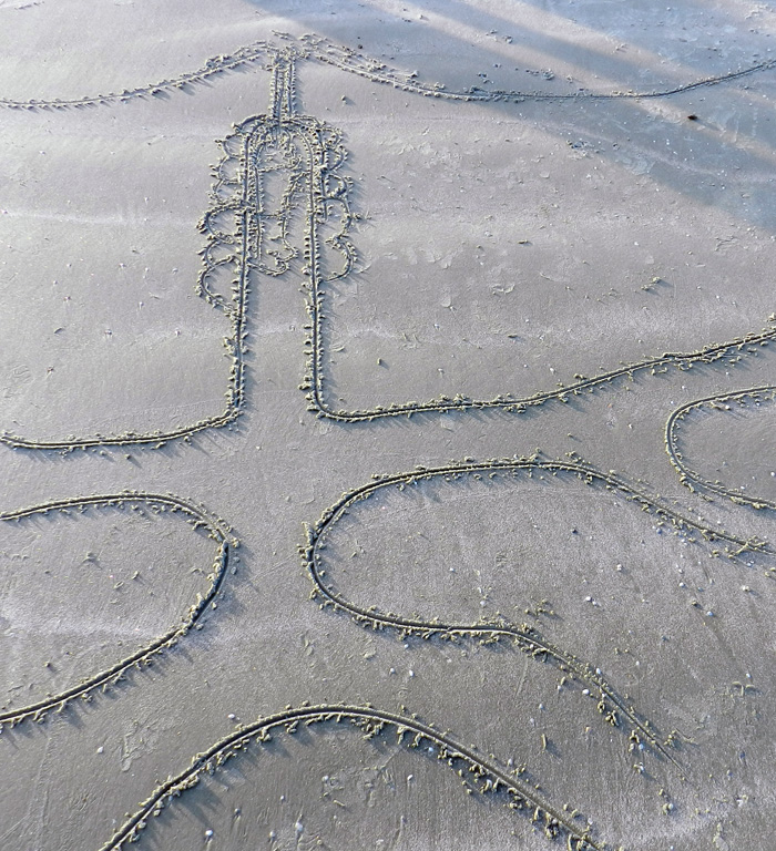
Tracking That Is Otterly Delightful

Writing about a place, its environments, and the plants and animals of those environments is challenging enough in itself. Yet to write about that place and what lives there, but without actually being there, seems almost like a type of fraud. Sure, given a specific place, I could read everything ever published about it, watch documentaries or other videos about it, carefully study 3-D computer-rendered images of its landscapes, interview people who have spent much time there, and otherwise gather information vicariously, all without experiencing it directly. But then is my writing just about the shadows on the wall of the cave?
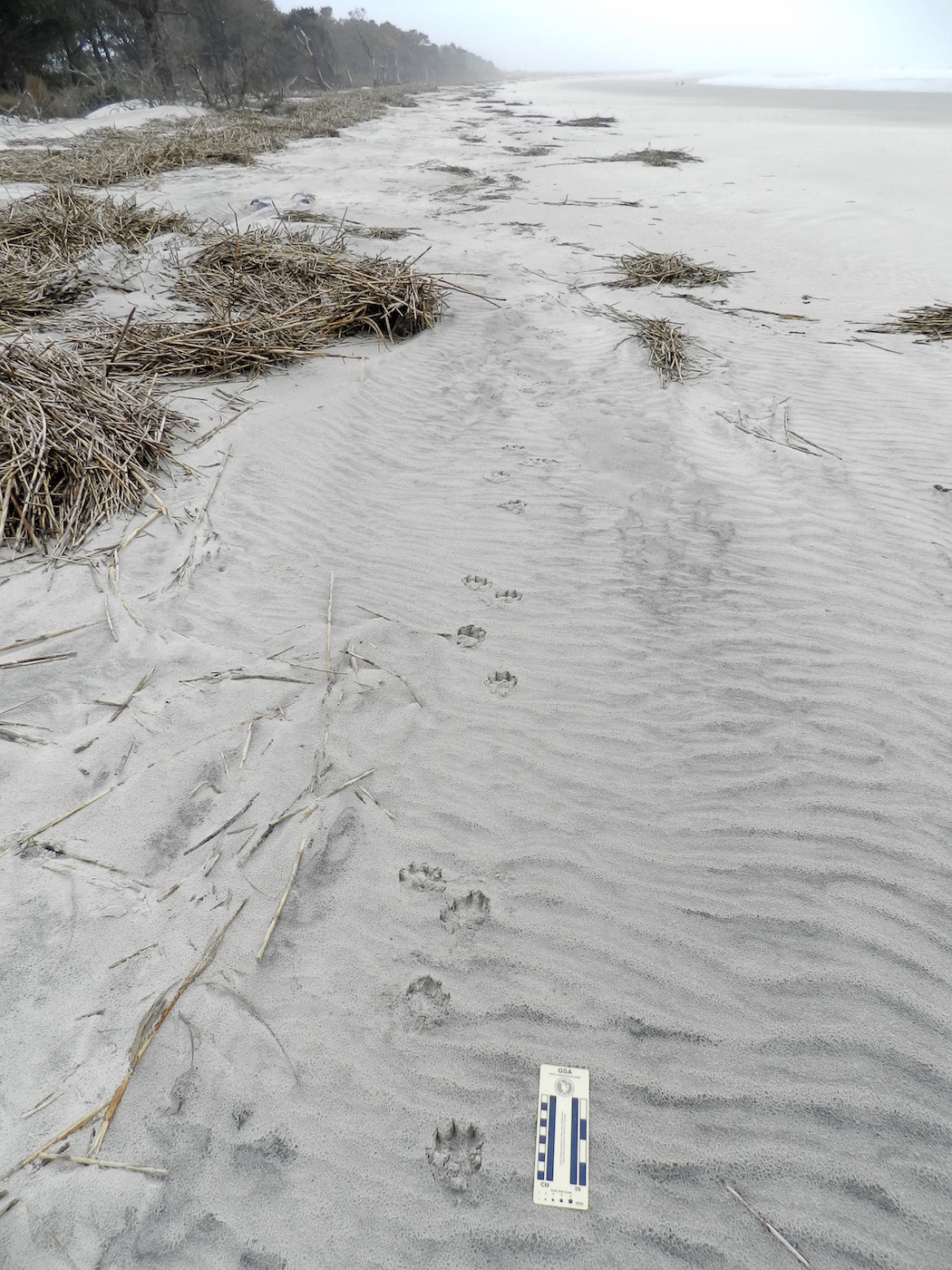
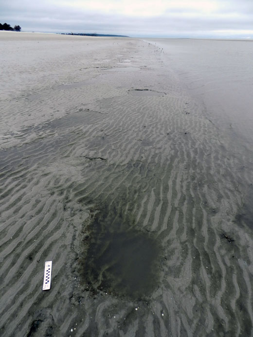
River-Otter-Tracks-Sapleo-Beach-1What do you see in this photo? I see fine quartz and heavy-mineral sand, originally parts of much larger rocks and forming parts of the Appalachian Mountains. I see the sand blowing down a long beach, but pausing to form ripples. I see a river otter galloping alongside the surf, slowing to a lope, then a trot, then back to a lope and a gallop. I see a brief rain shower, only about two hours after the otter has left the beach. (Photo by Anthony Martin, taken on Sapelo Island, Georgia.)

This pondering, of course, brings us to river otters. Yesterday, while on the third of a four-day writing retreat to Sapelo Island on the Georgia coast, my wife Ruth and I spent nearly an hour tracking a river otter along a long stretch of beach there. Had I read about river otters and their tracks before then? Yes. Had I watched video footage of river otters? Yes. Had I written about river otters and their tracks before then? Yes. Had I seen and identified their tracks before then? Yes. Had I seen river otters in the wild for myself? Yes, yes, and yes.

But still, this was different. When I first spotted the tracks on the south end of a long stretch of Cabretta Beach on Sapelo, I thought they would be ordinary. Granted, finding otter tracks is always a joy, especially when I’ve seen them on stream banks in the middle of Atlanta, Georgia. (Seriously, folks: river otters live in the middle of Atlanta. How cool is that?) And because Sapelo only has a few humans and is relatively undeveloped, your chances of coming across otter tracks on one of the beaches there isn’t like winning a lottery. But still.
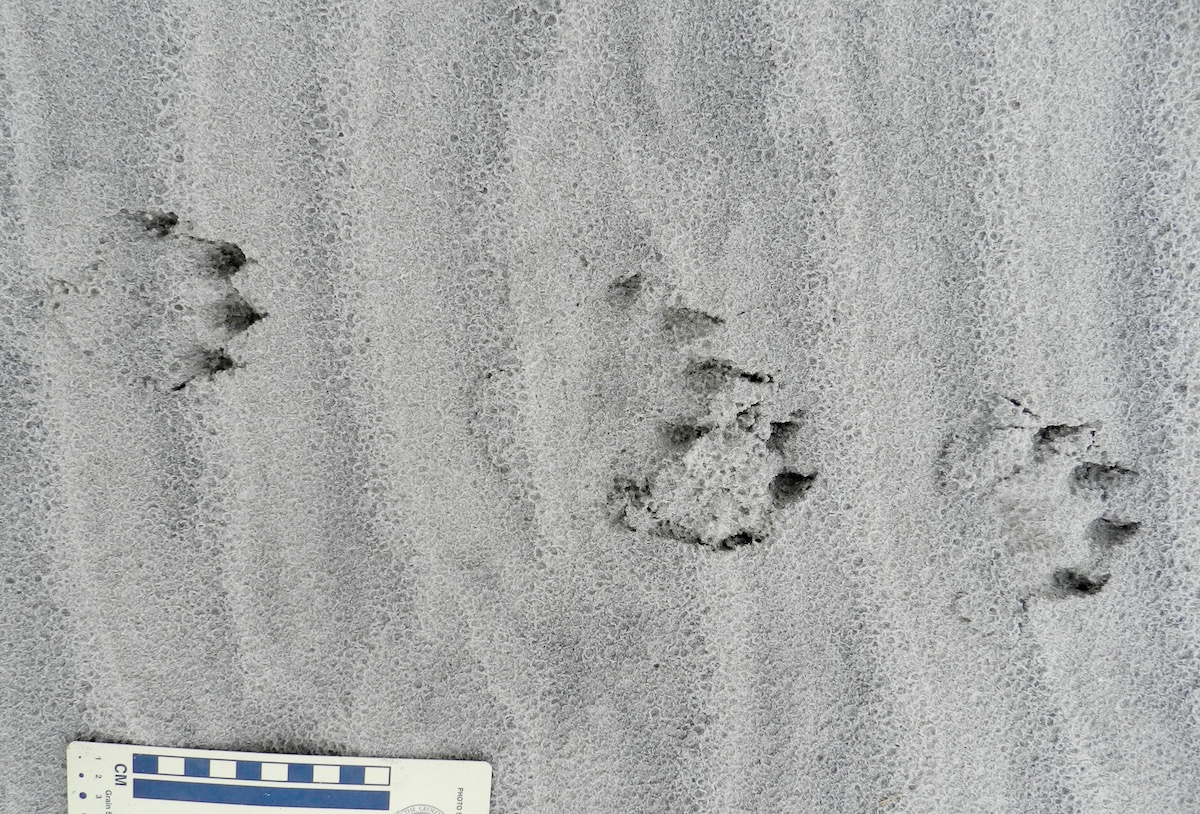
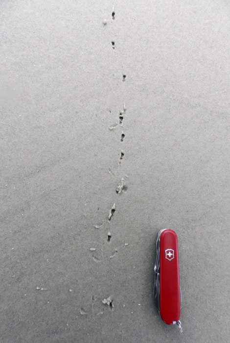
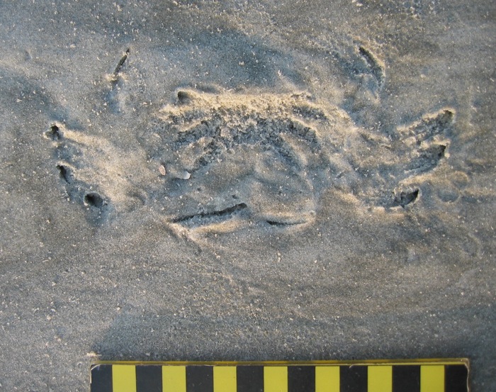
Otter-Tracks-Lope-Pattern-SapeloRiver otter (Lutra canadenis) tracks in what I (and some other trackers) call a “1-2-1” pattern. For gait, that translates into a “lope,” which is typical for an otter. In this pattern, one of the rear feet exceeds the front foot on one side, but the other rear foot ends up beside that same front foot; one front foot is behind. If that second rear foot lags behind the front foot, then it’s a “trot,” but if it exceeds the front foot (both rear feet ahead of both front feet), then that’s a “gallop.” Also, check out the wind ripples beneath the tracks, and raindrop impressions on top of them. (Photo by Anthony Martin, taken on Sapelo Island, Georgia; photo scale in centimeters, with the long bar = 10 cm (4 inches))

What made these tracks different was that they went on, and on, and on. These otter tracks spoke for the otter, saying in no uncertain terms that walking, trotting, loping, and galloping on a beach was the only thing it had on its schedule that morning. For nearly a kilometer (0.6 miles), we followed its tracks in the sandy strip of land between the high-tide line on the right and low coastal dunes on the left.

River-Otter-Tracks-Sapelo-Beach-2

Follow the river otter tracks for as far as you can in this photo. Then, when you can’t see them any more, decide where it went. Does that sound like a challenge? It probably would be if you’ve only written about tracking otters, but it can be tough for experienced trackers, too. (Photo by Anthony Martin, taken on Sapelo Island, Georgia.)

The tracks were only a few meters away from high tide, but sometimes turned that way, vanished, then reappeared further down the beach. This told us the otter was out close to  peak tide that morning (between 6-8 a.m.) and was mixing up its exercise regime by occasionally dipping into the surf. Raindrop impressions on top of the tracks confirmed this, as the tracks looked crisp and fresh except for having been pitted by rain. For us, rain started inland and south of there on the island around 10 a.m., but reached the tracks sooner than that. We were there about three hours after then, so the otter was likely long gone, on to another adventure. Nonetheless, we made sure to look up and ahead frequently, just in case the trackmaker decided to come back to the scene of his or her handiwork.

For those of you who are intrigued by animal tracks (and why would you not be?), I suggest you try following those made by one animal, and follow it for as long as you can. That way you can learn much more about it as an individual animal, rather than just its species name. In my experience, after tracking an animal for a long time, nuances of its behavior, decisions, and even its personality emerge.

For example, this otter was mostly loping (its normal gait), but once in a while slowed to a walk or trot, or sped up, when it galloped. In short, the tracks showed enough variations to say that the otter was likely reacting to stimuli in its surroundings, and in many different ways. What gave it a reason to slow down? What impelled it to move faster? Why did it jump into the surf when it did, and why did it come out? Or, do otters just want to have fun?
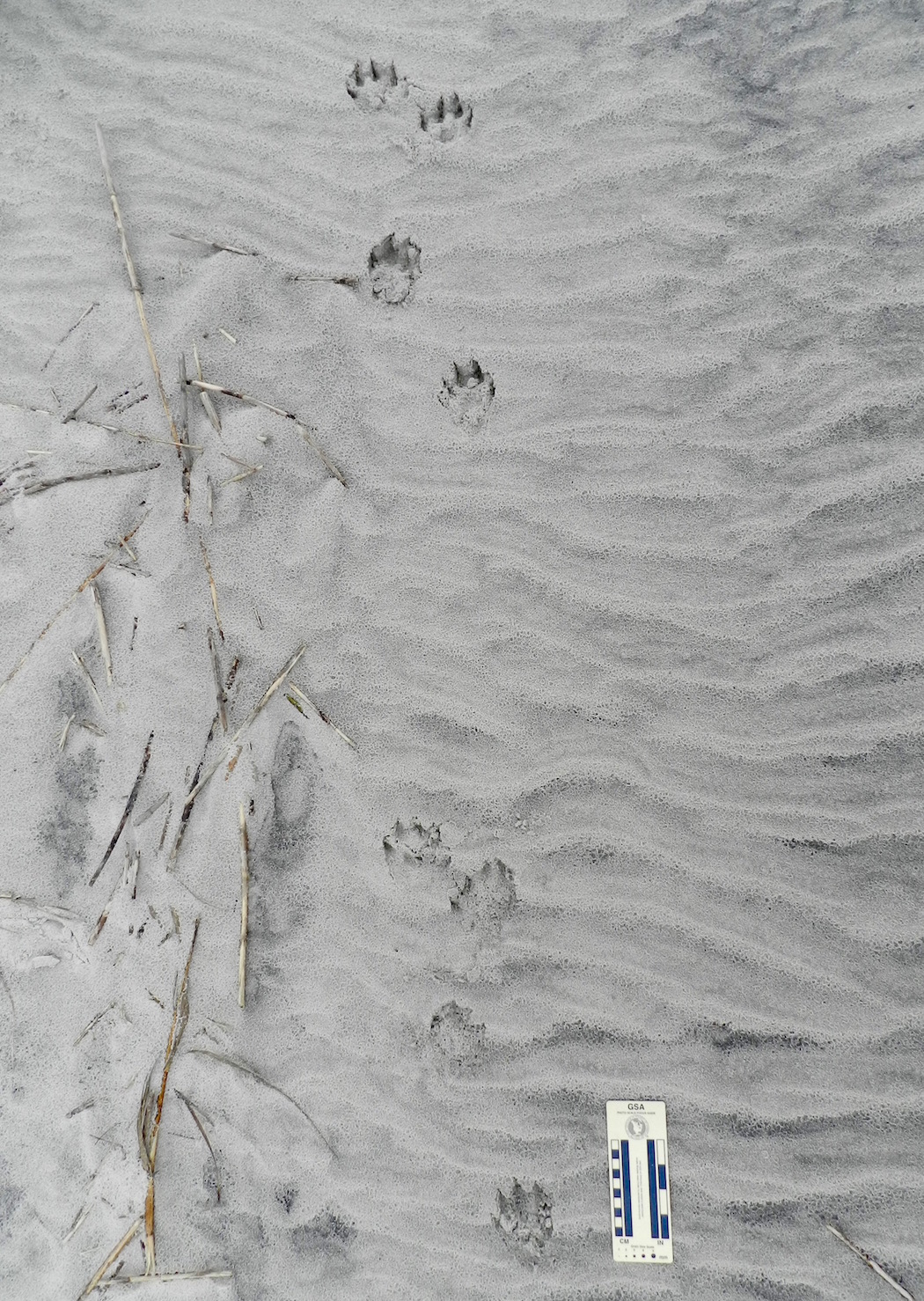
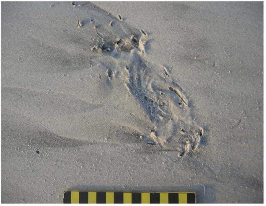
River-Otter-Gallop-Pattern-SapeloGallop pattern for a river otter, in which both of its rear feet exceeded the front feet, making a group of four tracks. In this instance, the group defines a “Z” pattern when drawing a line from one track to another, but gallops sometimes also produce “C” patterns. Notice also how the groupings are separated by a space with no tracks. This is also diagnostic of a gallop pattern: the longer the space, the longer the “air time” for the animal, when it was suspended above the ground between when its feet touched the ground. (Photo by Anthony Martin, taken on Sapelo Island, Georgia.)

Now I realize that discerning a “personality” and “moods” of a non-human animal based on a series of its tracks might sound like a little too “woo-woo” and “New Agey” for my skeptical scientist friends to accept, followed by jokes about my becoming a pet psychic. As a fellow skeptical scientist, I’m totally OK with that. In fact, I will join them in making fun of people who try to tell us that, say, they know what a Sasquatch was thinking as it strolled through a forest while successfully avoiding all cameras and other means of physical detection.

But here’s what happens when you’ve tracked a lot (which I have) and made lots of mistakes while tracking, but later corrected them (ditto). Intuition kicks in, and it usually works. For instance, at one point in following this otter, I lost its tracks on a patch of hard-packed sand. (Granted, I should have gotten down on my hands and knees to look closer, but was being lazy. Hey, come on, I was on a writer’s retreat.) So I then asked myself, “Where would I (the otter) have gone?” and looked about 10 meters (30+ feet) ahead in what felt like the right place. There they were. This happened three more times, results that led me to conclude this was almost like some repeatable, testable, falsifiable science-like thing happening. So there.
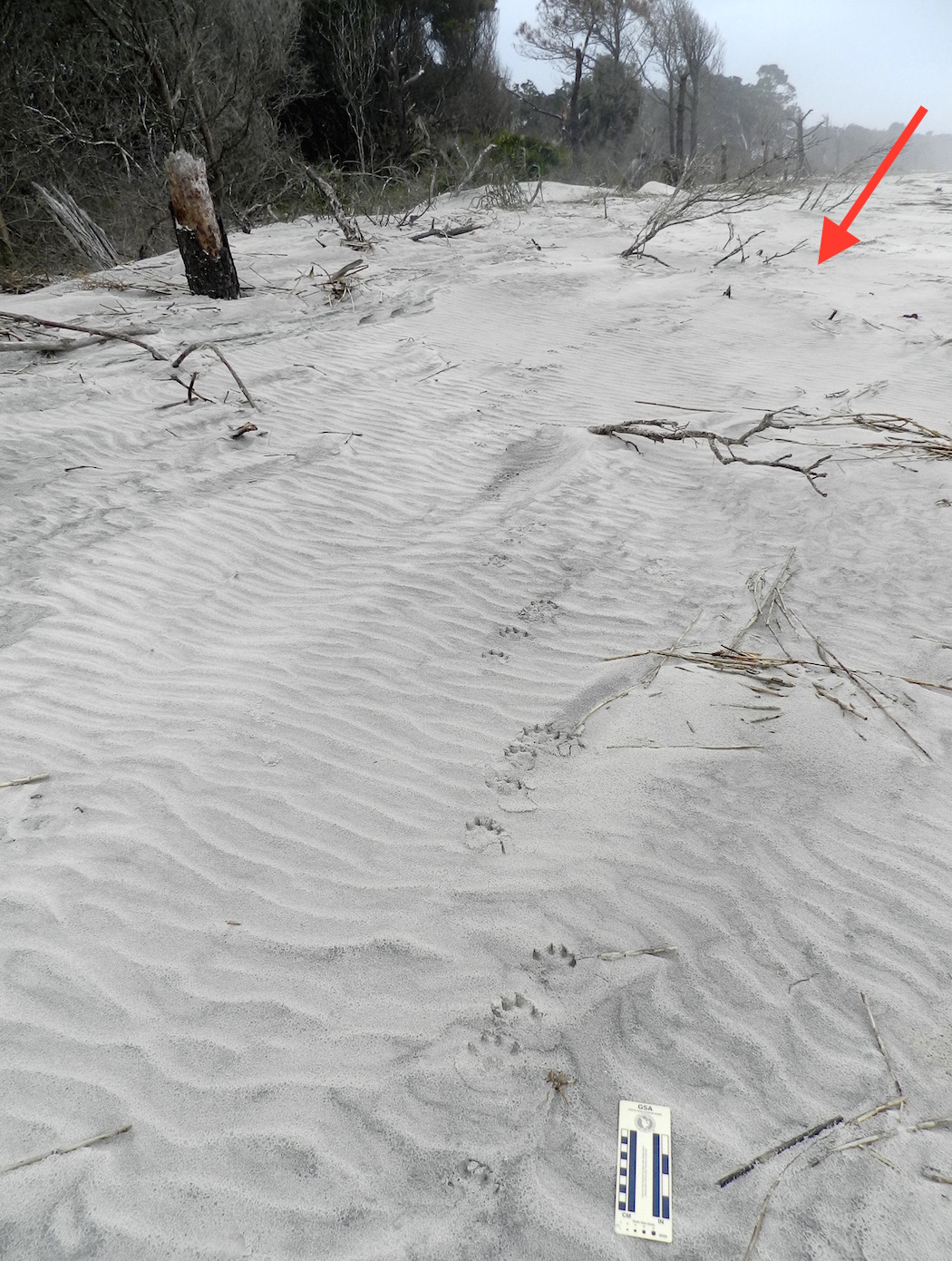
River-Otter-Tracks-Sapelo-Beach-2-LabeledOK, remember when I asked you to follow the river otter tracks for as far as you could in this photo, and when you couldn’t see them any more, decide where it went? If not, go back and re-read it and look at the photo again. If you have, then look at the red arrow, backtrack to the footprints in the foreground of the photo, then go forward. Do you see how the tracks are staying in the subtly lower area, just left of the slightly higher sand piled on the plant debris? Keep picking out those low areas, and you’ll end up where the arrow is pointing. After all, if I were an otter, that’s where I would go. (Photo by Anthony Martin, taken on Sapelo Island, Georgia.)

Oh yeah, regarding my main topic sentence: What’s all this have to do with writing about a place? Well, because of that otter and its tracks, I now understand at least one otter much better than before, and feel like I can write with a little more authority about otters in general. You know, like what you just read.
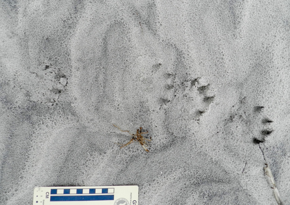
Otter-Tracks-Lope-Pattern-Sapelo-2Do you understand this river otter and its place a little better now, thanks to it leaving so many tracks while it enjoyed a morning at the beach, and because I tracked it for such a long time, and then wrote about that experience in that same place? Please say “yes,” as I want to keep writing about stuff like this. P.S. Thanks to Sapelo Island, this river otter, and my wife Ruth for teaching me so much yesterday. (Photo by Anthony Martin, taken on Sapelo Island, Georgia.)

Rooted in Time

As a paleontologist and geologist, time is always on my mind. Nonetheless, such musings do not always connect with millions or billions of years, the so-called “deep time” that earth scientists love to use whenever shocking people who normally ponder shorter time intervals used when, say, measuring the life of a fruit fly, or the length of a cat-themed video.

Still, sometimes other paleontologists and I also try to interpret brief time spans, such as a few minutes, hours, or years, but ones that elapsed millions of years ago. This is where ichnology comes in handy as a tool, as animal traces in particular – such as tracks or burrows – can give “snapshots” of animal behavior in the context of their original ecosystems. For instance, when I look at a limestone layer that was first laid down 95 million years ago and see burrows in that limestone, I think of it as soft, carbonate-laden mud with many small crustaceans digging into it. This is an instance of where imagination becomes a time machine, helping us to create evidence-based explanations that hopefully can be later honed with further scrutiny and re-imagining. When trace fossils are preserved as an assemblage in the sediments of that past ecosystem, whether it was a soil, lake bottom, or beach, the stories can be told in chronological order.

Throw plants into the mix, though, and they can screw up those linear-time stories to the point where you doubt every earth scientist when they tell a story about an ancient land-based ecosystem. Plants can occupy sediments that are hundreds, thousands, or millions of years old, and if their roots penetrate deep enough into these sediments, they may leave both remnants of their tissues and root traces. These geologically fresh root traces then mix with older animal trace fossils, conjuring the illusion of a contemporaneous community, all living happily together. Only a careful examination of the sediment, and which traces cut across which, would help to unravel the real story.

In the preceding video – taken more than four years ago on Sapelo Island on the Georgia coast – I tell such a cautionary tale of what happens when you assume that the animal and plant traces in an old sediment were made at the same time. (Spoiler alert: You would be wrong.)

For more about this relict marsh and the fascinating lessons we can learn from it, please read Fossils In Progress (which includes a short bibliography) and Teaching on an Old Friend, Sapelo Island. Both posts also discuss how to teach students some of these concepts of interpreting fossilization, paleoecology, and geologic time when in the field.

Flight of the Quahogs

Let’s try a science-education experiment. Give a child a live clam and ask, “Can this animal fly?” and I predict her or his answer – accompanied by much giggling – will be “No!’ But if you ask, “Can you fly?”, the answer may change, especially if this child has already flown on an aircraft. So of course humans can fly, but to do this, they require machines, paragliders, or other technological aids in order to move through the air and – this is important – arrive on the ground safely.

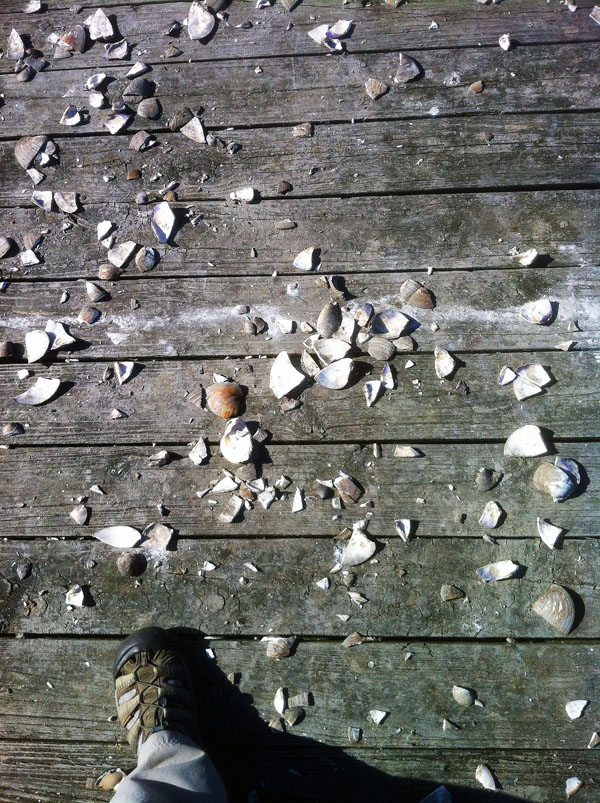
Shattered-Quahogs-Pier-Jekyll-IslandFor clams that try to fly, they end up with more than shattered dreams. How did these clams (Mercenaria mercenaria, also known as quahogs or “hard clams”) end up doing Humpty-Dumpty impressions on a wooden pier? Please read on. (Photograph by Anthony Martin, taken on Jekyll Island, Georgia.)

In a similar way, clams can fly. They just need a little help from other animals that can fly and willingly give them a temporary lift from the earth they and their molluscan relatives have known for all of their evolutionary history. Compared to most of our forays into the air, though, these flights are much more limited. Clam aerial exploits are brief and mostly vertical, with little time for them to appreciate the view from above or otherwise experience unusual sensations. They go up, then they come down, and fast.

Clams do not have landing gear. So they can hit the ground hard, especially if their free fall happened after a lengthy trip up into the air and the ground surface is hard: think of a sandflat at low tide, a paved parking lot, or a wooden boardwalk. A a result, the most common end to clam flights is a shattered shell, which is quickly followed by the demise of the clam as it is consumed by the very same animal that bestowed it with flight, however brief and self-serving.

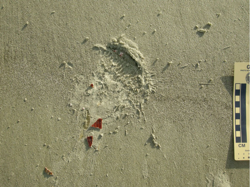
Impact-Trace-Seagull-Clam-DropTraces of a unidirectional vertically oriented clam flight (otherwise known as “falling”) that did not end well for the clam, but worked perfectly for the flying animal that took it for a ride. Notice the impact trace on the hard sandflat, outlining the ribbed shell of the clam (probably Dinocardium robustum) and bits of shell. Most of the probably-still-alive-but-definitely-dying animal  was dragged off to a nearby spot so that its soft parts could be eaten by the same perpetrator that took it for a ride. (Photograph by Anthony Martin, taken on Sapelo Island, Georgia.)
So just what flying animals do such dastardly deeds, taking hapless clams up for a ride, only to drop them to a certain death? By now the gentle reader has probably figured out birds are responsible for this blatant bivalvicide, and some may have already known that seagulls are the most likely culprits. In some coastal areas and during low tides, some seagulls fly over exposed sandflats and mudflats, searching for the outlines of clams buried below the surface. These avian ichnologists then swoop down, land, pick up the clam with their beaks, take off, and then once high enough, they drop them, serving up instant raw clam on the half (or quarter, or eighth) shell. Typically all that is left is a jigsaw puzzle of clamshell pieces and the seagull perpetrator’s footprints, but with the latter only evident on muddy or sandy surfaces amenable to preserving tracks.

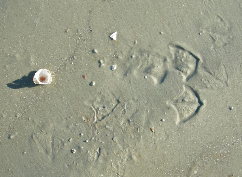
Seagull-Tracks-Eaten-ClamIchnological evidence of who killed the clam, provided by the tracks a laughing gull (Larus altricilla).The other half of the shell was broken by its falling onto the sandflat elsewhere, then the gull carried its clam on the half-shell to a more scenic place for its meal. (Photo by Anthony Martin, taken on Little St. Simons Island, Georgia.)

I found this behavior so compelling that I started my book Life Traces of the Georgia Coast (2013) with a story about a laughing gull (Larus altricilla) and the traces of its unwitnessed predation on an Atlantic cockle (Dinocardium robustum), seagull behavior on the Georgia coast. I was not the first person to note this method of clam-smashing by seagulls, as it has been documented by other scientists in parts of the U.S. and abroad, and has been caught on video. Amazingly, though, despite more than 15 years of visiting the Georgia coast, I had never actually witnessed seagulls dropping clams. instead I had only performed post-mortem forensics, in which I would find broken clamshells on hard sandflats accompanied by seagull tracks, telling tales of murder most fowl.

Video footage of a western gull (Larus occidentalis) picking up a clam, flying up about 10 meters (> 30 feet), and dropping it onto rocks to crack it open. After this doesn’t work the first time – and after shooing away a potential clam-stealing rival – it tries again, and is presumably successful. It’s almost as if this gull is using a scientific methodology, isn’t it? (The videographer is only credited as ‘Trisera’ on the YouTube page, and I don’t know where it was filmed, but suppose it’s on the western coast of the U.S.)

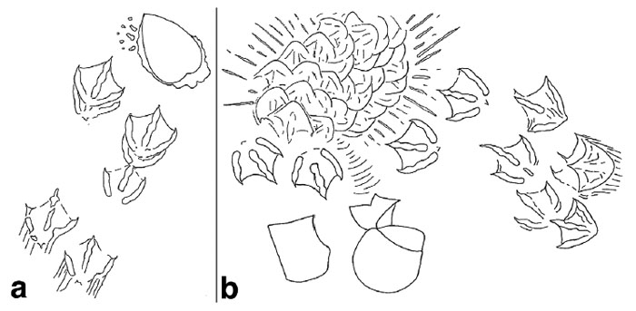
Seagull-Cockle-Predation-DiagramHere’s the first illustration a reader will see in my book, Life Traces of the Georgia Coast (2013, Indiana University Press), which I drew to provide a visual forensic analysis of how an Atlantic cockle met its demise at the hands of – er, I mean, wings and bill of – a laughing gull. Part (a) depicts the gull landing after recognizing the outline of the cockle from the air, stopping, and extracting it from the sandflat. Part (b) shows where the cockle was dropped and broken successfully, accompanied by the gull landing and trampling the area as it enjoyed its clam dinner.

This meant I was more than overdue to get visual confirmation of gulls killing clams, which was finally granted just a few weeks ago during a recent trip to Jekyll Island (Georgia). It was the day after I had given an invited talk at the annual meeting of The Initiative to Protect Jekyll Island environmental group, and while my wife Ruth and I were relaxing before leaving the island, but of course were also observing whatever nature we could.

In that spirit, and while sitting on a deck on the west side of the island and looking at a mudflat (in between swatting sand gnats), we noticed a seagull flying about 10 meters (>30 feet) above a wooden pier. At one point, it paused its ascent, and we saw an object fall from its mouth and down toward the pier. Thunk! We clearly heard the impact of the object correlate with what we saw, and with much excitement realized that we had just witnessed seagull clam-cracking for the first time.

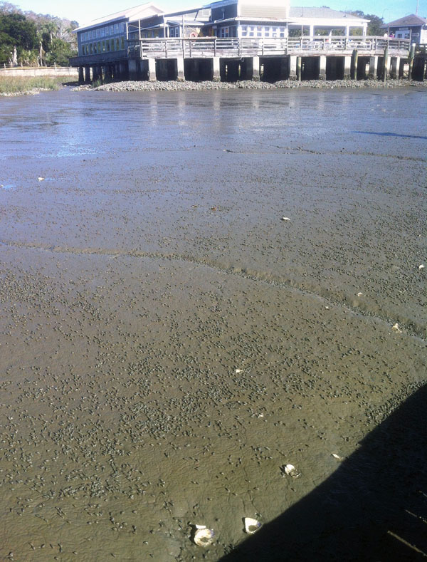
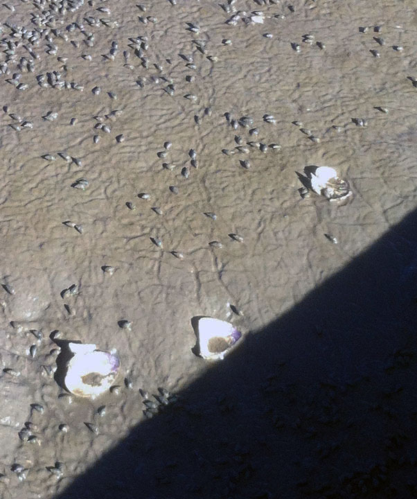
Jekyll-Island-Mudflat-Dead-Clams A mudflat replete with mud snails (probably Ilyanassa obseleta), grazing away and making gorgeous meandering trails on the western side of Jekyll Island (Georgia). But wait, what are those big white chunks on the same surface?

Dead-Clams-Mudflat-Jekyll-IslandWhy, look at that: hard clams (Mercenaria mercenaria) in an unnatural state, i.e., disarticulated, broken, and dead on the surface of the mudflat. These clams normally burrow into and live under the mud, and usually manage to stay intact if they stay below the surface. The pieces of clams here must have bounced off the wooden pier, which is casting a shadow in the lower right-hand side of the picture. (Both preceding photographs by Anthony Martin and taken on Jekyll Island, Georgia.)

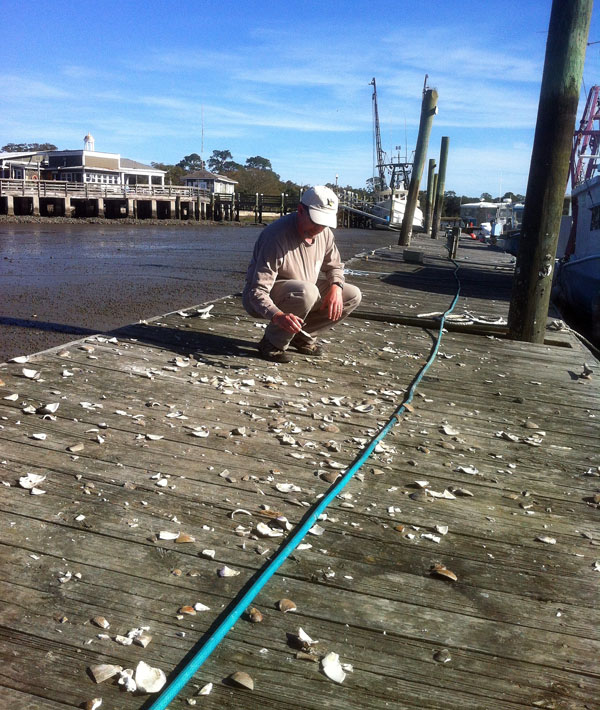
What was most surprising to me about this broken-shell assemblage on the pier was how it was represented only by the hard clam, or quahog (Mercenaria mercenaria). These thick-shelled clams are quite common in sparsely vegetated muddy areas of salt marshes, burrowing into the mud and connecting their siphons to the surface so that they can filter out suspended goodies in the water during high tides. During low tides, however, they become vulnerable to avian predation. Despite being “hidden” in the mud, somehow the seagulls spotted them from the air, landed next to them on the mudflat, and pulled them out of the mud. They then used the nearby pier as an anvil, and the clam’s hard, thick shell unwittingly became its own hammer when they hit the pier after falling from a fatal height.

Shattered-Quahogs-Jekyll-Pier-MartinThe horror, the horror: a clam killing “ground,” thoughtfully supplied by humans for seagulls in the form of a long, hard, wooden pier. (Photograph by Ruth Schowalter and Yours Truly for scale, taken on Jekyll Island, Georgia.)

OK, now it’s time to think about broken clams and deep time. If you found such an assemblage of broken shells of the same species of thick-shelled clams in a geologic deposit, how would you interpret it? Would you think of these broken shells as predation traces, let alone ones made by birds? Which also prompts the question, when did seagulls or other shorebirds start using flight and hard surfaces to open clams? Did it evolve before humans, and if so, was it passed on as a learned behavior over generations as a sort of “seagull culture”?

All of these are good questions paleontologists should ask whenever they look at a concentration of broken fossil bivalves that are all of the same species, and overlapping with the known geologic range of shorebirds. In short, these may not be “just shells,” but evidence of birds using gravity-assisted killing as part of their predation portfolio.

Horseshoe Crabs Are So Much More Awesome Than Mermaids

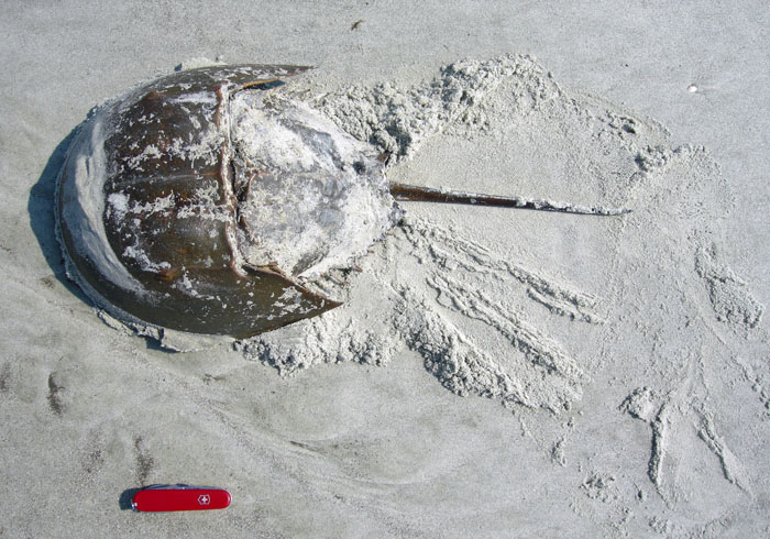
Given all of the controversy over a recent cable-TV program, in which its broadcasting channel decided mythical marine animals deserved more air-time than real ones, I thought it was important to highlight one extant animal that never fails to surprise me. This animal’s lineage is more ancient than dinosaurs, reptiles, or even amphibians, with its oldest fossils dating from about 450 million years ago. It is also the largest living marine invertebrate animal you are likely to see on beaches of the eastern U.S. and Gulf Coast. And at this time of year, if you see it crawling around on a beach, it’s because of sex. For the past month or so, this animal has been participating in massive orgies. Pictures of this gamete-laden frenzy somehow made it past prudish censors of Facebook and other social-media sites, titillating prurient invertebrate enthusiasts everywhere and filling them with cockle-warming glee.

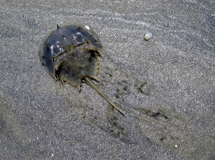
Juvenile-Limulid-SapeloBehold, a fine juvenile specimen of the Atlantic horseshoe crab (Limulus polyphemus)! Although it lives in the ocean, it can walk on land for hours, like some sort of reverse Aquaman, but totally cooler than him. And some day, if this one lives long enough, it will use those legs to walk on land again, but in pursuit of sex. Sounds to me like this animal deserves its own planet. (Photograph by Anthony Martin, taken on Sapelo Island, Georgia.)
As you already know from reading the title of this post, I’m talking about horseshoe crabs. More properly known as limulids by real marine biologists and paleontologists, these ultra-cool, über-hip, but totally retro critters are more closely related to spiders than they are to true crabs, but their common name is so, well, common, that scientists just sigh and begrudgingly go along with it for the sake of public communication.

Modern limulids are represented by four species, three of which are in Asia, but the grandest of them all is the Atlantic horseshoe crab, Limulus polyphemus. This species is at its largest here in Georgia, which may be a function of the Georgia Bight, an extensive offshore shelf that affords more food and habitat than other areas. How big? I’ve seen some as long as 70 cm (27 in) – tail included – and 40 cm (16 in) wide, big enough to scare both of our cats at home. They grow to these sizes after hatching as little limulids not much bigger than the period on this sentence, an astonishing increase in mass if they make it to adulthood (which most don’t).

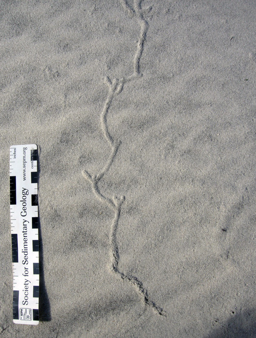
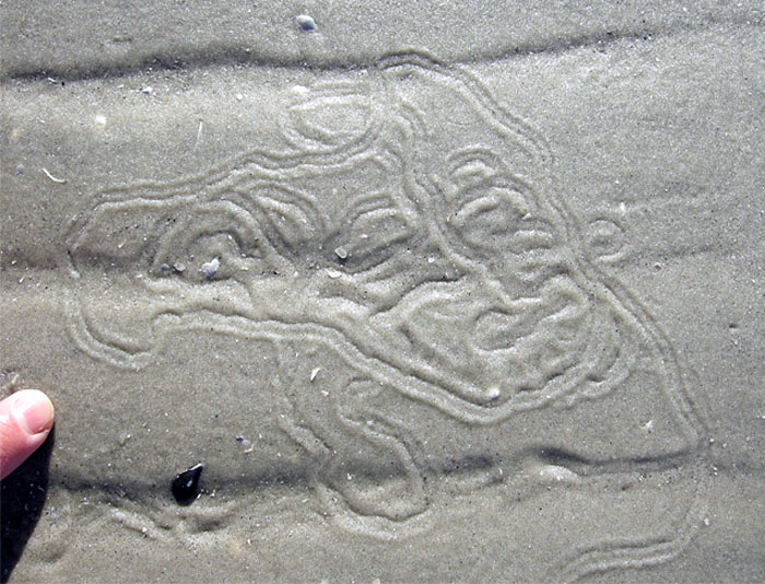
Baby-Limulid-TrailThe circuitous trail of a baby limulid, made on a sandflat at low tide. Its body width can be estimated by the width of the interior of the trail, and its body length was slightly more than that, meaning it was smaller than my fingernail. See that central groove? That’s from its tail, but if you want to impress your friends, call it a telson. (Photograph by Anthony Martin, taken on Sapelo Island, Georgia.)
Horseshoe crabs are so astounding that I could go on endlessly about all sorts of facts about them. Fortunately for you, gentle reader, other folks have written entire books about them and heaps of popular and scientific articles. (For starters, try going here.) So I don’t want to needlessly duplicate what others have done, and done well. Instead, I’ll focus on my main interest in these animals – their traces – and will regale you with tales of the traces they can make with their tails.

Horseshoe crab tails are spiky projections called telsons. Based on lots of the traces I’ve seen on the Georgia coast and a few direct observations, the main function of a telson is to help a horseshoe crab to get back on its feet after being knocked onto its back. That is, whenever a limulid is upside-down, it immediately start using its telson as a sort of sideways pole vault to lever itself into a less vulnerable position.

Without a telson, an upside-down horseshoe crab is stuck; its legs run furiously, but to no avail. However, with a telson, it can put the pointy end into the sand or mud underneath its body, and push itself up from a surface. This gives a limulid a fighting chance to get back to where it once belonged and start walking. This strategy works best if it turns to its right or left side, as limulids are longer than wide. They may be wonders of nature, but they’re not doing back flips or somersaults.

Limulid-Telson-Windshield-Wiper-TraceA large adult horseshoe crab that was right-side-up when trying to get back to the sea, got tired, and tried to use its telson to move itself along. In this instance, it didn’t work, but the traces made by the telson show its range of motion, working like a windshield wiper. (Photograph by Anthony Martin, taken on Sapelo Island, Georgia.)
OK, all of the preceding information I already knew. After all, I have: coauthored an edited book chapter about juvenile limulid traces and their close resemblance to trace fossils made by trilobites; coauthored another article on the history of limulid-trace studies (which go back to the 1930s!) that’s now in review; and devoted a lengthy section of a chapter in my book to limulids as tracemakers. So you could say I’ve been feeling pretty cocky about what I knew about these animals as tracemakers. That is, until one horseshoe crab showed me how much I still need to learn about them and what they can make.

The humility-inspiring traces showed up in a photo on a Facebook page I follow (and so should you), the St. Catherines Island Sea Turtle Conservation Program. The program organizers – Gale Bishop and Robert (Kelly) Vance – regularly add photo albums showing sea turtle traces (trackways, body pits, nests), and otherwise report on other facets of natural history they observe on St. Catherines Island beaches. As a result, I live vicariously through these pictures while marooned in the metro-Atlanta area. But they also like to throw me ichnological stunners once in a while, such as the following photo that Kelly posted last week.

Limulid-Telson-Trace-1Who needs made-up animals on TV when traces like these, made by awesome invertebrates like horseshoe crabs, turn up on a Georgia beach? (Photograph by Robert Kelly Vance, taken on St. Catherines Island, Georgia; scale is about 15 cm (6 in) long.)

Kelly found these traces while patrolling the beaches of St. Catherines Island for other traces, namely those of expectant mother sea turtles. Although these distracted briefly from his mission, I was very happy he stopped to document these, as I had never seen anything like them, despite much looking at traces on Georgia beaches.

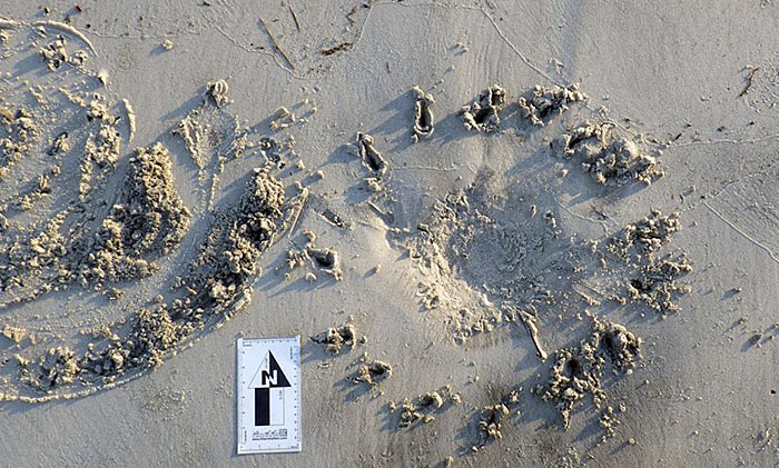
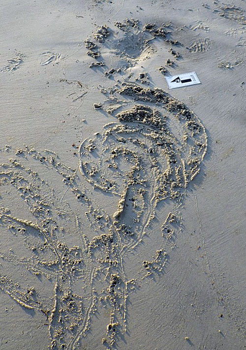
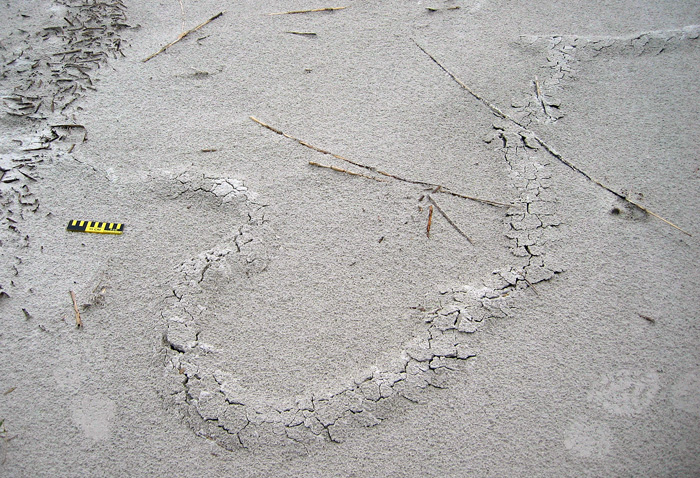
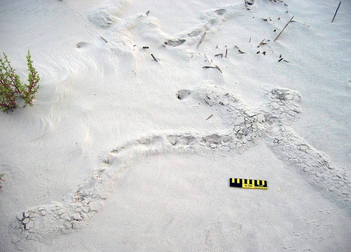
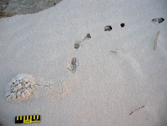
The holes in the sand, defining a nearly perfect circle, were made by the telson of an adult horseshoe crab that kept on trying to right itself after landing on its back. Each puncture mark shows where it inserted the telson into the sand and then pushed itself up and to its side. Based on the number of holes, direction of sand flung out of each hole, and little “commas” made by extraction of the telson, it tried to flip itself a minimum of 16 times, and all to the right. These separate actions culminated in a 360° clockwise rotation of its body. Also check out the central depression with smaller drag marks; this is where its head shield was in contact with the sand. To imagine the movement represented by these traces, think of a horseshoe crab doing a slow-motion, step-by-step, break-dance backspin.

Seeing the evidence for such persistence was wow-inducing in itself, but in my ichnologically influenced euphoria, I figured the limulid finally succeeded in righting itself. After all, the trackway just to the left of the trace, indicates where it walked away from the scene of its gravitationally challenged situation.

But then I realized there was no “impact mark.” This large horseshoe crab flipping itself onto the sandy surface should have registered an outline of its body before it started walking. Instead, the place where it started walking showed no such impression, meaning it must have made a soft landing, with only its legs and telson digging into the sand. What happened? Did it use mind over matter and levitate itself through telekinesis? Or was it gently picked up and placed on its feet by a merciful mermaid? (Or merman: let’s make sure we’re being inclusive when talking about made-up stuff.)

It turned out that Kelly was the dues ex machina that entered this limulid’s drama, providing divine intervention just when it was needed. When I expressed my puzzlement to Kelly about how this large arthropod finally turned itself over, he confessed to saving it, in which he lifted it and put it back on its feet, where it promptly walked away in a series of tight spirals. The spiraling is something I’ve seen before in their tracks, a method used to find the downslope direction, which normally leads horseshoe crabs to the low-tide mark and the comfort of a watery environment.

Limulid-Telson-Trace-2Another perspective of the “escape” traces made by the limulid’s telson (background), but this time with its tracks, showing how it started spiraling clockwise in an attempt to make its way back to the sea. Check out those telson drag marks in the trackway, doing a little bit of back-and-forth movement as its owner walked. (Photograph by Robert Kelly Vance, taken on St. Catherines Island, Georgia.)

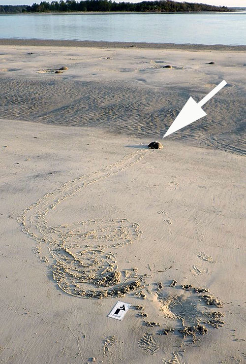
Limulid-Telson-Trace-3OK everyone, start singing “Born Free!” The spiraling helped this limulid (arrow) to find a downslope direction, which took it in the right direction to the sea. But it’s not all sunshine and lollipops for other limulids, some of which are visible in the background, and look like they’re still stuck. Given the tidal range on the Georgia coast – 2.5-3 m (8.2-9.8 ft) – strong wave energy, and wide beaches, lots of big limulids that come in with the flood tide get knocked onto their backs by waves and left behind. It’s almost as if some sort of natural selection is taking place, and something similar might have happened in the geologic past, affecting the evolution of its lineage. (Photograph by Robert Kelly Vance, taken on St. Catherines Island, Georgia.)

In the last photograph, I was glad to see how the story told by these traces promised a happy ending for this limulid that had so stubbornly tried to put itself back on its feet. Yet when you also notice how many of its compatriots did not make it back into the life-nourishing sea, it also serves as a sobering reminder that storybook endings don’t always happen in nature, and what we wish to be true sometimes isn’t.

In this instance, I don’t know whether this horseshoe crab made it back into the sea to live another day or not. Still, the lesson it left for us in the sand lives on, and I am now slightly more confident that if any limulids were stuck on their backs at any point in their 450-million-year history, made similar traces with their tails, and these marks were preserved as trace fossils, we just might recognize them for what they are. For that alone, I am grateful. Thank you, horseshoe crabs, for being real, making traces, and continuing to share this planet with us today.

(Acknowledgement: Special thanks to Drs. Robert Kelly Vance and Gale Bishop for being my ichno-scouts on St. Catherines Island, and feeding my mind with such tasty treats while I am landlocked.)

Further Reading

Brockmann, H.J. 1990. Mating behavior of horseshoe crabs, Limulus polyphemus. Behaviour, 114: 206-220.

Martin, A.J. Life Traces of the Georgia Coast. Indiana University Press, Bloomington, Indiana, 692 p.

Martin, A.J., and Rindsberg, A.K. 2007. Arthropod tracemakers of Nereites? Neoichnological observations of juvenile limulids and their paleoichnological applications. In Miller, W.M., III (editor), Trace Fossils: Concepts, Problems, Prospects, Elsevier, Amsterdam: 478-491.

Shuster, C.N., Jr., Barlow, P.B., and Brockmann, H.J. (editors). 2003. The American Horseshoe Crab. Harvard University Press, Cambridge, Massachusetts: 427 p.

Teaching on an Old Friend, Sapelo Island

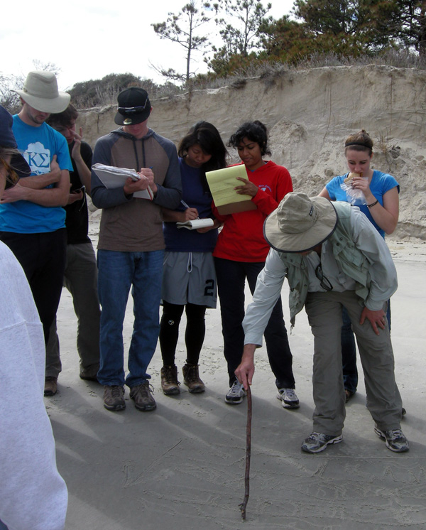
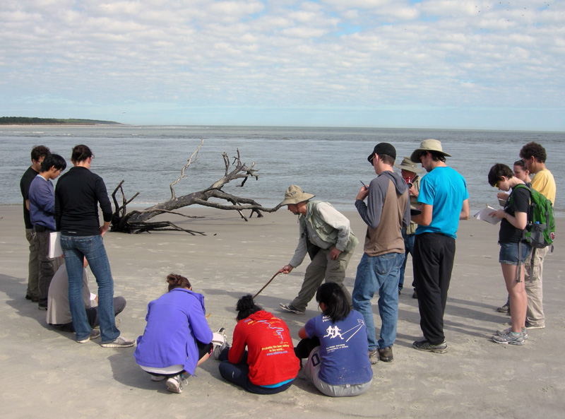
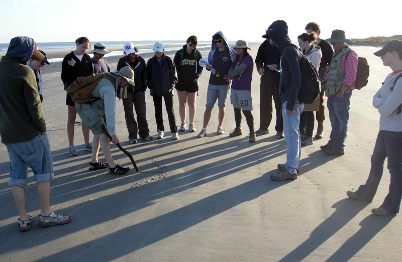
(This post is the fourth in a series about a spring-break field trip taken last week with my Barrier Islands class, which I teach in the Department of Environmental Studies at Emory University. The first three posts, in chronological order, tell about our visits to Cumberland Island, Jekyll Island, and Little St. Simons and St. Simons Islands. For the sake of conveying a sense of being in the field with the students, these posts mostly follow the format of a little bit of prose – mostly captions – and a lot of photos.)

When planning a week-long trip to the Georgia barrier islands with my students, I knew that one island – Sapelo – had to be included in our itinerary. Part of my determination for us to visit it was emotionally motivated, as Sapelo was my first barrier island, and you always remember your first. But Sapelo has much else to offer, and because of these many opportunities, it is my favorite as an destination for teaching students about the Georgia coast and its place in the history of science.

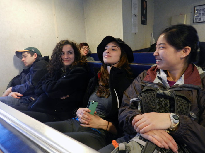
Getting to Sapelo Island requires a 15-minute ferry ride, all for the low-low price of $2.50. (It used to cost $1.00 and took 30 minutes. My, how times have changed.) For my students, their enthusiasm about visiting their fourth Georgia barrier island was clearly evident (with perhaps a few visible exceptions), although photobombing may count as a form of enthusiasm, too.

I first left my own traces on Sapelo in 1988 on a class field trip, when I was a graduate student in geology at the University of Georgia. My strongest memory from that trip was witnessing alligator predation of a cocker spaniel in one of the freshwater ponds there. (I suppose that’s another story for another day.) Yet I also recall Sapelo as a fine place to see geology and ecology intertwining, blending, and otherwise becoming indistinguishable from one another. This impression will likely last for the rest of my life, reinforced by subsequent visits to the island. This learning has always been enhanced whenever I’ve brought my own students there, which I have done nearly every year since 1997.

As a result of both teaching and research forays, I’ve spent more time on Sapelo than all of the other Georgia barrier islands combined. Moreover, it is not just my personal history that is pertinent, but also how Sapelo is the unofficial “birthplace” of modern ecology and neoichnology in North America. Lastly, Sapelo inspired most of the field stories I tell at the start of each chapter in my book, Life Traces of the Georgia Coast. In short, Sapelo Island has been very, very good to me, and continues to give back something new every time I return to it.

So with all of that said, here’s to another learning experience on Sapelo with a new batch of students, even though it was only for a day, before moving on to the next island, St. Catherines.

(All photographs by Anthony Martin and taken on Sapelo Island.)

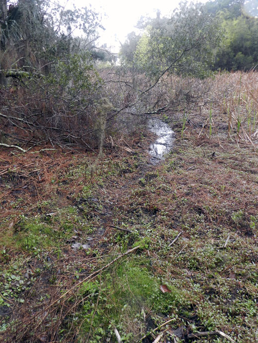
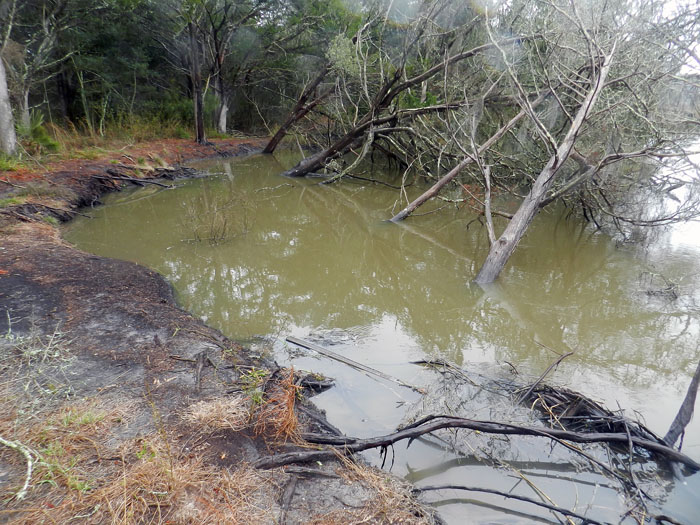
Next to the University of Georgia Marine Institute is a freshwater wetland, a remnant of an artificial pond created by original landowner R.J. Reynolds, Jr. More importantly, this habitat has been used and modified by alligators for at least as long as the pond has been around. For example, this trail winding through the wetland is almost assuredly made through habitual use by alligators, and not mammals like raccoons and deer, because, you know, alligators.

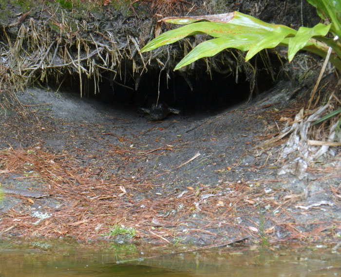
Photographic evidence that alligators, much like humans prone to wearing clown shoes, will use dens that are far too big for them. This den was along the edge of the ponded area of the wetland, and has been used by generations of alligators, which I have been seeing use it on-and-off since 1988.

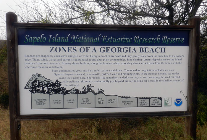
An idealized diagram of ecological zones on Sapelo Island, from maritime forest to the subtidal. This sign provided a good field test for my students, as they had already (supposedly) learned about these zones in class, but now could experience the real things for themselves. And yes, this will be on the exam.

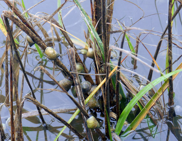
When it’s high tide in the salt marsh, marsh periwinkles (Littoraria irrorata) seek higher ground, er, leaves, to avoid predation by crabs, fish, and diamondback terrapins lurking in the water. Here they are on smooth cordgrass (Spartina alterniflora), and while there are getting in a meal by grazing on algae on the leaves.

Erosion of a tidal creek bank caused salt cedars (which are actually junipers, Juniperus virginiana) to go for their first and last swim. I have watched this tidal creek migrate through the years, another reminder that even the interiors of barrier islands are always undergoing dynamic change.

OK, I know what you’re thinking: where’s the ichnology? OK, how about these wide, shallow holes exposed in the sandflat at low tide? However tempted you might be to say “sauropod tracks,” these are more likely fish feeding traces, specifically of southern stingrays. Stingrays make these holes by shooting jets of water into the sand, which loosens it and reveals all of the yummy invertebrates that were hiding there, followed by the stingray chowing down. Notice that some wave ripples formed in the bottom of this structure, showing how this stingray fed here at high tide, before waves started affecting the bottom in a significant way.

Here’s more ichnology for you, and even better, traces of shorebirds! I am fairly sure these are the double-probe beak marks of a least sandpiper, which may be backed up by the tracks associated with these (traveling from bottom to top of the photo). But I could be wrong, which has happened once or twice before. If so, an alternative tracemaker would be a sanderling, which also makes tracks similar in size and shape to a sandpiper, although they tend to probe a lot more in one place.

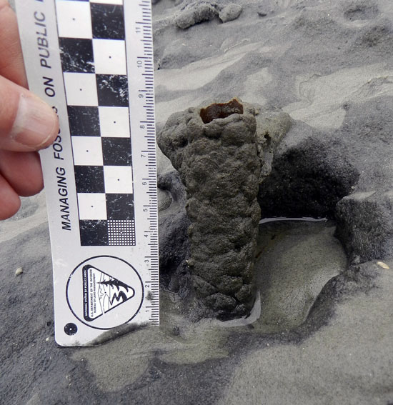
Just in case you can’t get enough ichnology, here’s the lower, eroded shaft of a ghost-shrimp burrow. Check out that burrow wall, reinforced by pellets. Nice fossilization potential, eh? This was a great example to show my students how trace fossils of these can be used as tools for showing where a shoreline was located in the geologic past. And sure enough, these trace fossils were used to identify ancient barrier islands on the Georgia coastal plain.

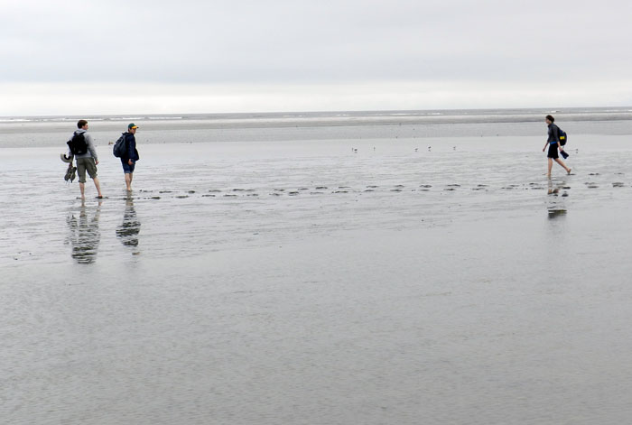
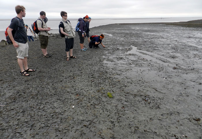
Understandably, my students got tired of living vicariously through various invertebrate and vertebrate tracemakers of Sapelo, and instead became their own tracemakers. Here they decided to more directly experience the intertidal sands and muds of Cabretta Beach at low tide by ambulating through them. Will their tracks make it into the fossil record? Hard to say, but I’ll bet the memories of their making them will last longer than any given class we’ve had indoors and on the Emory campus. (No offense to those other classes, but I mean, you’re competing with a beach.)

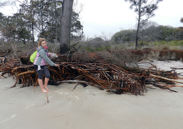
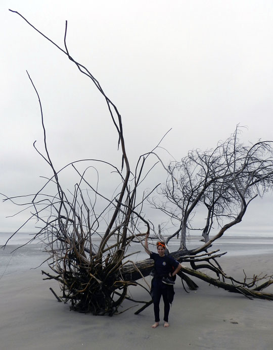
The north end of Cabretta Beach on Sapelo is eroding while other parts of the shoreline are building, and nothing screams “erosion!” as loudly as dead trees from a former maritime forest with their roots exposed on a beach. Also, from an ichnological perspective, the complex horizontal and vertical components of the roots on this dead pine tree could be compared to trace fossils from 40,000 year-old (Pleistocene) deposits on the island. Also note that at this point in the trip, my students had not yet tired of being “scale” in my photographs, which was a good thing for all.

Another student eager about being scale in this view of a live-oak tree root system. See how this tree is dominated by horizontal roots? Now think about how trace fossils made by its roots will differ from those of a pine tree. But don’t think about it too long, because there are a few more photos for you to check out.

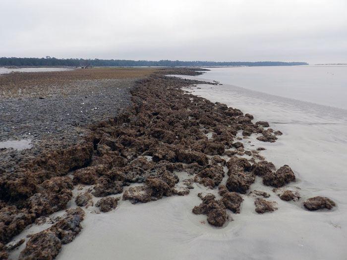
Told you so! Here’s a beautifully exposed, 500-year-old relict marsh, formerly buried but now eroding out of the beach. I’ve written about this marsh deposit and its educational value before, so will refrain from covering that ground again. Just go to this link to learn about that.

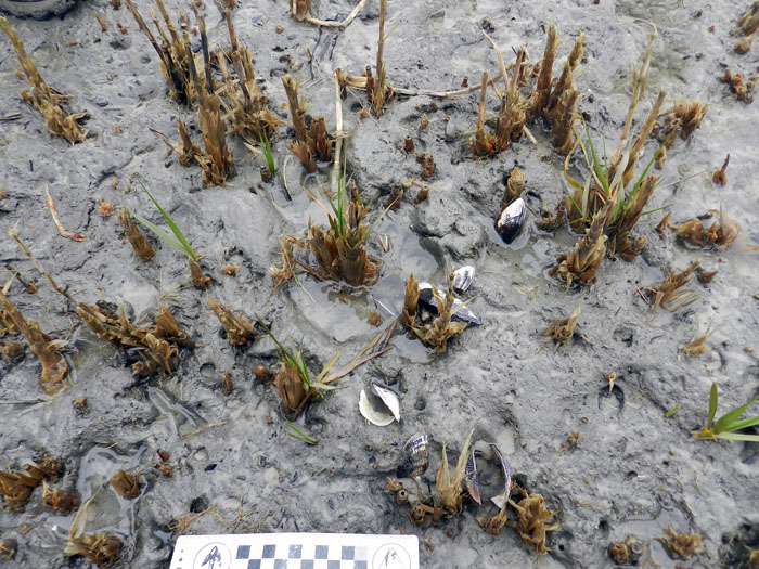
OK geologists, here’s a puzzler for you. The surface of this 500-year-old relict marsh, with its stubs of long-dead smooth cordgrass and in-place ribbed mussels (Guekensia demissa), also has very-much-live smooth cordgrass living in it and sending its roots down into that old mud. So if you found a mudstone with mussel shells and root traces in it, would you be able to tell the plants were from two generations and separated by 500 years? Yes, I know, arriving at an answer may require more beer.

Although a little tough to see in this photo, my students and I, for the first time since I have gone to this relict marsh, were able to discern the division between the low marsh (right) and high marsh (left). Look for the white dots, which are old ribbed mussels, which live mostly in the high marsh, and not in the low marsh. Grain sizes and burrows were different on each part, too: the high marsh was sandier and had what looked like sand-fiddler crab burrows, whereas the low marsh was muddier and had mud-fiddler burrows. SCIENCE!

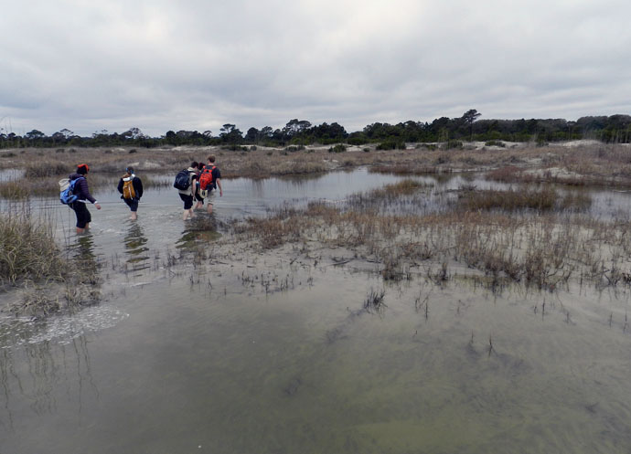
At the end of a great day in the field on Sapelo, it was time to do whatever was necessary to get back to our field vehicle, including (gasp!) getting wet. The back-dune meadows, which had been inundated by unusually high tides, presented a high risk that we might experience a temporary non-dry state for our phalanges, tarsals, and metatarsals. Fortunately, my students bravely waded through the water anyway, and sure enough, their feet eventually dried. I was so proud.

So what was our next-to-last stop on this grand ichnologically tainted tour of the Georgia barrier islands? St. Catherines Island, which is just to the north of Sapelo. Would it reveal some secrets to students and educators alike? Would it have some previously unknown traces, awaiting our discovery and description? Would any of our time there also involve close encounters with large reptilian tracemakers? Signs point to yes. Thanks for reading, and look for that next post soon.


Descent with Modification

At this time last year, Fernbank Museum of Natural History was hosting the Darwin exhibit. On loan from the American Museum of Natural History, this exhibit was a major coup for the museum and the Atlanta area, which has enjoyed a growing culture of celebrating science during the past few years. Along with this exhibit, the museum also planned and concurrently displayed an evolution-themed art show, appropriately titled Selections, which I wrote about then here.*

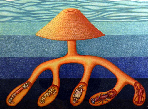
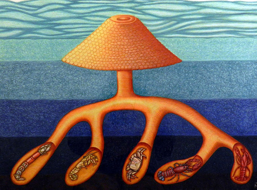
Descent with Modification (2011), mixed media (colored pencils and ink) on paper, 24″ X 36.” Although this artwork might at first look like a tentacled creature infested with crustaceans and living on a sea bottom, its main form actually mimics a typical burrow system made by ten-legged crustaceans (decapods). Yet it’s also an evolutionary hypothesis. Intrigued? If so, please read on. If not, there are plenty of funny cat-themed Web sites that otherwise require your attention. (Artwork and photograph of the artwork by Anthony Martin.)

One unusual feature of this art show was that five of the eight artists were also scientists (full confession: I was one of them). Furthemore, one of the other artists was married to a scientist (fuller confession: that would be my wife Ruth). The show stayed up for more than three months, which was also as long as the Darwin exhibit resided at Fernbank. Thus we like to think it successfully exposed thousands of museum visitors to the concept that scientists, like many other humans, have artistic inspirations and abilities, neatly refuting the stereotype that not all of us are joyless, left-brained automatons and misanthropes.

Last week I was reminded of this anniversary and further connections between science and art during a campus visit last week by marine biologist and crustacean expert Joel Martin (no relation). Dr. Martin was invited to Emory University to give a public lecture with the provocative title God or Darwin? A Marine Biologist’s Take on the Compatibility of Faith and Evolution. His lecture was the first of several on campus this year about the intersections between matters of faith and science, the Nature of Knowledge Seminar Series. This series was organized as a direct response to the university inviting a commencement speaker this past May who held decidedly strong and publicly expressed anti-science views.

Dr. Martin, who is also an ordained elder in his Presbyterian church and has taught Sunday school to teenagers in his church for more than 20 years, gave an informative, organized, congenial, and otherwise well-delivered presentation to an audience of more than 200 students, staff, faculty, and other people from the Atlanta community. In his talk, Martin effectively explored the false “either-or” choice often presented to Americans who are challenged by those who unknowingly misunderstand or deliberately misrepresent evolutionary theory in favor of their beliefs. Much of what he mentioned, he said, is summarized in a book he wrote for teenagers and their parents, titled The Prism and the Rainbow: A Christian Explains Why Evolution is Not a Threat.

I purposefully won’t mention any of the labels that have been applied to the people and organizations who promote this divisiveness between evolutionary theory and faith. After all, words have power, especially when backed up by Internet search engines. Moreover, it is an old and tired subject, of which I grow weary discussing when there is so much more to learn from the natural world. Better to just say that Martin persuasively conveyed his personal wonder for the insights provided by evolutionary theory, how science informs and melds with his faith, and otherwise showed how science and faith are completely compatible with one another. You know, kind of like science and art.

Previous to his arrival, his host in the Department of Biology asked Emory science faculty via e-mail if any of us would like to have a one-on-one meeting with Dr. Martin during his time here. I leaped at the chance, and was lucky enough to secure a half-hour slot in his schedule. When he and I met in my office, we had an enjoyable chat on a wide range of topics, but mostly on our shared enthusiasm for the evolution of burrowing crustaceans, and particularly marine crustaceans.

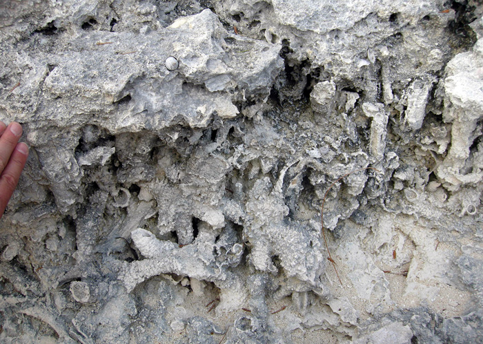
Ophiomorpha nodosa, a burrow network in a Pleistocene limestone of San Salvador, Bahamas. In this instance, the burrows were probably made by callianassid shrimp, otherwise known as “ghost shrimp,” and are preserved in what was a sandy patch next to a once-thriving reef from 125,000 years ago. (Photograph by Anthony Martin.)

Interestingly, during this conversation we also touched on on how art and science work together, and I was pleasantly surprised to find out that Dr. Martin is a talented artist, too. It turns out he has illustrated many of his articles with exquisite line drawings of his beloved subjects, marine crustaceans. Yes, I realize that some artists like to draw a line (get it?) between being an “artist” and an “illustrator,” with the latter being held in some sort of disdain for merely “copying” what is seen in nature. If you’re one of those, sorry, I don’t have the time or inclination to argue about this with you. (Now go back to putting a red dot on a white canvas and leave us alone.)

Cover art of branchiopod Lepidurus packardi from California, drawn by Joel W. Martin, for An Updated Classification of the Recent Crustacea, also co-authored by Joel W. Martin and George E. Davis: No. 39, Science Series, Natural History Museum of Los Angeles County, Los Angeles, California.

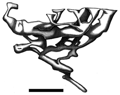
During our discussion in my office, I pointed out a enlarged reproduction of a drawing of mine depicting the burrow complex of an Atlantic mud crab (Panopeus herbstii). He immediately recognized it as a crustacean burrow, for which I was glad, because it is an illustration of just that in my upcoming book, Life Traces of the Georgia Coast.

Burrow complex made by Atlantic mud crab (Panopeus herbstii), originally credited to a snapping shrimp (Alpheus heterochaelis). Scale = 5 cm (2 in). (Illustration by Anthony Martin, based on epoxy resin cast figured by Basan and Frey (1977).

After his campus visit, though, I realized that an even more appropriate artistic work to have shown him was the following one made for the Selections art exhibit last fall, titled Descent with Modification. This title in honor of the phrase used by Charles Darwin to describe the evolutionary process, but also is a play on words connecting to the evolution of burrowing crustaceans.

Descent with Modification again, but this time look at it as an evolutionary chart, where the burrow junctions in the burrow system reflect divergence points (nodes) from common ancestors. For example, from left to right, the ghost shrimp is more closely related to a mud shrimp, and both of these are more closely related to the ghost crab (middle) than they are to the lobster and freshwater crayfish (right). The main vertical burrow shaft represents their common ancestry from a “first decapod,” which may have been as far back as the Ordovician Period, about 450 million years ago.

The image shows five burrowing crustaceans, or to be more specific, ten-legged crustaceans called decapods. Along with these is a structure, which has a burrow entrance surrounded by a conical mound of excavated and pelleted sediment, a vertical shaft connecting to the main burrow network, and branching tunnels that lead to terminal chambers. A burrowing crustacean occupies each chamber, and these are, from left to right: a ghost shrimp (Callichirus major), a mud shrimp (Upogebia pusilla), a ghost crab (Ocypode quadrata), a marine lobster (Homarus gammarus), and a freshwater crayfish (Procambarus clarkii).

Here’s the cool part (or at least I think so): this burrow system also serves as an evolutionary chart – kind of a cladogram – depicting the ancestral relationships of these modern burrowing decapods. For example, lobsters and crayfish are more closely related to one another (share a more recent common ancestor) than lobsters are related to crabs. Mud shrimp are more closely related to crabs than ghost shrimp. Accordingly, the burrow junctions show where these decapod lineages diverged. So the title of the artwork is a double entendre with reference to Darwin’s phrase describing evolution as a process of “descent with modification,” along with burrowing decapods undergoing change through time as they descend in the sediment.

Modern decapod burrows and trace fossils of probable decapod burrows support both the science and the artwork, too. Here are a few examples to whet your ichnological and aesthetic appetites:

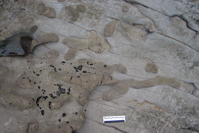
Thalassinoides, a trace fossil of horizontally oriented and branching burrow systems made by decapods in Early Cretaceous rocks (about 115 mya) of Victoria, Australia. In this case, these burrows were likely by freshwater decapods, such as crayfish, which had probably diverged from a common ancestor with marine lobsters more than 100 million years before then. Scale = 10 cm (4 in). (Photograph by Anthony Martin.)

Thalassinoides again, but this time in limestones formed originally in marine environments, from the Miocene of Argentina. Note the convergence in forms of the burrows with those of the freshwater crayfish ones in Australia. Think that might be related to some sort of evolutionary heritage? Scale = 15 cm (6 in). (Photograph by Anthony Martin.)

Horizontally oriented burrow junction of a modern ghost shrimp – probably made by a Carolina ghost shrimp (Callichirus major) – exposed along the shoreline of Sapelo Island, Georgia. Note the pelleted exterior, which is also visible on the burrow networks of the fossil ones in the Bahamas, pictured earlier. So if fossilized, this would be classified as the trace fossil Ophiomorpha nodosa. Scale in centimeters. (Photograph by Anthony Martin.)

Two ghost-shrimp burrow entrances on a beach of Sapelo Island, Georgia, with the one on the right showing evidence of its occupant expelling water from its burrow. No scale, but burrow mound on right is about 5 cm (2 in) wide. (Photograph by Anthony Martin.)

Burrow entrance and conical, pelleted mound made by a freshwater crayfish (probably a species of Procambarus) in the interior of Jekyll Island, Georgia. Scale = 1 cm (0.4 in). (Photograph by Anthony Martin.)

So the take-away message of all of these musings and visual depictions is that evolution, faith, science, art, trace fossils, modern burrows, and burrowing decapods can all co-exist and be celebrated, regardless of whether we sing Kumbaya or not. So let’s stop dividing one another, get out there, and learn.

*I’m also proud to say that my post from October 17, 2011, Georgia Life Traces as Art and Science, was nominated for possible inclusion in Open Laboratory 2013. Thank you!

Further Reading

Basan, P.B., and Frey, R.W. 1977. Actual-palaeontology and neoichnology of salt marshes near Sapelo Island, Georgia. In Crimes, T.P., and Harper, J.C. (editors), Trace Fossils 2. Liverpool, Seel House Press: 41-70.

Martin, A.J. In press. Life Traces of the Georgia Coast: Revealing the Unseen Lives of Plants and Animals. Indiana University Press, Bloomington, IN: 680 p.

Martin, A.J., Rich, T.H., Poore, G.C.B., Schultz, M.B., Austin, C.M., Kool, L., and Vickers-Rich, P. 2008. Fossil evidence from Australia for oldest known freshwater crayfish in Gondwana. Gondwana Research, 14: 287-296.

Martin, J.W. 2010. The Prism and the Rainbow: A Christian Explains Why Evolution is Not a Threat. Johns Hopkins University Press, Baltimore, MD: 192 p.

Martin, J.W., and Davis. G.E. 2001. An Updated Classification of the Recent Crustacea, No. 39, Science Series, Natural History Museum of Los Angeles County, Los Angeles, California: 132 p.


Marine Moles and Mistakes in Science

A first day of field work in the natural sciences can be expected to hold surprises, no matter what type of science is being attempted. Sometimes these are unpleasant ones, such as finding out the fuel gauge in your field vehicle – which you are driving for the first time, and in a remote place – doesn’t work. Other times, you make a fantastic discovery, like a new species of spider, a previously undocumented invasive plant, or a fossil footprint. But sometimes you see something that just makes you scratch your head and say, “What the heck is that?”, or more profane variations on that sentiment.

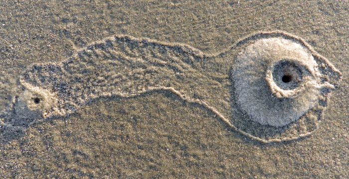
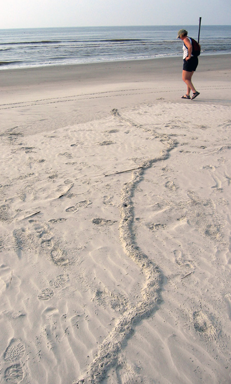
What is this long, meandering ridge making its way through a beach to the high tide mark on Sapelo Island, Georgia, and what made it? If you’re curious, please read on. But if you already know what it is, then you know a lot more than I did the first time I saw something like this. (Photograph by Anthony Martin.)

The last of those three scenarios happened to me on Sapelo Island, Georgia, in June 2004. My wife Ruth was with me, and we had just arrived on the island the previous afternoon, having stayed overnight at the University of Georgia (Athens) Marine Institute, or UGAMI. We decided that our first full morning in the field would be at Nannygoat Beach on the south end of Sapelo, which is a 5-minute drive or a 20-minute walk from the UGAMI.

We drove a field vehicle there (the gas gauge and everything else worked), parked, and took the boardwalk over the coastal dunes. Our elevated view from the boardwalk afforded a good look at many insect, ghost crab, bird, and mammal tracks made in the early morning. Circular holes punctured the dunes, made by ghost crabs (Ocypode quadrata). Sand aprons composed of still-moist sand were next to these burrow entrances, bearing crisply defined ghost-crab tracks, although early-morning sea breezes had already started to blur these.

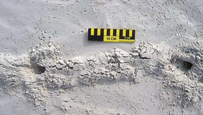
At some point after walking onto the beach, though, we saw traces that we had not noticed in previous visits to Sapelo, and ones I have rarely seen there or on other Georgia barrier islands since. These oddities were meters-long, slightly sinuous to meandering ridges, about 15-20 cm (6-8 in) wide, extending in the sandy areas from the dunes through the berm and down to the high-tide mark, where they ended abruptly.

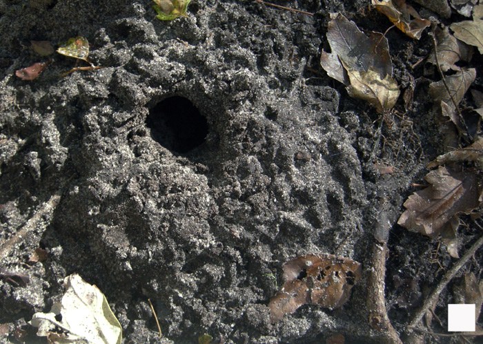
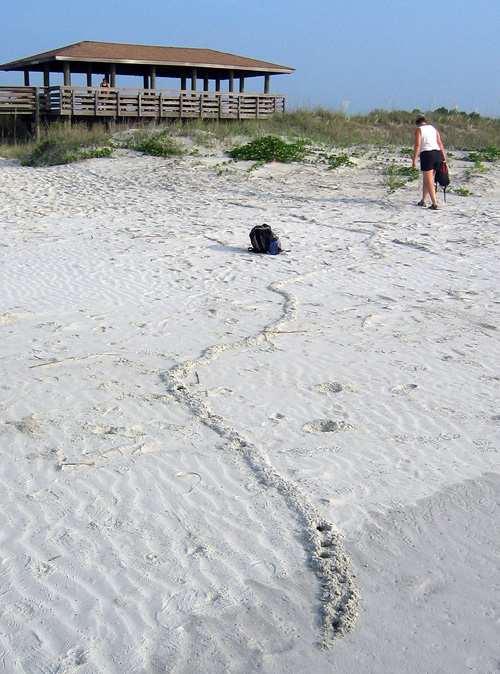
Same meandering ridge shown in the first photo, but viewed from the high-tide mark, showing how it connects with the primary dunes. Note how a few holes are punched in the part near me: more about those soon. (Photograph by Anthony Martin, taken on Sapelo Island, Georgia. P.S.: My wife Ruth is the scale in both photos, fulfilling one of the top 10 signs that I might be a geologist.)

Although a few ridges crossed one another, they rarely branched, and if they did, the branches were quite short, only about 10-15 cm (4-6 in). When we followed them to the dunes, they seemed to originate from some unseen place below the sandy surfaces. We investigated further by cutting through some of the ridges to see what they looked like inside. They turned out to be mostly open tunnels with circular cross sections about 5 cm (2 in) wide, slightly wider than a U.S. dollar coin. They were mostly hollow, and only occasionally did we encounter a plug of sand interrupting tunnel interiors. This supposition was backed up by ridges that had collapsed into underlying voids. A few of the ridges stopped with a rounded end the same diameter as the ridge, or as a larger, raised, elliptically shaped “hill.”

Ridge with quite a bit of meander in it. Check out the short branch toward the top right, where the tracemaker must have changed its mind and backed up, then continued digging toward the viewer. Scale = 15 cm (6 in). (Photograph by Anthony Martin, taken on Sapelo Island, Georgia.)
Two separate ridges intersecting, caused by one crossing the other, resulting in “false branching.” Also notice the partial collapse of sand into underlying hollow tunnels and how one of the ridges ends in a rounded mound. Scale = 15 cm (6 in). (Photograph by Anthony Martin, taken on Sapelo Island, Georgia.)
A short ridge ending in a raised, elliptical “hill,” connected to a partially collapsed tunnel that is not otherwise evident as an elevated surface. Same scale as before. (Photograph by Anthony Martin, taken on Sapelo Island, Georgia.)
Ruth and I agreed that these tunnels were burrows, instead of some random features made by the winds, tides, or waves. But by what? Clearly their makers were impressive burrowers, capable of digging through meters of sand. Their bodies also were probably just a little narrower than the burrow interiors, which helped us to think about body sizes. Then we considered where we were – dunes and beach – and what animals were the most likely ones to burrow in these environments.

A process of elimination – determining what they were not – was a good way to start figuring out their potential makers. For example, no way these burrows were from insects, such as beetle larvae, ant lion larvae, or mole crickets, because they were just too big. Insects also have a tough time handling salinity, so once they got to the surf zone with its saturated, saline sand, they would have had problems, or (more likely) an aversive reaction and turned around immediately instead of plowing ahead.

Insect burrow in coastal dune sand, made by a small beetle. Look at both the form and scale, and you’ll see this is not a match for what we were seeing. Scale in centimeters. (Photograph by Anthony Martin, taken on Cumberland Island, Georgia.)

Small mammals, like beach mice (Peromyscus polionotus), didn’t seem like good candidates either. Beach-mouse burrows are totally different from what we were seeing, and their burrows do not run all of the way down to the intertidal zone. Mice, like insects, also don’t like marine-flavored water; even if they might be able to temporarily tolerate it, they wouldn’t continue to burrow through moist, salty sand.

A beach-mouse burrow, with their tracks coming and going. Either the mice dug this burrow, or they occupied an abandoned ghost-crab burrow. Regardless, this also doesn’t match our mystery traces. Scale in millimeters. (Photograph by Anthony Martin, taken on Little St. Simons Island, Georgia.)

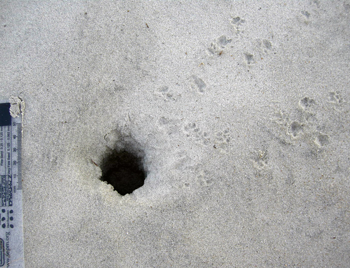
This led to an initial hypothesis that these burrows were from one of the most common larger burrowing animals in the area, and one comfortable in dune, berm, and beach environments with saturated, salty sand. These could only be from ghost crabs, I thought, an explanation supported by undoubted ghost crab burrows that perfectly intersected these tunnels, accompanied by undoubted ghost-crab tracks.

Ghost-crab burrows intersecting tunnels, accompanied by lots of ghost-crab tracks. Wow, that’s really convincing circumstantial evidence, wouldn’t you say? (Photograph by Anthony Martin, taken on Sapelo Island, Georgia.)
End of story, right? Well, no. I and a lot of other scientists have said this before, but it bears repeating: part of how science works is that in its practice we do not prove, we disprove. I somehow knew the “ghost crab burrowing horizontally through meters of sand from the dunes to the beach” hypothesis was a shaky one, and it bothered me that it just didn’t seem right. So I started reading as much as possible about ghost-crab burrowing behaviors. I thought I already knew a lot about this subject, but nonetheless was willing to acknowledge that there might be some holes in my learning (get it – holes?) that needed filling (get it – filling? Oh, never mind).

The gentle reader probably surmised what happened next. That’s right: not a single peer-reviewed reference mentioned ghost crabs digging meters-long shallow tunnels from the dunes to the beach. So either I was wrong, or I had documented a previously unknown and spectacular tracemaking behavior in this very well-studied species. A single cut by Occam’s Razor simply said, “You’re wrong.”

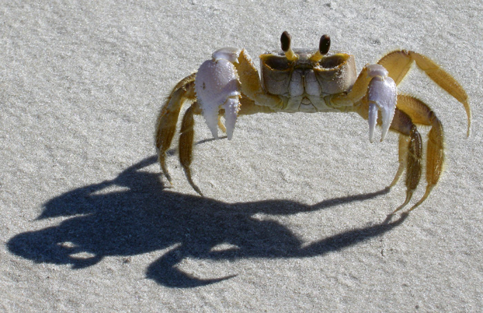
You thought I made long horizontal burrows that go all of the way from the dunes to the surf zone? Wow, you primates are dumber than I thought. (Photograph by Anthony Martin, taken on Sapelo Island, Georgia.)
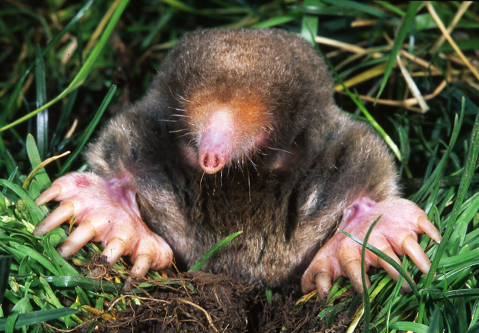
If not a ghost crab then, what else could make meters-long horizontal burrows of the diameter we had seen? This is when I began to reconsider my original rejection of moles as possible tracemakers.

So what am I: chopped liver? (Photograph from Kenneth Catania, Vanderbilt University, and taken from Wikipedia.org here.)

Here’s what was the most interesting about this mistaken interpretation: it was made because of where we were. In other words, our initial mystification about these traces stemmed from their environmental context. Had we seen these burrows winding down a sandy road in the middle of a maritime forest on Sapelo Island, we would not have hesitated to say the word “mole.” Yet because we saw exactly the same types of burrows in coastal dunes and beaches, we said, “something else.”

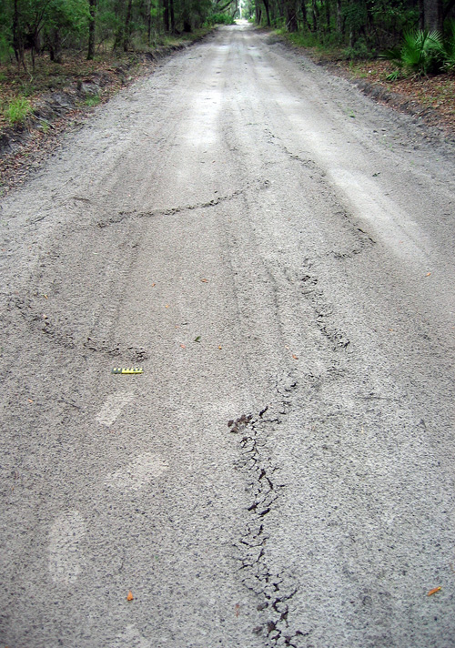
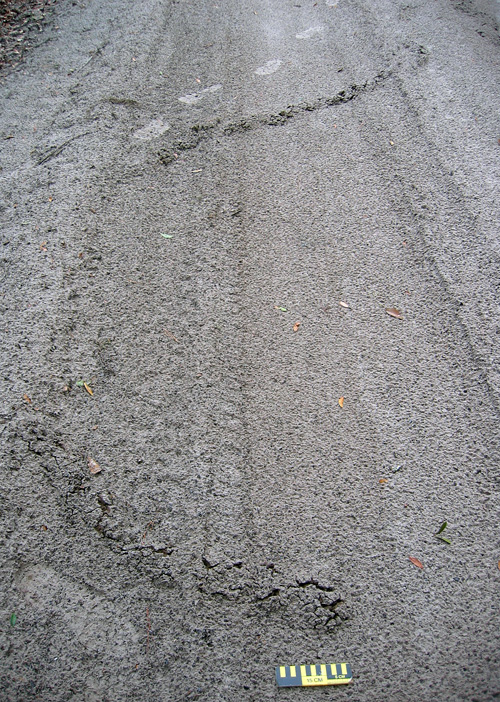
A long, meandering mole burrow in the sandy road going through a maritime forest on the north end of Sapelo Island. So if you see a burrow like this in the forest, you instantly say “mole.” But if you see it on the beach, you say, “Um, uh, duh…must be something else!” My tracks (size 8 1/2, mens) and 15 cm (6 in) photo scale for, well, scale. (Photograph by Anthony Martin.)

Another long, meandering ridge ended in a rounded “hill,” a trace that no one would hesitate to call a mole burrow, especially because it’s in the middle of a maritime forest. (Photo by Anthony Martin, taken on Sapelo Island, Georgia.)
A trip back to the literature further confirmed the mole hypothesis while also serving up a big slice of humble pie. I was embarrassed to find that these same burrows were described and interpreted as mole burrows in an article published in 1986. Even more mortifying: my dissertation advisor (Robert “Bob” Frey) was the first author on the article; it had been published while I was doing my dissertation work with him; and I had read the article years ago, but didn’t remember the part about mole traces. It was like these burrows were saying to me, “Go back to school, young man.”

OK, so these are mole burrows. Case closed. Now that we’ve identified them, we can stop thinking about them, and go on to name something else. But that ain’t science either, is it? This one answer – mole burrows – actually inspires a lot of other questions about them, which could lead to heaps more science:

Which moles made these burrows? The Georgia barrier islands have two documented species of moles, the eastern mole (Scalopus aquaticus) and star-nosed mole (Condylura cristata). Of these two, eastern moles are relatively common on island interiors, whereas star-nosed moles are either rare or locally extinct from some of the islands. But star-nosed moles are also more comfortable next to water bodies and seek underwater prey. So could these traces actually signal the presence of star-nosed moles in dune and beach environments? Frey and his co-author, George Pemberton, originally interpreted these as eastern mole burrows, but they also didn’t eliminate the possibility of star-nosed moles as the tracemakers, either.

What is the evolutionary history of moles on the Georgia barrier islands? Are these moles descended from populations isolated from mainland ones 10,000 years ago by the post-Pleistocene sea-level rise, or do they represent more modern stock that somehow made its way to the islands? A genetic study would probably resolve this issue, but who the heck is going to compare the genetic relatedness of moles from the Georgia barrier islands to those on the mainland?

What were they eating? Moles don’t just burrow for the exercise, but for the food. While burrowing, they are also voraciously chowing down on any invertebrate they encounter in the subsurface. But what would they eat in beach sands? As many shorebirds know, Georgia beaches are full of yummy amphipods, which would likely more than substitute for a mole’s typical earthworm and insect-filled diet in terrestrial environments. Yet as far as I can find in the scientific literature, no one has documented mole stomach contents or scat from coastal environments to test whether these small crustaceans are their main prey or not.

What happened to these moles once their burrows got to the surf zone? Did they turn around and burrow back, or did they go for a swim in the open ocean? The latter is actually not so far fetched, as moles are excellent swimmers, especially star-nosed moles. But how often would they do this?

Just how common (or rare) are these burrows in beaches? Just because I just perceive these burrows as rare could be an example of sample bias. Yes, I wrote an entire book about Georgia-coast traces and tracemakers and have done field work on the islands since 1998. But I don’t live on the Georgia barrier islands, nor have I spent more than a week continuously on any of them. Keenly observant naturalists who live on the islands or otherwise spend much time there could better answer this question than me. I suspect they’re actually much more common than I originally supposed, and now look for them to photograph or otherwise document whenever I go back to any of the islands.

Would such burrows preserve in the geologic record? Probably so, especially if they were made in dunes and filled with a differently colored or textured sand. But I’ll bet that nearly every paleontologist or geologist would make the same mistake I did, and reach for a burrowing marginal-marine crab or some other invertebrate as the tracemaker.

Geologists would be further fooled if fossil mole tunnels were intersected by genuine ghost-crab burrows, which would constitute a great example of a composite trace made by more than one species of animal. But why did the crabs burrow into the mole tunnels? Because it was easier. After all, the moles left hollow spaces and loosened sand over wide areas, practically begging ghost crabs to exploit these disturbed areas.

Anyway, I doubt many geologists would think of a small terrestrial mammal as a tracemaker for such burrows in sedimentary rocks formed in marginal-marine environments, although I’d love to be proved wrong on this. I’m hoping my writing about it here will help to prevent such confusion, and that whoever benefits from it will buy me an adult beverage as thanks.

In summary, this example of making a crab burrow out of a mole tunnel thus serves as a cautionary tale of how where we are when making observations in the field can influence our perceptions. But it also goes to show us how our wonderment with what we observe in natural environments can be renewed and encouraged by daring to be wrong once in a while, and learning from those mistakes.

Further Reading

Frey, R.W., and Pemberton, S.G. 1986. Vertebrate lebensspuren in intertidal and supratidal environments, Holocene barrier island, Georgia. Senckenbergiana Maritima, 18: 97-121.

Gorman, M.L., and Stone, R.D. 1990. The Natural History of Moles. University of Chicago Press, Chicago, Illinois: 138 p.

Harvey, M.J. 1976. Home range, movement, and diel activity of the eastern mole, Scalopus aquaticus. American Midland Naturalist, 95: 436-445.

Henderson, R.F. 1994. Moles. Prevention and Control of Wildlife Damage, Paper 49, University of Nebraska, Lincoln: D51-58. (Entire text here.)
Hickman, G.C. 1983. Influence of the semiaquatic habit in determining burrow structure of the star-nosed mole (Condylura cristata). Canadian Journal of Zoology, 61: 1688-1692.

Tracking the Wild Cattle of Sapelo Island

(The following is part of a series about traces of key invasive species of mammals on the Georgia barrier islands and the ecological effects of these traces. Here is an introduction to the topic from last month, and the first entry was about the feral horses of Cumberland Island.)
If I were pressed to name my favorite Georgia barrier island, it would be a tough choice, but it would be Sapelo. Many reasons support this preference, both practical and emotional, which I will relate before getting to the topic featured in the title.

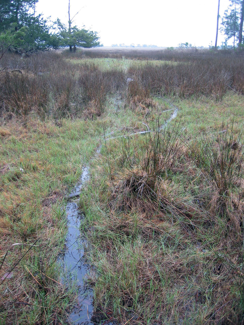
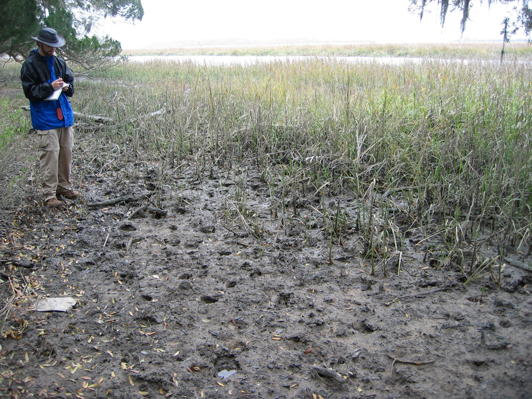
Trails made by feral cattle traveling far into a salt marsh on Sapelo Island, Georgia. But I thought cows only stayed in grassy fields and chewed their cuds? Please read on. (Photograph by Anthony Martin.)

As I mentioned in a previous entry, Sapelo is an excellent place to take university students for teaching basic coastal ecology, geology, ichnology, and taphonomy. Many ecologists consider it as the birthplace of modern ecology, which happened in the 1950s and ‘60s, and it hosted studies that established many basic principles of neoichnology (the study of modern traces) in the 1970s and ‘80s. For the latter, one of the key figures was Robert (Bob) Frey, who was my Ph.D. advisor when I attended the University of Georgia. Sapelo’s human history is also fascinating, dating back to more than 4,000 years ago – evidenced by a prominent Native-American shell ring – and continues through today with Hog Hammock, the only Gullah (“saltwater Geechee”) community left on the Georgia coast.

I have been to Sapelo dozens of times, with or without students, and each time there, I continue to be surprised and delighted by some new observation that reveals itself to those with open eyes and minds. Thus it has everything a field-oriented scientist could want, especially one who likes to learn something different with each visit.

All of these facts and feelings, though, may also lend to an impression that Sapelo is an idyllic and ecologically “pure” place, a true slice of what a Georgia barrier island should aspire to be. Alas, it is not, and like other Georgia barrier islands, Sapelo has been ecologically altered because of exotic plants and animals introduced there during colonial and post-colonial times. Among these species, the most noteworthy on Sapelo is Bos taurus, the only population of wild cattle on any Georgia barrier island and one of the few in the continental U.S.

Unlike the feral horses on Cumberland Island, nearly everyone agrees on the origin of the wild cattle on Sapelo: they are most likely descended from domestic cattle released on the island by millionaire R.J. Reynolds, Jr. (of carcinogenic fame). Although the details are sketchy as to exactly when and why he did this, Reynolds, who owned most of Sapelo from 1933 until his death in 1964, let loose his dairy cows and bulls in the first half of the 20th century. Many generations of these cattle have bred in the wild since, and still roam the island in sufficient numbers to warrant some attention from wildlife biologists, ecologists, and others interested in learning about their behavior and impacts on the local ecosystems.

In my experience, though, the words “wild” and “cattle” are rarely used in everyday conversations about these animals that, through our domestication of them, provide us with milk, cheese, and meat. Ask someone to describe a cow, for instance, and most people will be unflattering: “slow,” “docile,” and “stupid” are among the most common adjectives applied, which is sometimes followed by a giggling reference to the Midwestern U.S. tradition of cow-tipping.

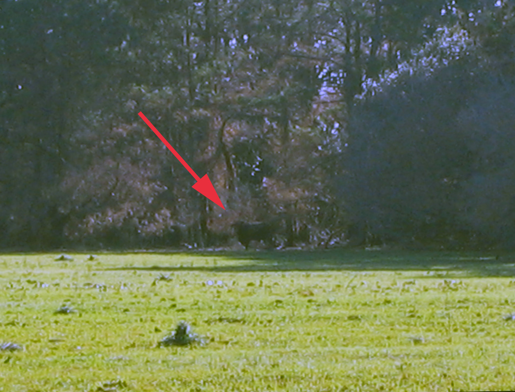
Thinking of tipping this cow? Be my guest, and be sure to forward the resulting video to Animal Planet for others’ lurid entertainment. The “cow” is actually a feral bull, and it was standing its ground at the edge of a field on Sapelo Island, fully aware that we spindly little bipeds were staring at it, and seemingly daring us to get closer. The poor quality of this photo is because I had my camera on maximum digital zoom: my momma didn’t raise no dumb kid. (Photograph by Anthony Martin.)

Yet these cattle are descended from wild species, aurochs (Bos primigenius) that survived the end-Pleistocene mass extinctions. You know, the same extinctions event that wiped out mammoths, mastodons, giant ground sloths, wooly rhinoceroses, saber-toothed cats, dire wolves, and other formidable megafauna of the Pleistocene. Hence aurochs must have had adaptive advantages over their Pleistocene cohorts. This was perhaps was related to their preferred ecosystems of wetland forests and swamps: remember that point with reference to Sapelo. Following the mass extinction, though, people in Eurasia, Africa, and India domesticated aurochs about 8,000 years ago. Through selective breeding, people came up with the present-day varieties we see of Bos taurus, which is considered a subspecies of B. primigenius.

Painting titled The Aurochs, by Heinrich Harder (1858-1935), probably made in 1920. Image is in the public domain and I found it on this Web site, authored by Peter Maas. Contrast how the artist depicted an auroch fighting off a pack of wolves with current expectations of how domestic cattle should behave in the face of pack-hunting predators, and you’ll get a better sense of the actual behaviors shown by wild cattle on Sapelo Island.

I am reminded of this evolutionary heritage whenever I go to Sapelo, because the cattle there are cryptic creatures of the maritime forest. Yes, that’s right: cryptic and living in the forest. A casual day-trip visitor to Sapelo will almost never see one, let alone any of several small herds that roam the island. Whenever an individual bull or herd is encountered in more open, grassy areas, they seemingly revert to Pleistocene behavior and slip into the woods, quickly concealing themselves from the prying eyes of humans. In short, they are not slow, docile, or stupid, and would never allow a person to get close enough to make an short-lived and ill-fated attempt to tip any of them.

This is about all you’ll see of a recent presence of the feral cattle on Sapelo Island: tracks, and if you are lucky enough to sight one, it will leave a lot more tracks and sign for you to study than that all-too-brief glimpse. Scale is in centimeters, and look closely where the slightly smaller the rear-foot track (manus) registered directly on top of the fron-tfoot (pes) track. (Photograph by Anthony Martin.)

Hence any meaningful study of these cattle and their ecological effects on Sapelo requires the use of – you guessed it – ichnology. Consequently, I have tracked these cattle, sometimes with my students and sometimes by myself, during many visits there. Although these tracking forays have generated many anecdotal yarns of yore about these “wild cows of mystery” worth retelling, I will reluctantly restrict myself here to summarizing their traces and the effects of these traces on the landscapes of Sapelo.

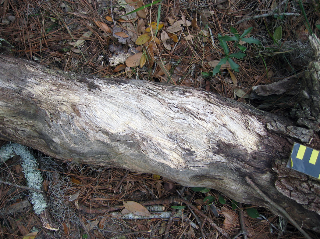
Traces of feral cattle on Sapelo consist largely of their tracks, trails or otherwise trampled areas, feces, and chew marks. In my experience, the vast majority of their traces are on the northern half of the island, although herds or individual bulls will occasionally leave their marks in the southern half when they graze on grassy areas there.

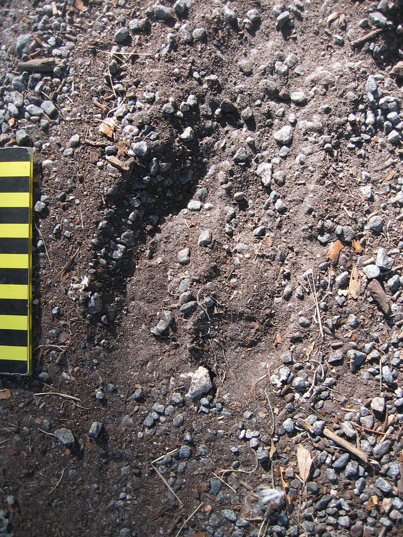
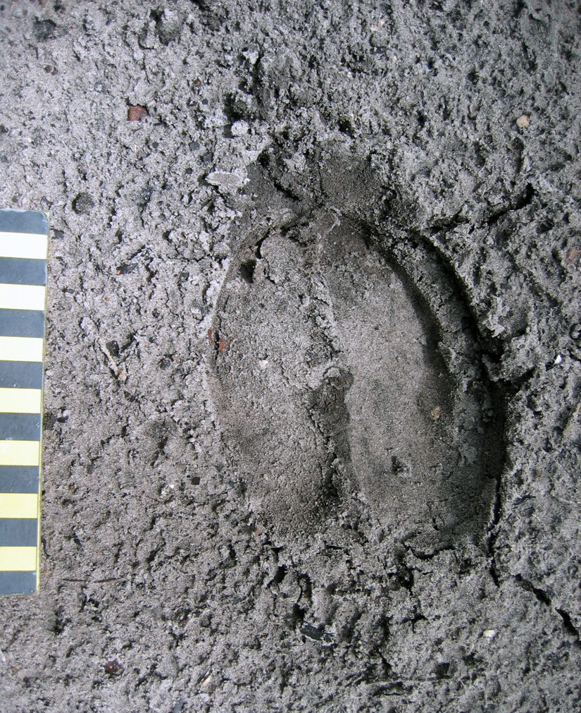
Tracks made by these feral cattle are unmistakable when compared to those of any other hoofed animal on Sapelo – such as white-tailed deer or feral hogs – which is a function of their greater size. Tracks are shaped like robust, upside-down Valentine’s hearts, with two bilaterally symmetrical hoof impressions rounded in the front and back. Tracks are normally about 9-14 cm (3.5-5.5 in) long, although I have seen newborn calf tracks as small as 5-6 cm (2-2.3 in) long; track widths are slightly less (by about 20%) than lengths. These cattle, like deer, spend much of their time walking slowly, so their rear-foot (pes) impressions often overlap behind their front-foot (manus) impressions, but can also overprint in direct register. Trackways typically show a diagonal-walking pattern, although these can be punctuated by frequent “T-stops,” in which tracks form a “T” pattern, with the top of the “T” made by the front feet whenever a trackmaker stopped.

Near-perfect direct register of smaller rear foot into front-foot tracks made by adult feral cow, recorded in exquisite detail in fine-grained sand. Scale in centimeters. (Photograph by Anthony Martin, taken on Sapelo Island.)

Because these cattle, for the most part, obey herding instincts, they habitually follow one another along the same narrow pathways through maritime forests and salt marshes, resulting in well-worn trails that wind between live oaks in forest interiors or cut straight across marshes. Nonetheless, the cattle also like to use the open freeways provided by the sandy roads that criss-cross much of the northern part of the island, which makes tracking them much easier, especially after a hard rain has “cleaned the slate.” When using a road, the cattle break single file and walk parallel or just behind one another, indicated by their overlapping and side-by-side trackways. On forest trails, they often drag their hooves across the tops of logs downed along trails, chipping and otherwise breaking down the wood.

Feral cattle tracks showing different sizes – and hence age structures – of the cattle, with some trackways overlapping (following one another) and some parallel, taking up the entire width of a sandy road on the north end of Sapelo Island. (Photographs by Anthony Martin, composite of three stitched together in Photoshop™.)

Log on feral-cattle trail, showing chipped wood on surface where hooves dragged across the top, possibly over generations of trail use. White-tailed deer do a similar behavior on their trails, but do not cause such obvious traces. (Photograph by Anthony Martin, taken on Sapelo Island.)

OK, here’s a reminder of something I just said and showed in a photo earlier: these cattle also form trails that wind deeply into the salt marshes. Why? Turns out that instead of restricting themselves to a terrestrial-only diet, they are eating smooth cordgrass (Spartina alterniflora), which grows abundantly in the marshes. This feeding results in their leaving many other traces, such as near-ground-level cropping of Spartina with clean tears, accompanied by considerable trampling of grazed areas. Although I was surprised to discover this for myself several years ago, people who raised cattle on the island in the 19th and early 20th centuries, perhaps through necessity, knew about this alternative foodstuff and fed it to cattle as a substitute for hay. Sure enough, historical references verify the use of smooth cordgrass as part of their diet (of the cattle, not the people, that is).

Evidence that feral cattle of Sapelo walk into salt marshes as a herd and eat the smooth cordgrass (Spartina alterniflora) there, based on trampling and overgrazing. Michael Bauman, who was an Emory undergraduate student at the time, for scale. (Photographs by Anthony Martin.)

Close-up of traces left on smooth cordgrass from feral cattle grazing, which are at various heights according to the level of their grazing activity. (Photograph by Anthony Martin, taken on Sapelo Island.)

Of course, among the most obvious traces these cattle leave in their wake are the end products of digestion (pun intended), feces. These “cow patties” vary in size depending on both the size of the tracemaker and liquid content of the scat. The bigger the tracemaker and the greater the water content to the plants, the wider the patties, which can exceed dinner-plate size. Similar to the situation on Cumberland Island with its feral horses and their feces, the native dung beetles must not be able to keep up with such a bounty, as I see many unrecycled, dried patties throughout the island, and have nearly stepped on freshly dropped pies that showed no signs of having been discovered by caring dung-beetle mothers.

Looks like cow scat. Smells like cow scat. Feels like cow scat. Tastes like cow scat. Good thing we didn’t step in it! But notice that the tracemaker did, leaving a bonus trace (track) on top of its impressive pile. (Photograph taken by Anthony Martin, taken on Sapelo Island.)

Given that the northern part of the island has extensive salt marshes flanking the maritime forest, and places with fresh-water sloughs containing more wetland plants, it makes sense that the cattle would stay mostly in that half of the island. The absence of humans on the north end of the island – other than occasional deer hunters, Department of Natural Resources personnel, or crazy ichnologists – is also a plus, as these cattle avoid people whenever possible.

But how does any of this relate to geology and paleontology? Well, because these feral cattle interact so much with Sapelo salt marshes, I actually included these animals as marginal-marine tracemakers in my upcoming book (Life Traces of the Georgia Coast, just in case you needed reminding). This places these bovines in the same category as feral horses – which negatively affect coastal dunes and salt marshes – and feral hogs, which even go into the intertidal zones of beaches for their foraging.

The biggest difference between the cattle and these other two hoofed species, though, is their impact on the marshes. In all of my years of noting cattle tracks and other sign on Sapelo, I have never seen evidence of their going to the beach, or even to the coastal dunes. Instead, they stay in the forests and wetlands, whether the latter are fresh-water or salt-water ones. This possibly reflects how the cattle, within just a few generations, switched back to auroch behaviors of the Pleistocene, preferring to live in wooded wetlands instead of in the terrestrial grasslands we modern humans keep forcing them to graze.

Thus any paleontologists looking into the fossil record of aurochs or their ancestral species – whether of body fossils or trace fossils – might use these present-day clues when prospecting for fossils. This serves as a great example of why I urge paleontologists to pay attention to invasion ecology and conservation biology, in which “ecologically impure” invasive species give us valuable insights on their evolutionary histories.

What else can we learn about these feral cattle and their ecological and geological impacts on Sapelo, especially through studies of their traces? For one, knowing the actual number of cattle on the island would be useful, as their quantity surely relates to how well the island ecosystems can handle present and future populations. But probably more important than this would be better defining their behaviors in the context of these non-native ecosystems. How to do this with a species that stays hidden so well, one that has apparently reverted to a Pleistocene way of life? Fortunately, behaviors can be defined through the ichnological methods I have outlined here. These methods can then easily augment others normally used by conservation biologists, such as trail cameras and direct observation.

Once this is done, we will know much more about these wild cattle than before, and will no longer have to rely on whispered legends of the mysterious bovines of Sapelo Island. Regardless, there is certainly still room for such stories, perhaps even artwork, operas, plays, movies, and music. Cattle have played such an integral role in the development of humanity, there is every reason to suppose that, as long as they continue to live on Sapelo, they and their traces will continue to intrigue us.

Further Reading

Ajmone-Marsan, P., Fernando Garcia, J., and Lenstra, J.A. 2010. On the origin of cattle: how aurochs became cattle and colonized the world. Evolutionary Anthropology, 19: 148-157.

Bailey, C., and Bledsoe, C. 2000. God, Dr. Buzzard, and the Bolito Man: A Saltwater Geechee Talks about Life. Doubleday, New York: 334 p.

McFeeley, W.S. 1995. Sapelo’s People: A Long Walk into Freedom. W.W. Norton, New York: 200 p.

Sullivan, B. 2000. Sapelo Island (GA): Images of America. Arcadia Publishing,  Mt. Pleasant, South Carolina: 128 p.

Teal, M., and Teal, J.M. 1964. Portrait of an Island. Atheneum, New York: 167 p. [reprinted by University of Georgia Press, Athens, in 1997: 184 p.]

Using Traces to Teach about Traces

This past weekend, my colleague Steve Henderson and I co-led a field trip to Sapelo Island, Georgia with 13 Emory University undergraduate students and our spouses. This trip is done biannually as a firm requirement for students taking a class of mine at Emory called Modern and Ancient Tropical Environments. This course, in turn, is a prerequisite for a 10-day field course we’ll do in December-January, ENVS 242, which appropriately has the same name as ENVS 241 except for the addition of “Field Course” at the end. That course, though, will take place on another island, albeit a very different one, San Salvador, one of the “Out Islands” of the Bahamas.

Why were we on Sapelo Island to prepare for a field course in the Bahamas? It was to fulfill several learning goals that will sound familiar to all science educators who take their students outside of a classroom for their learning. In no particular order, these are:

  • Get students to observe natural phenomena while in the field;
  • Ask good questions about what they’ve observed;
  • Learn how to properly record their observations;
  • Come up with explanations (hypotheses) for whatever questions were provoked by their field experiences; and
  • Staying safe while doing all of this, which included adjusting to whatever conditions we might encounter in the field.

Our spouses, Ruth Schowalter and Kitty Henderson, are also educators; Ruth teaches English as a Second Language (ESL) at Georgia Tech, and Kitty is a middle-school earth-science teacher in Covington, Georgia. Moreover, both have been to Sapelo Island many times, having gained a wealth of field-gained knowledge about its natural history. Hence our students were lucky to have all four of us there to introduce them to the island, and we likewise felt very fortunate to be there with such an eager group on a gorgeous fall weekend.

Environmental Studies students from Emory Univeristy with me (foreground) and Steve Henderson (right), looking at a 500-year-old relict salt marsh, exposed by erosion along Cabretta Beach on Sapelo Island, Georgia. Sure beats staying in a classroom to learn about modern and ancient environments. (Photograph by Ruth Schowalter.)

Of course, once on Sapelo or any other barrier island of the Georgia coast, I cannot help but use ichnology – the study of traces – as a uniting theme for my teaching. Steve, who did his Ph.D. research on Sapelo in the late 1970s, is more of a taphonomist, which is someone who studies how fossils are made, from death to burial to preservation. Nonetheless, ichnology and taphonomy overlap considerably, hence our respective approaches complement one another very well, a synergism aided by our having had the same Ph.D. advisor – Robert (Bob) Frey – at the University of Georgia. Once in the field, every track, burrow, feces, and body part of a dead animal we found – and the occasionally sighted live animal – became a dynamic learning opportunity for us, in which we could apply basic scientific methods that were all accented by a sense of wonder.

A dead blue crab (Callinectes sapidus) found in the middle of Sapelo Island, at least 2 kilometers (1.2 miles) from the ocean. How did it get there, and what happened to it? Our students went through the possibilities based on the evidence – main body nearly entire, no toothmarks on it, but bleached white and missing most legs. We finally concluded that it had been dropped by a large predatory bird, such as a great blue heron (Ardea herodias) or great egret (Ardea alba), which probably had shaken off most of the crab’s legs before attempting to eat it. A nice little lesson in taphonomy, for sure. (Photograph by Anthony Martin.)

But perhaps my favorite teaching techniques to use while on Sapelo or any other Georgia barrier island is to use the completely low-tech and ancient method of drawing in the sand. Through my own traces, then, I can teach my students about ichnology and its applications to understanding geologic processes. For example, one of the beaches on Sapelo – Cabretta Beach – is undergoing rapid erosion from a combination of longshore drift and sea-level rise. At this place, downed pines and oaks laid prone in the surf, a former forest now a beach. This was the perfect place to introduce the students to Walther’s Law, which states that laterally adjacent environments will succeed one another vertically in the geologic record. This principle then can be applied to figuring out how a given sequence of strata might reflect a rising or lowering of sea level in the past.

No PowerPoint? No projector? No computer? No problem. Teaching in the field is easy when you have such a nice canvas to work with. (Photograph by Ruth Schowalter.)

So with the sea behind me, a sandy beach wiped clean by the receding tide, and a handy stick, I scratched out a typical sequence of sedimentary strata and their diagnostic traces that would result from sea level going up (a transgression) on the Georgia coast. (Ruth and I were also inspired to create artwork on this theme, discussed in a previous entry.) Terrestrial environments with tree-root and insect traces were at the base of the sequence, succeeded vertically by sandy dune deposits with ghost-crab and insect burrows, then sandy beach deposits with ghost-shrimp burrows, topped off by offshore sandy muds and sands burrowed by fully marine echinoderms, such as heart urchins, sea stars, and brittle stars. I then asked the students to look around them and point to each of the laterally adjacent environments represented in my sand drawing, which they dutifully did. Finally, just to make sure our students got it, we inquired about what sequence should result if sea level dropped, and they correctly surmised that the place would revert back to terrestrial conditions, with the marine sediments buried below.

My applying the final touches on a sand-sketch masterpiece of a transgressive-regressive sequence of strata and its traces, as my students watch. Would you like to see it? Sorry, the tide came in just a few hours after I drew it, and we didn’t get a photo of it. So you’ll just have to draw your own, and preferably on a beautiful beach. (Photograph by Ruth Schowalter.)

As we all stood back to look at the transgressive-regressive sequence of strata, the formerly abstract concept of Walther’s Law became far more real for our students. The dead trees on either side of our group, an eroded dune and maritime forest behind us, and the sea in front of us, all reinforced this lesson, bolstered by our presence in a place with those environments being actively affected by geological and biological processes.

Another instance of using traces in the sand to teach about traces was with ghost-shrimp burrows. At low tide on the previous day of the field trip, the students found many small, volcano-like mounds on the intertidal beach surface some with neat piles of tiny mud-filled cylinders that looked like “chocolate sprinkles” sometimes seen on cupcakes. What were these?

I informed them that we were looking at the tops of ghost-shrimp burrows and their fecal pellets; earlier, we had seen the knobby, pelleted walls of these same ghost-shrimp burrows, which were the deeper parts. What does an entire ghost-shrimp burrow system look like in cross-section? Time for another sand drawing. This one introduced the students to what had been only disembodied words memorized for an exam – ghost shrimp, pellets, walls, vertical shafts, branching – that now could be supplemented by actual traces next to the drawing. You can’t beat these sorts of visual aids, a huge bonus from our being in the right places to see them.

Using a “clean slate” of a beach wiped smooth by the tide for sketching a cross-section of a typical ghost-shrimp burrow, many of which also happened to be underneath our feet. (Photograph by Ruth Schowalter.)

The final sketch of a ghost-shrimp burrow, showing its volcano-like top, narrow “chimney” leading down to the main shaft of the shrimp’s living chamber, some of the pellets lining its burrow walls, and the geometry of the burrow network below. (Photograph by Anthony Martin.)

Was my teaching technique new and innovative, worth presenting at an educational conference as an assessment-friendly pedagogy that would maximize outcome-based education? In short, no. Sand drawing as a tool for education has a very long tradition in indigenous cultures, especially those that have their own forms of ichnology (such as tracking) at their cores. For example, in central Australia, Ruth and I had seen a creation story etched in the ground that had been done some by the Arrente people who live near Uluru. This story likewise used animal traces (emu tracks) as a key feature, a sort of iterative use of traces for inspiration and teaching.

Creation story of the Arrente people drawn in the soil near Uluru in Northern Territory, Australia. The figure at the bottom is an emu, and its tracks are shown leading away from it. (Photograph by Anthony Martin.)

At the same place, we also watched an Arrente elder demonstrate how to make animal tracks using only his fingers and palms, which was also described in books we had read about

Did you know you can use your hands to make animal tracks? In this photo, I use the fine-grained dune sands of Sapelo Island to create a reasonable depiction of kangaroo tracks. Yes, I know, kangaroo tracks on the Georgia barrier islands are not very likely, but you get the idea. Next time I’ll do raccoon tracks instead.

Some of us educators are old enough to remember using a technological succession of blackboards and chalk, overhead projectors with pens, whiteboards with dry-erase pens, and now presentation software (Keynote, PowerPoint, and so on) for imparting lessons. So it gives me great comfort to know that, with a generation of students who have never known a world without computers with a concomitantly reduced connection to the outdoors, we can still switch back to using the ground beneath our feet, our eyes, hands, and imaginations to teach and learn about the life traces around us.

Further Reading

Bingham, J. 2005. Aboriginal Art and Culture. Raintree, Chicago, Illinois: 57 p.

Hoyt, J.H., and Hails, J.R. 1967. Pleistocene shoreline sediments in coastal Georgia: deposition and modification. Science, 155: 1541-1543.

Hoyt, J.H., Weimer, R.J., and Henry, V.J., Jr. 1964. Late Pleistocene and recent sedimentation on the central Georgia coast, U.S.A. In van Straaten, L.M.J.U. (editor), Deltaic and Shallow Marine Deposits, Developments in Sedimentology I. Elsevier, Amsterdam: 170-176.

Louv, R. 2005. Last Child in the Woods: Saving Our Children from Nature-Deficit Disorder. Algonquin Books, Chapel Hill, North Carolina: 390 p.

Middleton, G.V. 1973. Johannes Walther’s Law of the Correlation of Facies. GSA Bulletin, 84: 979-988.

Weimer, R.J., and Hoyt, J.H. 1964. Burrows of Callianassa major Say, geologic indicators of littoral and shallow neritic environments. Journal of Paleontology, 38: 761-767.

Ghost Crabs and Their Ghostly Traces

The ghost crabs of the Georgia barrier islands – all belonging to the species Ocypode quadrata – are among my favorite tracemakers anywhere, any time. My ichnological admiration for them stems from the great variety of behaviors they record in the beach and dune sands of the islands, telling many fascinating tales of what they were doing while no one was watching. Thus I thought it only appropriate that a blog entry posted close to Halloween deserved a story about an animal that not only has the word “ghost” in its common name, but one that also leaves mystifying marks of its unseen behavior.

On the dawn of June 22, 2004 on Sapelo Island (Georgia), my wife Ruth and I were presented with one of the most intriguing of ghost-crab mysteries related to their vestiges. We were scanning the freshly scoured surfaces of Nannygoat Beach on the south end of the island; high tide only a few hours before had cleansed the beach of the previous day’s traces. The low-angle rays of early-morning sunlight were optimal for contrasting any newly made animal signs on the beach, which is why we were there then. We went to the beach with our minds open to anything novel; indeed, my experience with the Georgia barrier islands is that no matter how many times you visit them, they always hold previously unsolved puzzles.

Sure enough, within about 15 minutes of stepping foot on the beach, Ruth paused and asked one of the most simple – yet important – of scientific questions: “What is this?” She pointed to a depression on the sandy surface, and what I saw was astonishing. It was a trace perfectly outlining the lower (ventral) half of a ghost crab, preserving in detail: impressions of all eight walking legs (pereiopods), including their pointed ends (dactyli); its smaller claw (inferior cheliped) and larger claw (superior cheliped); and its main, rectangular body.

A perfect outline of the bottom side of a ghost crab (Ocypode quadrata), found just after dawn and high tide on Nannygoat Beach, Sapelo Island, Georgia. Why would a ghost crab make such a trace? (Scale in centimeters, and photograph taken by Anthony Martin.)

Even more strangely, only one set of tracks connected with this body imprint, leading away from it, and none moved toward it. This was not an impression made by the dead body of a crab. Instead, the tracks showed that the crab was very much alive when it made its resting trace and immediately afterwards. But what happened just before then? It looked as if the crab floated through the air, dropped vertically, made a perfect 10-point landing, sat there for a while, and walked away.

Another exquisitely defined ghost-crab body impression, and with tracks leading away from it, showing this is not a crab “death mask,” but one made by a live crab. (Scale in centimeters, and photograph taken by Anthony Martin.)

The same ghost-crab impression as above, but this time with the crab anatomy labeled and direction of movement after it stopped and sat down on the sand. What happened to the tracks that must have led to its resting spot? And what’s with that word “hydration”? Let’s just say this is what you call “foreshadowing” in the story. (Scale in centimeters, and photograph taken by Anthony Martin.)

Knowing that ghost crabs can do a lot of things, but not aerial acrobatics, we wondered how this could have happened. Well, single observations can be the start of good science, but for this inquiry to progress any further, we had to see if this seemingly unusual observation could be repeated. So we walked further south along the beach to test whether this was an isolated incident, or if we could find any other ghost-crab outlines with single trackways attached. With such a search image in mind, we quickly found about a dozen more such marks made by crabs of various sizes, but showing an identical behavior. Even better, all were located just below the high-tide mark of the previous night.

Yet another beautiful ghost-crab resting trace, surrounded by a scoured beach surface. Lot of these traces and all just below the high-tide mark meant something was happening that could be answered by the awesome power of science. (Scale in centimeters, and photograph taken by Anthony Martin.)

Time to think. These crabs must have walked to their resting places, but why didn’t they leave any tracks? We soon realized that the tracks were certainly made, but not preserved. So like all other surface traces on the beach, they must have been made erased during high tide. Yes, that was it! The crabs walked to the surf zone just after the high tide, sat down, waited long enough for the tide to drop a little bit, and walked away.

Mystery solved? Well, not quite. This was an incomplete explanation, one with a big, unanswered question. Why did the ghost crab walk to – and sit down in – the surf? (With a prompt like that, feel free to create your own intertidal-crab equivalent of “chicken-crossing-road” punch lines.) Ghost crabs normally spend much of their time in deep, J- or Y-shaped burrows close to or in the dunes, and above the high-tide mark. They are most active at night, when they come out of their burrows to scavenge delectable dead things dumped on the beach by waves and tides, or to prey on smaller invertebrates, like dwarf surf clams (Mulinia lateralis). They also leave their burrows to seek mates, which might involve one crab enticing another to check out its burrow.

A seemingly indignant and defiant ghost crab outside of its burrow during the day, either looking for new territory, food, mates, or all three. They’re greedy that way. In this instance, though, it was mostly running away from me and my camera. (Photograph taken by Anthony Martin.)

None of the crabs that made these traces were scavenging, preying, or mating, yet something in the surf was life-sustaining enough for them to risk becoming meals for early-morning predatory shorebirds. I searched my memory for what I had read previously about ghost crabs and their biological needs, and finally realized what could have driven them to the surf in the middle of the night: they were thirsty.

You see, ghost crabs are living examples of so-called transitional animalsthat evolution-deniers insist do not exist, having an interesting mixture of adaptations to different environments. These crabs are descended from fully marine crabs, so they still have gills that allow them to filter oxygen from marine water. Yet they also have little lungs and can breathe air, enabling them to stay out of the water for hours. Having both gills and lungs makes them semi-terrestrial, living in a world between the land and ocean, and dependent on both realms. They live close to the sea for their food, reproduction (females lay their fertilized eggs in sea water), and water, but their main livelihood is gained from the beach and dunes.

In this respect, ghost-crab burrows in the upper parts of beaches and lower parts of dunes provide protection against predators, but also keep the crabs hydrated. One of the functions of a ghost-crab burrow – which can be more than one meter (3.3 feet) deep, is to intersect the water table below. That way, when a crab needs water for proper respiration, it crawls down the burrow to that saturated area and replenishes it bodily fluids. But they can’t stay down there as the tide rises, so they move higher up the burrow to where there’s some air. Unlike blue crabs (Callinectes sapidus), which have completely developed gills and hence fully marine, if you keep a ghost crab in sea water too long, it drowns.

The previous night was a higher tide than normal, which probably flooded many of the ghost-crab burrows and causing these crabs to abandon their homes. This meant the crabs spent most of the night outside of their burrows, resulting in dehydration, but having to wait out the high tide. As soon as the tide turned and began to drop, the crabs ran to the surf zone, settled down into the wet sand, and soaked up water through small openings where the legs connect to the main body. Spiky “hairs” (setae) on their legs help with this water up-take, drawing up moisture from the sand through capillary action.

My legs? Sorry, I meant to shave. Guess you’ll have to deal with it. Hey, wait a minute: does that pose look like it could make anything you’ve already seen, like, oh, I don’t know, a resting trace? Keep reading. (Photograph by Anthony Martin.)

Ghost crabs are amazingly efficient at pulling water out of sand. So their hunkering down onto a saturated sandy surface with waves breaking on top of them must have been like the ghost-crab equivalent of drinking from a funnel, quenching their thirst in a most satisfying way. Meanwhile, waves washed away their tracks leading to these resting spots. They stayed a while, long enough for the tide to drop and expose the sandy beach surface. Only then did they get up and walk away, fully rehydrated, refreshed, and ready to go back to their burrows or dig new ones.

This was a detailed explanation, but one based entirely on traces and what little I knew about ghost crabs from the scientific literature. How else to test it and see whether it was right or not?

If you just said, “By directly observing this interpreted behavior in a ghost crab,” you would be right. A little more than a month later, on July 30, 2004, I actually got to witness this behavior, and on Nannygoat Beach. Back without Ruth this time, and by myself, I was looking for more traces following a high tide, when I saw a small, wraith-like movement out of the corner of my eye. It was a beautiful adult ghost crab, flat-out running in full daylight and heading straight from the dunes to the surf zone. I stood back and watched it reach the surf, where it promptly sat down and became still.

Here’s a ghost crab that doesn’t mind getting a soggy bottom. This one sprinted from the dunes to the surf, stopped abruptly, and sat a spell. (Photograph by Anthony Martin.)

I took photos while walking toward this crab, expecting it to bolt at any moment. Instead, I was instead surprised to see it remain where it sat, even as its eye stalks rotated to look warily at me. Amazed, I grasped that this one must have been thirsty enough to risk being eaten or stomped. The photo you see shows just how close I got to it, and I was thrilled to see it in exactly the same position depicted by the traces Ruth and I had seen the month before.

Although scientists aren’t always right, if you practice good science, you sometimes hit the nail on the head. Or the crab on the sand. Or, well, never mind. Anyway, this ghost crab is making a trace just like the ones documented the month before and in the same place, and it is a direct result of the same behavior interpreted from just the traces and some knowledge of their physiology. It’s almost as if science has predictive power. Who’d have thought? (Photograph by Anthony Martin.)

With the “resting trace = rehydration” hypothesis now supported by both traces and direct observation, I wrote the results into a formal, peer-reviewed paper. Unexpectedly, such traces had never been documented for ghost crabs, and especially from the perspective of a paleontologist. In the paper, published in 2006, I pointed out that this behavior would explain similar-looking trace fossils in the geologic record, or the preservation of crab bodies frozen in the same position by death, perhaps reaching the surf too late and being buried by wave-borne sands. The geological significance of such trace fossils would be their value in pointing exactly to where the surf may have washed across an ancient shore, millions of years ago. Geologists really like this kind of precision, and become grateful to ichnologists who give them such tools they can easily use in the field.

A fossil crab from the Miocene Epoch (about 15 million years old), preserved in a sandstone bed cropping out on a beach near Comodora Rivadavia, Argentina. This crab and others like it in the sandstone were all preserved the same way: nearly entire, implying they were buried quickly, and parallel to the original sandy surface on which they settled. Could these have died after dehydration near the surf, and then been buried? How long ago did some crabs evolve to become semi-terrestrial? I don’t know, but now we have a hypothesis that can be applied to fossils like these and tested. (Coin is about 2.5 cm (1 in) wide; Photograph by Anthony Martin.)

Since then, I have seen these resting traces on the beaches of every Georgia barrier island, in the Bahamas, and other places where ghost crabs dwell. Although trace fossils echoing this behavior in ghost crabs or their ancestors have not yet been found, I predict that with the right images now in mind, geologists and paleontologists will recognize them some day.

So with this ichnological lesson from ghost-crab traces, I hope they have become just a bit less “ghostly” and much more alive in your imaginations.

Further Reading

Duncan, G.A. 1986. Burrows of Ocypode quadrata (Fabricus) as related to slopes of substrate surfaces. Journal of Paleontology, 60: 384-389.

Martin, A.J. 2006. Resting traces of Ocypode quadrata associated with hydration and respiration: Sapelo Island, Georgia, USA. Ichnos, 13: 57-67.

Wolcott, T. G. 1978. Ecological role of ghost crabs, Ocypode quadrata (Fabricius) on an ocean beach: Scavengers or predators? Journal of Experimental Marine Biology and Ecology, 31: 67-82.

Wolcott, T. G. 1984. Uptake of interstitial water from soil: mechanisms and ecological significance in the ghost crab Ocypode quadrata and two gecarcinid land crabs. Physiological Zoology, 57: 161-184.