On the 11th Day of Ichnology, My Island Gave to Me: 11 Plovers Probing

As mentioned in yesterday’s post, I will be celebrating the traces of the Georgia barrier islands over a 12-day period approaching the holidays (you know: Winter Solstice, Christmas, Kwanzaa, Boxing Day, and New Year’s). To keep it relatively simple, each post will be about traces from a Georgia barrier island depicted in a single photograph, followed by my pithy descriptions and trenchant analyses, which may be accompanied by witty asides (or not). Today’s topic is on the feeding traces made by those cute little shorebirds, semipalmated plovers (Charadrius semipalmatus).

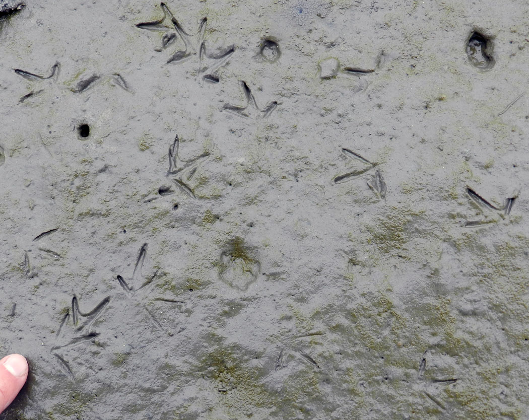
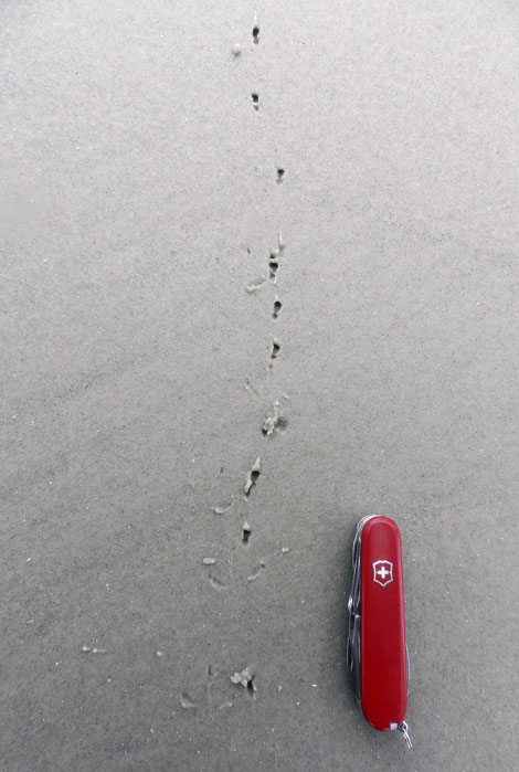
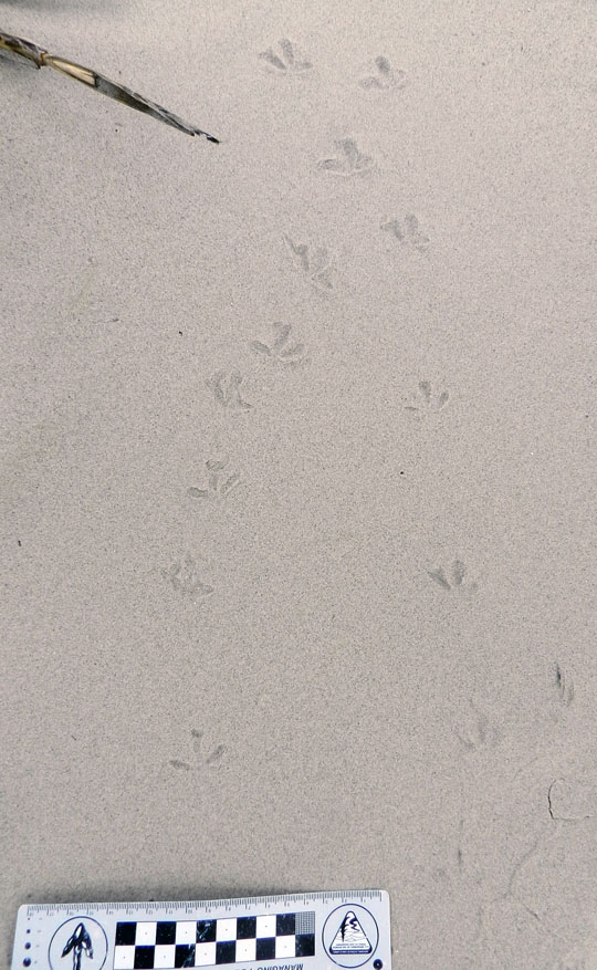
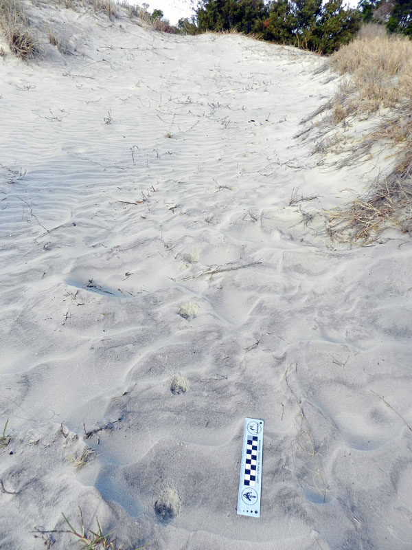
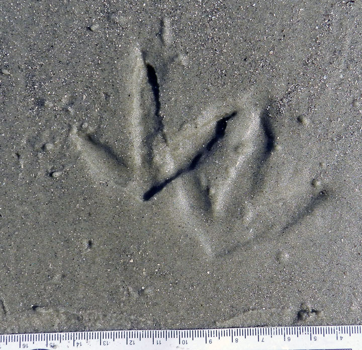
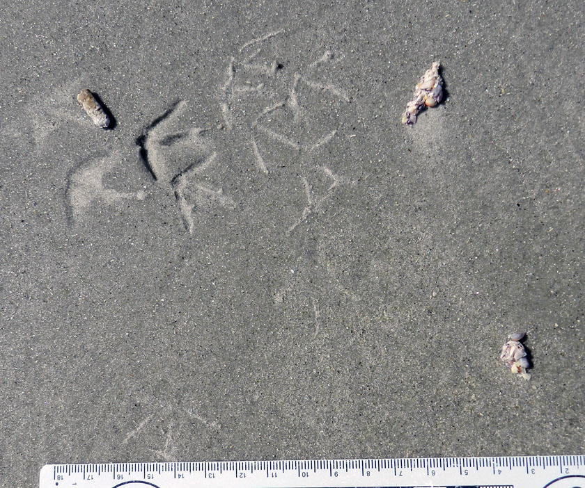
Plover-Tracks-ProbesSeimpalmated plover (Charadrius semipalmatus) tracks and probe marks made by their beaks on a sandy mudflat of Sapelo Island, Georgia. See the differences between the fresher probe marks versus the older ones? And what made those really tiny holes? (Photograph by Anthony Martin.)

Plover tracks in general show just three toes registering (no rear toe impression), are asymmetrical with an acute angle between the inner two toes, and have some webbing between the outermost two toes. If the toes were completely webbed, like that of a duck or goose, the foot form would be called palmate, but because it’s only semi-webbed, it’s called, well, I think you get it.

Although I didn’t see the birds making these tracks and probe marks, I’m fairly sure they were done by semipalmated plovers – rather than other species of plovers – based on tracks sizes and the commonness of this species on the Georgia coast. (What’s the scale? My finger is about 2 cm (0.8 in) wide, and don’t worry, it’s just my index finger.) These birds either walk fast, run, or stand still when they’re on the ground, and about the only reasons they have for standing still are to eat. The spacing between their tracks can act as an informal speedometer, with short spaces corresponding to walking and longer ones to running.

OK, so I identified the trackmaker, which means we’re done with all of that bothersome thinking stuff and we just end this post now, right? In a word, nope. It’s time to apply the awe-inspiring wisdom and power of ICHNOLOGY to this photo.

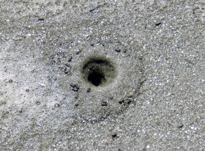
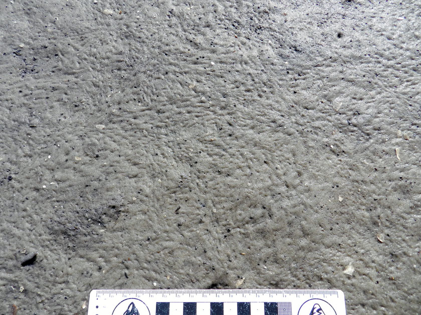
The combination of tracks and probe marks here, along with the teensy-weensy holes on the surface (did you just now see those?), give us insights on why the plovers were there in the first place. The tiny holes are probably made by the siphons of small clams: notice how some of them are paired, a typical pattern caused by incurrent (inhalant) and excurrent (exhalant) siphons for bringing in and pumping out water, respectively. The plovers were probably hunting these clams at low tide, along with any other yummy invertebrate treats they might have found once they stuck their beaks into someone’s business.

Notice also how the probe marks vary considerably in their diameters. This is a result of the plover finding its prey on the first try, or having to insert its beak several times to seek out their meals; the latter caused overlapping probe marks and a small depression. In some instances, these depressions collapse and form not-so-clear evidence of shorebird predation. Take another look at the photo: how many “old” feeding probes do you see now?

So if you’re a geologist looking at rocks of the right environments and ages for containing the traces of shorebirds – basically from the Early Cretaceous Period (~120 million years ago) onward – don’t just get all proud of yourself for just finding their tracks, slapping a name on those tracks, and dashing off a paper to your favorite journal. Look again for probe marks with those tracks, collapsed probe marks, and traces of those little invertebrate morsels that might have attracted those birds to that place, and then. There’s some little, once-breathing lives preserved in those rocks, wanting you to probe below the surface and learn about more about them.

Further Reading

Semipalmated plover. National Audubon Society.

Semipalmated plover. Cornell Lab of Ornithology.

Charadrius semipalmatus: semipalmated plover. Animal Diversity Web, University of Michigan.

Teaching on an Old Friend, Sapelo Island

(This post is the fourth in a series about a spring-break field trip taken last week with my Barrier Islands class, which I teach in the Department of Environmental Studies at Emory University. The first three posts, in chronological order, tell about our visits to Cumberland Island, Jekyll Island, and Little St. Simons and St. Simons Islands. For the sake of conveying a sense of being in the field with the students, these posts mostly follow the format of a little bit of prose – mostly captions – and a lot of photos.)

When planning a week-long trip to the Georgia barrier islands with my students, I knew that one island – Sapelo – had to be included in our itinerary. Part of my determination for us to visit it was emotionally motivated, as Sapelo was my first barrier island, and you always remember your first. But Sapelo has much else to offer, and because of these many opportunities, it is my favorite as an destination for teaching students about the Georgia coast and its place in the history of science.

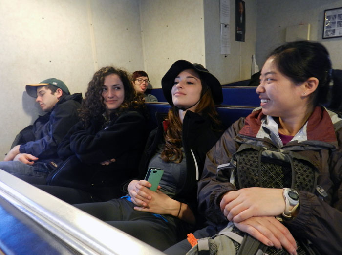
Getting to Sapelo Island requires a 15-minute ferry ride, all for the low-low price of $2.50. (It used to cost $1.00 and took 30 minutes. My, how times have changed.) For my students, their enthusiasm about visiting their fourth Georgia barrier island was clearly evident (with perhaps a few visible exceptions), although photobombing may count as a form of enthusiasm, too.

I first left my own traces on Sapelo in 1988 on a class field trip, when I was a graduate student in geology at the University of Georgia. My strongest memory from that trip was witnessing alligator predation of a cocker spaniel in one of the freshwater ponds there. (I suppose that’s another story for another day.) Yet I also recall Sapelo as a fine place to see geology and ecology intertwining, blending, and otherwise becoming indistinguishable from one another. This impression will likely last for the rest of my life, reinforced by subsequent visits to the island. This learning has always been enhanced whenever I’ve brought my own students there, which I have done nearly every year since 1997.

As a result of both teaching and research forays, I’ve spent more time on Sapelo than all of the other Georgia barrier islands combined. Moreover, it is not just my personal history that is pertinent, but also how Sapelo is the unofficial “birthplace” of modern ecology and neoichnology in North America. Lastly, Sapelo inspired most of the field stories I tell at the start of each chapter in my book, Life Traces of the Georgia Coast. In short, Sapelo Island has been very, very good to me, and continues to give back something new every time I return to it.

So with all of that said, here’s to another learning experience on Sapelo with a new batch of students, even though it was only for a day, before moving on to the next island, St. Catherines.

(All photographs by Anthony Martin and taken on Sapelo Island.)

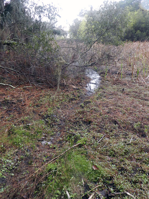
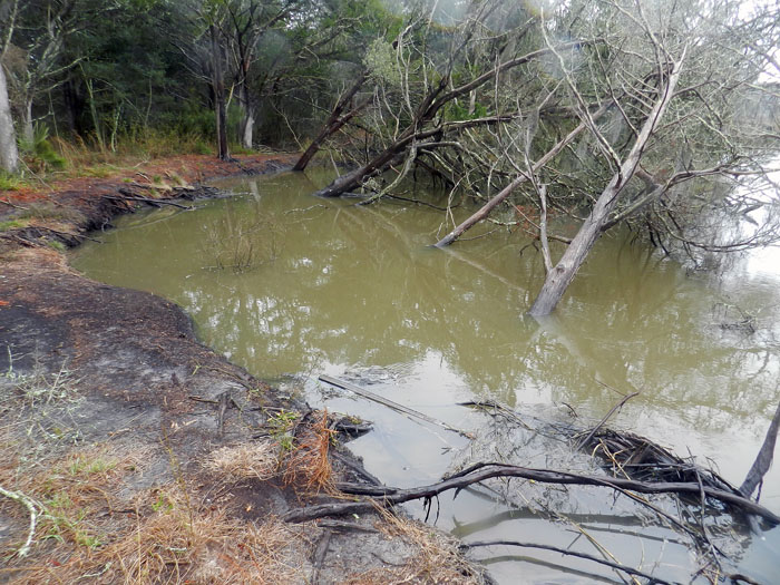
Next to the University of Georgia Marine Institute is a freshwater wetland, a remnant of an artificial pond created by original landowner R.J. Reynolds, Jr. More importantly, this habitat has been used and modified by alligators for at least as long as the pond has been around. For example, this trail winding through the wetland is almost assuredly made through habitual use by alligators, and not mammals like raccoons and deer, because, you know, alligators.

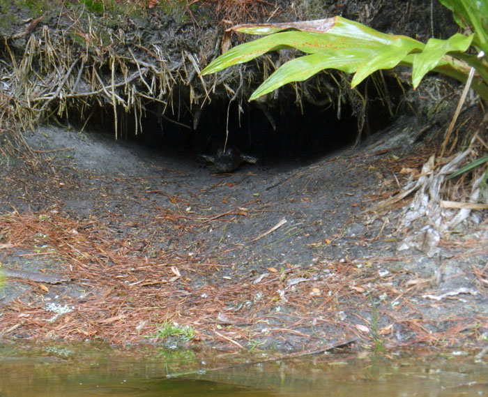
Photographic evidence that alligators, much like humans prone to wearing clown shoes, will use dens that are far too big for them. This den was along the edge of the ponded area of the wetland, and has been used by generations of alligators, which I have been seeing use it on-and-off since 1988.

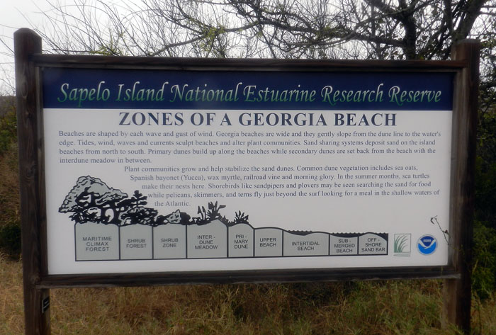
An idealized diagram of ecological zones on Sapelo Island, from maritime forest to the subtidal. This sign provided a good field test for my students, as they had already (supposedly) learned about these zones in class, but now could experience the real things for themselves. And yes, this will be on the exam.

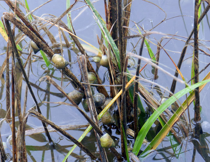
When it’s high tide in the salt marsh, marsh periwinkles (Littoraria irrorata) seek higher ground, er, leaves, to avoid predation by crabs, fish, and diamondback terrapins lurking in the water. Here they are on smooth cordgrass (Spartina alterniflora), and while there are getting in a meal by grazing on algae on the leaves.

Erosion of a tidal creek bank caused salt cedars (which are actually junipers, Juniperus virginiana) to go for their first and last swim. I have watched this tidal creek migrate through the years, another reminder that even the interiors of barrier islands are always undergoing dynamic change.

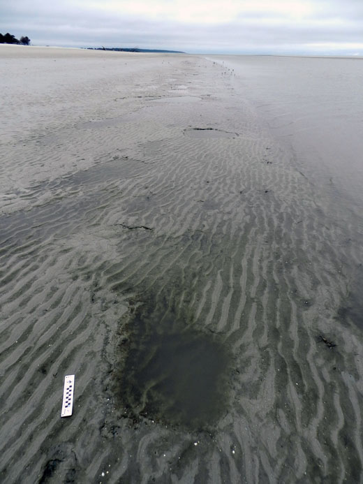
OK, I know what you’re thinking: where’s the ichnology? OK, how about these wide, shallow holes exposed in the sandflat at low tide? However tempted you might be to say “sauropod tracks,” these are more likely fish feeding traces, specifically of southern stingrays. Stingrays make these holes by shooting jets of water into the sand, which loosens it and reveals all of the yummy invertebrates that were hiding there, followed by the stingray chowing down. Notice that some wave ripples formed in the bottom of this structure, showing how this stingray fed here at high tide, before waves started affecting the bottom in a significant way.

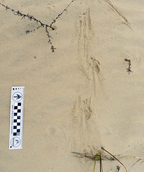
Here’s more ichnology for you, and even better, traces of shorebirds! I am fairly sure these are the double-probe beak marks of a least sandpiper, which may be backed up by the tracks associated with these (traveling from bottom to top of the photo). But I could be wrong, which has happened once or twice before. If so, an alternative tracemaker would be a sanderling, which also makes tracks similar in size and shape to a sandpiper, although they tend to probe a lot more in one place.

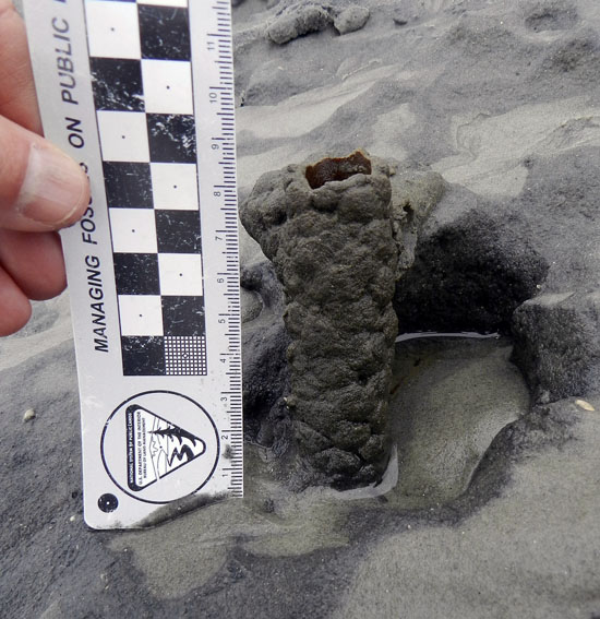
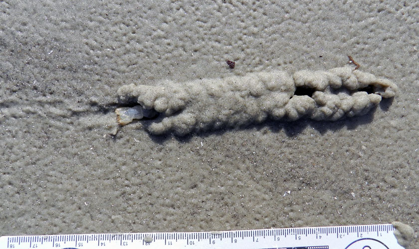
Just in case you can’t get enough ichnology, here’s the lower, eroded shaft of a ghost-shrimp burrow. Check out that burrow wall, reinforced by pellets. Nice fossilization potential, eh? This was a great example to show my students how trace fossils of these can be used as tools for showing where a shoreline was located in the geologic past. And sure enough, these trace fossils were used to identify ancient barrier islands on the Georgia coastal plain.

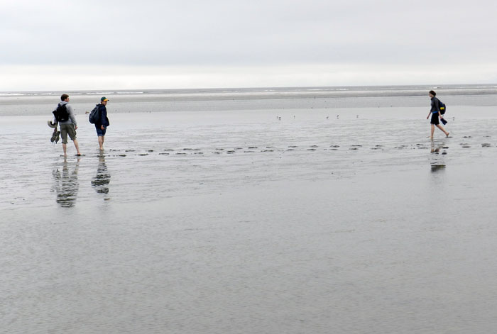
Understandably, my students got tired of living vicariously through various invertebrate and vertebrate tracemakers of Sapelo, and instead became their own tracemakers. Here they decided to more directly experience the intertidal sands and muds of Cabretta Beach at low tide by ambulating through them. Will their tracks make it into the fossil record? Hard to say, but I’ll bet the memories of their making them will last longer than any given class we’ve had indoors and on the Emory campus. (No offense to those other classes, but I mean, you’re competing with a beach.)

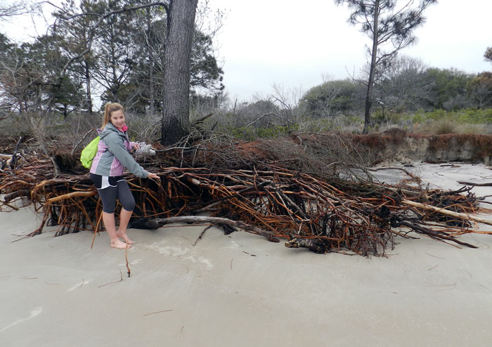
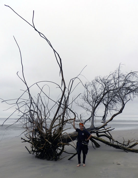
The north end of Cabretta Beach on Sapelo is eroding while other parts of the shoreline are building, and nothing screams “erosion!” as loudly as dead trees from a former maritime forest with their roots exposed on a beach. Also, from an ichnological perspective, the complex horizontal and vertical components of the roots on this dead pine tree could be compared to trace fossils from 40,000 year-old (Pleistocene) deposits on the island. Also note that at this point in the trip, my students had not yet tired of being “scale” in my photographs, which was a good thing for all.

Another student eager about being scale in this view of a live-oak tree root system. See how this tree is dominated by horizontal roots? Now think about how trace fossils made by its roots will differ from those of a pine tree. But don’t think about it too long, because there are a few more photos for you to check out.

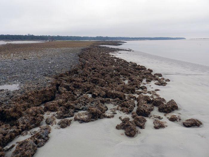
Told you so! Here’s a beautifully exposed, 500-year-old relict marsh, formerly buried but now eroding out of the beach. I’ve written about this marsh deposit and its educational value before, so will refrain from covering that ground again. Just go to this link to learn about that.

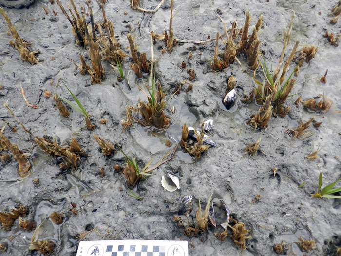
OK geologists, here’s a puzzler for you. The surface of this 500-year-old relict marsh, with its stubs of long-dead smooth cordgrass and in-place ribbed mussels (Guekensia demissa), also has very-much-live smooth cordgrass living in it and sending its roots down into that old mud. So if you found a mudstone with mussel shells and root traces in it, would you be able to tell the plants were from two generations and separated by 500 years? Yes, I know, arriving at an answer may require more beer.

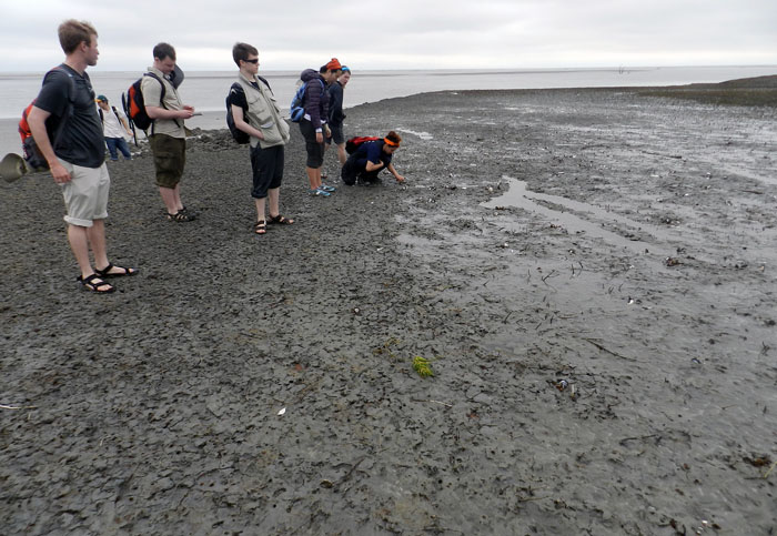
Although a little tough to see in this photo, my students and I, for the first time since I have gone to this relict marsh, were able to discern the division between the low marsh (right) and high marsh (left). Look for the white dots, which are old ribbed mussels, which live mostly in the high marsh, and not in the low marsh. Grain sizes and burrows were different on each part, too: the high marsh was sandier and had what looked like sand-fiddler crab burrows, whereas the low marsh was muddier and had mud-fiddler burrows. SCIENCE!

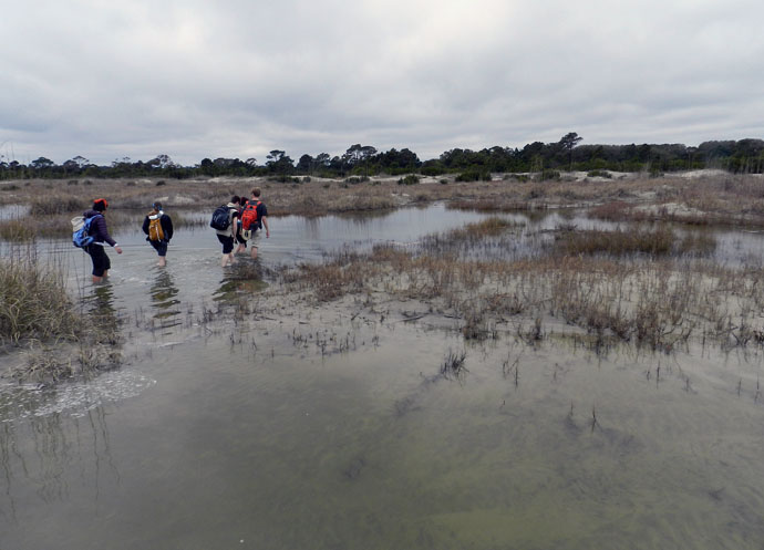
At the end of a great day in the field on Sapelo, it was time to do whatever was necessary to get back to our field vehicle, including (gasp!) getting wet. The back-dune meadows, which had been inundated by unusually high tides, presented a high risk that we might experience a temporary non-dry state for our phalanges, tarsals, and metatarsals. Fortunately, my students bravely waded through the water anyway, and sure enough, their feet eventually dried. I was so proud.

So what was our next-to-last stop on this grand ichnologically tainted tour of the Georgia barrier islands? St. Catherines Island, which is just to the north of Sapelo. Would it reveal some secrets to students and educators alike? Would it have some previously unknown traces, awaiting our discovery and description? Would any of our time there also involve close encounters with large reptilian tracemakers? Signs point to yes. Thanks for reading, and look for that next post soon.


A Tale (and Tails) of Two Islands

After visiting Cumberland Island and Jekyll Island, our Barrier Islands class had entered its third day (Monday, March 11), and was now about to embark onto our third and fourth barrier islands of the Georgia coast. These islands were a Pleistocene-Holocene pair – St. Simons and Little St. Simons, respectively – and the latter was our primary goal. After all, Little St. Simons is a privately owned and undeveloped island, one of the few that has not been logged or otherwise majorly altered by those ever-nefarious and industrious post-Enlightenment humans. St Simons, though, had its own lessons to teach us, including a realization I had that ichnological factors (bivalve feces, specifically) had played a role in deciding the fate of European power struggles on the Georgia coast during the 18th century.

Just like the previous two posts, this one will be told through photos and captions, which I hope captures much of what my students and I learned during our times on these two islands. Just watch out for those tails.

Little St. Simons is a privately owned island, but is available for day tours of groups like ours that are led by their knowledgeable and friendly naturalists. Soon after arriving by small boats on the island and being greeted by the naturalists assigned to us, Laura (pictured) and Ben (you’ll see him soon enough). While there, Laura provided a brief introduction to the geological history of Little St. Simons: Holocene (probably only a few thousands years old), and rapidly gaining weight (sediment, that is) each year, supplied by the nearby Altamaha River.

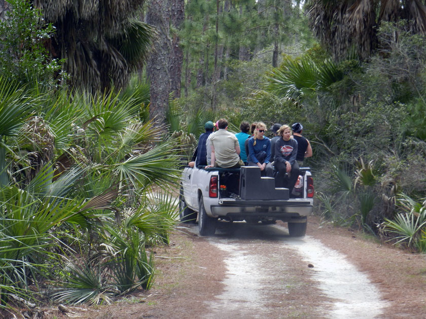
Check out our air-conditioned field vehicles! Seeing that this is a field course, traveling this way was ideal for experiencing the island a bit more directly, yet without descending in a Heart-of-Darkeness or Lord-of-the-Flies sort of mode. Because that would be bad.

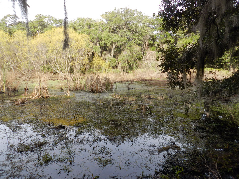
Little St. Simons has a healthy number of freshwater wetlands for such a small island (like this one), more closely resembling what used to be on the Georgia barrier islands before a few people decided that plantations and paper mills were great ideas.

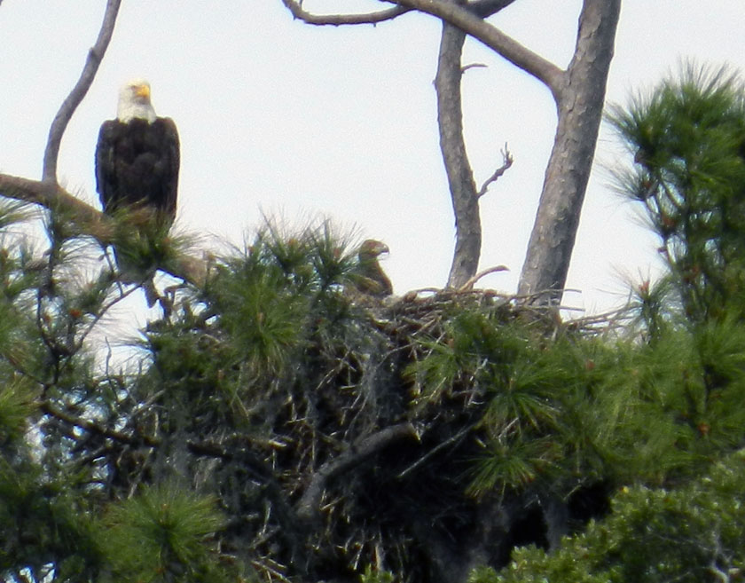
Say, isn’t that an all-American bird? Yes, it is, but more importantly, it has a rather prominent trace next to it – a bald eagle nest – that is also occupied by a couple of young eagles. (Here, one is sticking its head out of the nest while being overseen by a protective parent.) Bald eagle nests are among the largest tree nests made by any modern bird, leading me to wonder what tree-dwelling dinosaur nests from the Cretaceous Period must have looked like.

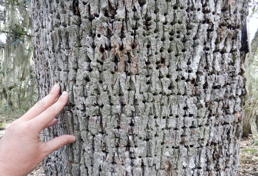
Sorry folks, can’t get enough of bird traces on this island. Many of the tree trunks on Little St. Simons bear the horizontally aligned holes of yellow-bellied sapsuckers. These woodpeckers pierce tree trunks to cause the tree to bleed sap, which attracts insects, which get stuck, which get eaten by the sapsuckers. Sap + insects = tasty treat!

Armadillo tracks on a coastal dune at the north end of the island show just how far-ranging these mammals can get. Having only recently arrived to the Georgia coast since the 1970s, these prolific tracemakers are now on every island.

Near the armadillo tracks, also in the coastal dunes, were these mystery burrows. I had no idea what made these, as they were too small to be mole burrows, too big to be insect burrows, and too horizontal to be mouse burrows. Just a reminder that even the author of a 700-page book about Georgia-coast traces still has a lot more to learn.

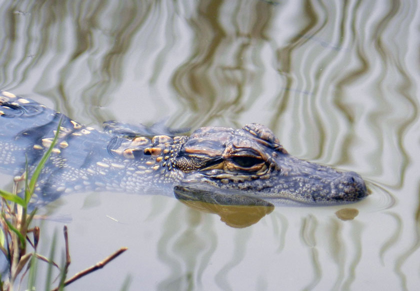
Aw, look at this cute little baby alligator, which was near its momma in one of the freshwater ponds on Little St. Simons. I wonder where it came from originally?

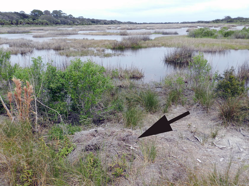
Why, there’s where it came from: it’s momma’s nest! The arrow is pointing toward a now mostly collapsed alligator nest, which hatched the little tykes that are now in the nearby wetland. Alligator nests are composed mostly of loose vegetation that the mother collects and piles, enough that it will give off heat to incubate her eggs. Such nests have very poor preservation potential in the fossil record, but it is still very interesting to study how they disintegrate so rapidly.

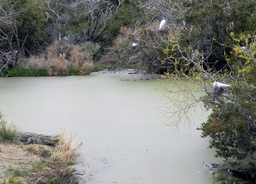
Alligators (left) and birds (right, with one on her nest) last shared a common ancestor early in the Mesozoic Era, but here they are, working together to their mutual benefit. Great egrets and woodstorks nest on islands, which are guarded by large alligators, who are good deterrents to egg predators. (In a grudge match between an alligator and raccoon, who do you think would win?) As payment for this protection, alligators get an occasional chick falling out of the nest, a small evolutionary price for the birds to pay when compared to an entire clutch of eggs getting munched.

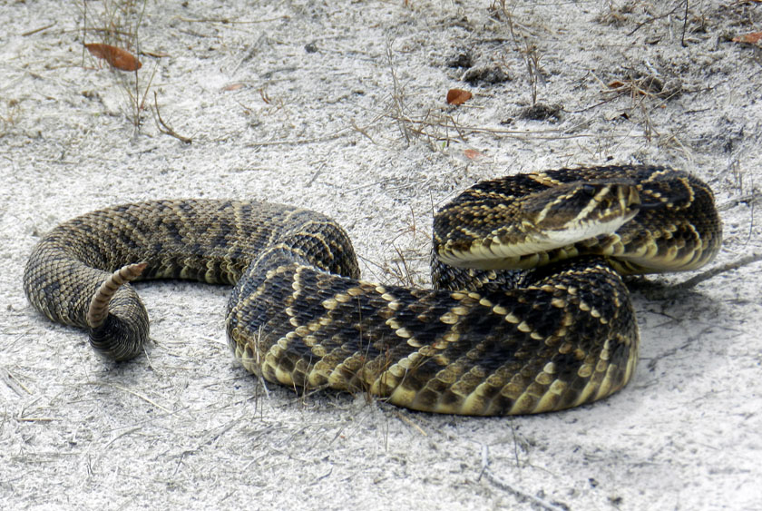
My, what a noisy tail you have! We were delighted to encounter this diamondback rattlesnake on one of the sandy roads of Little St. Simons, which urged us to approach it carefully, using a clearly audible warning and threat postures. (P.S. It worked.)

Our other guide, Ben, had an obviously deep affection for venomous reptiles, expressed first through some impromptu snake-handling. (No, he did not use his hands, nor did he speak in tongues. See that snake-handling device in his right hand?) Following our not-too-close encounter, he expounded on the ecological importance of rattlesnakes to the island, and related some interesting facts about rattlesnake behavior. Gee, you think the students might remember some of this lesson? (Personal note: Bring rattlesnakes into the classroom more often.)

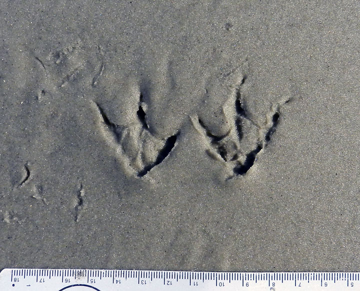
At the south end of Little St. Simons is a very nice beach, and on that beach were – you guessed it – shorebird tracks. Here are some plover tracks, which could be from Wilson’s plovers, semi-palmated plovers, or some other species.

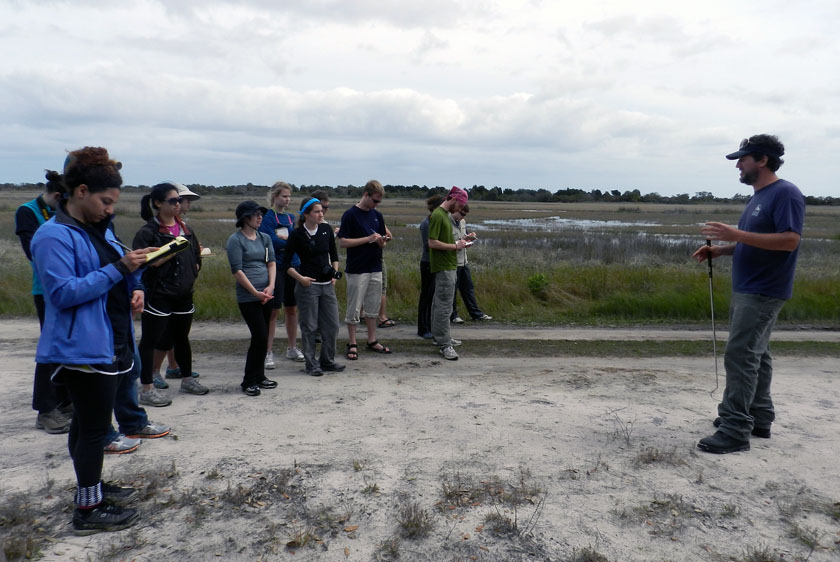
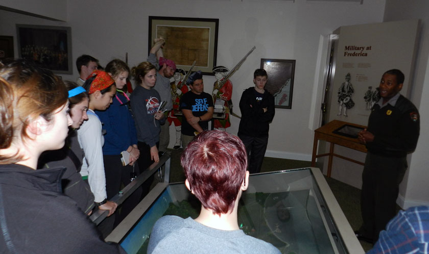
Sadly enough, our tour of Little St. Simons lasted only until 3:00 p.m., so we had some time on St. Simons to do a bit more learning. So I decided we would stop at Fort Frederica National Monument, on the north end of St. Simons Island. It turned out this was a educationally sound decision, especially when one of the rangers on duty – Mr. Ted Johnson (right) – volunteered to give our group a spirited and informative lecture about the former military importance of Fort Frederica. However, judging from the downcast looks on several of the students, I imagine they were already missing alligators, snakes, and shorebirds of Little St. Simons Island, and (of course) their traces.

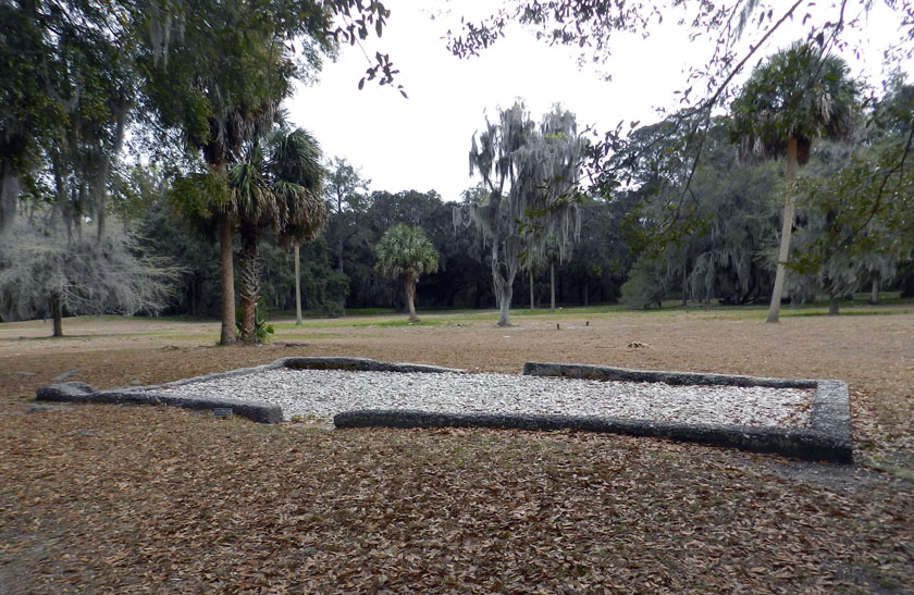
The most obvious human traces at Fort Frederica are these “footprints” (foundations) of some of the buildings there in the 18th century. Established as a British outpost in Georgia to compete with the Spanish presence to the south, Fort Frederica was a thriving town as long as the military was there.

OK, you’ve no doubt read this far to find out how bivalve feces helped the English to defeat the Spanish in the mid-18th century and consequently gain a permanent foothold in Georgia (until those pesky colonials defeated them later that century, that is). See where the fort is located? Right on a point, facing a tidal channel, and with salt marsh on either side of it. Because the salt marshes are largely composed of feces and similar muddy ejecta of ribbed mussels and other invertebrates, these make for wonderfully gooey substrates. Such substrates tend to discourage rapid movement of ordinance-laden ground troops, which forced the Spanish to try other means for attacking the fort, which failed. Bivalve feces for the win! Traces rule! ¡En la cara, los conquistadores!

As our day neared an end, my students decided that an appropriate way to signal their pleasure with all they had learned was for them to give me the now-official fiddler crab salute, waving their mock claws in unison. We all plan to still use this when greeting on the Emory campus, which should thoroughly mystify other students, faculty, and especially administrators, the latter of whom will wonder if it is some sort of secret-society sign. (Which, in a sense, it will be. Be afraid. Be very afraid)

What island was next on our journey? My old favorite, Sapelo Island, just to the north of Little St. Simons and St. Simons, and as different from these as the preceding islands were from one another. Stay tuned for those photos and comments in just a few days, and get ready to learn.

Doing Field Work on a Developed Barrier Island

The second day of our Barrier Islands class field trip (Sunday, March 10), which is taking place along the Georgia coast all through this week, involved moving one island north of Cumberland (mentioned in this previous post), to Jekyll Island. I’ve been to Jekyll many times, but none of my students had, so they didn’t quite know what to expect other than what I had told them.

For one, I warned the students that Jekyll was not at all like Cumberland, which is under the authority of the U.S. National Park Service as a National Seashore. Consequently, it has a few residents, but is limited to less than 300 visitors a day. In contrast, many more people visit or live on Jekyll, and people have modified it considerably more. For example, Jekyll has a new convention center, regularly sized and miniature golf courses, a water park, restaurants, bars, and other such items absent during most of its Pleistocene-Holocene history. Another difference is that a ferry was need to get onto Cumberland, whereas we could drive onto Jekyll and stay overnight there in a hotel.

So why go there at all with a class that is supposed to emphasize the geology, ecology, and natural history of the Georgia barrier islands? The main reason for why I chose Jekyll as a destination for these students was so they could see for themselves the balance (or imbalance) between preserving natural areas and human development of barrier islands. Jekyll is one of those islands that is “in between,” where much of its land and coastal areas have been modified by people, but patches of it retain potentially valuable natural-history lessons for my students.

So what you’ll see in the following photos will focus on those more natural parts of Jekyll island, with some of the wonders they hold. However, this series of photos will end with one that will shock and horrify all. Actually, you’ll probably just shake your head and sigh with rueful resignation at the occasional folly of mankind, especially when it comes to managing developed barrier islands.

We started our morning like every day should start, with ichnology. Here, tracks of a gray fox, showing direct register (rear foot stepping almost exactly into the front-foot impression) cut between coastal dunes on the south end of Jekyll Island. The presence of gray foxes on Jekyll has caused some curiosity and concern among residents, with the latter emotion evoked because these canids are potential predators of ground-nesting birds, like the Wilson’s plover. Also, people have no idea how many foxes are on the island. If only we had some cost-effective method for detecting their presence, estimating their numbers, and interpreting their behavior. You know, like tracking.

My students show keen interest in the gray fox tracks, especially after I tell them to show keen interest as I take a photo of them. Funny how that works sometimes.

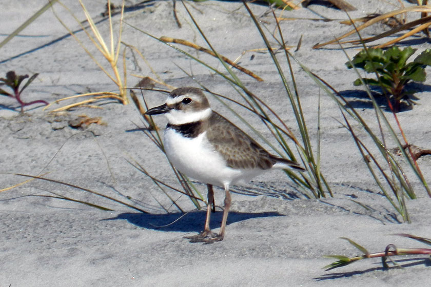
A Wilson’s plover! At least, I think it is.( Birders of the world, please correct me if this is wrong. And I know you will.) We spotted a pair of these birds traveling together on the south end of the island, causing much excitement among the photographers in our group blessed with adequate zoom capabilities on their cameras. Wilson’s plovers are ground-nesting birds, and with both gray foxes and feral cats on the island, their chicks are at risk from these predators. Again, if only we had some cost-effective method for discerning plover-cat-fox interactions. Tracking, maybe?

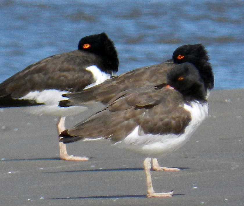
Here’s a little secret for shorebird lovers visiting Jekyll Island. Walk around the southwest corner of the island, and you are almost assured of seeing some cool-looking shorebirds along the, well, shore, such as these American oystercatchers, looking coy while synchronizing their head turns. These three were part of a flock of about twenty oystercatchers all traveling together, which I had never seen before on any of the islands. If you go walking on Jekyll, and know where to walk, you’ll see some amazing sights like this.

You were probably all wondering what American oystercatcher tracks look like, especially those made by ones that are just standing still. Guess this is your lucky day. Also notice the right foot was draped over the left one, causing an incomplete toe impression on the right-foot one. Wouldn’t it be nice to find a trace fossil just like this?

Black skimmers! We didn’t get to see them skim, but we still marveled at this flock of gorgeous shorebirds. These were in front of the oystercatchers, with an occasional royal tern slipping into the party, uninvited but seemingly tolerated.

Yeah, I know, you also wanted to know what black skimmer tracks look like. So here they are. Now you don’t need to use a bird book to identify this species: just look at their tracks instead!

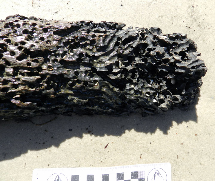
You think you’re bored? Try being driftwood, with marine clams out there adapted for drilling into your dead, woody tissue. This beach example prompted a nice little lesson in how this ecological niche for clams has been around since at least the Jurassic Period, which we know thanks to ichnology. You’re welcome (again).

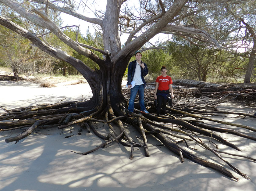
Beach erosion at the southernmost end of Jekyll gave us an opportunity to see the root systems of the main tree species there, such as this salt cedar (actually, it’s a juniper, not a cedar, but that’s why scientists use those fancy Latinized names, such as Juniperus virginiana). My students are also happily learning to become the scale in my photos, although I suspect they will soon tire of this.

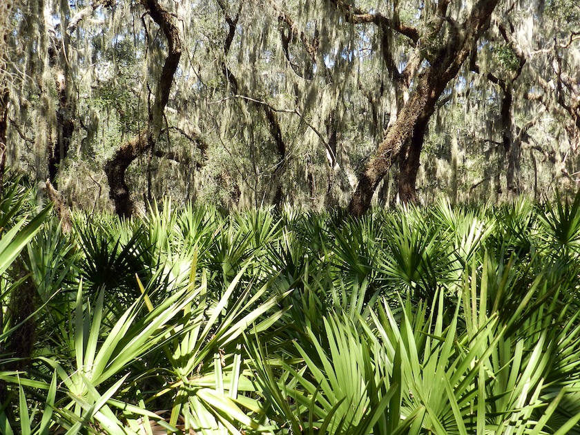
Look at this beautiful maritime forest! This is what I’m talking about when I say “…patches of it [Jekyll Island] retain potentially valuable lessons in natural history.” This is on the south end of the island, and this view is made possible by walking just a few minutes on a trail into the interior.

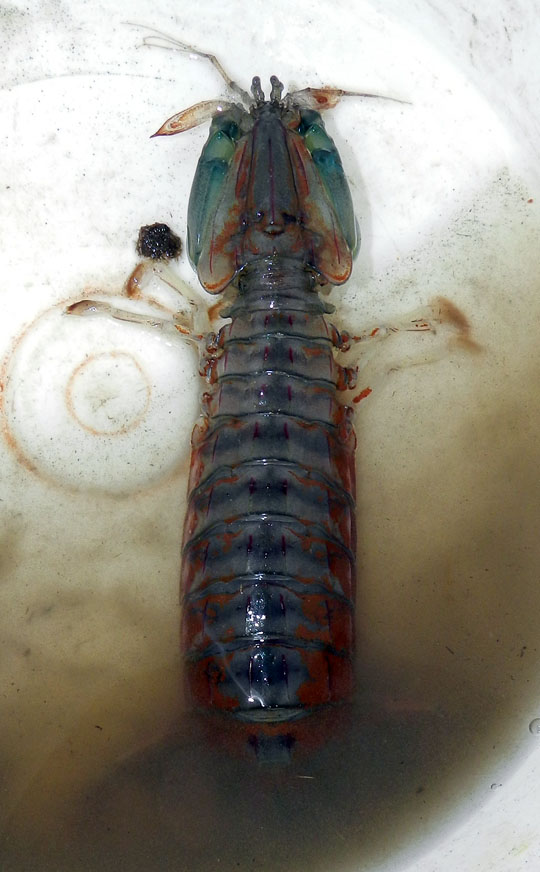
Few modern predators, invertebrate or vertebrate, provoke as much pure unadulterated giddiness in me as mantis shrimp. So imagine how I felt when, through sheer coincidence, a couple walked into the 4-H Tidelands Nature Center on Jekyll, while I was there with my class, and asked if I identify this animal they found on a local beach. The following are direct quotations from me: “Wow – that’s a mantis shrimp!! Squilla empusa!! It’s incredible!!” I had never seen a live one on the Georgia coast, and it was a pleasure to share my enthusiasm for this badass little critter with my students (P.S. It makes great burrows, too.)

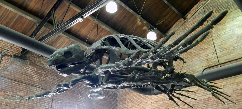
A stop at the Georgia Sea Turtle Center on Jekyll was important for my students to learn about the role of the Georgia barrier islands as places for sea turtles to nest. But I had been there enough times that I had to find a way to get excited about being there yet again. Which is why I took a photo of their cast of the Late Cretaceous Archelon, the largest known sea turtle. I never get tired thinking about the size of the nests and crawlways this turtle must have made during the Cretaceous Period, perhaps while watched by nareby dinosaurs.

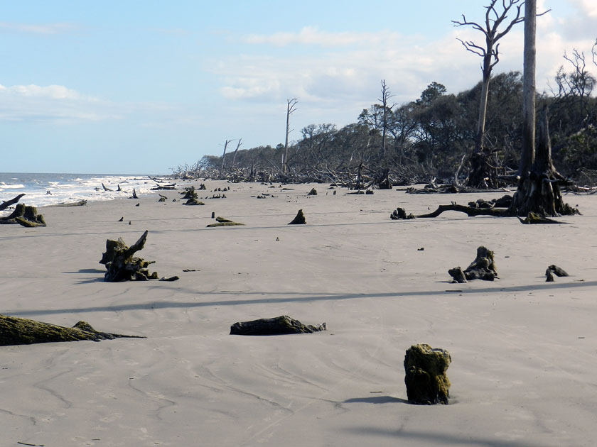
At the north end of Jekyll, shoreline erosion has caused the beach and maritime forest to meet, and the forest is losing to the beach. This has caused the forest to become what is often nicknamed a “tree boneyard,” in which trees die and either stay upright or fall in the same spot where they once practiced their photosynthetic ways.

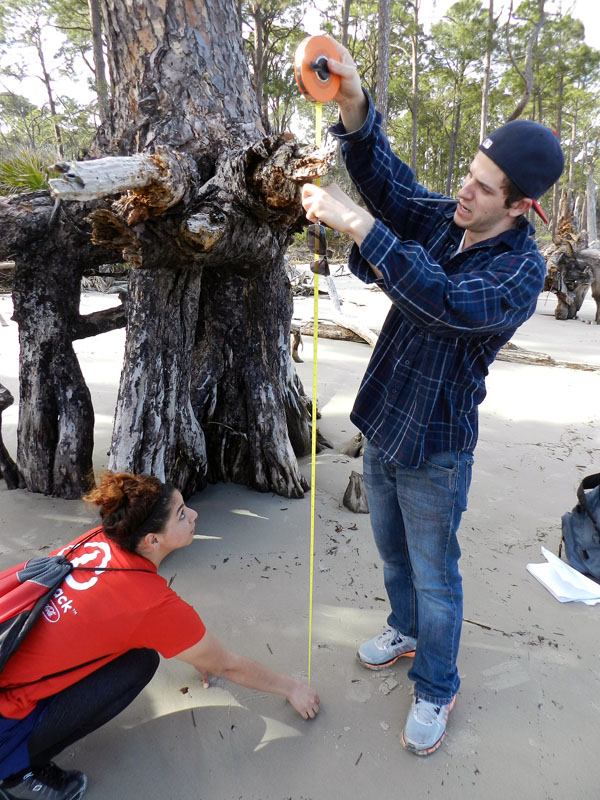
Quantify it! Whenever we encountered dead trees with root systems exposed, I asked the students to measure the vertical distance from beach surface to the topmost horizontal roots. This gave an estimate of the minimum amount of erosion that took place along the beach.

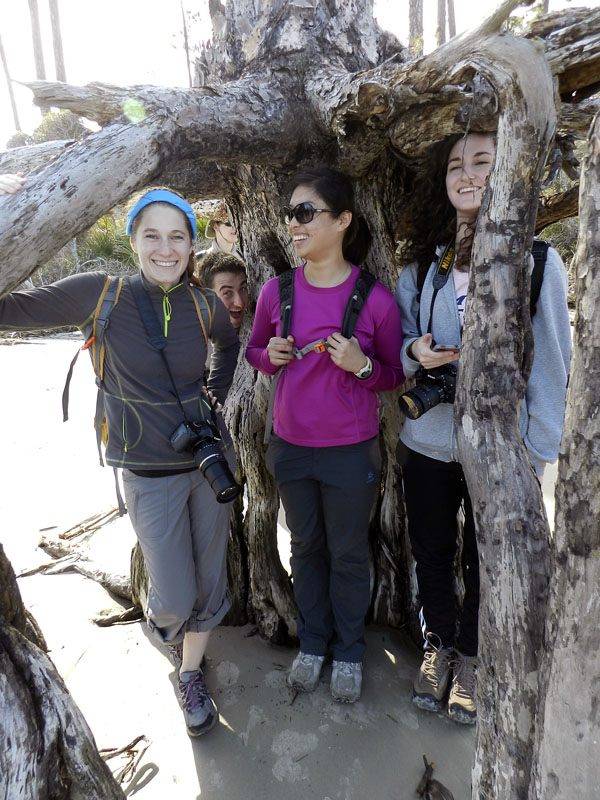
Perhaps a more personal way to convey the amount of beach erosion that happened here was to see how it related to the students’ heights. It was a great teaching method, well worth the risk of being photobombed.

Are you ready? Here it is, in three parts, what was without a doubt the traces of the day. Start from the lower left with that collapsed burrow, follow the tracks from left to right, and look at that raised area on the right.

A close-up of the raised area shows a chevron-like pattern, implying that this was an animal that had legs, and knew how to use them. Wait, is that a small part of its tail sticking out of the left side?

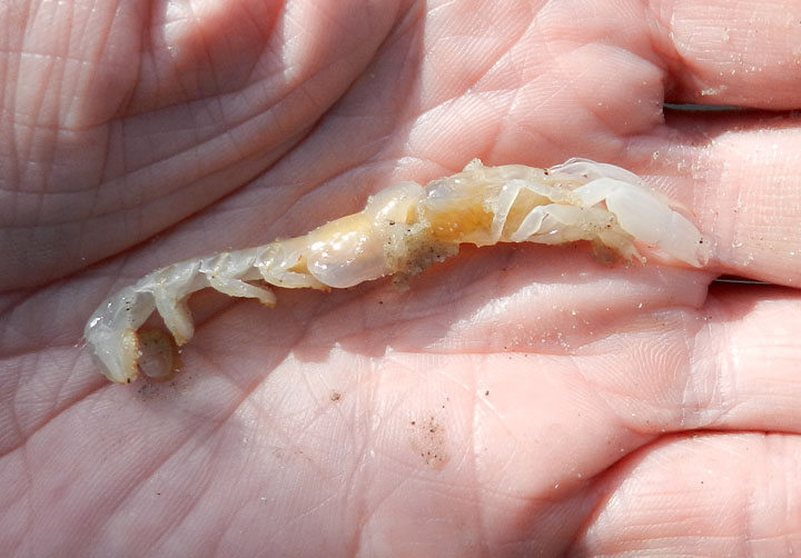
Violá! It was a ghost shrimp! I almost never see these magnificent burrowers alive and outside of their burrows, and just the day before on Cumberland Island, the students had just learned about their prodigious burrowing abilities (the ghost shrimp, that is, not the students). I had also never before seen a ghost shrimp trackway, let alone one connected to a shallow tunnel on a beach. An epic win for ichnology!

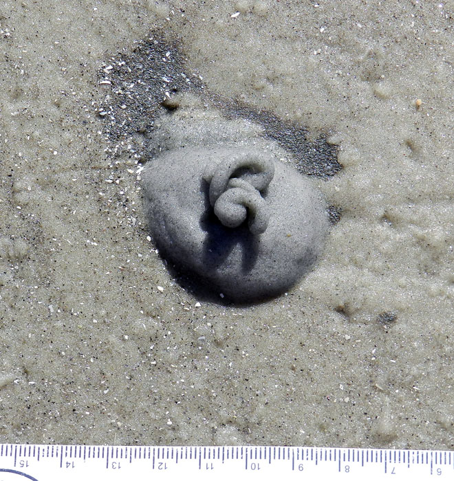
This may look like soft-serve ice cream, but I suspect that it’s not nearly as tasty. It’s the fecal casting of an acorn worm (Balanoglossus sp.), and is composed mostly of quartz sand, but still. These piles were common on the same beach at the north end of Jekyll, but apparently absent from the south-end beach. Why? I’m guessing there was more food (organics) provided by a nearby tidal creek at the north end. But I’d appreciate all of those experts on acorn worms out there to augment or modify that hypothesis.

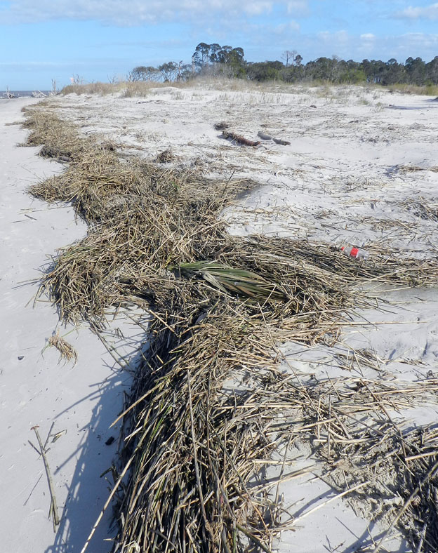
This is how dunes normally form on Georgia barrier-island beaches: start with a rackline of dead smooth cordgrass (Spartina alterniflora), then windblown sand begins to accumulate in, on, and around these. Throw in a few windblown seeds of sea oats and a few other dune-loving species of plants, and next thing you know, you got dunes. Dude.

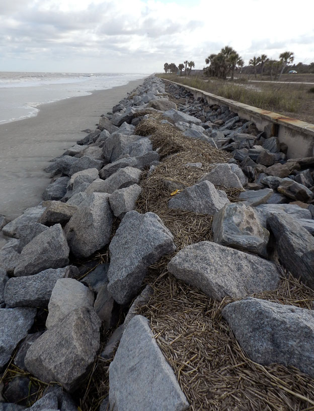
In contrast, here is how not to form dunes on Georgia barrier-islands beaches. Build a concrete seawall on the middle part of the island, truck in thousands of tons of metamorphic rock from the Piedmont province of Georgia, place the rocks in front of the seawall, and watch the beach shrink. So sad to see all of that dune-building smooth cordgrass going to waste. Anyway, the contrast and comparison you just saw is also what my students experienced by standing in both places the same day.

Jekyll Island gave us many lessons, but we only had a day there. Which islands were next? St. Simons and Little St. Simons, with emphasis on the latter. So look for those photos in a couple of days, in between new exploits and learning opportunities.


Cumberland Island, Georgia: Not a Barrier to Education

When learning about the natural sciences, there comes a time when just reading and talking about your topics in the confines of a classroom just doesn’t cut it. This semester, we had reached that point in a class I’m teaching at Emory University (Barrier Islands), in which we all needed a serious reality check to boost our learning. So how about a week-long field trip, and to some of the most scientifically famous of all barrier islands, which are on the coast of Georgia?

Last Friday, March 8, our excursion officially began with a long drive from the Emory campus in Atlanta, Georgia to St. Marys, Georgia. Fortunately, Saturday morning was much easier, only requiring that we walk across the street, step onto a ferry, and ride for 45 minutes to Cumberland Island. Cumberland was our first island of the trip, and the southernmost of the Georgia barrier islands. I have written about other topics there, including the feral horses that leave their mark on island ecosystems, the tracks of wild turkeys, and those marvelous little bivalves, coquina clams.

So rather than my usual loquacious ramblings, punctuated by whimsical asides, this blog post and others later this week will be more photo-centered and accompanied by mercifully brief captions. This approach is not only a practical necessity for proper time management while teaching full-time through the week, but also is meant to give a sense of the daily discoveries that can happen through place-based learning on the Georgia coast. I hope you learn with us, however vicariously.

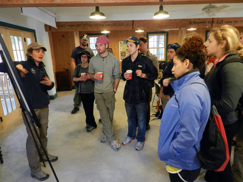
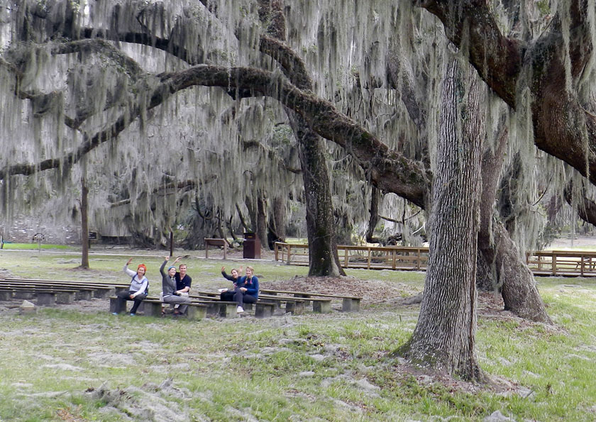
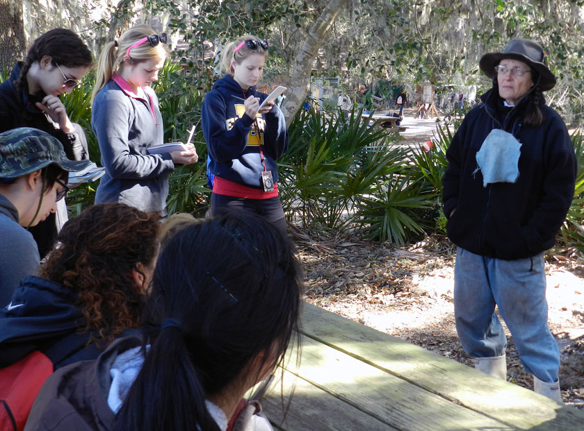
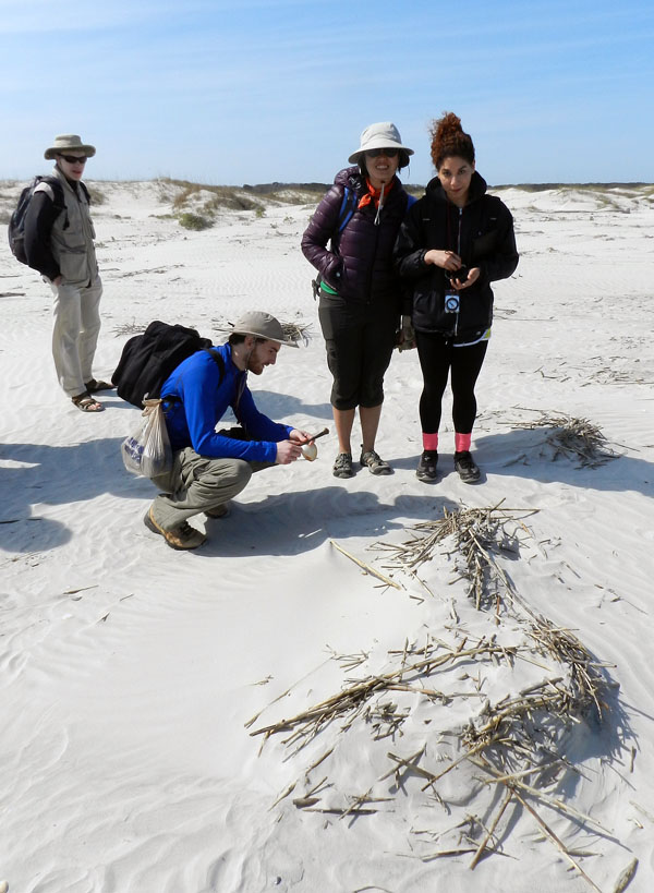
After a 45-minute ferry ride to Cumberland Island, the students received a different sort of lecture when naturalist extraordinaire Carol Ruckdeschel – who is writing a book about the natural history of Cumberland Island – met with them and gave them a brilliant overview of the island ecology. She mostly talked with the students about the effects of feral animals on the island, then spent another hour with us in the maritime forest and through the back-dune meadows. It was a real treat for the students and me, and a great way to start the field trip.

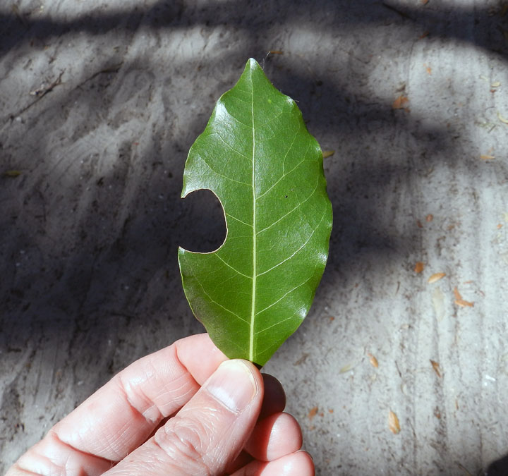
A leaf-cutter bee trace! Despite my writing about these and illustrating them in my book, these distinctive incisions were the first I can recall seeing on the Georgia barrier islands. These traces were abundantly represented in the leaves of a red bay tree we spotted along a trail through the maritime forest, making for a great impromptu natural history lesson for the students.

A freshly erupted ghost shrimp burrow on the beach at Cumberland, in which the students were lucky enough to witness the forceful ejection of muddy fecal pellets by the shrimp from the top of its burrow. I mean, really: explain to me how the life of an ichnologist-educator can get any better than that?

The fine tradition a field lunch, made even more fine by the addition of fine quart sand to our meals, freely delivered by a brisk sea breeze. Did the sand leave any microwear marks on our teeth? I certainly hope so.

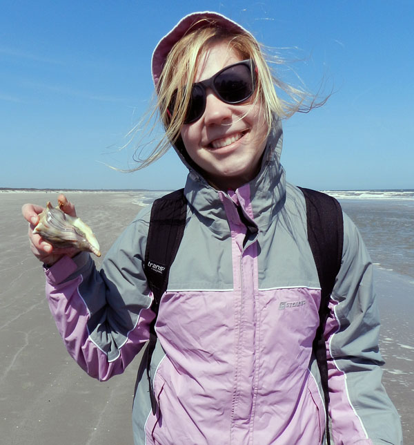
A student is delighted to test my ichnologically based method for finding buried whelks underneath beach sands, and find out that it is indeed correct. (Was there any doubt?) Here she is proudly holding a live knobbed whelk, which I can assure you she promptly placed back into the water once its photo shoot was finished for the day.

Just to join in the fun, other students decided my “buried whelk prospecting” method required further testing. Let’s just say this student did not disprove the hypothesis, but rather seemed to confirm it, and doubly so. It’s almost as if ichnology is a real science! (Yes, these whelks went back into the water, too.)

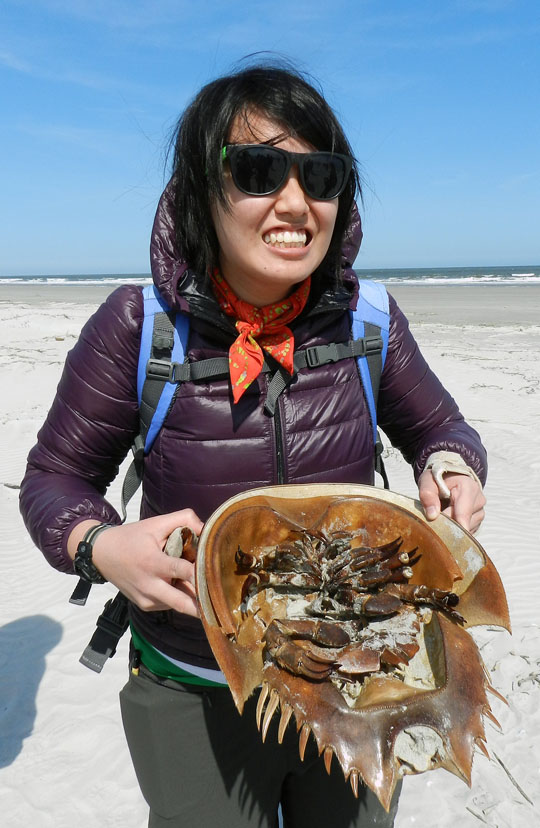
OK, enough about marine predatory gastropods (for now). How about some of the largest horseshoe crabs (limulids) in the world? We found a large deposit of their carapaces above the high-tide mark, some of which were probably molts, but others recently dead. Sadly, though, we did not see any of their traces. Bodies only do so much for me.

Where do dunes come from? Well, a mother and father dune love each other very much… No wait, wrong story. What happens is that dead cordgrass from the salt marshes washes up onto the beach, where it starts slowing down wind-blown sand enough that it accumulates. Now it just needs some wind-blown seeds of sea oats and other plants to start colonizing it, and next thing you know, dune. Dude.

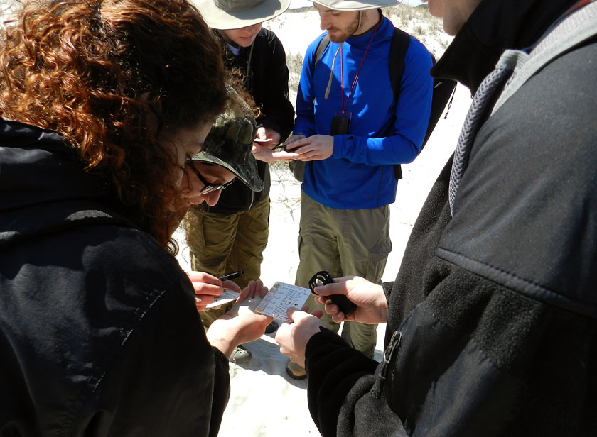
Ah, a geological tradition in action: comparing actual sand from a real outdoor environment to the sand categories on a handy grain-size chart, and using a hand lens. It’s enough to bring a tear to the eyes of this geo-educator. Or maybe that was just the wind-blown sand.

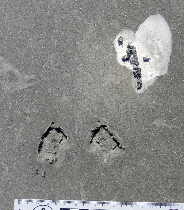
Finally, something that really matters, like ichnology! This is a three-for-one special, too: sanderling feces (left), tracks, and regurgitants (right), the last of these also known as cough pellets. Looks like it had coquina and dwarf surf clams for breakfast.

Wow, more shorebird traces! The tracks are from a loafing royal tern, and it clearly needed to get a load off its mind before moving on with the rest of its day.

Tired of shorebird traces? How about a modern terrestrial theropod? Wild turkey tracks in the back-dune meadows of Cumberland were a happy find, leading to my grilling the students with the seemingly simple question, “What bird made this?” They did not do well on this, but hey, it was the first day, and at least no one said “robin” or “ostrich.”

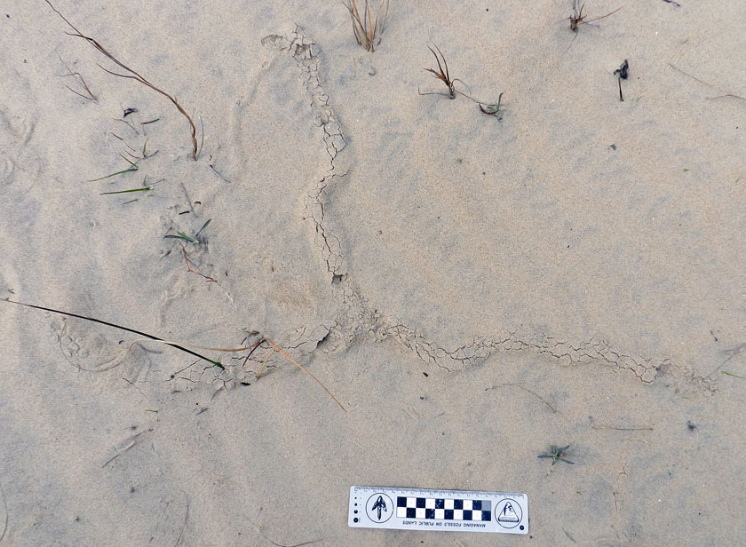
Did somebody say “doodlebug?” This long, meandering, and collapsed tunnel of an ant lion (a larval neuropteran, or lacwing) tells us that this insect was looking for prey in all the wrong places.

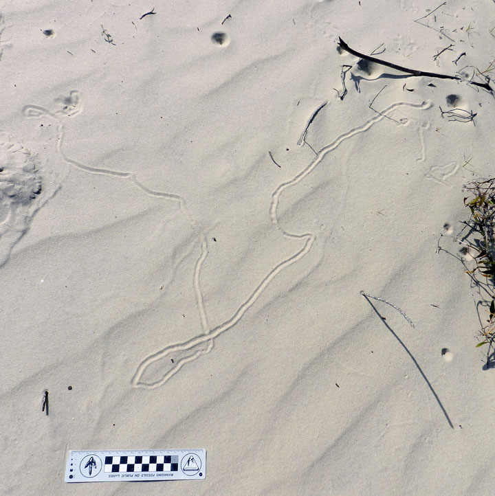
Behold, tracks that bespeak of great, thundering herds of sand-fiddler crabs that used to roam the sand flats above the salt marsh. Where have they gone, and will they ever come back? Who knows where the males might be waving their mighty claws? Do the female fiddler crabs suffer from big-claw envy, or are they enlightened enough to reject cheliped-based hierarchies imposed upon them by fiddler-crab society? All good questions, deserving answers, none of which make any sense.

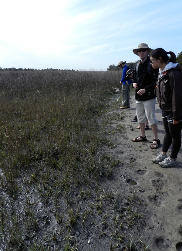
Yes, that’s right, feral horses are really bad for salt marshes. Between overgrazing and trampling, they aren’t exactly what anyone could call “eco-friendly.” My students had heard me say this repeatedly throughout the semester, and Carol Ruckdeschel said the same thing earlier in the day. But then there’s seeing it for themselves, another type of learning altogether.

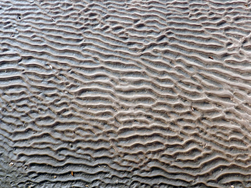
And the day ended with beautiful ripple marks, beckoning from the sandflat below the boardwalk on our trip back onto the ferry. Even this ichnologist can appreciate the aesthetic appeal of gorgeous physical sedimentary structures.

What’s the next island? Jekyll, which is just north of Cumberland along the Georgia coast, visited yesterday. Stay tuned, and look for those photos soon.

Shorebirds Helping Shorebirds, One Whelk at a Time

How might the traces of animal behavior influence and lead to changes in the behavior of other animals, or even help other animals? The sands and the muds of the Georgia barrier islands answer this, offering lessons in how seemingly inert tracks, trails, burrows, and other traces can sway decisions, impinging on individual lives and entire ecosystems, and encourage seemingly unlikely partnerships in those ecosystems. Along those lines, we will learn about how the traces made by laughing gulls (Larus altricilla) and knobbed whelks (Busycon carica) aided sanderlings (Calidris alba) in their search for food in the sandy beaches of Jekyll Island.
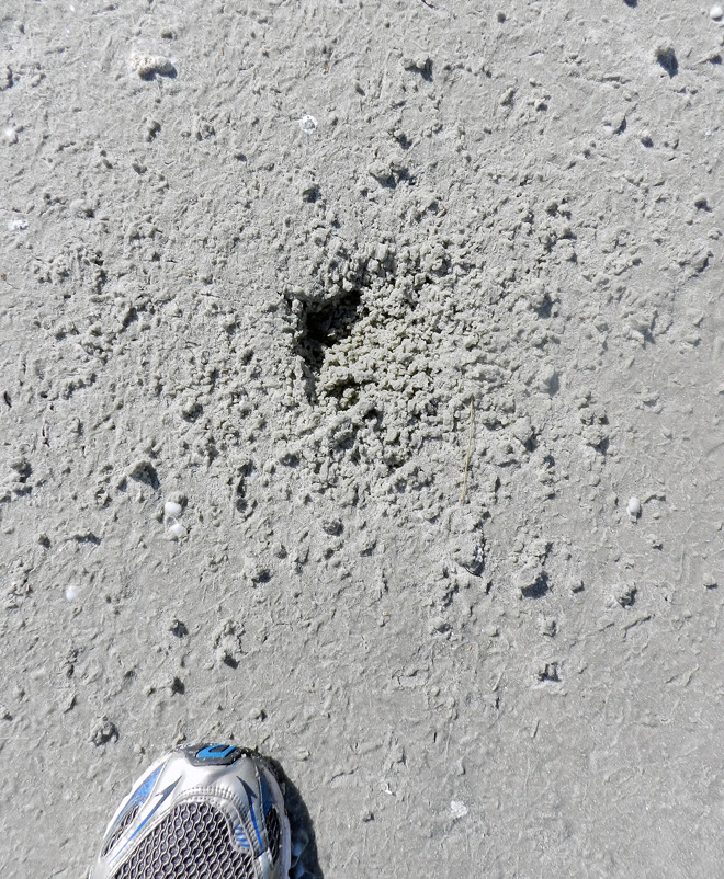
A roughly triangular depression in a beach sand on Jekyll Island, Georgia, blurred by hundreds of tracks and beak-probe marks of many small shorebirds, all of which were sanderlings (Calidris alba). What is the depression, how was it made, and how did it attract the attention of the sanderlings? Scale = size 8 ½ (men’s), which is about 15 cm (6 in) wide. (Photograph by Anthony Martin.)

Last week, we learned how knobbed whelks (Busycon carica), merely through their making trails and burrows in the sandy beaches of Jekyll Island, unwittingly led to the deaths of dwarf surf clams (Mulinia lateralis), the latter eaten by voracious sanderlings. Just to summarize, the dwarf surf clams preferentially burrowed around areas where whelks had disturbed the beach sand because the burrowing was easier. Yet instead of avoiding sanderling predation, the clustering of these clams around the whelks made it easier for these shorebirds to eat more of them in one sitting. Even better, this scenario, which was pieced together through tracks, burrows, and trails, was later verified by: catching whelks in the act of burying themselves; seeing clams burrow into the wakes of whelk trails; and watching sanderlings stop to mine these whelk-created motherlodes of molluscan goodness.
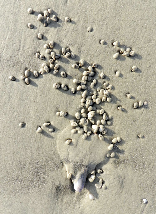
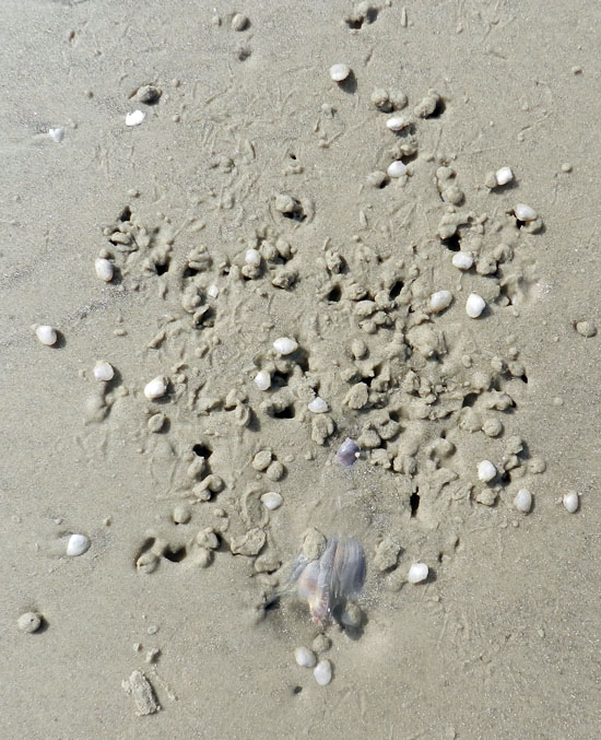
Before and after photos, showing how the burrowing of a knobbed whelk caused dwarf surf clams to burrow in the same small area (top), which in turn provided a feast for sanderlings (bottom); the latter is evident from the numerous tracks, peak-probe marks, and clam-shaped holes marking where these hapless bivalves formerly resided. (Both photographs by Anthony Martin, taken on Jekyll Island, Georgia.)

Was this the only trace-enhanced form of predation taking place on that beach? By no means, and it wasn’t even the only one involving whelks and their traces, as well as sanderlings getting a good meal from someone else’s traces. This is where a new character – the laughing gull (Larus altricilla) – and a cast of thousands represented by the small crustaceans – mostly amphipods – enter the picture. How these all come together through the life habits and traces these animals leave behind is yet another example of how the Georgia coast offers lessons in how the products of behavior are just as important as the behavior itself.

Considering that knobbed whelks are among the largest marine gastropods in the eastern U.S., it only makes sense that some larger animal would want to eat one whenever it washes up onto a beach. For example, seagulls, which don’t need much encouragement to eat anything, have knobbed whelks on their lengthy menus.

So when a gull flying over a beach sees a whelk doing a poor job of playing “hide-and-seek” during low tide, it will land, walk up to the whelk, and pull it out of its resting spot. From there, the gull will either consume the whelk on the spot, fly away with it to eat elsewhere (“take-out”), or reject it, leaving it high and dry next to its resting trace. An additional trace caused by gull predation might be formed when gulls carry the whelk through the air, drop them onto hard surfaces – such as a firmly packed beach sand – which effectively cracks open their shells and reveals their yummy interiors.
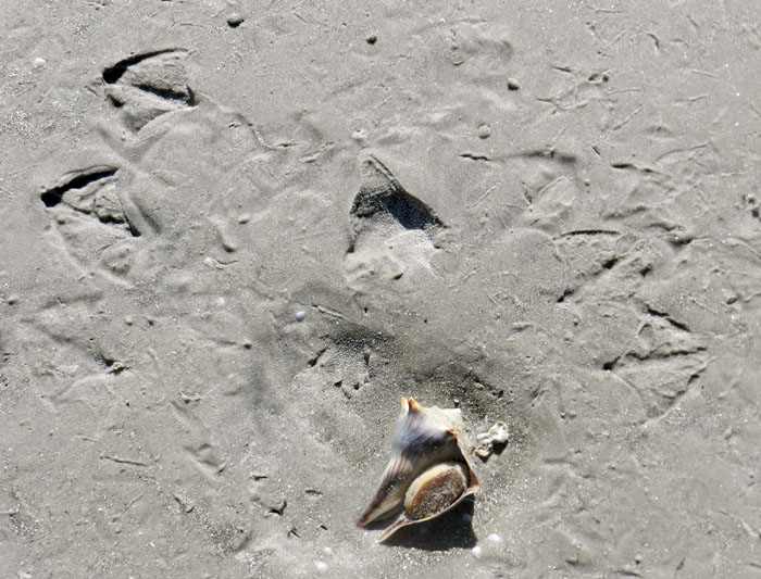
Paired gull tracks in front of a knobbed whelk resting trace, with the whelk tracemaker at the bottom of the photo. Based on size and form, these tracks were made by laughing gulls (Larus altricilla). The one on the left is likely the one that plucked the whelk from its resting trace, as its feet were perfectly positioned to pick up the narrow end of the whelk with its beak. The second gull might have seen what the first was doing and arrived on the scene soon afterwards, hoping to steal this potential meal for itself. For some reason, though, neither one ate it; instead, they discarded their object of desire there on the sandflat. For those of you who wondered if I then just walked away after taking the photo, I assure you that I threw the whelk back into water. At the same time, though, I acknowledged that the same sort of predation and rejection might happen again to that whelk with the next tidal cycle. Other shorebird tracks in the photo are from willets and sanderlings. (Photograph by Anthony Martin, taken on Jekyll Island.)

Sure enough, on the same Jekyll Island beach where we saw the whelk-surf clam-sanderling interactions mentioned last week, and on the same day, my wife Ruth Schowalter and I noticed impressions where whelks had incompletely buried themselves at low tide, only to be pried out by laughing gulls. Although we did not actually witness gulls doing performing, we knew it had happened because their paired tracks were in front of triangular depressions, followed by more tracks with an occasional discarded (but still live) whelk bearing the same dimensions as the impression.
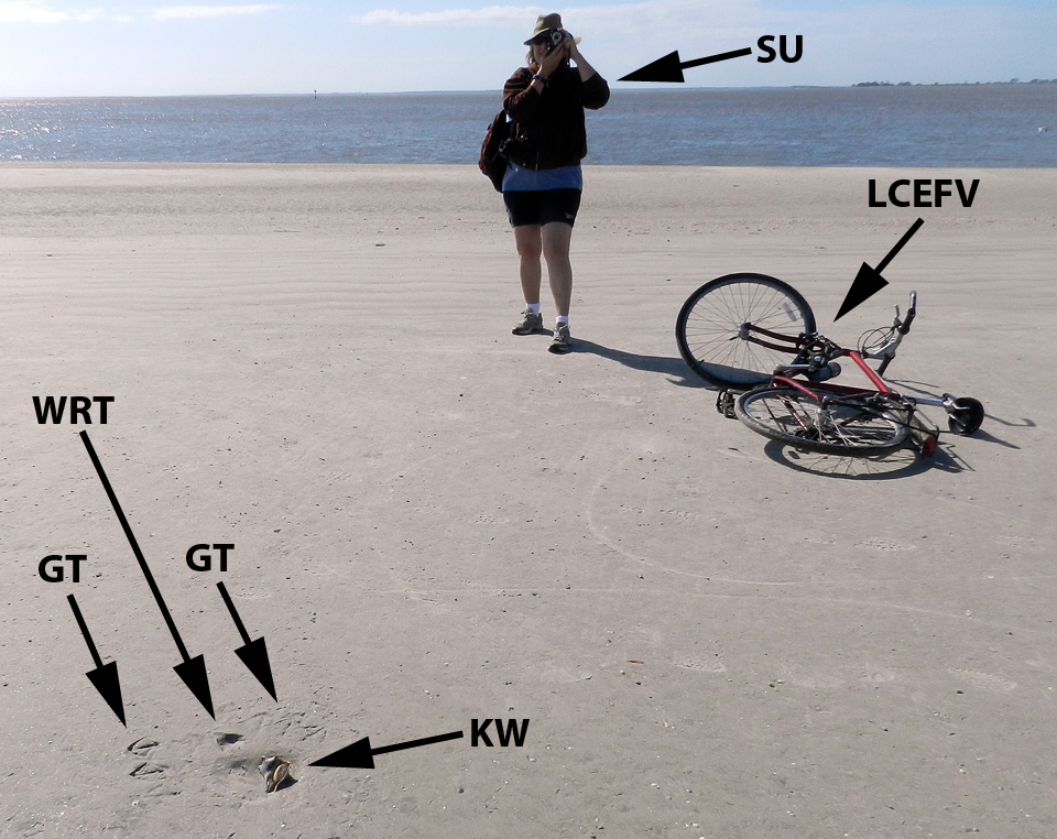
My wife Ruth aptly demonstrates how to document seagull and whelk traces (foreground) while on bicycle, no easy feat for anyone, but a cinch for her.  Labels are: GT = gull tracks; WRT = whelk resting trace; KW = knobbed whelk; SU = spousal unit; and LCEFV = low-carbon-emission field vehicle. (Photograph by Anthony Martin, taken on Jekyll Island, Georgia.)

With this search image of a whelk resting trace in mind, we then figured out what had happened in a few places when we saw much more vaguely defined triangular impressions. These were also whelk resting traces, but they were nearly obliterated by sanderling tracks and beak marks; there was no sign of gulls having been there, nor any whelk bodies. Hence these must have been instances of where the gulls flew away with their successfully acquired whelks to drop them and eat them somewhere else. But why did the sanderlings follow the gulls with the shorebird equivalent of having a big party in a small place?
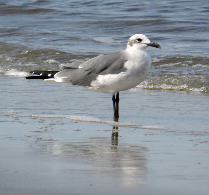
Yeah, I did it: so what? A laughing gull, looking utterly guiltless, stands casually on a Jekyll Island beach, unaware of how its going after knobbed whelks also might be helping its little sanderling cousins find amphipods. (Photograph by Anthony Martin.)

Although many people may not know this, when they walk hand-in-hand along a sandy Georgia beach, a shorebird smorgasbord lies under their feet in the form of small bivalves and crustaceans. The latter are mostly amphipods (“sand fleas”), which through sheer number of individuals can compose nearly 95% of the animals living in Georgia beach sands. Amphipods normally spend their time burrowing through beach sands and eating algae between sand grains or on their surfaces.
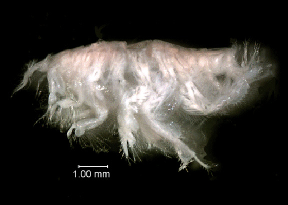
Close-up view of the amphipod Acanthohaustorius millsi, one of about six species of amphipods and billions of individuals living in the beach sands of the Georgia barrier islands, all of which are practically begging small shorebirds to eat them. Photo from here, borrowed from NOAA (National Oceanic and Atmospheric Administration – a very good use of U.S. taxpayer money, thank you very much) and linked to a site about Gray’s Reef National Marine Sanctuary, which is about 30 km (18 mi) east of Sapelo Island, Georgia.

Because amphipods are exceedingly abundant and just below the beach surface, they represent a rich source of protein for small shorebirds. But if you really want to make it easier for these shorebirds to get at this food, just kick your feet as you walk down the beach. This will expose these crustaceans to see the light of day, and the shorebirds will snap them up as these little arthropods desperately try to burrow back into the sand. This, I think, is also what happened with the gulls pulling whelks off the beach surface. Through the seemingly simple, one-on-one predator-prey act of a gull picking up a whelk, it exposed enough amphipods to attract sanderlings, which then set off a predator-prey interaction between the sanderlings and amphipods, all centered on the resting trace of the whelk.
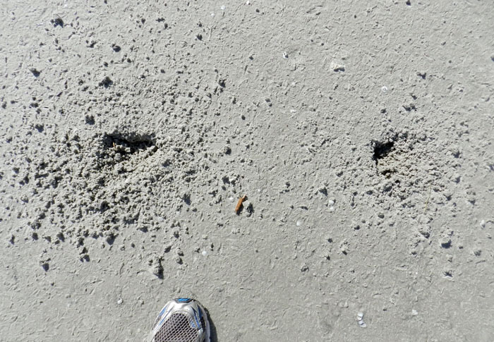
Two whelks near one another resulted in two resting traces, and now both are missing, which likely means they were taken by laughing gulls. Notice how all of the sanderling trampling and beak marks have erased any evidence of the gulls having been there. (Photograph by Anthony Martin, taken on Jekyll Island.)

So as a paleontologist, I always ask myself, how would this look if I found something similar in the fossil record, and how would I interpret it? What I might see would be a dense accumulation of small, overlapping three-toed tracks – with only a few clearly defined – and an otherwise irregular surface riddled by shallow holes. The triangular depression marking the former position by a large snail, obscured by hundreds of tracks and beak marks, might stay unnoticed, or if seen, could be disregarded as an errant scour mark. The large gull tracks would be gone, overprinted by the many tracks and beak marks of the smaller birds.
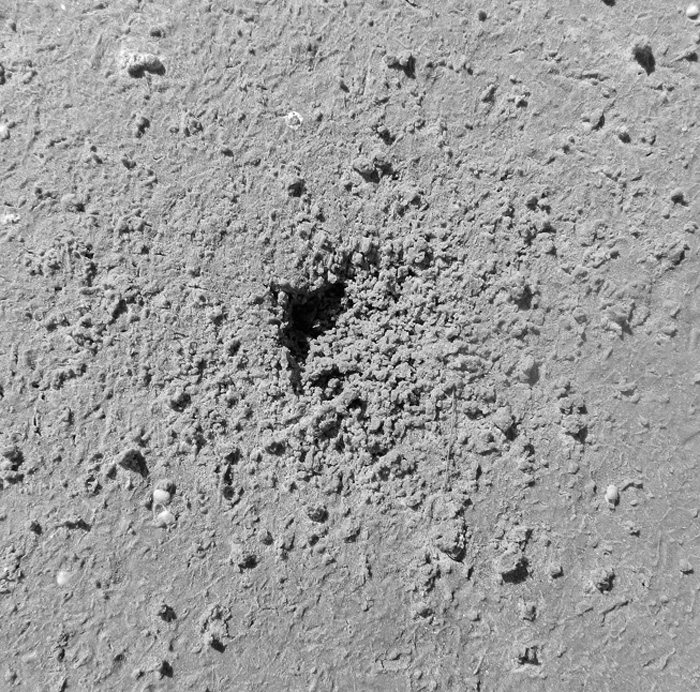
Take a look again at the scene shown in the first photograph, and imagine it fossilized. Could you piece together the entire story of what happened, even with what you now know from the modern examples? I’m sure that I couldn’t. Scale bar = 15 cm (6 in). (Photograph by Anthony Martin.)

Hence the role of the instigator for this chain of events, the gull or its paleontological doppelganger, as well as its large prey item, would remain both unknown and unknowable. It’s a humbling thought, and exemplary of how geologist or paleontologist should stop to wonder how much they are missing when they recreate ancient worlds from what evidence is there.
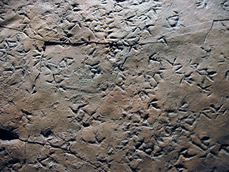
Cast (reproduction) of a dense accumulation of small shorebird-like tracks from Late Triassic-Early Jurassic rocks (about 210 million years old) of Patagonia, Argentina. These tracks are probably not from birds, but from small bird-like dinosaurs, and they were formed along a lake shoreline, rather than a seashore. Nonetheless, the tracemaker behaviors may have been similar to those of modern shorebirds. Why were these animals there, and what were they eating? Can we ever know for sure about what other animals preceded them on this small patch of land, what these predecessors eating, and how their traces might have influenced the behavior of the trackmakers? (Photograph by Anthony Martin; cast on display at Museo de Paleontológica, Trelew, Argentina.)
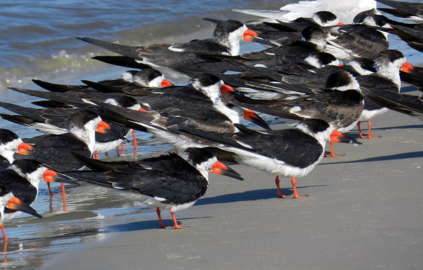
Another parting lesson that came out of these bits of ichnological musings is that all of the observations and ideas in this week’s and last week’s posts blossomed from one morning’s bicycle ride on a Georgia-coast beach. Even more noteworthy, these interpretations of natural history were made on an island that some scientists might write off as “too developed” to study, its biota and their ecological relationships somehow sullied or tainted by a constantly abundant and nearby human presence. So whenever you are on a Georgia barrier island, just take a look at the life traces around you, whether you are the only person on that island or one of thousands, and prepare to be awed.

Further Reading

Croker, R.A. 1968. Distribution and abundance of some intertidal sand beach amphipods accompanying the passage of two hurricanes. Chesapeake Science, 9: 157-162.

Elbroch, M., and Marks, E. 2001. Bird Tracks and Sign of North America. Stackpole Books. Mechanicsburg, Pennsylvania: 456 p.

Grant, J. 1981. A bioenergetic model of shorebird predation on infaunal amphipods. Oikos, 37: 53-62.

Melchor, R. N., S. de Valais, and J. F. Genise. 2002. The oldest bird-like fossil footprints. Nature, 417:936938.

Wilson, J. 2011. Common Birds of Coastal Georgia. University of Georgia Press, Athens, Georgia: 219 p.