Tales of Trails by Seahorse Tails

I’ve always been a big fan of aquariums. Having grown up in the landlocked Midwest and not seeing an ocean with its bountiful life until I was 20 years old, I am still drawn to the old-school charm of big tanks filled with salt water and populated by exotic fish and other sea critters. These environments, however artificial, never fail to inspire awe and wonder. Even better, they often teach me something new and relevant each time I pay closer attention to what they hold.

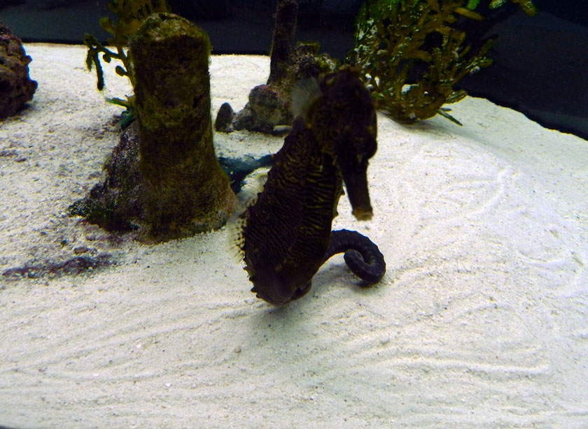
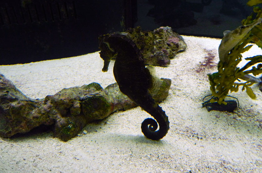
Seahorse-Making-Resting-TraceA seahorse, of course, is not a horse. But that’s not the only way seahorses differ from horses, in that they leave trails instead of tracks. Intrigued? Yeah, me too. (Photograph by Anthony Martin, taken at the UGA Aquarium, Skidaway Island, Georgia.)

Nonetheless, I also have a “problem,” which manifests itself whenever I’m at an aquarium, walking along a beach, sitting on a park bench, driving down a  road, or, well, conscious. As an ichnologist, I’m constantly looking for animal traces. Then once found, I study these traces carefully so that they may inform me whenever I see similar traces in the fossil record. But because I’m a land-dweller and rarely have the opportunity to snorkel or scuba-dive, aquariums come in handy for observing traces of aquatic animals I might not often see. Particularly helpful are aquariums in which the people caring for them were kind enough to include sand on their bottoms (the aquariums, that is).

So last weekend, while leading a class field trip to the Georgia coast and after a wonderful boat ride to Wassaw Island and back, I eagerly joined my students in viewing a salt-water aquarium. This particular venue was the UGA Aquarium (UGA = University of Georgia, Athens) is maintained by the UGA Marine Extension Service (MAREX) on Skidaway Island, Georgia. Our visit was especially satisfying because we were there on a Sunday afternoon, when the aquarium is closed to the public. This luxury afforded us plenty of room and quietude, qualities that are rumored to enhance learning.

Within just a few minutes of entering the main room, one tank to the right caught my eye, and not just because of its pretty colors, but for its denizens and traces on the sandy bottom of that tank. It contained seahorses, fishes that are so odd compared to other fishes, we humans had to compare them to hoofed domesticated mammals. The best part of all, though, was that this tank had lots of intersecting grooves and circular imprints on its sandy surface, which no doubt had been made by the seahorses.

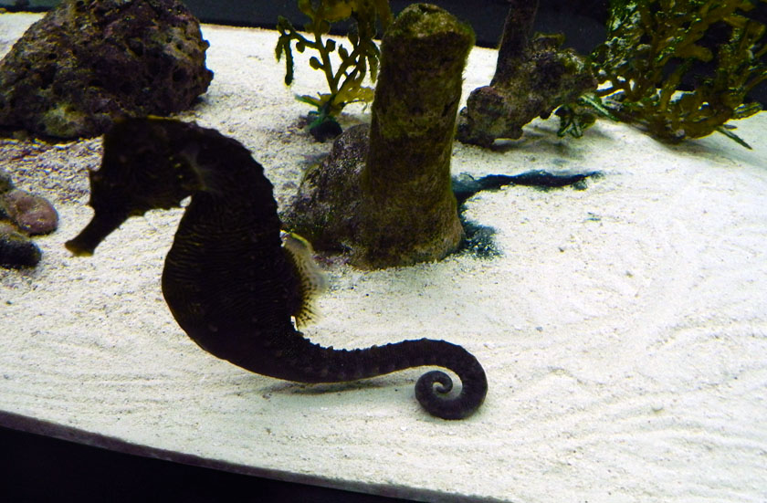
Seahorse-Making-TrailA seahorse (Hippocampus sp.) showing off its lack of swimming skills by moving along the sandy bottom of a tank. Gee, what are all of those meandering and intersecting grooves in the sand and circular imprints? I wonder what made those? Sorry, first guess doesn’t count. (Photograph by Anthony Martin, taken at the UGA Aquarium, Skidaway Island, Georgia.)

All seahorses are under the genus Hippocampus, which consists of more than fifty species. Evolutionarily speaking, they are ray-finned fish (actinopterygians) and share a common ancestor with pipefish and sea dragons (Sygnathidae). The oldest known fossil seahorses are in Miocene Epoch rocks, from about 13 million years ago. Besides their equine-like profiles, they are well known for their prehensile tails, which can either grasp onto algae, sponges, or corals, or curl up underneath them as they swim.

However, seahorses are never going to inspire bets at underwater race tracks, as they are among the slowest-swimming of fish, propelled mostly by tiny pectoral fins while moving upright. Still, they don’t need to be fast, as they are very successful predators, with about 90% accuracy in nabbing fast-swimming small crustaceans that get too close to their mouths. Seahorses also don’t need to swim away from larger predatory fishes that might wish to pick them from a seafood menu. Whenever seahorses attach to algae and corals, they sway in harmony with their temporary hosts, effectively blending in with their surroundings.

One point I keep in mind whenever visiting an aquarium, zoo, or other such enclosures is how these can alter so-called “normal” behaviors of their animals. In this instance, the smaller space of this tank, combined with little material for attachment, meant these seahorses were more likely to swim along its bottom then they might in an open ocean. Accordingly, they had made lots of traces in the sand: mostly undulating grooves, but a few circular impressions from their curled tails plopping onto one side or the other.

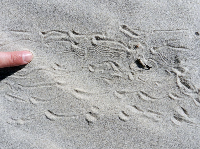
Seahorse-Making-Trail-2A seahorse making tail trails while swimming along the bottom of an aquarium. Notice how the trail would become less linear, wider, and more circular if the tail flops over to one side or another, involving a greater area of the curled end. (Photograph by Anthony Martin, taken at the UGA Aquarium, Skidaway Island, Georgia.)

Seahorse-TrailsA close-up of those trails left by swimming seahorses dragging their tails along a sandy surface. Also, check out the overlapping circular “plop” traces on the right, made by the curled part of the tail? (Photograph by Anthony Martin, taken at the UGA Aquarium, Skidaway Island, Georgia.)

What’s the take-home message of these observations for ichnologists, geologists, and paleontologists? That experience matters, as does questioning preconceived notions about what we might observe from the geologic record. Take a look at the preceding photo, and tell me – quite honestly – that your very first interpretation of the tracemakers would have been “fish,” let alone “seahorse.” Instead, I think nearly everyone (yes, me too) would have reached for the easiest answer, which would have been “worm trails,” similar to how geologists reflexively apply “worm burrows to anything small, tubular trace fossil they encounter at an outcrop. Wrong, wrong, wrong.

So next time when looking at rocks formed in marine environments – whether from the last 13 million years or much older – and these rocks host lots of “worm trails” on their surfaces, ask yourself who else could have made such trails, and how. Reach beyond easy and ordinary explanations, and imagine. Oh, and when you go to aquariums, don’t just look at their sea-life, but also the traces of the sea-life in them.

The Ichnology of Godzilla

Upon learning that Godzilla would be making its way back onto movie screens this summer, my first thought was not about whether it would it would serve as a powerful allegory exploring the consequences of nuclear power. Nor did I wonder if it would be a metaphor of nature cleansing the world’s ecological ills through the deliberate destruction of humanity. Surprisingly, I didn’t even ponder whether the director of this version (Gareth Edwards) would have our hero incinerate Matthew Broderick with a radioactively fueled exhalation as cinematic penance for the 1998 version of Godzilla.

Instead, my first thought was, “Wow, I’ll bet Godzilla will leave some awesome tracks!”  My second thought was, “Wow, I’ll bet Godzilla will leave some awesome bite and claw marks!” My third thought was, “Wow, I’ll bet Godzilla will leave some awesome feces!” All of these musings could be summarized as, “Wow, I’ll bet Godzilla will leave awesome traces, no matter what!”

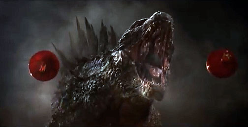
Godzilla-RoaringGodzilla: King of the Tracemakers. (Image and most others here from the movie were taken as screen-capture stills from the official trailer here and modified slightly for your science-learning pleasure.)

So as an ichnologist who is deeply concerned that movie monsters make plenty of tracks and other traces whilst rampaging, I am happy to report that yes, this Godzilla and its kaiju compatriots did indeed make some grand traces. Could they have made traces worthy of ichnological appraisal, ones that could be readily compared to trace fossils made by Godzilla’s ancestors? Yes, but these traces could have been better, and let me explain why.

[Minor spoilers follow, not least of which include the not-surprising news that The King of the Monsters prevails in the end, inevitably setting up a sequel in which I sincerely hope Godzilla and his rivals make more easily defined traces.]

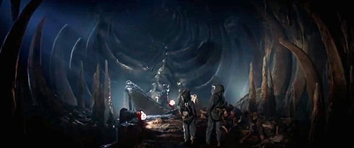
Early on in the movie – set in 1999 – a surface mine in the Philippines collapses. Drs. Ishiro Serizawa (Ken Watanabe) and Vivienne Graham (Sally Hawkins) are summoned to the site and quickly whisked underground. There they find a spacious chamber containing body fossils – bones or similar endoskeletal parts – of an enormous creature. Instantly, I began yawning. I mean, body fossils: how boring.

Muto-Egg-Chamber-BonesA bit of paleontology near the start of Godzilla, in which some of the humans (who are mostly irrelevant) find skeletal remains underneath a surface mine. Little do they know they’re about to undergo enlightenment and become ichnologists.

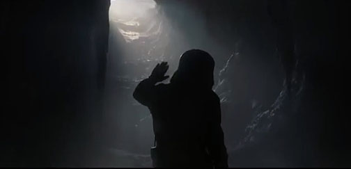
But then I sat upright in my seat when I realized – along with the screen scientists – that this chamber wasn’t a mere tomb, but also a place of rebirth: it was a hatching chamber. Views from inside and outside of the chamber then revealed the ichnological money shots of the movie, showing first an emergence burrow, then an emergence crater* connecting to a trail, the latter cutting a swath through the forest and leading directly to the sea. This was trace evidence of a yet-unseen monster that was very much alive, and one that was brooded and born in a subterranean terrestrial environment, but then moved to an oceanic environment.

Muto-Emergence-BurrowDr. Serizawa sees light at the end of the tunnel, and it’s not from an oncoming train, but something far worse. Still, it’s a cool example of an emergence burrow, so there was some consolation.

Muto-Larval-TrailKaiju emergence burrow connected with a kaiju trail, leading to the sea. So this is definite trace evidence of a heterometabolous animal, with different stages of its metamorphism (terrestrial egg –> marine larva) taking place in different environments. Unlike, you know, Gregor Samsa, who just stayed terrestrial.

A map of seismic signatures shown later in the film denoted where the animal burrowed in the seafloor from the Philippines to Japan, which would have made for one hell of a burrow. Why was this massive animal using so much energy to burrow to Japan? For some radiogenic sustenance, of course, which was conveniently located in a nuclear-power plant there. The “M.U.T.O.,” (= “Massive “Unidentified Terrestrial Object”) then caused a collapse of that power plant, thus qualifying as a feeding trace, rather than plate-tectonic-induced earthquake damage, which is what became the official story. That’s right, geophysicists: you’d better start studying some ichnology if you want to correctly interpret what’s causing those rapid releases of tensional energy that excite you so much. (I’m talking about earthquakes, you perverts.)

Anyway, people die, 15 years pass, families grow apart, blah blah blah, when the action finally returns to something that really matters, like monsters making traces. It turns out the Japanese government had been hiding the truth from the public, which, much like Tom Cruise, can’t handle it. The kaiju not only fed on a nuclear reactor in Japan, but also pupated there. As an example of how gigantic, deadly animal traces can be the real “job creators” in a modern economy, a huge industrial complex with hundreds of Japanese and American employees was monitoring the cocoon, with Drs. Serizawa and Graham as scientific advisors.

Watanabe-Hawkins-IchnologistsWho knew these actors – Ken Watanabe and Vivienne Graham – were actually playing ichnologists in the new Godzilla movie? Just about nobody, including them. (Photograph originally credited to Kimberley French, AP, and much reproduced elsewhere.)

The adult M.U.T.O. that emerged from the cocoon fractured the outer casing, broke through the steel cables that were supposed to restrain it, and immediately started making some tracks. So those are some mighty fine traces, and it was a pleasure watching them get made.

What about its tracks, though? Despite the kaiju’s blend of tetrapod and insect qualities, it had eight appendages and used six while walking – four forelimbs, two of which were wings, and two hindlimbs – making it hexapedal. Moreover, it used an alternating gait, similar to those used by pterosaurs or bats (if they had an extra pair of limbs, that is). Hook-like ends on the forelimbs would have made elongate impressions, and literally impressed a few panicked employees as the monster escaped. On the other hand, er, appendage, the hindlimbs looked as if they were terminated by flat-bottomed hooves. So if one were inclined to track this M.U.T.O, its trackway patterns might have looked like the following:

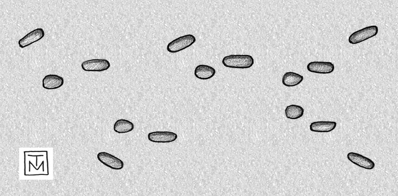
MUTO-Trackway-Pattern-GodzillaHypothesized male (winged) M.U.T.O. trackway pattern, moving from left to right, showing normal walking that ends with take-off. Wing impressions are on the outside and angled, whereas the forelimb tracks are just inside the trackway, and the hindlimb tracks are closest to the midline. Take-off pattern is at the end, with wing impressions forward so that, like a giant pterosaur, it could “pole vault” for its launch. What’s the scale? Really big. (Illustration by Anthony Martin.)

Toward the end of this scene, we find out this kaiju was also flight capable, as it takes off from its former pupation site. Accordingly, it would have made both take-off and landing track patterns, which have been interpreted in the fossil record for pterosaurs and birds, but from nothing nearly as big. (Oh, how I dream of finding Queztalcoatlus take-off or landing tracks some day…) This switch from terrestrial to aerial locomotion is noted in one of the few funny lines uttered in the movie, when U.S. Navy Admiral William Stenz (David Strathairn) first refers to the kaiju as a M.U.T.O., but then updates the status of its behavioral ecology by saying, “It is, however, no longer terrestrial, as it is airborne.”

Later in the movie, another tracemaking M.U.T.O. emerges from its pupation site –a nuclear-waste repository in Yucca Mountain, Nevada – and proceeds to leave a trail of devastation through Las Vegas, which included killing lots of people who probably bet that wouldn’t happen to them.

Muto-Trail-Las-VegasLeaving Las Vegas, female M.U.T.O. style, with a well-defined trail in its wake, and perhaps knowing it should have taken a left turn at Albuquerque. Hey, U.S. military: I think it went that way!

This kaiju was female and much larger than the male, thus providing a great example of sexual dimorphism in tracemakers of the same species, as seen in horseshoe crabs (limulids) and many other animals. This meant its trackway width would have been correspondingly wider than that of the male, and its tracks larger. It also lacked wings, with the homologous pair of limbs used instead for walking. Consequently, the kaiju’s locomotion (and hence its tracemaking) was restricted to terrestrial environments, with no take-off or landing tracks. So if any more of these monsters came out of the ground, such ichnological knowledge might come in handy for the U.S. military (or recreational hunters) to know which gender of a M.U.T.O. pair they might be tracking.

Muto-Bioerosion-BoringBioerosion trace (boring) made by M.U.T.O. as it encountered a human commerce-generating hive in San Francisco. Unlike most bioeroson structures, this is a locomotion trace, rather than a dwelling or feeding trace.

Other tracemaking done by the M.U.T.O.s included mastication marks on a Russian nuclear submarine and some ICBMs, a little bit of bioerosion when they walked through buildings, and – following some kaiju courtship and sexy time – a nest structure made in San Francisco (no doubt inspiring a new song titled I Left My M.U.T.O. Nest in San Francisco). The nest structure was in the style of those made by many shorebirds, looking like a scratched-out hollow, with the trivial differences of being hundreds of meters across, about a hundred meters deep, and composed of urban debris. The fertilized eggs were in the middle of the structure and attached to an ICBM, like a sort of atomic yolk sac. Overall, it was a tremendous nest structure, dwarfing those likely made by the largest known sea turtle, Archelon from the Late Cretaceous Period, which would have been a mere 10-15 m (33-67 ft) across.

OK, enough about the M.U.T.O. tracemakers. What about our beloved behemoth, The King of the Monsters, The Stomper with the Chompers, Godzilla? The movie – much like this review – held him back until about an hour into the story, only giving us teasing glimpses from photographs over the past 60 years. Sure, this was done deliberately to build suspense, but the title of the movie wasn’t M.U.T.O.s Making Traces (although it could have been, and I would’ve been fine with that). So I was more than ready for Godzilla to leave some tracks, bite marks, and other megatraces that would have made the world’s largest dinosaurs’ traces look puny by comparison.

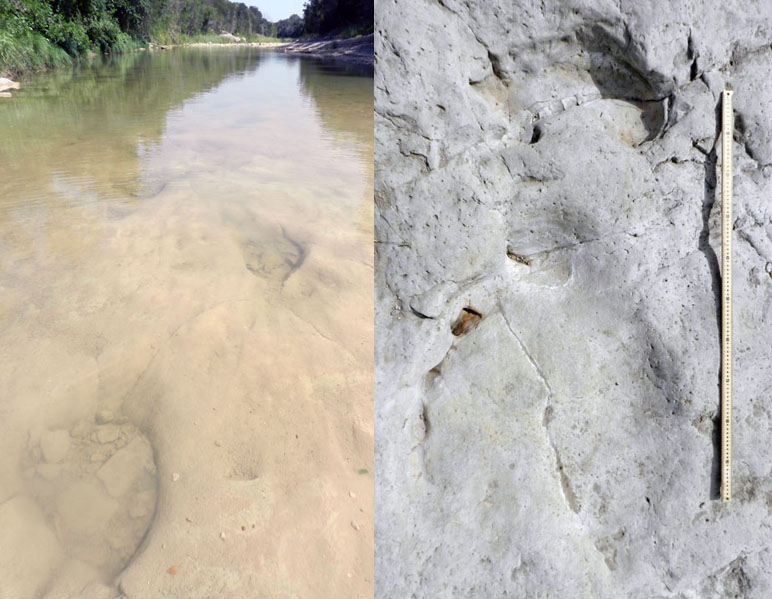
Sauropod-Tracks-Texas-GodzillaTracks on the left are of a sauropod dinosaur trackway in an Early Cretaceous (about 100-million-years-old) limestone bedrock in the Paluxy River of Texas. Tracks on the right are in rocks of same age and area, with left-side front- and rear-foot tracks; the stick is a meter long. For comparision, one Godzilla track would exceed the width of the river. (Both photographs by Anthony Martin, taken in Dinosaur Valley State Park, Texas; to read more about those tracks, go here.)

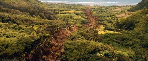
Did Godzilla leave any clearly defined tracks in the film? Oddly enough, no: imagine my disappointment. Such a glaring ichnological absence led me to believe that Godzilla tracks must not have been a high priority in director Gareth Edwards’s mind while making the film. This is also a rare instance of where the 1998 version of Godzilla surpassed the 2014 one, in that a few nicely outlined tracks were shown in the former.

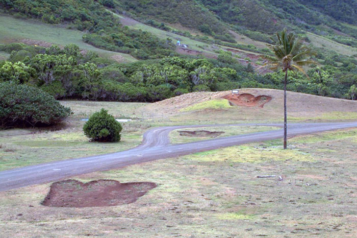
Godzilla-Trackway-HawaiiGodzilla trackway made for 1998 movie, still visible on Oahu, Hawaii. Photo from http://the-american-godzilla.wikia.com/, credited to “Varg2000.”

However, had Edwards decided to add the scientific excitement that would have been induced by overhead views of Godzilla tracks, they would have looked a lot different from the 1998 ones. Although all movie versions of Godzilla have shown it as bipedal on land, the monsters’ feet have been different. For instance, the 1998 Godzilla tracks were definitely modeled after those of theropod dinosaurs, with three separated and forward-pointing toes adorned by sharp claws, albeit greatly up-scaled. According to a reporter in Hawaii who saw one of the Godzilla footprints, he estimated it was about 12 feet long (3.6 m). So using a footprint formula applied to theropod dinosaurs, where the footprint length is multiplied by 4.0, the hip height of that Godzilla would have been 48 feet (14.5 m).

For those of you who have a monster foot fetish, you’re in for a treat. This video shows nothing but close-ups of Godzilla‘s feet landing on and crushing stuff in the 1998 movie.

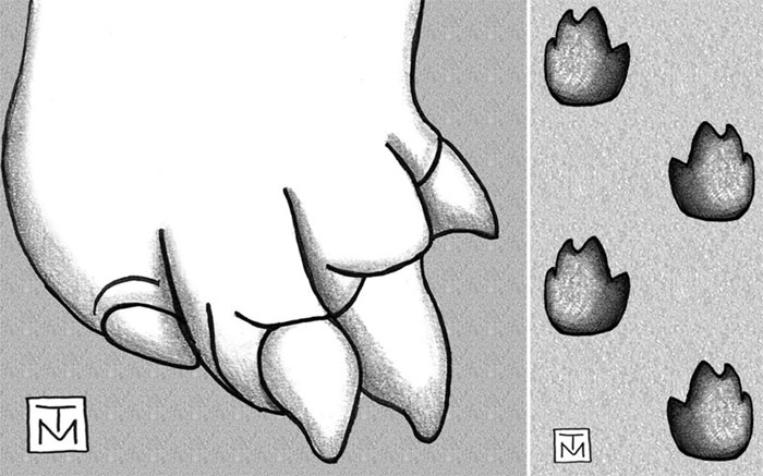
In contrast, the new Godzilla not only had a pedicure, but also a major foot makeover. Instead of three separate toes, this one has four toes scrunched together into more of an elephantine or sauropod-like configuration. It still has claws, but they look much more robust than those of the previous theropod-like feet of its predecessor, and more like those of a sauropod. Accordingly, Godzilla tracks from the 1998 movie versus the 2014 one would have been way different from one another. This means that a skilled movie-consulting ichnologist could have easily distinguished the two films just by glancing at tracks shown in each. (Mr. Edwards, please do keep me in mind if you need an ichnological advisor for Godzilla 2.)

Godzilla-Foot-Trackway-Pattern(Right) Right-foot anatomy of 2014 version of Godzilla, nearly as wide as long and with four digits ending in stout claws. (Left) Hypothesized trackway pattern for present version of Godzilla, using its normal city-destroying gait. Notice its wide stance, like that of a certain retired U.S. senator. A tail drag-mark is not included in this diagram, but probably would have registered once Godzilla stood more upright, such as to kick some M.U.T.U. abdomen. (Both illustrations by Anthony Martin, but foot anatomy is composite drawn freehand from unattributed online photos, such as this one.)

Something important to also note about these trackways is the lack of any tail drag marks. This is because both the 1998 and 2014 Godzillas kept their tails off the ground, which aligns with modern interpretations of how theropod dinosaurs walked. The original Godzilla – and many sequels after it – showed it dragging a weighty tail behind it. This behavior would have left a deep groove in the middle of the trackway, perhaps with a slight undulating pattern caused by side-by-side movement. This would have looked sort of like an alligator or crocodile trackway, but with only right-left tracks, because Godzilla was walking more like some guy wearing a rubber suit.

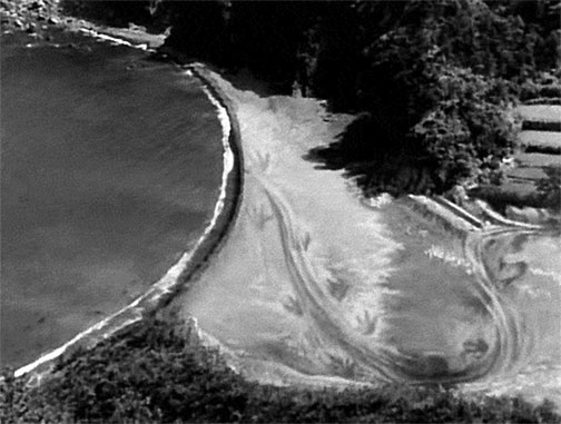
Godzilla-Trackway-1954Still taken from original 1954 Godzilla (Gojira), showing a bipedal trackway going from a terrestrial to marine environment. But also check out the prominent groove in the middle of the trackway, caused by a tail dragging behind it, and four forward-pointing toes on each foot.

What other traces would I have really liked to see Godzilla make, ones that would have made me stand up in the theater and scream “Ichnology for the win”? My #1 and # 2 choices, in that order, would have been urination marks and feces. In my latest book, Dinosaurs Without Bones (2014, Pegasus Books), I’ve written about trace fossils linked with dinosaur urination and defecation; dinosaur coprolites in particular are great trace fossils for showing what dinosaurs had for lunch millions of years ago. Alas, Godzilla performed neither excretory behavior in the movie, but that didn’t stop at least one scientist from speculating on how much urine this Godzilla would have produced.

So for my upcoming post, I’ll explore the possibility of a Godzilla urination trace. What mark would Godzilla have left if he got really pissed? Tune in next week, and in the meantime, enjoy seeing the movie. but now with an added ichnological perspective.

Other “Science and Godzilla” Posts

The Impossible Anatomy of Godzilla (Danielle Venton)

Godzilla Gets Bigger Every Year (Rhett Allain)

The Impossible Gait of Godzilla (Ria Misra)

The Ever Increasing Size of Godzilla: Implications for Sexual Selection and Urine Production (Craig McClain)

Reviewing the Science of Godzilla for Plausibility and Imagination (Mika McKinnon)

The Science of Godzilla (Scott Sutherland)

The Science of Godzilla, 2010 (Darren Naish)

*Just as a cool astronomical-geological-ichnological-cultural aside, indigenous Australians first interpreted a meteorite impact structure in Wolfe Creek Crater National Park of Western Australia as an emergence crater made a great, burrowing snake. Some stories that involve traces seem to repeat themselves in our human history.

The Paleozoic Diet Plan

Given the truth that the Atlantic horseshoe crab (Limulus polyphemus) is more awesome than any mythical animal on the Georgia coast (with the possible exception of Altmaha-ha, or “Altie”), it’s no wonder that other animals try to steal its power by eating it, its eggs, or its offspring. For instance, horseshoe-crab (limulid) eggs and hatchlings provide so much sustenance for some species of shorebirds – such as red knots (Calidris canutus) and ruddy turnstones (Arenaria interpres) – that they have timed their migration routes to coincide with spawning season.

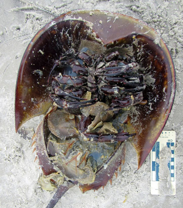
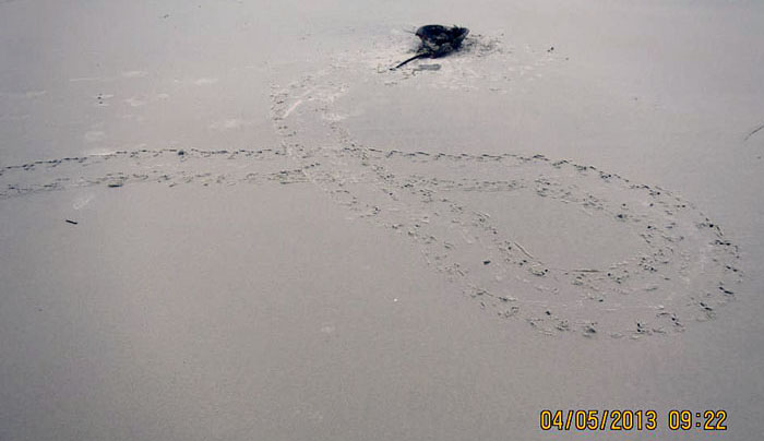
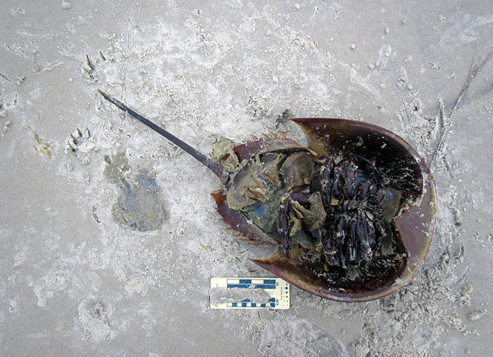
Ravaged-Limulid-SCISomething hunted down, flipped over, and ate this female horseshoe crab while it was still alive. Who did this, what clues did the killer leave, and how would we interpret a similar scenario from the fossil record? Gee, if only we knew some really cool science that involved the study of traces, such as, like, I don’t know, ichnology. (Photograph by Gale Bishop, taken on St. Catherines Island, Georgia, on May 4, 2013.)

Do land-dwelling birds mammals eat adult horseshoe crabs? Yes, and I’ve seen lots of evidence for this on Georgia beaches, but from only three species: feral hogs (Sus crofa) and vultures (Coragyps atratus and Cathartes aura: black vultures and turkey vultures, respectively). In all of these interactions, no horseshoe-crab tracks were next to their bodies, implying they were already dead when consumed; their bodies were probably moved by tides and waves after death, and later deposited on the beach. This supposition is backed up by vulture tracks. I’ve often seen their landing patterns near the horseshoe-crab bodies, which means they probably sniffed the stench of death while flying overhead, and came down to have an al fresco lunch on the beach.

Nonetheless, what I just described is ichnological evidence of scavenging, not predation. So I was shocked last month when Gale Bishop, while he was monitoring for sea-turtle nests on St. Catherines Island (Georgia), witnessed and thoroughly documented an incident in which a raccoon (Procyon lotor) successfully preyed on a live horseshoe crab. Yes, that’s right: that cute little bandit of the maritime forest, going down to a beach, and totally buying into some Paleozoic diet plan, a passing fad that requires eating animals with lineages extending into the Paleozoic Era.

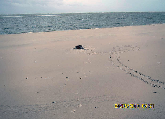
Limulid-Death-Spiral-SCISo what’s the big deal here? Horseshoe crab comes up on beach, gets lost, spirals around while looking for the ocean, and dies in vain, a victim of its own ocean-finding ineptitude: the end. Nope, wrong ending. For one thing, those horseshoe crab tracks are really fresh, meaning their maker was still very much alive, then next thing it knows, its on its back. Seeing that horseshoe crabs are not well equipped to do back-flips or break dance, I wonder how that happened? (Photograph by Gale Bishop, taken on St. Catherines Island, Georgia, and you can see the date and time for yourself.)

Here is part of the field description Gale recorded, which he graciously shared with me (and now you):

“Female Horseshoe Crab at 31.63324; 81.13244 [latitude-longitude] observed Raccoon feeding on upside-down HSC [horseshoe crab] on south margin of McQueen Inlet NO pig tracks. Relatively fresh HSC track. Did this raccoon flip this HSC?”

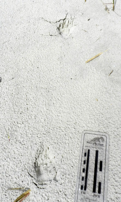
Raccoon-Tracks-Pee-Limulid-Eaten-SCIWell, well. Looks like we had a little commotion here. Lots of marks made from this horseshoe crab getting pushed against the beach sand, and by something other than itself. And that “something else” left two calling cards: a urination mark (left, middle) and just above that, two tracks. I can tell you the tracks are from a raccoon, and Gale swears the urination mark is not his. (Photograph by Gale Bishop, taken on St. Catherines Island, Georgia, and on May 4, 2013.)

I first saw these photos posted on a Facebook page maintained by Gale Bishop, the St. Catherines Island Sea Turtle Program (you can join it here). This was one of this comments Gale wrote to go with a photo:

GB: “This HSC must have been flipped by the Raccoon; that was NOT observed but the fresh crawlway indicates the HSC was crawling across the beach and then was flipped – only tracks are Rocky’s!”

[Editor’s note: “Rocky” is the nickname Gale gives to all raccoons, usually applied affectionately just before he prevents them from raiding a sea-turtle nest. And by prevent, I mean permanently.]

My reply to this:

AM: “VERY fresh tracks by the HSC, meaning this was predation by the raccoon, not scavenging.”

In our subsequent discussions on Facebook, Gale agreed with this assessment, said this was the first time he had ever seen a raccoon prey on a horseshoe crab, and I told him that it was the same for me. This was a big deal for us. He’s done more “sand time” on St. Catherines Island beaches than anyone I know (every summer for more than 20 years), and in all my wanderings of the Georgia barrier island beaches, I’ve never come across traces showing any such behavior.

(Yes, that’s right, I know you’re all in shock now, and it’s not that this was our first observance of this phenomenon. Instead, it is that we used Facebook for exchanging scientific information, hypotheses, and testing of those hypotheses. In other words it is not just used for political rants, pictures of cats and food, or political rants about photos of cat food. Which are very likely posted by cats.)

Now, here’s where ichnology is a pretty damned cool science. Gale was on the scene and actually saw the raccoon eating the horseshoe crab. He said it then ran away once it spotted him. (“Uh oh, there’s that upright biped with his boom stick who’s been taking out all of my cousins. Later, dudes!”) And even though I trust him completely as a keen observer, excellent scientist, and a very good ichnologist, I didn’t have to take his word for it. His photos of the traces on that Georgia beach laid out all of the evidence for what he saw, and even what happened before he got there and so rudely interrupted “Rocky” from noshing on horseshoe-crab eggs and innards.

Raccoon-Galloping-Limulid-Death-Spiral-Traces-SCIAnother view of the “death spiral” by the horseshoe crab, which we now know was actually a “life spiral” until a raccoon showed up and updated that status. Where’s the evidence of the raccoon? Look in the middle of the photos for whitish marks, grouped in fours, separated by gaps, and each forming a backwards “C” pattern. Those are raccoon tracks, and it was galloping away from the scene of the crime (toward the viewer).

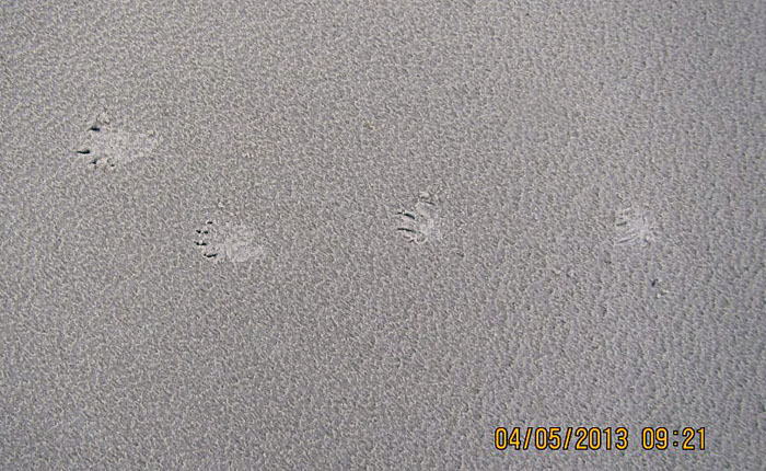
Raccoon-Galloping-Pattern-SCISo you don’t believe me, and need a close-up of that raccoon gallop pattern? Here you go. Both rear feet are left, both front feet are right, and the direction of movement was to the left; when both rear feet exceed the front, that’s a gallop, folks. Notice the straddle (width of the trackway) is a lot narrower than a typical raccoon trackway, which is what happens when it picks up speed. When it’s waddling more like a little bear, its trackway is a lot wider than this. Conclusion: this raccoon was running for its life.

Although this is the only time Gale has documented a raccoon preying on a horseshoe crab – and it is the first time I’ve ever heard of it – we of course now wonder whether this was an exception, or if it is more common that we previously supposed. The horseshoe crab was a gravid female, and was likely on the beach to lay its eggs. Did the raccoon somehow know this, and sought out this limulid so that – like many shorebirds – it could feast on the eggs, too, along with some of the horseshoe crab itself? Or was it opportunistic, in that it was out looking for sea-turtle eggs, saw the horseshoe crab, and thought it’d try something a little different? In other words, had it learned this from experience, or was it a one-time experiment?

All good questions, but when our data set is actually a datum set (n = 1), there’s not much more we can say about this now. But given this new knowledge, set of search patterns, and altered expectations, we’re more likely to see it again. Oh, and now that you know about this, so can you, gentle reader. Let us know if you see any similar story told on the sands of a Georgia beach.

You want one more reason why this was a very cool discovery? It shows how evolutionary lineages and habitats can collide. Horseshoe crabs are marine arthropods descended from a 450-million-year-old lineage, and likely have been coming up on beaches to spawn all through that time. In contrast, raccoons are relative newcomers, coming from a lineage of land-dwelling mammals (Procyonidae) that, at best, only goes back to Oligocene Epoch, about 25 million years ago. When did a horseshoe crab first go onto land and encounter a land-dwelling raccoon ancestor? Trace fossils might tell us someday, especially now that we know what to look for.

So once again, these life traces provided us with a little more novelty, adding another piece to the natural history of the Georgia coast. Moreover, a raccoon preying on a horseshoe crab was another reminder that even experienced people – like Gale, me, and others who have spent much time on the Georgia barrier islands – still have a lot more to learn. Be humble, keep eyes open, and let the traces teach you something new.

(Acknowledgement: Special thanks to Dr. Gale Bishop for again spotting something ichnologically weird on St. Catherines Island, documenting it, and sharing what he has seen during his many forays there.)

Teaching on an Old Friend, Sapelo Island

(This post is the fourth in a series about a spring-break field trip taken last week with my Barrier Islands class, which I teach in the Department of Environmental Studies at Emory University. The first three posts, in chronological order, tell about our visits to Cumberland Island, Jekyll Island, and Little St. Simons and St. Simons Islands. For the sake of conveying a sense of being in the field with the students, these posts mostly follow the format of a little bit of prose – mostly captions – and a lot of photos.)

When planning a week-long trip to the Georgia barrier islands with my students, I knew that one island – Sapelo – had to be included in our itinerary. Part of my determination for us to visit it was emotionally motivated, as Sapelo was my first barrier island, and you always remember your first. But Sapelo has much else to offer, and because of these many opportunities, it is my favorite as an destination for teaching students about the Georgia coast and its place in the history of science.

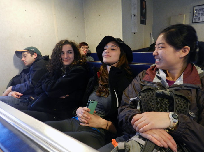
Getting to Sapelo Island requires a 15-minute ferry ride, all for the low-low price of $2.50. (It used to cost $1.00 and took 30 minutes. My, how times have changed.) For my students, their enthusiasm about visiting their fourth Georgia barrier island was clearly evident (with perhaps a few visible exceptions), although photobombing may count as a form of enthusiasm, too.

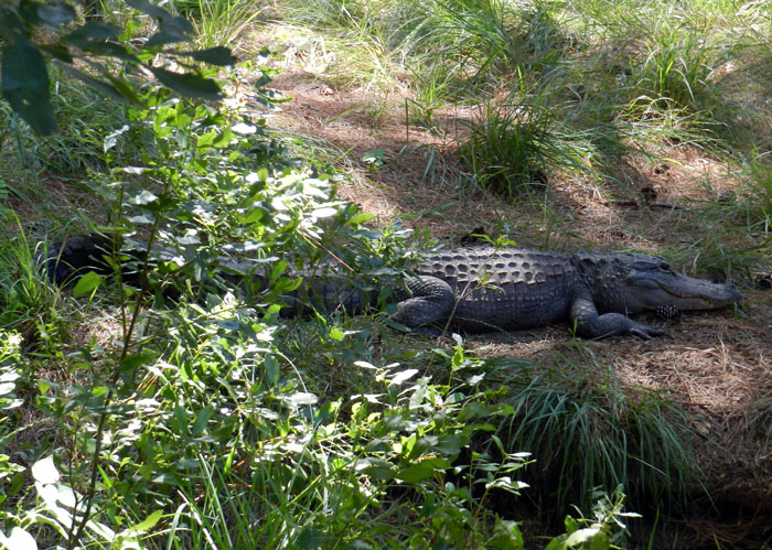
I first left my own traces on Sapelo in 1988 on a class field trip, when I was a graduate student in geology at the University of Georgia. My strongest memory from that trip was witnessing alligator predation of a cocker spaniel in one of the freshwater ponds there. (I suppose that’s another story for another day.) Yet I also recall Sapelo as a fine place to see geology and ecology intertwining, blending, and otherwise becoming indistinguishable from one another. This impression will likely last for the rest of my life, reinforced by subsequent visits to the island. This learning has always been enhanced whenever I’ve brought my own students there, which I have done nearly every year since 1997.

As a result of both teaching and research forays, I’ve spent more time on Sapelo than all of the other Georgia barrier islands combined. Moreover, it is not just my personal history that is pertinent, but also how Sapelo is the unofficial “birthplace” of modern ecology and neoichnology in North America. Lastly, Sapelo inspired most of the field stories I tell at the start of each chapter in my book, Life Traces of the Georgia Coast. In short, Sapelo Island has been very, very good to me, and continues to give back something new every time I return to it.

So with all of that said, here’s to another learning experience on Sapelo with a new batch of students, even though it was only for a day, before moving on to the next island, St. Catherines.

(All photographs by Anthony Martin and taken on Sapelo Island.)

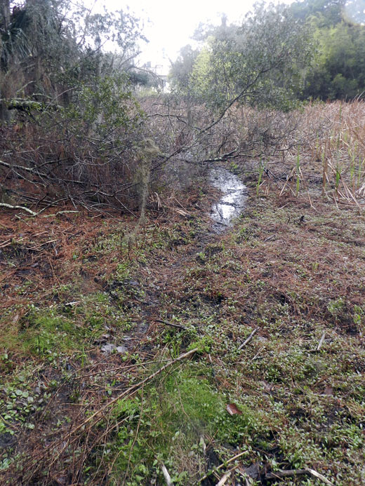
Next to the University of Georgia Marine Institute is a freshwater wetland, a remnant of an artificial pond created by original landowner R.J. Reynolds, Jr. More importantly, this habitat has been used and modified by alligators for at least as long as the pond has been around. For example, this trail winding through the wetland is almost assuredly made through habitual use by alligators, and not mammals like raccoons and deer, because, you know, alligators.

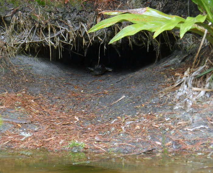
Photographic evidence that alligators, much like humans prone to wearing clown shoes, will use dens that are far too big for them. This den was along the edge of the ponded area of the wetland, and has been used by generations of alligators, which I have been seeing use it on-and-off since 1988.

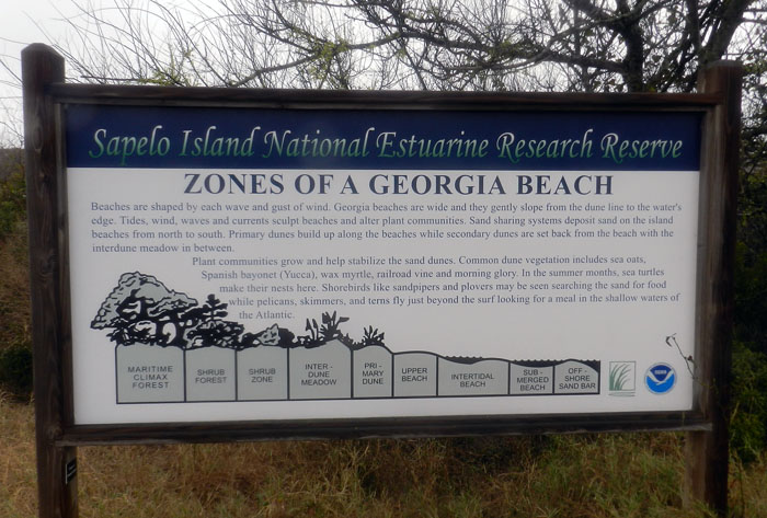
An idealized diagram of ecological zones on Sapelo Island, from maritime forest to the subtidal. This sign provided a good field test for my students, as they had already (supposedly) learned about these zones in class, but now could experience the real things for themselves. And yes, this will be on the exam.

When it’s high tide in the salt marsh, marsh periwinkles (Littoraria irrorata) seek higher ground, er, leaves, to avoid predation by crabs, fish, and diamondback terrapins lurking in the water. Here they are on smooth cordgrass (Spartina alterniflora), and while there are getting in a meal by grazing on algae on the leaves.

Erosion of a tidal creek bank caused salt cedars (which are actually junipers, Juniperus virginiana) to go for their first and last swim. I have watched this tidal creek migrate through the years, another reminder that even the interiors of barrier islands are always undergoing dynamic change.

OK, I know what you’re thinking: where’s the ichnology? OK, how about these wide, shallow holes exposed in the sandflat at low tide? However tempted you might be to say “sauropod tracks,” these are more likely fish feeding traces, specifically of southern stingrays. Stingrays make these holes by shooting jets of water into the sand, which loosens it and reveals all of the yummy invertebrates that were hiding there, followed by the stingray chowing down. Notice that some wave ripples formed in the bottom of this structure, showing how this stingray fed here at high tide, before waves started affecting the bottom in a significant way.

Here’s more ichnology for you, and even better, traces of shorebirds! I am fairly sure these are the double-probe beak marks of a least sandpiper, which may be backed up by the tracks associated with these (traveling from bottom to top of the photo). But I could be wrong, which has happened once or twice before. If so, an alternative tracemaker would be a sanderling, which also makes tracks similar in size and shape to a sandpiper, although they tend to probe a lot more in one place.

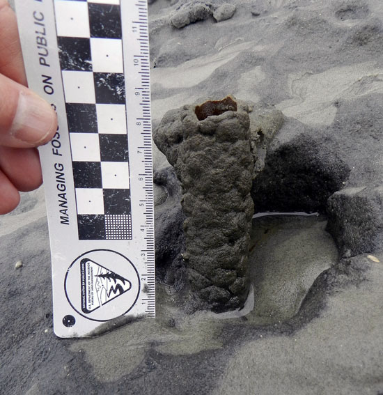
Just in case you can’t get enough ichnology, here’s the lower, eroded shaft of a ghost-shrimp burrow. Check out that burrow wall, reinforced by pellets. Nice fossilization potential, eh? This was a great example to show my students how trace fossils of these can be used as tools for showing where a shoreline was located in the geologic past. And sure enough, these trace fossils were used to identify ancient barrier islands on the Georgia coastal plain.

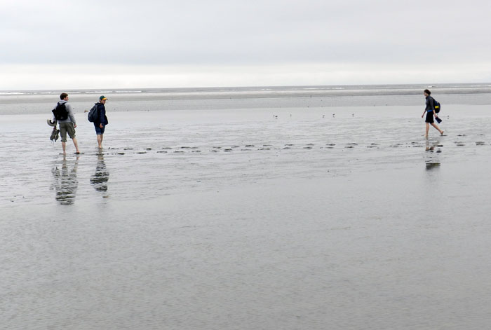
Understandably, my students got tired of living vicariously through various invertebrate and vertebrate tracemakers of Sapelo, and instead became their own tracemakers. Here they decided to more directly experience the intertidal sands and muds of Cabretta Beach at low tide by ambulating through them. Will their tracks make it into the fossil record? Hard to say, but I’ll bet the memories of their making them will last longer than any given class we’ve had indoors and on the Emory campus. (No offense to those other classes, but I mean, you’re competing with a beach.)

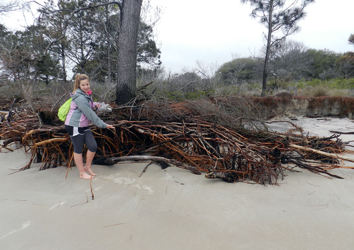
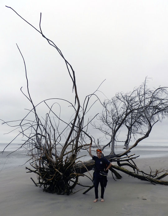
The north end of Cabretta Beach on Sapelo is eroding while other parts of the shoreline are building, and nothing screams “erosion!” as loudly as dead trees from a former maritime forest with their roots exposed on a beach. Also, from an ichnological perspective, the complex horizontal and vertical components of the roots on this dead pine tree could be compared to trace fossils from 40,000 year-old (Pleistocene) deposits on the island. Also note that at this point in the trip, my students had not yet tired of being “scale” in my photographs, which was a good thing for all.

Another student eager about being scale in this view of a live-oak tree root system. See how this tree is dominated by horizontal roots? Now think about how trace fossils made by its roots will differ from those of a pine tree. But don’t think about it too long, because there are a few more photos for you to check out.

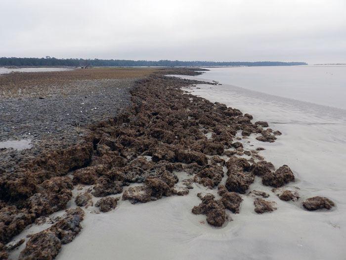
Told you so! Here’s a beautifully exposed, 500-year-old relict marsh, formerly buried but now eroding out of the beach. I’ve written about this marsh deposit and its educational value before, so will refrain from covering that ground again. Just go to this link to learn about that.

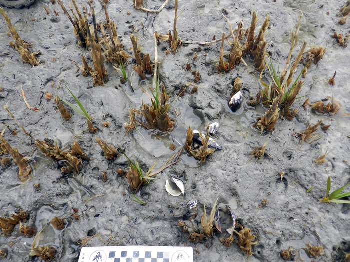
OK geologists, here’s a puzzler for you. The surface of this 500-year-old relict marsh, with its stubs of long-dead smooth cordgrass and in-place ribbed mussels (Guekensia demissa), also has very-much-live smooth cordgrass living in it and sending its roots down into that old mud. So if you found a mudstone with mussel shells and root traces in it, would you be able to tell the plants were from two generations and separated by 500 years? Yes, I know, arriving at an answer may require more beer.

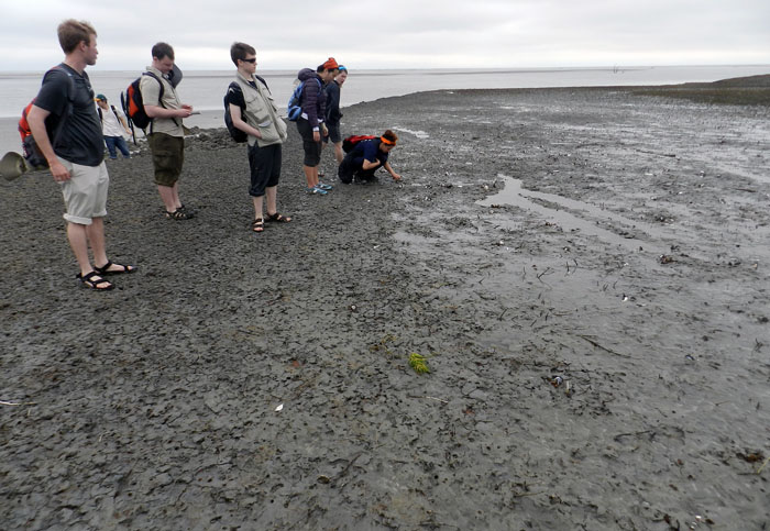
Although a little tough to see in this photo, my students and I, for the first time since I have gone to this relict marsh, were able to discern the division between the low marsh (right) and high marsh (left). Look for the white dots, which are old ribbed mussels, which live mostly in the high marsh, and not in the low marsh. Grain sizes and burrows were different on each part, too: the high marsh was sandier and had what looked like sand-fiddler crab burrows, whereas the low marsh was muddier and had mud-fiddler burrows. SCIENCE!

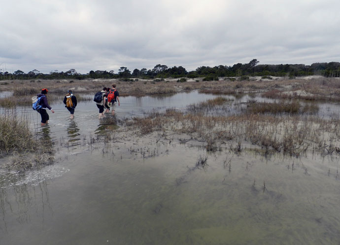
At the end of a great day in the field on Sapelo, it was time to do whatever was necessary to get back to our field vehicle, including (gasp!) getting wet. The back-dune meadows, which had been inundated by unusually high tides, presented a high risk that we might experience a temporary non-dry state for our phalanges, tarsals, and metatarsals. Fortunately, my students bravely waded through the water anyway, and sure enough, their feet eventually dried. I was so proud.

So what was our next-to-last stop on this grand ichnologically tainted tour of the Georgia barrier islands? St. Catherines Island, which is just to the north of Sapelo. Would it reveal some secrets to students and educators alike? Would it have some previously unknown traces, awaiting our discovery and description? Would any of our time there also involve close encounters with large reptilian tracemakers? Signs point to yes. Thanks for reading, and look for that next post soon.


Most Intriguing Traces of the Georgia Coast, 2012

The end of another revolution of the earth around the sun brings with it many “best,” “most,” “worst,” “sexiest,” or other such lists associated with that 365-day cycle. Tragically, though, none of these lists have involved traces or trace fossils. So seeing that the end of 2012 also coincides with the release of my book (Life Traces of the Georgia Coast), I thought that now might be a good time to start the first of what I hope will be an annual series highlighting the most interesting traces I encountered on the Georgia barrier islands during the year.

In 2012, I visited three islands at three separate times: Cumberland Island in February, St. Catherines Island in March, and Jekyll Island in November. As usual, despite having done field work on these islands multiple times, each of these most recent visits in 2012 taught me something new and inspired posts that I shared through this blog.

For the Cumberland Island visit, it was seeing many coquina clams (Donax variabilis) in the beach sands there at low tide, and marveling at their remarkable ability to “listen” to and move with the waves. With St. Catherines Island, it was to start describing and mapping the alligator dens there, using these as models for similar large reptile burrows in the fossil record. Later in the year, I presented the preliminary results of this research at the Society of Vertebrate Paleontology meeting in Raleigh, North Carolina. For the Jekyll trip, which was primarily for a Thanksgiving-break vacation with my wife Ruth, two types of traces grabbed my attention, deer tracks on a beach and freshwater crayfish burrows in a forested wetland. So despite all of the field work I had done previously on the Georgia coast, these three trips in 2012 were still instrumental in teaching me just a little more I didn’t know about these islands, which deserve to be scrutinized with fresh eyes each time I step foot on them and leave my own marks.

For this review, I picked out three photos of traces from each island that I thought were provocatively educational, imparting what I hope are new lessons to everyone, from casual observers of nature to experienced ichnologists.

Cumberland Island

Coyote tracks – Coyotes (Canis latrans) used to be rare tracemakers on the Georgia barrier islands, but apparently have made it onto nearly all of the islands in just the past ten years or so. On Cumberland, despite its high numbers of visitors, people almost never see these wild canines. This means we have to rely on their tracks, scat, and other sign to discern their presence, where they’re going, and what they’re doing. I saw these coyote tracks while walking with my students along a trail between the coastal dunes, and they made for good in-the-field lessons on “What was this animal?” and “What was it doing?” Because Cumberland is designated as a National Seashore and thus is under the jurisdiction of the U.S. National Park Service, I’m  interested in watching how they’ll handle the apparent self-introduction of this “new” predator to island ecosystems, which may begin competing with the bobcats (Lynx rufus) there for the same food resources.

Ghost Shrimp Burrows, Pellets and Buried Whelk – Sometimes the traces on the beaches at low tide are subtle in what they tell us, and the traces in this photo qualify as ones that could be easily overlooked. The three little holes in the photo are the tops of ghost shrimp burrows. Scattered about on the beach surface are fecal pellets made by the same animals; ghost shrimp are responsible for most of the mud deposition on the sandy beaches of Georgia. The triangular “trap door” in the middle of the photo is from a knobbed whelk (Busycon carica), which has buried itself directly under the sand surface. The ghost shrimp are perhaps as deep as 1-2 meters (3.3-6.6 ft) below the surface, and are feeding on organics in their subterranean homes. These homes are complex, branching burrow systems, reinforced by pelleted walls. Hence these animals and their traces provide a study in contrasts of adaptations, tiering, and fossilization potential. The whelk trace is ephemeral, and could be wiped out with the next high tide, especially if the waiting whelk emerges and its shallow burrow collapses behind it. On the other hand, only the top parts of the ghost shrimp burrows are susceptible to erosion, meaning their lower parts are much more likely to win in the fossilization sweepstakes.

Feral Horse Grazing and Trampling Traces – Probably the most controversial subject related to any so-called “wild” Georgia barrier islands is the feral horses of Cumberland Island, and what to do about their impacts on island ecosystems there. A year ago, I wrote a post about these tracemakers as invasive species, and discussed this same topic with students before we visited in February. But nothing said “impact” better to these students than this view of a salt marsh, overgrazed and trampled along its edges by horses. This is a example of how the cumulative effects of traces made by a single invasive species can dramatically alter an ecosystem, rendering it a less complete version of its original self.

St. Catherines Island

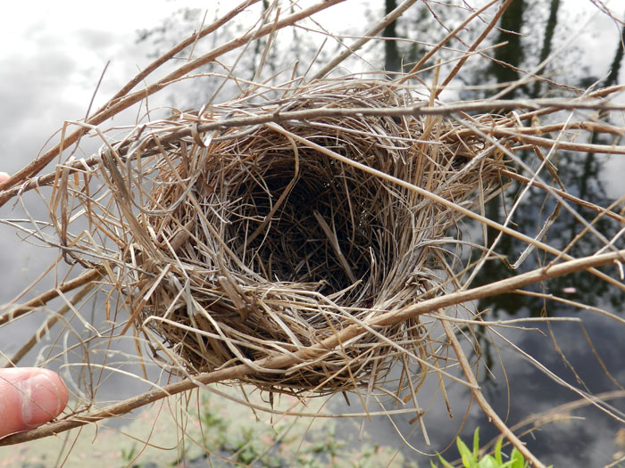
Suspended Bird Nest – I don’t know what species of bird made this exquisitely woven and suspended little nest, but I imagine it is was a wren, and one related to the long-billed marsh wren (Telmatodytes palustris), which also makes suspended nests in the salt marshes. This nest was next to one of several artificial ponds with islands constructed on St. Catherines with the intent of helping larger birds, such as egrets, herons, and wood storks, so that they can use the islands as rookeries. These ponds are also inhabited by alligators, which had left plenty of tracks, tail dragmarks, and other sign along the banks. With virtually no chance of being preserved in the fossil record, this nest was a humbling reminder of what we still don’t know from ichnology, such as when this specialized type of nest building evolved, or whether this behavior happened first in arboreal non-avian dinosaurs or birds.

Ant Nest in Storm-Washover Deposit – As you can see, the aperture of this ant nest, as well as the small pile of sand outside of it, did not exactly scream out for attention and demand that its picture be taken. But its location was significant, in that it was on a freshly made storm-washover deposit next to the beach. This “starter nest” gives a glimpse of how ants and other terrestrial insects can quickly colonize sediments dumped by marine processes, such as storm waves. These sometimes-thick storm deposits can cause locally elevated areas above what used to be muddy salt marshes. This means insects and other animals that normally would never burrow into or traverse these marshes move into the neighborhood and set up shop, blissfully unaware that the sediments of a recently buried marginal-marine environment are below them. Ant nests also have the potential to reach deep down to those marine sediments, causing a disjunctive mixing of the traces of marine and terrestrial animals that would surely confuse most geologists looking at similar deposits in the geologic record.

Alligator Tracks in a Salt Marsh – These alligator tracks, which are of the left-side front and rear feet, along with a tail dragmark (right) surprised me for several reasons. One was their size: the rear foot (pes) was about 20 cm (8 in) long, one of the largest I’ve seen on any of the islands. (As my Australian friends might say, it was bloody huge, mate.) This trackway also was unusual because it was on a salt pan, a sandy part of a marsh that lacks vegetation because of its high concentration of salt in its sediments. (According to conventional wisdom, alligators prefer fresh-water environments, not salt marshes.) Yet another oddity was the preservation of scale impressions in the footprints, which I normally only see in firm mud. Finally, the trackway was crosscut by trails of grazing snails and burrows of sand-fiddler crabs (Uca pugilator). This helped me to age the tracks – probably less than 24 hours old, and not so fresh that I should have reason to get worried. (Although I did pay closer attention to my surroundings after finding them.) Overall, this also made for a neat assemblage of vertebrate and invertebrate traces, one I would be delighted to find in the fossil record from the Mesozoic Era.

Jekyll Island

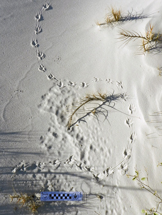
Grackle Tracks and Obstacle Avoidance – These tracks from a boat-tailed grackle (Quiscalus major), spotted just after sunrise on a coastal dune of Jekyll Island, are beautifully expressed, but also tell a little story, and one we might not understand unless we put ourselves down on its level. Why did it jog slightly to the right and then meander to the left, before curving off to the right again? I suspect it was because the small strands of bitter panic grass (Panicum amarum), sticking up out of the dune sand, got in its way. Similar to how we might avoid small saplings while walking through an otherwise open area, this grackle chose the path of least resistance, which involved walking around these obstacles, rather than following a straight line. If we didn’t know about this from such modern examples, but we found a fossil bird trackway like this but didn’t look for nearby root traces, how else might we interpret it?

Acorn Worm Burrow, Funnels and Pile – When I came across the top of this acorn-worm burrow, which was probably from the golden acorn worm (Balanoglossus aurantiactus), and on a beach at the north end of Jekyll, I realized I was looking at a two-dimensional expression of a three-dimensional structure. Acorn worms make deep and wide U-shaped vertical burrows, in which they quite sensibly place their mouth at one end and their anus at the other. These burrows usually have a small funnel at the top of one arm of the “U,” which is the “mouth end.” The “anus end” is denoted by a pile of what looks like soft-serve ice cream, which it most assuredly is not, as this is its fecal casting, squirted out of the burrow. What was interesting about this burrow is the nearby presence of a second funnel. This signifies that the worm shifted its mouth end laterally by adding a new burrow shaft to the previous one, superimposing a little “Y” to that part of the U-shaped burrow.

Ghost Crab Dragging Its Claw – As ubiquitous and prolific tracemakers in coastal dunes of the Georgia barrier islands, and as many times as I have studied their traces, I can always depend on ghost crabs (Ocypode quadrata) to leave me signs telling of some nuanced variations in their behavior. In this instance, I saw the finely sculpted, parallel, wavy grooves toward the upper middle of its trackway, made while the crab walked sideways from left to right. A count of the leg impressions in the trackway yielded “eight,” which is the number of its walking legs. This means the fine grooves could only come from some appendage other than its walking legs: namely, one of its claws. Why was it dragging its claw? I like to think that it might have been doing something really cool, like acoustical signaling, but it also might have just been a little tired, having spent too much time outside of its burrow.

So now you know a little more about who left their marks on the Georgia barrier islands in 2012. What will 2013 bring? Let’s find out, with open eyes and minds.


Different Coastlines, Same Traces, and Time

This past week, I visited North Carolina for varied reasons, but all related to paleontology and geology. First, I gave a well-attended evening lecture about polar dinosaurs, graciously invited and hosted by the Department of Geography and Geology at the University of North Carolina-Wilmington (UNCW). Later in the week, I presented a poster at the Society of Vertebrate Paleontology (SVP) meeting in Raleigh (covered last week here), while also taking in a couple of days of talks, posters, and enjoyably catching up with paleo-friends while meeting neo-friends. Regrettably, I had to leave the meeting early, but with good reason, which was for a field trip to look at fossils in a Pleistocene outcrop near Wilmington with faculty and students from UNCW. Overall, it was a fulfilling week, teeming with paleontological and social variety.

This pithy summary, though, omits lots of details (and if it didn’t, then it wouldn’t be pithy). But one item worth explaining a bit more here was a brief trip to Wrightsville Beach, which is a barrier island was just east of Wilmington. Dr. Doug Gamble, a geography professor in the UNCW Department of Geography and Geology, offered to take me there just before my talk, which I eagerly accepted. Considering all of the field work I had done on the Georgia barrier islands to the south of there, and that I would be teaching a course on barrier islands next semester, going to this beach was an opportunity to learn more about the similarities and differences between Georgia and North Carolina beaches.

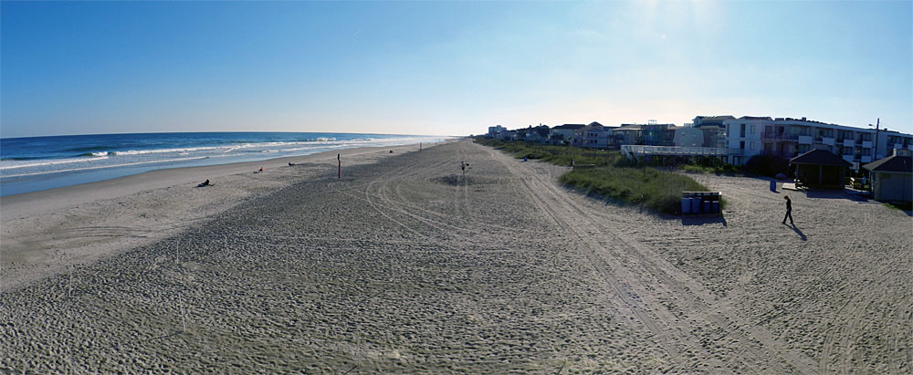
Panorama of Wrightsville Beach on the coast of North Carolina, replete with human locomotion traces and dwelling structures. These features make it very different from most beaches in Georgia. But what about other traces? Don’t you just love rhetorical questions? Including this one? (Photograph by Anthony Martin.)

Many North Carolina beaches are famous (or infamous) as examples of what can go wrong with unrestrained development of barrier islands. Many such case studies have been explored through the research, writings, and activism of geologist Dr. Orrin Pilkey of Duke University, as well as other coastal geologists who have looked at the effects of human alterations of these habitats. Wrightsville Beach is such a barrier-island beach, having  been heavily modified by human activities during the past 150 years or so. When comparing it in my mind to the Georgia barrier islands, it most resembled Tybee Island, which is also next to a relatively large city (Savannah), easily accessible by a bridge, and developed as a sort of “vacation destination” for people who like beaches, but also want them to have all of the amenities of the places they left behind. Otherwise, it held little resemblance to the mostly uninhabited and undeveloped beaches I prefer to peruse on the Georgia barrier islands.

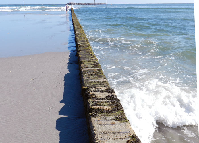
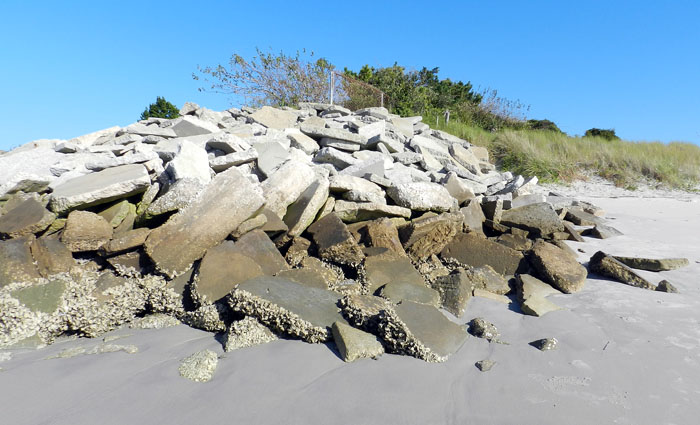
After driving over the bridge to the island, we walked onto the beach in several places, and I began looking for traces. At first there was little to see, which was a direct result of there being too much to see. Because it was a pleasant day and we were visiting in the afternoon, much of the beach had been heavily trampled by humans, with more than a few of these people aided in their bioturbation by canine companions. Obvious restructuring of the beach included a jetty at the north end that combined a concrete wall and boulders, and pilings of concrete blocks at the south end. Dunes were modest, low-profile, and capped by sparse stands of sea oats (Uniola paniculata), and behind these were hotels, condominiums, and houses, all chock-a-block. It would be too strong to say this beach was alien to me, let alone post-apocalyptic, but it did seem like an altered reality compared to my experiences in Georgia.

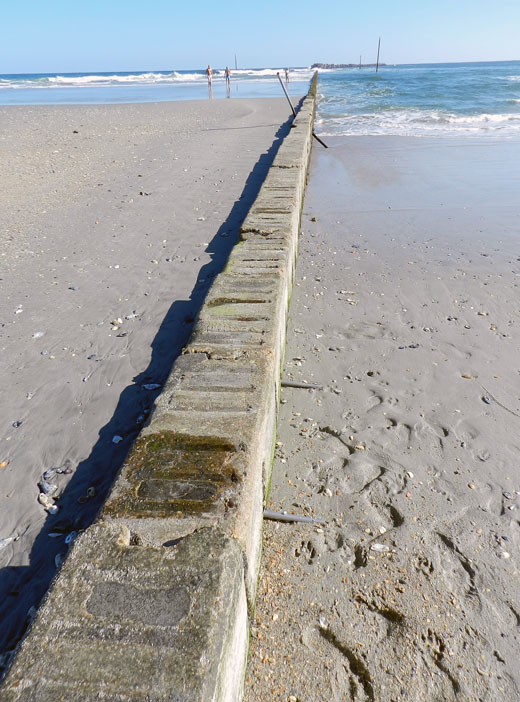
A jetty at Wrightsville Beach (North Carolina) composed of concrete and rocks, intended to preserve sand on the beach, which it is doing here, but also results in an imbalanced distribution of sand along it. Note the abundant human and canine tracks on the right, shouting out any other animal traces that might have been in the sand. (Photograph by Anthony Martin.)

Another view of the jetty at Wrightsville Beach, sharply contrasting sand deposition and erosion on either side of it. (Photograph by Anthony Martin.)

A pile of broken concrete being used as rip-rap at the south end of Wrightsville Beach in an attempt to slow erosion there. Or something. (Photograph by Anthony Martin.)

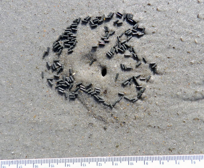
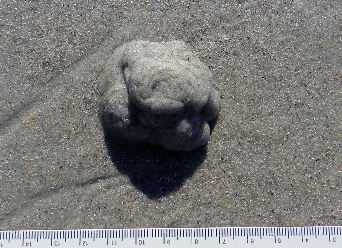
Only with more walking toward the south end of the beach did we see less of an overwhelming human-dog ichnoassemblage and start noticing signs of the native fauna. With this, I became comforted by the familiar. These traces included some I had seen many times on Georgia beaches, including: the soda-straw-like burrows of parchment worms (Onuphis microcephala); the volcano-like sand mounds and chocolate-sprinkle-like feces of callianassid shrimp (either Biffarius biformis and Callichirus major); the soft-serve-ice-cream-like fecal mound of acorn worms (Balanoglossus aurantiactus); and the hole-in-the-ground-like burrows of ghost crabs (Ocypode quadrata). (OK, so I ran out of metaphors.) Seagull tracks abounded as well, lending more of a dinosaurian flavor to the trace assemblage.

Two burrows of parchment worms (Onuphis microcephala) on Wrightsville Beach, exposed by a little bit of erosion, with tiny fecal pellets at their bases. Scale in millimeters. (Photograph by Anthony Martin.)

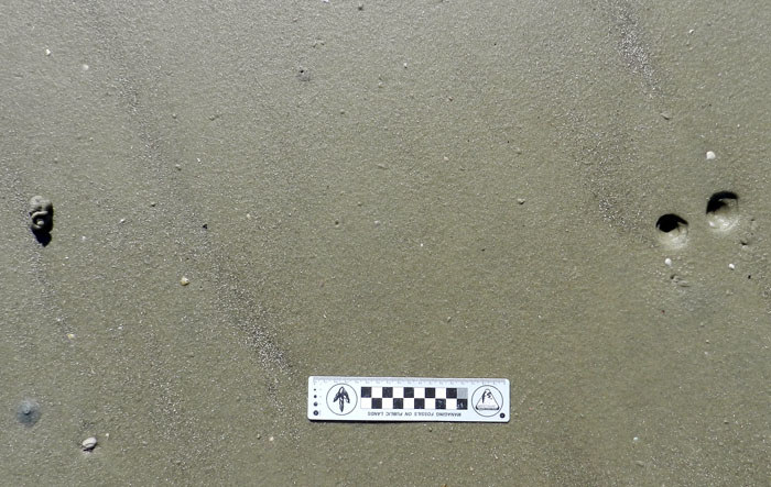
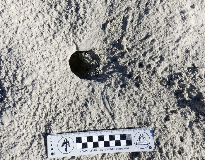
Burrow aperture and fecal pellets of a ghost shrimp (either Biffarius biformis or Callichirus major) on Wrightsville Beach. Scale in millimeters again. (Photograph by Anthony Martin.)

Fecal casting of an acorn worm, and probably that of a golden acorn worm (Balanoglossus aurantiactus) on Wriightsville Beach. One end of its burrow is underneath this pile, and that would be its anal end, which is sensibly located in a different place from its oral end. And I think you know the scale by now. (Photograph by Anthony Martin.)

Ghost crab (Ocypode quadrata) burrow and tracks, out of the intertidal zone and more into the dunes on Wrightsville Beach. (Photograph by Anthony Martin.)

These traces thus showed us that this North Carolina beach, one majorly changed by humankind during the past 150 years, actually was more biodiverse than one might think at first glance. In my mind, then, it became just a bit more wild through these signs of life hinting at what laid beneath our feet.

At this point, I could depress everyone by listing what traces and biota were not there, but that’s not the point, so I won’t. In a more progressive sense, what traces we saw represented traces of hope, of life hanging on despite environmental change, living almost invisibly beneath our feet. So as human development continues on beaches like these, and sea level rises through the rest of this century, I felt assured of their being survivors of this change, and of their traces outlasting our humanity. The trace fossils of the future are now, and recording our effects on the life that makes these traces. How many will wink out with our species, and how many of their marks will outlast us?

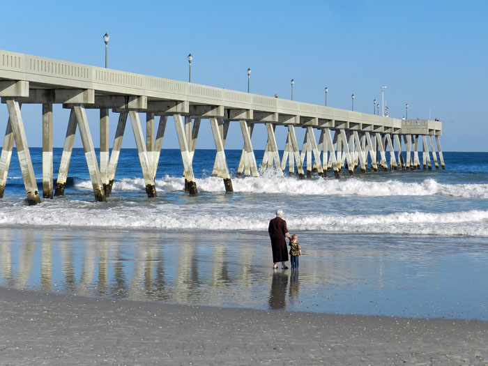
An intergenerational stroll – a grandmother and grandson? – alongside the pier on Wrightsville Beach in North Carolina. Did she have memories of this beach in her childhood? How do these compare to what she sees there now? What memories will this child have of it in the future, especially as the sea continues to rise? If these memories are not recorded, what will be left behind? (Photograph by Anthony Martin.)

Further Reading

Pilkey, O., and Fraser, M.E. 2005. A Celebration of the World’s Barrier Islands. Columbia University Press, New York: 309 p.

Thieler, E.R., Pilkey, O., Cleary, W.J., and Schwab, W.C. 2001. Modern sedimentation on the shoreface and inner continental shelf at Wrightsville Beach, North Carolina, U.S.A. Journal of Sedimentary Research, 71: 958-970.

Deconstructing an Ichnology Abstract, with Alligators

Many people from outside of the realm of academia (or is it a fiefdom?) prefer to get the latest scoops on new paleontological or geological research directly from the source, rather than just reading a press release or news article about it. As someone looking from the inside out, I’m pleased to see so many non-scientists try to probe one layer deeper with their understanding of a beloved scientific topic that interests them, and I try to encourage it through my own blogging, speaking, teaching, and other forms of outreach.
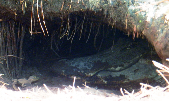
An alligator den on St. Catherines Island, (Georgia), with baby alligator and “big momma” alligator for scale. This week, I presented a poster with about these big burrows and their makers  at the Society of Vertebrate Paleontology meeting in Raleigh, North Carolina. The original field work we did for this research was reported back in March here, and now we’re ready to share more of what we found out. (Photograph by Anthony Martin.)

Unfortunately, many of the original research articles that become subjects of media attention are behind paywalls, requiring a reader to pay for access to read those articles, even if the research was publicly funded. This practice is especially common if the research is published in one of those glamorous journals that seemingly make or break academic careers in science, regardless of the lasting quality of the research. (I won’t name them directly, but let’s just say that’s the nature of science nowadays.)

So one option for these curious folks is to read abstracts from proceedings volumes of professional meetings. Abstracts, which ideally are succinct summaries highlighting the most significant findings of a given study, can thus serve as a way for the public to at least get a few insights on the latest scientific research happening in their favorite disciplines.
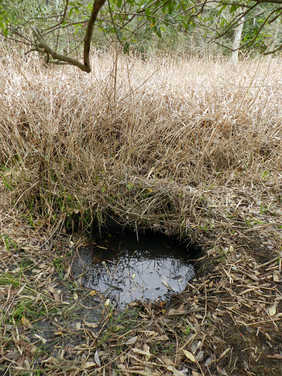
Want to get below the surface with this research? Oh, sorry, I was just being metaphorical. You really don’t want to go below the surface of an alligator den, which is why we mostly studied abandoned ones, mapped them, and otherwise tried to use methods that didn’t bother the alligators or otherwise have uncomfortable encounters with them.

Along those lines, the annual meeting of the Society of Vertebrate Paleontology (SVP) has been taking place this week in Raleigh, North Carolina, and it has an abstract volume associated with the meeting. Regrettably, though, the general public does not have access to these abstracts, only SVP members and people who have registered for the meeting. The Society of Vertebrate Paleontology also has a policy regarding researchers who publicly share their research results based on these abstracts, muddied by the word “embargo.” In short, this policy holds that people working for the media, which include reporters and bloggers (the latter of whom are also sometimes reporters), cannot write about and otherwise publicize research results presented at the meeting. That is, unless the researchers have given their permission to do so, or the results have been freely distributed by the researchers through a press release, blog, or other forms of outreach.

So in the spirit of the public having easier access to this primary scientific information, the following is our SVP abstract, which I presented as a poster at the meeting yesterday. The abstract is co-authored with Michael Page (Emory University), Sheldon Skaggs (Georgia Southern University), and R. Kelly Vance (also Georgia Southern University), and we worked together on the research, writing, and editing of the abstract. Because this abstract also includes a lot of scientific shorthand (charitably referred to as “jargon”), I also included a sentence-by-sentence explanation of it, in which the abstract text is in italics and my explanation is in formal typeface. So I hope you, the gentle reader, get something from this exercise in explanation, and we look forward to sharing more of this research with you as it continues to evolve and we publish it sometime next year as a peer-reviewed paper.

DENS OF THE AMERICAN ALLIGATOR (ALLIGATOR MISSISSIPPIENSIS) AS TRACES AND THEIR PREDICTIVE VALUE FOR FINDING LARGE ARCHOSAUR BURROWS IN THE GEOLOGIC RECORD

MARTIN, Anthony J., Emory University, Atlanta, GA, United States; PAGE, Michael, Emory University, Atlanta, GA, United States; SKAGGS, Sheldon, Georgia Southern University, Statesboro, GA, United States; VANCE, Robert K., Georgia Southern University, Statesboro, GA, United States

Large archosaur burrows are rarely interpreted from the geologic record, a circumstance that may be attributable to a lack of search images based on modern examples, rather than actual rarity.

Archosaurs make up an evolutionarily related group of vertebrates that include crocodilians (alligators and crocodiles), dinosaurs (the non-bird ones, that is), birds, and their extinct relatives. A few of the larger extinct archosaurs may have dug burrows, but paleontologists have reported very few of these, with one exception being the small Cretaceous ornithopod dinosaur Oryctodromeus cubicularis, found in its burrow with two juveniles of the same species. The authors are proposing here that this “rarity” of archosaur burrows in the fossil record might be more attributable to paleontologists not knowing what modern archosaur burrows look like. So they don’t recognize the fossil ones, leading to a perceived rarity rather than an actual one.

To test this idea, we measured, imaged, and mapped den structures of the American alligator (Alligator mississippiensis) on St. Catherines Island (Georgia, USA).

By “measured,” I mean that my colleagues and I used a low-tech instrument known as a “tape measure” to assess the width and height of an alligator den entrance. By “imaged,” we used a much more technologically complex instruments and method, called ground-penetrating radar (GPR) in combination with computers to figure out what these dens looked like below the surface. By “mapped,” I mean that we looked for alligator dens on St. Catherines Island (Georgia) and recorded their locations using a handheld GPS (global positioning system) unit, then plotted the distribution of these points to see if any patterns emerged.

St. Catherines is an undeveloped barrier island on the Georgia coast, consisting of Pleistocene and Holocene sediments.

St. Catherines Island is undeveloped in the sense that very few buildings or people live on the island year-round. It is privately owned and reserved for researchers’ uses under the direction of the St. Catherines Island Foundation. Like most of the Georgia barrier islands on the southern part of its coast, St. Catherines also has a geologically complex history. Its northwestern end is made of sediments deposited about 40,000 years ago – during the Pleistocene Epoch – whereas its southeastern end is made of much more recent sediments from the Holocene Epoch.

Alligators dug most dens along the edges of freshwater ponds in loosely consolidated Holocene or Pleistocene sand.

This sentence doesn’t need much more explanation other than to reemphasize that alligators gravitate to freshwater ecosystems to dig their dens (pictured below), not saltwater ecosystems, like salt marshes or coastal dunes.

Adult female alligators use dens to protect offspring, but burrows also aid in thermoregulation or serve as refugia for alligators during droughts and fires.

This is probably the neatest insight we gained from doing the research, is that the dens aren’t just used by big momma ‘gators for raising baby ‘gators, but also to make sure alligators of all ages are cozy during winters, stay wet during droughts, and are safe from fires. For instance, because southern Georgia has been going through a drought the past few years, some of the occupied dens we saw were in places that were high-and-dry, but the dens themselves intersected the local water table (seen in one photo above).

Some dens are evidently reused and modified by different alligators after initial construction.

This is an important point for paleontologists to know, and probably shouldn’t have been buried so far into the abstract, but we couldn’t very well put it at the beginning, either. Dens, like other homes, get used again, and probably by generations of alligators. This means that once a den is dug, stays open, and has a wetland nearby, alligators may just move into an abandoned den and modify it if needed, an alligator form of “home improvement.”

Drought conditions along the Georgia coast have exposed many abandoned dens, thus better allowing for their study while increasing researcher safety.

The drought is bad for alligators but was good for us when we did our field work, because so many dens were abandoned and exposed on dry land. This also eased any concerns we had about bothering the alligators, but especially alleviated worries we might have had about close encounters with protective parents near occupied dens. To be sure, we ran into a few of those, but not as many as we would have if conditions had been wetter.
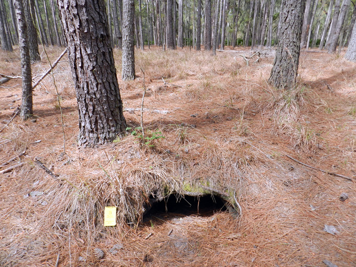
Den entrances have half-moon cross-sections, and based on one sample (n = 20), these range from 22-115 cm wide (mean = 63 + 23 cm) and 14-55 cm high (23 + 9 cm).

I like throwing numbers into ichnology, just to remind people that this is a part of it as a science. Although our sample size is small compared to other studies of traces and trace fossils, it gives people an idea of the range of sizes of these dens, or at least their entrances. As an exercise in the imagination, think about whether you could squeeze into one of these. You know, if you were crazy enough to do such a thing.

In addition to field descriptions, we applied geographic information systems (GIS) and ground-penetrating radar (GPR) to help define the ecological context and subsurface geometry of these structures, respectively.

Computer-aided mapping methods like GIS helped us to test how alligators decided to make dens as a function of the landscape. For instance, we found most of their dens were in lower-elevation areas, which made sense when you think about water accumulating in those places. And the GPR served the dual purpose of not bothering the alligators if they were in their dens, while also keeping us away from their, um, denizens. (Sorry.)

GIS gave spatial data relatable to alligator territoriality, substrate conditions, and proximity to potential nest sites. GPR produced subsurface images of active dens, which were compared to abandoned dens for a sense of taphonomic history.

Big alligators tend to stay away from other big alligators. They also tend to burrow in sediments that don’t take too much effort for them. Female alligators also make their nests close to water bodies and dens, so their little tykes don’t have to travel so far to the water. Newer, active dens were also compared to those no longer being used to see what happens to them over time with neglect, kind of like how an old, abandoned house tends to fall apart and collapse on itself over time.

Most den entrances are southerly facing, with tunnels dipping to the northwest or northeast.

This is pretty self-explanatory, but I’ll just ask readers to think about why these dens are oriented like this.

From entrances, tunnels slope at about 10-15°, turn right or left within a meter, and lead to enlarged turn-around chambers.

Pure description here too, but by “turn-around chamber,” that means the den has enough room inside the den for a big adult alligator to go in head-first and turn around so that it’s head is right at the entrance. (See the photo of “big momma” at the top for an example of that.)

Collapsed dens in formerly ponded areas (secondary-succession maritime forests) provided further insights into subsurface forms of these structures.

Dens left high-and-dry from years ago and taken over by forests collapsed in a way that we could see the full outline of the den and measure these.

These features are: 3.1-4.6 m long; 30-40 cm deep, relatively narrow at either end (35-60 cm), and 1.2-1.6 m wide in their middles.

Dude. Those are big burrows. Dude.

Expansive areas were probable turn-around chambers, and total volumes of collapsed dens accordingly reflect maximum body sizes of their former occupants.

The bigger the den, the easier it was for a large occupant to turn around in it. And although smaller, younger alligators could have lived in these dens, some of the dens were too small to allow the really big alligators from moving into them.

One sampled area (8,100 m2), an almost dry former pond, had 30 abandoned dens, showing how multiple generations of alligators and fluctuating water levels can result in dense concentrations of alligator burrows over time.

Think of an area about the size of an American football field, and put 30 alligator dens in that area. (Now that would make for an interesting game, wouldn’t it?) These dens weren’t all made at the same time, though, and were constructed or abandoned as the pond filled or dried out, respectively.

In summary, the sheer abundance, distinctive traits, and sizes of these structures on St. Catherines and elsewhere in the Georgia barrier islands give paleontologists excellent search images for seeking similar trace fossils made by large semi-aquatic archosaurs.

That’s the big take-home message here for vertebrate paleontologists. All of the information we gathered about these alligator dens from the Georgia barrier islands, especially what they look like, can be applied to test the fossil record of archosaurs. In other words, did archosaurs actually leave lots of dens for us to find, but we just didn’t know what to look for? Hopefully we’ll find out because of this research.
Later, denning ‘gator. (Photograph by Anthony Martin, taken on St. Catherines Island, Georgia.)

(Special thanks to Ruth Schowalter for assisting with the field work, and to the St. Catherines Island Foundation for funding some of the research.)

Source of Abstract (Reference):

Martin, A.J., Page, M., Vance, R.K., and Skaggs, S. 2012. Dens of the American alligator (Alligator mississippiensis) as traces and their predictive value for finding large archosaur burrows in the geologic record. Journal of Vertebrate Paleontology, 32 [Suppl. to No. 3]: 136.


Knobbed Whelks, Dwarf Clams, and Shorebirds: A Love Story, Told Through Traces

For the last three Thanksgivings, my wife Ruth and I have fled the metropolitan Atlanta area and sought “nature therapy” through the environments of Jekyll Island on the Georgia coast. For this all-too-short vacation, we take our bicycles with us, stay in a hotel near the beach, and ride for hours on Jekyll’s plentiful bike paths or long beaches, taking in the fresh sea air and stopping to look at and document any animal traces that catch our interest. It is ichnology with a low carbon footprint, natural history that’s also eco-chic. Best of all, though, we have been to Jekyll enough times to know where the best traces are likely to be found. Because of this inside knowledge and enthusiasm for all things ichnological, we sometimes discover phenomena, that, as far as we know, were previously unnoticed on any of the undeveloped Georgia barrier islands.

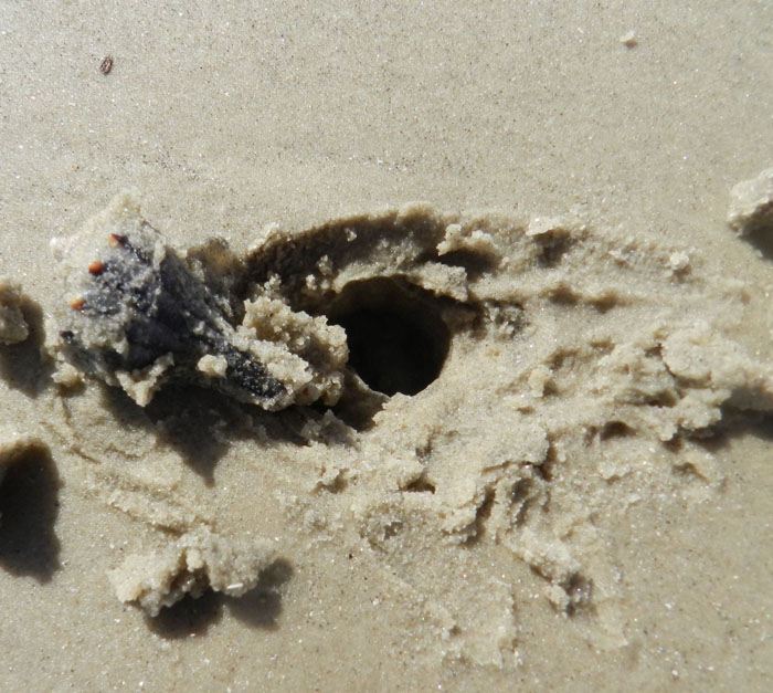
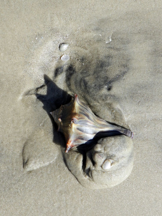
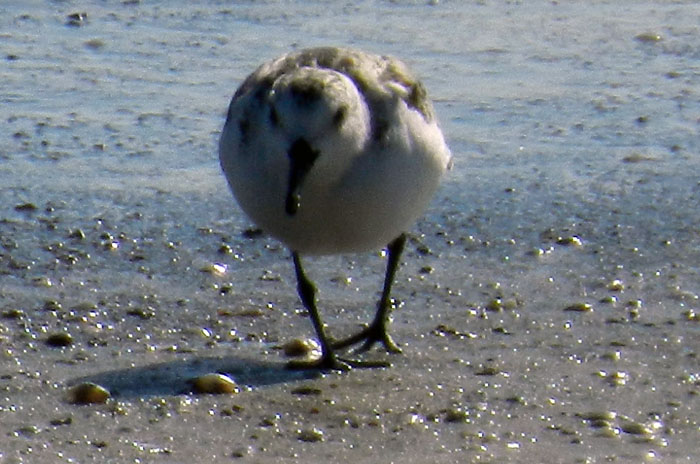
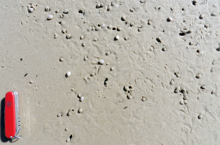
This Thanksgiving break was one of those times. The cast of characters in our latest novel find includes: two molluscans, knobbed whelks (Busycon carica) and dwarf surf clams (Mulinia lateralis); and two species of shorebirds, sanderlings (Calidris alba) and laughing gulls (Larus altricilla). How these four animals and their traces related to one another made for a fascinating story, nearly all of it discerned through their traces left on that Jekyll Island beach.

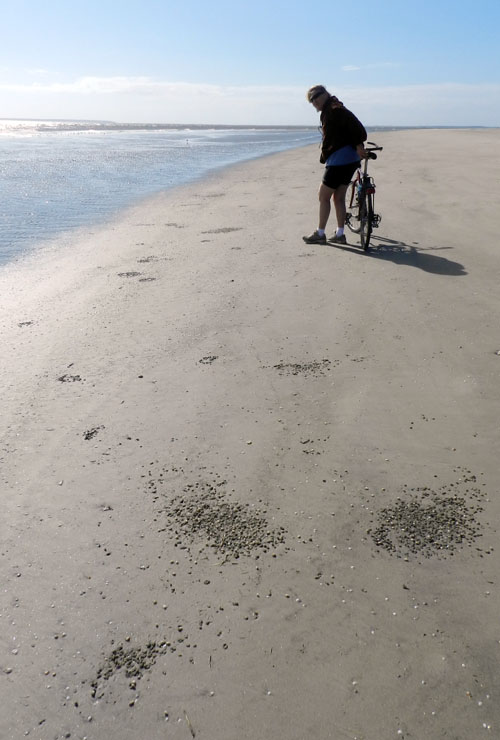
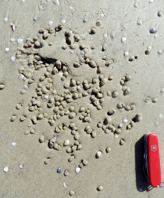
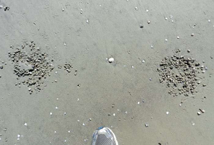
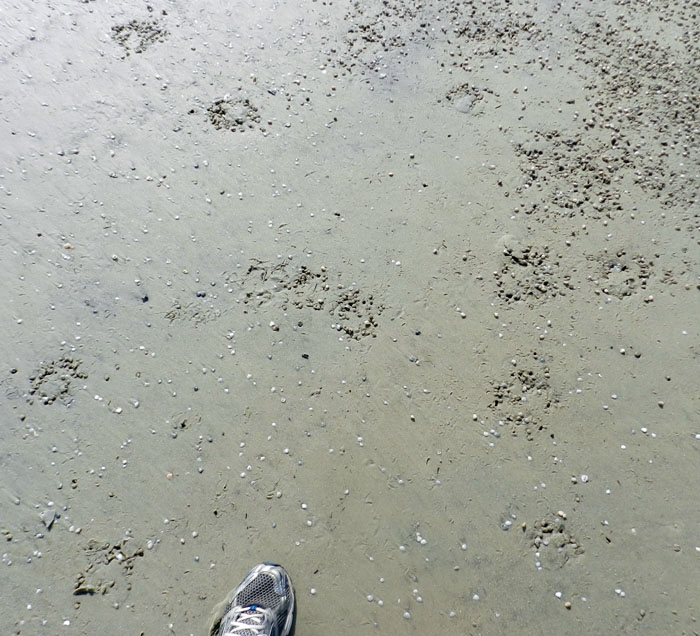
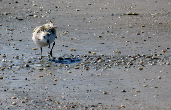
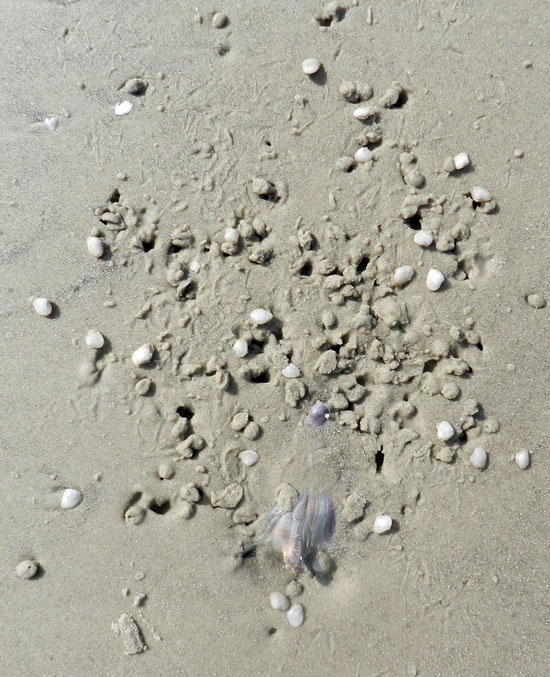
A view of a sandy beach on Jekyll Island at low tide with clusters of shallowly buried dwarf surf clams (Mulinia lateralis). These bivalves and their burrows, combined with beak marks and tracks of one of their predators, sanderlings (Calidris alba), make for the dark patches on the sand. But do you also see the abundant knobbed whelks (Busycon carica) and their traces in this photo? If not, please read on. (Ruth Schowalter for scale, happily standing by her bicycle, and photograph by Anthony Martin.)
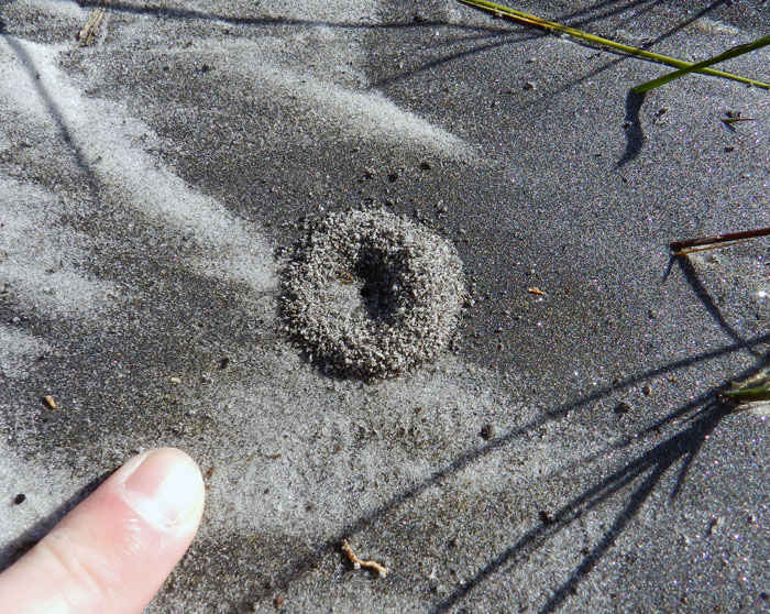
Jekyll is a developed island on the Georgia coast, its southern end about 30 kilometers (18 miles) north of the Georgia-Florida border, with sandy beaches, dunes, salt marshes, and maritime forests, all interrupted by residences, roads, golf courses, boutique shops, and other human-centered amenities. On the southeastern end of Jekyll, however, the beachside condominiums and hotels become fewer and the sandy natural areas correspondingly expand, holding bountiful traces of the local wildlife. With this geography in mind, we headed south on our bikes along the beach our first full day there. During this exhilarating outing, Ruth and I paused occasionally to figure out what animal activities might have taken place in the minutes or hours before our arrival, just after the high tide had turned and exposed broader areas of sandy beach.
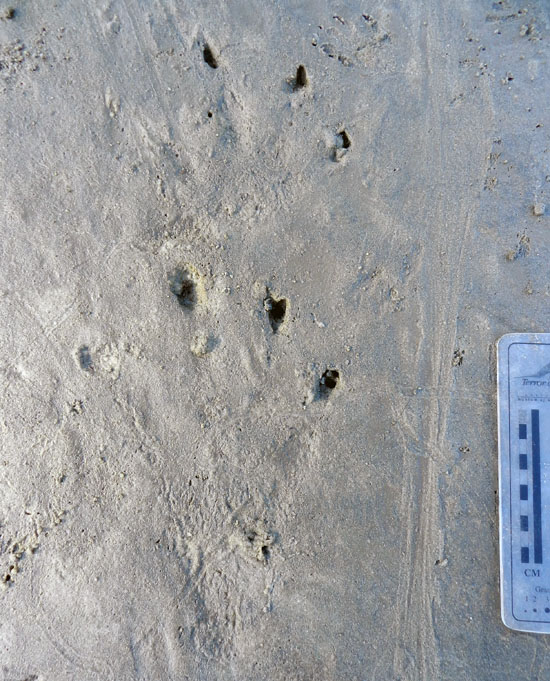
We were not disappointed, as some traces immediately caught our attention. Low in the intertidal zone, we noticed upraised flaps of sand that marked the subsurface positions of variably sized knobbed whelks, which are among the largest marine snails in the eastern U.S. These whelks, brought in by the high tide and strong waves, had burrowed down into the sand as soon as the tide subsided. This behavioral mode has been positively reinforced by millions of years by natural selection, a tactic by the whelk that avoids both desiccation and predation.

Here’s how to spot a buried whelk. Look for a triangular interruption in an otherwise smooth surface, where a flap of sand is slightly raised. Sometimes this trace also has a small hole at one end of the triangle. Test your hypothesis by digging in gently with your fingers. If you’re wrong, then revise your search image for their traces until you get it right. The knobbed whelk pictured here is a small one, but check out the size of the one in the next picture. (Both photographs by Anthony Martin, taken on Jekyll Island.)

A whelk uses its muscular foot to bury itself, expanding and contracting it so that the foot probes into the still-saturated sand left by the high tide; once the foot anchors in the sand, it pulls the rest of the whelk sideways and down. This really isn’t so much “burrowing” as an intrusion, where the animal insinuates itself into the sand. Contrast this method with the active digging we normally associate with burrows made by most terrestrial animals with legs.

A robust specimen of a knobbed whelk (held by Ruth), showing off its well-developed foot, which it uses to bury itself. (Photograph by Anthony Martin, taken on Jekyll Island.)

A knobbed whelk caught in the act of burying itself, leaving a short trail behind and a mound of sand in front as it starts to get underneath the beach surface. (Photograph by Anthony Martin, taken on Jekyll Island.)

Once a whelk is buried, waves may wash over its trail, erasing all evidence of its preceding actions. Nonetheless, once emergent, seawater drains downward through the sand and tightens these grains around the whelk, denoting it as a triangular “trap door” that occasionally has a small hole at one end. This hole marks where the whelk expelled water through the bottom end of its shell.

Near these clear examples of whelk traces on this beach were clusters of dwarf surf clams. Similar to whelks, these clams were washed up by the hide tide and waves, and they instinctually burrowed once exposed on the surface. Although much smaller and more streamlined than knobbed whelks, they likewise use a muscular foot to intrude the sand, anchor, and pull in their shelled bodies. Under the right conditions, these clams will also leave a trail behind them before descending under the sand, although such traces are easily wiped clean by a single wave.

Cluster of dwarf surf clams that burrowed into the sand at low tide, some noticeable through little “sand caps” on top of them. Say, I wonder why there’s a triangular-shaped bare spot of sand toward one end of that cluster? (Swiss Army knife = 6 cm (2.4 in) long; photograph by Anthony Martin, taken on Jekyll Island.)

Although dwarf surf clams ideally orient themselves vertically and push two siphons through the sand – making a Y-shaped burrow – they sometimes only have enough strength to bury themselves on their sides, hidden by a mere cap of sand. This bivalve equivalent of hiding under a blanket makes them much more vulnerable to predation, especially from shorebirds that find these clams and make quick snacks of them, such as sanderlings.

Sanderling (Calidris alba), 50-100 g of pure avian fury, prowling the sandy tidal flat of Jekyll Island in search of prey. Moon snails, given their fierce predation on other molluscans, may be the “lions of the tidal flat,”  but as far as small crustaceans and clams are concerned, sanderlings are the “tyrannosaurs.” (Photograph by Anthony Martin, taken on Jekyll Island.)

Sanderlings eat many small crustaceans that live in the sand, but they are also fond of small bivalves, such as dwarf surf clams. Sure enough, wherever you find a cluster of these clams, you will also find abundant tracks and beak probe marks made by these birds. Both their tracks and the probe patterns made by their beaks are diagnostic of this species: when I see these traces on any Georgia beach, I don’t have to look at a bird-identification guide to know whether sanderlings, dunlins, plovers, or sandpipers were there. Their food choices are clarified even more when you see their tracks and beak-probe marks directly associated with almond-shaped holes, where they neatly extracted the clams from their burrows.
Sanderling tracks and beak-probe marks, with holes where clams were located by the sanderlings and  plucked out of their shallow burrows. (Swiss Army knife = 6 cm (2.4 in) long; photograph by Anthony Martin, taken on Jekyll Island.)

So how do these three species and their traces all relate to one another? (And what about the laughing gull?) Well, this is where it got even more interesting. Ruth and I soon started spotting triangular outlines within the clam clusters, bare spots on the sand devoid of both clams and beak marks. Underneath these were whelks. As we stood back and looked down the beach, we then saw how these clumps of clams were throughout the intertidal zone, and each was surrounding a whelk. Somehow the whelks had served as nucleation sites for clams, which had chosen to burrow in the sand around the whelks, instead of being randomly dispersed throughout the beach.

Remember this previous photo? There’s a whelk buried underneath that bare triangular patch.

Didn’t believe me? Well, there it is. It’s almost as if ichnology is a science, in which hypotheses, once confirmed by evidence-based reasoning, have predictive power.

Here are two more clusters of dwarf surf clams around buried whelks, hidden but still identifiable.

Quiz time: how many whelks are here? Thanks to ichnology, you don’t actually have to see them to dig them out for a census. (All four photographs by Anthony Martin and taken on Jekyll Island.)

Why were the clams burrowing around the whelks? Was this some sort of commensalism, in which the clams found more food around the whelks? No, because these clams are filter feeders, taking in water with suspended organic material for their sustenance, instead of ingesting the sand around them. How about protection? That didn’t seem likely either, because the whelk had no interest in defending the clams, and its body wasn’t even serving as a shield against shorebirds.

So I thought about how these clams burrow, and then it all made sense. Because dwarf surf clams are so small, sand grains are more like cobbles would be to you and me. Moving through these sediments thus takes considerable effort, especially as water drains from the sand and surface tension holds together the grains more tightly. This means the clams have to take advantage of sand that acts more like quicksand and less like concrete, and burrow when the sand has lots of water between the grains.

This is where the whelk became both the unwitting friend and enemy of the dwarf surf clams. As it burrowed, it fluidized the sand around it, shaking up the grains so that more space opened between them, which allowed in more water. This zone of disturbance and liquified sand was eagerly exploited by nearby clams, which easily burrowed into both the whelks’ trails and the immediate areas around their bodies.

Alas, this opportunity for safety provided by the whelk ultimately led to the sanderlings chowing down on the clams. What might have been a meticulous search for small clams sprinkled hither and tither throughout the broad Jekyll beach had now became a lot easier, thanks to both the whelks and the clams. All a sanderling had to do was find each motherlode of clams conveniently grouped around a buried whelk and start probing. It was an all-you-can-eat clam feast, and the traces clearly showed where some of these birds stopped and took their time gorging on the clams. Their tracks also showed where one stopped sanderling attracted the attention of others, which then rushed to the scene and joined in the buffet.

Wait, what have we here? A sanderling alters its course to investigate an obvious dense accumulation of dwarf surf clams. How did this population get so dense? Blame the knobbed whelk, which was just minding its own business by burrowing.

The carnage of sanderling plundering, in which about a third of buried dwarf surf clams were pulled from their burrows and the sand was trampled by thundering avian feet. This gruesome scene can all be laid at the feet, er, foot of the the whelk pictured here, which through its burrowing made it easier for the clams to burrow around it. (Both photographs by Anthony Martin and taken on Jekyll Island.)

But what about the laughing gull and its role in this story? Sorry, that will have to wait until next week’s post. In the meantime, in these days immediately following the Thanksgiving holiday in the U.S., let us all be thankful for the natural areas still preserved on Jekyll Island that allow for such wanderings of our bodies and minds, as well as the little personal discoveries of its life traces, infused with wonder, that can be shared with others.

Further Reading

Elbroch, M., and Marks, E. 2001. Bird Tracks and Sign of North America. Stackpole Books. Mechanicsburg, Pennsylvania: 456 p.

Howard, J.D., and Dörjes, J., 1972. Animal-sediment relationships in two beach-related tidal flats: Sapelo Island, Georgia. Journal of Sedimentary Research, 42: 608-623.

MacLachlan, A., and Brown, A.C. 2006. The Ecology of Sandy Shorelines. Academic Press, New York: 373 p.

Powers, S.G., and Kittinger, J.N. 2002. Hydrodynamic mediation of predator–prey interactions: differential patterns of prey susceptibility and predator success explained by variation in water flow. Journal of Experimental Marine Biology and Ecology, 273: 171-187.

Wilson, J. 2011. Common Birds of Coastal Georgia. University of Georgia Press, Athens, Georgia: 219 p.