Walking with the Alligators

Alligators swim, and they walk. However, most people who live in coastal areas with American alligators (Alligator mississippiensis) – such as the Georgia barrier islands – also know that alligators can (and do) swim in the open ocean, and that they can (and do) walk long distances overland on beaches and dunes. Still, despite many visits to Georgia coast barrier islands hosting healthy populations of alligators, I have not yet witnessed either behavior. Fortunately, I’m an ichnologist, so I don’t have to just take the word of local residents or actually see these ‘gator behaviors to know they happen. Tracks and other traces are there to inform, letting me know where these alligators go, what they are doing, and when they are doing whatever alligators do when human eyes are not watching.

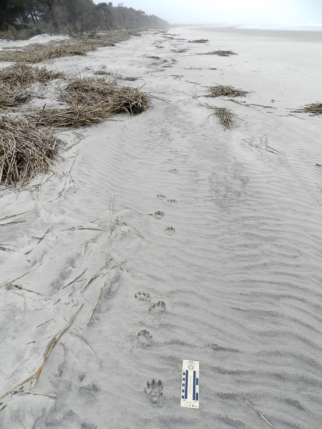
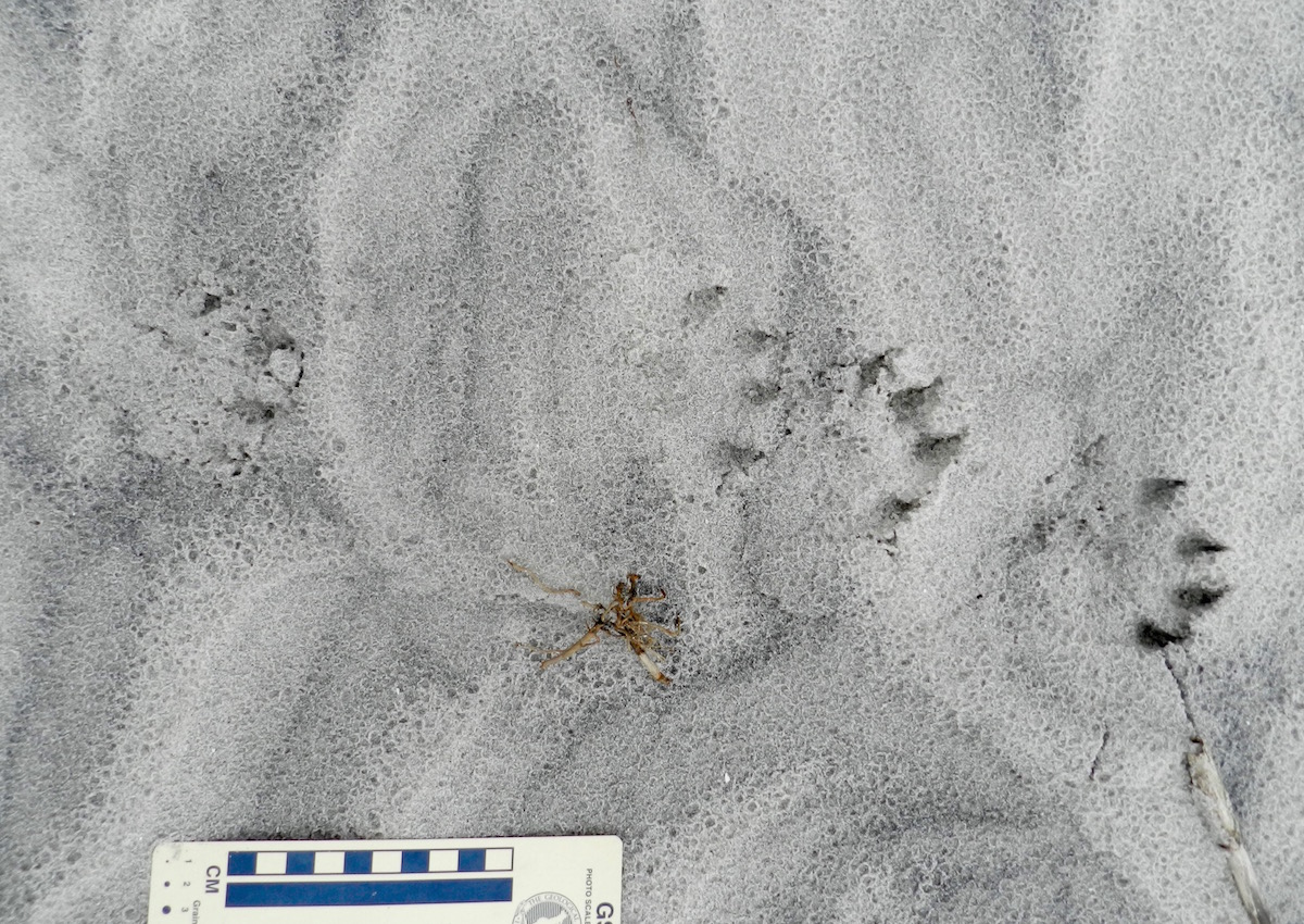
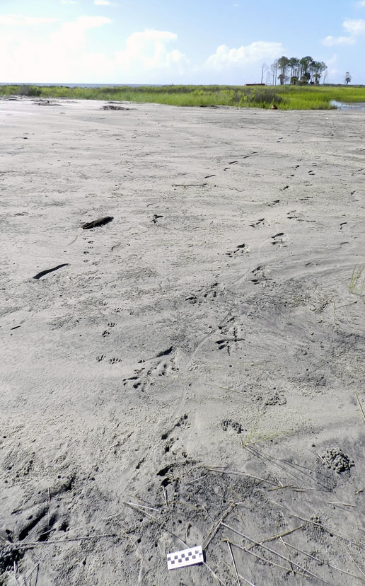
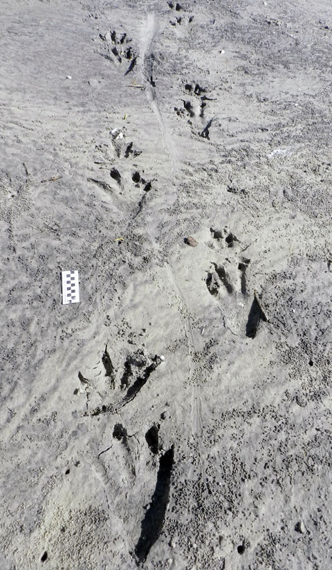
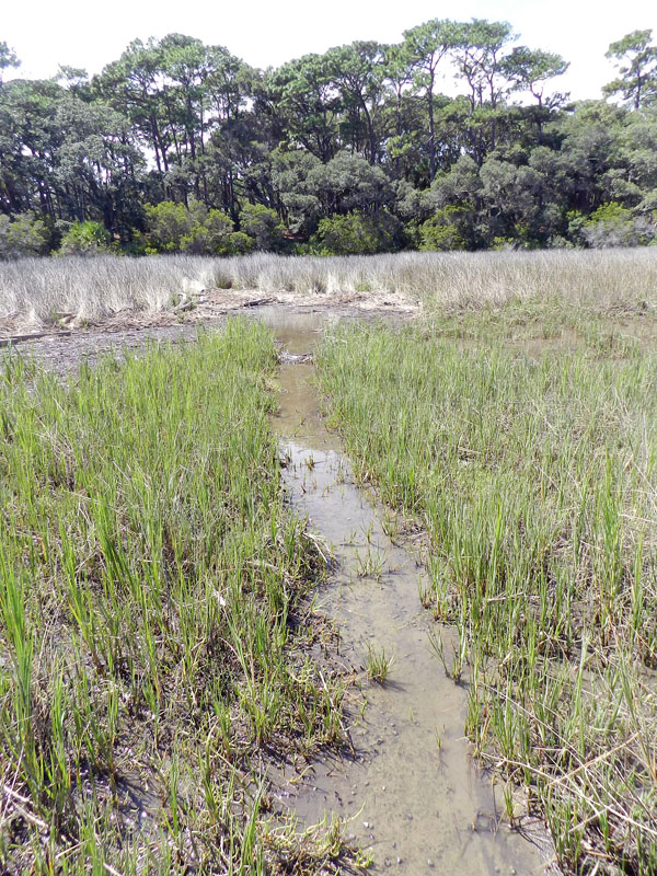
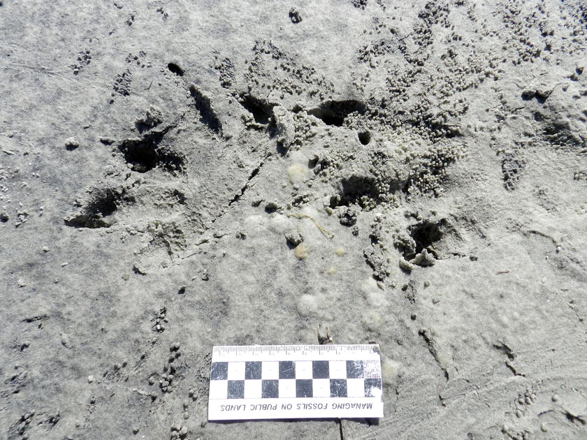
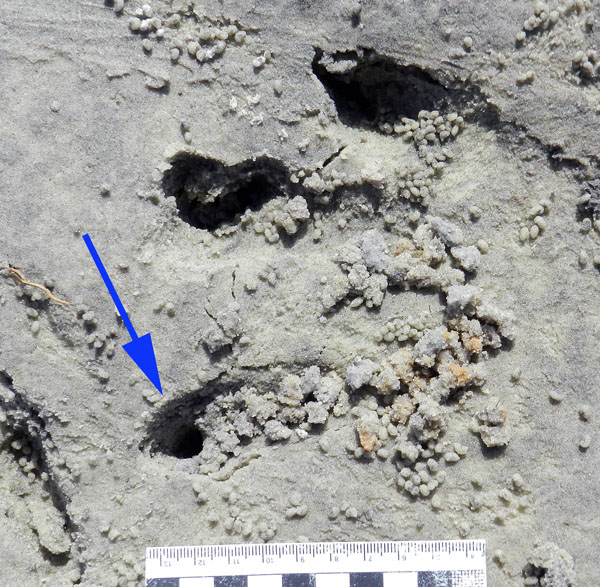
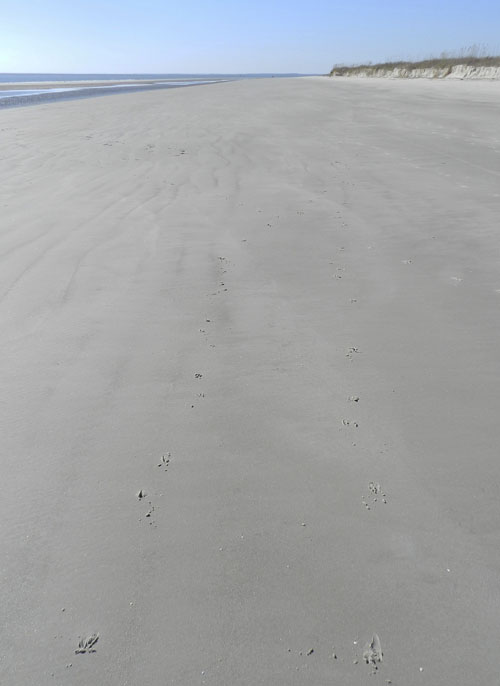
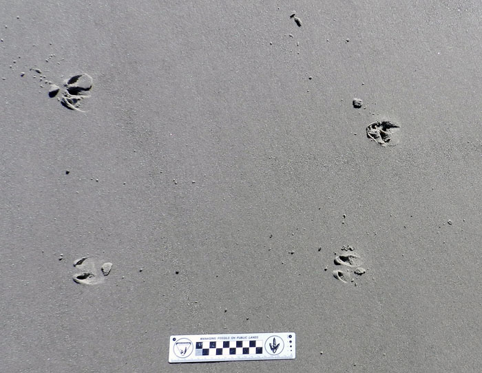
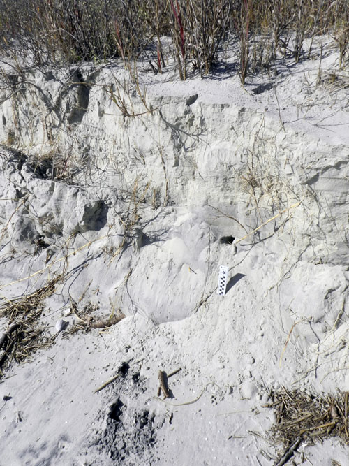
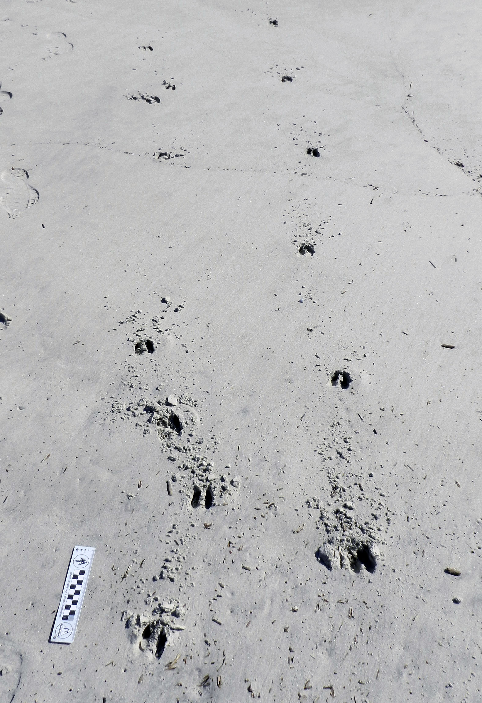
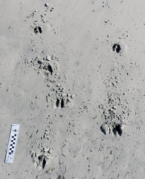
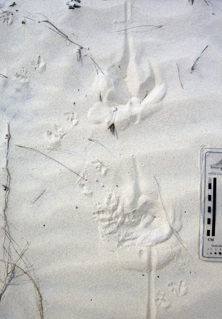
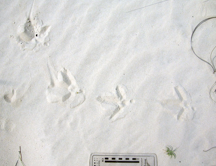
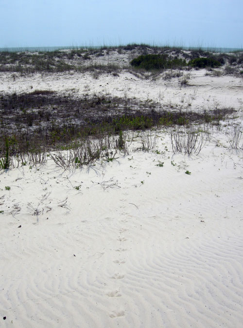
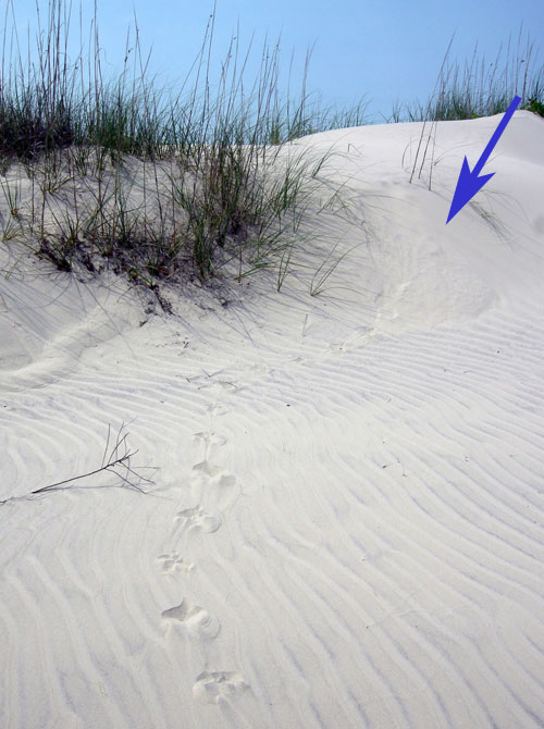
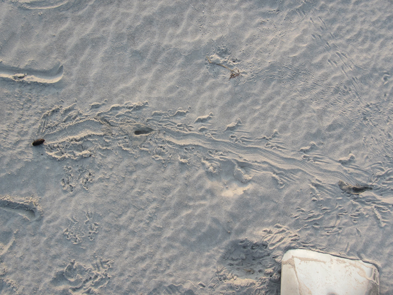
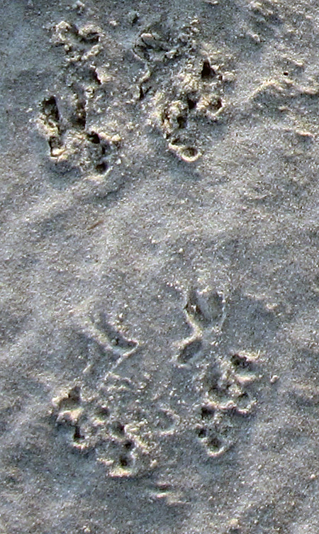
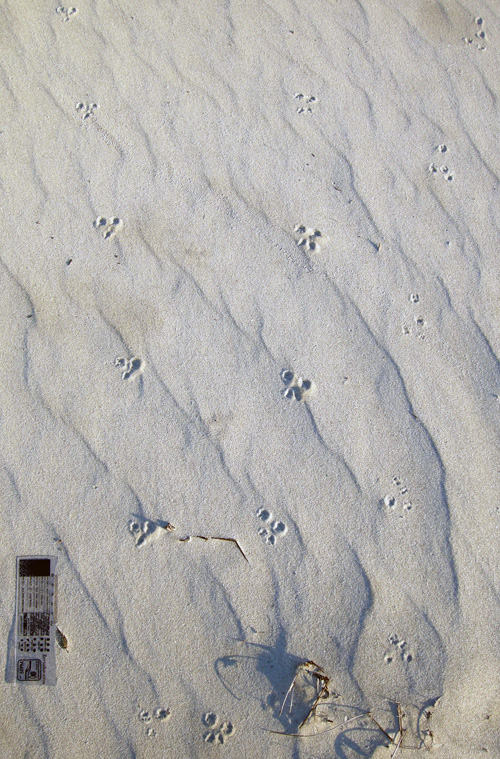
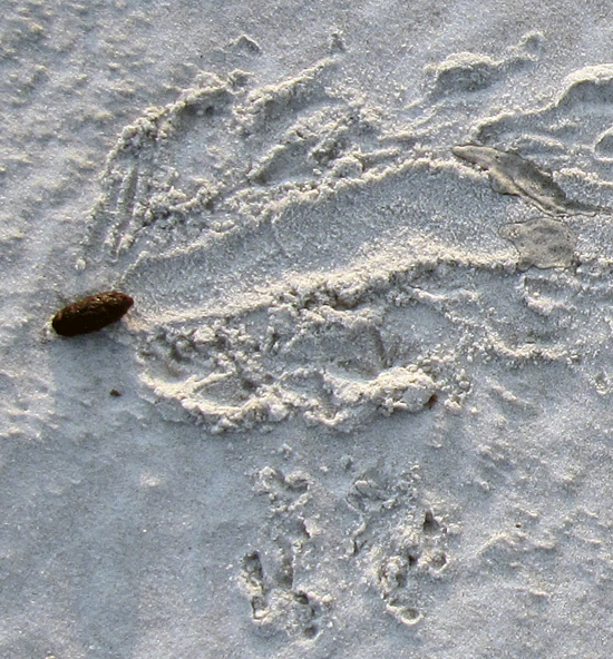
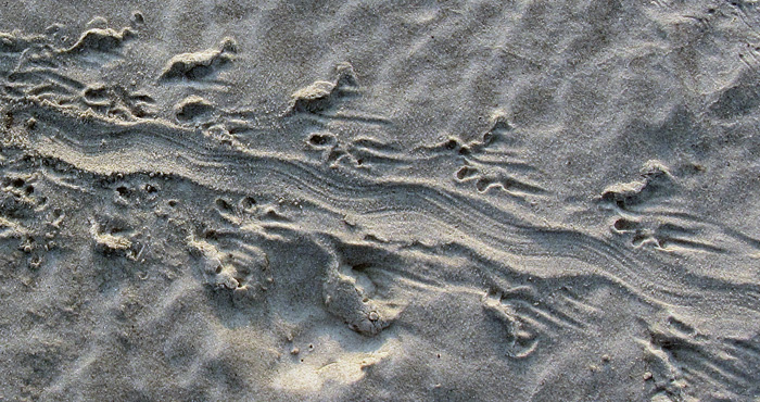
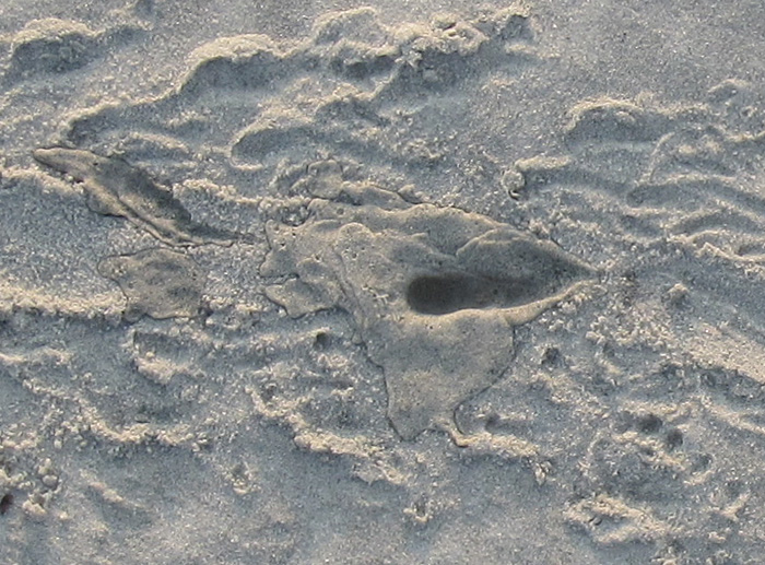
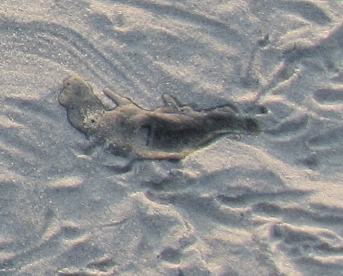
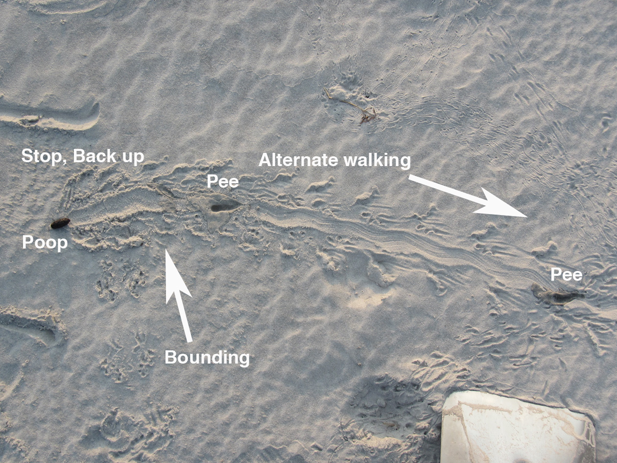
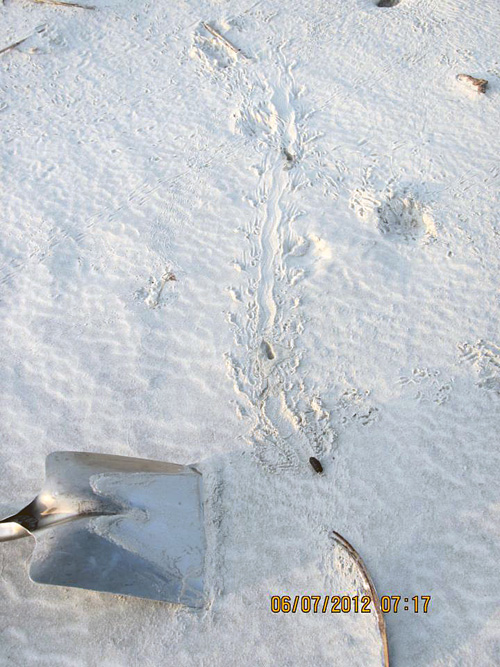
Fresh tracks and tail-drag traces of a large adult alligator (Alligator mississippiensis) going for a stroll on a beach after an open-ocean swim. Where did it go after crossing the beach? Find out for yourself in the following video. (Yours Trult for scale; photo taken by Ruth Schowalter on Sapelo Island, Georgia.)

Since the end of my academic year in May, I have spent much of the summer at home in Decatur, Georgia writing my next book. I’m pleased to report that I made good progress on that writing, but I really needed a break from it, and one that took me away from home to some other place for a mental shift. That “other place” was Sapelo Island on the Georgia coast, where my wife Ruth and I got in three days of glorious field work. And among the many ichnological and other nature-related wonders we encountered were these alligator tracks.

I’ll let the following video do the talking for me, and I mean that literally, as it is me talking in the video. Because I used my digital camera as the video-recorder, the sound quality isn’t perfect (wind intrudes), but should be 95% understandable. Also, the camera lens had a smudge that I didn’t notice until later, which makes the image a little blurry in spots. So if you can filter out both of these audio and video flaws, you just might enjoy walking with those Sapelo Island alligators, tracking them from the ocean to, well, you’ll have to watch and see.

Tracking That Is Otterly Delightful

Writing about a place, its environments, and the plants and animals of those environments is challenging enough in itself. Yet to write about that place and what lives there, but without actually being there, seems almost like a type of fraud. Sure, given a specific place, I could read everything ever published about it, watch documentaries or other videos about it, carefully study 3-D computer-rendered images of its landscapes, interview people who have spent much time there, and otherwise gather information vicariously, all without experiencing it directly. But then is my writing just about the shadows on the wall of the cave?

River-Otter-Tracks-Sapleo-Beach-1What do you see in this photo? I see fine quartz and heavy-mineral sand, originally parts of much larger rocks and forming parts of the Appalachian Mountains. I see the sand blowing down a long beach, but pausing to form ripples. I see a river otter galloping alongside the surf, slowing to a lope, then a trot, then back to a lope and a gallop. I see a brief rain shower, only about two hours after the otter has left the beach. (Photo by Anthony Martin, taken on Sapelo Island, Georgia.)

This pondering, of course, brings us to river otters. Yesterday, while on the third of a four-day writing retreat to Sapelo Island on the Georgia coast, my wife Ruth and I spent nearly an hour tracking a river otter along a long stretch of beach there. Had I read about river otters and their tracks before then? Yes. Had I watched video footage of river otters? Yes. Had I written about river otters and their tracks before then? Yes. Had I seen and identified their tracks before then? Yes. Had I seen river otters in the wild for myself? Yes, yes, and yes.

But still, this was different. When I first spotted the tracks on the south end of a long stretch of Cabretta Beach on Sapelo, I thought they would be ordinary. Granted, finding otter tracks is always a joy, especially when I’ve seen them on stream banks in the middle of Atlanta, Georgia. (Seriously, folks: river otters live in the middle of Atlanta. How cool is that?) And because Sapelo only has a few humans and is relatively undeveloped, your chances of coming across otter tracks on one of the beaches there isn’t like winning a lottery. But still.

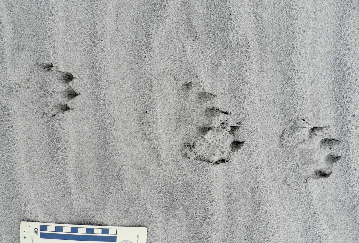
Otter-Tracks-Lope-Pattern-SapeloRiver otter (Lutra canadenis) tracks in what I (and some other trackers) call a “1-2-1” pattern. For gait, that translates into a “lope,” which is typical for an otter. In this pattern, one of the rear feet exceeds the front foot on one side, but the other rear foot ends up beside that same front foot; one front foot is behind. If that second rear foot lags behind the front foot, then it’s a “trot,” but if it exceeds the front foot (both rear feet ahead of both front feet), then that’s a “gallop.” Also, check out the wind ripples beneath the tracks, and raindrop impressions on top of them. (Photo by Anthony Martin, taken on Sapelo Island, Georgia; photo scale in centimeters, with the long bar = 10 cm (4 inches))

What made these tracks different was that they went on, and on, and on. These otter tracks spoke for the otter, saying in no uncertain terms that walking, trotting, loping, and galloping on a beach was the only thing it had on its schedule that morning. For nearly a kilometer (0.6 miles), we followed its tracks in the sandy strip of land between the high-tide line on the right and low coastal dunes on the left.

River-Otter-Tracks-Sapelo-Beach-2

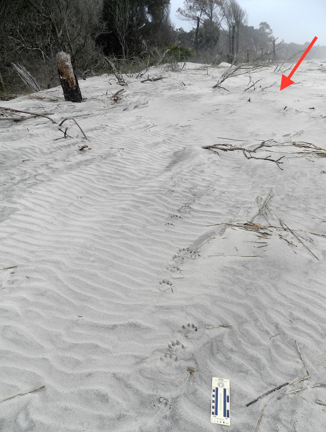
Follow the river otter tracks for as far as you can in this photo. Then, when you can’t see them any more, decide where it went. Does that sound like a challenge? It probably would be if you’ve only written about tracking otters, but it can be tough for experienced trackers, too. (Photo by Anthony Martin, taken on Sapelo Island, Georgia.)

The tracks were only a few meters away from high tide, but sometimes turned that way, vanished, then reappeared further down the beach. This told us the otter was out close to  peak tide that morning (between 6-8 a.m.) and was mixing up its exercise regime by occasionally dipping into the surf. Raindrop impressions on top of the tracks confirmed this, as the tracks looked crisp and fresh except for having been pitted by rain. For us, rain started inland and south of there on the island around 10 a.m., but reached the tracks sooner than that. We were there about three hours after then, so the otter was likely long gone, on to another adventure. Nonetheless, we made sure to look up and ahead frequently, just in case the trackmaker decided to come back to the scene of his or her handiwork.

For those of you who are intrigued by animal tracks (and why would you not be?), I suggest you try following those made by one animal, and follow it for as long as you can. That way you can learn much more about it as an individual animal, rather than just its species name. In my experience, after tracking an animal for a long time, nuances of its behavior, decisions, and even its personality emerge.

For example, this otter was mostly loping (its normal gait), but once in a while slowed to a walk or trot, or sped up, when it galloped. In short, the tracks showed enough variations to say that the otter was likely reacting to stimuli in its surroundings, and in many different ways. What gave it a reason to slow down? What impelled it to move faster? Why did it jump into the surf when it did, and why did it come out? Or, do otters just want to have fun?

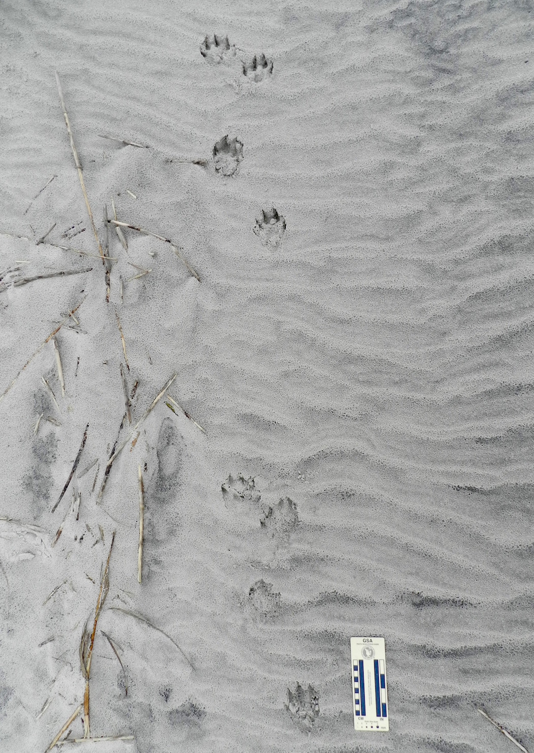
River-Otter-Gallop-Pattern-SapeloGallop pattern for a river otter, in which both of its rear feet exceeded the front feet, making a group of four tracks. In this instance, the group defines a “Z” pattern when drawing a line from one track to another, but gallops sometimes also produce “C” patterns. Notice also how the groupings are separated by a space with no tracks. This is also diagnostic of a gallop pattern: the longer the space, the longer the “air time” for the animal, when it was suspended above the ground between when its feet touched the ground. (Photo by Anthony Martin, taken on Sapelo Island, Georgia.)

Now I realize that discerning a “personality” and “moods” of a non-human animal based on a series of its tracks might sound like a little too “woo-woo” and “New Agey” for my skeptical scientist friends to accept, followed by jokes about my becoming a pet psychic. As a fellow skeptical scientist, I’m totally OK with that. In fact, I will join them in making fun of people who try to tell us that, say, they know what a Sasquatch was thinking as it strolled through a forest while successfully avoiding all cameras and other means of physical detection.

But here’s what happens when you’ve tracked a lot (which I have) and made lots of mistakes while tracking, but later corrected them (ditto). Intuition kicks in, and it usually works. For instance, at one point in following this otter, I lost its tracks on a patch of hard-packed sand. (Granted, I should have gotten down on my hands and knees to look closer, but was being lazy. Hey, come on, I was on a writer’s retreat.) So I then asked myself, “Where would I (the otter) have gone?” and looked about 10 meters (30+ feet) ahead in what felt like the right place. There they were. This happened three more times, results that led me to conclude this was almost like some repeatable, testable, falsifiable science-like thing happening. So there.

River-Otter-Tracks-Sapelo-Beach-2-LabeledOK, remember when I asked you to follow the river otter tracks for as far as you could in this photo, and when you couldn’t see them any more, decide where it went? If not, go back and re-read it and look at the photo again. If you have, then look at the red arrow, backtrack to the footprints in the foreground of the photo, then go forward. Do you see how the tracks are staying in the subtly lower area, just left of the slightly higher sand piled on the plant debris? Keep picking out those low areas, and you’ll end up where the arrow is pointing. After all, if I were an otter, that’s where I would go. (Photo by Anthony Martin, taken on Sapelo Island, Georgia.)

Oh yeah, regarding my main topic sentence: What’s all this have to do with writing about a place? Well, because of that otter and its tracks, I now understand at least one otter much better than before, and feel like I can write with a little more authority about otters in general. You know, like what you just read.

Otter-Tracks-Lope-Pattern-Sapelo-2Do you understand this river otter and its place a little better now, thanks to it leaving so many tracks while it enjoyed a morning at the beach, and because I tracked it for such a long time, and then wrote about that experience in that same place? Please say “yes,” as I want to keep writing about stuff like this. P.S. Thanks to Sapelo Island, this river otter, and my wife Ruth for teaching me so much yesterday. (Photo by Anthony Martin, taken on Sapelo Island, Georgia.)

A Birds-Eye View of a Georgia Barrier Island

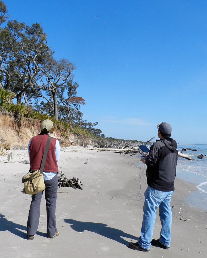
All scientists use tools when investigating how the natural world works. Yet as a traditionally trained field scientist – and an ichnologist – I’ve always been wary of adopting anything more complicated than field notebooks, pencils, tape measures, hand lenses, and cameras. Granted, I did add GPS units to my equipment list starting about 12 years ago and now consider these location-finding devices as standard (and essential) field gear. Still, if you told me even a year ago that I would happily welcome the services of flying robots while tracking alligators on the Georgia barrier islands, I would have smiled and said, “Yes, and Bud Light is my favorite beer.” (Just to clarify: It is not, nor will it ever be.)

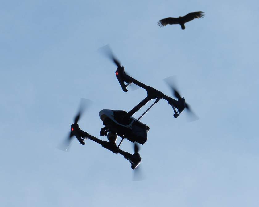
Drone+VultureNeed a better overhead view of barrier-island ecosystems with identified locations, and don’t feel like waiting for the latest satellite photos? I suggest strapping a camera and GPS unit onto a vulture and training it to take pictures while simultaneously recording waypoints. Or, have an aerial drone do the same for you, which will do a much better job, while also not annoying the vulture. (Photograph by Anthony Martin, taken on St. Catherines Island, Georgia.)

So here I am, ready to buy everyone a round of their favorite beverage (perhaps Kool-Aid) in celebration of my being wrong. Earlier this year, an Emory colleague of mine – Michael Page – convinced me that an aerial drone might be a good tool for getting overhead views of ecosystems on the Georgia barrier islands. So as soon as Emory purchased a new, state-of-the-art drone in early 2015, Michael and I plotted to take it to St. Catherines Island for its first real field test in March 2015.

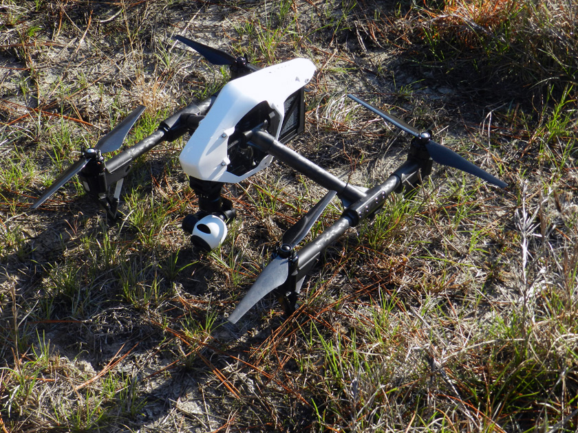
Drone-1Yeah, I know, it’s not New Horizons, but this drone is still a pretty nifty piece of field equipment, and I’m glad to have added it to my ichnology utility belt. (Photograph by Anthony Martin, taken on St. Catherines Island, Georgia.)

The last time Michael and I were on St. Catherines Island together was two years ago, when we had a group of Emory students help us map gopher tortoise burrows and alligator dens there. (That was fun.) We’ve also been working with a few other colleagues at Georgia Southern University to describe the gopher tortoise burrows and alligator dens on St. Catherines Island over the past few years. So Michael and I figured we could use the drone to aid in this research, starting with the gopher-tortoise burrows.

Perhaps the most persuasive point Michael made about the drone’s potential value was its winning combination of built-in GPS and high-definition video camera. This meant we could instantly map (“georeference”) gopher-tortoise trails between their burrows, as well as the burrows themselves. The latter were easily visible from the wide, white, sandy aprons just outside burrows entrances, and sometimes even show up in satellite photos of the area. The big difference with using a drone versus satellite photos, though, would be in their ‘real-time” capture of these traces – rather than a randomly taken satellite image – while also having much better resolution.

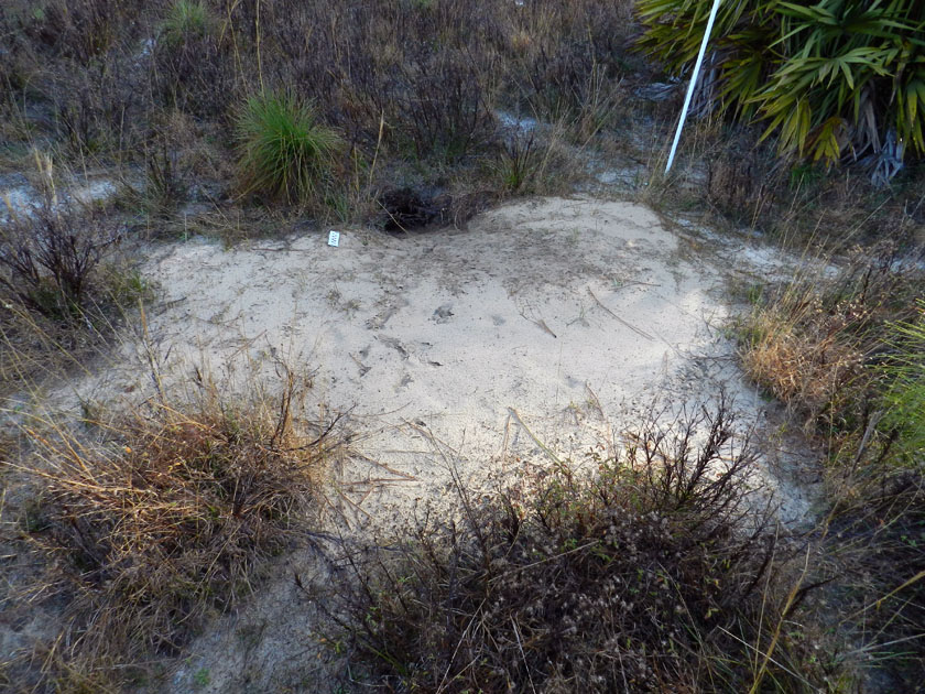
Tortoise-Burrow-ApronSee that hole in the ground? That’s a gopher-tortoise burrow. See those breaks in the grass to the left and right in the foreground, and elsewhere? Those might be trails that connect this burrow to others in the area. How to map all of them? Call in the drone! (Photograph by Anthony Martin, taken on St. Catherines Island, Georgia.)

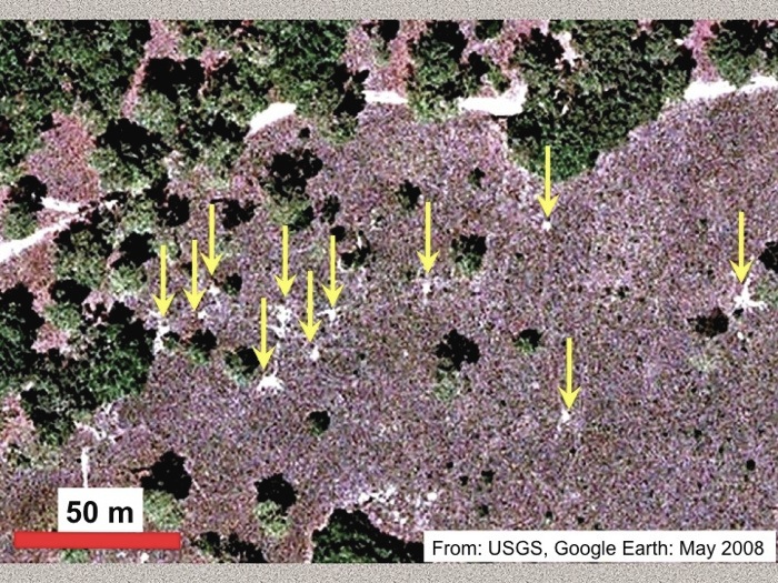
GT-Aprons-Trails-SCICan you see gopher tortoise traces from space? Surprisingly, yes. Not only are burrow aprons visible in this GoogleEarth™ photo (denoted by the arrows), but also trails connecting some of the burrows. Although if you find yourself squinting and turning your head sideways to see these, you’ll understand why sending up a drone with a high-resolution camera might be a better way to map these traces. (Image taken from a presentation I gave at the 2011 annual meeting of the Geological Society of America in Minneapolis, Minnesota.)

Most of the gopher-tortoise burrows are in a broad, flat area on St. Catherines that used to be pasture land, but is now being restored to the tortoises’ long-leaf pine-wiregrass ecosystem. This re-located tortoise population has done quite well here, and because of its isolation on St. Catherines, it’s an example of one that does not face as many human-related problems as their compatriots on the Georgia mainland. Its remote location also helped us with trying out the drone, as we didn’t have to worry about it dodging buildings, power lines, or gawking locals, all of which might have complicated its flights.

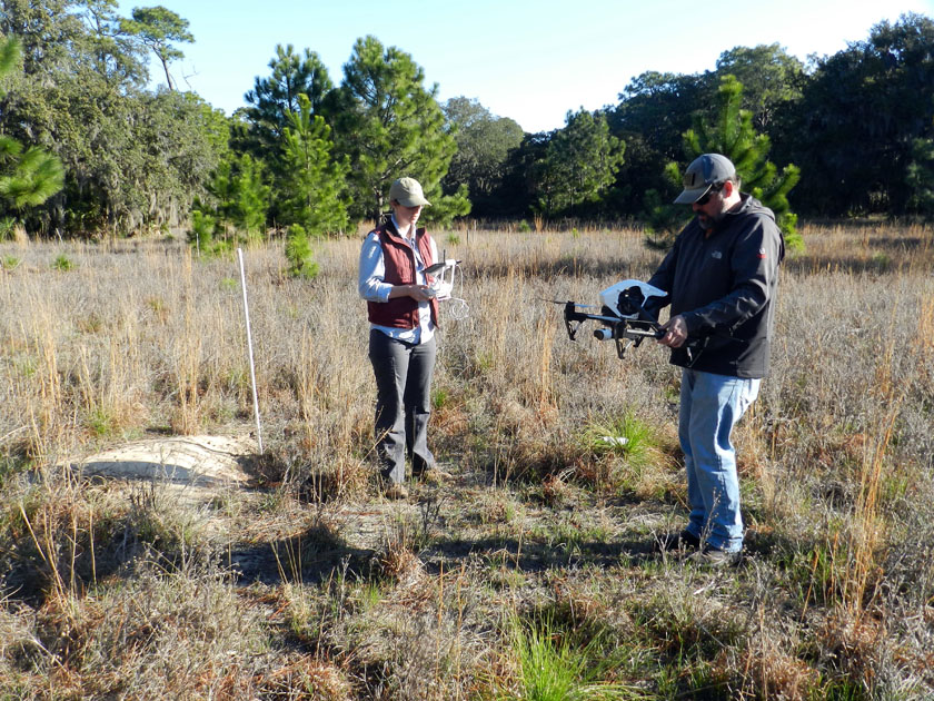
Tortoise-Burrow-Drone-PilotsAlmost ready for take-off! Drone pilots/wranglers Alison Hight (left) and Michael Page (right) look for a flat place near a staked gopher-tortoise burrow for setting down our “eyes in the sky.” (Photograph by Anthony Martin, taken on St. Catherines Island, Georgia.)

This was the drone’s maiden voyage on St. Catherines Island, taking off from the gopher-tortoise field. It did just fine. (Video footage by Anthony Martin, taken on St. Catherines Island, Georgia.)

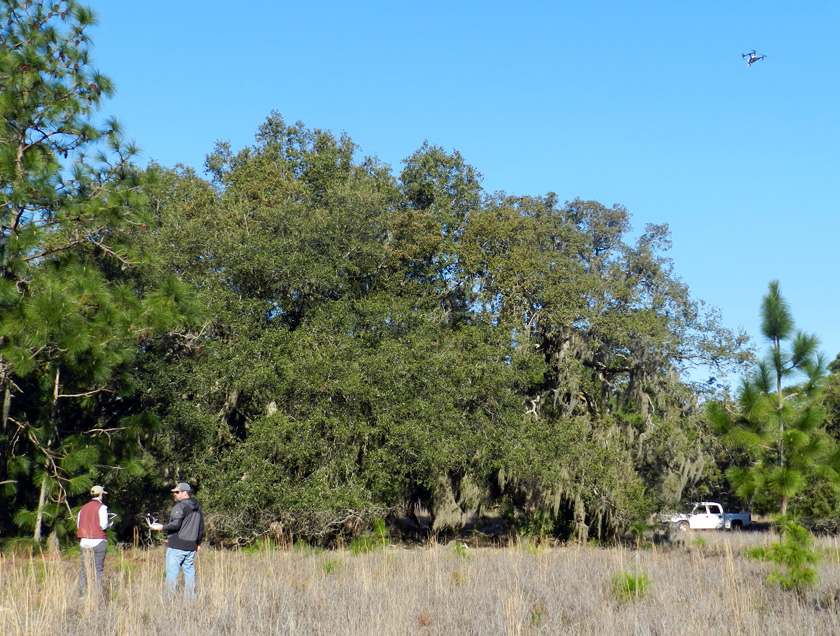
Drone-Above-Tortoise-FieldThe drone pilots doing a great job, sending the drone around the gopher-tortoise field for a spin. (Photograph by Anthony Martin, taken on St. Catherines Island, Georgia.)

This flight was a big success, in that the drone went up, took lots of video and photos while in the air – all of which was georeferenced – and it came down without crashing. So we decided to try it elsewhere. That’s when we remembered the Atlantic Ocean was only about 500 meters away on the eastern edge of St. Catherines, with a lengthy beach, salt marshes, storm-washover fans, tidal creeks, and a bluff of Pleistocene sand with maritime forest on top of it. So off we went, and we did Flight #2 over the storm-washover fans, salt marshes, and tidal creeks near the north end of the island.

Drones (much like me) operate well in places with wide-open spaces that involve Georgia beaches. Check out how quickly it disappears from view once in the air. (Video footage by Anthony Martin, taken on St. Catherines Island, Georgia.)

Following this flight, we decided to send the drone father north to survey the bluff from just offshore. This was probably the most exciting flight, as we watched it go out to sea, then fly parallel to the shore, with its camera trained on the coastline.

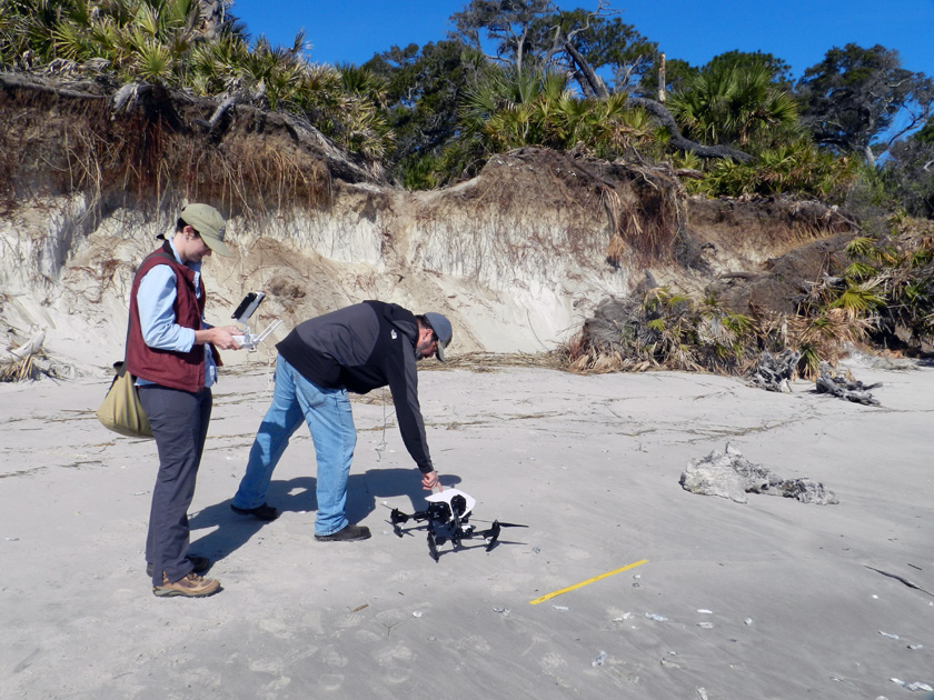
Drone-Yellow-Banks-Bluff-1Michael setting down the drone on a almost-flat surface as Alison prepares it for take-off. The yellow yardstick serves as an easily visible scale that can be used to estimate ground-level distances. (Photograph by Anthony Martin, taken on St. Catherines Island, Georgia.)

Off we go, into the wild blue yonder. (Video footage by Anthony Martin, taken on St. Catherines Island, Georgia.)

Drone-Yellow-Banks-Bluff-3Bringing it back home. Look for the spot near the top-center of the photo for our “hand lens in the sky.” (Photograph by Anthony Martin, taken on St. Catherines Island, Georgia.)

Coming in for a soft landing, which is much preferred over the other type of landing. (Video footage by Anthony Martin, taken on St. Catherines Island, Georgia.)

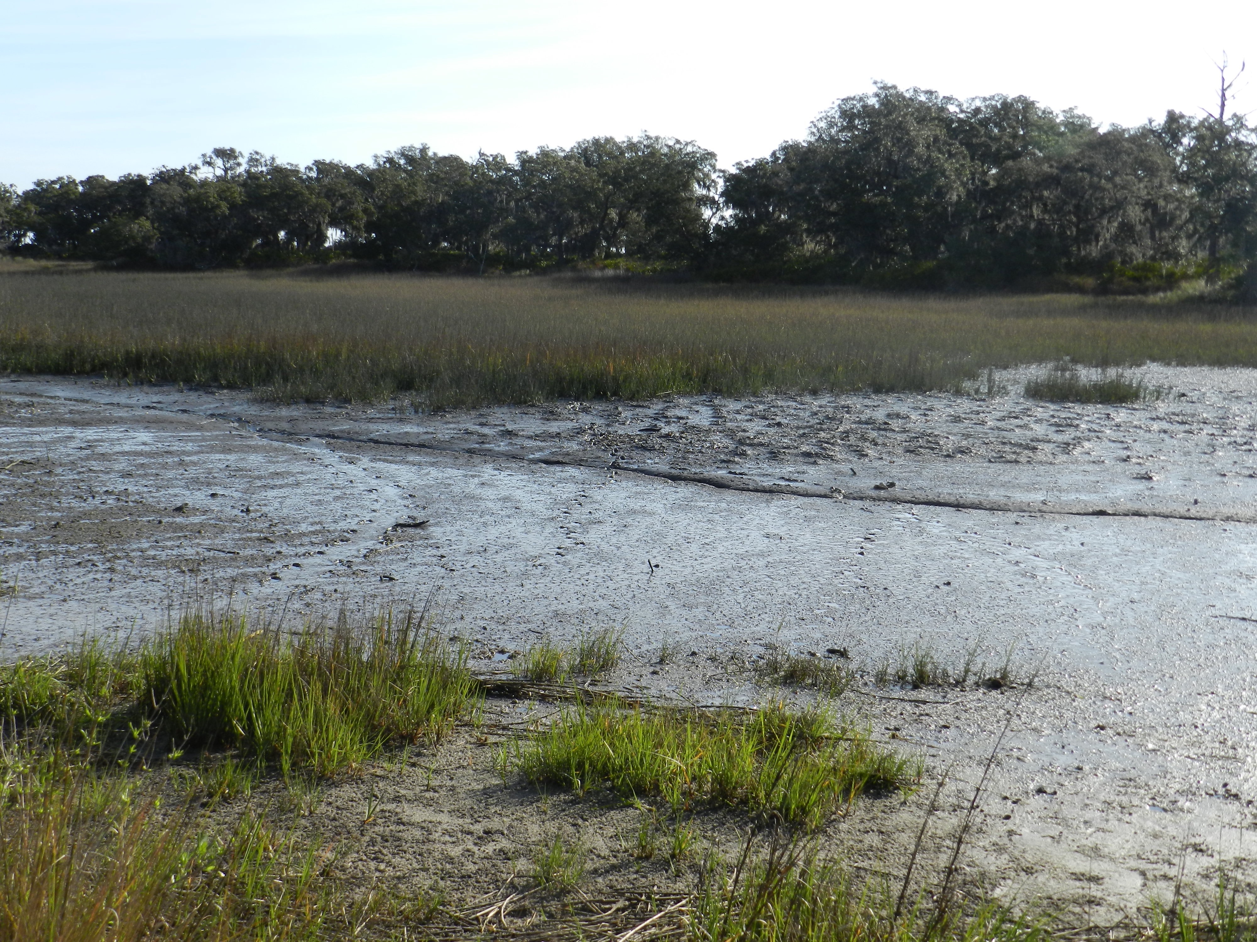
So following these inland and coastal successes, which clearly were applicable to studying gopher tortoises and coastal geology, it was time to try using the drone to look at the apex predators of the island – alligators – and their traces. The next day,while scouting areas further to the south for alligator dens and tracks, we paused on a causeway cutting through a salt marsh. Because the marsh was at low tide, its mudflats were exposed, which allowed a few big animals to walk across it and leave their tracks, and for us to see these tracks.

At least two of the trackways were from alligators, made distinctive by their sinuous tail drags, arcing footprints, and belly drags. I suspect the other trackways were from feral hogs, but I couldn’t tell for sure because they were in squishy mud beyond my carrying capacity. Which is to say, I would have quickly immersed myself in this environment had I gone any further out. Gee, if only we had some way to photograph those trackways from above, better helping us to see their lengths, patterns, and directions.

Alligator-Trackways-MarshA salt-marsh mudflat at low tide, with low marsh and a patch of forest (hammock) in the background. See the alligator trackway to the left, where the alligator turned? Look in the middle and you’ll see two more trackways that are probably from feral hogs, and another curving trackway to the right that is from another alligator. (Photograph by Anthony Martin, taken on St. Catherines Island, Georgia.)

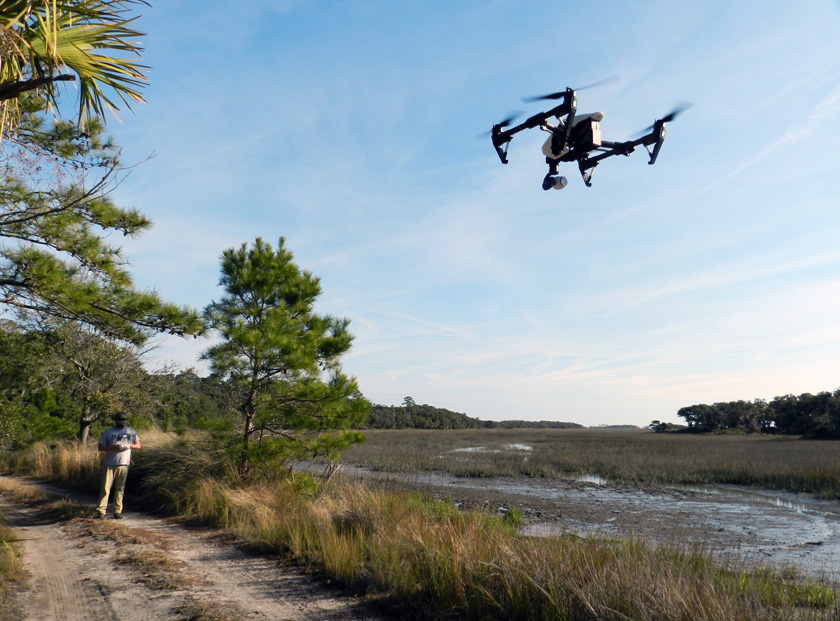
Drone-Landing-Salt-MarshWhy wade into waist-deep salt-marsh mud to track an alligator when you can stay safely (and cleanly) on dry land, telling a drone what to do? (Photograph by Anthony Martin, taken on St. Catherines Island, Georgia.)

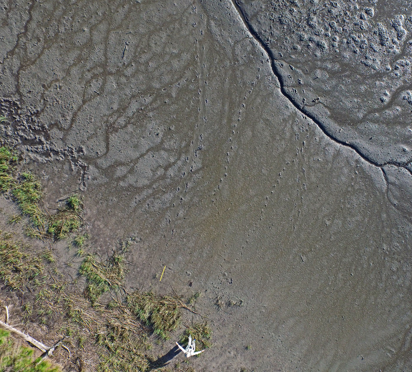
So it was time for another flight, and the drone’s first alligator-track-mapping mission, which I’m pleased to say was a success. One example of that success is conveyed by the following photo, which made me gasp when I first saw it. There were the two alligator trackways and the two hog trackways, but also two not-so-clear trackways I had missed and a clear view of where the hogs had dug along the marsh edge. This photo similarly evoked a collective “Ooooo!” when I showed it to an audience the next week at the Southeastern Section meeting of the Geological Society of America meeting in Chattanooga, Tennessee. My talk was a progress report on the alligator dens of St. Catherines Island, but I threw in this photo toward the end of it to show how drones might help with some of our tracking alligator movements through difficult-to-access environments on the island.

DCIM100MEDIADJI_0100.JPGOK, you’re probably wondering by now how good those photos and videos taken by the drone might be, and whether or not any useful science can come from them. See that guy in the lower center of the photo? That’s me, pointing to each of the two alligator trackways, with the yellow yardstick providing an additional scale to the left. Notice also the probable feral hog trackways in the middle and fainter ones to the right, as well as the “hogturbation” (rooting disturbance caused by hogs) in the upper left of the photo. As an ichnologist, I was pretty darned pleased by this picture, and I want more like it. (Photograph by The Aerial Drone, taken on St. Catherines Island, Georgia.)

Lastly, I was also happy to see that drones have their own ichnology, in that they make flight traces. I’ve been long fascinated by flight traces – called volichnia by ichnologists – and have done my best to describe these in modern birds of the Georgia coast, as well as bird flight traces in the fossil record. Given the right substrate, anatomy, and behavior, the take-off and landing traces of birds and other flighted animals can preserve well enough for us to interpret them for their true nature.

Now, to do the same for a drone requires knowing how they have vertical take-offs and landings, using rapidly moving rotors. This means air will be pushed down onto the substrate directly underneath the drone, then dissipated abruptly outside that zone. The result would be a sem-circular depression slightly more that the maximum width of the drone, and one that would look very much the same whether made by a take-off or landing. The difference would be in the timing of the landing-pad traces: if obscured by the depression, then it was taking off, but if they are impressed on the depression, then it was landing.

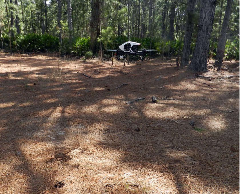
Drone-Making-Landing-TraceDrone coming in for a landing, already pushing aside pine needles on the forest floor and making its landing trace. (Photograph by Anthony Martin, taken on St. Catherines Island, Georgia.)

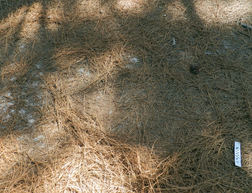
Drone-Landing-Trace-2Drone landing trace, minus the drone. Do you see the square pattern in the middle of the oval depression? That’s the outline of the drone, defined by its landing gear. (Photograph by Anthony Martin, taken on St. Catherines Island, Georgia.)

So now we know that a drone can be used for conservation biology, coastal geology, behavioral ecology, and – most importantly – ichnology. How about art? Yes indeed. Once we got back to the Emory campus, Michael handed over the footage to Steve Bransford, a skilled videographer employed by Emory and founder of Terminus Films. Given all of the drone footage, he snipped out the boring parts (always a good thing to do), added a few maps at the start to orient the viewers, put in a soothing soundtrack, and basically created an aesthetically pleasing and extraordinarily educational video. So we submitted it for consideration as an video in the peer-reviewed online journal Southern Spaces, which was founded at Emory University. Much like an aerial drone on an unobstructed coastline, it sailed through peer review and is now available for viewing by all who have an Internet connection.

St. Catherines Island Flyover from Southern Spaces on Vimeo. Never mind the stern message: just click on the link or the video and it will play. Once it does start playing, please watch it on a big screen, sit back, and enjoy the ride. Also be sure to read the accompanying article linked to the peer-reviewed online journal Southern Spaces.

What’s aerial adventures await us next? We’ll see, as we have plenty of visual information and data to process from our previous visit. But for now we can be pleased to have shown the value of an aerial drone as both a scientific instrument and a means for engaging our senses with soaring imaginations.

Acknowledgements: Many thanks to the St. Catherines Island Foundation for its support of our research on St. Catherines, and to Royce Hayes and Michael Halstead for their assistance on field logistics. We also appreciate the expert piloting of the drone by Alison Hight while on St. Catherines. Steve Bransford did a fantastic job with creating the video for the Southern Spaces article, which should win the Georgia equivalent of an Oscar. Input from the editor of Southern Spaces, Allen Tullos, improved our article accompanying the video, and we are grateful to the staff of Southern Spaces for their quality service in putting this video and article online. And as always, many thanks to Ruth Schowalter for her help and support, in and out of the field.

Emory News (July 15, 2015): Drone Offers Stunning Aerial Views of Georgia’s St. Catherines Island.

The Ichnology of Godzilla

Upon learning that Godzilla would be making its way back onto movie screens this summer, my first thought was not about whether it would it would serve as a powerful allegory exploring the consequences of nuclear power. Nor did I wonder if it would be a metaphor of nature cleansing the world’s ecological ills through the deliberate destruction of humanity. Surprisingly, I didn’t even ponder whether the director of this version (Gareth Edwards) would have our hero incinerate Matthew Broderick with a radioactively fueled exhalation as cinematic penance for the 1998 version of Godzilla.

Instead, my first thought was, “Wow, I’ll bet Godzilla will leave some awesome tracks!”  My second thought was, “Wow, I’ll bet Godzilla will leave some awesome bite and claw marks!” My third thought was, “Wow, I’ll bet Godzilla will leave some awesome feces!” All of these musings could be summarized as, “Wow, I’ll bet Godzilla will leave awesome traces, no matter what!”

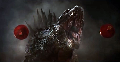
Godzilla-RoaringGodzilla: King of the Tracemakers. (Image and most others here from the movie were taken as screen-capture stills from the official trailer here and modified slightly for your science-learning pleasure.)

So as an ichnologist who is deeply concerned that movie monsters make plenty of tracks and other traces whilst rampaging, I am happy to report that yes, this Godzilla and its kaiju compatriots did indeed make some grand traces. Could they have made traces worthy of ichnological appraisal, ones that could be readily compared to trace fossils made by Godzilla’s ancestors? Yes, but these traces could have been better, and let me explain why.

[Minor spoilers follow, not least of which include the not-surprising news that The King of the Monsters prevails in the end, inevitably setting up a sequel in which I sincerely hope Godzilla and his rivals make more easily defined traces.]

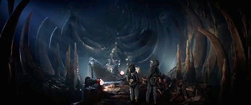
Early on in the movie – set in 1999 – a surface mine in the Philippines collapses. Drs. Ishiro Serizawa (Ken Watanabe) and Vivienne Graham (Sally Hawkins) are summoned to the site and quickly whisked underground. There they find a spacious chamber containing body fossils – bones or similar endoskeletal parts – of an enormous creature. Instantly, I began yawning. I mean, body fossils: how boring.

Muto-Egg-Chamber-BonesA bit of paleontology near the start of Godzilla, in which some of the humans (who are mostly irrelevant) find skeletal remains underneath a surface mine. Little do they know they’re about to undergo enlightenment and become ichnologists.

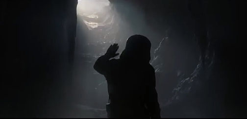
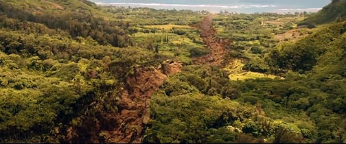
But then I sat upright in my seat when I realized – along with the screen scientists – that this chamber wasn’t a mere tomb, but also a place of rebirth: it was a hatching chamber. Views from inside and outside of the chamber then revealed the ichnological money shots of the movie, showing first an emergence burrow, then an emergence crater* connecting to a trail, the latter cutting a swath through the forest and leading directly to the sea. This was trace evidence of a yet-unseen monster that was very much alive, and one that was brooded and born in a subterranean terrestrial environment, but then moved to an oceanic environment.

Muto-Emergence-BurrowDr. Serizawa sees light at the end of the tunnel, and it’s not from an oncoming train, but something far worse. Still, it’s a cool example of an emergence burrow, so there was some consolation.

Muto-Larval-TrailKaiju emergence burrow connected with a kaiju trail, leading to the sea. So this is definite trace evidence of a heterometabolous animal, with different stages of its metamorphism (terrestrial egg –> marine larva) taking place in different environments. Unlike, you know, Gregor Samsa, who just stayed terrestrial.

A map of seismic signatures shown later in the film denoted where the animal burrowed in the seafloor from the Philippines to Japan, which would have made for one hell of a burrow. Why was this massive animal using so much energy to burrow to Japan? For some radiogenic sustenance, of course, which was conveniently located in a nuclear-power plant there. The “M.U.T.O.,” (= “Massive “Unidentified Terrestrial Object”) then caused a collapse of that power plant, thus qualifying as a feeding trace, rather than plate-tectonic-induced earthquake damage, which is what became the official story. That’s right, geophysicists: you’d better start studying some ichnology if you want to correctly interpret what’s causing those rapid releases of tensional energy that excite you so much. (I’m talking about earthquakes, you perverts.)

Anyway, people die, 15 years pass, families grow apart, blah blah blah, when the action finally returns to something that really matters, like monsters making traces. It turns out the Japanese government had been hiding the truth from the public, which, much like Tom Cruise, can’t handle it. The kaiju not only fed on a nuclear reactor in Japan, but also pupated there. As an example of how gigantic, deadly animal traces can be the real “job creators” in a modern economy, a huge industrial complex with hundreds of Japanese and American employees was monitoring the cocoon, with Drs. Serizawa and Graham as scientific advisors.

Watanabe-Hawkins-IchnologistsWho knew these actors – Ken Watanabe and Vivienne Graham – were actually playing ichnologists in the new Godzilla movie? Just about nobody, including them. (Photograph originally credited to Kimberley French, AP, and much reproduced elsewhere.)

The adult M.U.T.O. that emerged from the cocoon fractured the outer casing, broke through the steel cables that were supposed to restrain it, and immediately started making some tracks. So those are some mighty fine traces, and it was a pleasure watching them get made.

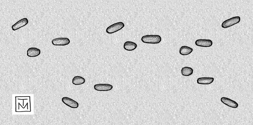
What about its tracks, though? Despite the kaiju’s blend of tetrapod and insect qualities, it had eight appendages and used six while walking – four forelimbs, two of which were wings, and two hindlimbs – making it hexapedal. Moreover, it used an alternating gait, similar to those used by pterosaurs or bats (if they had an extra pair of limbs, that is). Hook-like ends on the forelimbs would have made elongate impressions, and literally impressed a few panicked employees as the monster escaped. On the other hand, er, appendage, the hindlimbs looked as if they were terminated by flat-bottomed hooves. So if one were inclined to track this M.U.T.O, its trackway patterns might have looked like the following:

MUTO-Trackway-Pattern-GodzillaHypothesized male (winged) M.U.T.O. trackway pattern, moving from left to right, showing normal walking that ends with take-off. Wing impressions are on the outside and angled, whereas the forelimb tracks are just inside the trackway, and the hindlimb tracks are closest to the midline. Take-off pattern is at the end, with wing impressions forward so that, like a giant pterosaur, it could “pole vault” for its launch. What’s the scale? Really big. (Illustration by Anthony Martin.)

Toward the end of this scene, we find out this kaiju was also flight capable, as it takes off from its former pupation site. Accordingly, it would have made both take-off and landing track patterns, which have been interpreted in the fossil record for pterosaurs and birds, but from nothing nearly as big. (Oh, how I dream of finding Queztalcoatlus take-off or landing tracks some day…) This switch from terrestrial to aerial locomotion is noted in one of the few funny lines uttered in the movie, when U.S. Navy Admiral William Stenz (David Strathairn) first refers to the kaiju as a M.U.T.O., but then updates the status of its behavioral ecology by saying, “It is, however, no longer terrestrial, as it is airborne.”

Later in the movie, another tracemaking M.U.T.O. emerges from its pupation site –a nuclear-waste repository in Yucca Mountain, Nevada – and proceeds to leave a trail of devastation through Las Vegas, which included killing lots of people who probably bet that wouldn’t happen to them.

Muto-Trail-Las-VegasLeaving Las Vegas, female M.U.T.O. style, with a well-defined trail in its wake, and perhaps knowing it should have taken a left turn at Albuquerque. Hey, U.S. military: I think it went that way!

This kaiju was female and much larger than the male, thus providing a great example of sexual dimorphism in tracemakers of the same species, as seen in horseshoe crabs (limulids) and many other animals. This meant its trackway width would have been correspondingly wider than that of the male, and its tracks larger. It also lacked wings, with the homologous pair of limbs used instead for walking. Consequently, the kaiju’s locomotion (and hence its tracemaking) was restricted to terrestrial environments, with no take-off or landing tracks. So if any more of these monsters came out of the ground, such ichnological knowledge might come in handy for the U.S. military (or recreational hunters) to know which gender of a M.U.T.O. pair they might be tracking.

Muto-Bioerosion-BoringBioerosion trace (boring) made by M.U.T.O. as it encountered a human commerce-generating hive in San Francisco. Unlike most bioeroson structures, this is a locomotion trace, rather than a dwelling or feeding trace.

Other tracemaking done by the M.U.T.O.s included mastication marks on a Russian nuclear submarine and some ICBMs, a little bit of bioerosion when they walked through buildings, and – following some kaiju courtship and sexy time – a nest structure made in San Francisco (no doubt inspiring a new song titled I Left My M.U.T.O. Nest in San Francisco). The nest structure was in the style of those made by many shorebirds, looking like a scratched-out hollow, with the trivial differences of being hundreds of meters across, about a hundred meters deep, and composed of urban debris. The fertilized eggs were in the middle of the structure and attached to an ICBM, like a sort of atomic yolk sac. Overall, it was a tremendous nest structure, dwarfing those likely made by the largest known sea turtle, Archelon from the Late Cretaceous Period, which would have been a mere 10-15 m (33-67 ft) across.

OK, enough about the M.U.T.O. tracemakers. What about our beloved behemoth, The King of the Monsters, The Stomper with the Chompers, Godzilla? The movie – much like this review – held him back until about an hour into the story, only giving us teasing glimpses from photographs over the past 60 years. Sure, this was done deliberately to build suspense, but the title of the movie wasn’t M.U.T.O.s Making Traces (although it could have been, and I would’ve been fine with that). So I was more than ready for Godzilla to leave some tracks, bite marks, and other megatraces that would have made the world’s largest dinosaurs’ traces look puny by comparison.

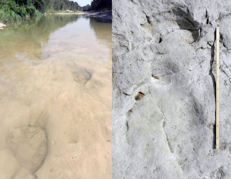
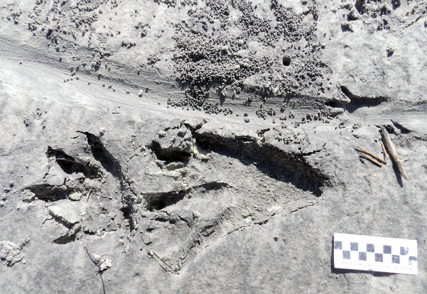
Sauropod-Tracks-Texas-GodzillaTracks on the left are of a sauropod dinosaur trackway in an Early Cretaceous (about 100-million-years-old) limestone bedrock in the Paluxy River of Texas. Tracks on the right are in rocks of same age and area, with left-side front- and rear-foot tracks; the stick is a meter long. For comparision, one Godzilla track would exceed the width of the river. (Both photographs by Anthony Martin, taken in Dinosaur Valley State Park, Texas; to read more about those tracks, go here.)

Did Godzilla leave any clearly defined tracks in the film? Oddly enough, no: imagine my disappointment. Such a glaring ichnological absence led me to believe that Godzilla tracks must not have been a high priority in director Gareth Edwards’s mind while making the film. This is also a rare instance of where the 1998 version of Godzilla surpassed the 2014 one, in that a few nicely outlined tracks were shown in the former.

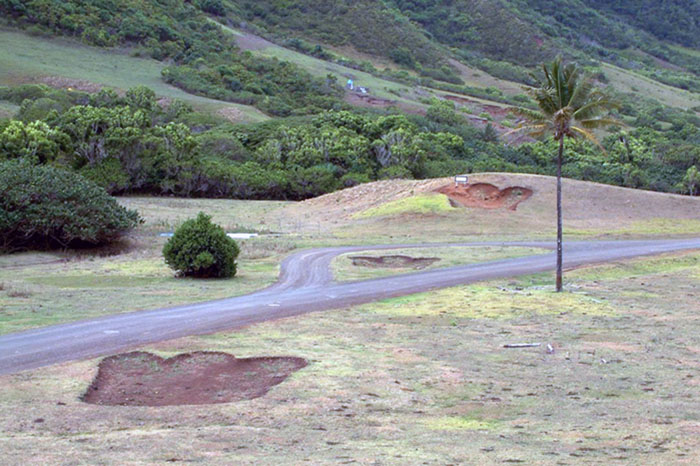
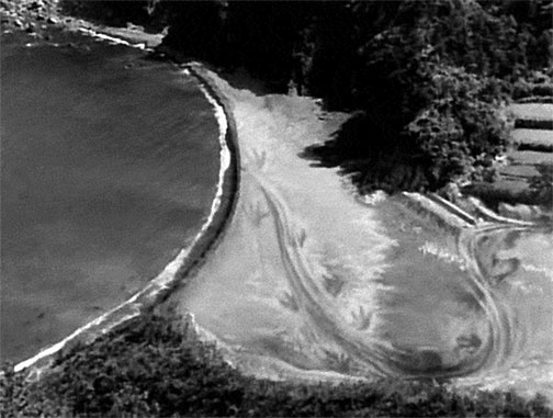
Godzilla-Trackway-HawaiiGodzilla trackway made for 1998 movie, still visible on Oahu, Hawaii. Photo from http://the-american-godzilla.wikia.com/, credited to “Varg2000.”

However, had Edwards decided to add the scientific excitement that would have been induced by overhead views of Godzilla tracks, they would have looked a lot different from the 1998 ones. Although all movie versions of Godzilla have shown it as bipedal on land, the monsters’ feet have been different. For instance, the 1998 Godzilla tracks were definitely modeled after those of theropod dinosaurs, with three separated and forward-pointing toes adorned by sharp claws, albeit greatly up-scaled. According to a reporter in Hawaii who saw one of the Godzilla footprints, he estimated it was about 12 feet long (3.6 m). So using a footprint formula applied to theropod dinosaurs, where the footprint length is multiplied by 4.0, the hip height of that Godzilla would have been 48 feet (14.5 m).

For those of you who have a monster foot fetish, you’re in for a treat. This video shows nothing but close-ups of Godzilla‘s feet landing on and crushing stuff in the 1998 movie.

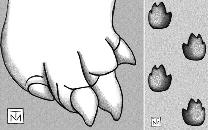
In contrast, the new Godzilla not only had a pedicure, but also a major foot makeover. Instead of three separate toes, this one has four toes scrunched together into more of an elephantine or sauropod-like configuration. It still has claws, but they look much more robust than those of the previous theropod-like feet of its predecessor, and more like those of a sauropod. Accordingly, Godzilla tracks from the 1998 movie versus the 2014 one would have been way different from one another. This means that a skilled movie-consulting ichnologist could have easily distinguished the two films just by glancing at tracks shown in each. (Mr. Edwards, please do keep me in mind if you need an ichnological advisor for Godzilla 2.)

Godzilla-Foot-Trackway-Pattern(Right) Right-foot anatomy of 2014 version of Godzilla, nearly as wide as long and with four digits ending in stout claws. (Left) Hypothesized trackway pattern for present version of Godzilla, using its normal city-destroying gait. Notice its wide stance, like that of a certain retired U.S. senator. A tail drag-mark is not included in this diagram, but probably would have registered once Godzilla stood more upright, such as to kick some M.U.T.U. abdomen. (Both illustrations by Anthony Martin, but foot anatomy is composite drawn freehand from unattributed online photos, such as this one.)

Something important to also note about these trackways is the lack of any tail drag marks. This is because both the 1998 and 2014 Godzillas kept their tails off the ground, which aligns with modern interpretations of how theropod dinosaurs walked. The original Godzilla – and many sequels after it – showed it dragging a weighty tail behind it. This behavior would have left a deep groove in the middle of the trackway, perhaps with a slight undulating pattern caused by side-by-side movement. This would have looked sort of like an alligator or crocodile trackway, but with only right-left tracks, because Godzilla was walking more like some guy wearing a rubber suit.

Godzilla-Trackway-1954Still taken from original 1954 Godzilla (Gojira), showing a bipedal trackway going from a terrestrial to marine environment. But also check out the prominent groove in the middle of the trackway, caused by a tail dragging behind it, and four forward-pointing toes on each foot.

What other traces would I have really liked to see Godzilla make, ones that would have made me stand up in the theater and scream “Ichnology for the win”? My #1 and # 2 choices, in that order, would have been urination marks and feces. In my latest book, Dinosaurs Without Bones (2014, Pegasus Books), I’ve written about trace fossils linked with dinosaur urination and defecation; dinosaur coprolites in particular are great trace fossils for showing what dinosaurs had for lunch millions of years ago. Alas, Godzilla performed neither excretory behavior in the movie, but that didn’t stop at least one scientist from speculating on how much urine this Godzilla would have produced.

So for my upcoming post, I’ll explore the possibility of a Godzilla urination trace. What mark would Godzilla have left if he got really pissed? Tune in next week, and in the meantime, enjoy seeing the movie. but now with an added ichnological perspective.

Other “Science and Godzilla” Posts

The Impossible Anatomy of Godzilla (Danielle Venton)

Godzilla Gets Bigger Every Year (Rhett Allain)

The Impossible Gait of Godzilla (Ria Misra)

The Ever Increasing Size of Godzilla: Implications for Sexual Selection and Urine Production (Craig McClain)

Reviewing the Science of Godzilla for Plausibility and Imagination (Mika McKinnon)

The Science of Godzilla (Scott Sutherland)

The Science of Godzilla, 2010 (Darren Naish)

*Just as a cool astronomical-geological-ichnological-cultural aside, indigenous Australians first interpreted a meteorite impact structure in Wolfe Creek Crater National Park of Western Australia as an emergence crater made a great, burrowing snake. Some stories that involve traces seem to repeat themselves in our human history.

Erasing the Tracks of a Monster

Life can certainly imitate art, as can life traces. I was reminded of this last week while doing field work on St. Catherines Island (Georgia), and after encountering traces made by two very different animals, alligators and fiddler crabs. What was unexpected about these traces, though, was how they intersected one another in a way that, for me, evoked scenes from the recent blockbuster summer movie, Pacific Rim.

Alligator-Tracks-Fiddler-Crab-Burrows-1

Could these be the tracks of a kaiju, making landfall on the shores of Georgia? Sorry to disappoint you, but they’re just the right-side and very large tracks of an American alligator (Alligator mississippiensis), accompanied by its tail drag-mark, left on a sandy area next to a salt marsh. Note the scale impressions in its rear-foot track, a symbol of the awesome reptilian awesomeness of its tracemaker. But wait: what nefarious nonsense is happening to the tail drag-mark, which is being covered by tiny balls of sand? Who made that hole next to the drag-mark? And what the heck was a raccoon (Procyon lotor) doing in the neighborhood, leaving its track on the tail drag-mark? With such a monster on the loose, shouldn’t that raccoon be hiding in the forest? (Photo by Anthony Martin, taken on St. Catherines Island; scale in centimeters.)

For anyone who has not seen Pacific Rim, you can read what I wrote about its distinctive fictional ichnology here. But what came to my mind while I was doing field work was one of the themes expressed early on in the film: how quickly humanity returned to normalcy following a lull in attacks by gigantic monsters (kaiju) that emerged from the ocean, destroyed major cities, and killed millions of people. It reminded me of how horrific hurricanes can strike a coast, such as the 1893 Sea Islands Hurricane that hit Georgia, but because no hurricane like it has happened there since, coastal developers think it’s hunky-dory to start building on salt marshes.

But enough about malevolent evil as exemplified by kaiju and coastal developers: let’s get back to traces. Last week, I was on St. Catherines Island for a few days with my wife (Ruth) and an undergraduate student (Meredith) to do some field reconnaissance of my student’s proposed study area. The area was covered by storm-washover fans; these are wide, flat, lobe-shaped sandy deposits made by storm waves, which span from the shoreline to more inland on barrier islands. We were trying to find out what traces had been left on these fans – tracks, burrows, scrapings, feces, and so on – which would tell us more about the distribution and behaviors of animals living in and around the washover fans.

Alligator-Trackway-St-Catherines-2Part of a storm washover fan on St. Catherines Island (Georgia), with the sea to the left and salt marsh (with a patch of forest) in the background. Say, I wonder what made those tracks coming out of the tidal creek and toward the viewer? (Photograph by Anthony Martin.)

It didn’t take long for us to get surprised. Within our first half hour of walking on a washover fan and looking at its traces, we found a trackway left by a huge alligator, split in half by a wavy tail-drag mark. I recognized this alligator from its tracks, as I had seen them in almost exactly the same place more than a year before. Besides their size, though, what was remarkable about these tracks was their closeness to a salt marsh behind the washover fan. When we looked closer, we could see long-established trails cutting through the salt-marsh vegetation, which were the width of a large adult alligator.

Alligator-Trackway-St-Catherines-1That ain’t no skink: the distinctive tracks and tail drag-mark of a large alligator, strolling through a storm-washover fan and next to a salt marsh. You think these animals are “freshwater only”? Traces disagree. Scale = 10 cm (4 in). (Photograph by Anthony Martin, taken on St. Catherines Island, Georgia.)

Alligator-Trail-Salt-Marsh-SCIAlligator trail cutting through a salt marsh. Trail width was about 45-50 cm (18-20 in), which is about twice as wide as a raccoon trail. And it wasn’t made by deer or feral hogs either, because, you know, alligators. (Photograph by Anthony Martin, taken on St. Catherines Island, Georgia.)

So although the conventional wisdom about alligators is that these are “freshwater-only” animals, their traces keep contradicting this assumption. Sure enough, in the next few days, we saw more alligator tracks of varying sizes going into and out of tidal creeks, salt marshes, and beaches.

Based on a few traits of these big tracks, such as their crisp outlines (including scale impressions), the alligator had probably walked through this place just after the tide had dropped, only a couple of hours before we got there. But when we looked closer at some of the tracks along the trackway, we were astonished to see that something other than the tides had started to erase them, causing these big footprints to get fuzzy and almost unrecognizable.

The culprits were sand fiddler crabs (Uca pugilator), which are exceedingly abundant at the edge of the storm-washover fans closest to the salt marshes. These crabs are industrious burrowers, making J-shaped burrows with circular outlines corresponding to their body widths. They also scrape the sandy surfaces outside of their burrows to eat algae in the sand, then roll up that sand into little balls, which they deposit on the surface.

In this instance, after this massive alligator had stomped through their neighborhood, they immediately got back to work: digging burrows, scraping the surface, and making sand balls. Within just a few hours, parts of the alligator trackway was obscured. If these parts had been seen in isolation, not connected to the clear tracks and tail drag mark, I doubt we would have identified these slight depressions as large archosaur tracks.

Alligator-Tracks-Burrowed-Fiddler-CrabsHey, what’s going on here? Who would dare to erase and fill in giant alligator tracks? Don’t they know who they’re dealing with? (Photograph by Anthony Martin, taken on St. Catherines Island, Georgia.)

Alligator-Tracks-Destroyed-Fiddler-Crab-Burrows-1Going, going, gone: alligator tracks nearly obliterated by burrowing, surface scraping, and sand balls caused by feeding of sand fiddler crabs (Uca pugilator). (Photograph by Anthony Martin, taken on St. Catherines Island, Georgia; scale in centimeters.)

What was even neater, though, was how some of the fiddler crabs took advantage of homes newly created by this alligator. In at least a few tracks, we could see where fiddler crabs had taken over the holes caused by alligator claw marks. In other words, fiddler crabs saw these, said, “Hey, free hole!”, and moved in, not caring what made them.

Alligator-Tracks-Destroyed-Fiddler-Crab-BurrowsDon’t believe me about fiddler crabs moving into alligator claw marks? OK, then what’s that I see poking out of that alligator claw mark (red square)? (Photograph by Anthony Martin, taken on St. Catherines Island, Georgia; scale in centimeters.)

Fiddler-Crab-Burrow-Alligator-Claw-MarkWhy, it’s a small sand fiddler crab! Does it care that its new home is an alligator claw mark? Nope. Does ichnology rule? Yup. (Photograph by Anthony Martin, taken on St. Catherines Island, Georgia.)

Fiddler-Crab-Burrow-Alligator-Claw-2Need a free burrow? Then why start digging a new one when alligator claw marks (arrow) gives you a nice “starter burrow”? Notice the sculpted, round outline, showing the claw mark was modified by a crab. Also check out the sand balls left outside of the other claw marks, meaning these have probably been occupied and mined for food by fiddler crabs, too. (Photograph by Anthony Martin, taken on St. Catherines Island, Georgia; scale in centimeters.)

As a paleontologist, the main lesson learned from this modern example that can be applied to fossil tracks, is this: any tracks made in the same places as small, burrowing invertebrates – especially in intertidal areas – might have been destroyed or otherwise modified immediately by the burrowing and feeding activities of those much smaller animals. The secondary lesson is on how large vertebrate tracks can influence the behaviors of smaller invertebrates, resulting in their traces interacting and blending with one another.

More symbolically, though, these alligator tracks and their erasure by fiddler crabs also conjured thoughts of fictional and real analogues: Pacific Rim and coastal development, respectively. With regard to the latter, it felt too much like how, as soon as a hurricane (a meteorological “monster”) passes through a coastal area, we begin to talk about rebuilding in a way that, on the surface, wipes out all evidence that a hurricane ever happened.

Yet unlike fiddler crabs, we have memories, we have records – including the plotted “tracks” of hurricanes – and thanks to science, we can predict the arrival of future “monsters.” So the preceding little ichnological story also felt like a cautionary tale: pay attention to the tracks while they are still fresh, and be wary of those that vanish too quickly.

Deer on a Beach

In the southeastern U.S., the most common large herbivorous mammal native to this region is the white-tailed deer (Odocoileus virginianus). Accordingly, deer traces, such as their tracks, trails, scat, and chew sign are abundant, easy to identify, and interpret. Some of these traces I discuss in my upcoming book, which has, like, you know, the same title as this blog. (Oh, all right, here’s the link.) But since writing the book, I’ve encountered many more examples of deer traces that surprise me, with implications for better understanding the behavioral flexibility of these mammals.

Yours Truly taking a break from biking to look at some deer tracks on a beach. Yes, that’s right: deer on a beach. Which I’ll take any day over, say, snakes on a plane. (Photograph by Ruth Schowalter, taken on Jekyll Island, Georgia.)

The ecology and ichnology of deer is a big subject, and I began writing a much longer post addressing just that, explored in exquisite detail, with stunningly brilliant insights and witty bon mots sprinkled throughout. Fortunately for all of us, I realized I was being a typical perfectionist (and pedantic) academic, instead of just getting to the point of this post. Thus the gentle reader will be spared such a tome for now, and instead I’ll talk about the cool deer traces my wife Ruth and I encountered while on Jekyll Island (Georgia) last week.

For the past four years, Ruth and I have traveled to Jekyll during our Thanksgiving break for a much–needed escape from teaching, grading, and urban environments of Atlanta, trading these in for wide beaches, beautiful salt marshes, fresh air, and exercise. Like previous years, we took our bicycles with us and spent several days there riding on its plentiful bike trails, or on the beaches at low tide.

Jekyll, unlike most other Georgia barrier islands, is partially developed, with about a thousand residents, and is amenable to tourists staying on the island. This made it convenient for us to pull up on Thursday, check into a hotel, saddle up, and start riding. Of course, we don’t just ride our bikes, but we also look for traces and other interesting tidbits of natural history while speeding along Jekyll’s beaches. For example, last year while riding there, we discovered interesting interactions happening between small burrowing clams, whelks, and shorebirds (links to those here and here), a phenomenon we had never noticed before on other Georgia barrier islands.

This year, on a gorgeous Friday morning on the south beach of Jekyll, we breezed past thousands of human and dog tracks, but grew bored with the ichnological homogeneity wrought by these two tracemakers. But then, something different popped out in the midst of these ordinary, domestically produced ones, prompting us to stop and look more closely. These were deer tracks, and from two deer walking together in the intertidal zone of the beach, where a dropping tide had cleaned the beach surface.

A broad expanse of sandy beach on the south end of Jekyll Island, exposed at low tide, and with two sets of deer tracks pointing downslope and then parallel to the shoreline. Note how these trackways are more-or-less equally spaced from one another, implying that the deer were next to one another and maintained their respective “personal spaces” at this point. (Photograph by Anthony Martin.)

We had seen deer tracks on Georgia barrier-island beaches before, but these are typically in the upper parts of Georgia beaches, closer to the dunes and above the high tide mark. Hence these trackways were unusual for us, showing an unexpected foray into a habitat that was not life-sustaining at all for these deer: no food, no cover, no bedding material, or other creature comforts provided by the forests and back-dune meadows. Just open beach.

Still, there they were, so we enjoyed this opportunity to figure out what they were doing while there. For one, we wondered exactly when they were on the beach. Fortunately, this was relatively easy to answer, as one of the nicer aspects of tracking animals in intertidal zones of beaches (other than being on a beach, of course) is that their tracks can be aged accurately in accordance with the tides. In this instance, high tide was in the early morning, at 3:43 a.m., and the low tide was at 10:18 a.m. We spotted the tracks at about 11:30 a.m., so it was still low tide then, but rising. The furthest down-beach extent of the deer tracks was in the middle of the intertidal zone. This implied that about three hours had elapsed after the high tide receded sufficiently to allow the deer to travel this far down the beach slope: so at 6:45-7:00 a.m. Dawn that morning was at 7:00 a.m., so their presence in this area just before dawn also synched well with the well-known crepuscular movements of deer.

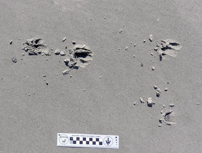
Two sets of deer tracks, showing them moving downslope from above the high-tide mark (look at the rackline in the bottom third of the photo), and heading toward a runnel before turning to the left and paralleling the surf zone. You may have also noticed where their trackways cross over further down the beach. Say, looks like there’s some differences in their trackway patterns. I wonder why? (Photograph by Anthony Martin, taken on Jekyll Island.)

Further evidence of the freshness of these tracks was the moistness of the fine-grained sand, still holding their shape. The morning sunlight had dried them slightly along the edges, and especially the plates or ridges (pressure-release structures) outside of the tracks. The ocean breeze coming out of the east, though, was too gentle to have eroded the tracks, so they looked as if they had been made only a few hours before. Which they had.

Tracking deer doesn’t get much easier than this, folks. Fine-grained and well-packed sand, still moist enough to hold the shape of the tracks and pressure-release structures, gentle wind, and fresh tracks, only about four hours old. (Photograph by Anthony Martin, taken on Jekyll Island.)

We backtracked the deer to their entry point on the beach, which was from the eroded scarp of the primary dunes. One deer must have been following the other, as their tracks came together at this point. The lead deer made the decision to step down onto the beach, a drop of a little more than a meter (3.3 ft), and then the second one followed it down.

The decision point, where one of two deer took the lead and stepped down from the primary dunes to the beach (indicated by tracks at top and bottom of the photo). Note the ghost-crab burrow in the middle-right part of the photo, just above the photo scale. (Photograph by Anthony Martin, taken on Jekyll Island.)

What was really interesting for me, as an ichnologist and just a plain ol’ tracker, was to see the differences in how they stepped down and moved once both deer were on the beach. Based on the trackway patterns, the lead deer simply took a big step down, landed with little drama, and began moving in a normal (baseline) gait for a deer, which is a diagonal pattern with indirect and direct register (rear-foot track on top of front-foot track on the same side). In contrast, the second deer leaped nearly two meters from the dune scarp to the beach, landed heavily, and broke into a gallop, denoted by a set of four tracks – both rear footprints ahead of both front footprints – followed by a space, then another set of four tracks.

Me taking a closer look at the tracks of the “jumper,” whose first tracks show up just behind me, whereas the other deer preceding it simply took a big step down. (Photograph by Ruth Schowalter, taken on Jekyll Island.)

A contrast in trackway patterns by deer on a beach: one that made a normal, diagonal-walking pattern with direct or indirect register (rear foot registering totally or partially on the front-foot impression), and the other galloping, in which front feet landed, then were exceeded by both rear feet, followed by a suspension phase. (Photograph by Anthony Martin, taken on Jekyll Island.)

A close-up of those tracks, in which Deer #1 (right) was strolling relaxedly, not kicking up so much sand, whereas Deer #2 (left) was taking sand with it as it forcefully punched through and extracted its feet from the sand while galloping. (Photograph by Anthony Martin, taken on Jekyll Island.)

This stark difference in their gait patterns led me to ask a simple question: why? This is where a bit of intuition came into play, in which I imagined the following scenario:

  • The first deer arrived at the dune scarp first, surveyed the scene, saw no threats in the immediate area, stepped down onto the beach, and walked normally.
  • The second deer, following behind the first, must have temporarily lost sight of the first deer once it stepped off the dune scarp. Not wanting to be left behind, it quickened its pace up to the scarp edge, spied its companion walking nonchalantly down the beach, and jumped.
  • The best way to catch up with its companion from there was to gallop, which it did.

With this hypothesis in mind – that maybe one deer was trying to catch up with the first one to join it – I had to be a good scientist and test it further. Looking down the beach, we saw how the tracks of the walking and the galloping deer eventually crossed one another, with the walking one crossing left, and the galloping one crossing right. Aha! I could use the old tried-and-true method used by generations of geologists, cross-cutting relations! This principle states that whatever cross-cuts another medium (say, a fault cross-cutting bedrock) is the younger of the two events. In this instance, I tracked the galloping deer to where it crossed and stepped on the tracks of the walking deer. Hence it came afterwards, but perhaps only a few minutes later, as the preservational quality of its tracks were identical to the first deer’s tracks. So it was very likely following and trying to catch up with its companion.

Close-up of the where Deer #2 stepped on the tracks of Deer #1 as it tried to catch up. This cross-over point is also where Deer #2 started going to the right of Deer #1, and was on the ocean side of it once they started traveling together, side-by-side. (Photograph by Anthony Martin, taken on Jekyll Island.)

Close-up of where Deer #2 stepped on the tracks of Deer #1 as it crossed its trackway, eventually traveling to the right of Deer #1. Scale in centimeters. (Photograph by Anthony Martin, taken on Jekyll Island.)

The tracks went down-slope for a distance further, and at some point turned to the left (north), showing where they walked next to one another, about 1.5 m (5 ft) apart and paralleling the surf zone. Where did they go from there? We don’t know, but I suspect they soon went back up into the dunes and back-dune meadows, just in time to avoid all of the humans and dogs who would be on the beach in the next few hours following sunrise. Still, the tracks conjured a beautiful image, of two white-tailed deer walking down the beach together, side-by-side, as the sun came up over the ocean to their right.

Not wanting to spend our entire morning tracking these two deer, we said, “OK, that was neat,” and got back on our bikes for more riding. Later, though, while reflecting on this lesson imparted by the deer tracks in a paleontological sense, I extended their range back into prehistory. How might such tracks from terrestrial mammals have been preserved in ancient beach sediments?  If they did get preserved, how would we would recognize them for what they were, or would we just assume they must be traces from some marine-dwelling animal (probably an invertebrate)? And even if we did realize these traces came from big terrestrial mammals, would we have the skills to interpret how two or more animals were affecting each others’ behaviors, which we did so easily with modern, fresh tracks directly in front of us, and knowledge of the daily tides and sunrise? This is the power of ichnology, in which these life traces motivate us to move mentally from the present, to the past, and back again.

As it was, we ended up not seeing a deer during the four days we spent on Jekyll. Nevertheless, we came away with a good story of at least two deer, knowing about their almost-secret trip to the beach, just a few hours before our own.

Further Reading

Elbroch, M. 2003. Mammal Tracks and Sign: A Guide to North American Species. Stackpole Books, Mechanicsburg, Pennsylvania: 779 p.

Halls, L.K. 1984. White-tailed Deer: Ecology and Management. Stackpole Books, Mechanicsburg, Pennsylvania: 864 p.

Hewitt, D.G. (editor). 2011. Biology and Management of White-tailed Deer. Taylor & Francis, Oxon, U.K.: 674 p.

Webb, S.L., et al. 2010. Measuring fine-scale white-tailed deer movements and environmental influences using GPS collars. International Journal of Ecology, Article ID 459610, doi:10.1155/2010/459610: 12 p.


Tracking Wild Turkeys on the Georgia Coast

Of the many traditions associated with the celebration of Thanksgiving in the U.S., the most commonly mentioned one is the ritual consumption of an avian theropod, Meleagris gallopavo, simply known by most people as “turkey.” The majority of turkeys that people will eat this Thursday, and for much of the week afterwards, are domestically raised. Yet these birds are all descended from wild turkeys native to North America. This is in contrast to chickens (Gallus gallus), which are descended from an Asian species, and various European mammals, such as cattle, pigs, sheep, and goats (Bos taurus, Sus scrofa, Ovis aries, and Capra aegagrus, respectively).

Trackway of a wild turkey (Meleagris gallopavo) crossing a coastal dune on Cumberland Island, Georgia. Notice how this one, which was likely a big male (“tom”), was meandering between clumps of vegetation and staying in slightly lower areas, its behavior influenced by the landscape. Scale = 20 cm (8 in). (Photograph by Anthony Martin.)

American schoolchildren are also sometimes taught that one of the founding fathers of the United States, Benjamin Franklin, even suggested that the wild turkey should be elevated to the status of the national bird, in favor of the bald eagle (Haliaeetus leucocephalus). With an admiring (although I suspect somewhat facetious) tone, he said:

He [the turkey] is besides, though a little vain & silly, a Bird of Courage, and would not hesitate to attack a Grenadier of the British Guards who should presume to invade his Farm Yard with a red Coat on.”

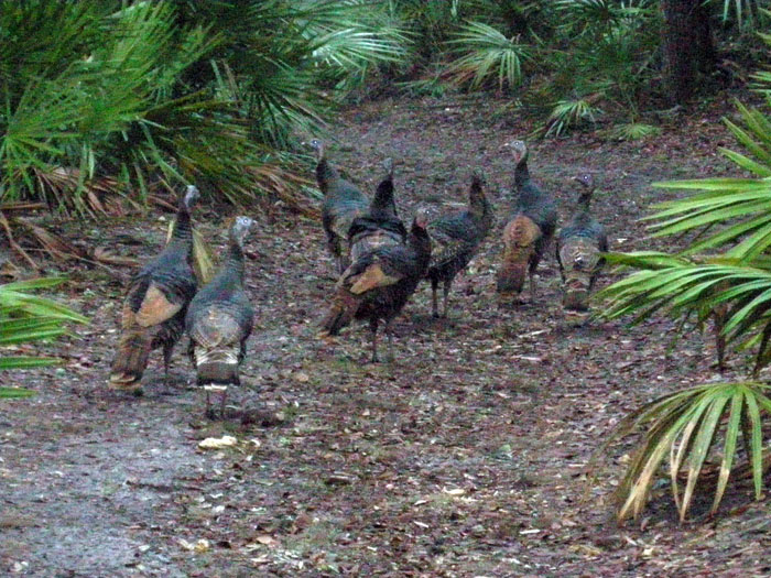
There are eight of us, and only one of you. Do you really want to mess with us? (Photograph by Anthony Martin, taken on Cumberland Island, Georgia.)

Unfortunately, because I live in the metropolitan Atlanta area, I never see turkeys other than the dead packaged ones in grocery stores. Nonetheless, one of the ways I experience turkeys as wild, living animals is to visit the Georgia barrier islands, and the best way for me to learn about wild turkey behavior is to track them. This is also great fun for me as a paleontologist, as their tracks remind me of those made by small theropod dinosaurs from the Mesozoic Era. And of course, as most schoolchildren can tell you, birds are dinosaurs, which they will state much more confidently than anything they might know about Benjamin Franklin.

Compared to most birds, turkeys are relatively easy to track. Their footprints are about 9.5-13 cm (3.7-5 in) long and slightly wider than long, with three long but thick, padded toes in front and one shorter one in the back, pointing rearward. In between these digits is a roundish impression, imparted by a metatarsal. This is a trait of an incumbent foot, in which a metatarsal registers behind digit III because the rear part of that toe is raised off the ground. The short toe is digit I, equivalent to our big toe, but not so big in this bird. Despite the reduction of this toe, its presence shows that turkeys probably descended from tree-dwelling species, as this toe was used for grasping branches. Clawmarks normally show on the ends of each toe impression, and when a turkey is walking slowly, it drags the claw on its middle toe (digit III), thus making a nicely defined linear groove.

Wild turkey tracks made while it was walking slowly up a gentle dune slope, dragging the claw on the middle digit of its right foot, making a long groove. Also notice the bounding tracks of a southern toad (traveling lower right –> upper left), cross-cutting the turkey tracks. (Photograph by Anthony Martin, taken on Cumberland Island.)

A normal walking pace (right foot –> left foot, left foot –> right foot) for a turkey is anywhere from 15-40 cm (6-16 in), and its stride (right foot –> right foot, left foot –> left foot) is about twice that, or 30-80 cm (12-32 in), depending on the age and size of the turkey. Their trackways show surprisingly narrow straddles for such wide-bodied birds, only 1.5 times more than track widths. This is because they walk almost as if on a tightrope, with angles between each step approaching 180°; so they still make a diagonal pattern, but nearly define a straight line. However, turkeys meander, stop, or change direction often enough to make things interesting when tracking them. Their flocking behavior also means their tracks commonly overlap with one another or cluster, making it tough to pick out the trackways of individual turkeys. However, in such flocks, the dominant male’s tracks are noticeably larger than those of the females or younger turkeys, so these can be picked out and help with sorting who’s who.

Turkey trackway in which it walked across the wind-rippled surface of a coastal dune on Cumberland Island, meandering while moseying. Same photo scale as before. (Photograph by Anthony Martin.)

An abrupt right turn recorded by a turkey’s tracks. Check out that beautiful metatarsal  impression in the second track from the right, and how the claw dragmark in the thrid track from the right points in the direction of the next track. (Photograph by Anthony Martin.)

One of the more remarkable points about these Georgia barrier-island turkeys, though, is how their tracks belie their stereotyped image as forest-only birds. Although they do spend much of their time in the forest, I’ve tracked turkeys through broad swaths of coastal dunes, and sometimes they will stop just short of primary dunes at the beach. So however difficult it might be to think about these birds as marginal-marine vertebrates, their tracks overlap the same places with ghost-crab burrows and shorebird tracks. Geologists and paleontologists take note: this exemplifies the considerable overlap between terrestrial and marginal-marine tracemakers that can happen in coastal environments. This also happened with dinosaurs that strolled onto tidal flats or otherwise passed through marginal-marine ecosystems.

Turkey tracks heading toward the beach, with the open ocean visible just beyond. Is this close enough to consider turkeys as marginal-marine tracemakers? (Photograph by Anthony Martin.)

Do these turkeys also have an impact on the dunes themselves? Yes, although these effects vary, from trackways disrupting wind ripples to more overt changes to the landscape. For instance, one of the most interesting effects I’ve seen is where they’ve caused small avalanches of sand downslope on dune faces. Interestingly, this same sort of phenomenon was also documented for Early Jurassic dinosaurs that walked across dry sand dunes, which caused grainflows that cascaded downhill with each step onto the sand.

Grainflow structure (arrow), a small avalanche caused by a turkey walking down a dune face. (Photograph by Anthony Martin.)

Close-up of grainflow structure (right) connected to turkey tracks, which become better defined once the turkey reached a more level surface. (Photograph by Anthony Martin, taken on Cumberland Island.)

What other traces do turkeys make? A lot, although I’ve only seen their tracks. Other traces include dust baths, feces, and nests. Dust baths, in which turkeys douse themselves with dry sediment to suffocate skin parasites, must be awesome structures. These are described as 50 cm (20 in) wide, 5-15 (1-3 in) deep, semi-circular depressions, and feather impressions show up in those made in finer-grained sediments. Although such structures would have poor preservation potential in the fossil record, I hold out hope that if paleontologists start looking more at modern examples, they are more likely to find a fossil dust bath, whether in Mesozoic or Cenozoic rocks.

Turkey feces, like most droppings from birds, have white caps on one end, but are unusual in that these can tell you the gender of their depositor. Male turkeys tend to make curled cylinders that are about 1 cm wide and as much as 8 cm long (0.4 X 3 in), whereas females make more globular (not gobbular) droppings that are about 1 cm (0.4 in) wide. These distinctive shapes are a result of their having different digestive systems. Turkeys are herbivores, so their scat normally includes plant material, but don’t be surprised to see insects parts in them, too. Still think about how exciting it would be to find a grouping of same-diameter cylindrical and rounded coprolites in the same Mesozoic deposit, yet filled with the same digested material, hinting at gender differences (sexual dimorphism) in the same species of dinosaur maker.

Turkeys normally make nests on the ground by scratching out slight depressions with their feet, but evidently this is a flexible behavior. On at least one of the Georgia barrier islands (Ossabaw), these birds have been documented as building nests in trees. Although this practice seems very odd for a large, ground-dwelling bird, it is an effective strategy against feral hogs, which tend to eat turkey eggs, as well as eggs of nearly every other species of bird or reptile, for that matter. Just to extend this idea to the geologic past, ground nests are documented for several species of dinosaurs, but tree nests are unknown, let alone whether species of ground-nesting dinosaurs were also capable of nesting in trees.

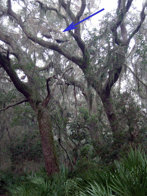
As everyone should know from their favorite WKRP episode, domestic turkeys can’t fly. But wild turkeys can, and use this ability to get into the branches of live oaks (arrow), high above their predators, or even curious ichnologists. (Photograph by Anthony Martin, taken on Cumberland Island.)

So whether or not you have tryptophan-fueled dreams while dozing later this week, keep in mind not just the evolutionary heritage of your dinosaurian meal, but also what their traces tell us about this history. Moreover, it is an understanding aided by these magnificent and behaviorally complex birds on the Georgia barrier islands. For this alone, we should be thankful.

Paleontologist Barbie, tracking wild turkeys on the Georgia coast to learn more about how these tracemakers can be used as modern analogs for dinosaur behavior and traces, and once again demonstrating why she is the honey badger of paleontologists. (Yes, photograph by me, and taken on Cumberland Island. P.S. Happy Thanksgiving!)

Further Reading

Dickson,J.G. (editor). 1992. Wild Turkeys: Biology and Management. Stackpole Books, Mechanicsburg, Pennsylvania: 463 p.

Elbroch, M., and Marks, E. 2001. Bird Tracks and Sign of North America. Stackpole Books, Mechanicsburg, Pennsylvania: 456 p.

Fletcher, W.O., and Parker, W.A. 1994. Tree nesting by wild turkeys on Ossabaw Island, Georgia. The Wilson Bulletin, 106: 562.

Loope, D.B. 2006. Dry-season tracks in dinosaur-triggered grainflows. Palaios, 21: 132-142.

How to Track a Vampire (Bat)

The arrival of Halloween reminds us to celebrate mythical creatures that frighten yet also intrigue us, although recent popular crazes have made this less of an annual event and more year-round. Along those lines, probably the top three of such imaginary beings are zombies, werewolves, and vampires. All of these can be classified as changelings of a sort, with two of them dead, but not really. Here in Georgia, public fascination with zombies has even provided employment opportunities, as many people compete for coveted slots as shuffling extras on the TV series The Walking Dead.

Among these inspirations for Halloween costumes, short stories, novels, musicals, TV shows, and movies, which would be the toughest for an aspiring Van Hesling to track down using ichnological methods? Zombies would be far too easy, considering their slow-moving, foot dragging, bipedal locomotion; their trackways would also commonly intersect as they bump into one another in their search for cranial sustenance. In other words, zombie trackway patterns would closely match those of people texting.

As a result, we have many modern analogs for zombie traces, which would also make their recognition in the fossil record that much easier. Traces made by the zombie-like characters portrayed in 28 Days Later, however, would be far different, showing greater distances between tracks and reflecting more rapid movement. (And all kidding aside, we actually do have trace fossil evidence of zombie ants from about 50 million years ago, an example of reality trumping fiction.)

Similarly, tracking werewolves would be straightforward, in that trackway patterns should show normal human bipedal locomotion followed by abrupt changes to quadrupedal patterns that would range from a trot to full gallop, gaits that are comparatively rare in humans. Anatomical details of tracks would also include a transition from five-toed plantigrade tracks to four-toed digitigrade ones, and metatarsal impressions would be replaced by heel-pad impressions. Additional traces to expect from a werewolf would be the direct effects of successful predation, such as blood spatters, scattering of prey body parts, toothmarks, and so on. (Don’t ask me about werewolf scat, though. I don’t even want to think about some of the things that would show up in that, especially if they started consuming suburbanites.)

Mixed assemblage of wolf and human tracks, which no doubt proves the existence of werewolves. Or not. Your choice. (Photograph by Anthony Martin, taken in Yellowstone National Park, Wyoming: scale = 10 cm (4 in).)

A closer look at those supposed “wolf” tracks. Yes, I know, they’re in the same area of Yellowstone National Park where a successful wolf-release program took place. But my doubt means you have to consider the impossible as equally valid.

A gorgeous “wolf” track with evidence of skidding to a halt and turning to the right. Could this have been made immediately after a human transformed into a wolf? My Magic 8-ball says, “Ask again later.”

Scene from some movie I’ll never see, in which one of the characters undergoes a mid-air transformation from a human to a werewolf (Canis lupus hormonensis), abruptly changing his tracks from a more plantigrade bipedal running to digitigrade quadrupedal movement. Sorry, I don’t know if any evidence of teen angst would preserve in such a trackway, nor do I care.

In contrast to zombies and werewolves, vampires would be the most challenging to track, considering their occasional aerial phases of movement, as depicted in Bram Stoker’s novel Dracula (1897) and various popular adaptations. Traces made during a pre-transformation phase – while still in human form – would be indistinguishable from those of a non-undead human, texting or not, and once in the air, no evidence of its movement would be recorded.

A large bat (megachiropteran) in flight, leaving no traces of its passing when traveling in a substrate of air.

So just to leave vampires for a moment, let’s talk about bats, which are real and do leave traces of their activities. Knowing that bats are among the most diverse and abundant of mammals (more than 1,200 species), I made sure to discuss their traces in my upcoming book, Life Traces of the Georgia Coast. Although I personally have not yet seen any of their traces on the Georgia barrier islands, these are predictable and identifiable, so I hold out hope that I or someone else will find them some day.

Probably the most likely traces made by bats that one could encounter on the Georgia barrier islands are their feces, which in other places, through the right geology (think caves) and collective action, can form economic resources (more on that later). About 75% of bat species are insectivores, and because they catch their meals on the fly, their scat will mostly contain winged insect parts. However, the geology of the Georgia barrier islands lacks limestone, and thus precludes the formation of caves or other environments serving as roosting spots for bat colonies. Thus bat feces, such as those dropped by the common brown bat (Myotis lucifugus), will be hard to find unless you look in the right place, such as below a favorite roosting spot. If you are lucky enough to notice these, though, these traces are dark 2-3 mm (0.1 in) wide and 5-15 mm (0.2-0.6 in) long cylinders and filled with parts of flying insects.

Two small samples of bat poop for you. You’re welcome. (Image from Internet Center for Wildlife Damage Management.)

Most other bats are fruit-eaters; this means these bats, like many birds, are also important seed dispersers through their excreting indigestible seeds covered in fertilizer. Speaking of fertilizers, massive deposits of bat feces (guano) also accumulate in caves and other places where millions of bats have roosted. These nitrogen- and phosphorous-rich deposits have been mined for fertilizers used in agriculture, an example of feeding traces helping to feed people.

Do bats come to the ground and leave tracks? Yes, once in a while they do, where they might forage and walk on all fours. When they do this, they make diagonal walking patterns, contacting with the thumbs on the tips of their wings – which are skin membranes connected to their other, elongated fingers – and their rear feet.

OK, now back to vampires, or rather, vampire bats. There are only three species of parasitic bats, all of which subsist on the blood of other mammals. For feeding, they slice skin with their sharp teeth, which leaves a small (several centimeters long, millimeters thin) incision. They then lap up whatever blood comes out, and the victim often isn’t aware of its blood loss. These wounds also heal, but leave visible scars.

What about other traces left by vampire bats? Surprisingly, scientists have actually asked themselves, “Hey, I wonder how vampire bats get around on the ground?”, and conducted experiments on terrestrial movement of the common vampire-bat (Desmodus rotundus), as well as the short-tailed bat of New Zealand (Mystacina tuberculata).

Just in case you needed another reason why science is cool, these scientists constructed bat-sized treadmills and placed these bats on them. This experiment confirmed that bats, including the common vampire bat, perform an alternating-walking movement in which the rear foot (pes) registers just behind the thumb, which also bears a claw. (This claw comes in handy as a sort of grappling hook at they climb onto their blood sources.)

Walking on Wings from Science News on Vimeo.

Based on this video, here is what I would hypothesize as the trackway pattern of a walking vampire bat. Note that the rear foot has five digits, nearly equal in length, and that the feet point away from the midline of the trackway.

But then they found out something most people didn’t expect. When they increased treadmill speeds, the bats bound and almost gallop, in which their rear feet nearly move past their wings. While bounding, these bats land on one of the digits on their wings, then push off with their rear feet, causing a suspension phase, reaching maximum speeds of 1.2 m/s. (Which, incidentally, is about the same speed as most people walking while texting, or slow zombies.) The resulting trackway patterns would be in sets of four – rear feet paired behind thumb impressions – separated from one another by about a body length. Based on my viewing of the videos, the trackways would show both half-bound and full-bound patterns, in which the rear feet are either offset or parallel, respectively.

Vampire Running from Science News on Vimeo.

And here is the hypothesized trackway pattern for a running vampire bat, which is almost like a gallop pattern, but more like a half-bound or full-bound. The feet actually should point a little more inward than during walking, and depending on the substrate, deformation structures might be associated with track exteriors.

Just to insert a little paleontology into this consideration of bat traces: has anyone found a trackway, feces, or other traces made by bast in the fossil record? No, unless you count old guano deposits as trace fossils (which I would if they exceed 10,000 years old). The body fossil record for bats extends back to the Eocene Epoch, about 50 million years ago, but such fossils are rare, too. Far more impressive than a bat body fossil, though, would be a fossil bat trackway would be the discovery of a lifetime, almost as noteworthy as finding an actual vampire. And if you found a fossil bat trackway where it was running? Time to start playing the lottery.

More readily available in ancient strata, though, are pterosaur tracks, whose makers likely walked in a manner similar to bats when on land. Hence bats, although not directly related to these flying reptiles, may provide analogues for how some small pterosaurs moved about when on the ground. Despite their long study and many pterosaur fossils, though, a few people are still arguing about how pterosaurs moved on the ground. So hopefully more studies of bat locomotion will help us to better understand the earthbound behaviors of pterosaurs.

The take-home message of the preceding is that even though zombies, werewolves, and vampires still garner plenty of attention from the public, the truth is that real animals of the past and present – like bats and pterosaurs – are actually more fantastic than we sometimes know. Sure, let’s continue to have fun with our mythical creatures, but in the meantime, also keep an eye out for traces left by the marvelous animals of today and yesteryear.

Further Reading

Elbroch, M. 2003. Mammal Tracks and Sign: A Guide to North American Species. Stackpole Books, Mechanicsburg, Pennsylvania: 778 p.

Mazin, J.-M., Billon-Bruyat, J.-P., and Padian, K. 2009. First record of a pterosaur landing trackway. Proceedings of the Royal Society of London, B, 276: 3881-3886.

Padian, K., and Fallon, B. 2012. Meta-analysis of reported pterosaur trackways: testing the corrspondence between skeletal and footprint records. Journal of Vertebrate Paleontology, 32 [Supplement to 3]: 153.

Riskin, D.K. et al. 2006. Terrestrial locomotion of the New Zealand short-tailed bat Mystacina tuberculata and the common vampire bat Desmodus rotundus. Journal of Experimental Biology, 209: 1725-1736.

Traces of Toad Toiletry and Naming Trace Fossils

Sometimes I envy those people on the Georgia barrier islands who, through sheer number of hours in the field, come upon animal traces that I’ve never seen there. But this was one of those instances where the find was so extraordinary that I will suppress my jealous urges, celebrate the person who found it, marvel at it, and share its specialness with others.

Gale Bishop, a fellow ichnologist who is currently on St. Catherines Island, found an intriguing sequence of traces during a morning foray on its dunes and beaches there last week. In his second life – his first was as a geology professor at Georgia Southern University – he has transformed into an indefatigable sea-turtle-nesting monitor on St. Catherines and coordinator of a teacher-training program. Part of his daily routine there, among many other duties, includes looking for mother-turtle traces – trackways and nests – during the nesting season, which in Georgia is from May through September.

Along the way, with his eyes well trained for spotting jots and tittles in the sand, Gale often notices oddities that likely would be missed by most people, including me. The following photograph, which he shared on the St. Catherines Island Sea Turtle Program page on Facebook, is from a find he made about 7:15 a.m. on Saturday, July 7. Take a look, and please, if you haven’t already, forget the title of this post as you ponder its clues.

A mystery in the dune sands of St. Catherines Island on the Georgia coast, begging to be interpreted. No, not the shovel: those are never mysterious. Look at the traces to the left and above the shovel. What made these, what was it doing, and who else was in the neighborhood afterwards? Oh, and again, stop staring at the shovel. (Photograph by Gale Bishop.)

Gale called me out specifically when he posted this and several other related photos on Facebook, and asked me to tell a story about it. I gave him my abbreviated take in the comments, kind of like an abstract for the research article:

Looks like southern toad (Bufo terrestris) to me. What’s cool is the changes of behavior: hopping, stopping, pooping, and alternate walking (which people don’t expect toads to do – but they do).

That was my knee-jerk analysis, which took a grand total of about a minute to discern and respond. (After all, this was Facebook, a forum in which prolonged and deep thinking is strongly discouraged.) But I also kept in mind that quick, intuitive interpretations later need introspection and self-skepticism, especially when I’m making them. (See my previous post for an example of how wrong I could be about some Georgia-coast traces.) So rather than fulfill some Malcolm Gladwell-inspired cliché through my intuition, I sat down to study the photo with this series of questions in mind:

  • Why did I say “Southern toad” as the tracemaker for the sequence of traces that start from the lower left and extend across the photo?
  • What indicates the behaviors listed and in that order: hopping, stopping, pooping, and alternate walking?
  • What signified the changes in behavior, and where did these decisions happen?
  • Why did I assume that most people don’t expect toads to walk (implying that they think they just hop)?

The first leap in logic – how did I know a Southern toad (Bufo (Anaxyrus) terrestris) was the tracemaker – was the easiest to make, as I’ve often seen their tracks in sandy patches of maritime forests and coastal dunes. These hardy amphibians leave a distinctive bounding pattern, with the front-foot impressions together and just preceding the rear-foot ones; the toes of their front feet also point inward. In the best-expressed tracks, you will see four toes on the front feet and five toes on the rear.

Close-up of bounding pattern (from lower left of previous photo), showing front-foot impressions just in front of and more central than the rear feet impressions. Direction of movement is from bottom to top of photo. (Photograph enhanced to bring out details, but originally taken by Gale Bishop.)

The only other possible animal that could make a trackway pattern confusable with a toad in this environment is a southeastern beach mouse (Peromyscus polionotus). Still, mice mostly gallop, in which their rear feet exceed their front feet as they move. Mouse feet are also very different from those of a toad, with toes on both feet all pointing forward (remember, toad toes point inward). So although dune mice live in the same environment as these tracks, these weren’t mouse tracks. The only alternative tracemakers would be spadefoot toads (Scaphiopus holbrookii) or a same-sized species of frog, such as the Southern leopard frog (Rana sphenocephala). But neither of these species is as common in coastal dunes as the Southern toad, so I’ll stick with my identification for now.

Mouse tracks – probably made by the Southeastern beach mouse (Peromyscus polionotus) – on costal dunes of Little St. Simons Island, Georgia. The two trackways on the left are moving away from you, whereas the one on the trackway on the right is heading toward you. All three show a gallop pattern, in which the larger rear feet exceeded the front feet. Scale = 10 cm (4 in). (Photograph by Anthony Martin)

The second conclusion – the types of behaviors and their order – came from first figuring out the direction of travel by the tracemaker, which from the lower left of the photo toward its middle. This shows straight-forward hopping up to the point where it stops.

From there, it gets really interesting. The wide groove extends to the left past the line of travel and had to be made by the posterior-ventral part of the toad’s body (colloquially speaking, its butt). This, along with the disturbed sand on either side of the groove, shows that the toad turned to its right (clockwise) and backed up with shuffling movement. That’s when it deposited its scat, which I’ve also seen in connection with toad tracks (and on St. Catherines, no less). This really helped me to nail down the identity of the tracemaker, almost being able to declare, “Hey, I know that turd!”

Southern toad bounding pattern that abruptly stops, followed by clockwise turning, backing up, and, well, making a deposit. (Photograph by Gale Bishop, taken on St. Catherines Island.)

How about the alternate walking? Turns out that toads don’t just hop, but also walk: right side, left side, right side, and so on. This pattern – also called diagonal walking by trackers – is in the remainder of the photo (with the direction of movement left to right). When toads do this, the details of their front and rear feet are better defined, and you can more clearly see the front foot registers in front of the rear and more toward the center line of the body.

This side-by-side movement is also what imparted a slight sinuosity to the central body dragmark, which was from the lower (ventral) part of its body, or what some people would call “belly.” In my experience, most people are very surprised to find out that toads can walk like this, which I can only attribute to sample bias. In other words, they’ve only seen frogs and toads hop away from them when startled by the approach of large, upright bipeds.

Close-up of alternate walking pattern and body dragmark made by Southern toad. Direction of movement is from upper left to lower right. (Photograph enhanced to bring out its details, but original taken by Gale Bishop on St. Catherines Island.)

But wait, what are those two dark-colored depressions in the center of the alternate-walking trackway? Well, it doesn’t take much imagination to figure those out, especially if you’ve already had a couple of cups of coffee. Yes, these are urination marks, and even more remarkable, there are two of them in the same trackway. So not only did this toad do #2, but also #1 twice.

Southern toad urination mark #1, not too long after doing #2. (Photograph by Gale Bishop.)

Urination mark #2 , which you might say was #2 of #1, but with both #1’s after #2, or, oh, never mind.

Notice that the second mark seems to have had less of a stream to it, which makes sense in a way that I hope doesn’t require any more explanation or demonstration.

So to answer to one of the questions above – what signified the changes in behavior – you have to look for the interruptions in the patterns, much like punctuation marks in a sentence. The commas, semi-colons, colons, dashes are all part of a story too, not just the words.

The summary interpretation of what happened. Let’s just say that this frog (or toad, whatever) didn’t come a courtin’.

Through the series of photos Gale shared in an album on Facebook, he also showed that he was following a protocol all good trackers do: he changed his perspective while observing the traces. Likewise, I teach my students to use this same technique when presented with tracks and other traces, that it’s a good idea to walk around them. While doing this, they see changes in contrast and realize how the direction and angle of light on the traces alters their perceptions of it. At some points, a track or other trace may even “disappear,” then “reappear” with maximum clarity with just a few more steps.

A different perspective of the same traces, viewed from another angle. Do you notice something new you didn’t see in the previous photo and its close-ups? (Photograph by Gale Bishop, taken on St. Catherines Island.)

Now, because I’m also a paleontologist, this interesting series of traces also prompts me to ask: what if you found this sequence of traces in the fossil record? Well, it’d be a fantastic find, worthy of a cover story in Nature. (That is, if the tracks somehow went across the body of a feathered dinosaur.) Right now, I can’t think of any trace fossils like this coming from vertebrates – let alone toads or frogs – so let’s go to invertebrate trace fossils for a few examples of similarly interconnected behaviors preserved in stone.

In 2001, a sequence of trace fossils was reported from Pennsylvanian Period rocks (>300 million years old), in which a clam stopped, fed, and burrowed along a definite path, with all of its behaviors clearly represented and connected. The ichnologists who studied this series of trace fossils – Tony Ekdale and Richard Bromley – reckoned these behaviors all happened in less than 24 hours; hence the title of their paper reflected this conclusion.

Ichnologists have a sometimes-annoying and always-confusing practice of naming distinctive trace fossils, giving them ichnogenus and ichnospecies names. (For a detailed discussion of this naming method, I talked about it in another blog from the dim, dark, distant past of 2011 here.) For instance, Ekdale and Bromley stated in their study that three names could be applied to the distinctive trace fossils made by a single clam, with each a different form made by a different behavior: Protovirgularia (burrowing), Lockeia (stopping), and Lophoctenium (feeding).

Along those lines, another ichnologist (Andy Rindsberg) and I also suggested that an assemblage of trace fossils in Early Silurian rocks (>400 million years old) of Alabama, with many different ichnogenera, were all made by the same species of trilobite. The take-home message of that study, as well as Ekdale and Bromley’s, is that a single species or individual animal can make a large number of traces. This also means that ichnodiversity (variety of traces) almost never equals biodiversity (variety of tracemakers).

So let’s go back to the toad traces, put on our paleontologist hats, and think about a “what if.” What if you found this series of traces disconnected from one another: the hopping trackway pattern, the diagonal walking pattern, the urination marks, the groove, and the turd, all found in disparate pieces of rock? Taken separately, such trace fossils likely would be assigned different names, such as “Bufoichnus parallelis,” “B. alternata,” “Groovyichnus,” “Tinklichnus,” and “Poopichnus.” (Please do not use these names beyond an informal, jovial, and understandably alcohol-fueled setting.)

Color, present-day version of the variety of traces made by a Southern toad (above), and a grayscale imagining of it fossilizing perfectly (below). Key for whimsically named ichnogenera in fossilized version: Bp = “Bufoichnus parallelis,” Ba = “Buofichnus alternata,” G = “Groovyichnus,” P = “Poopichnus,” and T = “Tinklichnus.” Please don’t cite this.

Granted, the environment in which Gale noted these traces – coastal dune sands – are not all that good for preserving what is pictured here, but other environments might be conducive to fossilization. To quote comedian Judy Tenuta, “It could happen!”

So if someone does find a fossil analogue to Gale’s evocative find on St. Catherines Island, I will understand their giving a name to each separate part, even if I won’t like it. The most important matter, though, is not what you call it, but what it is. And in this case, the intriguing story of toiletry habits left in the sand one July morning by a Southern toad is worth much more than any number of names.

Further Reading

Ekdale, A.A., and Bromley, R.G. 2001. A day and a night in the life of a cleft-foot clam: Protovirgularia-Lockeia-Lophoctenium. Lethaia, 34: 119–124.

Halfpenny, J.C., and Bruchac, J. 2002. Scats and Tracks of the Southeast. Globe Pequot Press, Guilford, Connecticut: 149 p.

Jensen, J.B. 2008. Southern toad. In Jensen, J.B., Camp, C.D., Gibbons, W., and Elliott, M.J. (editors), Amphibians and Reptiles of Georgia. University of Georgia Press, Athens, Georgia: 44-46.

Rindsberg, A.K., and Martin, A.J. 2003. Arthrophycus and the problem of compound trace fossils. Palaeogeography, Palaeoclimatology, Palaeoecology, 192: 187-219.

Going Hog Wild on the Georgia Barrier Islands

(The following is the third part of a series about traces of invasive species of mammals on the Georgia barrier islands and the ecological effects of these traces. Here is an introduction to the topic, the first entry about the feral horses of Cumberland Island, and the second entry about the feral cattle of Sapleo Island.)

Anytime I hear someone refer to a Georgia barrier island as “pristine,” I wince a little bit, smile, and say, “Well, bless your heart.” The truth is, nearly every island on the Georgia coast, no matter how beautiful, is not in a pristine state, having been considerably altered by humans over the past 4,500 years, whether these were Native Americans, Europeans, or Americans. These varying degrees of change are sometimes subtle but nonetheless there, denoted by the loss of original habitats and native species or the addition of non-native species.

Still, one Georgia barrier island comes close to fulfilling this idealistic label: Wassaw Island, which during its 1,000-year geologic history somehow escaped commercial logging, agriculture, animal husbandry, and year-round settlements. Partially because of this legacy, Wassaw is designated as a National Wildlife Refuge, and is reserved especially for ground-nesting birds. One of the ways this island works well as a refuge for these birds is – as of this writing – its “hog free” status, a condition that can be tested with each visit by looking for the obvious traces of this invasive species.

The interior of Wassaw Island, with maritime forest surrounding a freshwater wetland created by alligators, the rightful owners of the island. On Wassaw, there are no tracks or signs of feral hogs, qualifying it as a “pristine” island. (Photograph by Anthony Martin.]
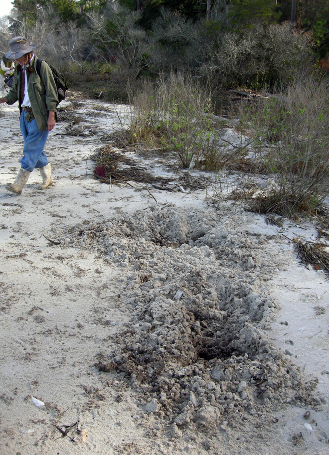
Contrast this with Cumberland Island National Seashore, where hogs run wild and freely. The huge pits here are in an intertidal zone of a beach on the northwest corner of the island. Naturalist Carol Ruckdeschel (background) for scale. (Photograph by Anthony Martin.)

Feral hogs (Sus scrofa) have a special place in the rogue’s gallery of invasive mammals on the Georgia barrier islands, and most people agree they are the worst of the lot. Hogs are on every large undeveloped island – Cumberland, Sapelo, St. Catherines, and Ossabaw – and they wreak ecological havoc wherever they roam. The widespread damage they cause is largely related to their voracious and omnivorous diet, in which they seek out and eat nearly any foodstuff, whether fungal, plant, or animal, live or dead. Their fine sense of smell is their greatest asset in this respect: every time I have tracked feral hogs, their tracks show head-down-nose-to-the-ground movement as the norm, punctuated by digging that uses a combination of their snouts and front hooves to tear up the ground in their quest for food. In other words, they generally act like, well, you know what.

Most importantly from the standpoint of native animals that try to live more than one generation beyond a single hog meal, feral hogs eat eggs. Hence ground-nesting birds and turtles are among their victims, and hogs are quite keen on eating sea turtle eggs. Mothers of all three species of sea turtles that nest on the Georgia coast – loggerhead (Caretta caretta), green (Chelonia mydas), and leatherback (Dermochelys coriacea) – dig subsurface nests filled with 100-150 eggs full of protein and other nutrients, making tempting targets for any free-ranging feral hogs. Similarly, hogs also threaten another salt-water turtle, the diamondback terrapin (Malaclemys terrapin); this turtle lays its eggs in shallow nests near the edges of salt marshes, which hogs manage to find. Conservation efforts to save diamondback terrapins from human predation have mostly succeeded (it used to be a tasty ingredient in soups), but hogs can’t read and don’t discriminate when it comes to eating eggs. Here is where feral hogs are particularly dangerous as an invasive species: unlike feral horses or cattle, which “merely” degrade parts of their ecosystems: feral hogs can contribute directly to the extinction of native species. As I often tell my students, if you want to cause a species to go extinct, stop it from reproducing.
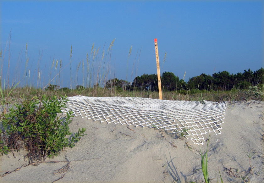
Sea-turtle nest on Sapelo Island, marked by a stake and protected by plastic fencing to prevent feral hog and raccoon depredation of its eggs. An individual raccoon would only eat about 1/3 of the eggs in a sea-turtle nest, whereas pigs would just keep on eating. (Photograph by Anthony Martin.)

As an ichnologist, though, what astounds me the most about these hogs is the extremely wide ecological range of their traces. I have seen their tracks – often made by groups traveling together – in the deepest interiors of maritime forests, in freshwater wetlands, and crossing back-dune meadows, high salt marshes, coastal dunes, and beaches. If their traces became trace fossils, paleontologists would refer to them as a facies-crossing species, in which facies (think “face”) are the identifiable traits of a sedimentary environment preserved in the geologic record. Based on their tracks and sign, they are ubiquitous in terrestrial and marginal-marine environments. Oh, and did I mention they are also good swimmers? Swimming across a tidal channel at low tide is an easy feat for them, enabling hogs to spread from island to island, without the assistance of humans.
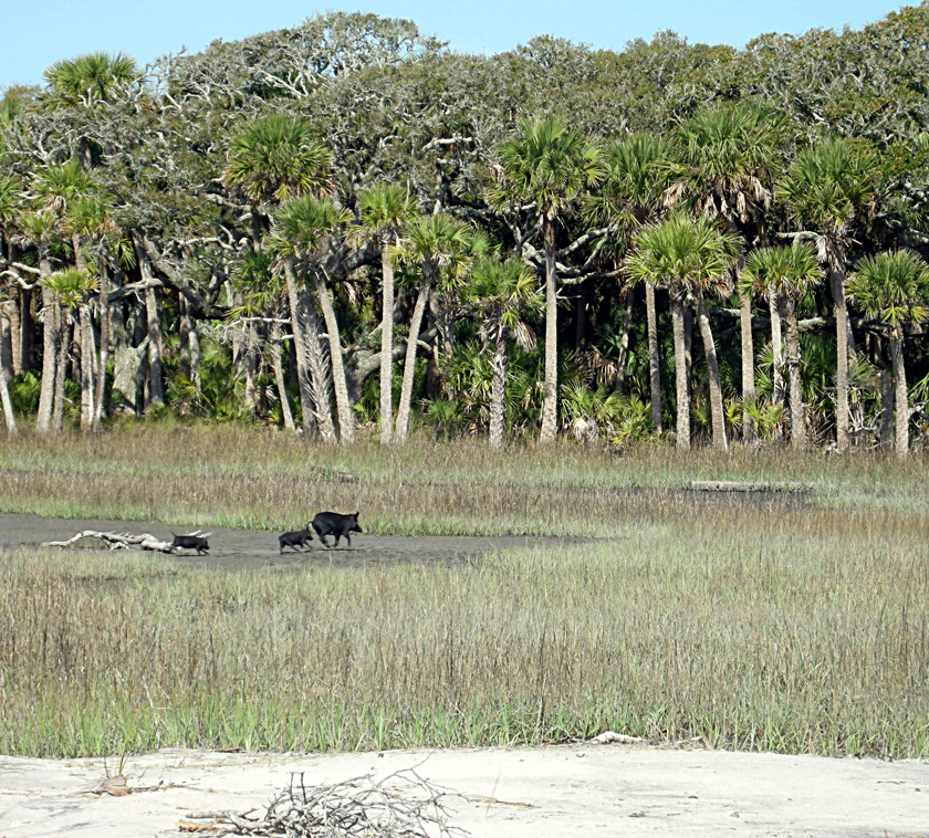
Run away, run away! Feral hogs in a St. Catherines Island salt marsh, consisting of two juveniles and an adult, do not stick around to see whether humans are going to shoot them; they just assume so. This sighting, along with their widespread tracks and other traces, show how feral hogs can occupy and affect nearly every environment on a Georgia barrier island. (Photograph by Anthony Martin.)

So to better understand why feral hogs are such successful invaders of the Georgia islands, it’s helpful to think about their evolutionary history. As expected, this history is complicated, just like that of any domesticated species in which selective breeding narrowed the genetic diversity we see today. About 15 subspecies of Sus scrofa have been identified, making its recent family tree look rather bushy. Based on genetic studies, divergence between wild species of Sus scrofa (so-called “wild boars”) and various subspecies may have happened as long ago as 500,000 years ago in Eurasia, although humans did not capture and start breeding them until about 9,000 years ago.
Depiction of a European wild boar from 1658, in The History of Four-Footed Beasts and Serpents by Edward Topsell. Original image from a woodcut, digital image in Wikipedia Commons here.

The closest extant relatives to these hogs native to North America are peccaries, which live in the southwestern U.S., Central America, and South America. However, peccaries are recent migrants to North America, and only one Pleistocene species (Mylohyus nasutus) is known from the fossil record of the eastern U.S. This means that the post-Pleistocene ecosystems of the eastern U.S., and especially those of the Georgia barrier islands, have never encountered anything like these animals. Also, unlike the feral horses of Cumberland Island and the feral cattle of Sapelo Island, the feral hogs of the Georgia barrier islands were likely introduced early in European colonization of the coast, and may have started with the Spanish in the 16th century.

Unfortunately, part of the selective breeding of Eurasian hogs was for early sexual maturity and large litter sizes. Female feral hogs can reach breeding age at 5 months, and litters typically have 4-8 piglets, but can be greater than 12; females also can produce three litters in just more than a year. Do the math, and that adds up to a lot of pigs in a short amount of time. Furthermore, on Georgia barrier islands with few year-round human residents, the only predation pressures young piglets face daily include raptors (no, not that kind of raptor) or alligators. This means young hogs reach sexual maturity soon enough to rapidly overrun a barrier island.
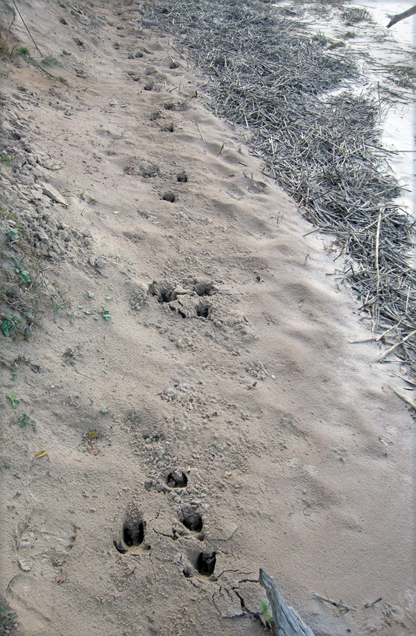
Feral hog trackway in a sandy intertidal zone of Cumberland Island, showing a typical gallop pattern (four tracks together –> space –> four tracks together), symbolizing how they are running roughshod over this and other islands. (Photograph by Anthony Martin.)

Yet as we have learned in North America, and particularly on the Georgia barrier islands, feral hogs rapidly revert to their Pleistocene roots. Similar to the feral cattle of Sapelo Island, these hogs are rarely seen by people, especially on islands where humans regularly hunt them. Every time I have spotted them on Cumberland, Sapelo, St. Catherines, or Ossabaw, they instantly turn around, briefly flash their potential pork loins and ham hocks, and flee. As anyone who has raised hogs can tell you, pigs are smart and learn quickly. Hence I imagine that after only one or two shootings of their siblings or parents, they readily associate upright bipeds with imminent death, especially if these bipeds are carrying boomsticks.” (Speaking of which, I know of at least one sea turtle researcher who does his part to decrease feral hog populations – while also feeding the local vultures – through his able use of such a baby-sea-turtle-protection device.)

Hence much of what we learn about these free-ranging pigs and their behaviors in the context of the Georgia barrier islands is from their traces. Among the most commonly encountered feral hog traces are:

• Tracks

• Rooting pits

• Wallows

• Feces

Feral hog tracks are potentially confused with deer tracks, as they both consist of paired hoofprints and overlap in their size ranges, which are about 2.5-6 cm (1-2.5 in) long. Nonetheless, feral hog tracks are less “pointed,” have nearly equal widths and lengths, rounded ends, and the two hoofs often splay. Two dew claws – vestigial toes – frequently register behind the hoofs, especially when hogs step into soft sand or mud or are running. Trackways normally show indirect register of the rear foot onto the front footprint in a diagonal walking pattern, but can also display a whole range from slow walk to full gallop patterns. With repeated use of pathways, trackways become trails, although I’m not sure if hogs are merely using and expanding previously existing whitetail deer trails, if they are blazing their own, or a combination of the two. (I suspect the last of these is the most likely.)
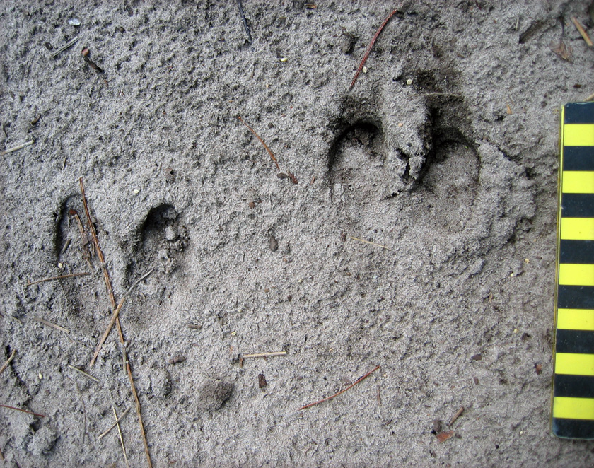
Feral hog tracks, showing nearly equal lengths and widths, rounded ends, and splaying of hooves, all three of which help to distinguish these from whitetail deer tracks. Scale in centimeters. (Photo by Anthony Martin, taken on Sapelo Island.)
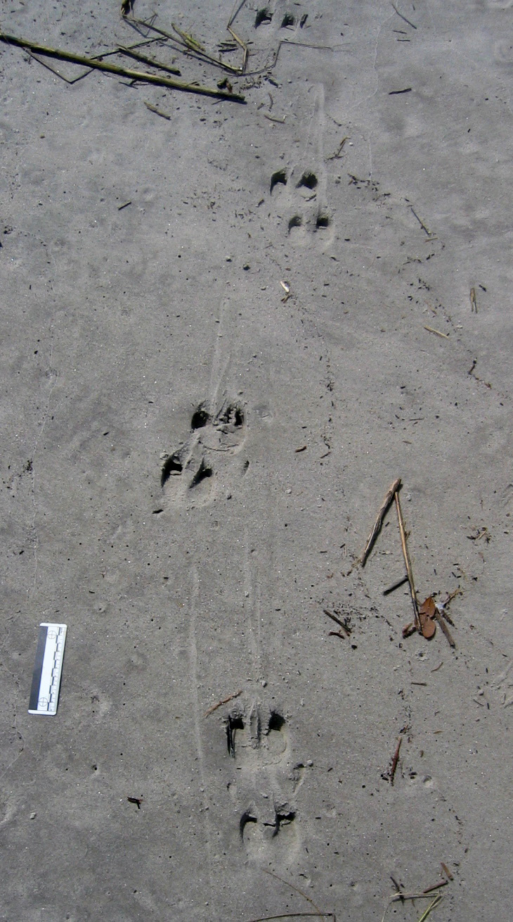
Feral hog trackway on upper part of a sandy beach (moving parallel to shore), showing slow diagonal walking pattern, verified by hoof dragmarks between sets of tracks. Scale = 10 cm (4 in). (Photo by Anthony Martin, taken on St. Catherines Island.)

Rooting pits are broad but shallow depressions – as much as 5 m (16 ft) wide and 30 cm (1 ft) deep – that are the direct result of feral hogs digging for food. In most instances, I suspect they are going for fungi and plant roots, but they probably also eat insect larvae, lizards, small mammals, and any other animals that live in burrows. These pits are typically in maritime forests and back-dune meadows, but I have seen them in salt marshes and dunes, and, most surprisingly, in the intertidal areas of beaches. What are they seeking and eating in beach sands? I think anything dead and buried that might be giving off an odor. I have even seen their tracks associated with broken carapaces of horseshoe crabs (Limulus polyphemus), a menu item that never would have occurred to me if I had not seen these traces.
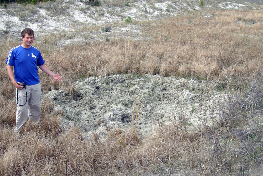
Rooting pit in back-dune meadow on St. Catherines Island. Former student, who answers to the parent-given appellation of “Andrew,” for scale. (Photograph by Anthony Martin.)
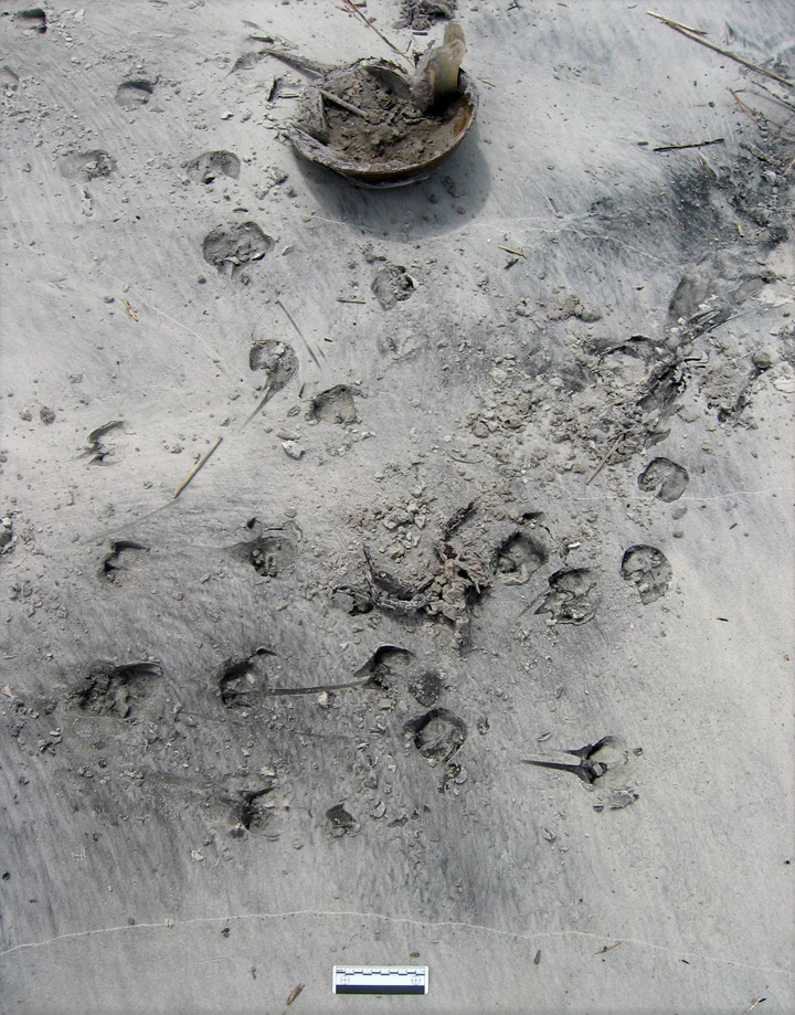
Evidence of feral hog feeding on a horseshoe crab (Limulus polyphemus). All I can say is, it must have been really hungry. (Photo by Anthony Martin, taken on St. Catherines Island.)

Wallows are similar in size and appearance to rooting pits, but have a different purpose, which is to provide hogs with relief from both the Georgia summer heat and biting insects that invariably go with this heat. These structures are often near freshwater wetlands in island interiors, but I’ve seen them next to salt marshes, too. If these wallows intersect the local water table, they also make for attractive little ponds for mosquitoes to breed, meaning these hog traces indirectly contribute to the potential spread of mosquito-borne diseases.
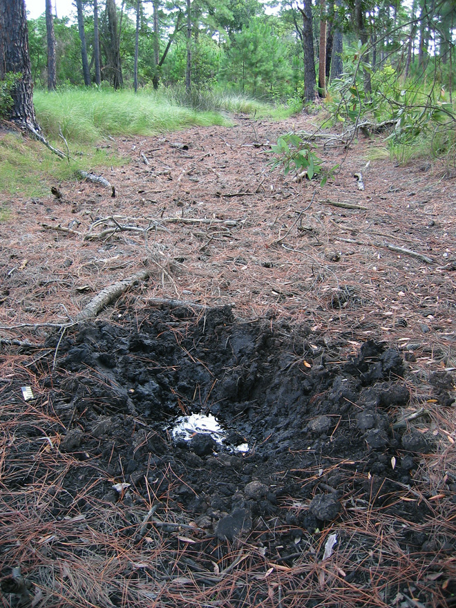
Wallow in maritime forest, Sapelo Island, with a standing pool of water indicating the local water table at the time. (Photo by Anthony Martin.)

Hog feces may look initially like deer pellets, but tend to aggregate in clusters. Most of the ones I have seen are filled with vegetation, but the extremely varied diets of feral hogs means you should expect nearly anything to show up in their scat.
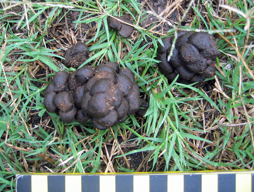
Feral hog feces on Sapelo Island, which is more clumped than that of whitetail deer. Scale in centimeters. (Photo by Anthony Martin, taken on Sapelo Island.)

Which of these traces would make it into the fossil record? I would certainly bet on at least some of their tracks getting preserved, based on the sheer ubiquity of these traces in nearly every sedimentary environment of a Georgia barrier island. Other likely traces would be their pits and wallows, although their broad size and shallow depths would make them difficult to recognize unless directly associated with tracks. Feces would be the least likely to make it into the fossil record as coprolites, unless these contained a fair amount of bone or other mineralized stuff, which could happen with hogs.

What to do about these hogs, and how to decrease the impacts of their traces? Well, as most people know, pigs are wonderful, magical animals that were domesticated specifically for their versatile animal protein. So one solution is more active and year-round hunting of hogs, and using them to supplement breakfasts, lunches, and dinners of local residents on the Georgia coast, a neat blend of reducing a harmful feral species while encouraging a chic “locavore” label on such food.

However, the sheer numbers of hogs on some of the islands would likely require a more systematic slaughter to make a dent in their numbers, an approach that would probably deter any ecotourism unrelated to hog hunting. (Let’s just say that firearms and bird watching are an uneasy mix.) The introduction of native predators is another possible solution. For example, Cumberland Island has a population of bobcats (Lynx rufus) that was introduced primarily to control the whitetail deer population, but these cats probably also take a toll on the feral hogs (although how much is unknown). I have even heard suggestions of reintroducing red wolves (Canis rufus) to a few of the islands. These pack-hunting predators were native to the southeastern U.S. before their extirpation by fearful European settlers, and probably would reduce feral hog populations, but just how much of an impact they would have is hard to predict.

In summary, the feral horses, cattle, and hogs of the Georgia barrier islands have significant effects on the ecology and geology of the Georgia barrier islands, and will continue to do so until creative solutions are proposed and implemented to reduce and otherwise manage their numbers. In the meantime, though, these invasive species present opportunities for us to study their traces, learn more about their unseen behaviors, and compare these behaviors with their evolutionary histories. More science is always good, and in this respect, the Georgia barrier islands are the gifts that keep on giving.
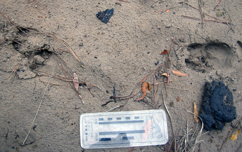
Traces of feral mammals on Sapleo Island: feral hog tracks strolling past a piece of feral cattle scat in a sandy road next to a maritime forest. What is the fate of these invasive species on the Georgia barrier islands, and how will these environments continue to change because of their presence? (Photo by Anthony Martin, taken on Sapelo Island.)

Further Reading

Ditchkoff, S.S., and West, B.C. 2007. Ecology and management of feral hogs. Human-Wildlife Conflicts, 1: 149-151.
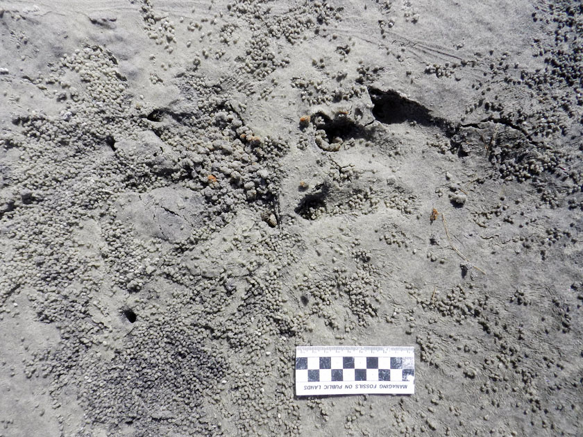
Giuffra, E., Kijas, J.M.H., Amarger, V., Carlborg, Ö., Jeon, J.-T., and Andersson, L. 2000. The origin of the domestic pig: independent domestication and subsequent introgression. Genetics, 154: 1785-1791.
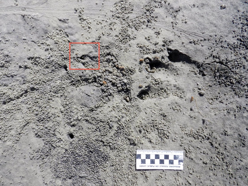
Mayor, J.J., Jr., and Brisbin, I.L. 2008. Wild Pigs in the United States: Their History, Comparative Morphology, and Current Status. University of Georgia Press, Athens, Georgia: 336 p.

Taylor, R.B., Hellgren, E.C., Gabor, T.M., and Ilse, L.M. 1998. Reproduction of feral pigs in southern Texas. Journal of Mammalogy, 79: 1325-1331.

Wood, G.W., and Roark, D.N. 1980. Food habits of feral hogs in coastal South Carolina. The Journal of Wildlife Management, 44: 506-511.